

Tour The Historic Mono County Jail In Bridgeport
Found just off of Bridgeport’s Main Street, behind the historic courthouse, sits one of the oldest still-standing buildings in Mono…
Contains affiliate links | 2 minute read
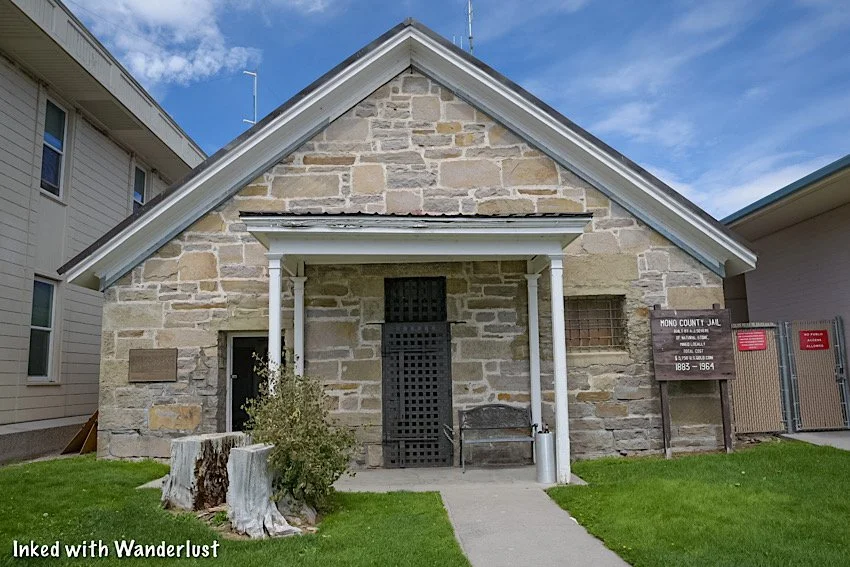
Found just off of Bridgeport’s Main Street, behind the historic courthouse, sits one of the oldest still-standing buildings in Mono County, the historic jail.
Originally built in 1883 and made up of mostly concrete and iron, this wonderfully preserved jail gives visitors a small glimpse into what being imprisoned was like near the turn of the century.
The craziest fact of this jail is that it was in use as recently as 1964, when it closed. It still sits in its original location, with the modern county jail built directly adjacent to it.
These days, the county keeps the front door open to anyone who wishes to explore it. In this guide, we’ll cover topics such as fees, where to find it and much more.
Be sure to check out our post, “7 Things You’ll Love About Bridgeport”, for more amazing things to do in Bridgeport!
Quick Stats
Location: Bridgeport, California
Fee: None
Permit: None
Open: Open during daylight hours
For: Everyone
Restroom: None
Parking: Along the street
EV Stations: Nearest ones are down the street behind the Shell station
Difficulty: Easy, but not fully ADA compliant to protect historical integrity
Popularity: Low
Time: An hour or less
Condition: Well-maintained
Pets: Not allowed inside
Our Visit(s): September 2022

Getting There
As mentioned above, the historic jail is located in the tiny mountain town of Bridgeport, CA. It’s on Bryant street, directly behind the courthouse (a historic building in its own right).
If you’re coming into town from the north, you’ll turn left onto School street, then turn right onto Bryant street. The jail will be on your left.
If you’re coming from the south, you’ll turn right onto Sinclair street (just after Rhino’s Bar & Grill) and turn left onto Bryant street. The jail will be on your right.
Free parking is available along the street on either side. If for some reason there’s nothing there, you can find a spot along the main drag and walk to the jail.

Touring The Historic Jail
Tours of Mono County Historic Jail are self-guided and free of charge. So feel free to take as much or as little time as you wish.
There are no posted hours of operation, but I was told that the jail is usually open daily during daylight hours. It’s usually closed on major holidays, though.
Here are some stats of the historic jail:
Construction on the historic jail was completed on December 12th, 1883.
It’s original cost was $5,750.
The building is only 32 x 34 feet.
Its stone walls are two feet thick, twelve feet high, and are made up of hammer-dressed stone.
The iron cells were reused from the old jail.
The iron doors were constructed of 1.5 inch bar stock.
The iron gratings in the windows are one inch bars, set deeply into the stone blocks.
The jail remained in operation until 1964.
After learning these facts and experiencing the jail for yourself, you’ll quickly realize that this place wasn’t build for comfort. Not even a little.
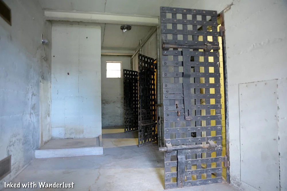
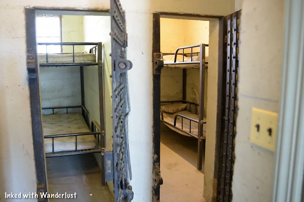
There are around half a dozen or so jail cells of varying sizes, all of which are open for you to enter and explore. You can also see the two shower stalls that all inmates had to share.
Inside the cells are examples of bunks and bedding inmates were given to sleep on. I can’t say for certain if these were actually used in the jail or if they’re just examples, though.


It won’t take you very long to explore the jail. There’s only two main rooms consisting of six or so cells, two shower stalls and the administration area when you first walk in.
When you’re done checking it out, simply head back to your car and enjoy the rest of your day. While you’re in Bridgeport, be sure to check out the other amazing things to see.
If you’re not sure what else there is to do here, check out our post, “7 Things You’ll Love About Bridgeport”.
If you’re looking for a bite to eat (specifically a juicy burger), check out our post about our favorite burger joint in the area, Burger Barn.

Your Thoughts…
Are you or someone in your family history buffs? If so, we believe you (or them) would love this quick roadside stop. Tell us about any other historic structures in the area that you know of. We love hearing from our readers!


Please support our website by subscribing to our newsletter below.
Thank you for reading.
Check Out These Amazing Destinations!


How To Apply For (And Win) A Mount Whitney Permit In 2023
Standing at a commanding 14,505 feet above sea level, Mount Whitney is the second tallest peak in the United States. Second only…
Contains affiliate links | 4 minute read
Standing at a commanding 14,505 feet above sea level, Mount Whitney is the second tallest peak in the United States. Second only to Alaska’s Mount Denali.
If you only count the lower 48 in the contiguous United States, Whitney is THE highest. Due to this, she attracts thousands of summit hungry hikers annually.
Due to the mountain’s popularity and out of a desire to protect it, if you want to want to hike up to the summit, you must have a permit.
In order to obtain a permit, you must enter the (highly competitive) permit lottery (whether that’s the pre-season lottery or the web reservations).
While there’s no way to guarantee yourself a permit, there a few things you can do to improve your odds. In this guide, we’re going to cover the lottery process, tips, things you should know and more.

Mount Whitney Lottery Process
Much like most wilderness lotteries, Mount Whitney’s begins and ends at recreation.gov. If you don’t have an account already set up, you should do so now.
The quota season for Mount Whitney is between May 1st and November 1st. So if your desired date coincides within that timeframe, you must have a permit.
Below are the dates you need to be aware of:
February 1st - March 1st: This is the period in which the lottery is open and when you're eligible to throw your name in the hat.
March 15th: This is when you’ll find out whether or not you’ve won a permit.
April 21st: This is the deadline to finalize your trip information, pay your fees and complete your reservation.
April 22nd: This is when web reservations for remaining dates become available on a first-come, first-serve basis.
When entering the lottery, you’ll want to have information such as desired dates, party size, etc, ironed out. Below are the steps you’ll take:
Head over the Mount Whitney permit page on recreation.gov.
Click/tap, “Register for Lottery”.
Fill out the information for the trip leader (probably yourself).
Select alternate trip leaders. You may select up to three. Being an alternate means they have the authority to pick up and use the permit if you’re unable to.
Select which permit you’d like. You can select either day-use or overnight. You’ll also select your desired dates (you can select up to 15).
Read through the pertinent information, then click/tap, “proceed”.
Take a second to ensure all the information you’ve entered is correct before proceeding from here. You do have a time-limit.
Enter your payment information and pay the $6 fee to submit your application.
There is no advantage to submitting your application early in the window. Those who submit theirs on the last day have as much of a chance as those who submit one on the first day does.
If you’re unsuccessful, you can try again once web reservations become available. If you’re successful, you’ll confirm your date and party size, then pay your per person fees.
One week prior to your trip, you’ll be asked to print your permit and will be expected to keep it on you throughout the duration of your time on the mountain.
*Note: If you’ve printed your permit, you will NOT have to pick one up in person at the Eastern Sierra Interagency Visitor Center as in years past
Rangers do patrol this trail and you may be asked to produce it. If you don’t have it on you, you’ll likely be asked to leave the trail and/or possibly be fined.
Mount Whitney Permit Fees
As with most things in life, there are fees attached to obtaining your permit. Thankfully, they’re reasonable and go towards the continuous improvement and care of the mountain.
The fees you’ll pay are as follows:
$6.00 per application: This is the fee you’ll pay when you first enter the lottery. Notice this is per APPLICATION, not per person. This fee is mandatory and will not be refunded regardless of the lottery results.
$15.00 per person: This is the fee you’ll pay if you’ve won a permit, the total of which being dependent on your party size (i.e - two people on your permit = $30 total). Once you’ve completed your reservation, this fee is non-refundable.
As stated above, all fees associated with a completed reservations are non-refundable. There are also no rain checks or credits given under any circumstances.
You're not able to sell or transfer your permit to another person. If you’re unable to make the trip, only the alternates listed on your reservation will be able to use it.
If you or anyone in your group is unable to make the trip, update your reservation through the portal so other hikers can have the chance of snagging a spot.

Best Time To Hike Mount Whitney
May 1st - November 1st is the timeframe when permits are required to be on this trail. Whether you’re doing it as a day hike or an overnight.
Outside of those dates, the only permit you’ll need is a wilderness permit. However, the reason you won’t need to enter the lottery for those months is due to one reason - heavy snow.
Unless you’re a skilled mountaineer, you should stick with the quota season. Though you’ll still encounter snow/ice along the trail up until July and as early as late September.
So if you don’t have experience hiking in snow/ice and/or have little experience on a mountain, your best bet is to hike sometime between July and September.
Things To Know and Consider
KNOW THIS INFORMATION PRIOR TO ENTERING THE LOTTERY: Group leader, alternates, party size (15 person limit), desired entry/exit dates (up to 15 selections), permit type (overnight or day-use), exit location and camp locations (if going overnight).
THE TRIP LEADER IS RESPONSIBLE FOR THE GROUP. As the group leader, you’re charged with ensuring everyone in your group understands the rules and regulations.
BEAR CANISTERS ARE REQUIRED. Bears are very active at Mount Whitney Portal and all along the trail. Keep yourself safe by stashing all smellables inside a bear proof container and ensure it remains outside and away from of your tent.
YOU MUST PACK OUT SOLID HUMAN WASTE. Complimentary WAG Bags can be picked up at the Eastern Sierra Interagency Visitor Center or you can bring your own. At the end of your trip, they can be disposed of near the restrooms at Mount Whitney Portal. Note that this is a requirement.
CHANGES TO YOUR PERMIT ARE LIMITED. Once you’ve confirmed your reservation, you’re only allowed to change your exit date (for overnight permits) and reduce your group size. You cannot change the group leader, alternates, increase your group size or change your entry date.
PRINT YOUR PERMIT TO AVOID PICKING IT UP IN PERSON. If you cannot print it, you can pick it up, in person, at the Eastern Sierra Visitor Center. They’re usually open daily between 8:30 to 4:30 but check the link above for up to date information.
DAY USE PERMITS CAN ONLY BE USED FROM MIDNIGHT TO MIDNIGHT. Consecutive day-use permits are not allowed. So if you’ll need to stay overnight, then obtain an overnight permit.
GROUP SIZE IS LIMITED. Your group size is limited to 15 people, including the group leader. While up to 15 people may be permitted, keep in mind that the bigger your group size, the higher the odds are against you.
DON’T GET SUMMIT FEVER. If there are stormy looking clouds in the area or you’re experiencing symptoms of altitude sickness, turn around. It isn’t worth the risk.

Increase Your Odds
In 2021, there were more than 25,000 applications submitted requesting space for 108,500 people. Of those, just 28% of group leaders were successful in obtaining a permit for their selected date.
The most competitive timeframe was during the months of July and August. This is due to the near picture-perfect weather during this time.
If you must go during these two months, I highly suggest requesting a weekday entry date and with a group size as small as possible.
If you’re flexible, the months of May and September, with midweek entry dates, offer the best chances. Keep in mind that until July, snow and ice are still present on the trail.
In my opinion, September would be the best month. It’s my personal favorite month of the year for hiking in the Eastern Sierras.
The summer heat has usually cooled down by that point and the notorious afternoon thunderstorms don’t occur nearly as much, offering you your best chance at a successful summit.
Your Thoughts…
Are you or someone you know planning to hike Mount Whitney this year? What’s your opinion on the permit lottery system? Were you successful in obtaining a permit? Let us know in the comments below. We love hearing from our readers!


Please support our website by subscribing to our newsletter below.
Thank you for reading.
Check Out These Amazing Destinations!


Hike The Convict Lake Loop In Mammoth Lakes
If you’ve never been to Convict Lake before, you really should plan a visit. It’s one of the most beautiful, photogenic and easy-to-access…
Contains affiliate links | 3 minute read
If you’ve never been to Convict Lake, you really should plan a visit. It’s one of the most beautiful, photogenic, easy-to-access lakes in the area.
While fishing is the top activity here, many people are unaware of the loop trail that encircles the lake. It’s a fairly easy-going trail with little elevation change.
In this article, we’re going to cover our experience hiking this trail for the first time. Topics such as where to find the trailhead, how Convict Lake got its name and more will be covered.

Quick Stats
Location: Convict Lake (Mammoth Lakes, CA)
Fee: None for the loop trail
Permit: None
Open: Spring, Summer & Fall
For: Hikers
Restroom: Near the trailhead
Parking: Small lot at the trailhead, larger lot further down the road
EV Stations: None
Difficulty: Easy
Popularity: Medium
Mileage: 2.5-miles
Time: 1 - 2 hours
Elevation Gain: 180-feet
Condition: Well-maintained
Features: Large lake surrounded by mountains
Pets: Allowed on leash
Drones: Not allowed
Hazards: None aside from usual wilderness hazards
Our Visit(s): October 2022
How To Get There

Getting to Convict Lake is pretty straight-forward as the street leading to the lake is directly off from Highway 395, just outside of Mammoth Lakes.
Regardless of which direction you’re traveling on the highway, you’ll want to turn onto Convict Lake road and follow that until it terminates at the lake.
For simplicity, plug in, “Convict Lake Resort”, into any GPS capable device and that’ll get you there. The resort is located right on the lake.
Trailhead & Parking

As you’re driving up on the lake, right before you’re forced to turn left, you’ll see a small parking lot for the marina on your right.
If there’s space, pull into this lot and park as this is the closest to the trailhead you can get. If not, continue left. There are numerous parking lots further down the road.
To find the trailhead, simply walk to the far end of the first parking lot (just a little bit past the marina). You’ll see trail signage indicating you’re in the right spot.
Convict Lake Loop

The trail is well-maintained and mostly flat throughout its entirety. You’ll encounter several small, gentle hills but most are barely noticeable.
Aside from a few moments of thick tree cover, the lake will be in view the entire time, giving you the opportunity to see it from multiple angles.
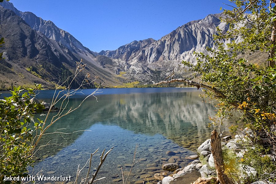
Also in view throughout much of the hike is Mount Morrison. This impressive, granite peak towers over Convict Lake at its head.
Mount Morrison is named after Robert Morrison, who was killed near the lake in a shootout with escaped convicts from Carson City (more on this later).

Along the trail, you’ll see many flora scattered throughout with rabbitbrush making multiple appearances (at least during our visit).
While not nearly as impressive of a view, be sure to look behind you as you progress. Many view the lake head-on but rarely do they see it from the opposite direction.

Prior to reaching the head of the lake, you’ll come across two forks on the trail. To remain on Convict Lake Loop proper, keep to the left at both junctions.
As you approach the head of the lake, you’ll come across a beach to relax on. There are many rocks and downed logs to sit on, as well as shade.
Depending on the time of year that you’re here, this beach may or may not be accessible. This is due to the decrease in snow pack as summer progresses.

Here, you’ll have easy access to the lake if you decide to go for a mid-hike swim (like I did) or to just simply dip your toes into the water.
When you’ve finished relaxing, simply continue in the same direction you were heading to complete the loop. More views await you.
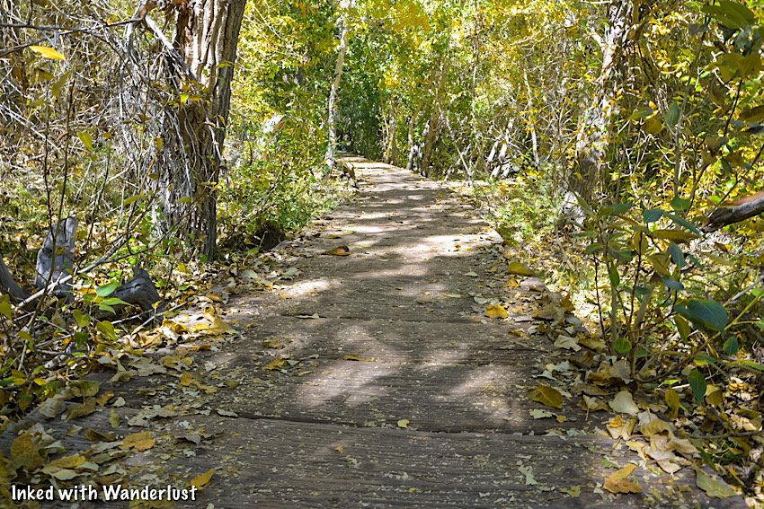
Soon after passing the beach is when you’ll come across the boardwalk that elevates you above the creek. It’s fairly slim with no guardrails. So take care when passing others.
The reason for the boardwalk is the heavy run-off from melting snow pack early in the season. If it weren’t for this boardwalk, this section of trail would be inaccessible during that time.
We were here in mid-October, so there wasn’t any run-off to speak of. Even without the run-off, though, the boardwalk made for an idyllic element to the trail.

After a short while you’ll be back on hard compacted dirt and hiking through beautiful aspens before heading up a short incline to the other side of the lake.
Up until this point, the trail was relatively flat. On this side of the trail, you’ll encounter quite a few ups and downs. Fret not, they’re barely noticeable.

Soon, you’ll come to a point that’ll appear to be the end of the trail. That point is another beach with a large, paved parking lot just above it.
To re-join the trail, work your way through this area (or the parking lot). From this point forward, you’ll be on the paved, accessible portion of the trail.

Throughout this section of the trail, the views of Convict Lake and Mount Morrison will be heavily obstructed by trees.
Here and there, the views open up through the trees and as you near the end, you’ll come across an accessible fishing dock with a commending view.

From here, simply continue on until you’ve reached your vehicle. Better yet, stop by the marina and inquire about kayak or paddle board rentals.
You could also head a ways up the road and stop at the resort for lunch. They’re open daily during the summer months and most days in the fall.
How Did Convict Lake Get Its Name?

In 1871, a group of inmates escaped from a prison in Carson City and somehow, without shoes, made it all the way to what was then known as Monte Diablo Creek.
These days, with established highways, that trek would be about 140-miles. Keep in mind that Highway 395 wasn't constructed until 1926. So they trekked much, much longer than that.
At Monte Diablo Creek (what is now Convict Creek) Sheriff George Hightower and members of his posse (consisting of Robert Morrison, Mono Jim and others) encountered the inmates.

The inmates ambushed the posse and a shootout ensued. In the shootout, both Robert Morrison and Mono Jim were killed. The inmates got away, but were later captured in Round Valley.
For their sacrifice, the mountain towering over the lake was named, Mount Morrison, while the smaller peak adjacent to it was named Mono Jim.
Then, the lake was named, Convict. This gives the representation that the two posse members who perished will always have the watch over the convicts.

Your Thoughts…
Have you hiked the Convict Lake Loop before? If not, does this sound like a trail you and your family would enjoy?
Let us know in the comment section below! We love hearing from our readers.
Please support our website by subscribing to our newsletter below.
Thank you for reading.
Check Out These Amazing Oregon Destinations!

How to Visit Hot Creek Geologic Site in Mammoth
Located right off of the famed highway 395 and a stone’s throw from Convict Lake, Hot Creek Geologic Site is a wonderful example…
Contains affiliate links | 3 minute read
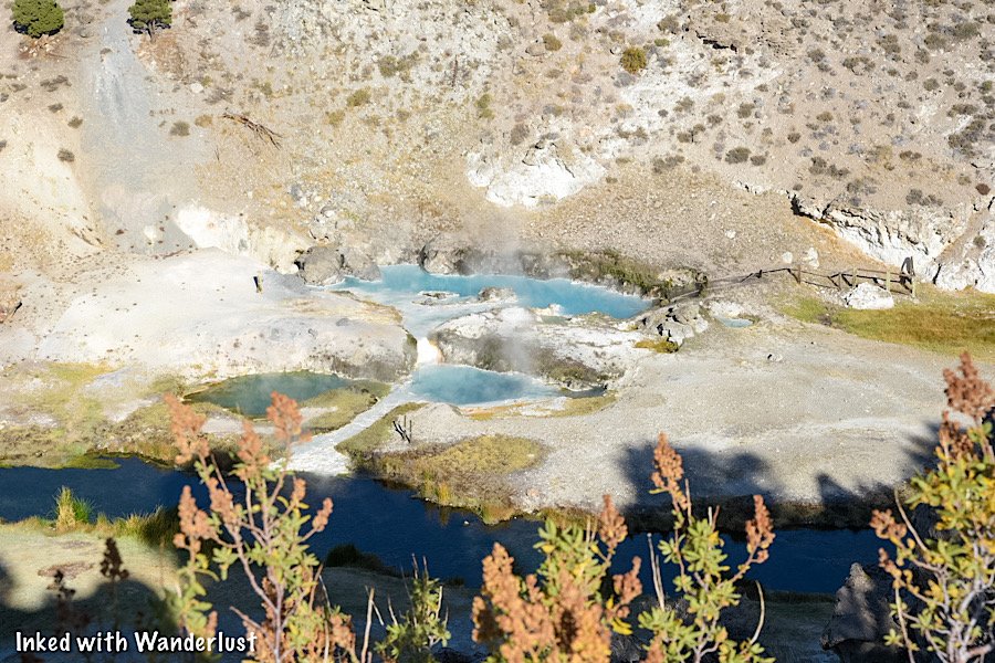
Located right off of the famed highway 395 and a stone’s throw from Convict Lake, Hot Creek Geologic Site is a wonderful example of the area’s volcanic past and present.
Here, you’ll bear witness to geology in action as boiling water rises to the surface from a chamber of hot magma lying three miles below your feet. It’s appropriately nicknamed, “Little Yellowstone”.
Read on below to find out how you can visit this amazing California destination for yourself. It’s definitely worth a stop on your travels along highway 395.

Quick Stats
Location: Mammoth Lakes, CA (Mono County)
Fee: None
Permit: None
Open: All year, sunrise to sunset (road can be difficult to navigate during winter)
For: Everyone
Restroom: Multiple at the parking lot
Parking: Large, paved lot at the main overlook.
EV Stations: None
Difficulty: Easy, but does have a slightly steep pathway
Popularity: Moderate
Mileage: Less than a mile, out and back
Time: One hour or more
Elevation Gain: N/A
Condition: Well-maintained
Pets: Allowed on leash
Drones: Drone friendly, but small airport nearby
Hazards: Stick to the path and do not enter the water
Our Visit(s): 2017 and 2022
Getting To Hot Creek
As stated above, Hot Creek is just a few miles off of highway 395, just outside of Mammoth Lakes. If you’re in the area visiting Convict Lake (or just driving through), Hot Creek is an easy stop.
Regardless of which direction you’re traveling from, you’ll turn onto Hot Creek Hatchery road for about 3.5 miles to the parking lot on your left.

The road is paved for the first half mile or so but will turn into dirt/gravel path for the remainder. Our Chevrolet Cruze made it just fine, so high clearance isn’t necessary.
Do note that during winter, this road can be difficult, even impossible, to navigate in a vehicle. Skis, snowmobiles or snowshoes may be necessary.
The parking lot is fairly large with ample space. There is no parking or entry fee to worry about. If needed, there are multiple restrooms at the far end of the lot.
Hot Creek Overlook and Trail
If all you want to do is see the geothermal pools but you don’t want to trek to the bottom, you can easily do so from the overlook.
The trail going to the bottom is paved and easy to follow, but it is steep going in and coming back out. I’m not sure I would recommend it to someone using a wheelchair.
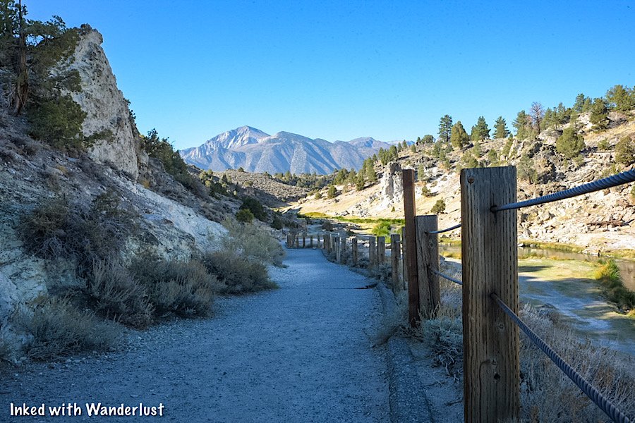
Following the trail, head past the restrooms on your right and then go left at the junction. From here, you’re less than a quarter-mile to the bottom.
Along the way, you’ll see multiple signs warning you to keep to the trail and the dangers of the water. Please heed these warnings
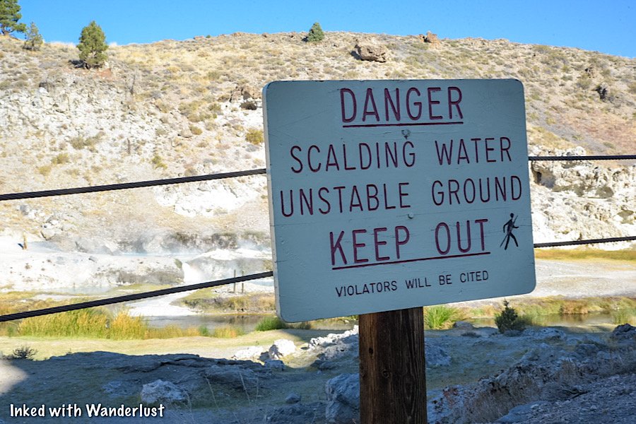
Years ago, people were actually permitted to soak in the pools. However, the pools have since risen to a dangerous temperature, so soaking is now banned.
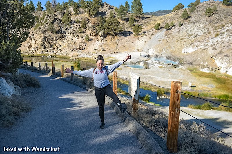
At the bottom, there will be signs stating which areas are closed off. Unfortunately, you can’t get near the water and the geothermal pools are actually located across the river.
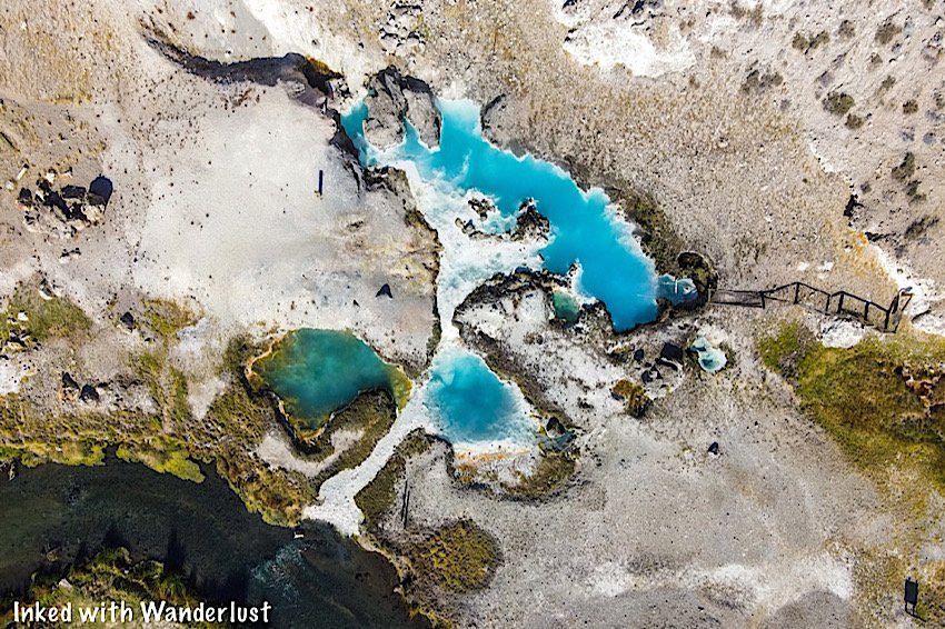
The main pools across Hot Creek give off a beautiful baby blue hue when the sun hits them just right. It’s a stark contrast to the darker color of the creek.
Further up river, there are additional thermal pools, but they are difficult to see as most of this area is closed off due to unstable ground.

To see them, head back up the pathway where you initially turned left at the junction. At the junction, go left and continue straight to a small overlook.
Be careful here. The views of the creek, pools and mountains are top notch, but there are no guard rails and the drop-offs are steep.
Your Thoughts…
Have you been to Hot Creek Geologic Site before? If not, is this something you think you and your family would enjoy checking out? Do you know of more sites like this?
Let us know in the comments below! We love hearing from our readers!
Be sure to check out our posts about more great destinations in Mono County below.
Please support our website by subscribing to our newsletter below.
Thank you for reading.
Check Out These Amazing Nevada Destinations!

Base Camp Pizza: An Excellent Option For Pizza in Tahoe
We’ve all been there. You’ve been outside, hiking or skiing all day long, and you’re completely famished. To make matters…
3 minute read | contains affiliate links
We’ve all been there. You’ve been outside, hiking or skiing all day long, and you’re completely famished. To make matters worse, you have no idea where to eat.
Thankfully, in Lake Tahoe, there is no shortage of amazing eateries to choose from. You’ll find everything from fine dining establishments to burger shacks and everything in between.
If you and your family are looking for delicious pizza, though, we believe we have a great recommendation for you; Base Camp Pizza.
Located in Heavenly Village in South Lake, Base Camp Pizza offers up amazing, mouth-watering pizzas with all sorts of creatively unique toppings.
In this post, we’ll discuss our experience dining here and hopefully help you determine whether or not you and your family would enjoy it as well. Let’s get into it!

Pertinent Info
Location: South Lake Tahoe in Heavenly Village
Address: 1001 Heavenly Village way
Cost: $10 - $15 per person
Food: Pizza and other Italian food
Open: All year
Seating: Indoor and outdoor
Alcohol: Full bar w/ extensive cocktail menu
Website/Menu: www.basecamppizzaco.com
Our Visit(s): 2017 & 2022
The Restaurant
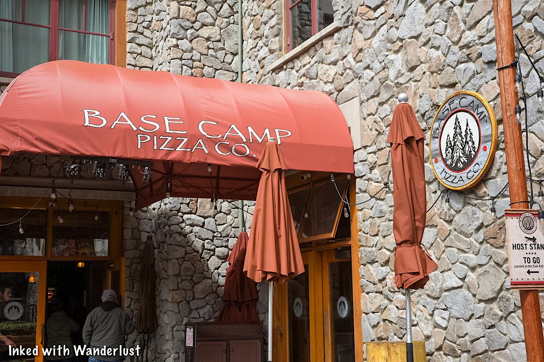
As stated above, Base Camp Pizza is located in the Heavenly Village complex in South Lake Tahoe (the busiest and most developed area of the lake).
If you park in heavenly’s parking garage, you’ll find Base Camp across from the garage’s exit just past the bathrooms and ATM machines.

If you don’t want to pay for parking, park in the Safeway parking lot across the street from Heavenly Village Cinemas.
Simply cross the street and walk past the movie theatre. You’ll soon see a mini-put course in the center of the walk-way. Base camp will be just past that on your left.

The restaurant features both indoor and outdoor seating. If your visit coincides with the busy summer months, both will likely be full.
One downside to here is they don’t accept reservations. So if it’s busy (or if your group is larger) we would recommend eating during non-traditional times to avoid a lengthy wait.
The Food

Much like most pizza eateries, Base Camp offers a variety of creatively topped pies. Of course, they also offer your garden variety types such as combo, pepperoni and plain cheese.
So as long as everyone in your group likes pizza, chances are, no one will go without. In the event that someone in your party doesn't , however, they do have other options. Such as:
Spaghetti Bolognese
Italian Herb Shrimp Pene
Four Cheese Ravioli
Gouda Mac & Cheese
Tomato Basil w/ Meatballs
A variety of soups and salads

As far as appetizers are concerned, we were impressed with Base Camp’s offerings. Typically, pizza eateries don’t put too much thought into those.
We went with the beer battered parmesan garlic fries and loved them. They were perfectly crisp and came with a generous amount of garlic and parmesan.
Our one and only critique was we wish they got a little more creative with the dipping sauce rather than serving basic ketchup. Aside from that, they were great.

Now we get to the pizza. The hero. I assume that’s why most of you are reading this post, correct? As stated above, they have a variety of toppings to choose from but if you’re into the classics, they have those.
I ordered the smokey bbq chicken with bacon. It was topped with roasted chicken, crispy bacon, red onions, bbq sauce, cilantro, creamy smoked gouda cheese and their signature four cheese blend.
In short, it was delicious! I’m usually a pepperoni guy, so this was a break from my normal. If you’re picky (like me), go with this one. It doesn’t have any “scary” ingredients on it.

We also ordered the restaurant’s namesake pizza, The Base Camp. Its toppings include pepperoni, Italian sausage, roasted onions, portobello mushrooms and their signature four cheese blend.
This one was full of flavor, but all the heavy toppings caused the crust to get a bit soft towards the middle. Just fair warning if you plan on ordering this one.

They also have an extensive drink menu with a full bar. If you don’t see a drink you like on the menu, they can make most cocktails if you request it.
Since it was a stormy day I ordered an Irish coffee with a shot of Baileys. Kisha ordered the, Tahoe Toddy. Both drinks were delicious and hit the spot.
Our Thoughts…
We’ve eaten at Base Camp Pizza twice and both times were stellar experiences. The service was good and the food was great. We really don’t have much to complain about.
The only negative we can come up with is the price but honestly, you’re eating at a restaurant in the Heavenly Village complex. You’re going to pay more for everything here.
All things considered, you could bring a large group here, order a couple large pizzas and still get away with feeding that large group for a decent price. Especially if the group splits it.
So in reality, a family eating here would make the most economical sense versus a place where you would each order your own own entree at $15 to $20 (or more) per plate.
So, yes, we recommend giving Base Camp Pizza a try if you’re planning a trip to the South Lake Tahoe area. We don’t thin you’d regret it.
Your Thoughts…
Does Base Camp Pizza sound like a place you and your family would enjoy? Do you have a recommendation for another great eatery in the area? Let us know in the comments below. We love hearing from our readers!
Please support our website by sharing it with your family and friends.
Thank you for reading.

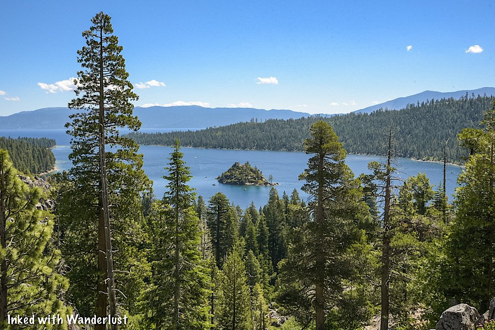
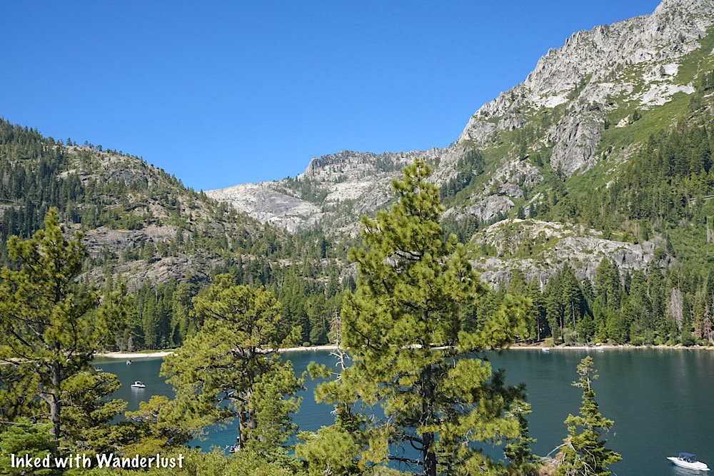
Emerald Bay State Park Guide: Hiking, Camping, Vikingsholm, Kayaking and More
Established as a state park in 1953 Emerald Bay is one of, if not the, most gorgeous enclaves in all of Lake Tahoe. It’s over…
3 minute read | contains affiliate links
Established as a state park in 1953, Emerald Bay is regarded as one of the most gorgeous enclaves in all of Tahoe. It’s over 1,500 acres of hiking trails, turquoise water and pine trees.
It features one of Tahoe’s original summer homes, Vikingsholm Castle, and the only island on the lake, Fannette Island.
One caveat to Emerald Bay is due to its beauty, it is very popular and has a minimal amount of available parking. These two things can seriously complicate your visit.
In this guide, we’re going to cover topics such as directions, camping, activities, parking and much more. Let’s get into it!
How To Get To Emerald Bay

Emerald Bay State Park is located on the west side of the lake, along CA-89 (Emerald Bay road). Despite what you may think, getting there is pretty much a straight shot.
From South Lake Tahoe:
The south side of Lake Tahoe is where most visitors stay and play. It shares a border with Nevada and thus, is littered with casinos, hotels, shops, restaurants, ski lifts and more.

Drive south on Lake Tahoe blvd. (away from Stateline) for 2.5 - 3 miles (you’ll feel like you’re driving away from the lake. Don’t worry, you’ll rejoin it soon)
When you come to the intersection for Lake Tahoe blvd. and CA-89 (Emerald Bay road), turn right and continue straight for about 8.5 miles.
As you enter the perimeter of the park, you’ll arrive at the campground entrance first. If you’re NOT staying here, continue straight
After another couple miles, you’ll see a small lot on your right with the entrance sign (pictured above). This is the lot for Emerald Bay State Park proper.

From North Lake Tahoe/Incline Village:
Unfortunately, visiting from the north side or Incline Village means a longer drive, though it’s still pretty straight forward.
If you’re coming from Incline Village, you could go either direction. Our recommendation, however, would be to follow the north route.
Drive south on Hwy 28 for about 10 miles
Keep left to turn onto West Lake blvd.
At the traffic circle, merge onto CA-89 and follow this for about 18 miles
You’ll pass D.L. Bliss State Park on your left
About 2-miles after passing D.L. Bliss, you’ll see the parking lot for Emerald Bay on your left
Parking & Fees

The parking situation at Emerald Bay is abysmal, at best. Considering the amount of daily visitors the park sees, the amount of parking spaces is insufficient.
If you arrive early enough, and we mean EARLY, you’ll be ok. We arrived just after 8am on a weekday to near empty lot, as you can see in the photo above.
By the time we gathered our things, paid the fee and began our hike (maybe 8:30) the lot was near capacity. That’s how quickly it can happen.

If you see this sign, it’s too late. You’ll either need to circle around a few times until something opens up or try again later in the day.
Keep in mind that parking isn’t allowed on the side of the road and while you could park nearby in the Eagle Falls parking lot, walking along this road is pretty sketchy.

As is the case with most attractions in Lake Tahoe, there’s a fee to use this lot. The pay stations are to the left of the entrance of the trail to Emerald Bay.
These pay stations accept credit/debit cards, as well as cash. They do not, however, give change. So be sure you have the exact amount.
Fees are as follows:
$10.00 for day-use (your day-use receipt is also good for visits to D.L. Bliss and other state parks in the same day)
$3.00 for a single hour (if you’re just looking to check out the view and leave, this is the option for you. If you’re wanting to go down to the beach, you’ll want to opt for day-use)
Emerald Bay Viewpoints

These are a few easy-access viewpoints where you can get a commanding view of Emerald Bay and Fannette Island.
Emerald Bay State Park Viewing Deck

We’ll start with the main viewpoint located just steps from the parking lot were just discussing. It’s large and provides the closest view of the island.
If this is all you want to do (and not hike into the bay itself) then you’ll select the $3.00, one-hour option at the pay stations.
Lower Eagle Falls View
While a bit obstructed by pine trees, the view from Lower Eagle Falls (across the street from the Eagle Falls trailhead) is gorgeous, nonetheless.
If you position yourself correctly, the trees even provide frame for Fannette Island. This is also a great spot to see a sunrise/sunset over Emerald Bay.
Inspiration Point Vista

Further down the road is the small parking lot for Inspiration Point. In our opinions, this is the weakest view of the three. If it’s all you can get, though, it’s better than nothing.
Much like the Vikingsholm lot, there is a fee to park here. The fees are:
$5.00 for 30-minutes or less
$10.00 for over 30-minutes
Honestly, beyond the view, there isn’t much else to do over here. So if all you’re doing is checking out the view, opt for the 30-minute timeframe.
If the Bayview trailhead lot is full (Cascade Falls), you can check for a space in this one. Keep in mind, though, that it’ll add a half-mile to your hike and you’ll need to pay the $10 for the over 30-minute timeframe.
Emerald Bay Things To Do

Despite being a relatively small enclave of the much larger Lake Tahoe, there are many recreational opportunities in Emerald Bay.
Hiking Trails

There are a number of hiking trails contained within Emerald Bay State Park. They range from easy jaunts to full-day treks.
The main hiking trail is the one leading from the parking lot down into Emerald Bay. It’s one-mile, round trip, and is easy going down but steep going back out.
The most famous would be the Rubicon Trail. It’s a beautiful shoreline hike connecting Emerald Bay and D.L. Bliss and is roughly 16-miles, round trip.
Other trails that are outside of Emerald Bay proper but can be accessed along Emerald Bay road include Eagle Falls & Eagle Lake, Granite Lake, Maggie’s Peaks, Cascade Falls, Velma Lakes and much more.
Vikingsholm Castle Tour

This gorgeous example of Scandinavian architecture is a former summer home of multiple people from the early 1900’s.
Daily tours are held during the summer season. A knowledgable guide takes you through the interior and details its history.
If you want more details on Vikingsholm Castle, we suggest reading our previous post about it here.
Kayaking, Paddleboarding, & Swimming

Other popular activities at Emerald Bay include kayaking, swimming and paddleboarding. Emerald Bay’s exclusive vendor, Kayak Tahoe, rents out both daily during the summer months.
I recently tried kayaking for first time in Emerald Bay and wrote a post about my experience kayaking to Fannette Island. If you’ve never kayaked before and are interested, give it a read.

Also, you could always swim or simply hang out at the beach. Note that if you want to swim, you must do so in the designated area.
It’s marked, located near the middle of the beach line and is rather small. If it’s a particularly busy day, this can fill with people quickly.
Emerald Bay Visitor Center

The Visitor Center, while small, is a must-do while in Emerald Bay. Especially if it’s your first time. In it, you’ll find multiple exhibits detailing the history and development of the park.
There’s also a small gift shop inside selling typical items like t-shirts, patches, pins and coffee mugs in addition to food and drink items.
Behind the Visitor Center is a short trail to the lower section of Eagle Falls. This is best viewed in spring or early summer. Run-off is near non-existent after that.
*Note: Eagle Falls is the only waterfall in Lake Tahoe that feeds directly into the lake.
Emerald Bay Boat Tours

There are multiple boat tour operators in Lake Tahoe but our favorite is, Tahoe Cruises. They’ve been operating since 1979, are fully licensed and insured.
They provide both day-time and sunset cruises around Tahoe and Emerald Bay. Their vessels have fully stocked bars and food is available for purchase.
Camping & Lodging

If you’re looking to camp in Emerald Bay, you’ll want to book a site at the Eagle Point Campground. You can reserve a site up to six months in advance.
You must reserve your site through Reserve California and due to its popularity, sites sell-out fast. So the earlier you decide on a date, the better.
Another popular campground near the lake is Fallen Leaf Lake Campground. These sites need to be reserved through Recreation.gov, also up to six-months in advance.
If you’d rather stay in a hotel, we highly recommend, The POSTMARC, in south lake. Particularly if it’s just you and your spouse. It’s our favorite and only 13-miles from Emerald Bay.
Otherwise, if you’re here with family, we recommend Bluelake Inn (budget friendly), Lakeland Village at Heavenly (luxury condos) and Hotel Azure.
Things To Do Near Emerald Bay

While there’s a lot to do in Emerald Bay, there are a plethora of activities and sights to see that are either just outside the boundaries of the park and some just a few miles away.
Below, we’re going to cover a handful of our favorites and some we think you and your family would enjoy.
Eagle Falls & Eagle Lake

Just down the road from the Emerald Bay parking lot is the trailhead for one of the most popular trails in Tahoe - Eagle Falls and Eagle Lake.
Upper Eagle Falls is a short, but somewhat steep jaunt from the parking lot. Beyond that, you hike another mile to the beautiful Eagle Lake.
It’s fairly short and family-friendly. Though you’ll want to bring hiking poles with you (tap the link to see our top recommendation) as this trail is VERY rocky.
*Tip: Check out our post about the hike to Eagle Lake here
Hike to Cascade Falls

Cascade Falls is another fantastic hike just outside of Emerald Bay proper. You’ll find the trailhead at the Bayview trailhead just across the street from the Inspiration Point parking lot.
Much like the trail to Eagle Lake, this one is also rocky. However, it’s only the last 2/3rd’s-of-a-mile. The first third is relatively flat and smooth.
To get the full experience, you should do this hike in spring or early summer. As snow melt depletes, so does the run-off.
*Tip: To get all the details of this hike, check out our post about it here
Get An Epic View From Cave Rock

This one’s a bit of drive away as it’s located on the Nevada side of the lake. Despite that, we feel it’s worth mentioning as the view of the lake from Cave Rock is too good to miss.

The trail is short (about a quarter-mile) and goes at a barely noticeable incline. You will need to scramble up to the top of Cave Rock but it isn’t anything technical.
*Tip: Get all the details about Cave Rock by checking out our post here
Other Things To Do Nearby
Those were just a few of our recommendations. Below, we’ll list a bunch more and how close/far away they are from Emerald Bay:
D.L. Bliss State Park - 2 miles
Fallen Leaf Lake - 9 miles
Baldwin Beach - 15.5 miles
Pope Beach - 17 miles
Sand Harbor Beach State Park - 35 miles
Heavenly Mountain Resort - 24 miles
Skunk Harbor - 38 miles
Stateline - 24 miles
Zephyr Cove - 28 miles
King’s Beach - 28 miles
Tahoe City - 18.5 miles
Mount Tallac Trailhead - 18 miles
Mount Rose Trailhead - 43 miles
This isn’t an exhaustive list by any means, but the places/sights listed above are some of the most popular in the area.
Restaurants Near Emerald Bay

Aside from quick treats at the Visitor Center, there are no eateries inside of or in the immediate vicinity of Emerald Bay State Park.
Below are a handful of restaurants located nearby. All of these can be found along Emerald Bay road.
The Burger Lounge
Beacon Bar & Grill
Sonney’s BBQ Shack
Emerald Bay Bar & Grill
Evan’s American Gourmet Cafe
Hunan Garden Restaurant
Jalapeño’s Tapueria
Camp Richardson’s Ice Cream Parlor
Margarita’s Mexican Restaurant
Cakes by the Lake
Your Thoughts…
Have you been to Emerald Bay? Do you feel there’s something we left out? Let us know in the comments below. We love hearing from our readers!
Please support our website by sharing it with your family and friends.
Thank you for reading.

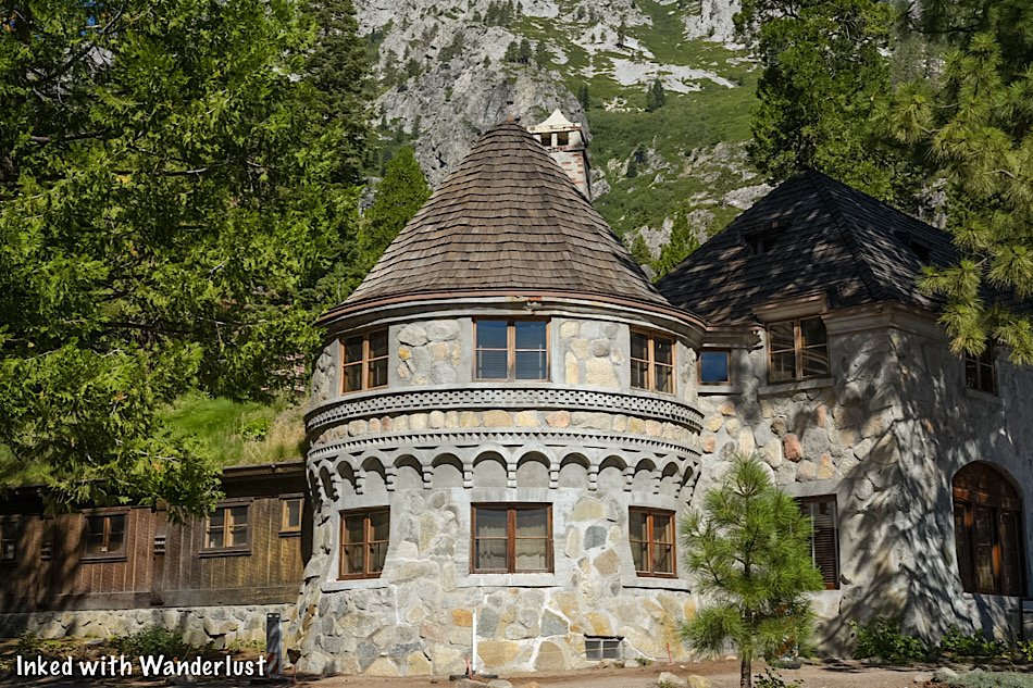
How To Visit Vikingsholm Castle In Emerald Bay State Park
Located along the beach and at the head of Emerald Bay State Park, Vikingsholm Castle is a fine example of Scandinavian…
3 minute read | contains affiliate links
Located along the beach and at the head of Emerald Bay State Park, Vikingsholm Castle is a fine example of Scandinavian architecture right here in Lake Tahoe.
This Nordic estate sits on 232-acres of pristine beach line, beautiful turquoise water, Fannette Island (the only island in Tahoe) and the only waterfall in Tahoe that flows directly into the lake.
Unlike most state parks and attractions like Vikingsholm, you cannot drive up to it. A visit to Emerald Bay and Vikingsholm requires you to either hike or boat in.
In this guide, we’ll cover all the necessary information you’ll need to plan a visit for yourself. Topics such as the hiking trail, parking, when to go and more will be covered.
Let’s get into it!

Exciting news for our readers!
We’re excited to Introduce the all-new "Inked with Wanderlust" online store!
We're thrilled to bring you a fantastic collection of wanderlust-inspired merchandise. Celebrate your love for travel and exploration with our stylish apparel and accessories, designed to ignite your sense of adventure.
Discover a range of unique designs that capture the spirit of wanderlust, from cozy hiking-themed t-shirts to charming accessories that make your wanderlust spirit soar!
Visit our online store today and start your journey of style and adventure. Happy exploring!

Quick Stats
Location: Emerald Bay State Park, Lake Tahoe
Fee: $10 parking fee
Permit: None
Open: Year round, but road is sometimes closed in winter
For: Hikers, beach-goers, swimmers, kayakers, etc
Restroom: At the trailhead and at the beach
Parking: Medium-sized lot
EV Stations: None
Difficulty: Moderate
Popularity: High
Mileage: Two-miles, round trip
Time: A couple hours to a full day
Elevation Gain: 377-feet
Condition: Well-maintained and signed
Features: Vikingsholm Castle, waterfall and beach
Pets: Not allowed
Drones: Not allowed
Hazards: None other than usual wilderness dangers
Our Visit(s): August 2022
Parking and Location

Vikingsholm Castle is located in Emerald Bay, the crown jewel of Lake Tahoe. It’s one of the most popular destinations along the lake and thus, gets crowded quickly.
The key to a successful visit is to arrive early. Emerald Bay does have it’s own parking lot but for the crowds it sees, it’s inadequate at best.
We arrived just after 8am to a near empty lot. By 8:30am, while we were still gathering our things, the lot was nearly full. So arrive early. Earlier if you’re here on a holiday.

If you see this sign, you’ve arrived too late. It won’t re-open until enough space has been made and you’re not allowed to park on the side of the road.
You’ll either need to circle around a few times until spaces become available or try back again later in the day.
If you find space near the Eagle Falls trailhead, you can park there and walk to it but keep in mind, the road is very narrow and borderline hazardous for pedestrians.


The fee to use this lot is $10 for the day. This fee covers other California state parks in Tahoe during the same day (D.L. Bliss State Park is just down the road).
The pay stations accept cash or credit/debit cards. After paying, you’ll be given a receipt. You’ll need to display this receipt on your dashboard.
*Note: If you’re paying with cash, have the exact amount. The pay stations do not give change.

Just to the right of the pay stations is a booth. Head past this to access both the trail and the viewing deck for Emerald Bay.

Soon after passing the booth you’ll see a viewing deck on your right. This platform provides a commanding view of Emerald Bay and Fannette Island.

A lot of people simply get to this point, take their pictures and leave. If your intention is to visit the castle, then rejoin the trail and continue forward.
The Trail to Vikingsholm Castle

We’ll first address the difficulty of this trail. At more than a few spots, trail signage indicates how steep and borderline difficult the way back up can be.
From my perspective, the hike back up wasn’t bad. It was a constant incline and a little steep in some spots, but overall I didn’t have a problem with it.
That being said, if you have certain physical limitations, be honest with yourself. The way in is a breeze, but the way out can be difficult if you’re not acclimated to trails like this.


As stated above, the way in is a breeze. If you’re here early, the majority of the trail will have a plethora of shade and you’ll have sporadic views of Fannette Island.

As you near the end of the trail, you’ll reach a junction. If you go left, you’ll be on the Rubicon Trail. To continue to Vikingsholm Castle, go right.
Soon after this juncture, you’ll see the public restrooms for Emerald Bay on your right. Soon after that, you’ll see the back side of Vikingsholm Castle on your left.
Vikingsholm Castle

Vikingsholm Castle is sight to behold and one you’ll have to see for yourself to truly appreciate. How well it blends in with its natural surroundings is a wonderful example of how construction can compliment nature.


Vikingsholm Castle was designed by Swedish architect, Lennart Palme, in 1928. Palme was the nephew of the property owner, Lora Josephine Knight.
Construction of the castle was completed in 1929 and was used my Mrs. Knight and her family as a summer home (one of the first of which in Lake Tahoe).


The castle was owned by Mrs. Knight until her death in 1945. The castle traded hands a couple more times until the State of California acquired it in 1953.
Considering the jaw-dropping beauty of Emerald Bay, it’s crazy to imagine that someone once lived here. I know we would love to have Emerald Bay all to ourselves for the summer.
Tours of Vikingsholm Castle

Unfortunately, we didn’t partake in the tour of the castle as by the time the first one embarked, it was time for us to get going.
Tours of the castle are offered daily and take you through the interior. You’ll follow a knowledgable guide who’ll detail the history of the castle, its development and impact on the area.

Tour information is as follows:
Tours are guided
They are 30-minutes in length
They’re offered daily, early June - late September
Tour times are between 11am - 4pm
$15 per adult, $12 per child 7-17, free for under 7
Tickets can be purchased at the Emerald Bay Visitor Center
For more information on the guided tours, you can check out the Sierra State Parks Foundation.
Also, if you want further details of the history of Emerald Bay, Vikingsholm Castle and the people involved, we highly recommend checking out their official website.
Additional Activities in Emerald Bay

There’s more to do in Emerald Bay than just touring the castle. Many people make the trek down here to hang out on the beach and recreate on the lake.
There’s a dedicated (but small) swimming area near the center of the beach. There’s no swimming allowed outside this border due to the amount of vessels going through the bay.

Paddle boarding and kayaking are also popular activities. There’s a dedicated rental stand (Kayak Tahoe) where you can rent either one for an hour or for the day.
While I was here, I took the opportunity to try kayaking for the first time. It didn’t take me long to get it down so if you’ve never done it, don’t let that stop you.
If you’re interested in reading about my kayaking experience to Fannette Island and the Tea House, check out our article about it here.
Your Thoughts…
Have you visited Emerald Bay, Vikingsholm Castle or Fannette Island before? Do you have any additional tips about visiting this park? Let us know in the comments below. We love hearing from our readers!
Please support our website by sharing it with your family and friends.
Thank you for reading.

How To Kayak To The Fannette Island Tea House in Emerald Bay
Recently, during a visit to Emerald Bay State Park, I made the last minute decision to rent a kayak and explore Fannette…
4 minute read | contains affiliate links
Recently, during a visit to Emerald Bay State Park, I made the last minute decision to rent a kayak and explore Fannette Island and its famed tea house.
I’ve never kayaked before, but I really wanted to check out the island and have always thought about giving kayaking a try, so I pulled the trigger.
After experiencing it, I wanted to put this post together to hopefully encourage others who haven’t kayaked, but have always wanted to.
In this post, l’ll cover topics such as how get to Emerald Bay, where to find the rental place, a little information about Fannette Island and more!
Let’s get into it!
Emerald Bay State Park

In order to kayak to Fannette Island, you’ll first need to access Emerald Bay. There’s only two ways to do this - you either hike or boat in.
I’m going to assume you’re like most people and don’t own or know how to operate a boat. So in this guide, we’ll cover the later.


To start, you’ll begin at the parking lot and trailhead for Vikingsholm Castle. From here, it’s a one-mile trek down to the beach.
You’ll need to pay a $10 fee to park in this lot and you’ll also need to arrive early. The lot fills very quickly.
The trail is a breeze going in, but it will be all uphill on the way out. In my opinion, it wasn’t difficult, but it could be for some. So be honest with yourself.

When you get to the end of the trail and facing Vikingsholm Castle, look to your right and you’ll see a pier leading from the beach into the water.
Just beyond that you’ll see the rental stand for, Kayak Tahoe. They’re the exclusive vendor for kayak and SUP rentals in Emerald Bay.
Kayak Tahoe Rentals

Kayak Tahoe is open during the typical tourist season in Emerald Bay. That usually means June through September.
They open at 10am and close at 5pm, with the final rental leaving the beach at 4pm. No additional rentals can be booked beyond that.


Prices are typical for what you’d find at most beaches in Tahoe. They are:
Single Kayak: $35 one hour, $45 two hours, or $100 full day
Double Kayak: $45 one hour, $65 two hours, or $120 full day
SUP (Paddleboard): $35 one hour, $45 two hours, or $100 full day
These prices are current as of the 2022 season. We always do our best to keep information like this up-to-date, but just in case, here’s their official website.
*Tip: You’ll want to bring a dry bag with you. (tap the link to see our recommendation). These bags will keep your cell phone, camera, wallet and other valuables dry if they were to fall into the water or get splashed.

Once you’ve made your selection, paid the fee and filled out the waiver, you’ll be given a life vest and instructions on how to operate your kayak.
If you’re like me and have never kayaked before, don’t fret, you’ll be ok. Listen to and follow their instructions and you’ll catch on quickly.
*Here’s a few tips they gave me that’ll help you
Stabilize half of the kayak on shore and when getting in, sit down onto that side of the kayak.
Never step in. That’ll cause your kayak to tip.
Always wear a life jacket.
Keep your hips loose and in movement with the kayak.
Always give motorized vessels the right of way.
I went with the one-hour rental and that was more than enough time for me to get to the island, explore the Tea House and kayak back to the beach.
If you feel like it’ll take you longer, be on the safe side and go with the two-hour rental so you won’t feel rushed.
Fannette Island

The island’s now permanent name is Fannette. In the last 100 years, however, it has also gone by Baranoff, Emerald Isle, Dead Man’s, Coquette and Hermit’s.
The shoreline of the island is rocky with little to no beach to speak of. As you approach it, you’ll need to find a spot to park and secure your kayak.
*Tip: The front-facing shoreline has a lot of space to park your kayak and provides the easiest access to the tea house. The rear of the island (the side facing the mouth of Emerald Bay) has very limited access.

As you can see in the photo above, I found the perfect spot in a set of rocks to cradle the kayak while I was gone. This spot was along the shoreline facing the beach.


Once you’re actually on the island, you’ll find the path up to the Tea House through thick brush. You’ll then get to a point where you’re scrambling up some boulders (nothing complicated).
At around the halfway mark, you’ll start getting great views of the bay and a sneak peak of the Tea House over some boulders.


After a short while, you’ll arrive at the Tea House on top of the island. You’ll enter it through the doorless entryway on the side.
The Tea House

The biggest draw to visiting Fannette Island is the old Tea House. All that remains is an empty shell, but it’s still worth to checking out.

The 16 by 16-foot structure was built between 1928-1929, the same timeframe as Vikingsholm Castle and owned by Mrs. Knight (who also owned the castle).

It was used for the purpose in which it’s named; a literal tea house. Mrs. Knight and her guests would be transported to the island by motorboat and be served tea there.
There was a fireplace in the corner and a large oak table with four oak chairs in the center, giving the Tea House a rustic appearance.

From both inside and outside the Tea House, you’ll get fantastic views of Emerald Bay and the Lake Tahoe mountains on each side.

When you’re done checking out the Tea House, simply head back down the same way you came. Hopefully, your kayak will still be there.
I still had around 20-minutes left on my rental time, so I decided to circle the island before heading back. I recommend doing the same if you have the time.


From here, simply head back to the beach to drop off your kayak and life vest. If you’re up for more activities, check out the posts of other things you do in the area below!
“How To Visit Vikingsholm Castle In Emerald Bay”
Your Thoughts…
Have you tried kayaking before or have you been wanting to try it? Tell us about it in the comments below. We love hearing from our readers!
Please support our website by sharing it with your family and friends.
Thank you for reading.

Hiking To Cascade Falls In South Lake Tahoe
Cascade Falls is a beautiful series of waterfalls just outside of the boundaries of Emerald Bay State Park in Lake Tahoe…
5 minute read | contains affiliate links
Cascade Falls is a beautiful series of waterfalls just outside the boundaries of Emerald Bay State Park in Lake Tahoe.
To get the full experience, you’ll need to see it in spring or early summer. Unfortunately, when we came, it was early August. So the run-off was lite.
However, the lack of run-off created dozens of tiny waterfalls scattered throughout (instead of one big cascading waterfall). So it was still a great experience.
In this guide, we’re going to cover all the information you’ll need to visit it for yourself. Topics such as directions, parking information, what to expect and more will be covered.
Let’s get into it.
Quick Stats
Location: West side of Lake Tahoe
Fee/Permit: $10 per vehicle parking fee
Open: Year round, but difficult to access in winter
For: Hikers
Parking: Semi-large parking area
Restroom: In the parking lot
EV Stations: None
Drone Use: Not allowed
Difficulty: Easy to moderate
Popularity: High
Time: 2-3 hours
Milage: 2-miles, round trip
Elevation Gain: 255-feet
Trail Condition: Maintained, but very rocky
Main Feature(s): Cascading waterfall / views of the lake
Pets: Allowed on leash
Special Notes/Hazards: Trail is very rocky. Broken ankles aren’t uncommon on this trail
Our Visit(s): August 2022
Directions, Parking & Trailhead

Getting to the trailhead for Cascade Falls is easy and straight forward. Simply plug Bayview Campground into your GPS and follow the directions.
Shortly after entering Emerald Bay State Park, you’ll see a sign for Bayview Campground on the side of the road. Turn into this lot.
If there’s space available, a parking attendant will approach you to collect the parking fee. It is $10 per vehicle, payable by cash or check.
*Note: Credit/debit cards are not accepted as of 2022
Bayview is a former campground that was re-purposed into a parking for this popular trail. The former camp sites have been repurposed into parking spaces.
If there isn’t space available, you’ll be directed to find a spot along the side of the road. While you won’t have to pay for a spot here, you may have to circle around a couple times and it will add another half-mile to your overall hike.
Cascade Falls Trail
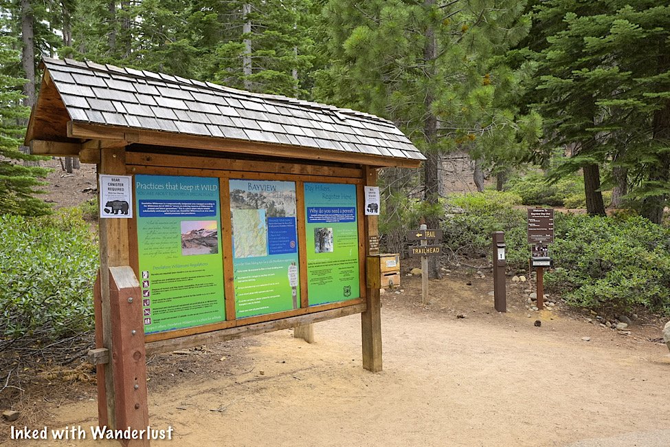
The trailhead is located at the back-end of the parking lot, across from the restrooms. This trailhead is also for the trail to Granite Lake and Maggie’s Peaks.
If you’re only going to Cascade Falls, a Desolation Wilderness permit isn’t required. If you’re going to Granite Lake or Maggie’s Peaks, then you will need to fill one out.

To go to Cascade Falls, head left at the trailhead. This section of the trail takes you under a plethora of shade from the pine trees and is relatively flat.
As you approach Cascade Lake, you’ll hit your first set of steps along this trail. At the top, you’ll get a partial view of Cascade Lake on your left. Keep going to get the full view.

As you reach the top, you’ll continue to follow the dirt/rock trail for another third-of-a-mile. Cascade Lake will remain on your left throughout its entirety.

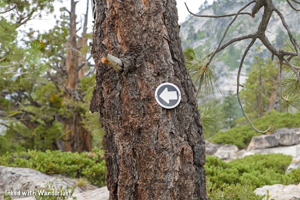
As you get closer to Cascade Falls, you’ll see a small sign of an arrow pointing left posted on a tree. Heed these directions.
From here, the trail moves over solid granite rock and can be hard to follow. Simply use common sense and head in the direction of the waterfall.
Cascade Falls

As stated earlier in this post, if you’re here in spring or very early summer, you’ll be fortunate enough to experience the falls at peak flow.
We were here in early August, so the run-off was down to a trickle. If you happen to be here during this timeframe, fret not, you’ll be treated to dozens of mini waterfalls.


The best ones we found were closer to the bottom where the edge of the falls is, but there are others literally all over the place. You just have to find them.

If you’re a photographer (or aspiring one) be sure to bring a tripod and ND filter with you to help you get creative with your photos.


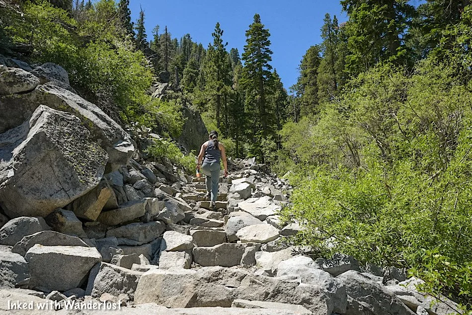
To get to the edge of Cascade Falls, you’ll need to scramble down some boulders but don’t worry, it’s nothing difficult.
From there, you’ll have a commanding view of Cascade Lake with Tahoe out in the distance. We’re not certain how accessible this spot is during peak flow, though.

From here, you can continue further up the trail to other desolation lakes. Keep in mind, though, that if you intend to do so you’ll need to have had filled out the permit at the trailhead.
If you’ve gotten your fill, simply head back in the same direction you came. You’ll be on an incline on your way out so make sure you’re prepared with plenty of water.

Your Thoughts…
Have you hiked to Cascade Falls before? Were you fortunate enough to see it at peak flow? Let us know in the comments below. We love hearing from our readers!
Please support our website by sharing it with your family and friends.
Thank you for reading.

Hike To Eagle Falls and Eagle Lake In Lake Tahoe
Lake Tahoe is filled to the brim with hiking trails of varying lengths. Some can be done in a matter of hours while some will…
6 minute read | contains affiliate links
Lake Tahoe is filled to the brim with hiking trails of varying lengths. Some can be done in a matter of hours while some will take a day or two to complete.
If you’re new to hiking - or you’re a family with children in tow - you may be wondering which Tahoe trails would be best for you. Enter, Eagle Lake.
It’s a short, albeit rocky trail that begins at a beautiful waterfall (Eagle Falls) and concludes at the equally beautiful sub-alpine lake surrounded by rocky granite mountains.
In this guide, we’ll cover everything you’ll need to know about this trail, including; how to get there, what to expect, pictures and more! Let’s get into it!
Here’s some great hiking equipment we recommend…
Quick Stats
Location: Emerald Bay State Park, Lake Tahoe
Fee/Permit: $10 per vehicle parking fee
Open: Year round (though the road to Emerald Bay does close in the winter if conditions are bad
For: Hikers
Parking: Small, paved lot at the trailhead and another (even smaller) lot along the road
Restroom: Yes. At the trailhead
EV Stations: None
Drone Use: Not allowed
Difficulty: Easy to moderate
Popularity: High
Time: 2-3 hours
Milage: 1.9-miles, round-trip
Elevation Gain: 459-feet
Trail Condition: Maintained and clearly signed
Main Feature(s): Waterfall and lake
Pets: Allowed on leash
Special Notes/Hazards: This trail is VERY rocky.
Our Visit(s): 2016, 2018, & 2022
Location & Parking

While not contained within Emerald Bay State Park proper, the parking lot and trailhead can be found just outside its bounderies across the road.
From South Lake Tahoe:
Head south on Lake Tahoe blvd for 2.5 to 3-miles (depending on where you are in South Lake).
Turn right onto CA-89 north/Emerald Bay road.
You’ll soon hit a series of switchbacks and before long, you’ll arrive in Emerald Bay.
Don’t turn right in the lot when you see the sign for Emerald Bay. That’s for the campground.
Instead, continue straight until you see the sign for Eagle Falls (pictured above) and turn left into the parking lot.
From North Lake Tahoe:
Make your way to CA-89 south and stay on it for about 18-miles.
You’ll pass D.L. Bliss State Park before arriving.
After entering Emerald Bay, turn right into the parking lot at the Eagle Falls sign.
Parking is going to be the hardest part of this whole experience. For starters, the lot fills QUICKLY during the spring and summer months.
If you arrive before 9am, you’ll probably be ok. Any time after that, though, and you’ll have a rough time. It may be necessary to circle around a couple of times.
If the lot at the trailhead is full, there’s a small pull-out style lot along the road you can use. Every time we’ve gone, this was where we ended up parking.
The biggest advantage to parking here is you don’t have to pay the parking fee. If you park in the main lot, then you’ll need to pay the $10 per vehicle fee.
Lower Eagle Falls

One aspect of this hike people tend to miss is the lower section of Eagle Falls. To get to it, you’ll need to (safely) cross the road from the parking lot.
You won’t get the traditional, straight-on view of the falls, but you will have the opportunity to get close to it. Especially when the run-off starts to slow down.

From the lower falls, you’ll also get an awesome view of Emerald Bay and Fannette Island. You’ll be contending with trees slightly obstructing your view, though.

When you’re done taking in the views, simply head back up to the road and cross it to get back over to the Eagle Falls trailhead.
If you’re facing the lot, use the boardwalk style walkway on your left. This is a much safer route to the trailhead versus walking through the lot and dodging vehicles.
Upper Eagle Falls

The tail to Eagle Lake officially begins near the upper portion of Eagle Falls. From the trailhead to the bridge at the upper falls, it’s about a quarter-mile.
The trail immediately begins to climb from the trailhead up wide steps made from rock and wooden pillars. You’ll get a temporary reprieve at the top.

As the trail levels out, you’ll come to a junction. Going right will take you to an elevated viewing area for Eagle Falls. Going straight will take you to the bridge.
Shortly after the junction, the bridge will come into view. To the right of it, there’s a bench you can use to rest if needed.


To the left of the bench you’ll find a small viewing area that provides a full view of the upper falls with the bridge in the backdrop.
You will need to scramble down to it and it’s a bit sketchy. Taking small children down there probably wouldn’t be the best idea.

After crossing the bridge, you’ll see a small opening on your right between a few boulders and bushes. If you go through it, it’ll take you to the pond above Eagle Falls.


There wasn’t any signage stating to keep out but I would advise against against it considering it’s literally RIGHT above the crest of the falls.
To continue onto Eagle Lake, simply get back onto the trail and head up. From here, the trail gets even rockier. So watch your footing.
Trail To Eagle Lake

From this point forward, you’ll be in Tahoe’s Desolation Wilderness. In order to pass this point, you will have needed to fill out a permit at the trailhead.
The permit doesn’t cost anything. This is just their way of keeping track of how many people are in Desolation and in case anyone goes missing, they’ll have an idea where you are.
Simply fill out the permit at the trailhead and drop it into the iron ranger. This rule was suspended during the 2022 season but it’ll probably kick back up again in 2023.
From here, the trail gets even rockier than how it was before. It’s literally carved out of rock in most places. Being mindful of your footing is paramount. Many of the rocks are slick.
You’ll continue this incline for another quarter-mile or so before it flattens out up top for a temporary reprieve. From here, you’ll be treated to an epic view of Emerald Bay and the lake.

This middle section of the trail crosses over straight granite, making the trail a bit easy to lose at times. Follow the rocks lining the path and keep to the left.
If you want to see the view of Lake Tahoe as pictured above, you will need to leave the official trail a bit to see it.

Also coming into view throughout this section are the craggy peaks surrounding Eagle Falls and Eagle Lake. The scenery is simply stunning.
Before long, the trail will begin to ascend again as you make the final push to Eagle Lake. The sounds of the creek in the ravine below signals how close you’re getting.

The incline levels out a bit as the peak above Eagle Lake comes into view. You’ll pass another junction at this point. Keep straight.
Soon after this junction, you’ll come to Eagle Lake. Most people stop at the rocky beach near the outlet of the lake. For more privacy, continue straight to other spots.
Eagle Lake

As stated above, this small rocky beach is where most people stop. The outlet is right there and is lined with stepping stones to afford you access to the other side.
You can continue straight for other beaches with less crowds, but these aren’t very well maintained. So you’ll be fighting fallen branches and other hazards.


Eagle Lake sits at around 6,000-feet and is surrounded by rocky, granite peaks. It gets its water from snow melt run-off in the mountains.
The lake itself, while cold, is perfect for swimming or wading. We would recommend keeping kids away from the outlet of the lake, though.


From here, you have a couple choices. The first is you just head back the same way you came to the trailhead.
If you have enough energy, though, you can continue up the trail to more alpine lakes including Granite Lake, Dick’s Lake and Velma Lake.
This short-but-sweet hike to Eagle Falls and Eagle Lake is nothing short of spectacular. It packs a lot of punch with little effort required.
Your Thoughts…
Does this seems like a trail you and your family would enjoy? Tell us about it in the comment section below. We love hearing from our readers!
Please support our website by sharing it with your family and friends.
Thank you for reading.

Burger Barn: The Best Cheeseburgers in Mono County
Whenever we go to (or through) the tiny town of Bridgeport, it’s hard for us to NOT stop at Burger Barn. After a long day of hiking…
2 minute read | contains affiliate links
Whenever we go to (or through) the tiny town of Bridgeport, it’s hard for us to NOT stop at Burger Barn. After a long day of hiking, it’s the perfect spot for a delicious, juicy burger.
They’ve been serving the people of Bridgeport and their visitors since 1983 and have no intention of going anywhere, anytime soon.
This is our inaugural foodie post on Inked with Wanderlust and couldn’t think of a better subject for the first one than Burger Barn.
*Side Note: We’re not restaurant critics by any means, nor do we claim to be. This is simply our honest opinions (from a customer perspective) about our particular experience to help you discover new places to try.

Pertinent Info
City/State: Bridgeport, CA
Address: 152 Main Street
Cost: $6 - $13 per person
Food: Burgers, Tacos, Ice Cream, Chili, etc
Open: Seasonally (usually closed throughout winter)
Seating: Both outdoor and indoor
Service: Walk-up order window/self-seating
Alcohol: Beer served
Website/Menu: No official website, but they are on Facebook
Our Visit(s): 2016, 2017, 2018, 2019, 2020, 2021, & 2022

Getting There
Once you’re in Bridgeport, Burger Barn is very easy to find as it’s right on Main Street (the main drag through town).
From Reno:
Travel south on US-395 for about 115-miles
Soon after arriving in Bridgeport, you’ll see Burger Barn on your left
From Yerington:
For a total of 65-miles, travel south on NV-339 and eventually merge onto NV-208 west
When you arrive at the US-395 junction in town, turn right
You’ll soon see Burger Barn on your right
From Mammoth Lakes:
Travel north on US-395 for about 50-miles
Soon after arriving into Bridgeport, you’ll see Burger Barn on your right
There’s quite a bit of parking here. Some along the side of the restaurant, more in front of the indoor seating building and others on the street.
If you have to park on the street, keep in mind that you’ll need to back into the spaces. Parking on the street facing the sidewalk is a citable offense here.
The Restaurant

To order your food, simply walk-up to the counter window. You’ll place your order, pay and receive an order number.
They’ll call your order over the intercom when it’s ready. Simply pick it up at the other window and enjoy your meal.

As far as seating is concerned, the outdoor portion sits directly in front of the restaurant and consists of several picnic tables.
If the weather is bad (or there’s no outdoor seating available), there’s indoor seating with more picnic tables adjacent to the restaurant.
The Food

While the name of restaurant gives away it’s main feature, Burger Barn actually has an array for food items to choose from.


Firstly, the burgers are amazing. They’re flavorful, juicy and cooked perfectly every time. Though to be fair, our burgers were over-seasoned a couple times.
If you’re not feeling like a burger, they have plenty of variety. One of their offerings, the California Burrito, is great. They also serve street tacos, chili, teriyaki rice bowls, ice cream and more.
Things To Do Nearby

If tasty burgers aren’t enough to convince you to make the trip, perhaps all the other activities Bridgeport has to offer will give you that extra push.
Just down the street from Burger Barn is the historic Mono County Courthouse and behind that is the historical jail. Both of which you can look around in.
About eight miles outside of Bridgeport is the area’s crown jewel; Twin Lakes. Both the lower and upper lake offer world-class fishing, kayaking and more.
In the surrounding mountains are a plethora of popular hiking trails. One of which is the Robinson Creek trail to Barney Lake (our personal favorite).

Another great feature of the area are the numerous hot springs. The two most popular/most easily accessible ones being Travertine Hot Springs and Buckeye Hot Springs.
Travertine is located just off of US-395 behind the Ranger Station. Buckeye is closer to Twin Lakes and is accessed by a maintained dirt road.

Bridgeport is also well known for being in close proximity to many major attractions in the county and state. The closest being Bodie State Historic Park.
It’s also only 38-miles to the east entrance to Yosemite National Park. If you’re a hiker, then this is the side of Yosemite you want to visit.
Additional nearby attractions include:
Wilson Canyon (Nevada)
and much more!
Something else you may not have known is how famous Bridgeport (and the rest of Mono County) is for the area’s fall colors. They’re simply stunning!
Your Thoughts…
Have you been to Burger Barn before? What was your experience with it? Tell us about it in the comment section below. We love hearing from our readers!
Please support our website by sharing it with your family and friends.
Thank you for reading.
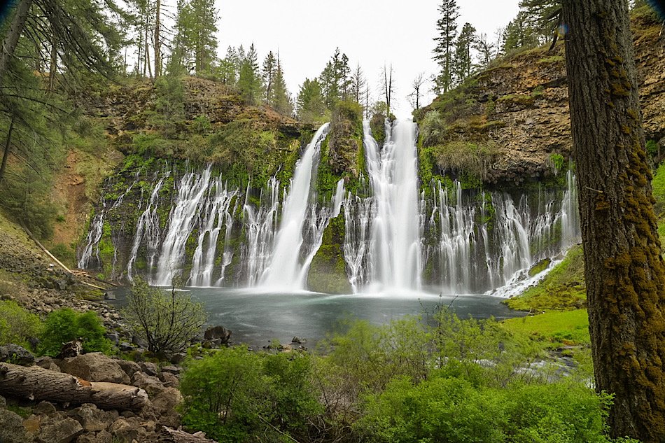
How To Hike The Burney Falls Scenic Loop Trail
Burney Falls is one of the most visit state parks in all of California. Prior to covid, the park would see an average of 4,000…
3 minute read | contains affiliate links
Burney Falls is one of the most visited state parks in all of California. Prior to covid, the park would see an average of 4,000 daily visitors. Since covid, that number has more than tripled to an average of 13,000.
It’s no wonder, either. Burney Falls is a spectacular waterfall. On top of that, it’s one of the most easily accessible waterfalls as it can viewed from an accessible viewing deck just steps away from the parking lot or by taking a short, paved trail to the base.
Many people are completely unaware of the hiking trails contained within the park. So we’ve decided to write a post about the most popular one, the Burney Falls Scenic Loop. It’s a beautiful trail that begins at the rim of the falls and concludes at the base.
If you’ve never been there, you should check out our comprehensive guide on Burney Falls. In it, we cover a lot of information such as directions, camping, hiking trails, best time to visit and more! So if you’re looking for that information, you should definitely read that one and come back here.
Let’s get into it.

Quick Stats
Location: McArthur-Burney Falls State Park
Fee/Permit: $10 per vehicle to enter the park
Open: Year round
For: All visitors/hikers
Parking: Semi-large, paved lot
Restroom: At the visitor center
EV Stations: None
Drone Use: Not allowed
Difficulty: Easy
Popularity: Highly trafficked
Time: 1 hour or more
Milage: 1.2-miles
Elevation Gain: 167-feet
Trail Condition: Well maintained
Main Feature(s): Burney Falls
Pets: Not allowed
Special Notes/Hazards: Though it’s a beautiful trail, Burney Falls will be out-of-view for the majority of the hike
Our Visit(s): October 2016, August 2019, & May 2022

Trailhead, Parking & Direction
The trailhead for the Burney Falls loop trail is directly across the road from the park’s visitor center and parking lot. You’ll see a sign up ahead indicating as such (pictured above).
The parking lot is fairly large, probably closer to medium sized, actually. As we covered in our guide to Burney Falls, this lot tends to fill quickly in the summer months. So if you go during that time, we highly advise that you plan for an early arrival.
Once you’ve parked and paid your entry fee ($10), cross the street and head towards the rim of the falls to begin your hike. There’s a viewing deck where you can get a from above view of the falls.

Burney Falls Loop Trail
If all you want to do is go to the base of falls and leave, bear right towards the stairwell. It’ll only take a few minutes to get down there as it’s only a third-of-a-mile along a well-maintained path.
If you’re dead-set on the loop trail (as you should be) you’ll want to bear left along the dirt path. This trail also takes you to the base, just not as quickly.

Unfortunately, Burney Falls won’t be visible for much of the trail. In fact, you’ll only get the full view once you’ve circled down to the base. Shortly after the beginning of the trail, you’ll get one final look at it through some trees.
After a short time, you’ll arrive at the serene, ‘Fisherman’s Bridge’, crossing Burney Creek just upstream from the top of the falls. If you’re an angler, there are great spots here along the creek to fish for Rainbow Trout.

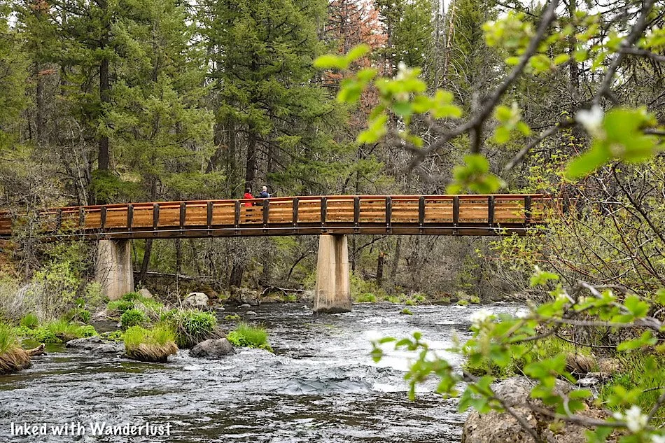
Be sure to stop near the middle of the bridge to take in the views. You won’t be able to see the crest of Burney Falls from here, but you’ll get a great view looking upstream of the creek.

After the bridge, turn right and you’ll enter a heavily forested portion of the trail filled with Douglas Firs and Oaks. Also along this stretch are a number of benches. Feel free to rest your feet for a moment and take in the sights around you.
The trail will begin to descend slightly along a series of gentle switchbacks. Before hitting the descent, you’ll pass a junction to the Pacific Crest Trail and a series of rocky steps built into the trail. No need to worry as the steps are easily navigable.


Near the halfway mark down the switchbacks you’ll get your first glimpse of Burney Falls since the start of the trail. Again, it’s through a collection of trees but it’s a gorgeous view nonetheless.
Rainbow Bridge Junction

At the bottom of the switchbacks you’ll come to another footbridge crossing over Burney Creek. This one is named, “Rainbow Bridge”. Much like the first one, stopping here to take in the views of the creek would be worth your while.
From here, you have two directions in which you could go. Going left from Rainbow Bridge will take you on a detour to Lake Britton. This is a solid option as the picturesque lake provides many recreational activities.
*Note: The detour to Lake Britton from this junction is closed for the 2022 season due to heavy storm damage to the trail. No word on when it’ll open. To reach Lake Britton, you’ll need to utilize the trail leaving from the rim of the falls and through the campground.

To keep to the loop trail and continue on to the falls, however, you’ll want to bear right as you’re walking off of the bridge. Along this stretch, you’ll pass a huge boulder field on your left. Showcasing evidence of the area’s volcanic past.
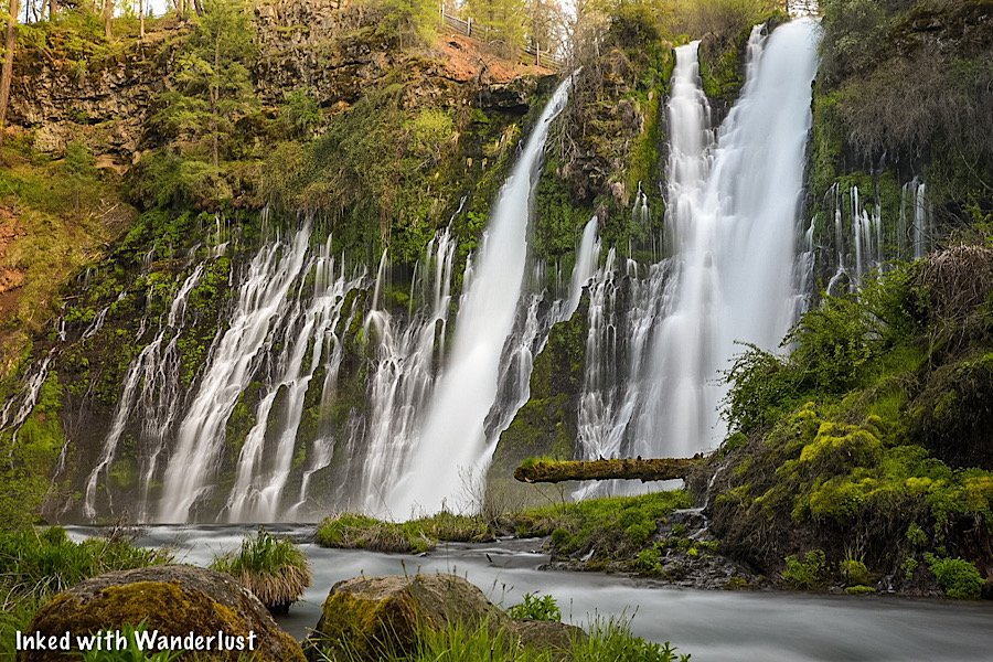
Soon, you’ll begin to hear the sounds of Burney Falls crashing into the pool below it and before long, it’ll come into view. There are many spots along this stretch of the creek to get an excellent side view of the falls. You’ll need to scramble a bit but trust us, it’s worth it.
The Base of Burney Falls

This is the main viewing area of Burney Falls and is where you would’ve ended up had you gone right at the trailhead instead of left. This area is defined by a perimeter made of rocks and is a somewhat small area (considering the crowds this park sees).
For a closer look - or to go for a swim in the pool below the falls - you’ll need to scramble down a rock field. The constant mist from the falls makes most of these rocks very slick. So be sure to watch your footing.

If you’re here on a particularly busy day (pretty much any day during the summer season) expect to find many, many people to be here. It doesn’t take long before that viewing area - and even the rock field - becomes a shoulder-to-shoulder situation.
We’ve never been here during winter, but we feel spring is the best time to go, crowds wise. Our most recent visit was the first week of May, 2022, and we practically had the falls all to ourselves. A few people came and went but that was it.

Once you’ve gotten your fill of the views, continue on the trail by heading up the paved switchbacks back to the rim (where you first began). Along the way, you’ll encounter several interpretive signs detailing the development and history of Burney Falls and the area.

It may be a persistent climb back to the rim but fret not, it isn’t that bad. The switchbacks are gentle and towards the end, there’s a couple sets of stairs to help with the final push.
Once you’re back at the rim and satisfied with your visit to the park, simply cross the road to get back to the parking lot. Or better yet, stop by the visitor center before leaving. They have many interesting/informative exhibits.

Which Direction Should You Go?
That’s entirely up to you, but we wrote this trail guide in the clockwise direction as that was the direction we went and feel it’s the way to go. The reason is because of the epic payoff at the end (Burney Falls).
However, there’s nothing that says you can’t go counter-clockwise. If you do, you’ll arrive at the falls after just a third-of-a-mile. To continue past that, head down the paved trail along the creek.
When you reach Rainbow Bridge, simply cross it and head up the dirt switchbacks and onward to Fisherman’s Bridge. There’s no right or wrong. Either direction will provide the same great views and experience.
*Tip: Be sure to read our comprehensive guide about Burney Falls State Park. It’ll help you plan your visit with information on weather, camping, amenities, directions and more!

Your Thoughts…
Does this sound a trail you and your family would enjoy hiking together? Have you been to Burney Falls or have you been dying to go? Tell us about it in the comments below. We love love hearing from our readers!
Please support our website by sharing it with your family and friends.
Thank you for reading.

Hedge Creek Falls: A Short Hike To An Incredible Waterfall
While not a grand sight or a long hike deep into the wilderness, Hedge Creek Falls still packs a punch as a highly scenic…
3 minute read | Contains affiliate links
While not a grand sight or a long, deep hike into the wilderness, Hedge Creek Falls still packs a punch as a highly scenic, simple trail terminating at the 35-foot waterfall spilling over a hanging wall of basalt.
The trail’s unique feature, aside from the waterfall itself, gives hikers the rare chance of going behind the waterfall via a large cleft in the rock.
Hedge Creek Falls is perfect for families with small children, pets, or anyone who happens to be driving by and wants to stretch their legs. Both the parking lot and trailhead are conveniently located right off Interstate-5.
In this guide, we’ll cover everything you’ll need or want to know about hiking to Hedge Creek Falls. Let’s get into it.

Quick Stats
Location: Dunsmuir, CA
Fee/Permit: None
Open: All year
For: Hikers
Parking: Small dirt lot across the street from the trailhead
Restroom: Port-O-Potty in the parking lot
EV Stations: None
Drone Use: No signs stating you can’t
Difficulty: Easy
Popularity: Moderate
Time: Less than an hour
Milage: 0.7-miles, out and back
Elevation Gain: 200 feet
Trail Condition: Well maintained
Main Feature(s): 35 foot waterfall, views of Mount Shasta, and views of the Sacramento River
Pets: Allowed on leash
Special Notes/Hazards: Vehicle break-ins are common in the trail’s parking lot
Our Visit(s): May 2022
*Please practice leave no trace principles and keep to the trail

Trailhead and Parking
The Hedge Creek Falls trail is probably one of the easiest trailheads on earth to find. Both it and the parking lot are located directly off Interstate-5 on Dunsmuir Ave.
Whether you’re traveling south or north on I-5S, you will see signs for Hedge Creek as you get close. From either direction, take exit #732 and go right on Dunsmuir Ave and it’ll be right there.

If you’re coming from Burney Falls, simply travel north on CA-89 for about 56-miles before jumping on Interstate-5 south for a short time. From there, follow the same directions above.
The parking lot is of the dirt variety and small. It fills rather quickly in the summer so the sooner you can arrive, the better. To find the trailhead, simply cross the street.

The Trail
The trail begins just past the water fountain on the left. It’s a well maintained, packed dirt trail with very little tripping hazards (rocks, branches, etc).
You’ll descend down to the falls under the cover of trees, providing plenty of shade even on the sunniest of days. After just a few minutes, you’ll take note of the sounds of Hedge Creek.

After just ten minutes or so, you’ll arrive at the waterfall. The time of year you’re visiting will determine how heavy the flow is. We were here in May and it wasn’t flowing very heavily.
As you approach the falls, the trail temporarily gets rockier (and slick during the winter) due to how close you’re able to get to both the falls and the creek.


Here, you’ll have the rare opportunity to walk directly behind a waterfall. There’s a large cleft cut into the columnar basalt wall for you to walk through.
You’ll also take notice of the dozens of handprints all over the walls of the hanging rock. These were left by visitors who used the mud in the cleft to leave those prints.


From here, the trail continues for another tenth of a mile to a spectacular view of the Sacramento River and an ‘ok’ view of the summit of Mount Shasta (the rest is obstructed by trees).

Onward to Mossbrea Falls
Now, there’s (almost) nowhere left to go. Most will simply turn around and go back their car. Others could cross the river (if it’s safe) and continue on to an even more beautiful waterfall, “Mossbrea Falls”.
Currently, there’s only an unofficial trail to Mossbrea that requires hikers to commit the crime of trespassing on more than one occasion. So the only other way is to cross the river.
The Mount Shasta Trail Association has been making efforts to finally construct an official trail. Essentially, the plan is to connect Mossbrea Falls to the Hedge Creek Falls trail via a bridge over the river.

Unfortunately, there hasn’t been much progress as the last update given by the MSTA was back in July of 2020. If you want to keep tabs on this project, go here.
Hopefully this project will pick up steam soon because Mossbrea Falls is amazing and it’s criminal that it can’t be accessed without risking a misdemeanor charge.
Have you been to Hedge Creek Falls? Or are you a local and have heard any rumors about the trail to Mossbrea or what the hold up’s about? Lets us know about it in the comments below!
Please support our website by sharing this article with your family and friends.
Thanks for reading.
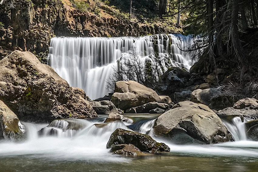
McCloud River Falls: Three Fantastic Waterfalls in One Hike
Just a short distance between two popular Northern California towns; Burney and Dunsmuir, McCloud Falls is a series of three…
Disclosure: This post contains affiliate links. If you make a purchase through these links, I may earn a small commission at no additional cost to you. I only recommend products or services that I believe will add value to my readers.

Just a short distance between two popular Northern California towns; Burney and Dunsmuir, McCloud Falls is a series of three beautiful waterfalls along the McCloud River.
Lower, Middle, and Upper McCloud Falls are easily accessible by foot via a 3.9-mile (out-and-back) hiking trail or by driving to each one via the paved road connecting the three. Additionally, each fall has its own parking lot with picnic tables, signage, restrooms and a campground nearby.
In this guide, we’ll cover a few things you’ll need to know about each of the falls like where to find them, how to access them once you’re there, etc. Let’s get into it.
Quick Stats
Location: McCloud, CA (in between Burney and Dunsmuir)
Fee/Permit: None
Open: Year round, but can be difficult to access in winter
Parking: Large, paved lots at each waterfall
Restroom: Three (one at each waterfall)
EV Stations: None
Drone Use: Allowed (UAV must be registered and follow applicable laws)
Difficulty: Easy by vehicle / Easy to moderate by foot
Popularity: Popular
When: Weekdays and early is best for lower crowds
Time: 2-3 hours
Milage: 3.9 miles, out and back via the trail
Elevation Gain: 337-feet
Trail Condition: Well maintained and easy to follow
Main Feature(s): Three waterfalls of varying heights
Campground: Fowler’s Campground (located near the lower falls)
Pets: Allowed on leash
Special Notes/Hazards: Each waterfall can either be hiked or driven to. No specific dangers aside from usual wilderness hazards.
Our Visit(s): August 2019 & May 2022
Directions To McCloud Falls

If you already happen to be at Burney Falls (or will be), making McCloud Falls part of your itinerary is easy as it’s just under fifty miles away. Even better, if you’re coming from Interstate-5, it’s only thirty(ish) miles away.
McCloud Falls is a well known destination, so simply plugging that into your GPS of choice will get you there without issue. If you’re not a tech person, here’s the simple directions:
From Burney: Go north on Highway 89 for 35-40 miles, then take a left onto Fowler Public Camp road and follow the directions.
From Dunsmuir: Go north on Interstate-5 and take the exit for Highway 89 south. Follow this for about 20-25 miles and take a right onto Fowler Public Camp road.
The road leading to the falls is paved and well maintained. You just need to decide whether you’re going to hike to all three or simply drive.
The falls are handicap accessible and feature viewing decks straight off of the parking lots. For those who wish to, you have the option to walk down to the base of each one for a closer look.
Because we stopped here between our visits to Dunsmuir and Burney, we decided to drive to each waterfall and walk down to their bases to save time. While I recommend hiking the trail connecting the three, you can save a significant amount of time by doing what we did.
Lower McCloud Falls

The lower falls is a great place to begin your visit. The parking lot is paved and decently large. The viewing deck is just off the parking lot, past the restrooms.
If you’re able, I highly recommend going down the stone steps to get a closer view of this 15-foot waterfall. These stone steps is also where the official beginning (or end) of the hiking trail is. I have seen pictures of people swimming in the emerald green plunge pool, so I assume it’s allowed.
In fact, while you’re there, look for metal hooks embedded into the rock. According to a local I spoke with, those are the remains of what used to be a ladder swimmers used to climb out.
From here, you can either start hiking up the trail to the middle falls or head back to your car and drive up. If you drive, simply take a right up the road and look out of the waterfall sign.
Middle McCloud Falls

The middle falls was our favorite and arguably the most impressive of the three. If you only have time for one, I recommend this one. If you’re hiking here from the lower falls, the trail will take you straight to the base. If you drive, you’ll need to hike down or simply view it from above.
To get to the base, you’ll need to hike the short, quarter-mile(ish) trail to the bottom. It’s easy to miss and there isn’t any signage indicating where to go (at least none that we saw). What you’ll look out for is a dirt path, lined with rocks, spurring off to the right from the paved one going to the viewing deck.
The trail consists of packed dirt and while a bit rocky in some spots, overall it’s a well-maintained, easy to-follow trail. You’ll take a short series of graded switchbacks before reaching the bottom.

When the trail flattens out at the bottom, keep left to the falls and you’ll eventually reach a rest area. Between you and the falls is a boulder field that you’ll need to scramble over if you want a closer view. The pool in front of the falls is perfect for swimming and while we don’t how deep it is, we have seen videos of people cliff jumping into it, indicating it’s decently deep.
Out of the three, the middle fall is where we spent the majority of our time. I wrote an extensive post highlighting the middle falls and its trail if you’d like to read more about it.
Upper McCloud Falls

The upper falls is the one with second tallest plunge at 30-feet. Similar to the lower fall, it’s narrow and dumps into a small pool but unlike the lower fall, it’s carved out an opening between the basalt rock walls, rather than just spilling over it.
There’s a plethora of viewing space up top but unfortunately, none of them provided an impressive view of the waterfall (in my opinion, anyway). To get a better view, you’ll need to rough it a bit.
Just past the last viewing deck, where the dirt trail begins, you’ll see a spur trail on your left going straight down to the waterline. Watch your footing and take your time. It’s short, but steep with nothing but loose dirt and rocks. Taking a spill here wouldn’t feel good.
There isn’t a lot of space at the water’s edge. Most of it consists of awkwardly spaced boulders that you’ll need to sit or stand on to view the waterfall.
When you’re done, head back up and go a little further upstream to see the cascades feeding the waterfall or read about the development of these falls on the informational signs near the trailhead.
Hike or Drive?

That all depends on personal preference, physical limitations, how much time you have, etc. Both have their advantages and disadvantages.
Hiking the trail: You’ll need to ensure you have the proper equipment with you such as trekking poles (see my recommendation here), hiking boots/shoes, water, sun protection, etc. Each waterfall is less than one mile from the next and the only real “challenging” part is the uphill slog out of the middle fall. Aside from that, it’s a fairly simple trail.
Driving to each fall: For those short on time or with physical limitations, this would be the best option. Each fall has its own parking lot and all of the upper viewing decks are wheelchair accessible. If you’re able, you can still get a close view of each waterfall (which is really the main point, anyway).
As far as where to start, that’s also your personal preference. If you’re hiking with a group with multiple vehicles, our recommendation would be to leave a vehicle at the lower fall, take another up to the upper fall, and start the hike there.
This strategy is two-fold as:
You’re hiking down to the lower falls, bypassing having to work your way up and out of the middle falls.
Saves you time by cutting the hike in half.
If you’re driving, it doesn’t really matter where you start. If you only have time for one waterfall, we recommend the middle falls as it’s the largest, most scenic/photogenic, and has the best swimming hole.
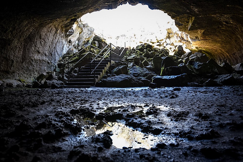
Subway Cave: Explore An Awesome Lava Tube Near Burney Falls
Subway Cave, located just a small distance from the town of Lassen Volcanic National Park, is the largest and most easily accessible lava…
5 minute read | Contains affiliate links
Subway Cave, located just a short distance from Lassen Volcanic National Park, is the largest and most easily accessible lava tube in the world.
The access road is right off of highway 44 and the cave itself is a short, five-minute walk from its decently sized parking lot.
If you’ve ever wanted to explore a cave but you don’t feel like crawling through tight spaces, Subway Cave is perfect for you as it’s large and wide open.
So how do you get there? What’s the inside of the cave like? We answer these questions and much more below!

Quick Stats
Location: Near Old Station, California
Red Tape: None
Open: Seasonal. May through October
For: Hikers/Explorers
Parking: Fairly large, paved lot
Restroom: Yes. At the trailhead
EV Stations: None
Drone Use: Not allowed
Difficulty: Easy
Time: One hour or more
Milage: 1/3 of a mile
Trail Condition: Well maintained outside the cave. Inside the cave is “as-is”. Rough floor, but no extreme hazards
Main Feature(s): Lava Tube
Pets: Not allowed
Special Notes/Hazards: You’ll need to bring a flashlight as its pitch black in the cave. You’ll also need a light jacket or sweater as the cave hovers at around 46 degrees.
Our Visit(s): May 2022

Getting To Subway Cave
Getting to Subway Cave is simple and straight forward. Especially if you happen to already be in the area or will be driving through.
Since it doesn’t take very long to explore, it makes for an excellent roadside stop to get out and stretch your legs for an hour or so.
From Reno
Take highway 395 north for about ninety miles
Go right on CA-44 west for forty-six miles
Turn right on CA-89 north
About a third of a mile after turning on CA-89, you’ll see a sign for Subway Cave. Turn right onto the road
Total drive time is about two hours and twenty minutes
From Redding
Take CA-44 east for fifty-seven miles
Continue onto CA-89 north for about a third of a mile
When you see the large sign for Subway Cave, turn right.
Total drive time is just over an hour
From Burney Falls State Park
Take a right out of the park onto CA-89 south for twenty-eight miles
Total drive time is about thirty minutes
Parking at Subway Cave

After turning onto the road from the highway, it’s a short drive to the parking lot. The lot itself is fairly large, bring able to accommodate at least a few dozen vehicles.
There’s no guesswork involved as the road eventually terminates at the lot. You won’t have to worry about money as both parking and entering the cave are free.
At the trailhead you’ll find a few interpretive signs detailing the formation and history of the cave, along with the area as whole.
Subway Cave Lava Tube

As stated above, it’s only a five-minute walk from the trailhead to the entrance of the cave. You’ll start down a paved path before hitting a set of stairwells.
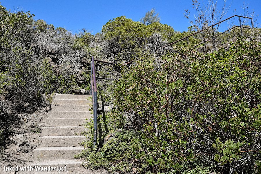
At the top of the stairwell, you’ll continue on a dirt path for a short distance before arriving at the mouth of the cave dubbed; Devil’s Doorway.
Devil’s Doorway

The entrance to Subway Cave will be on your right and down a couple sets of stairwells. Around you, you’ll notice debris from the cave collapse that formed the 25-30-foot across entrance.
As soon as you reach the cave floor, you’ll immediately notice the temperature change. It could be one hundred degrees at the surface, but the cave remains at a cool forty-six.

The other element of the cave you’ll immediately take notice of is how dark it is. It won’t take long before you’ll be unable to see your own hand in front of your face.
*There are NO natural or artificial light sources in Subway Cave!
Due to this, be sure to bring a flashlight or headlamp with a minimum of 500 lumens to safely navigate the cave. The light on your cell phone will not cut it.

The image above is deceitful as its isn’t representative of the actual lighting conditions in the cave. This was a camera trick to enable us to show you details of the cave walls and its shape.
The image below is a more accurate depiction of how dark the cave really is. The flashlight we had was one we just picked up at Target on the way in. It wasn’t great as you can see.

While easy to navigate, you should know that the cave floor can be slick in some spots, along with being jagged and uneven throughout its entirety.
So much so, that the first stretch of the tube you’ll walk through is dubbed, Stubtoe Hall. Just aim your light to the floor while walking and you’ll be fine.
Lucifer’s Cul-De-Sac

You’ll eventually reach what seems like a split. A choice to go either left or right. Keep in mind that there is only one entrance and exit.
We recommend going left first, as this will take you to a room called, Lucifer’s Cul-De-Sac. You’ll start out with six-foot ceilings before reaching the room with a fifteen-foot high ceiling.
The trail dead-ends here so once you’re finished exploring it, head back the same way to came and go right at the split to continue.
At this point, you’re at about the halfway mark of the cave. There are small signs dotted along the cave floor that help you determine where you are.
The Sanctum

You’ll come to an even larger room called, The Sanctum. It has a high ceiling before reaching a point where, depending on your height, you may need to duck to get through.
Take this opportunity to check out the ceiling and walls around you. They’re covered in these popcorn looking formations called, Speleothems, or “Lavacicles”.

These formations develop when water passes through the soil above the limestone, absorbing carbon dioxide. It then becomes acidic and cools.
You’ll eventually reach a rubble pile on your right and soon after this, you’ll see the exit up ahead (Rattlesnake Collapse). Much like the entrance, a stairwell leads you up to the surface.

That’s it. As stated, Subway Cave isn’t very big and doesn’t take long to explore. Many people discover that its over before they know it.
After reaching the top of the stairwell, turn around (facing the cave exit) and take the trail to the left of the cave. This will take you back to the parking lot.
If you want to spend more time in the cave, there isn’t anything that says you can’t go back through to the other side. It’s totally up to you.
A quick note…
We’re often asked about the equipment we use to capture the photos on our website. Below, we’ve added Amazon links to those products and others that we recommend.
If you decide to purchase, Amazon will pay us a small commission. This helps us keep Inked with Wanderlust running and doesn’t cost you anything extra.
“Understanding Exposure” by Bryan Peterson (this book is a great resource for anyone starting out in photography)
Conclusion
It is our hope that this article was helpful to you in planning your next adventure. If so, please share it with your family and friends on Facebook or Pinterest.
You can further show support by subscribing to our newsletter below. In it, you’ll receive a once weekly newsletter containing announcements, new post alerts, news, and more!
If you have any questions, comments, or suggestions, please engage with us in the comment section below.
Thanks for reading and safe travels!

Barney Lake: A Beautiful Day Hike Near Bridgeport
Hiking to Barney Lake via the Robinson Creek trail is one of the many premier hiking experiences in Mono County…
3 minute read | contains affiliate links
Hiking to Barney Lake via the Robinson Creek trail is one of the many premier hiking experiences in Mono County.
The trailhead is located behind the campground at Mono Village, which is just 10-miles or so outside of the small town of Bridgeport.
We have hiked this trail many times. It’s one of our favorites. In fact, it was on this trail where the idea and name for this website was born.
In this guide, we’ll cover topics such as directions, what to expect along the trail, places to eat and more! Let’s get into it.
Here’s some great hiking products we recommend…

Quick Stats
Location: Bridgeport, CA
Fee: None
Permit: None
Open: Year round, though difficult to access in winter
For: Hikers & Equestrians
Restroom: At the trailhead in the campground
Parking: Large day-use dirt lot
EV Stations: None
Difficulty: Easy to moderate
Popularity: Medium
Mileage: 8-9 miles, roundtrip
Time: 3-4 hours
Elevation Gain: 1,223-feet
Condition: Fairly maintained, mostly unsigned
Features: Robinson Creek & Barney Lake
Pets: Allowed on leash
Drones: Not allowed
Hazards: None aside from usual wilderness dangers
Our Visit(s): 2015, 2016, 2017, 2018, 2019, & 2021
Mono Village Campground
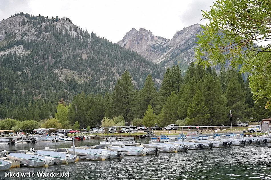
As stated at the beginning of this post, the trailhead for Barney Lake is behind the campground at Mono Village.
Mono Village is easy to get to from the town of Bridgeport. From town, go down Twin Lakes road and continue straight for about ten miles.
Mono Village is located at the terminus of Twin Lakes road. You’ll literally run right into it. Shortly after arriving, you can park in the day-use lot on the left.

If you have time before or after your hike, there’s plenty to do at Mono Village if you’re here during their normal operational months. These include:
A large campground with many sites for tents, RV’s, etc.
Boat, Kayak and Paddleboard rentals
Bait & tackle shop
A general store
Restaurant
If you need to use the restroom before heading out, you can find one just behind the restaurant. If you’re eating there, there’s also one inside.
Finding The Barney Lake Trailhead

To find the trailhead, stand near the check-in booth to the left of the restaurant and face the campground.
Ahead of you, you’ll see two trees with a pathway going between them and yellow markers on each tree. Head between those trees.
Continue on this pathway until you see a meadow at the rear of the campground. Keep going straight while keeping this meadow on your left.
After a half-a-mile or so, you’ll see the one and only trail sign on this trail. It’s an arrow pointing right and says, Barney Lake, on it. Bear right with the sign.
Robinson Creek Trail to Barney Lake

As of now, you’re officially on the Robinson Creek trail. Initially, this part of the trail is mostly flat, with a few gentle inclines here and there.
There’s a plethora of tree cover and if you’re here during spring and early summer, there will be a few creeks to cross (easy to do).
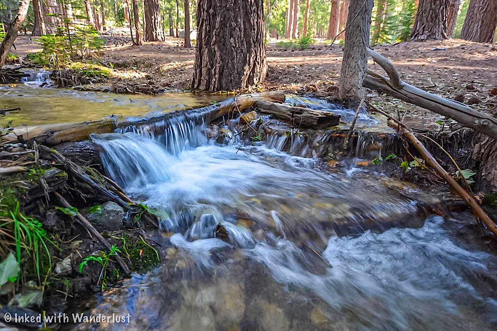
After a mile or so, you’ll enter a large meadow with mountain peaks surrounding you. There isn’t a lot of shade on this section of the trail.
*Tip: Be sure to bring plenty of water with you. Tap to check out the Hydration Backpack we recommend (affiliate link). It can carry 2-liters of water in addition to your day-hike essentials.

You’ll eventually dip back down under tree cover but don’t get too excited. After a short time, you’ll come out of tree cover and start going at a slight incline.
This is also where you’ll meet back up with Robinson Creek. Aside from the lake itself, this is our favorite part of the trail.
There’s a few spots here where you can take a break and admire a couple mini waterfalls. All the while enjoying your return to tree cover.
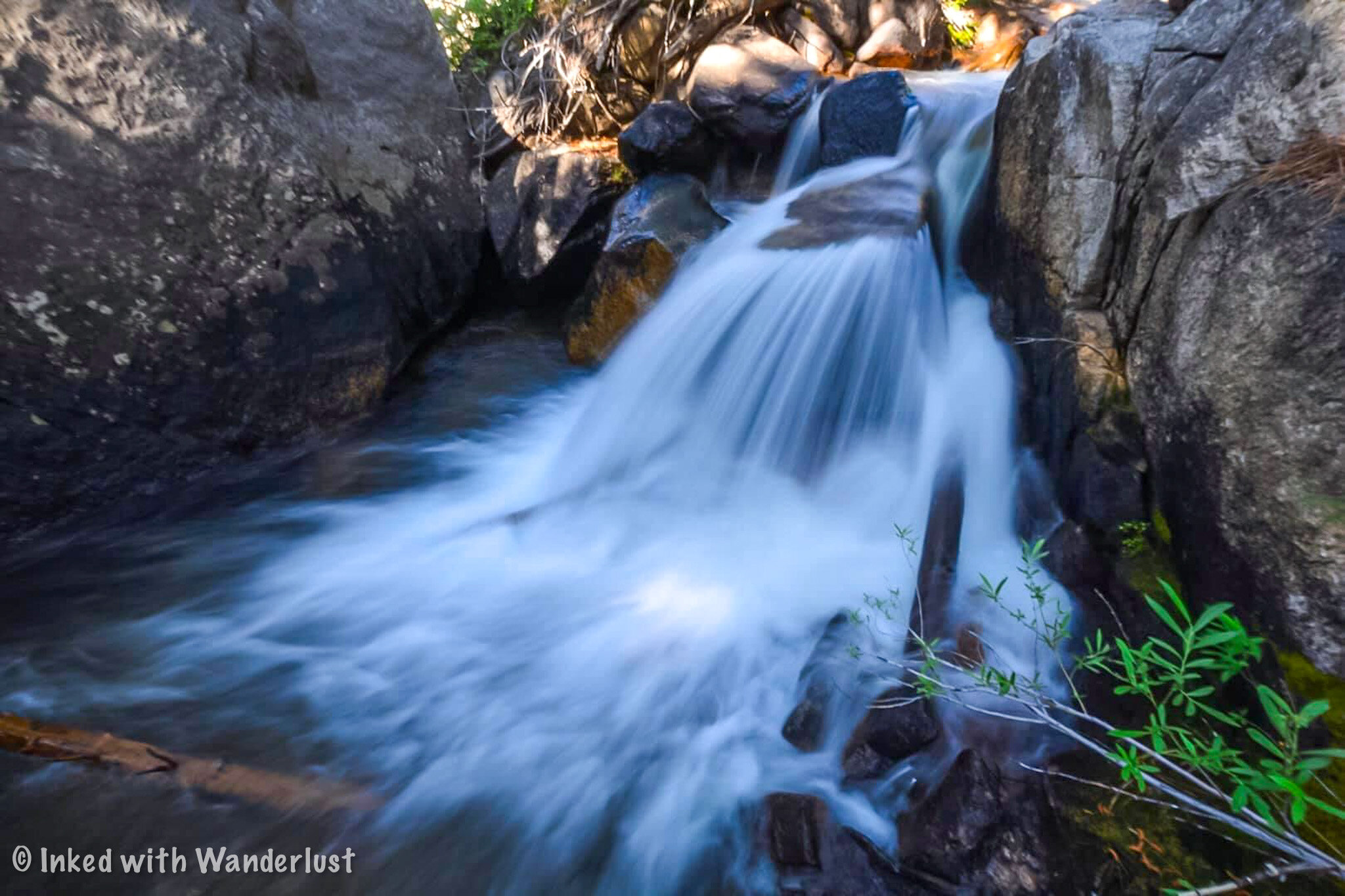

Once you feel rested, continue up the trail. After coming into another opening, you’ll arrive to the start of the switchbacks (at this point, you’re close to the lake).
These switchbacks aren’t bad at all, but this is the least maintained part of the trail. There’s a lot of overgrowth.
To make matters worse, if you’re here in the spring or early summer, they’re muddy and slick from the water run-off.
About halfway up the switchbacks, you’ll come to a point where it seems as though the trail disappears. Continue up and over the granite rock to rejoin the trail.
Shortly after this point, the trail will flatten out and the sight of Barney Lake will soon come into view.
Barney Lake

The scenery at Barney Lake is impossibly gorgeous. Especially if you’re here on a day without wind. The surface of the lake is glass-like.
The west end of the lake (near the outlet) provides an alternate view, los of shade and many seating opportunities.
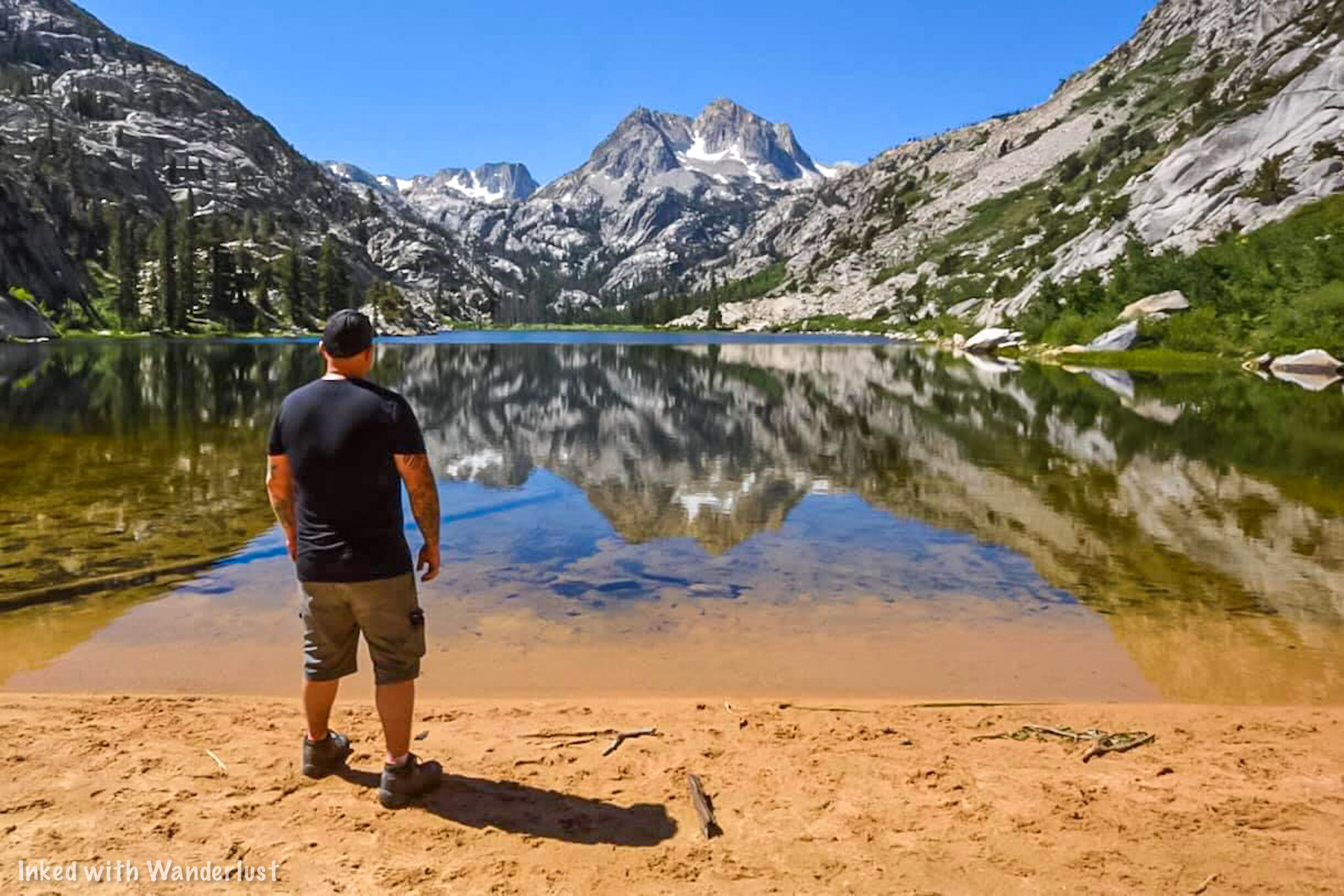
If you’re here in spring, the beach may be non-existent due to the amount of snow melt still coming off the mountains.
Throughout summer, as snowmelt lessens and water levels subside, the beach becomes more prominent.
Optional Lakes

From here, you have two choices. The first one is you can simply finish up with your hike and make your way back to the trailhead.
If you still have some energy to burn, you can continue up the trail and onto additional, even more amazing lakes.
Some of these lakes include Crown Lake, Robinson Lake, Peeler Lakes, Snow Lake and more!
Additionally, you can go even further by making your way over the pass and dropping into the Grand Canyon of the Tuolumne in Yosemite.
Unless you’re a super fit hiker, you’ll need to secure a permit to do most of these as you’ll be spending a night or three in the backcountry.
*Tip: If you’re feeling hungry after your hike, stop by the Burger Barn before heading home. Tap the link to check out our post about them!
Your Thoughts…
Have you hiked to Barney Lake before? If so, tell us about your experience in the comment section below. We love hearing from our readers!
Please support our website by sharing it with your family and friends.
Thank you for reading.

The Mist Trail: Hike One Of Yosemite's Most Beautiful Trails
Yosemite National Park is filled to the brim with many popular and beautiful natural attractions and trails. However, there are a select handful that are…
5 minute read | Contains affiliate links
Yosemite is filled to the brim with many popular and beautiful natural attractions and trails. However, there are a select handful that are insanely popular in the park.
We have been blessed to have hiked many Yosemite trails and while they are all amazing in their own right, there are two that stand out from the pack; Half Dome and The Mist Trail.
We’ve covered Half Dome in a previous article that details my experience and gives you a good idea of what to expect.
While The Mist Trail is partially covered in that one (The Mist Trail is where most hikers begin), we felt it to be deserving of its own detailed, dedicated post.

Quick Stats
Location: Yosemite National Park (Valley)
Red Tape: None for the trail, but you’ll need to pay the park entrance fee
Open: Spring through Fall
For: Hikers only
Parking: Large dirt lot a quarter mile from the trailhead
Restroom: Two. One at the Vernal footbridge and another at the top of Nevada Fall
EV Stations: None
Drone Use: Not allowed
Difficulty: Moderate to hard
Time: Two to four hours
Milage: Three miles (RT) to Vernal Fall / Seven miles (RT) to Nevada Fall
Elevation Gain: 1,925 feet
Trail Condition: Well maintained and marked
Main Feature(s): Vernal Fall & Nevada Fall
Pets: Not allowed
Special Notes/Hazards: The stone steps along the trail are slick, some are steep, and they can be dangerous. Watch your footing
Our Visit(s): September 2017 & June 2020
The Mist Trail

Parking can be somewhat complicated for this trail (Yosemite as a whole, really). This trail is one of, if not the, most popular in the park. So the lot fills quickly.
Those who are hiking Half Dome utilize this trail and parking lot as well and they get an early start. So the lot may be already partially full by the time the sun rises.
Usually, if you get here before 9am, you’ll likely score yourself a spot. If it’s full, signs will be posted alerting you to that.
Your options in this case would be to park at Curry Village (an additional half a mile away) or park elsewhere in the park and take the free shuttle.

Private vehicles are not allowed on the road going to the trailhead. So either way, you’re going to have to walk to get there.
Simply follow the road to the trailhead. It’ll be to your right after the bridge. After a short distance, you’ll see a gate and trail signage on your left. This is the official starting point.
Vernal Falls
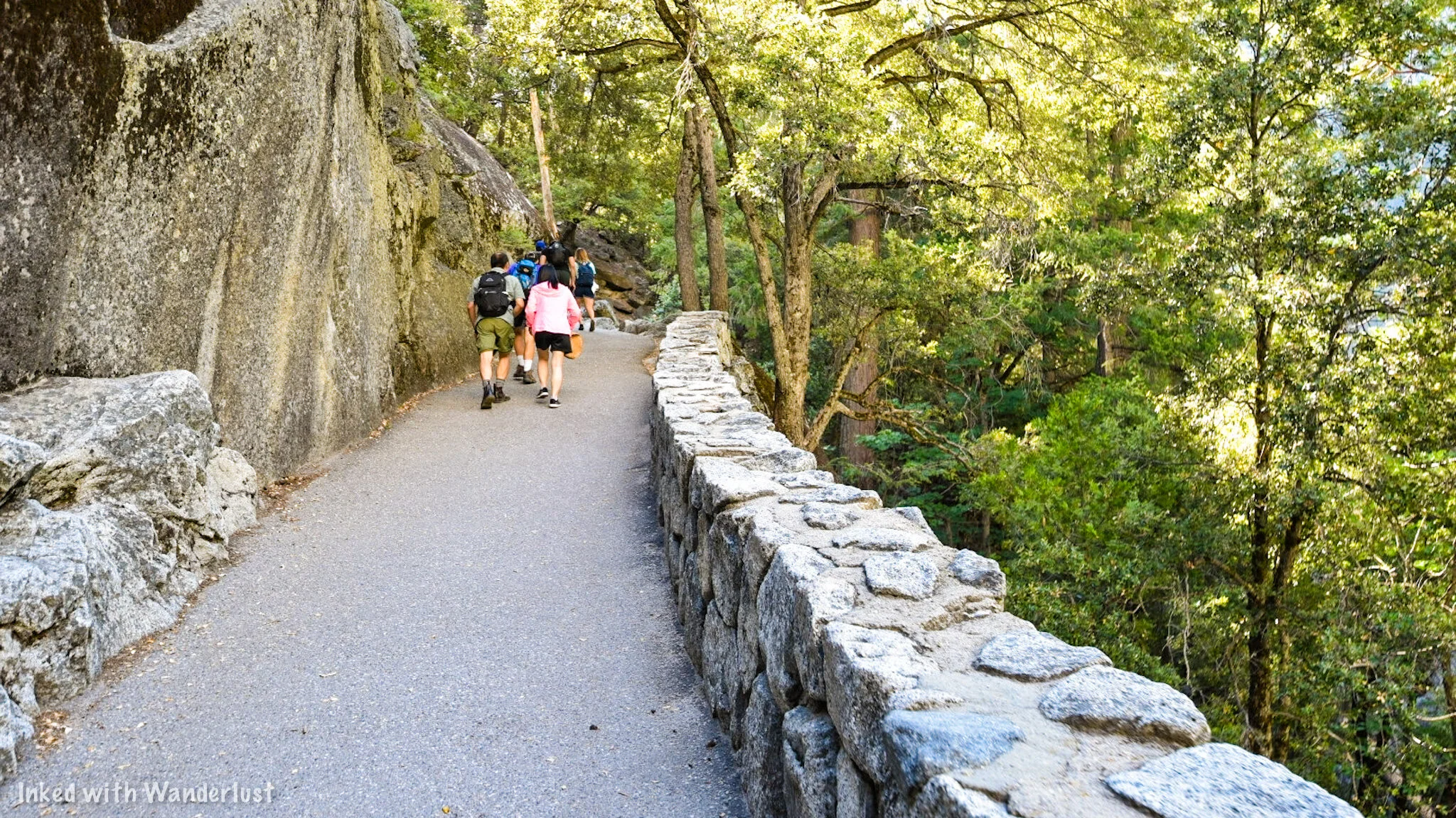
The first feature on this trail is the beautiful Vernal Fall. Not counting the distance from the parking lot, it’s 1.5 miles from the trailhead to the top of Vernal.
Don’t let the short distance fool you. This trail is anything but easy. It’s a relentless, uphill slog nearly the entire way. Not to mention the slick, stone steps.
After a mile, you’ll arrive at the Vernal Fall footbridge. Here, you’ll get your first and only opportunity at filtered water via the fountain. You’ll also have access to the first of two restrooms.
Both are located just past the bridge. This is the point where a lot of visitors decide to call it a day and head back (you do get a slight view of the falls from the bridge).

You’ll also have a fork in the trail here. If you don’t want to deal with the slick stone steps, you can take the John Muir Trail.
This trail is on a far more even grade, but it will not take you to the base of Vernal and it will add a bit more time to your hike. To experience the mist, continue left on the trail proper.
The trail begins to climb again as you get closer to Vernal. Soon, you’ll approach the beginning of the stone steps and get your first glimpse of this magnificent waterfall.
I’ve never counted them, but according to my research, there are 500-600 of these steps. Again, these steps are SLICK. Be mindful of your footing.
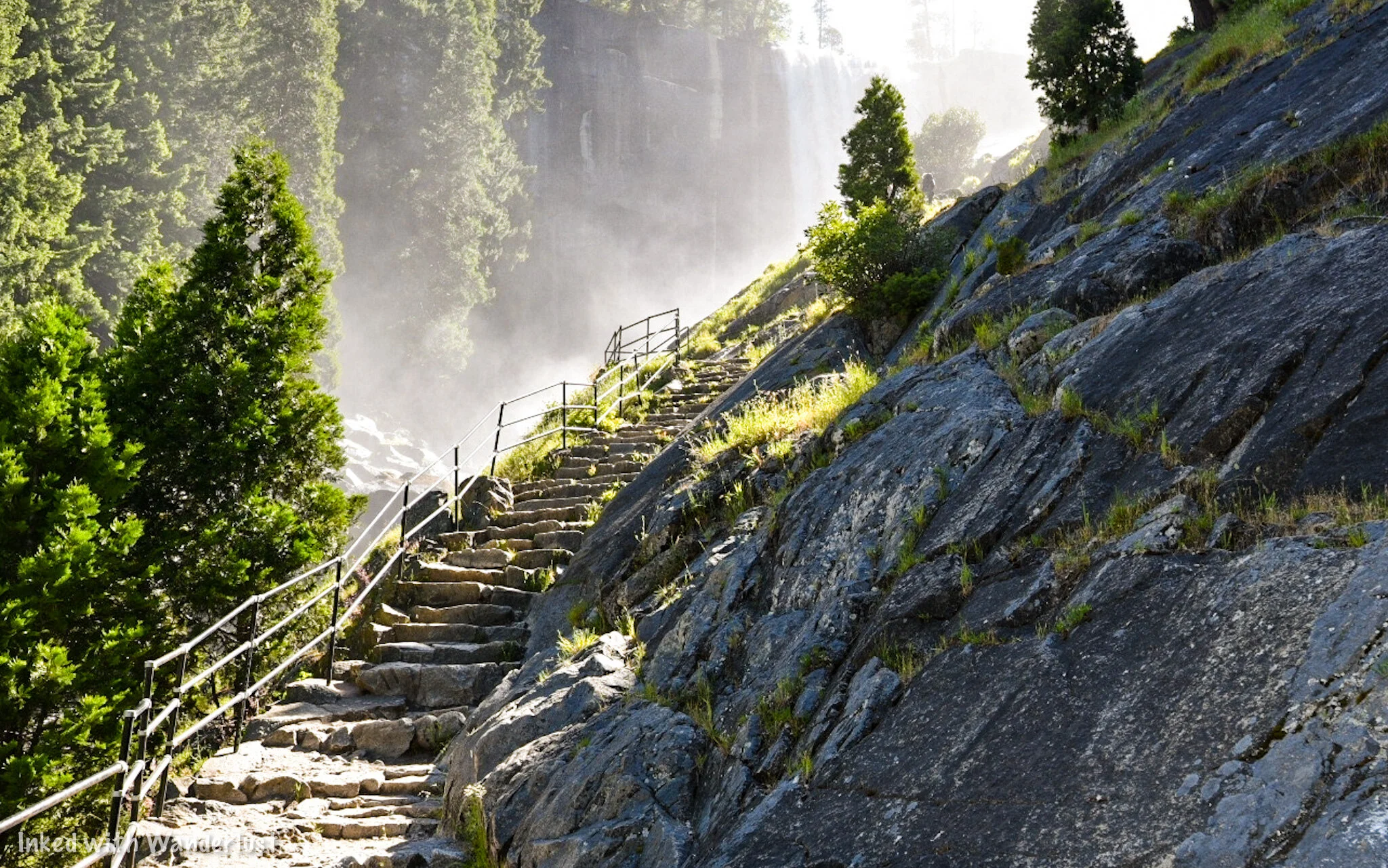
As you make your way up the steps, it’ll soon dawn on you where this trail’s namesake comes from. Though the amount of mist you experience will depend on the time of year.
If you’re here in the fall, you’ll experience little, if any. This is due to the falls not flowing as heavily as they do in the spring.
That said, come during spring or early summer and you’ll definitely find out why it’s called the Mist Trail. You WILL get wet. Soaked, even.
We caution anyone with a camera that isn’t properly weather sealed to stow it away before proceeding. Also, If you’re against getting wet, a poncho would be advisable.

Once you’ve reached the mid-way point between the steps (you’ll know you’re there when you’re on a flat-ish area at eye level with the waterfall), you’ll be mostly out of the reach of the mist.
You’ll also have a decent amount of tree cover to help you escape the sun for a bit with various rocks to site on, if needed.

From here, you’ll have an epic view of the gorge that Vernal dumps into and the river, which has been cutting through here for many years. It’s an amazing, unbeatable sight.
If you’re lucky, the sun will hit the mist just right and present you with a rainbow (or two) to gaze at. At this point, you’re roughly one-mile into the hike.
From here, you’ll have a choice. This is the point where a lot of visitors decide to turn back. However there are more amazing views at the top of Vernal.
To do this, you must hike another half mile up a few hundred more stone steps. These steps are not usually as slick as the ones along the base, though.
Pictured above, you’ll see the last of the steps you’ll need to tackle before reaching the top. Once up there, you’ll see much more of the gorge leading into the valley and get up close to Vernal’s edge.


The river you see feeding the falls is the Merced River. The waters leading to the edge usually appear calm, but strong currents are always present.
At the edge, the Merced dumps millions of gallons of water 317-feet into the gorge below. The view up here is simply remarkable.
From here, you'll again have a choice to make. You can head back to your car or you can continue on for another 1.5 miles to Nevada Fall.

Nevada Falls
About a mile from Vernal, you’ll come to the Nevada Fall footbridge. The view of the Merced cutting through the granite boulders is an amazing sight.
From the bridge, you’ll have a great view of Liberty Cap. Many visitors mistake this for Half Dome (wishful thinking). From here, you’re close to the end of the trail (and another restroom).

While Nevada doesn’t produce nearly the amount of mist that Vernal does, the steps will still be slick. The good news is you won’t have as many to deal with as in between the steps are moments of compact dirt.
Once at the top, there’s rocks and log furniture to take a break on. There’s also the second opportunity for restroom use. This one is surprisingly well maintained.

If you’re a Half Dome permit holder, you’ll want to continue onward from here. For you Mist Trail day hikers, it’s time to head back. You’ll have two options on how to do this:
You can take the John Muir Trail down. This will add another mile to the hike, but its much smoother as you won’t have to negotiate the stone steps. Plus, you’ll get a unique view of Nevada Fall.
You can head back down the same way you came up. Keep in mind, going down those steps is worse than going up (especially if they’re slick). Going down the JMT may add an hour, but it wouldn’t necessarily add more time as it would more than likely take longer to deal with the steps.
On our 2017 visit, we opted to go back down the Mist Trail versus the JMT. Almost immediately, I regretted that decision. Seriously, consider the JMT.
Things to Remember
This is NOT an easy going trail. It may be fairly short, but don’t underestimate the potential dangers. More people have been killed or hurt on this trail than any other in the park. That includes Half Dome. It is sun exposed, has thousands of slick stone steps, and a powerful river running through it. Keep to the trail, watch your step, bring plenty of water/snacks, and don’t overdue it.
Swimming or wading is NOT allowed. Years ago, people were able to swim in the emerald pools up river from Vernal Fall. Unfortunately, those days are over. Far too many deaths have occurred from people getting swept over the edge.
The trailhead parking lot fills up early. The closest parking lot to the trailhead fills up quickly. Even if you do snag a spot, you’ll still have to walk a quarter-mile to the trailhead. So keep this in mind when planning your day and prepare for the possibility of having to park further away and taking the shuttle in.
Have a great time. Despite the potential dangers, this trail is one of the most breathtakingly beautiful trails you’ll ever hike. Pace yourself, take pictures, and be sure to pause and allow the beauty of Yosemite to consume you. If you only have time for one day hike during your visit, this is the one.
A quick note…
We’re often asked about the equipment we use to capture the photos on our website. Below, we’ve added Amazon links to those products and others that we recommend.
If you decide to purchase, Amazon will pay us a small commission. This helps us keep Inked with Wanderlust running and doesn’t cost you anything extra.
“Understanding Exposure” by Bryan Peterson (this book is a great resource for anyone starting out in photography)


Conclusion
It is our hope that this article was helpful to you in planning your next adventure. If so, please share it with your family and friends on Facebook or Pinterest.
You can further show support by subscribing to our newsletter below. In it, you’ll receive a once weekly newsletter containing announcements, new post alerts, news, and more!
If you have any questions, comments, or suggestions, please engage with us in the comment section below.
Thanks for reading and safe travels!

Explore Sutro Baths and Hike The Lands End Trail in San Francisco
Located in the northwestern corner of the beautiful city of San Francisco, a coastal oasis awaits eager visitors and hikers alike; Lands End…
7 minute read | Contains affiliate links
Located in the northwestern corner of the beautiful city of San Francisco, a coastal oasis awaits eager visitors and hikers alike; Lands End.
From the moment you leave your vehicle, you’re treated to near non-stop stunning views of the city’s coast, Golden Gate Bridge, Pacific Ocean, and Marin Headlands.
If that wasn’t enough, you’ll also get to check out many historic sights and subjects such as the USS San Francisco Memorial, Sutro Baths, Cliff House, and more!
You can spend your visit just exploring the ruins of the Sutro Baths or extend your visit by hiking this short, but beautiful stretch of California’s infamous, Coastal Trail.
So how do you get to Lands End? Is the trail dog friendly? How many miles is it? We’ll answer all these questions and more below. Let’s get into it!
Lands End Information
Lands End Lookout
The parking lot for Lands End is located in the Sutro Heights district of the city, just off of Point Lobos Ave.
Here, you can access the Visitor Center, Cliff House, Sutro Bath ruins, and the trailhead for the Lands End trail.

For GPS purposes, here is the address:
680 Point Lobos Ave. San Francisco, CA, 94121
Sutro Baths Ruins

From the parking lot, you’ll see a stairwell descending towards the ocean. This stairwell will take you down to the Sutro Baths ruins.
The Sutro Baths complex was a massive saltwater swimming pool owned by Adolph Sutro. They were built in 1894 and remained opened until 1964.

The complex was sold to real estate developers with the idea to build ocean-side condos, but a fire in 1966 put an end to that plan.

Now run by the National Park Service, all that remains of the baths are the concrete foundations, walls, and stairwells.


It may seem like nothing, but the ruins are fun to explore. You’re free to climb and walk on them but be careful! One misstep and you’re in the ocean.


To the right of the ruins is a tunnel carved into the rock. It isn’t long and there’s not much to see at the end, but it’s still a cool feature of the area.
Sutro Baths Upper Traill
On the concrete path to the ruins, you’ll notice a dirt path that spurs off up and to the right. This is the Upper Trail.
The view from above will give you an idea of just how massive the Sutro Baths complex really was.
Lands End Trail

Trailhead near Sutro Baths.
Trail Information
The trailhead on the lookout side of the trail is adjacent to the parking lot. If you’re facing Sutro Baths at the top, go right.
You can access the other side of the trail by parking near the Legion of Honor building and walking down the pathway along the road.

Trailhead near Legion of Honor off of Lincoln Highway.
The Lands End trail is a section of the infamous, Coastal Trail. A near 1200-mile trail stretching from Mexico up to Oregon.
The Lands End portion is 1.5-miles, one-way, along a mostly dirt path winding along beautiful coastal bluffs lined with Cypress trees.


The trail is easy-to-mild in difficulty, but does present a few moderately challenging stairwells at certain points.
The trail starts out (from the lookout side) on a wide path under Cypress trees, before opening up to an amazing view of the Golden Gate Bridge.


About halfway through, the path narrows and turns into a more traditional hiking trail. For the most part, the trail is very shaded.
*Bathroom Alert: In short, there are none. Not on the trail, anyway. There are bathrooms at the Lands End Lookout visitor center and occasionally, there’s a portable restroom near Fort Miley at the dead-end.
Trail Detours & Features
If you just want to go from one end to another, you can. However, along the way, you’ll encounter a few cool detours you should consider taking.

Lands End Point
At around the half-mile point (coming from the lookout side), you’ll see a sign pointing towards a set of steep steps (pictured below).
This stairwell will take you down to three great detours; Lands End Point, Mile Rock Beach, and Lands End Labyrinth.

Halfway down the stairwell, where it flattens, veer to right to Lands End Point. It features a spectacular view of the Golden Gate Bridge.
It makes for an excellent spot to take a break and take some photos. You could also enjoy a picnic here with your partner.

You’ll see remnants of a foundation that held some kind of military artillery. To the left of that is the Lands End Labyrinth (our photo didn’t turn out well at all. Sorry).
*If you’re interested in more locations around the city with military history, check out our articles about Kirby Cove and the Muir Beach Overlook.
Mile Rock Beach
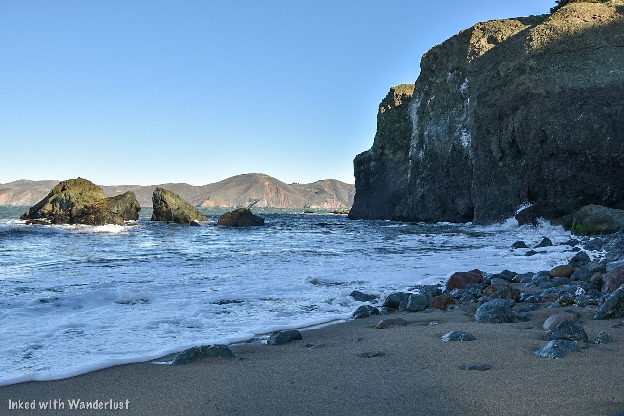
Taking the second set of stairs will take you to Mile Rock Beach. There’s also a short, but sketchy, path from Lands End Point you can take.
The beach is small, but beautiful. What it’s most known for are the seemingly hundreds of rock stacks along the cove.
These were left by many visitors over the years and the rocks used in the Labyrinth above the beach were taken from here.
Eagles Point

Eagles Point isn’t a detour as it’s directly off the trail, but it’s worth mentioning as it provides the closest view of the bridge on the trail.
If you’re starting on the Lincoln Highway side of the trail, you’ll see it right away as it’s just past the trailhead sign on your right.
Legion of Honor

Legion of Honor is a museum located near the trail in Lincoln Park. They display a collection of ancient and European artifacts from the last 4,000 years.
The Beaux-arts building was built in a way to commemorate Californian soldiers who were killed in battle during World War 1.
We would recommend visiting before or after your hike. For more information or to purchase advance tickets, go here.
USS San Francisco Memorial

This memorial was built to honor the memory of the men who died on the USS San Francisco during the Battle of Guadalcanal.
The memorial was built out of materials from the actual ship. You can see the holes made by enemy bullets all around it.

Coming from the Sutro Baths side of the trail, you’ll soon come to an opening on the trail with the Golden Gate Bridge on full display.
To the right of this viewing area, you’ll see a steep set of concrete steps on your right (you can’t miss them). Take these to the top and go right.
Additional Information

When To Go
The Lands End Trail and Sutro Baths are accessible throughout the year, so there’s no real bad time to go.
The summer months will obviously be the hottest and will have the heaviest crowds. Aside from that, it’s pretty much your preference.
It was late November when my Dad and I hiked this and we experienced minimal crowding and perfect weather.
Most of the crowds we saw were at the Sutro Baths and it was close to noon by the time we reached that point.
Cliff Warnings
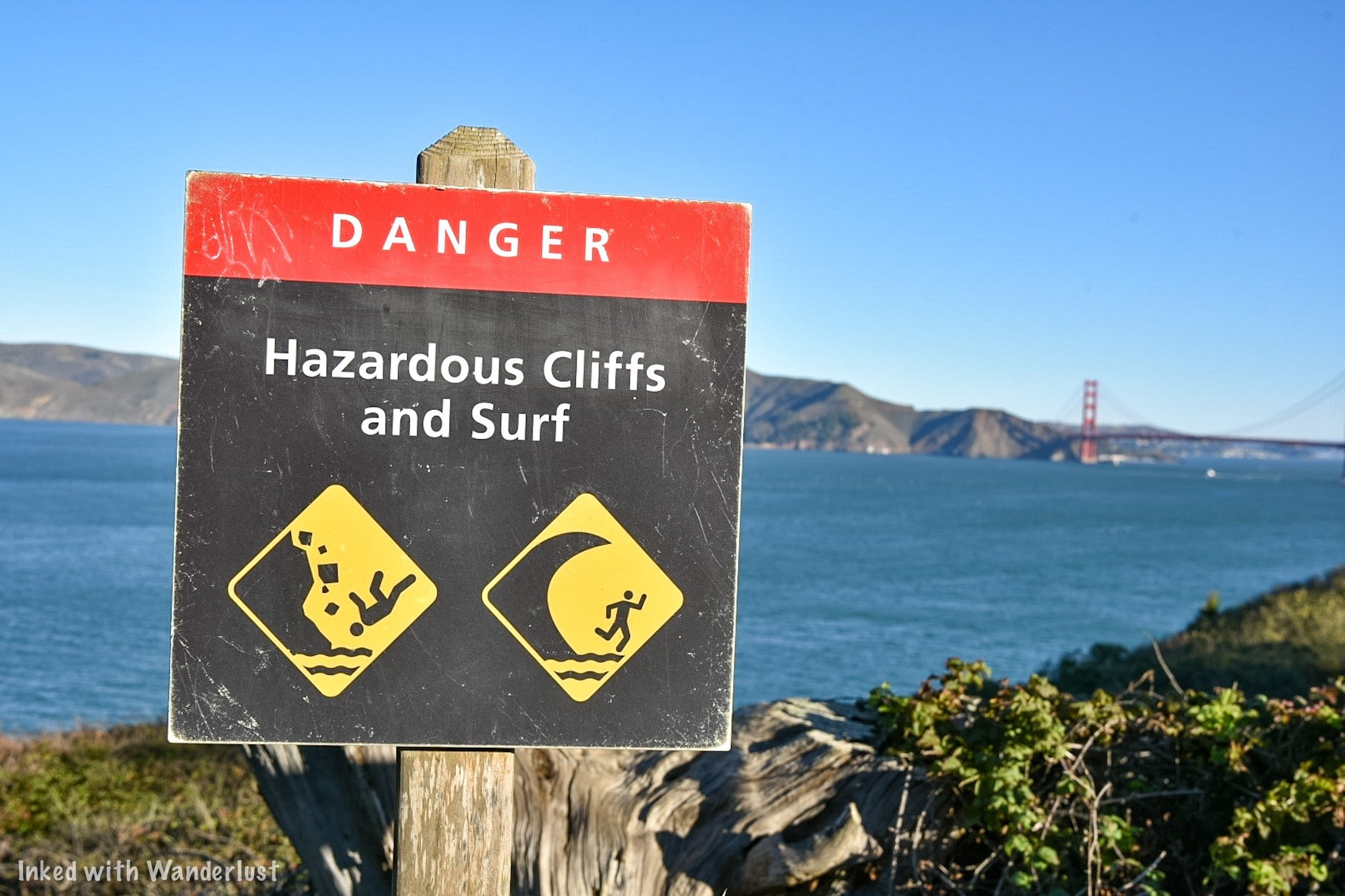
Scattered throughout the trail and at Sutro Baths, you’ll likely notice signs such as the one pictured above. It’s best to heed these warnings.
Unfortunately, there have been many deaths along this trail. One being a 17-year-old girl who lost her life after falling over a cliff.
When my Dad and I were here, someone had fallen off a cliff after entering a restricted area near Sutro Baths.
Thankfully, he was recovered by Fire & Rescue Personnel and survived his injuries, but it could have been much, much worse.
Is The Trail Dog and Bike Friendly?

Dogs, leashed or not, are welcomed all along the trail and at Sutro Baths. Bikes, on the other hand, are a bit more complicated.
Bikes are allowed between Lands End Lookout and the cut-off for Mile Rock Beach. From there, there’s a bike trail that splits from the main one.
The new trail you’ll be on parallels Lands End Trail, but higher up and will eventually terminate near the Legion of Honor building.
A Quick Note…
We’re often asked about the equipment we use to capture the photos on our website. Below, you’ll find Amazon links to them.
If you decide to purchase, Amazon will give us a small commission. This helps us keep the site running and doesn’t cost you anything extra.
“Understanding Exposure” by Bryan Peterson (this book is an excellent resource for anyone getting into photography)


It is our hope that this article was helpful to you in planning your next adventure. If so, please share it with your family and friends on Facebook or Pinterest.
You can further show support by subscribing to our newsletter below. In it, you’ll receive a once weekly newsletter containing announcements, new post alerts, news, and more!
If you have any questions, comments, or suggestions, please engage with us in the comment section below.
Thanks for reading and safe travels!

The Complete Guide to Muir Woods: Trails, Reservations, and More
Muir Woods National Monument is one of the most popular attractions in the Bay Area, bringing in hundreds of thousands of visitors annually…
Muir Woods National Monument is one of the most popular attractions in the Bay Area, bringing in hundreds of thousands of visitors annually. A trip to the area just wouldn’t be complete without a visit.
Enacted as a National Monument by Theodore Rosevelt in 1908, Muir Woods is 554 acres of tranquility. These giant coastal redwoods have an average age of 600-800 years old. The oldest clocking in at a whopping 1200 years!
Your first time walking amongst these ancient giants is a magical experience. Many of the trees in the monument are north of 200-feet tall and will undoubtedly leave you in awe as you gaze upon them.
While we encourage anyone and everyone to visit this amazing place, there are certain things you need to know and do before going to ensure a successful visit. Let’s get into it!
Visitor Information
Parking Reservations
If you want to visit Muir Woods, before you do anything else, you need to check the park calendar and ensure there is an available parking reservation for the day(s) you want to go.
Reservations are required no matter the day or time of year. Parking lots at the monument are not large and parking isn’t allowed on the sides of the road. So this is needed in order to mitigate over-crowding.
How To Make a Reservation
To make a parking reservation, follow the steps below:
Go to this website
Click/Tap the reservation button and select the day you want.
You’ll then select your vehicle type.
Select your arrival time window (Arrival times are in 30-minute intervals).
You’ll then be given the option to pay for your park admission fees ahead of time (This fee is in addition to your reservation fee).
Now you’ll enter your information and payment method.
You’ll be emailed a QR code that will contain your reservation and admission fees (if you opted to pre-pay). Be sure to screen shot this and save it. When you arrive, pull it up on your phone and the parking attendant will scan it.
You should also print it out a hard copy in case your phone dies.
Parking Reservation Fees
The following is a list of parking fees for your type of vehicle. These fees are mandatory and are paid at the time you make your reservation:
Standard Vehicle - $9.00
Handicap Accessible - $9.00
Electric Vehicle - $13.00*
Vehicle 17-22 feet - $30
Vehicle 23-35 feet - $45
*The reason EV’s are more is because it includes charging. If you think you’ll be fine without it, just opt for the standard vehicle price. If you’re driving a Tesla, remember to bring your J1772 adaptor.

Shuttle
If you’re visiting on a weekend or holiday, the shuttle is another option. You’ll park at an offsite location at Pohono Park & Ride and take the 30-minute ride in.
If you go with this option, you will NOT need to make a parking reservation. Though you WILL need to select a 30-minute window of arrival at the Pohono lot.
The address for Pohono Park & Ride is as follows:
100 Shoreline Highway, Mill Valley, CA 94941
Fees for the shuttle are:
$3.50 (per person 16 years and up)
Free (persons under 15 years)
The shuttles are ADA accessible with each one able to accommodate two wheelchairs. When making your reservation, be sure to select this option to ensure a spot.

Is Ride-Sharing an Option?
The short answer? Yes and no. You could get an Uber to take you into the monument but once there, you won’t have cell reception. So getting one to pick you up wouldn’t be possible.
Taking a Taxi would be your best bet if you don’t have your own vehicle or you’re visiting on a weekday. We would advise you to arrange a pick-up time with the driver or you can call them on the payphone behind the restrooms near the entrance.
Speaking of restrooms, there are two at the park:
As mentioned above, there’s one just before the entrance near the parking lot.
The other is located near the gift shop and cafe.
Beyond the gift shop, there are no other bathrooms in the monument.
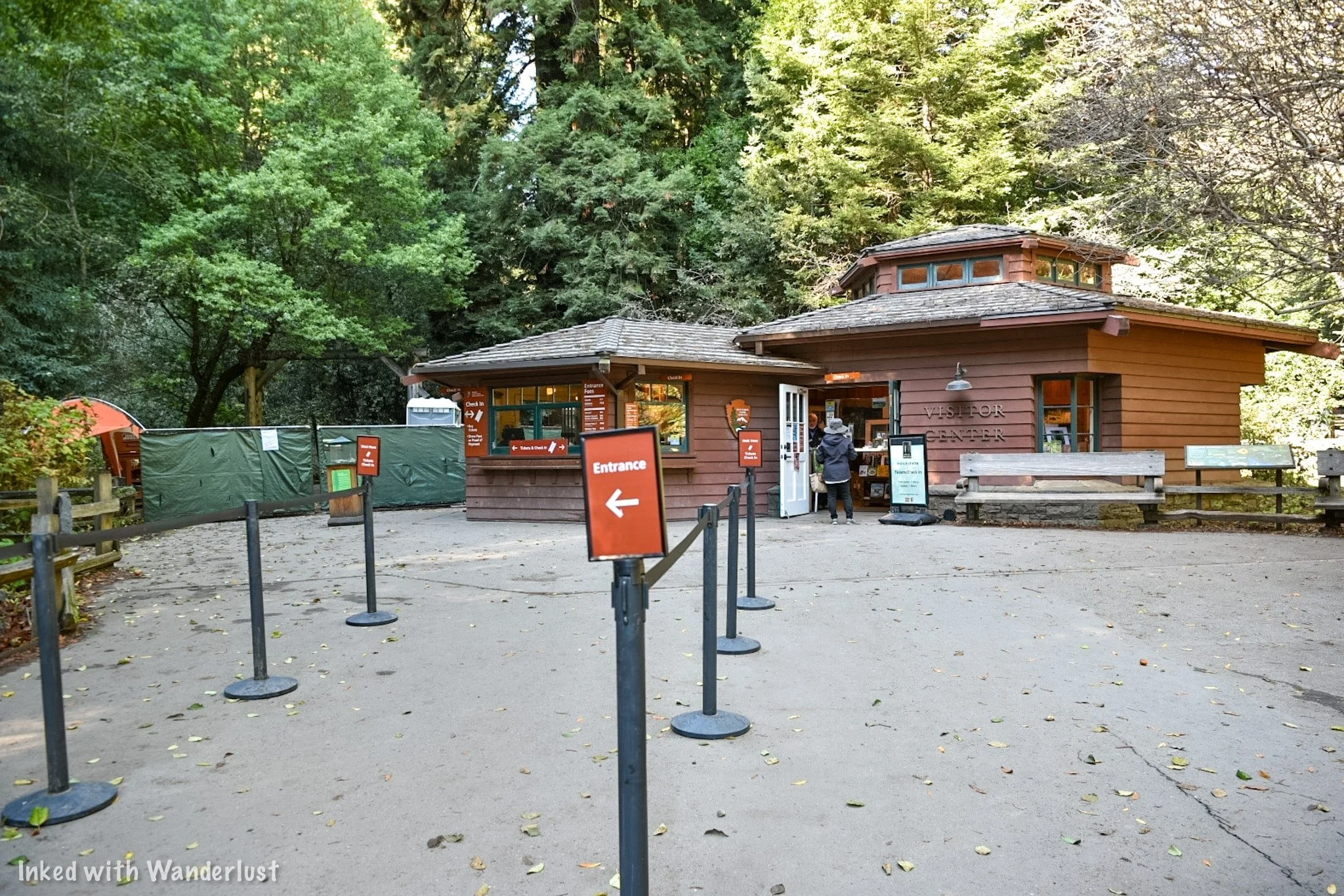
Park Entrance Fees
In addition to paying for either the shuttle or a parking reservation, you will need to pay park entrance fees as well (unless you’re a holder of one of the various annual passes).
Muir Woods entrance fees are as follows:
$15.00 (per person ages 16 and up)
Free for persons 15 years and younger.
*Pro Tip: If you’re a family of 3- 4 and everyone is 16 years or older, consider purchasing the Muir Woods Annual Pass. It costs $45 (the total cost of three adults), is good for 12-months, and covers up to four people per visit! Just keep in mind that it will NOT cover parking or shuttle fees.
The easiest and most convenient way to pay for your entrance fee is online while making your shuttle or parking reservation. When you arrive, the attendant will scan your QR code and you’re done.
If you prefer to pay on arrival, you can. Current accepted forms of payment are cash, credit/debit card, or Apple Pay. Just keep in mind that shuttle or parking fees MUST be paid online, in advance.
Directions to Muir Woods

From San Francisco
Most don’t realize just how close Muir Woods is to San Francisco. How close? Only a mere 11-miles from the Golden Gate Bridge! To get there:
Go north on Highway 101 and cross the Golden Gate Bridge
Take the Highway 1 exit to Stinson Beach
Turn left to stay on Highway 1
Turn right on Panoramic Highway
Turn left on Muir Woods road and continue until you reach the parking lot

From the East Bay
Make your way to and get on Highway 101 South
Take the Highway 1 exit to Stinson Beach
Follow steps 3, 4, and 5 above
For GPS purposes, here is the official address for the monument:
1 Muir Woods Road, Mill Valley, CA 94941
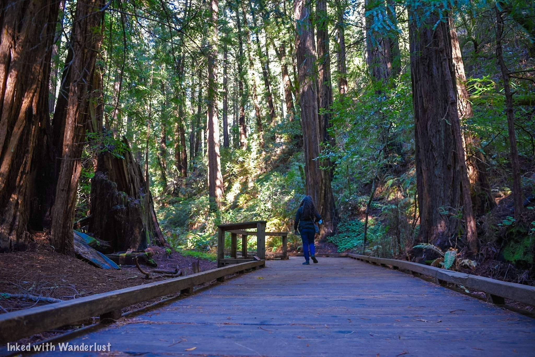
Park Hours
Normally (as in, when we don’t have pandemics going on), Muir Woods is open all year long, including on major holidays. However, it is NOT open 24/7. The monument is open to the public:
8:00am to 5:00pm, daily.
The park facility hours vary slightly from normal park hours. They are:
Visitor Center: 8:00am to 4:30pm. This is the building at the entrance to the monument.
Gift Shop: 9:00am - 5:00pm. This building is roughly 50-60 yards or so behind the visitor center.
Cafe: 10:00am - 4:00pm. The cafe is adjacent to the gift shop.
Best Time to Go

Busiest Time
Peak travel months for Muir Woods is May - October. Due to its proximity to San Francisco, it sees heavy visitation during these months. So much so, it can downright miserable.
If you must come during these months, we highly recommend a weekday and arrive as close to opening as possible. It’ll still be crowded, but it’ll at least be slightly easier than the weekend.
Off Season
In our opinion, the best time to visit is between the months of November and April. Yes, it does get cold and yes, it can be rainy, but the park also sees a major reduction in crowds.
The photos in this post were from our trip in November 2021 and as you can see, the crowds were minimal. If you can help it, we highly advise that you plan your trip for the off season.

Hiking Trails
Within the monument itself, there are 6-miles of trails. There are others that begin in Muir Woods but spur off to other locations such as Muir Beach, Stinson Beach, and neighboring Mount Tamalpias State Park.
All of the park trails begin and end at the visitor center at the entrance of the park. These include:
Bridge 2 and back ( .5 miles): This is a short, peaceful walk along Redwood Creek. The boardwalk following this trail is both wheelchair and stroller friendly.
Bridge 3 and back ( 1 mile): This also follows Redwood Creek (on both sides) but extends your excursion into old growth Redwoods.
Bridge 4 and back (1.5 miles): We highly recommend doing this. This trail takes you all the way to the end of the park (any further and you’ll enter Mount Tamalpias State Park). From here, you can turn around and head back or…..
Hillside Trail (2.0 miles): The first two miles includes the initial 1.5 miles to bridge 4. Instead of heading back the way you came, cross the bridge and head up the hill. This will loop you back and spit you back out at bridge 2. Going this way gives you a different perspective of the forest.

As mentioned above, there are other trails that spur off to other places outside park boundaries. A couple of these include:
Muir Woods to Muir Beach (6 miles): This trail takes you to Muir Beach and back. It isn’t a long or difficult trail but depending on your level of fitness, we would definitely recommend allocating at least a few hours.
Dipsea Trail (up to 10 miles): Dipsea is one of the most popular trails in the area. It begins at Muir Woods and ends at Stinson Beach. You can do the whole thing (about 10-miles, one-way) or you can shorten it to your desired milage.
To see more more trail options, go here.
Whether you intend to stay within the park or hike beyond it, we recommend picking up a park map at the visitor center. You’ll likely be handed one when you get there but if not, definitely ask.

What to Bring
Muir Woods is located almost directly off the coast of the Pacific Ocean. In the morning, that misty fog San Francisco is known for appears quite often. Temperatures rarely exceed 70 degrees and due to the height of the trees, there’s plenty of shade.
Due to this, there are certain things you’ll want to bring with you. Particularly if you’re visiting during the off season months. Here are a few of our suggestions:
Backpack: For us, this is essential. I never go anywhere without my backpack. I use it for camera gear, carrying water, snacks, spare clothing, and other personal items.
Camera: Nearly everyone has a camera on them these days. From DSLR’s to iPhones. Whichever you use, be sure to bring it to capture the memories you’re sure to make. Just don’t try to use a Drone here. They’re not allowed.
Water: Beyond the gift shop, there are no water fountains. Make you to bring plenty of water with you.
Dress in Layers: For the off season months, bring a waterproof jacket. As the day progresses, it’ll start warming up. So keep a long sleeve and short sleeve shirt with you.
Proper Footwear: While the main trail along Redwood Creek is well maintained, you’re still in a wild place. There’s tree stumps, rocks, dirt, etc. Hiking boots or sturdy shoes with good grip would suffice.
Snacks: You can pick some up at the Cafe or save some money/time by bringing them with you. Just be sure to pack out any empty wrappers, bags, etc.

Keep to the Trail
We don’t mean to be preachy, but it needs to be said. It’s important to remain on the trail and boardwalk in Muir Woods. As tempting as it may be to get closer, please don't.
Redwoods have shallow roots and stepping on the little ones can stunt growth. Trampling through the soil could also have devastating consequences for the insects and other wildlife that depend on it as their habitat.
Muir Woods Gift Shop & Cafe
About 20 yards behind the visitor center, you’ll find the gift shop and cafe. Both are housed in one building. The gift shop has all the usuals; shirts, framed pictures, pins, patches, coffee mugs, etc.
The cafe mostly serves a variety of hot and cold sandwiches and some grab & go options. I’ve had the gilled cheese with tomato soup and found it to be fine. Nothing out-of-this-world, but it did the job. You can see their full menu here.
Things to Do Nearby
While you could easily spend an entire day at Muir Woods, if you’re up to it, there are a few places nearby that are worth a visit in their own right.
Muir Beach Overlook: This stunning overlook is located about 10-minutes from Muir Woods. From it, you have endless views of the Pacific Ocean, stunning views of the beach and coastline, and you’ll also learn some awesome military history on top of that. You can read all about it on our post here.
Stinson Beach: About 20-minutes is all it takes to drive to Stinson Beach from Muir Woods.
Kirby Cove Hiking Trail: About 13-miles from Muir Woods and on the Marin Headlands side of the Golden Gate Bridge, this short hiking trail takes you to a stunning cove with jaw an amazing view of the bridge and city. Read our guide on it here.
Mount Tamalpais State Park: What the locals refer to as, “Mount Tam”, this stunning State Park has a huge network of hiking trails through amazing forests, waterfalls, the mountain’s summit, and more!

Conclusion
We thoroughly enjoyed our visit to Muir Woods and we have no doubt you will too. We’re so excited to finally add it to our website and help you put together a trip for yourself. Let us know in the comments if you have any further questions!
We hope you enjoyed this article and it was helpful to you. If so, please support our website by sharing it with your friends and family on Facebook, Pinterest, or your favorite social media site. You can further show support by staying on and reading one or more of the related articles above.
Thanks for reading and safe travels!

The Ultimate Guide To Visiting and Touring Alcatraz Island
Welcoming more than 1.4-million people annually since opening its doors to tourists in 1973, Alcatraz is one of the undisputed top rated attractions…
Welcoming more than 1.4-million people annually since opening its doors to tourists in 1973, Alcatraz is one of the undisputed top rated attractions in San Francisco.
Its rich, yet complicated history makes it appealing to anyone with even a remote interest in the subject. While its gone through multiple stages of claims and ownership, what it’s most famous for is its service as a Federal Penitentiary.
From 1933 to its closing in 1963, Alcatraz, or simply, “The Rock”, housed some of the most notorious inmates in the United States, including; Al Capone, George “Machine-Gun” Kelly, Bob Stroud, and Roy G. Gardner.

Though many have tried, Alcatraz was considered inescapable. Most escape attempts ended in surrender or death of the escapee. Five inmates, however, were never found. Assumed to have drowned in the frigid waters of the bay.
These days, visitors are welcomed and tours of the cell house and island are offered daily. With the click of a mouse, you can visit this historic place for yourself.
This guide will cover everything you’ll need to know, including; making reservations, prices, tour types, and history. You’ll also get sneak peaks of what you’ll see during the tour of the cell house tour.
NOTE: This post is long. At the top of the page, you’ll find jump links to the four major sections of the post. While we encourage you to read the whole thing, if you’d rather skip to what you’re most interested in, just click or tap to go to that specific section.
History of Alcatraz

Military Period (1850 - 1933)
Alcatraz’s notoriety started back in 1850 when, at the behest of a joint Navy and Army commission of implementing a “triangle of defense” to guard San Francisco Bay, President Fillmore signed an executive order to secure land around the bay for such use. This included Alcatraz.
Construction on the lighthouse was completed in 1854, beginning its service as the first lighthouse on the Pacific Coast. By 1859, 87 men of Company H, Third US Artillery took post on the island and by 1863 would take their first prisoners by seizing a confederate ship and imprisoning its crew.
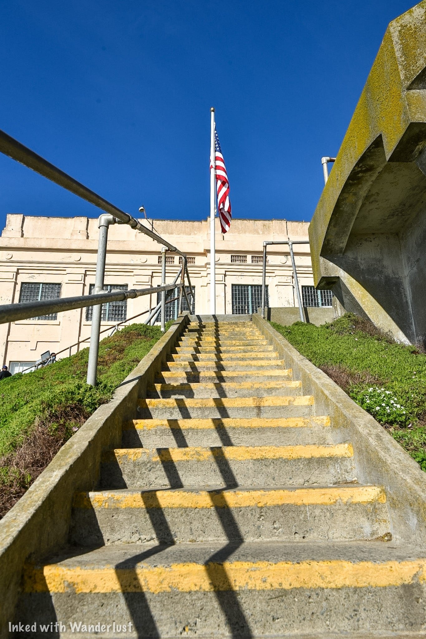
The prison was heavily used during the Spanish-American War and by its conclusion in 1898, Alcatraz would be severely overcrowded. This resulted in the building of the upper prison on the parade ground at the turn of the century.
In 1912, the new cell house (the one you see today) was built. It was constructed using convict labor and finished in the same year. This would be the final cell house built under Military supervision.
By 1930, the Federal Government was in need of a tough prison that could house a criminal population that was either too dangerous, too difficult, or had a high potential for escape. So in 1933, Alcatraz was transferred to the Feds and began its service as a Federal Penitentiary.

Federal Penitentiary Period (1934 - 1963)
The whole goal of the Federal Government was to have a prison that criminals feared. ‘The Rock’, fit the bill and quickly earned a reputation of being tough, miserable, and impossible to escape from. The cells were small (even by prison standards) and frills were minimal.
A man by the name of James A. Johnston would be appointed as its first Warden and would go on to serve for 14-years, nearly half of its operating years. Warden Johnston implemented many rules and other security features such as fortified bars, strategically-placed guard towers, and a dozen inmate counts per day.

Though it had a reputation of being “escape-proof”, some inmates challenged this as several attempts were made, most of which resulted in surrender or death of those involved. There are two notable attempts we will briefly cover.
Battle of Alcatraz
In 1946, several inmates planned and executed an escape attempt that quickly went awry and resulted in the deaths of all inmates directly involved and two guards. Not to mention over a dozen additional guards getting severely injured.
The three main inmates never made it out of the cell house and, after refusing to surrender, died in a hail of gunfire in a small utility corridor by Guards and U.S Marines. If you would like to read about it from the point of view of an inmate who was there, read:
Inside Alcatraz: My Time on the Rock: by Jim Quillen (highly recommended)

Frank Morris & The Anglin Brothers
Probably the most famous escape attempt, due to a Clint Eastwood film being made about it, is the one by Frank Morris and brothers John & Clarence Anglin. The men spent several months chipping away at the deteriorating walls around the vent at the rear of their cells.
They also made dummy models of their heads out of paper, plaster, and real hair, placing them in their beds to fool guards into thinking they were asleep. Sometime after final count on June 11th, 1962, the three men made their move by squeezing through the vent and to the roof through the utility corridor.

They successfully made it to the island’s north shore without being detected, hastily constructed a raft made from 50 raincoats, and headed out into the frigid waters, never to be seen again.
The official conclusion from the Warden was the men drowned. In reality, no one knows for sure. The water temperatures in the Bay are notorious for being very cold with strong currents. Their fate remains a mystery to this day.
Book - Escaping Alcatraz: The Untold Story of the Greatest Prison Break in American History
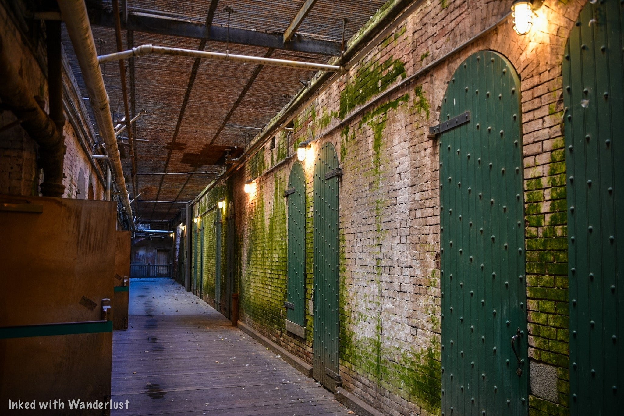
While successful in building an image feared by criminals, Alcatraz would prove itself to be too costly. The salty ocean air was slowly deteriorating the prison. Rising maintenance costs and other ongoing expenses proved to be too much. By order of Attorney General Robert F. Kennedy, Alcatraz was closed in 1963.
Tribal Occupation Period (1969 - 1971)

In 1969, an activist group called, “Indians of All Tribes”, landed on Alcatraz with the intent of reclaiming it as Native-American land. They did so in the name of an 1868 treaty that allowed for Indians to reclaim unused federal land. They wanted to redevelop the island into an Indian cultural center and school.
As is often the case, the federal government didn’t agree with their interpretation of the treaty and swiftly began negotiating with the group. It soon became clear that the group would settle for nothing less than complete ownership of the island. Soon, the group of activists on the island would swell to over 300 people.
When negotiations went nowhere, the Feds cut power to the island and used other tactics in an effort to remove the activists. In 1970, after the death of his young Daughter on the island, the leader of the group, Richard Oakes, left the island.

Eventually, more activists would leave and by 1971, just a handful of men, women, and children remained. At this point, the Feds moved onto the island and removed them. While technically defeated, the actions here inspired many Indian related protests at locations across the country, including Mount Rushmore and Plymouth Rock.
If you want to read about the Indian occupation in greater detail (and we suggest you do), read this article. They give a great account of what happened, why it happened, and the end result.
National Park Period (1973 - Present)

During Alcatraz’s operational years, there were only a few ways you could go to the island; you were either working there, incarcerated there, or visiting an inmate. That changed in 1973 when Alcatraz was transferred to the National Park Service and began offering public tours.
The NPS has done a wonderful job maintaining the island and keeping the facilities as authentic as possible while allowing the public to get up close and personal to what was once described as, “hell on earth”.
You, too, can visit and tour Alcatraz for yourself. However, there is a lot to know and you’ll need to be prepared. Now that we’ve gone over the general history of the island, lets get to the information you’ll need to know in order to go.
(Click to go back to top)
Visitor Information

Buying Tickets
Much like anything else, there is a fee to tour the island. The fee you’ll pay includes your entrance to Alcatraz, the cell house tour, and the round-trip ferry ride. Prices for the day tour are as follows (subject to change):
$41.00 - Adult (12 years old and up)
$38.65 - Senior (62 years old and up)
$25.00 - Child (5 - 11 years old)
$119.60 - Family Pack (Two adult & two child tickets)
As far as purchasing tickets go, you have two options:
Online: This is the preferable and easiest way. Often times, it’s the ONLY way. Tickets are known to sell out months in advance. So purchasing your tickets right when you decide on a date is the only sure-fire way. Alcatraz City Cruises is the official concessioner for Alcatraz tickets. You’ll see many others but they’re middle-men and you’ll end up paying more.

Purchase Day-Of: As stated above, tickets have been known to sell out far in advance. We’re not saying it’s impossible to get day-of tickets, but it’s not worth risking the disappointment. If you decide to go this route, head to Pier 33, scan the QR code at the entrance with your phone, see if there’s availability and if there is, make your purchase.
After you make your purchase, you’ll be emailed a receipt with a QR code (your tickets are contained within it). Simply screenshot it with your phone and present it to the ticket booth upon arrival. They’ll scan it and send you on your way. As always, be sure to print a copy just in case your phone dies.

Types of Tours
While the day tour is the most popular, there are two other types of tour you should be aware of:
Night Tour: Limited to just a few hundred visitors per night, the night tour gives you the opportunity to see a sure-to-be spectacular sunset over the Golden Gate Bridge and experience the island in the dark. Prices are similar to that of the day tour but cost just a bit more.
Behind the Scenes Tour: Ever walk by a spot on the tour with the dreaded, “closed to the public”, sign? Here’s your chance to go to THOSE areas. While pricey, you and a group of no more than twenty are taken to areas of Alcatraz seldom seen by the public. Areas such as special gardens, the underground jail, and the tunnel that stretches from one end of the island to the other.

Best Time to Go
There’s really no bad time to visit San Francisco but in our opinions, September - November is best. Temperatures are warm but not unbearable and crowds are minimal.
Winter is when you’ll get the best deal on hotels but you’ll also be contending with regularly occurring rain showers. Spring is good due to mild temps and rain is nearly non-existent.
Summer, as you guessed, would be our least desirable time of year to go. It’s hot, crowded, and everything is pricier than usual. If you can help it, try either spring or fall.
Pier 33 - Alcatraz Landing
Location
Your journey to Alcatraz begins and ends at Pier 33 on the Embarcadero. The simplest and best ways to get there is by either walking, taking public transit, or a ride sharing option.
If you need to drive, parking can be found at Pier 29.5 (adjacent to Pier 33), across the street from the Exploratorium, a parking garage across from Pier 39, behind the ferry building, and other locations nearby. They all charge their own fees.
The boarding area contains multiple informative displays and a scaled model of what the island looked like when the prison was operational. There’s plenty of seating scattered about and portable restrooms.
You’ll see the boarding queue up front and at the entrance will be a sign indicating which group is boarding (your group is the time you selected during your ticket purchase).

You can arrive as early or as close to your departure time as you like. However, it is recommended to arrive one hour prior as the vessel is loaded on a first come-first serve basis. You could end up having to wait for the next one if it’s full.
*Side Note: It is here where you can request a Braille and American Sign Language transcript of the cell house tour.
Arriving at Alcatraz
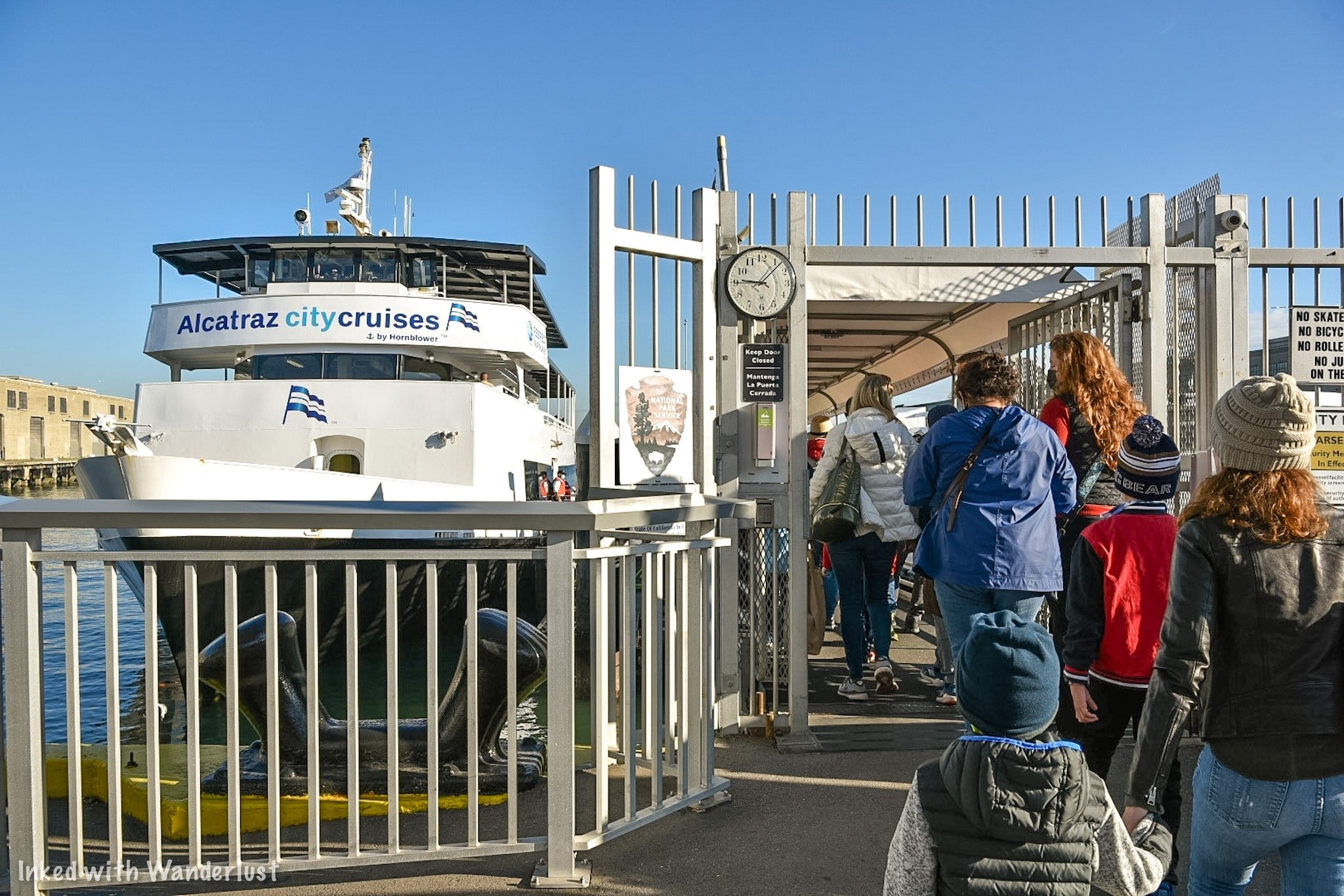
The Ferry Ride
The ride to Alcatraz is scenic and short, maybe 12-15 minutes. In fact, you’ll spend more time embarking and disembarking. If you’re going on a particularly busy day, be prepared for a cramped ride.
*Side Note: As of December 2021, masks are required in all boarding areas, on the vessel (ferry), and in all interior areas on the island. Vaccination status is NOT being checked.
Building 64 will likely be the first thing you’ll notice as you pull into the dock. The upper section was where the military barracks were. Soldiers protecting the bay and guarding the prisoners slept here.
The lower section was part of the fortification protecting the bay. Looking closely, you’ll notice large square holes around the lower section. Those were canon ports.
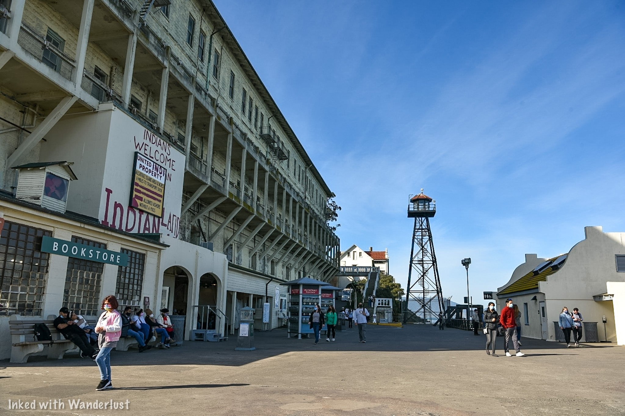
Before taking off, stop and listen to the Ranger presentation held in front of the bookstore. In it, the Ranger discusses the Indian occupation that took place on the island. You’re asked to take part in this but it isn’t required.
The small building across from the bookstore is the first of three restrooms on the island. There’s another adjacent to the entrance of the cell house and one more across from the administration building.
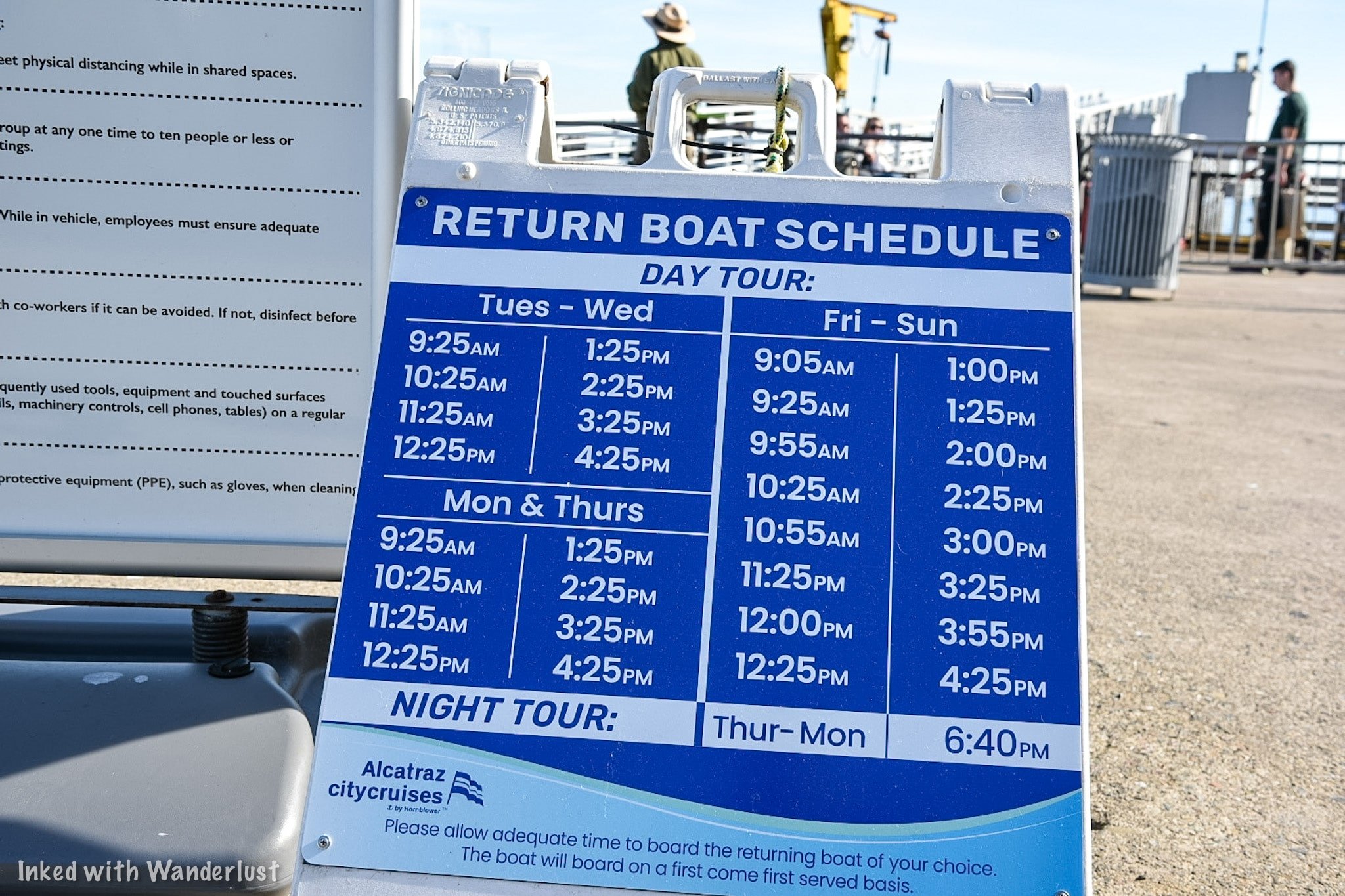
*Side Note: Take note of the sign displaying ferry return times. They vary according to day and the type of tour you’re on. Unless you grabbed a brochure, it would be a good idea to take a picture of this so you’ll know the next available ferry.
(Click to go back to top)
Cell House Tour
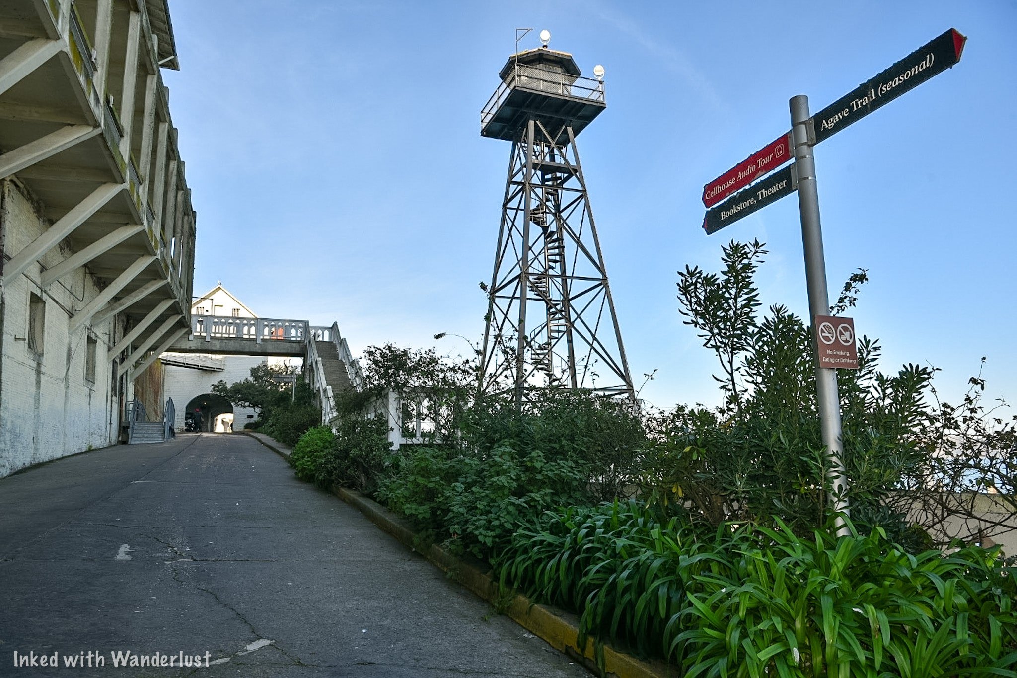
Getting There
To start the tour, walk parallel to Building 64 on East Road towards the guard tower. Before the tunnel (Sally Port), you’ll see a door on your left. This is the theater exhibit room. It wasn’t in operation when we were here, but we’ve seen it before and it’s worth checking out.
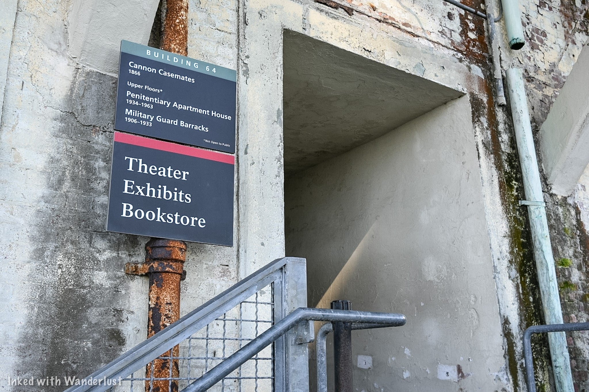
Here’s a few important details about the pathway to the cell house:
The walk from the dock to the cell house is a quarter-mile.
During this, you’ll have 130-feet of elevation gain.
This is the equivalent to climbing a 13-story building (spread out over a quarter-mile).

It does get a bit steep in some places but honestly, it isn’t difficult to get up there. I only mention this because most people don’t realize how the walk to the cell house is.
On the way up, the pathway spurs off in different directions. At these crossroads, you’ll see signage indicating the correct way to the audio tour. Just follow those.
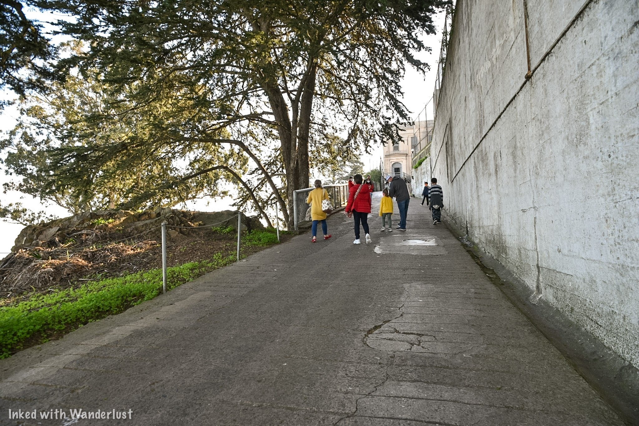

If you have mobility issues of any kind, you can utilize the shuttle. It picks up at the dock and drops you off right at the cell house entrance (and vice versa). Oh, and it’s free.
Cell House Entrance

Audio Choices
When you see rotted bars with a sign stating, “Main Prison”, you’ve reached the beginning of the tour. Before heading in, you’ll need to make a decision on how you’ll plan to take the tour. You have two options:
Utilize their audio device.
Download the app and use your phone.
Each comes with they’re own negatives and positives. The audio device is small, but it’s in a thick plastic sleeve and due to covid, they no longer include headphones. So you’ll continuously need to hold it against your ear.
Downloading the app means you won’t have to worry about hearing the narrator through a sleeve as you'll able to use your headphones. The downsides are that it’s known to be buggy and the connection gets lost in some spots.
Neither is perfect but in order to hear the tour, you’ll need to do one or the other. We opted to use the audio device as we didn’t know about the app ahead of time and already drained the batteries on our AirPods.
Alcatraz Showers

After walking through the entrance, you will enter the shower room. The queue wraps around the showers to the other side, where you will pick up your audio device. Each person in your group will be given one.
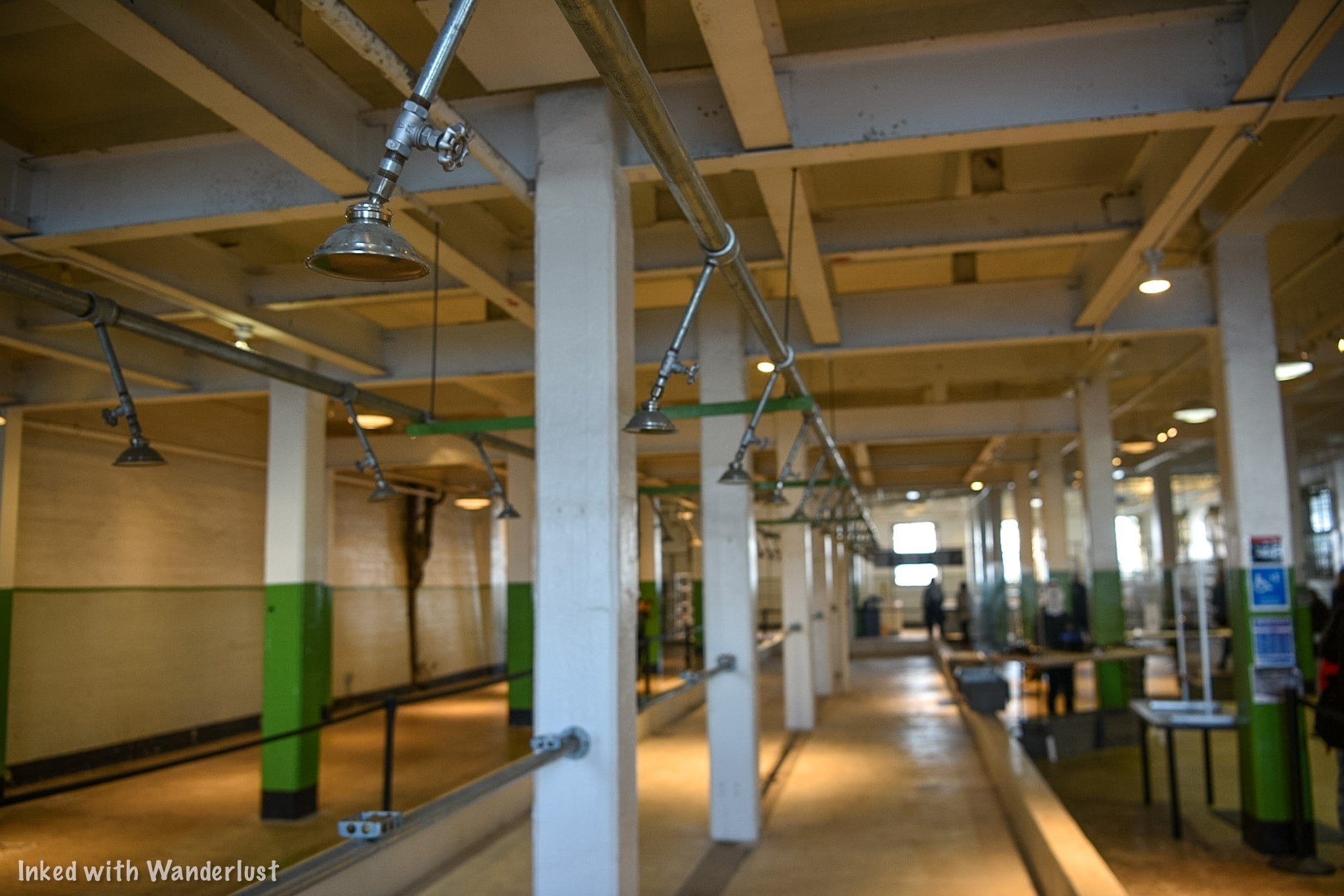
When you reach the front of the queue, inform the attendant if you’ll be using the app or the device. If you choose the app, you’ll go right through.
If you want the device, inform the attendant of your language preference. You can choose between:
English
Spanish
Mandarin
Japanese
Italian
German
French
Dutch

Once you’re set, head up the stairs to the cell house (there’s an elevator for those with mobility issues). At the top of the stairwell, go left and look for a red sign (pictured below). Do not start the device/app until you reach this point.


Michigan Ave
When you reach this point, the tour officially begins. After you hit the green button, you’ll be introduced to the narrators, four former inmates of Alcatraz. They are:
Leon “Whitey” Thompson (Weapons charge, 1960 - 1962)
John Banner (Bank Robbery, 1954 - 1958)
James Quillen (Kidnapping, 1942 - 1952)
Darwin Coon (Bank Robbery, 1959 - 1963)
You’ll also hear from a couple former guards as well (unfortunately, we didn’t catch their names). Also, park officials swap narrators from time to time. So they may be different when you go.
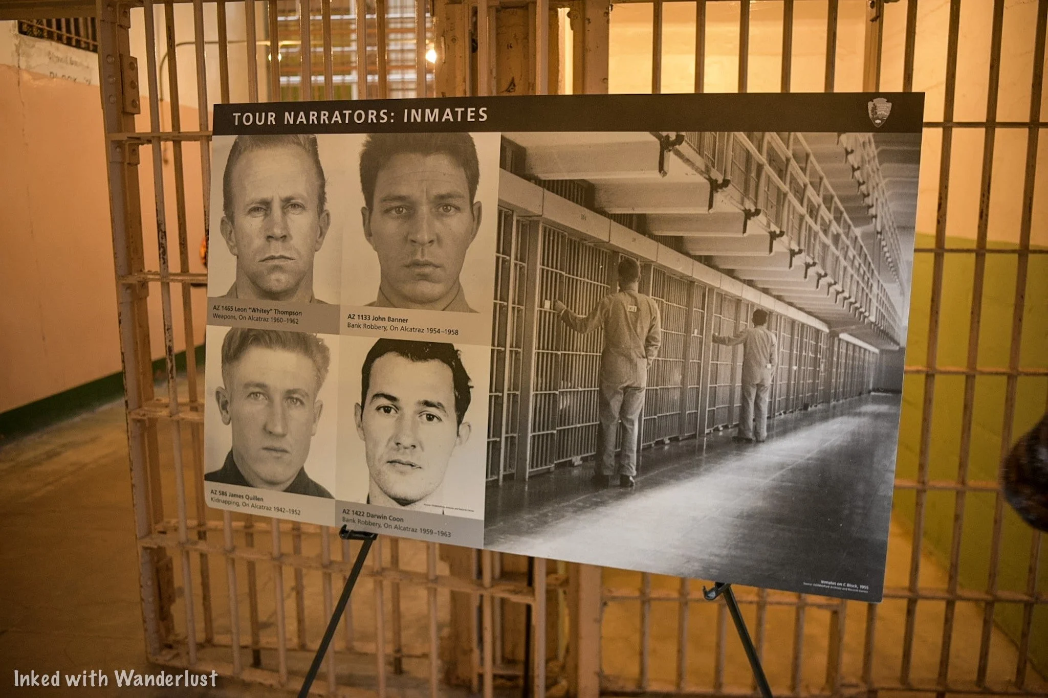
The cell block you’ll see in front of you is B Block. Behind you is A Block, which was seldom used during the island’s run as a federal prison. Unfortunately, it is not part of the regular tour. To see A Block, you’ll need to book the “Behind the Scenes” tour.

The tour narrators will tell you when to stop, what to look at it, describe what you’re looking at, and which direction to go in next. This is why it’s imperative to pay close attention.
You will have the ability to pause the tour and rewind in case you get turned around, missed something, or want to linger in one spot for a while longer.
To the left of the sign with the narrators on it is the, “cut-off”, a passageway through the middle of B Block. You’ll go through here and turn right coming out.
Broadway

After going through the cut-off, you’ll turn onto, “Broadway”. This is the aisle between B and C Blocks. Your narrator will guide you to a few different cells with notable occupants.
Each cell on B and C Blocks are some of the smallest you’ll ever see. Grown men lived in cells that were 5 feet by 9 feet and 7 feet high. Most inmates could stretch their arms and easily touch each side of their cells.

You’ll work your way up Broadway towards what is known as, “Times Square”. When you reach this point, you’ll turn left and head towards the doorway leading to the Recreation Yard.
Recreation Yard

The Recreation Yard (or simply, “Rec Yard”), is where most inmates would spend a portion of their days. Some would play cards while others played handball. Some, simply, would sit and stare at the impressive views of the city and Golden Gate Bridge.


You will want to pause the tour and spend some time looking around the yard. If you look towards the back wall, you’ll notice an open, rusted door leading to a steep stairwell.
This is the door where inmates would march through to go to whichever job they held. They would have to go up and down these stairs on a near daily basis.


Feel free to spend all the time you want exploring the yard. Once you’re ready to resume the tour, simply head back the same way you came in. When you reach the doorway, hit start on your device and head straight to D Block.
D Block & Prison Library
Inmates who proved to be problematic for guards, i.e, got into fights, assaulted guards, or just didn't follow a specific rule, were sent to D Block. It was quickly given the nickname of, “Punishment Block”.
These cells were much bigger than the ones in the other blocks, but inmates were confined to them 24 hours a day (with the exception of their twice weekly showers).

Since they were completely confined to their cells, everything was brought to them by other inmates or guards. On top of that, the only two activities allowed here were reading and quietly talking to the inmate next to you.
The other feature of D Block, specifically on the upper tiers, was the view of the city. Inmates, however, said this was the worst part because when the wind blew towards Alcatraz, it carried sounds of people talking and laughing from the city, reminding them of how isolated they were.

Further down D Block is where you’ll find the infamous solitary confinement cells, also known as the, “prison within a prison”.
These cells were solid concrete with nothing but a toilet, sink, and a bed inside. No light source was provided so when the solid door was closed, inmates were in total darkness and could hear nothing.

If you want a small taste of what it was like, go to the cell at the very end. Both doors are left open and you are allowed to step inside. Although you cannot shut the door behind you, it will give you a sense of what the inmates experienced.

After D Block, your next step will be the prison library. It’s another example of a, ‘prison within the prison”, as you feel like you’re walking into a cage.
On arrival at Alcatraz, inmates were given a library card and were allowed three books at a time. This was in addition to a bible, text books, and approved magazine subscriptions (newspapers were prohibited).


Inmates weren’t allowed to come and go as they pleased, though. If they wanted to check out a book, they would fill out a slip and turn it in. The Librarian would find the book(s) and deliver them to that inmate’s cell.
There are benches in the library that you’re free to use if you need to sit-down for a bit. When you’re ready to move on, exit the Library and go right on “Park Ave.”

Park Ave., Good-Time Cells, & Visitation
Coming out of the library, the narrator will have you view a few of the cells on C Block on what is known as, “Park Ave.” These cells are referred to as, “Good-Time Cells”, as inmates in these cells were allowed paint supplies and other privileges.
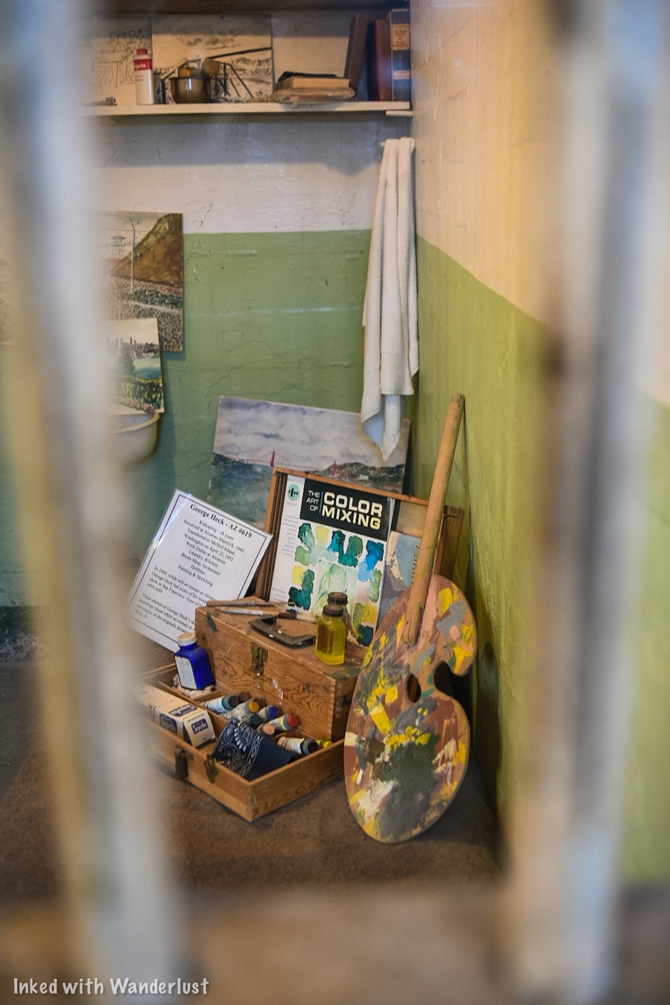
From here, you’ll round the corner to view the visitation area, also known as, “Peek’n Place”. Here, inmates would visit their loved ones by talking to them through a phone and thick, glass barriers. Under most circumstances, inmates were allowed only one visit per month.

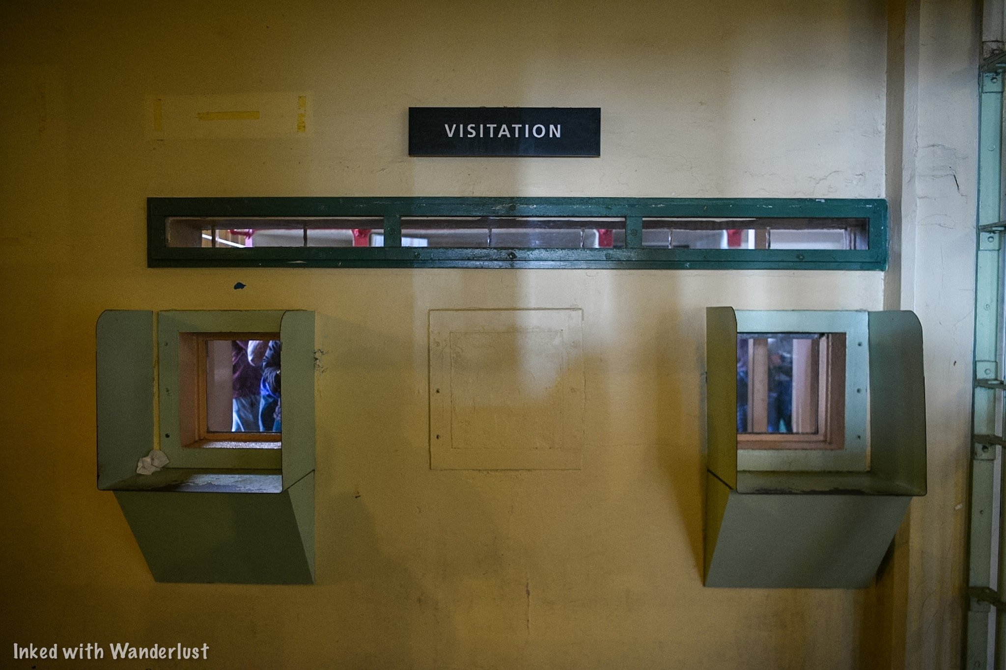
Head to the opposite side of the wall to see it from the visitor’s perspective. There would be a guard stationed here listening to all conversations. Among other topics, discussing current events was prohibited and could’ve resulted in privileges.

The area behind the visitation is where the administrative offices are. You can come back here after the conclusion of the tour. For now, head back down broadway.
Broadway & Dining Hall

Before arriving at the Dining Hall (the final room of the tour), you’ll take one last stroll down Broadway. On the way, you’ll stop to see the cells of Frank Morris and the Anglin Brothers. They took part in the greatest escape attempt in the history of Alcatraz.

You’ll see the vent in the back of their cells where they squeezed through to gain access to the corridor. They took advantage of Alcatraz’s deteriorating state by chipping away at the wall around the vent.
You’ll also see the plaster molds of their heads they constructed. They placed them in their beds at night to fool the guards into thinking they were asleep. In reality, they were in the corridor behind the cells working on the next phase of the escape.

The final section of the cell house tour is the Dining Hall. Here, hundreds of men would gather together for breakfast, lunch, and dinner, everyday. The guards would tell you that this was always the most tense part of the day as fights or riots could break out at any time.


To deter this, tear gas canisters were positioned in the rafters throughout the room that could be set off remotely. There was also an abundant of armed guards present. Despite these security features, a few riots have broken out here.
Inmates were given 20-minutes to eat and were not limited in how much food they could consume. The only caveat to this was no matter how much they took they had to eat it all, leaving no waste. If they made a habit out of doing that, it could result in the removal of privileges.

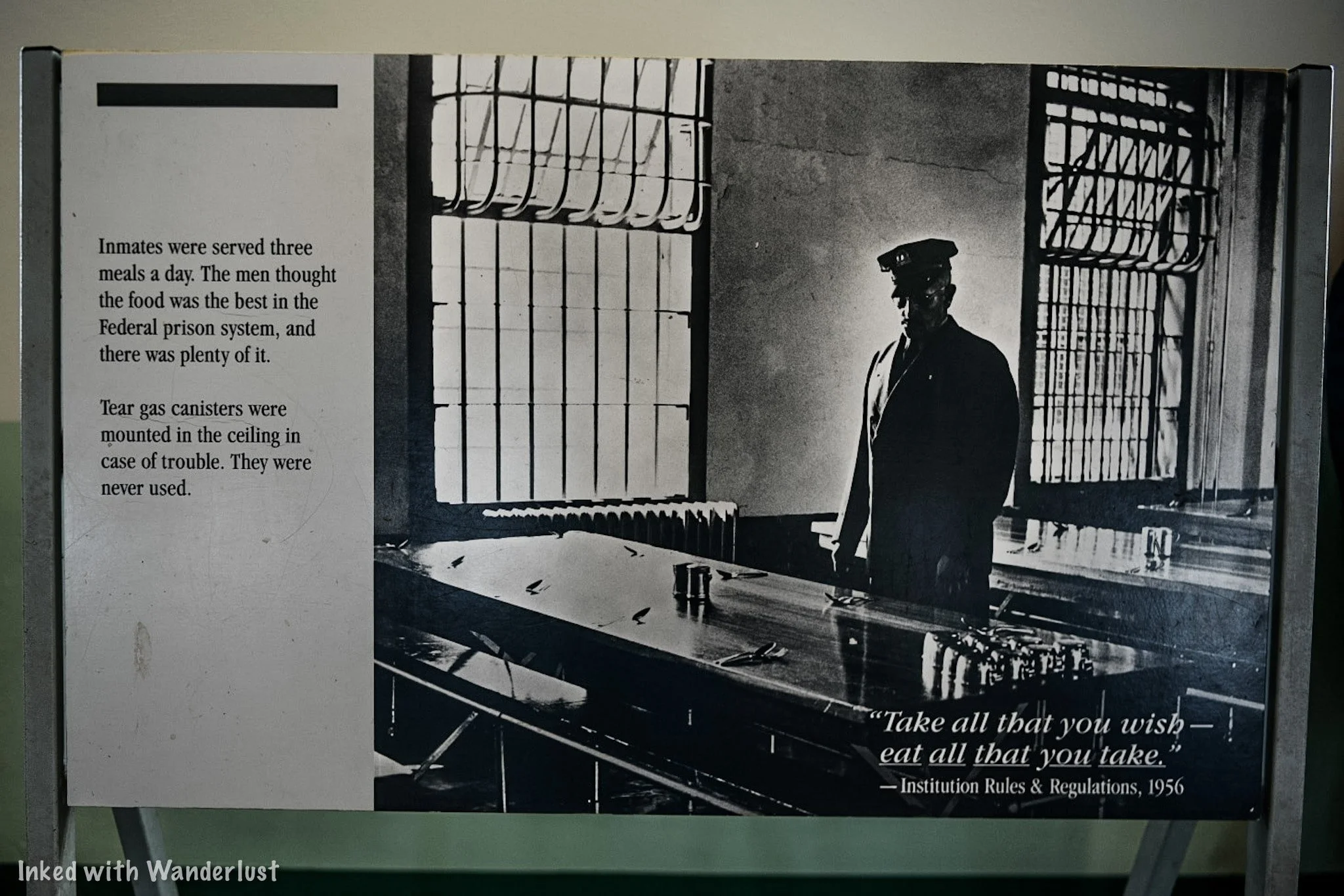
Hanging above the entrance to the kitchen is the menu of the final breakfast served at Alcatraz. Inmates reported the food here to be the best of any Federal Penitentiary they’ve been to.
By now, the narrator has concluded the tour and from this point forward, you’re free to explore the island at your leisure. Turn in your device to the booth in the middle of the room and head back down the stairs.


From there, you’ll come down the stairs and back into the showers. You’ll be directed to exit through the gift shop and when you do that, you’ll be right back where it all began at the cell house entrance.
(Click to go back to top)
Exploring the Island
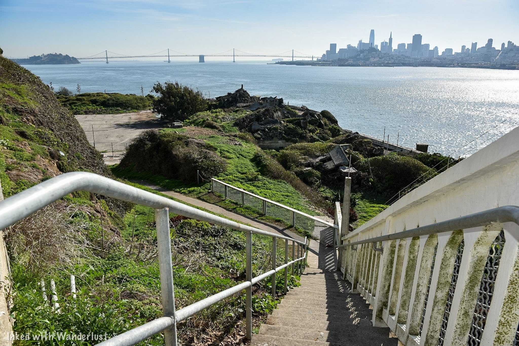
Your visit to Alcatraz doesn’t end with the cell house tour. You’re free to spend as little or as much time here as you please as long as you’re off the island by the final ferry departure time.
At the conclusion of the tour, simply head back down the path and go from there. Having a map of the island would come in handy here but if you don’t have one, just follow the signage.
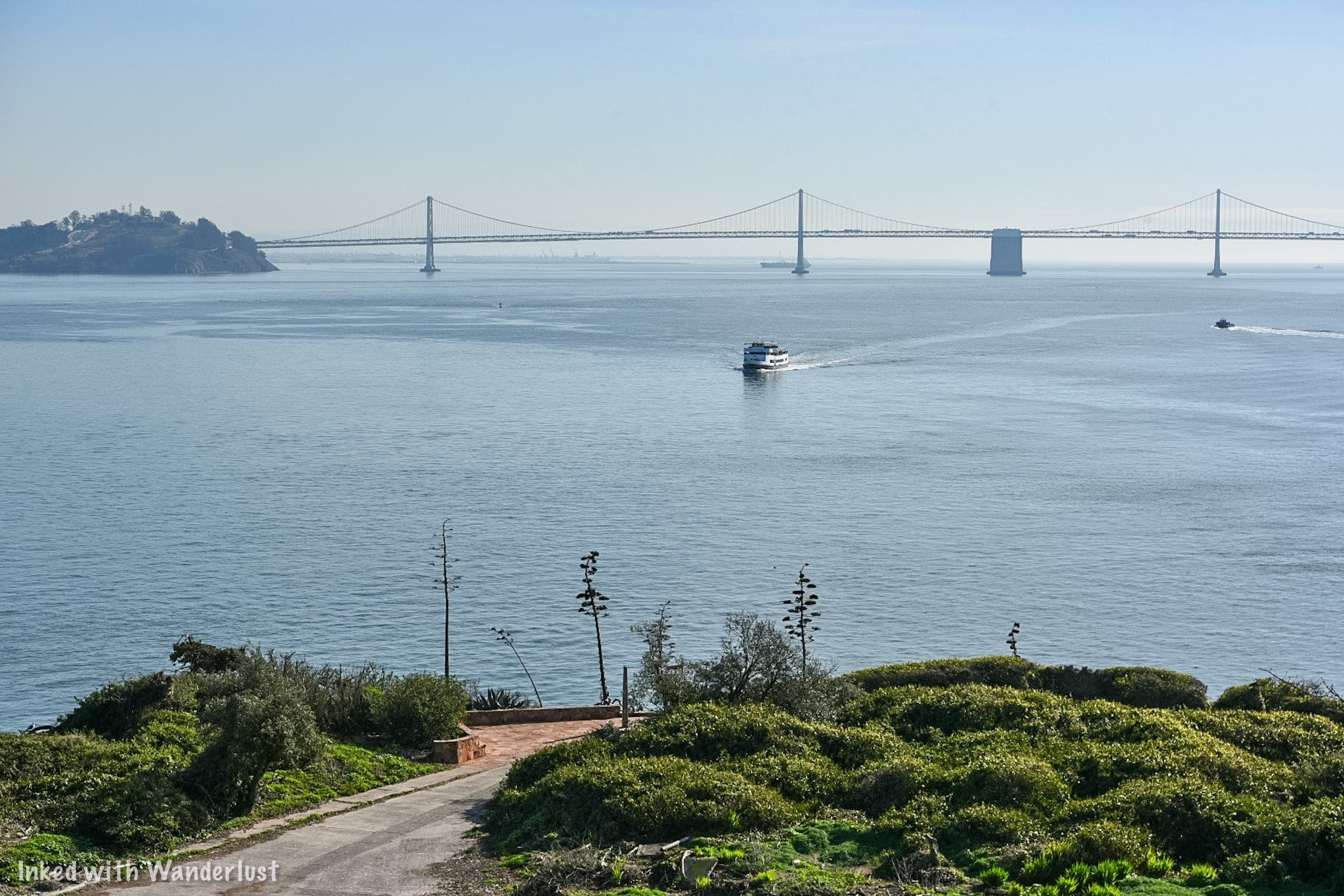
Southwest & Northwest Side
On the southwest side of the island (facing the Bay Bridge) is the administration building, the remains of the Warden’s house, the historic Lighthouse, and the ruins of, ‘Officer’s Row’ (where housing for the guards and their families used to be).


In the admin building, you’ll see the Warden’s office, control room, and other offices. You can also access the cell house from here if you want to see it again.
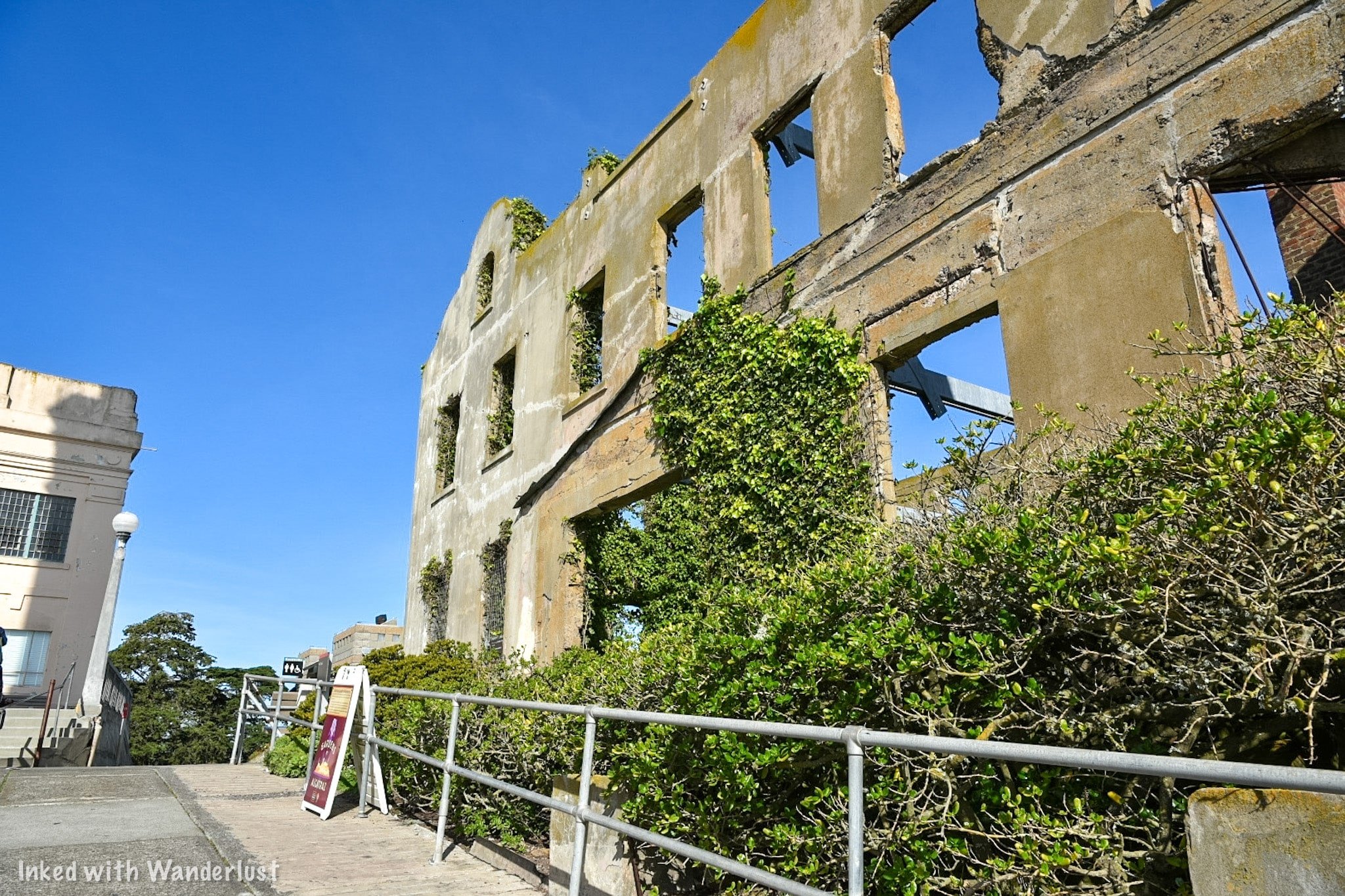
Outside the admin building is the former home of the Warden. As you can see in the image above, the elements and nature have taken over. As you’ll see when you’re here, though, the Warden once had an amazing view of the bridge and city.
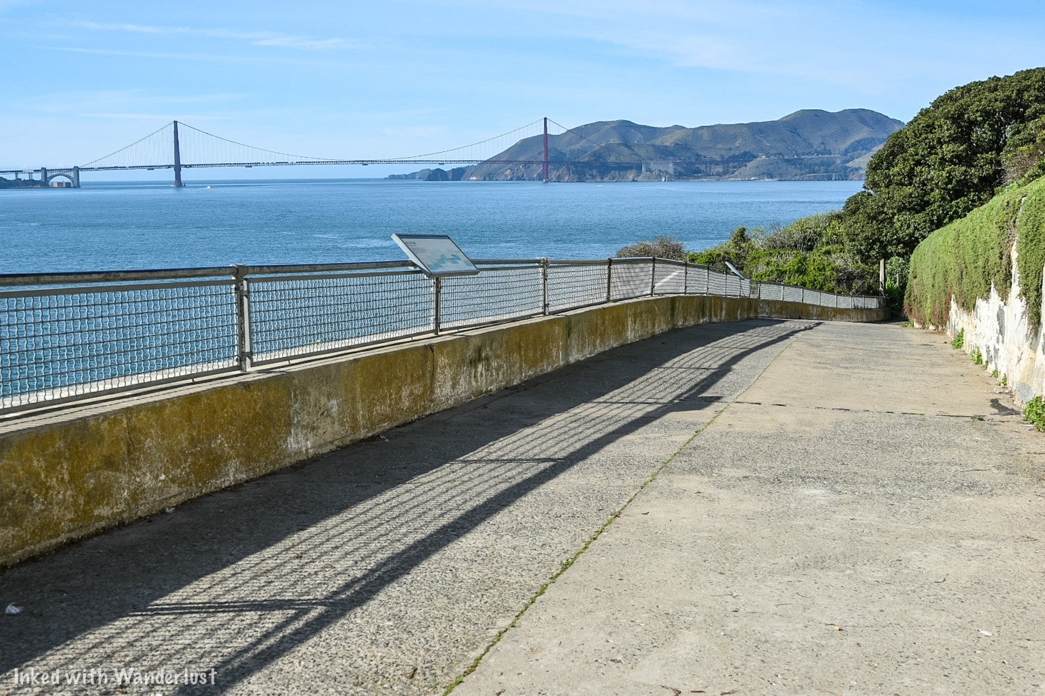
Take the west road (pictured above) to see the Northwest side of the island. Here you’ll find a beautiful garden that was once maintained by the inmates.
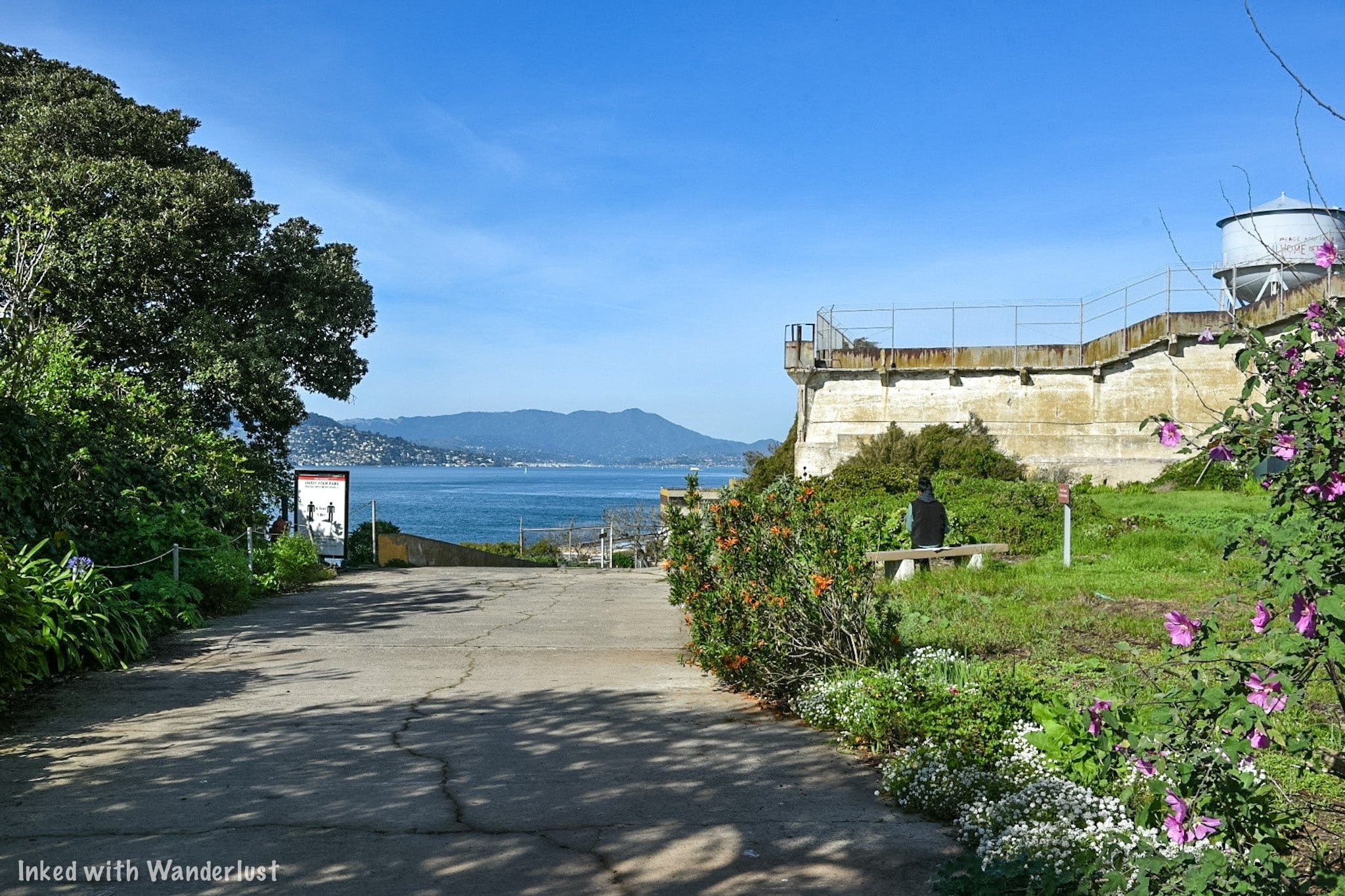

The west road eventually terminates near the stairwell that leads back to the Recreation Yard. If you like, you’re welcomed to go back up there. If not, you’ll need to turn back and go the way you came in.
Southeast and Northeast Side
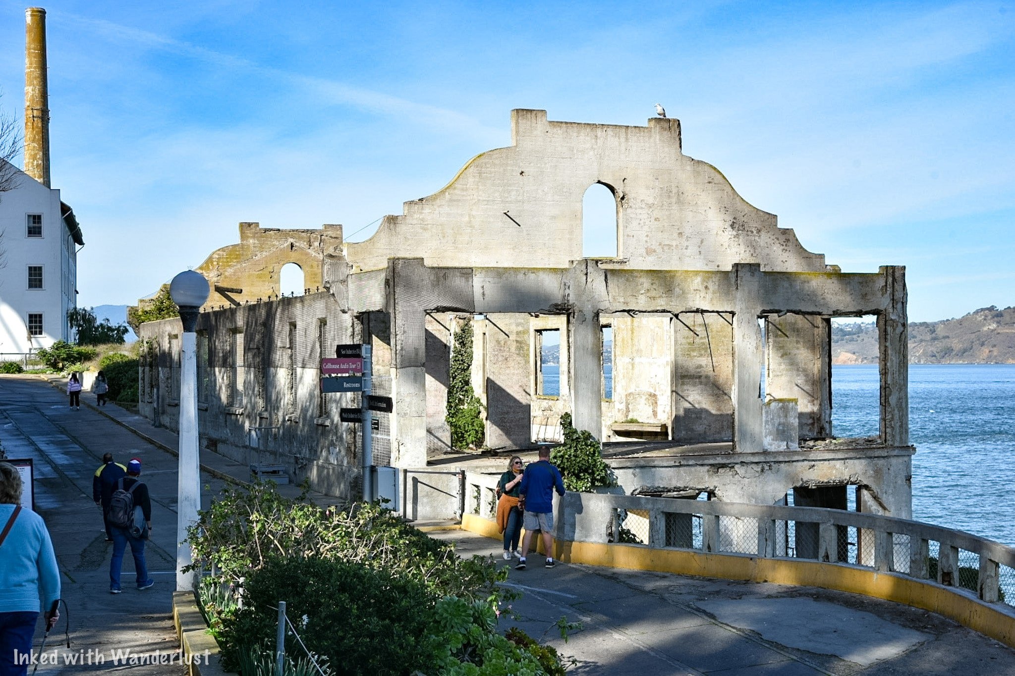
These are on the opposite side of the island. To get there, you have two options:
Go up the stairs through the recreation yard and cut through the cell house to the other side. You’ll go back down the stairs in the Dining Hall and out through the gift shop. Or….
Take the west road back to the Warden’s house and loop back to the other side on east road.

There are multiple historic buildings on this side of the island. Building 64, the Sally Port, the old Boat Dock, and (pictured above) the remains of the Officer’s Club.
Continuing straight away from the Officer’s Club is where you’ll find the Powerhouse, Model Industries Building, and Water Tower. A bit further up the road (going towards the cell house) you’ll find the Morgue.


The Model Industries Building is fenced off so you’re not able to go in and see it. We did see a lot of construction material nearby so that may possibly change in the future.

At this point, you have no other recourse but to turn around. From here, it’s completely up to you where to go.
As stated above, you can remain on Alcatraz for as long as you wish. You can explore the island some more, do the cell house tour again, you can hike the Agave Trail (starts near the ferry dock), or head back to the city.

*We’re often asked about the kind of camera equipment we use to capture the photos used on our website. Below are Amazon links to what we use. If you decide to purchase, Amazon pays us a small commission and it doesn’t cost you anything extra.
(Click to go back to top)
Conclusion
Phew! That was a long one. If you read that entire thing, you rock! If you skimmed through it, you still rock! We’ve been wanting to add Alcatraz to our website for a long time and we’re excited for you to read it. Be sure to let us know in the comment section if you’ve been to Alcatraz or are now wanting to go.
We hope you’ve found this post helpful in planning your next adventure. If so, please support our site by sharing it with your family and friends on Pinterest or Facebook. You can further show support by staying on and reading one or more of the related articles above.
Thanks for reading and safe travels!