
The Ultimate Bodie State Historic Park Guide (Ghost Town)
Regarded as the “Disneyland” of California ghost towns, Bodie contains dozens of historical structures, including the town’s former…
Disclosure: This post contains affiliate links. If you make a purchase through these links, I may earn a small commission at no additional cost to you. I only recommend products or services that I believe will add value to my readers.

If you’ve ever wanted to know what life was like during the height of the California gold rush in the mid to late 1800s, there are few destinations more suitable of an example than the state’s most infamous ghost town, Bodie State Historic Park.
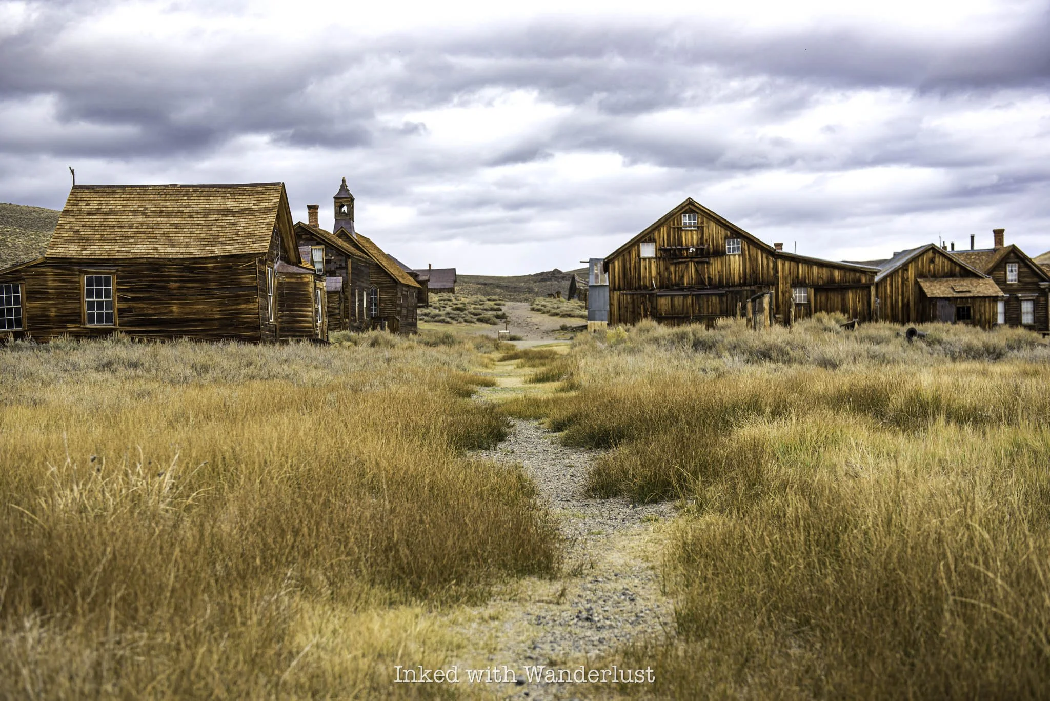
Regarded as the “Disneyland” of California ghost towns, Bodie contains dozens of historical structures, including the town’s former hotel, church, schoolhouse, saloon, as well as various homes, all preserved in a state of arrested decay (meaning they do nothing to improve the buildings, but just enough to prevent them from deteriorating).
Initially founded in 1849, a year after John Marshall’s first discovery of gold in California and just a couple years after the disastrous events of the infamous Donner Party saga, Bodie is steeped in history and thus, more than worthy of a visit.
If you’ve never been there, you’re likely wondering how to visit this spectacular place and see it for yourself. In this guide, I’ll cover all pertinent topics such as best time to visit, what you can expect, parking, fees and more. Let’s get into it!
Bodie - A Brief Historical Rundown

Bodie was named for Waterman S. Bodey, the man who made the initial discovery of gold in what is now known as the Bodie Hills, just north of Mono Lake. Those hills later revealed a monumental amount of gold and silver deposits, meaning the boom was now in full swing.
Word began to spread and soon, people flocked to Bodie by the thousands, transitioning it from a few structures with a couple dozen miners into a bustling municipality with over 8,000 people. At its peak, there were many saloons, gambling halls, banks, a jail, hotels, schoolhouse, hundreds of homes, brothels and more.
After its peak in 1881 and mining started diminishing due to operations becoming increasingly expensive, folks began abandoning Bodie, moving on to the next. By the early 1930’s, there was interest in getting the town running again by utilizing electrical power to operate the stamp mill and a cyanide process to work the mill tailings.
In a twist of fate, however, a fire started by a two year old playing with matches destroyed roughly ninety percent of Bodie. This incident, compounded with the 1942 presidential order ceasing all mining of gold and silver, resulted in Bodie losing its township and all hopes of a revival were dashed.
After years of negotiations between the state of California and owners of the Standard Oil company, Bodie was sold in 1962 and transformed into a state park, preserving this historically significant destination for generations to come.
Getting to Bodie, Parking, Hotel and Dining
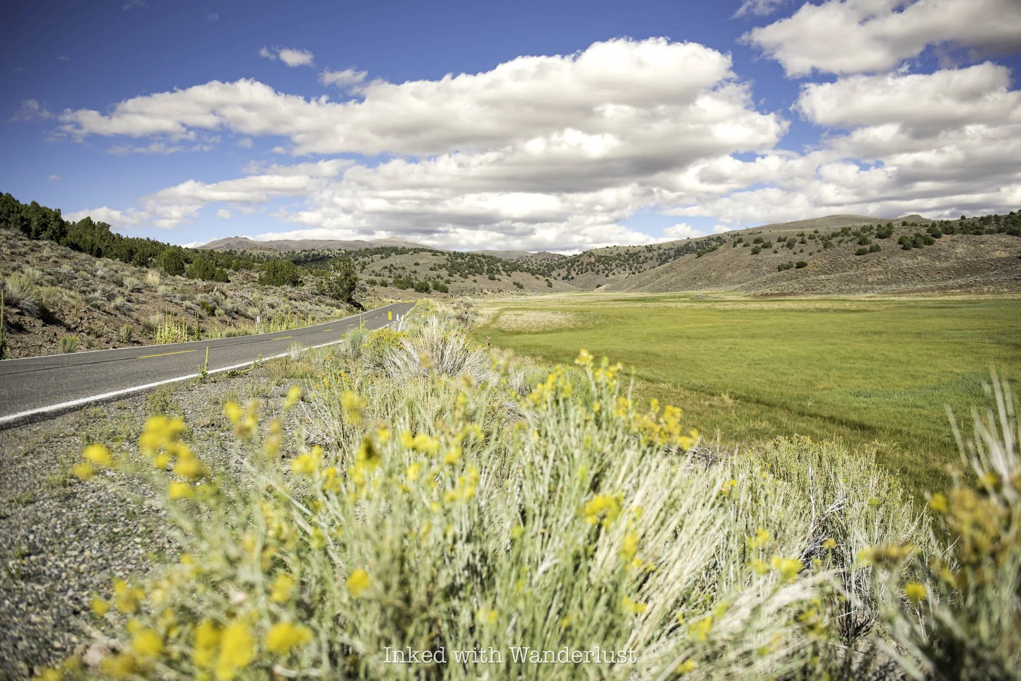
Bodie is simple to get to as it’s located between Bridgeport and Lee Vining, two small California mountain towns. From Bridgeport, it’s seven miles south on Highway 395 to State Route 270 (left) and another 13 miles to the park itself. From Lee Vining, it’s roughly 18 miles north on Highway 395 to the turnoff (right).
The first ten miles of State Route 270 (also known as the, “road to Bodie”) is paved, with the final three miles converting to a dirt road. The is passable for most, some may just need to take it slow. There are no huge boulders or potholes to negotiate, but there are a few semi-rough washboarded areas.
As you can see, Bridgeport is much closer to Bodie than Lee Vining is, making it an obvious basecamp for visitors. However, I highly encourage you to at least visit Lee Vining after exploring the park, as it’s an incredible place to visit in its own right.
There are no major airports close to the park. The closest would be Reno International to the north and various Los Angeles-area airports to the south. The closest of which is 163-miles away. That said, bringing your own vehicle is paramount.
Parking

Parking at Bodie is relatively easy to come by. They have one, rather large gravel lot, capable of hosting quite a few vehicles. Parking is included with your entrance fee (which we’ll discuss in detail below).
Shortly after driving into the park, you’ll notice a small lot on your left. That one is for park employees. Continue straight for another thirty feet or so and you’ll come to the day-use parking lot on your right.
Accommodations

In short, there are none. Not inside of the park, anyway. In the aforementioned nearby towns of Lee Vining and Bridgeport you’ll find quite a few options. In Bridgeport, accommodations include the historic Bridgeport Inn, Virginia Creek Settlement (closest to the park) and a few Airbnb rentals.
In Lee Vining, you’ll find Lake View Lodge, El Mono Hotel, and Yosemite Gateway Hotel, along with numerous campgrounds along Tioga Pass (which are also close to the east entrance of Yosemite National Park, by the way).
Dining

Unfortunately, there aren’t dining options in the park either. Water fountains can be found in the parking lot, adjacent to the restrooms. As with accommodations, both Lee Vining and Bridgeport offer plenty of local eateries. I would advise bringing your own food with you, as you’ll easily spend half a day exploring the park.
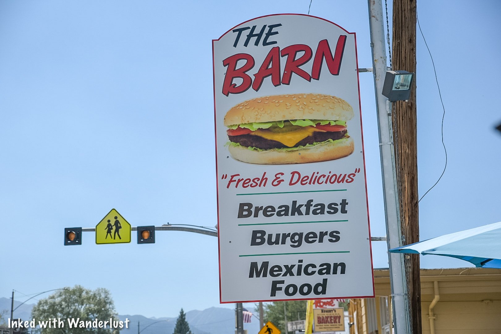
In Bridgeport, I recommend one of my personal favorites, Virginia Creek Settlement, which is the closest eatery to the park at less than a mile from the Route 270 turn-off. Another favorite of mine, Burger Barn, is located in Bridgeport, proper.
Alternatively, Lee Vining also has a few restaurants of note. My go-to, Whoa Nelly Deli, is located at the southern end of town, just after the Tioga Pass turn-off. They offer a variety of hot sandwiches, along with burgers, seafood, and more.
Bodie State Park Fees and Hours

Park hours vary according to time of year. They are:
Summer Hours
9:00am - 6:00pm (March - September)
Winter Hours
9:00am - 4:00pm (October - February)
Although the park is open in winter, State Route 270 (the road leading to Bodie) is closed to vehicles due to heavy snowpack and the road isn’t plowed at all during winter. This means you can only access Bodie is by snow-shoeing or snowmobile.
Bodie sits at 8,375 feet in elevation (at the visitor center) and has unpredictable weather patterns, including the summer months, where afternoon thunderstorms occur regularly. Sub-zero temperatures and blistering white-out conditions occur in winter, as well.

Bodie State Park’s admission fees as of 2025 are:
$8.00 per adult
$5.00 per child ages 4-17
Free for ages 3 & younger
$3.00 per tour booklet
$6.00 per person (Stamp Mill tour)
While cash is accepted, they prefer payments by credit card. Additionally, change isn’t always available so if you’re paying with cash, bring exact change. If there’s no ranger at the booth, you can pay at the electronic pay station just past the booth.
Something I always recommend to first-time visitors is to purchase the self-guided tour book and the cemetery tour book as well. They’re $3 a piece, but they’re worth the extra expenditure as they provide invaluable information on the various structures and cemetery plots, respectively.
As you approach a structure, look for the number (usually staked into the ground) and match it to the corresponding number in the booklet. It’ll tell you what the structure was used for, who lived there, etc. It’s highly informative and a great way to learn about the park in depth.
Best Things to do at Bodie

There a seemingly limitless amount of things to do at Bodie. For a place that never changes, there’s somehow always something new to see. That’s why I recommend taking the time to explore the park. You won’t see everything, but it’s the best way to try.
Despite that, there are a handful of notable structures and activities offered at the park and should be a priorty during your visit, especially if it’s your first. These include:
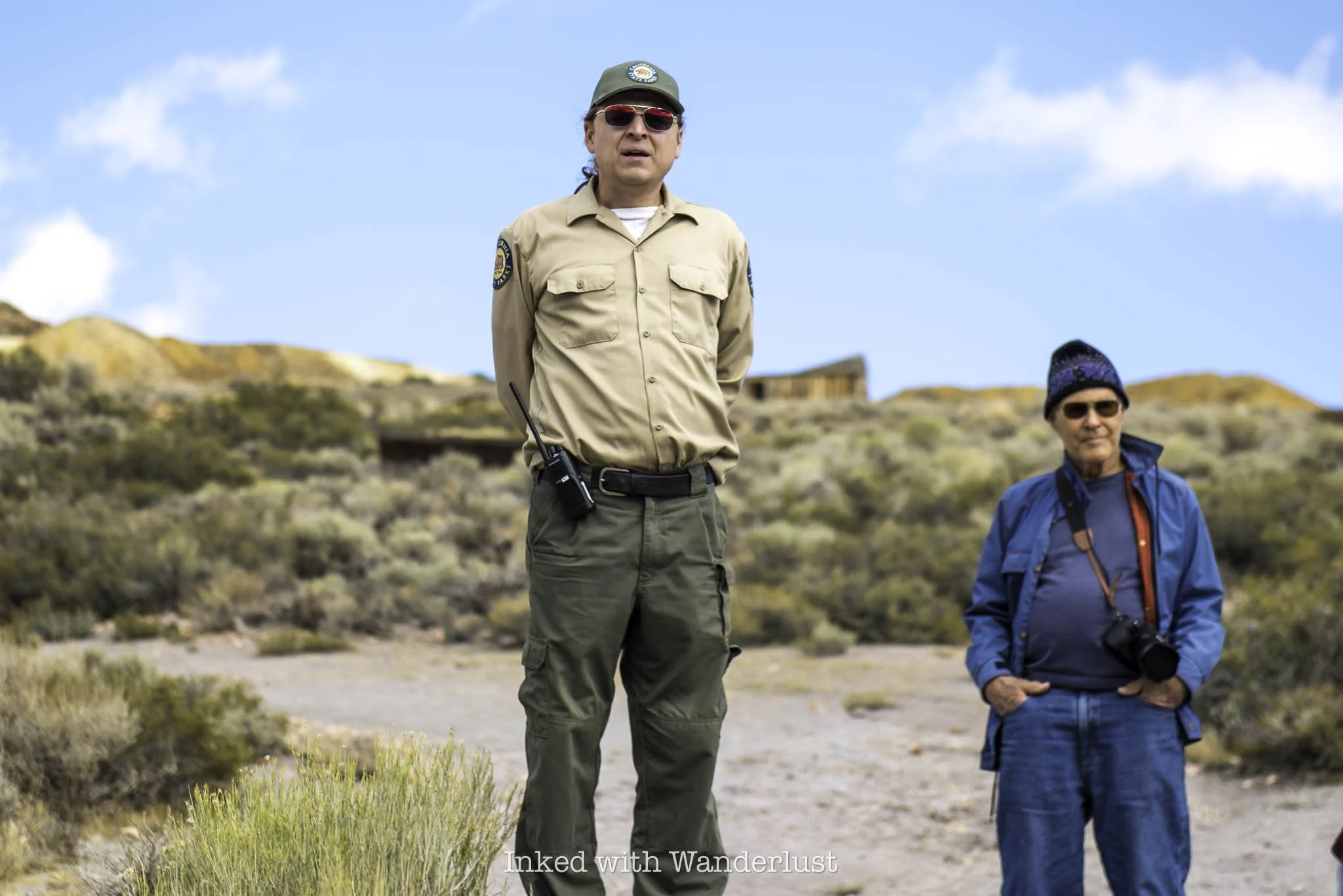
History Talks
History talks are free, ranger or staff-guided mini tours, conducted once or twice daily, depending on time of year. They meet in front of the museum and a member of park staff will walk with you to a couple buildings, discussing the park’s history.

Methodist Church
Bodie’s Methodist church is perhaps the most recognizable, iconic structure in the park. It was built in 1882 and was one of only two churches in town. It’s the park’s sole surviving house of worship and conducted its final service in 1932, after the devastating fire that destroyed ninety percent of the town.

Bodie Museum and Visitor Center
The museum is free to enter and explore. It’s packed full of historical artifacts discovered inside the various structures and around the park. Since people traveled almost exclusively in covered wagons, they could only take what they could travel with. Consequently, folks abandoned most of their items when leaving town.
There’s also a small gift shop located inside. There, you can purchase a variety of items, including Bodie’s famous calendar, t-shirts, patches and pins, history books, random trinkets, and more. Additionally, you can purchase stamp mill tour tickets and self-guided booklets. All sales benefit the Friends of Bodie Foundation.
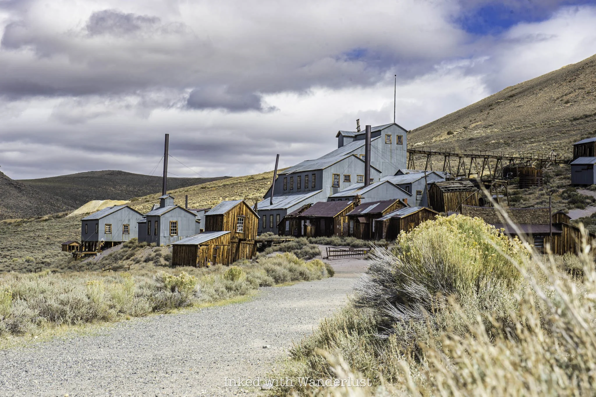
Stamp Mill Tour
The park’s historic stamp mill is the best preserved stamp mill in the state and only surviving ore-processing mill in Bodie. Ranger or park staff-guided tours are conducted two to three times daily throughout the season and cost $6.00 per person.

Bodie Cemetery
Bodie’s cemetery is located across the main road that leads to the parking lot and overlooks the town. In it are several dozen headstones and unmarked graves, with a few notables buried here as well. Two of which are Evelyn, known as the “Angel of Bodie” and Waterman S. Bodey, the town’s founding Father and namesake.

The Miller House
The Miller House is notable not so much for its previous occupants, but for its uniqueness in that it’s the only former home in the park where visitors can enter and explore. The bedroom and kitchen are fenced off, but you’re free to explore the living quarters and dining room.
These are just a small handful of things to do at Bodie. As stated above, the best way to get the full experience is by purchasing the self-guided tour book. You’ll gain so much knowledge from spending just a few bucks.
Best Time To Visit Bodie

Bodie is open throughout the year and is perfectly accessible throughout most of it. However, as stated above, the road to Bodie is closed to vehicles in Winter. For most people that leaves Spring, Summer and Fall.
Spring: If you get here right at the beginning of the tourist season, you’ll typically experience mild weather and lighter crowds. Weekends are busy but not to the point of being miserable.
Summer: This is the height of the tourist season and with it, brings hot days with semi-regular afternoon thunderstorms. Crowds are at their heaviest during this time so if you must come during summer, arriving on a weekday and being there early would be your best bet.
Fall: By this time, crowds begin to thin and temperatures start cooling back down. Until the end of October, weekends will still have a decent turn out with weekdays reverting to light. This is far and away my favorite and preferred time of year to go.
Winter: Crowds are non-existent. Aside from the on-site park staff, you’ll likely have the park to yourself. The museum and stamp mill are closed, but you’ll have the chance to see a side of Bodie most never do. Get your hands on a snowmobile and you’re set (if you happen to have one and would be willing to transport me out there, be sure to hit me up!).
The Bodie Curse
As previously mentioned, Bodie’s a protected site and as such, stealing and/or damaging items or structures in the park is prohibited. You’ll face fines, be trespassed, arrested or something a bit more sinister…get cursed.
The story varies wildly from person to person but they all seem to agree on one thing, bringing anything home from Bodie could bring you misfortune. Per local legend, rangers often receive packages containing stolen items such as dolls, old cans and rocks, accompanied by letters from apologetic senders.
The letters typically state that they’ve had nothing but bad luck since returning home with the stolen item. After sending the item back, however, life returns to normal. Regardless of whether you believe the curse is real or not, it’s important to respect Bodie, and everything in it, to ensure its longevity.
“Take nothing but pictures…leave nothing but footprints”.
Things to do Near Bodie

There are many other attractions and destinations both near Bodie and within a couple hours drive. In fact, most people visit Bodie as a stop on their overall road trip along the famed Highway 395. If that’s you, or you’re staying nearby, there are plenty of other wonderful sights to see.
If you’re using Lee Vining or Bridgeport as your base, you’re close to the majority of these (tap/click the link to read my guides on these destinations):
Conway Summit
Twin Lakes
Sierra Strange - Coffee and Oddities
* Denotes a link to a separate post


This post was originally published in 2021 and has been recently updated for accuracy and additions.

Our Pick Of 12 Mono County Destinations For Your 2023 Summer Plans
Situated between Nevada and Yosemite National Park, Mono County is located in the east central part of California with the…
3 minute read | contains affiliate links
Situated between the Nevada state line and Yosemite, Mono County is located in the east central portion of California.
Mono County is infamous for being a haven for fisherman, hikers, skiers and sightseers alike. It truly is a wonderful place.
Now that new year celebrations are past us, many people, including yourself, are probably beginning to map out your travel plans for the year.
I wrote this post to help inspire you to consider Mono County for your family vacation this year. It is one of our favorites and I have no doubt you’d love it too.
So read on as we list our twelve personal favorite destinations that we think you and your family would love.
1) Bridgeport, CA

Kicking off the list is our favorite little mountain town - Bridgeport. The town may be small but it’s packed with all sorts of sights to see.
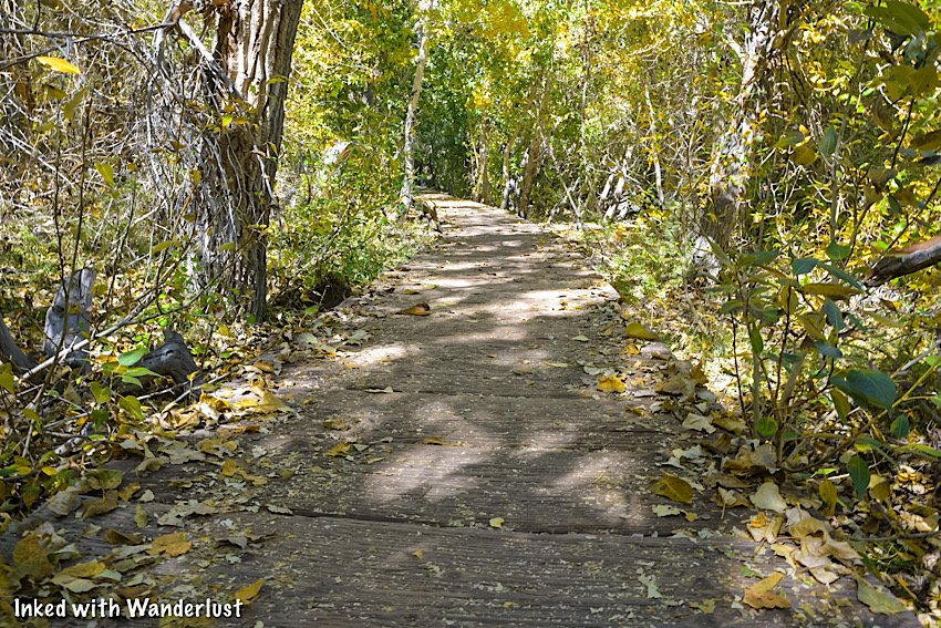
You can soak in hot springs, explore historic buildings like the old jail, experience world-class fishing, dine at a local favorite or hit one the many hiking trails.
With so much to see and do, you could spend your entire vacation in Bridgeport. There are many hotels in and around town to accommodate you.
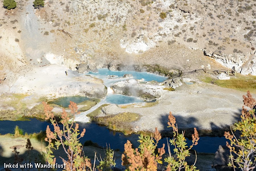
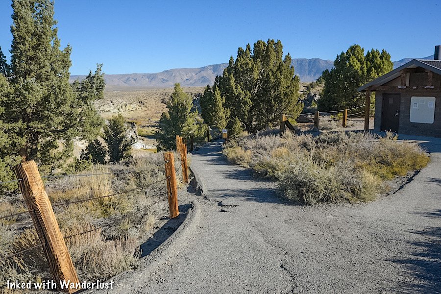
2) Travertine Hot Springs

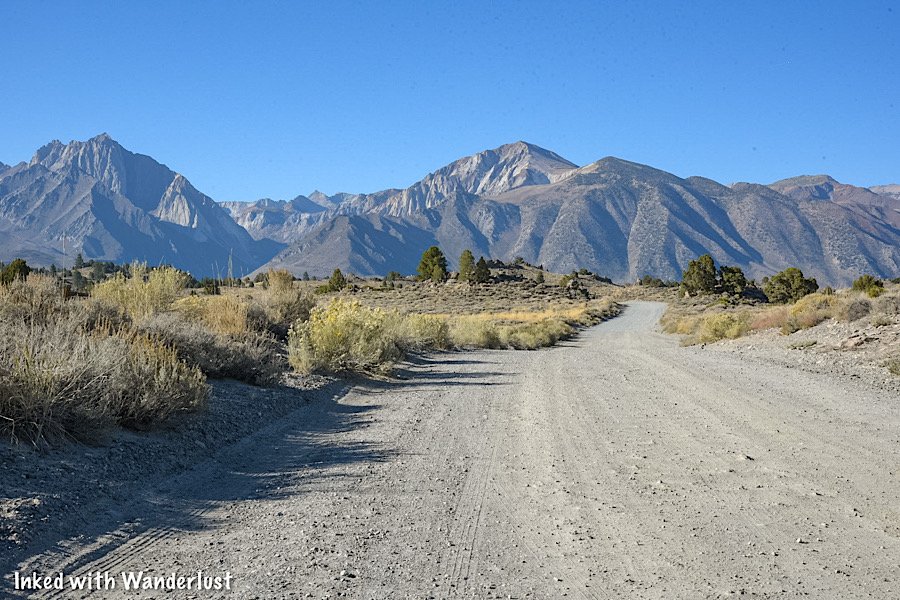
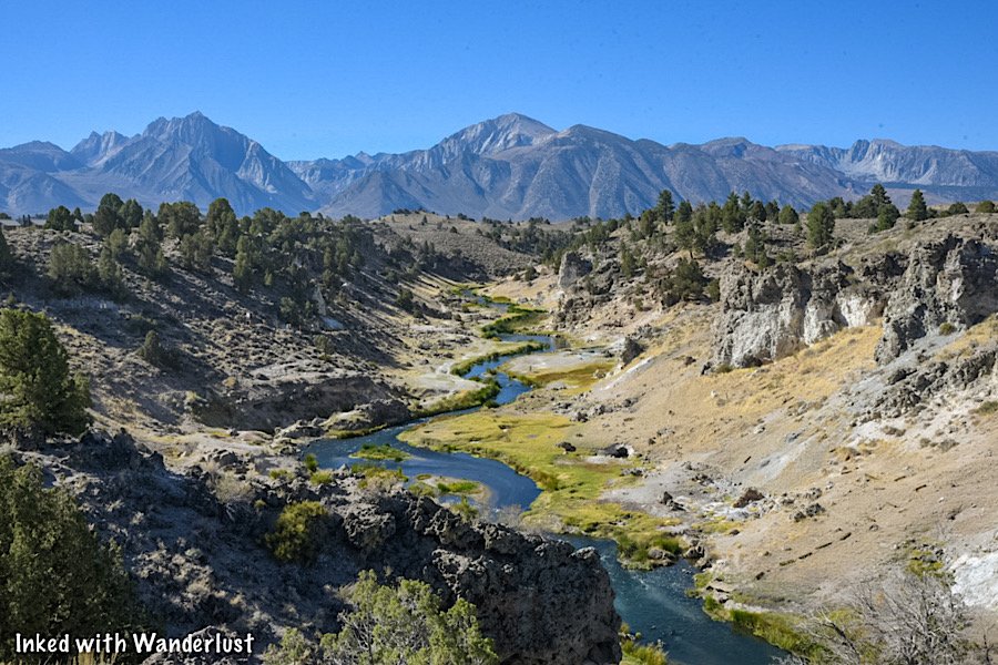
Located down a dirt road behind the Bridgeport Ranger Station, Travertine Hot Springs in one of the many natural springs in Mono County.
This one, however, stands out as our favorite due to its ease of access and beautiful mountain views. Sunrise, in my opinion, is the best time to be here.
READ: “Travertine Hot Springs: A Relaxing Soak With Mountain Views”
3) The Robinson Creek Trail To Barney Lake

There are many fantastic hiking trails in Mono County, but the Robinson Creek trail to Barney Lake ranks up there as one our favorites.
The trail begins at the rear of the Mono Village campground and is a semi-moderate trek through the Hoover Wilderness.
It’s about 8-miles, out-and-back, and with the exception of some switchbacks towards the end, it’s fairly flat with no steep inclines.
4) The Virginia Lakes Trail

Another fantastic hiking trail, this one located at the mid-point between Bridgeport and Lee Vining, is the Virginia Lakes trail.
This trail is easy-to-moderate and around the same milage as Barney Lake but has a few semi-steep inclines. Still, they’re nothing difficult.
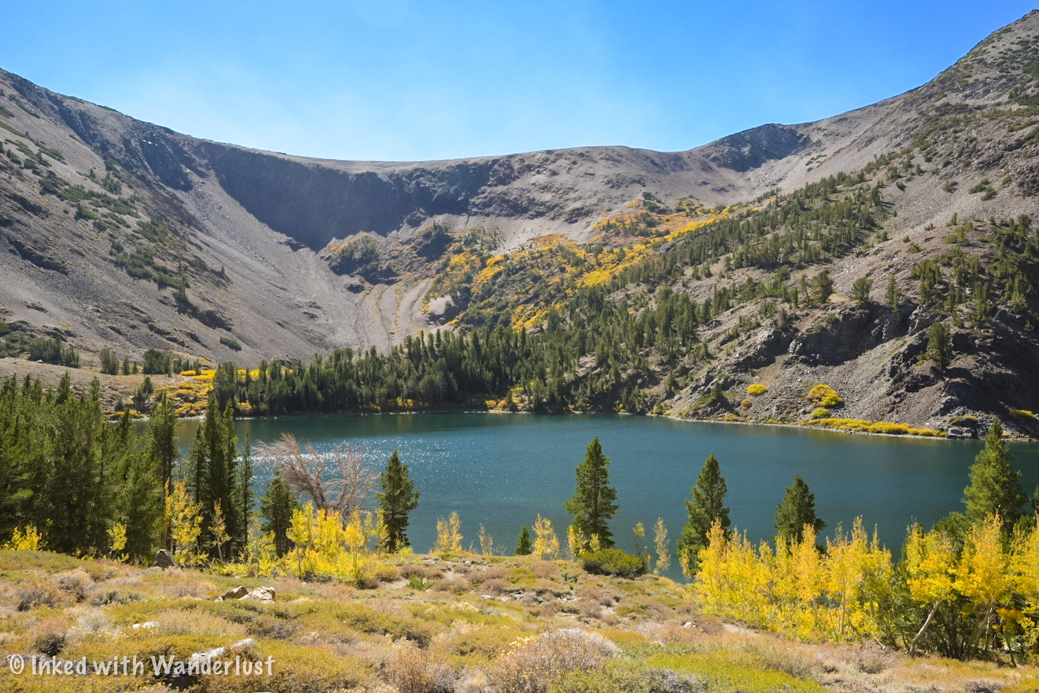
The best part of the trail is you’ll see three beautiful lakes; Blue Lake, Cooney Lake and Frog Lakes (which consists of three smaller lakes).
At the end, if you still have the energy, you can continue past Frog Lakes up the pass (difficult) to two additional lakes; Summit Lake and Hoover Lakes.
5) Conway Summit

Also situated between Bridgeport and Lee Vining (and just before the turn-off to Virginia Lakes) is Conway Summit.
What makes it special is it’s the highest point along highway 395. It’s easy to view as there are multiple pull-outs along the highway.
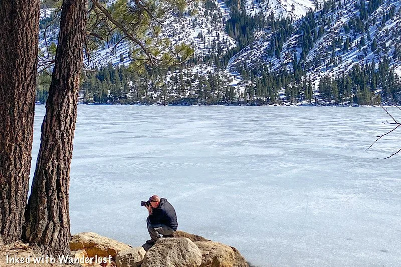
While it’s scenic any time of year, what really makes it shine is the fall colors that pop like none other. So be sure to add it to your plans if you’re driving through.
6) Lundy Canyon
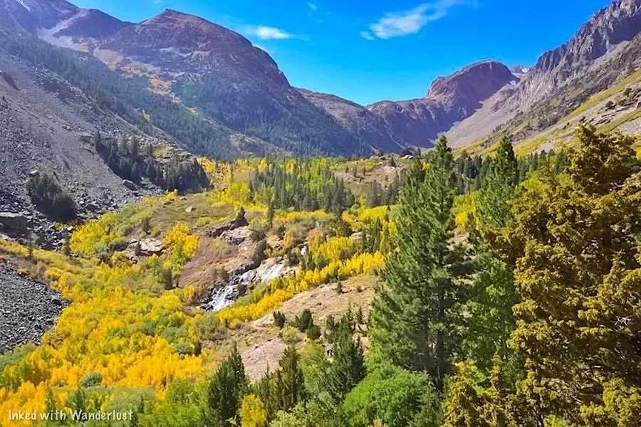
The third hiking trail on this list, the trailhead for Lundy Canyon can be found closer to Lee Vining, past Lundy Lake and down a dirt road.
This trail is less than five-miles, roundtrip, but is more on the moderately difficult side. Mainly due to its extended rocky section and numerous inclines.
While it’s a fine trail to do anytime of year, where it really shines is in the fall. Aspen trees are everywhere here and their foliage pops during that time.
7) Mono Lake Tufa Reserve

Perhaps the most recognizable attraction in Mono County, Mono Lake may look featureless from afar, but that changes as you get closer to the shore.
The Mono Lake South Tufa Reserve is where you’ll find the largest collection of tufa towers found anywhere on the lake.
Tufas begin their formation underwater, when calcium-rich freshwater springs mix with lake water rich in carbonates. This process continues over decades, forming tufa towers
The reserve allows you to get up-close-and-personal with the tufas and enables you to walk through what was once an ancient underwater world.
8) Drive Up Tioga Pass

Tioga Pass one of the highest drivable mountain passes in the United States and once at the top, you’ll get excellent views of the canyon looking down.
There are numerous lakes along the pass you can park and view but if you continue on, you’ll eventually reach the eastern entrance of Yosemite National Park.
9) Drive June Lake Loop

This 16-mile, highly scenic drive just past Lee Vining takes you on a tour through not one, not two, but FOUR stunning lakes. Each viewable from the road.
If you’re starting from the Lee Vining side, the lakes you’ll see are; Grant Lake, Silver Lake (my favorite), Gull Lake and June Lake.
If you get hungry during the drive, the town of June Lake has many local restaurants but for a real treat, stop by the Silver Lake Cafe for lunch.
READ: “June Lake Loop: A Highly Scenic Drive In The Sierras”
10) Convict Lake
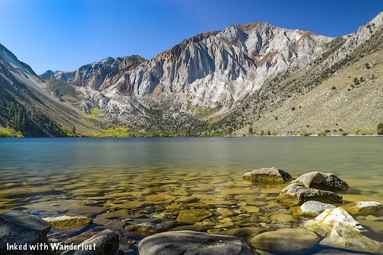
Convict Lake is a beautiful drive-up lake just outside of Mammoth Lakes. It’s renowned for its fishing, but you can also kayak, paddle-board, swim and hike.
The 2.5-mile loop trail that encircles the lake is considered an easy hike. It’s perfect for those with small children or for those who’re new to hiking.
For more of a challenge, you can break off from the loop trail to higher elevation lakes, such as Edith Lake, Mildred Lake, Lake Dorothy and Lake Genevieve.
11) Hot Creek Geologic Site

If you want to get a small taste of Yellowstone right here in Mono County, look no further than Hot Creek Geologic Site.
You can view the main geothermal pools from the viewpoint but for a better look, take the quick (but steep) trail down to the bottom.
Both parking and entry into Hot Creek is free, making it a great stop for the kids to get out and stretch their legs during a road trip.
12) Bodie State Historic Park
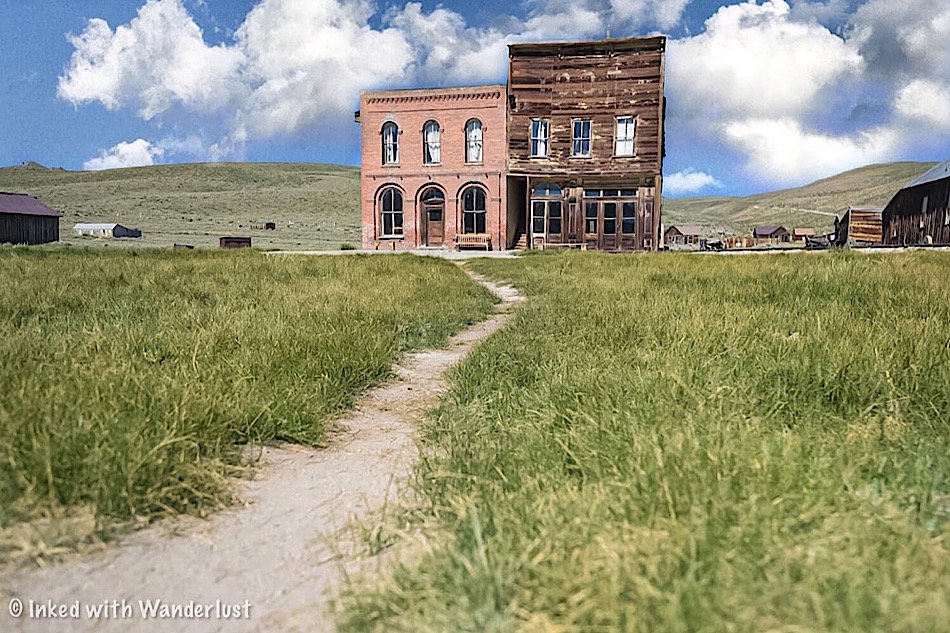
Coming in last (but nowhere near least), no trip to Mono County would be complete with a visit to California’s premier ghost town, Bodie.
Bodie was a huge boomtown during California’s gold rush but as soon as the gold dried up, its residents abandoned it. Leaving behind their homes and belongings.
The remaining buildings in the park are being preserved in a state of arrested decay. Meaning they’re maintained, but only to prevent them from deteriorating.
You could easily spend a full day, or even two, exploring this park. You can even take a tour of the town’s former process mill (for an additional fee).
Your Thoughts…
Those were our twelve picks of amazing places in Mono County that we feel you would love. Are you planning on visiting any of them this year? Let us know in the comments below! We love hearing from our readers.
Please support our website by subscribing to our newsletter below.
Thank you for reading.
Check Out These Amazing Destinations!


Tour The Historic Mono County Jail In Bridgeport
Found just off of Bridgeport’s Main Street, behind the historic courthouse, sits one of the oldest still-standing buildings in Mono…
Contains affiliate links | 2 minute read
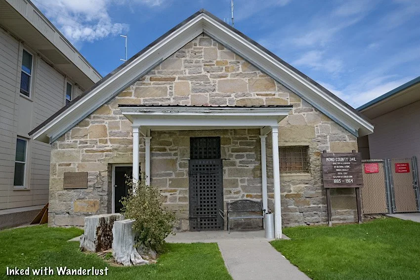
Found just off of Bridgeport’s Main Street, behind the historic courthouse, sits one of the oldest still-standing buildings in Mono County, the historic jail.
Originally built in 1883 and made up of mostly concrete and iron, this wonderfully preserved jail gives visitors a small glimpse into what being imprisoned was like near the turn of the century.
The craziest fact of this jail is that it was in use as recently as 1964, when it closed. It still sits in its original location, with the modern county jail built directly adjacent to it.
These days, the county keeps the front door open to anyone who wishes to explore it. In this guide, we’ll cover topics such as fees, where to find it and much more.
Be sure to check out our post, “7 Things You’ll Love About Bridgeport”, for more amazing things to do in Bridgeport!
Quick Stats
Location: Bridgeport, California
Fee: None
Permit: None
Open: Open during daylight hours
For: Everyone
Restroom: None
Parking: Along the street
EV Stations: Nearest ones are down the street behind the Shell station
Difficulty: Easy, but not fully ADA compliant to protect historical integrity
Popularity: Low
Time: An hour or less
Condition: Well-maintained
Pets: Not allowed inside
Our Visit(s): September 2022

Getting There
As mentioned above, the historic jail is located in the tiny mountain town of Bridgeport, CA. It’s on Bryant street, directly behind the courthouse (a historic building in its own right).
If you’re coming into town from the north, you’ll turn left onto School street, then turn right onto Bryant street. The jail will be on your left.
If you’re coming from the south, you’ll turn right onto Sinclair street (just after Rhino’s Bar & Grill) and turn left onto Bryant street. The jail will be on your right.
Free parking is available along the street on either side. If for some reason there’s nothing there, you can find a spot along the main drag and walk to the jail.

Touring The Historic Jail
Tours of Mono County Historic Jail are self-guided and free of charge. So feel free to take as much or as little time as you wish.
There are no posted hours of operation, but I was told that the jail is usually open daily during daylight hours. It’s usually closed on major holidays, though.
Here are some stats of the historic jail:
Construction on the historic jail was completed on December 12th, 1883.
It’s original cost was $5,750.
The building is only 32 x 34 feet.
Its stone walls are two feet thick, twelve feet high, and are made up of hammer-dressed stone.
The iron cells were reused from the old jail.
The iron doors were constructed of 1.5 inch bar stock.
The iron gratings in the windows are one inch bars, set deeply into the stone blocks.
The jail remained in operation until 1964.
After learning these facts and experiencing the jail for yourself, you’ll quickly realize that this place wasn’t build for comfort. Not even a little.
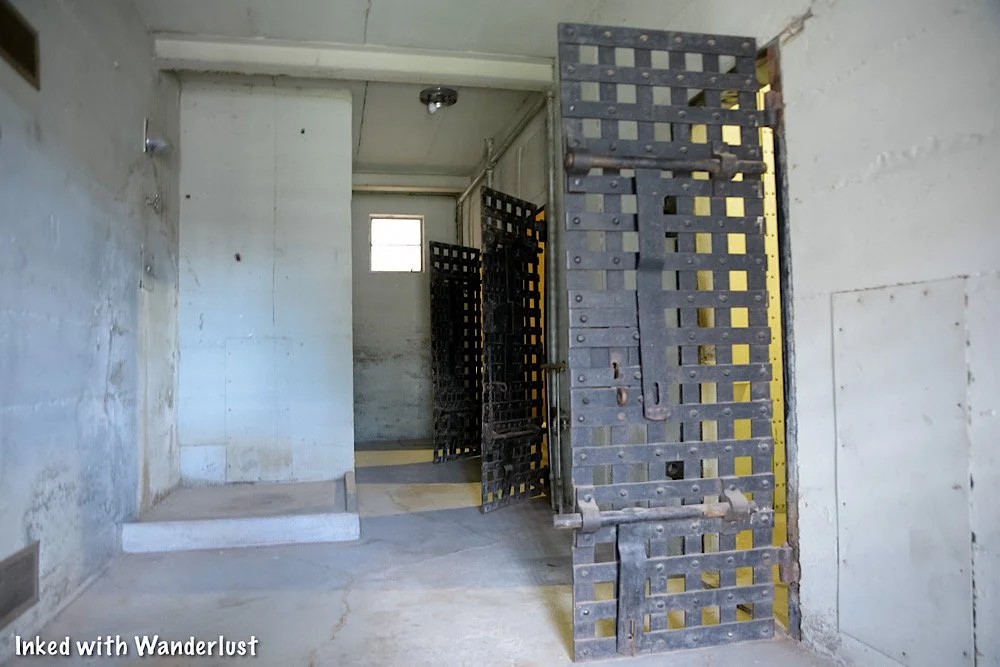
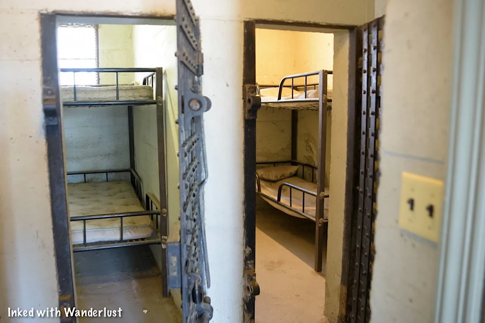
There are around half a dozen or so jail cells of varying sizes, all of which are open for you to enter and explore. You can also see the two shower stalls that all inmates had to share.
Inside the cells are examples of bunks and bedding inmates were given to sleep on. I can’t say for certain if these were actually used in the jail or if they’re just examples, though.


It won’t take you very long to explore the jail. There’s only two main rooms consisting of six or so cells, two shower stalls and the administration area when you first walk in.
When you’re done checking it out, simply head back to your car and enjoy the rest of your day. While you’re in Bridgeport, be sure to check out the other amazing things to see.
If you’re not sure what else there is to do here, check out our post, “7 Things You’ll Love About Bridgeport”.
If you’re looking for a bite to eat (specifically a juicy burger), check out our post about our favorite burger joint in the area, Burger Barn.

Your Thoughts…
Are you or someone in your family history buffs? If so, we believe you (or them) would love this quick roadside stop. Tell us about any other historic structures in the area that you know of. We love hearing from our readers!
Please support our website by subscribing to our newsletter below.
Thank you for reading.
Check Out These Amazing Destinations!


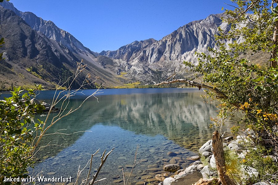
Hike The Convict Lake Loop In Mammoth Lakes
If you’ve never been to Convict Lake before, you really should plan a visit. It’s one of the most beautiful, photogenic and easy-to-access…
Contains affiliate links | 3 minute read
If you’ve never been to Convict Lake, you really should plan a visit. It’s one of the most beautiful, photogenic, easy-to-access lakes in the area.
While fishing is the top activity here, many people are unaware of the loop trail that encircles the lake. It’s a fairly easy-going trail with little elevation change.
In this article, we’re going to cover our experience hiking this trail for the first time. Topics such as where to find the trailhead, how Convict Lake got its name and more will be covered.

Quick Stats
Location: Convict Lake (Mammoth Lakes, CA)
Fee: None for the loop trail
Permit: None
Open: Spring, Summer & Fall
For: Hikers
Restroom: Near the trailhead
Parking: Small lot at the trailhead, larger lot further down the road
EV Stations: None
Difficulty: Easy
Popularity: Medium
Mileage: 2.5-miles
Time: 1 - 2 hours
Elevation Gain: 180-feet
Condition: Well-maintained
Features: Large lake surrounded by mountains
Pets: Allowed on leash
Drones: Not allowed
Hazards: None aside from usual wilderness hazards
Our Visit(s): October 2022
How To Get There

Getting to Convict Lake is pretty straight-forward as the street leading to the lake is directly off from Highway 395, just outside of Mammoth Lakes.
Regardless of which direction you’re traveling on the highway, you’ll want to turn onto Convict Lake road and follow that until it terminates at the lake.
For simplicity, plug in, “Convict Lake Resort”, into any GPS capable device and that’ll get you there. The resort is located right on the lake.
Trailhead & Parking

As you’re driving up on the lake, right before you’re forced to turn left, you’ll see a small parking lot for the marina on your right.
If there’s space, pull into this lot and park as this is the closest to the trailhead you can get. If not, continue left. There are numerous parking lots further down the road.
To find the trailhead, simply walk to the far end of the first parking lot (just a little bit past the marina). You’ll see trail signage indicating you’re in the right spot.
Convict Lake Loop

The trail is well-maintained and mostly flat throughout its entirety. You’ll encounter several small, gentle hills but most are barely noticeable.
Aside from a few moments of thick tree cover, the lake will be in view the entire time, giving you the opportunity to see it from multiple angles.
Also in view throughout much of the hike is Mount Morrison. This impressive, granite peak towers over Convict Lake at its head.
Mount Morrison is named after Robert Morrison, who was killed near the lake in a shootout with escaped convicts from Carson City (more on this later).

Along the trail, you’ll see many flora scattered throughout with rabbitbrush making multiple appearances (at least during our visit).
While not nearly as impressive of a view, be sure to look behind you as you progress. Many view the lake head-on but rarely do they see it from the opposite direction.

Prior to reaching the head of the lake, you’ll come across two forks on the trail. To remain on Convict Lake Loop proper, keep to the left at both junctions.
As you approach the head of the lake, you’ll come across a beach to relax on. There are many rocks and downed logs to sit on, as well as shade.
Depending on the time of year that you’re here, this beach may or may not be accessible. This is due to the decrease in snow pack as summer progresses.

Here, you’ll have easy access to the lake if you decide to go for a mid-hike swim (like I did) or to just simply dip your toes into the water.
When you’ve finished relaxing, simply continue in the same direction you were heading to complete the loop. More views await you.
Soon after passing the beach is when you’ll come across the boardwalk that elevates you above the creek. It’s fairly slim with no guardrails. So take care when passing others.
The reason for the boardwalk is the heavy run-off from melting snow pack early in the season. If it weren’t for this boardwalk, this section of trail would be inaccessible during that time.
We were here in mid-October, so there wasn’t any run-off to speak of. Even without the run-off, though, the boardwalk made for an idyllic element to the trail.

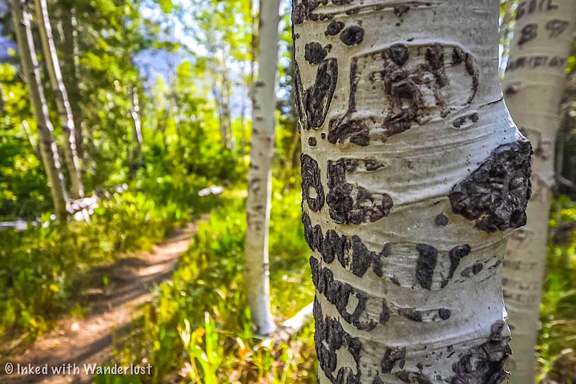
After a short while you’ll be back on hard compacted dirt and hiking through beautiful aspens before heading up a short incline to the other side of the lake.
Up until this point, the trail was relatively flat. On this side of the trail, you’ll encounter quite a few ups and downs. Fret not, they’re barely noticeable.

Soon, you’ll come to a point that’ll appear to be the end of the trail. That point is another beach with a large, paved parking lot just above it.
To re-join the trail, work your way through this area (or the parking lot). From this point forward, you’ll be on the paved, accessible portion of the trail.

Throughout this section of the trail, the views of Convict Lake and Mount Morrison will be heavily obstructed by trees.
Here and there, the views open up through the trees and as you near the end, you’ll come across an accessible fishing dock with a commending view.

From here, simply continue on until you’ve reached your vehicle. Better yet, stop by the marina and inquire about kayak or paddle board rentals.
You could also head a ways up the road and stop at the resort for lunch. They’re open daily during the summer months and most days in the fall.
How Did Convict Lake Get Its Name?

In 1871, a group of inmates escaped from a prison in Carson City and somehow, without shoes, made it all the way to what was then known as Monte Diablo Creek.
These days, with established highways, that trek would be about 140-miles. Keep in mind that Highway 395 wasn't constructed until 1926. So they trekked much, much longer than that.
At Monte Diablo Creek (what is now Convict Creek) Sheriff George Hightower and members of his posse (consisting of Robert Morrison, Mono Jim and others) encountered the inmates.

The inmates ambushed the posse and a shootout ensued. In the shootout, both Robert Morrison and Mono Jim were killed. The inmates got away, but were later captured in Round Valley.
For their sacrifice, the mountain towering over the lake was named, Mount Morrison, while the smaller peak adjacent to it was named Mono Jim.
Then, the lake was named, Convict. This gives the representation that the two posse members who perished will always have the watch over the convicts.

Your Thoughts…
Have you hiked the Convict Lake Loop before? If not, does this sound like a trail you and your family would enjoy?
Let us know in the comment section below! We love hearing from our readers.
Please support our website by subscribing to our newsletter below.
Thank you for reading.
Check Out These Amazing Oregon Destinations!

How to Visit Hot Creek Geologic Site in Mammoth
Located right off of the famed highway 395 and a stone’s throw from Convict Lake, Hot Creek Geologic Site is a wonderful example…
Contains affiliate links | 3 minute read
Located right off of the famed highway 395 and a stone’s throw from Convict Lake, Hot Creek Geologic Site is a wonderful example of the area’s volcanic past and present.
Here, you’ll bear witness to geology in action as boiling water rises to the surface from a chamber of hot magma lying three miles below your feet. It’s appropriately nicknamed, “Little Yellowstone”.
Read on below to find out how you can visit this amazing California destination for yourself. It’s definitely worth a stop on your travels along highway 395.

Quick Stats
Location: Mammoth Lakes, CA (Mono County)
Fee: None
Permit: None
Open: All year, sunrise to sunset (road can be difficult to navigate during winter)
For: Everyone
Restroom: Multiple at the parking lot
Parking: Large, paved lot at the main overlook.
EV Stations: None
Difficulty: Easy, but does have a slightly steep pathway
Popularity: Moderate
Mileage: Less than a mile, out and back
Time: One hour or more
Elevation Gain: N/A
Condition: Well-maintained
Pets: Allowed on leash
Drones: Drone friendly, but small airport nearby
Hazards: Stick to the path and do not enter the water
Our Visit(s): 2017 and 2022
Getting To Hot Creek
As stated above, Hot Creek is just a few miles off of highway 395, just outside of Mammoth Lakes. If you’re in the area visiting Convict Lake (or just driving through), Hot Creek is an easy stop.
Regardless of which direction you’re traveling from, you’ll turn onto Hot Creek Hatchery road for about 3.5 miles to the parking lot on your left.

The road is paved for the first half mile or so but will turn into dirt/gravel path for the remainder. Our Chevrolet Cruze made it just fine, so high clearance isn’t necessary.
Do note that during winter, this road can be difficult, even impossible, to navigate in a vehicle. Skis, snowmobiles or snowshoes may be necessary.
The parking lot is fairly large with ample space. There is no parking or entry fee to worry about. If needed, there are multiple restrooms at the far end of the lot.
Hot Creek Overlook and Trail
If all you want to do is see the geothermal pools but you don’t want to trek to the bottom, you can easily do so from the overlook.
The trail going to the bottom is paved and easy to follow, but it is steep going in and coming back out. I’m not sure I would recommend it to someone using a wheelchair.
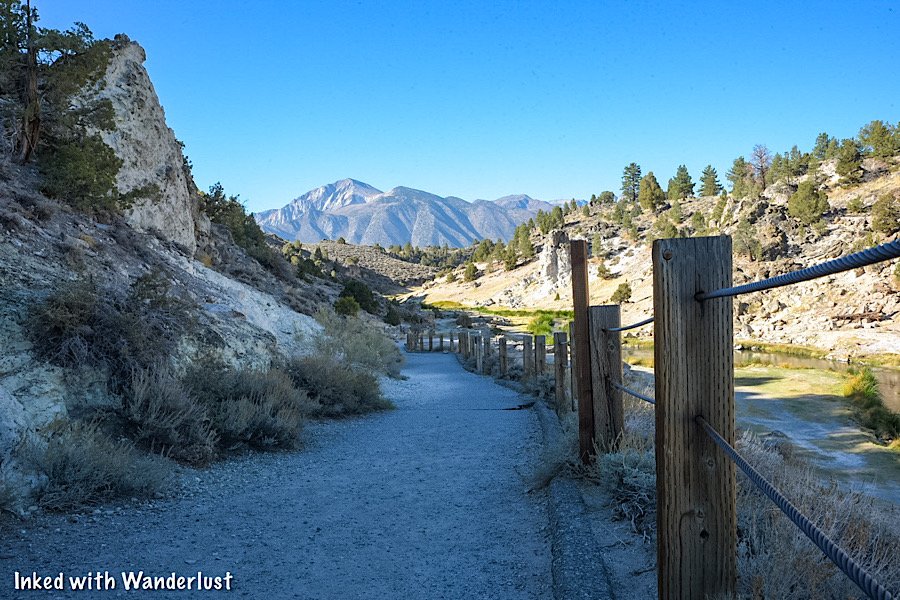
Following the trail, head past the restrooms on your right and then go left at the junction. From here, you’re less than a quarter-mile to the bottom.
Along the way, you’ll see multiple signs warning you to keep to the trail and the dangers of the water. Please heed these warnings
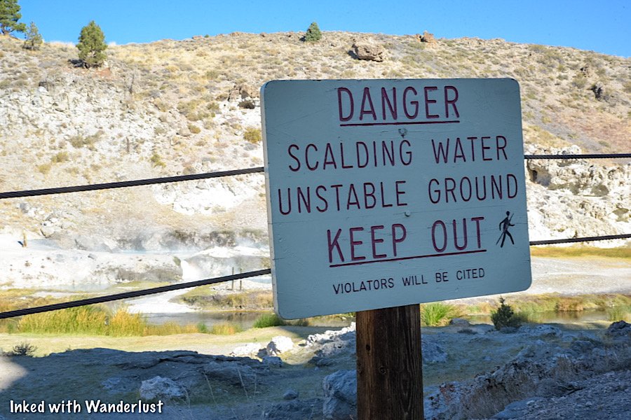
Years ago, people were actually permitted to soak in the pools. However, the pools have since risen to a dangerous temperature, so soaking is now banned.
At the bottom, there will be signs stating which areas are closed off. Unfortunately, you can’t get near the water and the geothermal pools are actually located across the river.
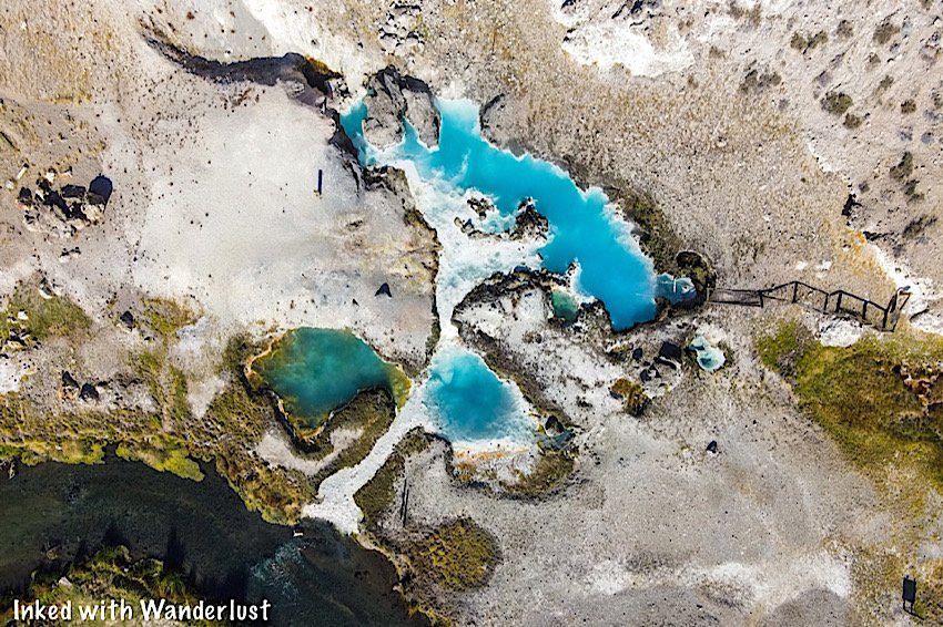
The main pools across Hot Creek give off a beautiful baby blue hue when the sun hits them just right. It’s a stark contrast to the darker color of the creek.
Further up river, there are additional thermal pools, but they are difficult to see as most of this area is closed off due to unstable ground.

To see them, head back up the pathway where you initially turned left at the junction. At the junction, go left and continue straight to a small overlook.
Be careful here. The views of the creek, pools and mountains are top notch, but there are no guard rails and the drop-offs are steep.
Your Thoughts…
Have you been to Hot Creek Geologic Site before? If not, is this something you think you and your family would enjoy checking out? Do you know of more sites like this?
Let us know in the comments below! We love hearing from our readers!
Be sure to check out our posts about more great destinations in Mono County below.
Please support our website by subscribing to our newsletter below.
Thank you for reading.
Check Out These Amazing Nevada Destinations!

Burger Barn: The Best Cheeseburgers in Mono County
Whenever we go to (or through) the tiny town of Bridgeport, it’s hard for us to NOT stop at Burger Barn. After a long day of hiking…
2 minute read | contains affiliate links
Whenever we go to (or through) the tiny town of Bridgeport, it’s hard for us to NOT stop at Burger Barn. After a long day of hiking, it’s the perfect spot for a delicious, juicy burger.
They’ve been serving the people of Bridgeport and their visitors since 1983 and have no intention of going anywhere, anytime soon.
This is our inaugural foodie post on Inked with Wanderlust and couldn’t think of a better subject for the first one than Burger Barn.
*Side Note: We’re not restaurant critics by any means, nor do we claim to be. This is simply our honest opinions (from a customer perspective) about our particular experience to help you discover new places to try.
Pertinent Info
City/State: Bridgeport, CA
Address: 152 Main Street
Cost: $6 - $13 per person
Food: Burgers, Tacos, Ice Cream, Chili, etc
Open: Seasonally (usually closed throughout winter)
Seating: Both outdoor and indoor
Service: Walk-up order window/self-seating
Alcohol: Beer served
Website/Menu: No official website, but they are on Facebook
Our Visit(s): 2016, 2017, 2018, 2019, 2020, 2021, & 2022

Getting There
Once you’re in Bridgeport, Burger Barn is very easy to find as it’s right on Main Street (the main drag through town).
From Reno:
Travel south on US-395 for about 115-miles
Soon after arriving in Bridgeport, you’ll see Burger Barn on your left
From Yerington:
For a total of 65-miles, travel south on NV-339 and eventually merge onto NV-208 west
When you arrive at the US-395 junction in town, turn right
You’ll soon see Burger Barn on your right
From Mammoth Lakes:
Travel north on US-395 for about 50-miles
Soon after arriving into Bridgeport, you’ll see Burger Barn on your right
There’s quite a bit of parking here. Some along the side of the restaurant, more in front of the indoor seating building and others on the street.
If you have to park on the street, keep in mind that you’ll need to back into the spaces. Parking on the street facing the sidewalk is a citable offense here.
The Restaurant

To order your food, simply walk-up to the counter window. You’ll place your order, pay and receive an order number.
They’ll call your order over the intercom when it’s ready. Simply pick it up at the other window and enjoy your meal.

As far as seating is concerned, the outdoor portion sits directly in front of the restaurant and consists of several picnic tables.
If the weather is bad (or there’s no outdoor seating available), there’s indoor seating with more picnic tables adjacent to the restaurant.
The Food

While the name of restaurant gives away it’s main feature, Burger Barn actually has an array for food items to choose from.


Firstly, the burgers are amazing. They’re flavorful, juicy and cooked perfectly every time. Though to be fair, our burgers were over-seasoned a couple times.
If you’re not feeling like a burger, they have plenty of variety. One of their offerings, the California Burrito, is great. They also serve street tacos, chili, teriyaki rice bowls, ice cream and more.
Things To Do Nearby

If tasty burgers aren’t enough to convince you to make the trip, perhaps all the other activities Bridgeport has to offer will give you that extra push.
Just down the street from Burger Barn is the historic Mono County Courthouse and behind that is the historical jail. Both of which you can look around in.
About eight miles outside of Bridgeport is the area’s crown jewel; Twin Lakes. Both the lower and upper lake offer world-class fishing, kayaking and more.
In the surrounding mountains are a plethora of popular hiking trails. One of which is the Robinson Creek trail to Barney Lake (our personal favorite).

Another great feature of the area are the numerous hot springs. The two most popular/most easily accessible ones being Travertine Hot Springs and Buckeye Hot Springs.
Travertine is located just off of US-395 behind the Ranger Station. Buckeye is closer to Twin Lakes and is accessed by a maintained dirt road.

Bridgeport is also well known for being in close proximity to many major attractions in the county and state. The closest being Bodie State Historic Park.
It’s also only 38-miles to the east entrance to Yosemite National Park. If you’re a hiker, then this is the side of Yosemite you want to visit.
Additional nearby attractions include:
Wilson Canyon (Nevada)
and much more!
Something else you may not have known is how famous Bridgeport (and the rest of Mono County) is for the area’s fall colors. They’re simply stunning!
Your Thoughts…
Have you been to Burger Barn before? What was your experience with it? Tell us about it in the comment section below. We love hearing from our readers!
Please support our website by sharing it with your family and friends.
Thank you for reading.

Barney Lake: A Beautiful Day Hike Near Bridgeport
Hiking to Barney Lake via the Robinson Creek trail is one of the many premier hiking experiences in Mono County…
3 minute read | contains affiliate links
Hiking to Barney Lake via the Robinson Creek trail is one of the many premier hiking experiences in Mono County.
The trailhead is located behind the campground at Mono Village, which is just 10-miles or so outside of the small town of Bridgeport.
We have hiked this trail many times. It’s one of our favorites. In fact, it was on this trail where the idea and name for this website was born.
In this guide, we’ll cover topics such as directions, what to expect along the trail, places to eat and more! Let’s get into it.
Here’s some great hiking products we recommend…

Quick Stats
Location: Bridgeport, CA
Fee: None
Permit: None
Open: Year round, though difficult to access in winter
For: Hikers & Equestrians
Restroom: At the trailhead in the campground
Parking: Large day-use dirt lot
EV Stations: None
Difficulty: Easy to moderate
Popularity: Medium
Mileage: 8-9 miles, roundtrip
Time: 3-4 hours
Elevation Gain: 1,223-feet
Condition: Fairly maintained, mostly unsigned
Features: Robinson Creek & Barney Lake
Pets: Allowed on leash
Drones: Not allowed
Hazards: None aside from usual wilderness dangers
Our Visit(s): 2015, 2016, 2017, 2018, 2019, & 2021
Mono Village Campground
As stated at the beginning of this post, the trailhead for Barney Lake is behind the campground at Mono Village.
Mono Village is easy to get to from the town of Bridgeport. From town, go down Twin Lakes road and continue straight for about ten miles.
Mono Village is located at the terminus of Twin Lakes road. You’ll literally run right into it. Shortly after arriving, you can park in the day-use lot on the left.

If you have time before or after your hike, there’s plenty to do at Mono Village if you’re here during their normal operational months. These include:
A large campground with many sites for tents, RV’s, etc.
Boat, Kayak and Paddleboard rentals
Bait & tackle shop
A general store
Restaurant
If you need to use the restroom before heading out, you can find one just behind the restaurant. If you’re eating there, there’s also one inside.
Finding The Barney Lake Trailhead

To find the trailhead, stand near the check-in booth to the left of the restaurant and face the campground.
Ahead of you, you’ll see two trees with a pathway going between them and yellow markers on each tree. Head between those trees.
Continue on this pathway until you see a meadow at the rear of the campground. Keep going straight while keeping this meadow on your left.
After a half-a-mile or so, you’ll see the one and only trail sign on this trail. It’s an arrow pointing right and says, Barney Lake, on it. Bear right with the sign.
Robinson Creek Trail to Barney Lake

As of now, you’re officially on the Robinson Creek trail. Initially, this part of the trail is mostly flat, with a few gentle inclines here and there.
There’s a plethora of tree cover and if you’re here during spring and early summer, there will be a few creeks to cross (easy to do).
After a mile or so, you’ll enter a large meadow with mountain peaks surrounding you. There isn’t a lot of shade on this section of the trail.
*Tip: Be sure to bring plenty of water with you. Tap to check out the Hydration Backpack we recommend (affiliate link). It can carry 2-liters of water in addition to your day-hike essentials.

You’ll eventually dip back down under tree cover but don’t get too excited. After a short time, you’ll come out of tree cover and start going at a slight incline.
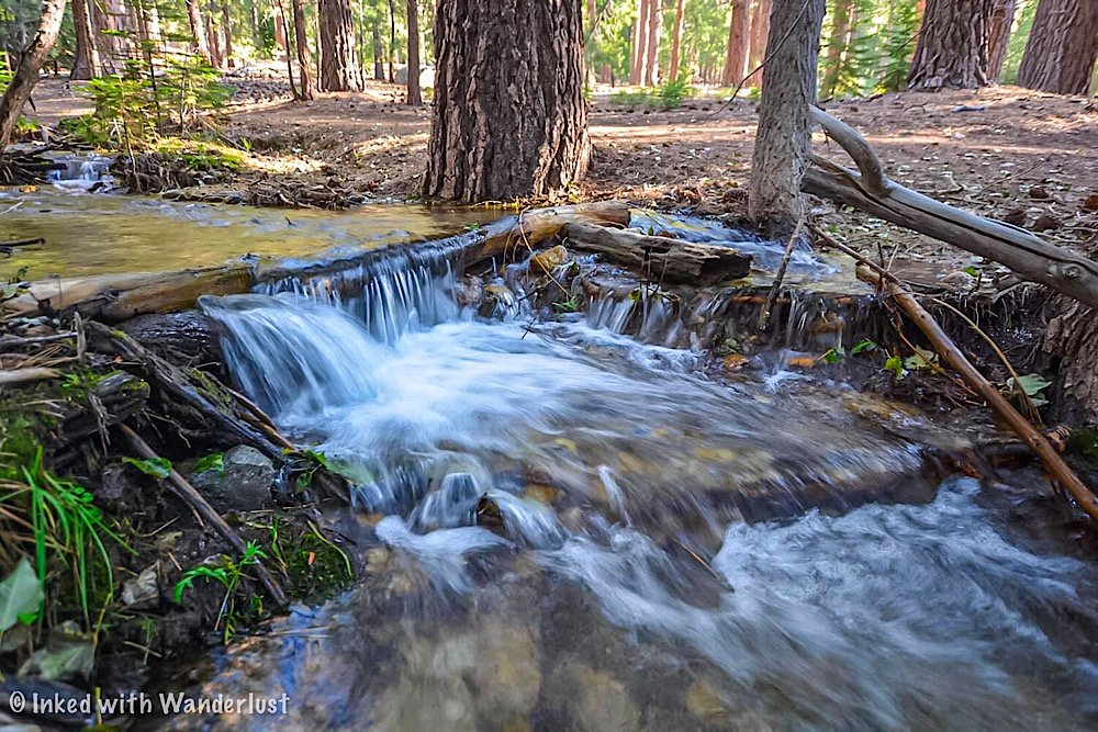
This is also where you’ll meet back up with Robinson Creek. Aside from the lake itself, this is our favorite part of the trail.
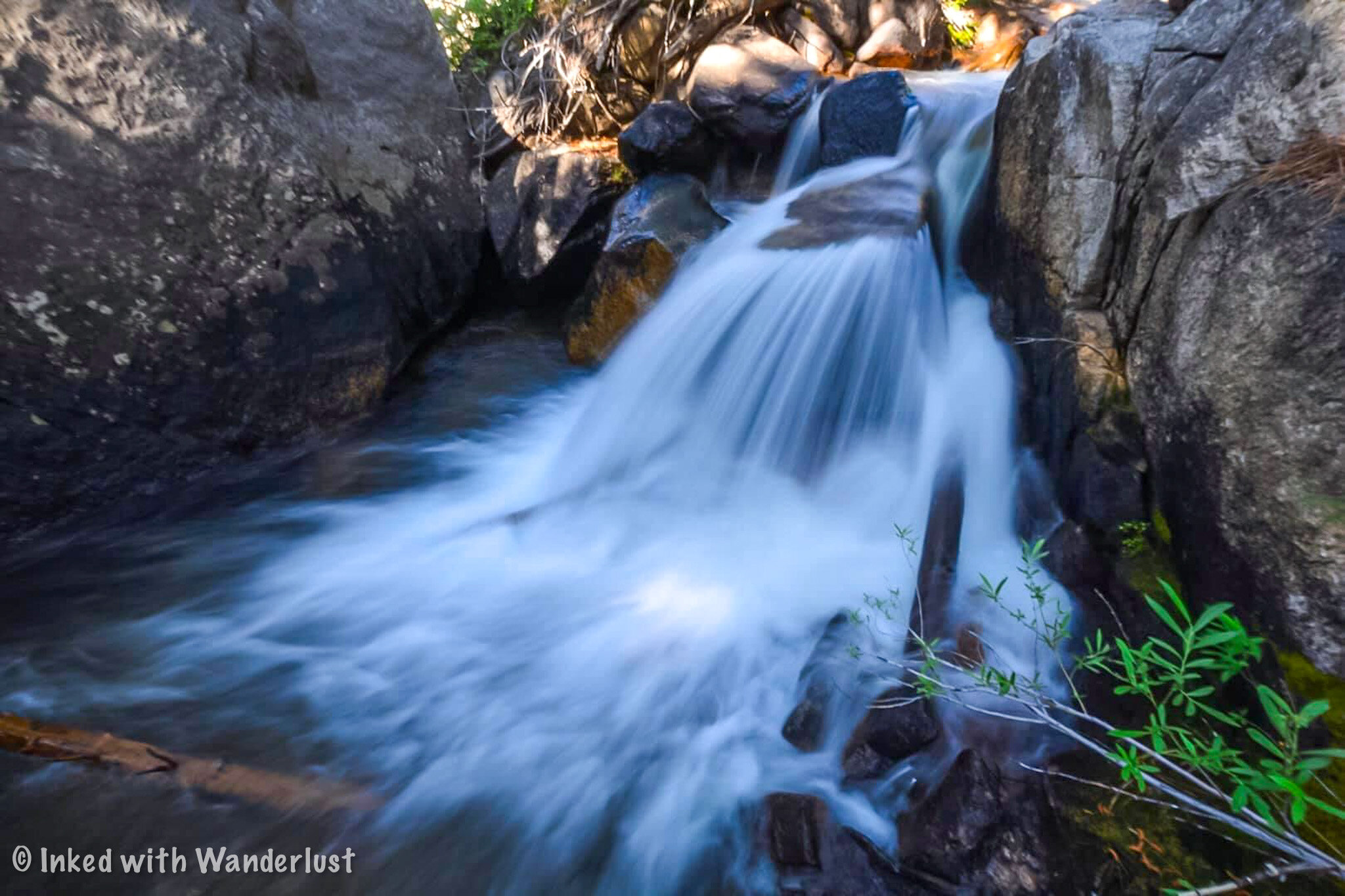
There’s a few spots here where you can take a break and admire a couple mini waterfalls. All the while enjoying your return to tree cover.

Once you feel rested, continue up the trail. After coming into another opening, you’ll arrive to the start of the switchbacks (at this point, you’re close to the lake).
These switchbacks aren’t bad at all, but this is the least maintained part of the trail. There’s a lot of overgrowth.
To make matters worse, if you’re here in the spring or early summer, they’re muddy and slick from the water run-off.
About halfway up the switchbacks, you’ll come to a point where it seems as though the trail disappears. Continue up and over the granite rock to rejoin the trail.
Shortly after this point, the trail will flatten out and the sight of Barney Lake will soon come into view.
Barney Lake

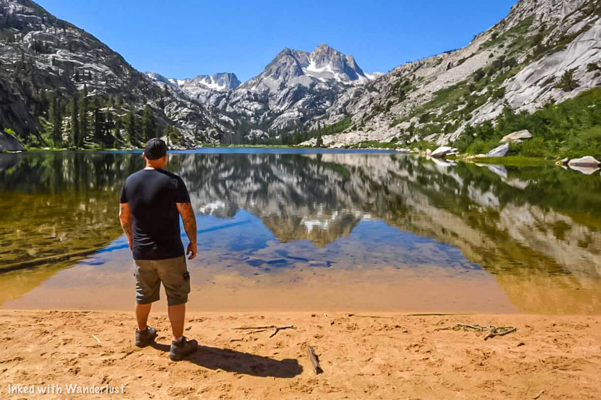
The scenery at Barney Lake is impossibly gorgeous. Especially if you’re here on a day without wind. The surface of the lake is glass-like.
The west end of the lake (near the outlet) provides an alternate view, los of shade and many seating opportunities.
If you’re here in spring, the beach may be non-existent due to the amount of snow melt still coming off the mountains.
Throughout summer, as snowmelt lessens and water levels subside, the beach becomes more prominent.
Optional Lakes

From here, you have two choices. The first one is you can simply finish up with your hike and make your way back to the trailhead.
If you still have some energy to burn, you can continue up the trail and onto additional, even more amazing lakes.
Some of these lakes include Crown Lake, Robinson Lake, Peeler Lakes, Snow Lake and more!
Additionally, you can go even further by making your way over the pass and dropping into the Grand Canyon of the Tuolumne in Yosemite.
Unless you’re a super fit hiker, you’ll need to secure a permit to do most of these as you’ll be spending a night or three in the backcountry.
*Tip: If you’re feeling hungry after your hike, stop by the Burger Barn before heading home. Tap the link to check out our post about them!
Your Thoughts…
Have you hiked to Barney Lake before? If so, tell us about your experience in the comment section below. We love hearing from our readers!
Please support our website by sharing it with your family and friends.
Thank you for reading.

7 Things You Will Love About Lee Vining
Prior to launching Inked with Wanderlust, one of the first articles I wrote as part of the “first batch” was, “7 Things You Will Love About Bridgeport”. At the time, everybody else was doing…
Prior to launching Inked with Wanderlust, one of the first articles I wrote as part of the first batch was, “7 Things You Will Love About Bridgeport”. At the time, everybody else was doing top ten lists so I figured we would be different by doing lists of seven. It eventually went on to become one of our most read articles. Thank you for that.
So we started to think about all the other communities along highway 395 that could be featured in a post like this and decided to turn, “7 Things”, into a series. There’s plenty to love about dozens of towns throughout the state but we decided that the first follow up would be dedicated to Lee Vining.
If you’re unfamiliar with it, Lee Vining is a small town with a population of just 98 (as of 2019). It sits just 21-miles southeast of Bridgeport and is the gateway town to Yosemite National Park’s east side. In the winter, with that part of Yosemite being closed, not much is going on here. Once summer gets into full swing, though, the population and energy increases significantly.
With its proximity to Yosemite, multiple hiking trails, Mono Lake, hotels, great restaurants, and more, Lee Vining has something for any person, couple, or family who love the outdoors. So read on while we show you the 7 things you will love about Lee Vining.
1) Proximity to Yosemite’s East Side

Tenaya Lake in Yosemite National Park.
I like to consider the eastern side of Yosemite to be the hikers side. While there’s many beautiful trails in the valley, the east side boasts, in my opinion, the best ones. Cloud’s Rest, Cathedral Lakes, North Dome, Mono Pass, and Glen Aulin are just a few of the highlights. Plus, from the gate, the valley is only an hour or so away.
Luckily for anyone staying in Lee Vining, all of this is just a quick 20 minute drive up Tioga Pass to the gate. There are no other towns that have direct access to this side of the park so if your intention is to spend a few days here, then staying in Lee Vining is a no-brainer.
2) June Lake Loop

June Lake, California.
Many of you are probably familiar with June Lake as it’s one of the most popular lakes for fishing in the area. What a lot of people may not realize is that in addition to that, this area also features one of the most scenic drives you’ll ever take. Called the, “June Lake Loop”, this beautiful drive is 16-miles and features four incredible lakes in that time.
Additionally, you could drive to Convict Lake (making it five lakes) as it’s only another 25 miles from June Lake. The official beginning of the drive is only a few miles south of Lee Vining on 395 making it an easy day outing. The first lake you’ll see is Grant Lake, followed by Silver Lake, Gull Lake, and finally June Lake capping it off.
READ ALSO: June Lake Loop: A Scenic Ride In The Sierras
3) Mono Lake Tufa State Natural Reserve

Mono Lake Tufas.
One visit to Mono Lake will make you feel like you’re walking on an alien planet. There are many access points to the lake along the road but none are more popular than the state reserve. This area contains the largest concentration of tufas and is only a few bucks per person to visit.
Aside from being the gateway to Yosemite east, Mono Lake is what Lee Vining is most known for. Kayaking tours can be arranged (not through the reserve) and in some places throughout the lake, swimming is permitted. However, due to the saltiness of the lake, we advise you be 110% sure you have no cuts on your body. It WILL hurt.
READ ALSO: The Essential Guide To Seeing The Mono Lake Tufas
4) The Upside Down House

Upside Down House in Lee Vining, California.
The Upside Down House is owned and operated by the Mono Basin Historical Society and is part of a collection of other attractions including the Old Schoolhouse Museum and an old boat that used to provide tours of Mono Lake. It was originally built as a roadside attraction in the 1950’s and has since been moved here in order to preserve it.
Admission is free, but they do appreciate donations as any money they get goes towards the preservation of these historical buildings. To find it, turn on Beaver Street (you’ll see “Mono Cone” on the corner) and then take a left on Mattly Ave. The Upside Down House will be on your left shortly after turning.
5) Whoa Nellie Deli

Exterior of Whoa Nellie Deli.
There are quite a few great, local restaurants in Lee Vining and we encourage you to try them all. However, our personal favorite and one we always recommend is Whoa Nellie Deli. It is located inside the Tioga Mart gas station and serves up great dishes such as delicious omelettes and burritos for breakfast to pizza, fish tacos, and baby-back ribs for lunch and dinner.
While the gas station operates year round, the mart and deli are open seasonally. Essentially, once Yosemite is close to reopening, they open and when it’s close to closing, they close. This is generally from May to October. Be sure to stop by to fill up both your gas tank and stomachs before heading up to the park.
6) Driving Tioga Pass

Tioga Pass leading to Yosemite.
If your plan is to visit Yosemite, then driving Tioga Pass is already built into the trip. However, even if you don’t plan on going to park, driving this pass is still worth it. It is the highest drivable pass in the state and features a few beautiful lakes and amazing views.
The lakes you will see are Lake Ellery, Tioga Lake, and Saddlebag Lake. There’s also a short interpretive trail called, “Nanutak Loop”, that shows examples of how volcanic activity and glaciers carved out this massive mountain pass and Yosemite itself. If that isn’t enough, there’s numerous pullouts along the road you could use to take in the views (such as the one in the image above).
7) A Variety of Hiking Trails

Twenty Lakes Basin loop located near Sanddlebag Lake and Yosemite.
There are many hiking trails located near Lee Vining. A couple well known ones being Panum Crater, Lundy Canyon, and Virginia Lakes (all amazing). My personal favorite, however, is Twenty Lakes Basin Loop. The trailhead begins at Saddlebag Lake just over the border of Yosemite. I like to refer to it as, “Yosemite without the crowds”.
No matter which one you choose to do, you won’t be disappointed. There are trails ranging from family friendly all the way to difficult, mountain summits. It just depends on your skill, experience, and comfort level. There’s something for everyone here.
BONUS! It’s Proximity to Bodie

Bodie State Historic Park, California.
Much like in our Bridgeport post, we decided to spoil you with a bonus. While we listed Bodie as something you will love about Bridgeport (since it’s so close), Bodie is also very close to Lee Vining as well. In fact, it’s almost perfectly situated in between both towns.
From the center of Lee Vining to Bodie’s entrance, it’s 45 miles. That’s an easy day trip. So if Bodie was a big part of your plan to visit the area but you also want to be close to Yosemite, staying in Lee Vining would be the perfect compromise. Head north on highway 395 for 20 miles and turn right at the sign. You can’t miss it.
Conclusion
We sincerely hope this article was helpful to you in planning your travels. If you enjoyed it, please support our website by sharing it with your friends and family on Facebook, Pinterest, or your favorite social media site.
You can further show your support by staying on and reading one or more of the related articles above. Thank you and safe travels!
If you haven’t read the first entrant in this series yet, you can so here.

June Lake Loop: A Highly Scenic Drive in The Sierras
In the state of California, there’s a large number of scenic drives you could take. Some can be done in a day while others would…
3 minute read | contains affiliate links
In the state of California, there’s a large number of scenic drives you could take. Some can be done in a day while others take multiple days.
There’s one drive in particular that is not only highly scenic, but it can be done in half a day or less. That drive is the June Lake Loop.
The drive begins where State Route 158 breaks away from Highway 395 for 16 miles, then reconnects with it and either end.
You can begin at either the southern tip (closest to June Lake) or at the northern tip (from Lee Vining). This article is going to focus on the north to south route.
In this direction, the lakes you will see are listed below in order of appearance:
First - Grant Lake
Second - Silver Lake
Third - Gull Lake
Fourth - June Lake
If you’re coming from the southern direction, look for the sign indicating you’ve reached the June Lake Junction and turn left here.
At the end of the article, we’ll fill you in on a nearby lake we think you’d be interested in seeing once you’re finished with the drive, proper.
So buckle up, fill your tank (or charge your battery) and head out to this unique, one-of-a-kind drive.

Quick Stats…
The drive is 16 miles in length
You’ll pass a total of four lakes with an option to add a fifth
You can start from either end (north or south)
If you just drive the whole way without stopping, you could complete the loop in less than an hour
However, if you get out at each lake and spend some time on the lakes themselves, you could easily spend a full day here
Bathrooms are available at all four lakes (some are portables)
A variety of restaurants and taverns can be found in the downtown strip between June and Gull Lake
Gas stations are available in the town of Lee Vining (northern end) and at the June Lake Junction (southern end)
Grant Lake

As stated above, this article is going to cover the north to south route. From here, your journey will begin in the small town of Lee Vining:
Head south on Highway 395 for about 5 miles
Turn right on State Route 158
Once you turn onto State Route 158, you have officially began the June Lake Loop. Right around the 3.8 mile mark you’ll run into the largest lake of the four, Grant Lake.
Though it’s the largest, water levels vary greatly as it’s a reservoir for the City of Los Angeles. Early morning fishing and camping are popular here.
While the mountain side of the lake is scenic, the lakeshore and roadside are a bit barren with sagebrush shrub being the closest thing to flora.
Silver Lake

Once you’re done checking out Grant Lake, get back in your car and drive south for another five miles. At that time, you’ll see my personal favorite lake of the four; Silver Lake.
The road runs along the west shore. There’s a small parking lot on your left as you approach the lake with additional parking at the resort.

Much like all the lakes on this list, fishing is the most popular activity here. In fact, The Silver Lake Resort, is one of the oldest operating lake resorts in the Sierras.
If you’re feeling hungry, stop by the cafe inside the resort for lunch. It’s a small space, but they offer meaty sized portions for fair prices.
Gull Lake

Gull Lake is the smallest of the four but it’s no less scenic. Our first time on the loop, we drove right by it without noticing.
The highlight of this lake is the Gull Lake Marina. This small, charming Marina offers a variety of boat rentals such as pontoons, motor barges, kayaks, paddle boats, and boards.

In addition, they have a tackle shop where you pick up bait, licenses and a variety cold sandwiches and drinks. It’s a nice place for a picnic if you’re so inclined.
From Silver Lake, you’ll drive 4.1-miles (roughly 10 minutes) and:
Make a sharp left turn on Gull Lake Road (seriously, it sneaks up on you)
Turn left onto East Granite Ave
Turn left onto West Granite Ave (you’ll see the parking lot/entrance to the marina ahead of you
June Lake

Leaving Gull Lake, you’ll drive through the charming downtown area of June Lake. This strip is dotted with shops, restaurants, motels and a brewery.
There are also two marinas that serve June Lake and much like Silver and Gull Lakes, you can rent boats or launch your own if you’d like.

At the southern end of June Lake you’ll find the popular overlook, “Oh! Ridge”. This is a highly scenic and photogenic spot and has been the subject of many photos.
Also at the southern end is where you’ll find June Lake Beach (pictured above). To get there:
Turn left onto North Shore Drive
Turn left onto June Lake Beach Road and follow it to the parking lot
At this point, you’ve reached the official end of the June Lake Loop drive.
From here, you can complete the loop by heading away from the lake to June Lake Junction and rejoin highway 395 towards Lee Vining. Or………
Convict Lake Add-On

If you feel like calling it a day at June Lake (or Grant Lake if you went northbound) I wouldn’t blame you.
You’ve just driven one of California’s most beautiful roads and spent time at four, fantastic lakes.
If you’re feeling to it, though, we do have one more suggestion; Convict Lake.
Convict is just 24 miles from June Lake is one of the most picturesque in the area. It is definitely worth the extra effort.

Getting to Convict Lake from June Lake couldn’t be any easier:
From June Lake, head south back to the June Lake Junction (about 2 miles)
Turn right onto highway 395 for about 20 miles
Keep an eye out for Convict Lake Road and turn right. Keep going straight until you’ve reached the parking lot.
Much like the others, there’s a marina where you can rent boats or other water equipment. The nearby Convict Lake Resort features a highly rated restaurant if you’re hungry.
If you have time, we highly recommend hiking the Convict Lake loop. It’s a family friendly, two mile trail that encircles the lake. You can read about it here.
Best Time To Drive June Lake Loop
June Lake is a year round destination offering world-class skiing in the winter. Due to this, the road is open and drivable all year long.
However, this area gets pounded with snow on an annual basis. Sometimes necessitating closing famed highway 395. June Lake Loop is also subject to this.
During spring, you’re usually free of snow. The area flora comes to like, surrounding the lakes with color. Hiking trails can like hiking though creeks, though.
Summer is the tourist season. Lots of people with occasional afternoon storms. Hiking trails are clear and the resorts are in full operational mode.
Fall brings beautiful color to the region. Mono County is known for its fall colors and June Lake Loop is no exception. In my opinion, this is the best time.
Your Thoughts…
What are your thoughts on June Lake Loop? Does it sound like a drive you would love to take your family on?
Let us know in the comments below! We love hearing from our readers.
Please support our website by subscribing to our newsletter below.
Thank you for reading.
Check Out These Amazing Destinations In Oregon!

Hike The Virginia Lakes Trail In Mono County
There are a number of hikes in Mono County that, in my eyes, stand out from the crowd. Robinson Creek (Barney Lake), Lundy Canyon, Twenty Lakes Basin…
4 minute read | contains affiliate links
There are numerous trails in Mono County that stand out from the crowd. Robinson Creek, Lundy Canyon, Twenty Lakes Basin, Crown Point Loop, and Virginia Lakes round out our personal top five in Mono County.
The Virginia Lakes trail is a great option for everyone from total beginners to seasoned backpackers as you can customize it to your comfort level.
You can keep it semi-shot only only hiking from the trailhead up to Frog Lakes. Then turn around. This will be about 6-miles, out-and-back.
If you want to push further, head past Frog Lakes up Burro Pass to higher elevation lakes like Summit Lake and Hoover Lakes.
So how do you go about hiking this beautiful trail? How do you get to the trailhead? What can you expect? We answer these questions and more below.

Quick Stats
Location: Mono County, CA (between Lee Vining and Bridgeport)
Fee: None
Permit: None
Open: Usually opens late spring and closes around November
For: Hikers
Restroom: At the trailhead
Parking: Large parking lot at the trailhead
EV Stations: None
Difficulty: Moderate
Popularity: Moderate to high
Mileage: 6-8 miles, out-and-back
Elevation Gain: 571 to 2,329 feet (depending how far you go)
Condition: Rocky, but maintained
Features: Numerous lakes and old mining cabin structures
Pets: Allowed on leash
Drones: Not allowed in Hoover Wilderness
Hazards: Nothing aside from usual wilderness hazards
Our Visit(s): 2018 & 2022

Getting to the Trailhead
Getting to the trailhead is pretty simple. If you’re coming from:
Bridgeport: You’ll travel on Highway 395 south for about 13 miles and turn right on Virginia Lakes road. From there, travel 5.5 miles until you reach the parking lot at the end of the road.
Lee Vining: Travel on Highway 395 north and turn left on Twin Lakes road (this will happen shortly after passing the Mono Lake Viewpoint) and follow the same directions above.
Virginia Lakes road is mostly paved and well maintained until around the last quarter mile or so. After passing Virginia Lakes Resort the road turns to gravel (don’t worry, compact cars will have no issues here).

Shortly after the start of the gravel section, you’ll reach the road’s terminus at the parking lot for Big Virginia Lake.
Parking is plentiful on both the upper and lower sections. The lower portion has picnic tables and the upper portion has the restrooms.

Speaking of the restrooms, look for the Hoover Wilderness information post behind them. This post is directly adjacent to the trailhead.
Before you head off, be sure to spend some time checking out Big Virginia Lake. This lake is VERY popular with fisherman.
There’s a short trail to Red Lake heading south away from Big Virginia you could use as a warm-up if you’d like to check it out.
The Trail
You’ll begin at 9,800 feet at the trailhead and trek an uphill slog right from the start. You can skip this by turning right on the trail along the lake (by the restroom) but if you do, you’ll miss out on an amazing view of Big Virginia (pictured above).

The trail will drop you back down a bit before flattening out. Around a quarter of a mile in, you’ll come to a sign announcing your official crossing into Hoover Wilderness and offers you two directions to go in.

Going in either direction will keep you on the trail but the one to the left hugs the lake while the one to the right takes you a bit up and around it. You can’t go wrong with either as both will eventually intersect again at Blue Lake.
Blue Lake

Shortly after crossing into Hoover Wilderness you’ll get your first glimpse of Blue Lake on your left.
This would make for an excellent place to stop for a quick break to take pictures. There’s a few spur trails leading to the lake’s rocky shore.

You’ll begin your ascent through a large scree field (don’t worry, the trail is obvious). Using trekking poles might be beneficial.
The trail flattens out at the top for a brief reprieve. While there, go off trail a bit to the rocky shelf to get an unparalleled view of the lake.
Miners Cabin & Cooney Lake

After some more climbing the trail will smooth out once again (this is common on this trail) and you’ll soon come across an old miner’s cabin.
Gold & silver mining was huge in this area in the late 1800’s. There are more cabins on other trails such as Lundy Canyon, Gaylor Lakes, and Mono Pass.
Support beams on the left side of the cabin keep it from falling over and rocks help keep the roof intact. It’s an interesting, unexpected find.

After the cabin you’ll begin to hear running water as you inch your way closer to the second lake; Cooney Lake (10,244 feet). Cooney was our favorite of the three.
Just before you arrive, depending on the time of year, you may find a small waterfall near the lake’s outlet. In spring and early summer it’s quite the sight. In fall, however, it’s a trickle.
Frog Lakes

Just a short distance from Cooney Lake is Frog Lakes. If you could view them from above you’ll see that they’re three lakes shaped in a triangular pattern.
We’re almost certain that they begin the season as one giant lake (right as the snow pact begins to melt).

To the north, picturesque granite crags make up the backdrop for these beautiful lakes. To the northeast, Dunderberg Peak (12,374 feet) fills in the skyline.
At this point, you’ve hiked about two miles and are at an elevation of 10,371 feet which gives you 571 feet of elevation gain from the trailhead.
Where to go From Here

This is usually the point where people decide what they want to do. Some choose to call it a day (which is what we did) and some decide to head up to Burro Pass (11,120 feet).
This would add another 1.2 miles up a rocky, barren series of switchbacks. From what i’ve been told by others who have do it, it’s challenging.
From there, you can hike to Summit Lake (10,183) and make it a four and half mile hike. You could also go right and hike to Hoover Lakes.
Your Thoughts…
Does the Virginia Lakes trail sound like one you and your family would enjoy? Let us know in the comments below! We love hearing from our readers.
Please support our website by sharing it with your family and friends.
Thank you for reading.
Editor’s note: This post was originally published in October 2020 and has been recently updated for comprehensiveness and accuracy.

7 Things You Will Love About Bridgeport
The small mountain town of Bridgeport in eastern California is one of my favorite places in the country. There’s not only plenty to do within…
3 minute read | Contains affiliate links
The small mountain town of Bridgeport in Eastern California is one of our favorite places in the country. There’s so much much to do in town and so much within a close proximity, you could spend an eternity exploring the area.
The following list is by no means exhaustive, but it’s a combination of what the town is most known for and what we feel you would enjoy most about it. So let’s get into it!
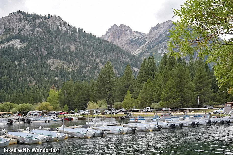
1) Twin Lakes

Located just 10 miles from town down highly scenic Twin Lakes road (which is honestly an attraction all its own), Twin Lakes is both easy to get to, features top notch views, and offers great recreational opportunities.
Twin Lakes is made up of two separate lakes (lower & upper) and covers a combined 650 acres. Lined with evergreens and towered by the Sawtooth Mountain Range, many activities such as fishing, boating, and more can be enjoyed here.
2) Soak in the Hot Springs

There are two hot springs within close proximity of Bridgeport. Travertine Hot Springs (pictured above) is just up the road from the Bridgeport Ranger Station and the other, Buckeye, is located near Twin Lakes.
Both springs are clothing optional, however, we have been to Travertine numerous times and people have always been respectful whenever families were there. Just something to keep in mind if you decide to go.
READ ALSO: Soak and Relax At Travertine Hot Springs
3) Hiking & Camping

If you’re into hiking, camping, or both, Bridgeport is where you’ll want to be. At Twin Lakes there are at least half a dozen wonderful campgrounds to choose from including Mono Village, Doc & Al’s, Twin Lakes Resort, and Lower Honeymoon.
Pictured above is Barney Lake and can be accessed via a 4-mile hike on the Roberson Creek trail. Other popular trails include Green Lake, Benson Lake Loop, and Virginia Lakes.
READ ALSO: Take A Day Hike To Beautiful Barney Lake
4) Local Restaurants

After hiking all day, there’s nothing more we want to do than head to the nearest burger joint and chow down. Bridgeport has many local eateries serving up delicious food daily. These include Burger Barn, Nugent’s High Sierra Bakery, Jolly Kone, and more!
5) Fishing Galore!

Bridgeport is one of the premier fishing destinations in Mono County and is often touted for having the best trout fishing in the entire state. In fact, back in 1987, the current record holding brown trout was caught in Upper Twin Lake and weighed a whopping 26 pounds, 8 ounces.
Who knows? Perhaps you could be the one to catch the next record breaker.
6) Historic Buildings

There are numerous historic buildings in Bridgeport but perhaps the most known are the Mono County Courthouse and the (old) Mono County Jail. The courthouse was built in 1880 and is the 2nd oldest operating courthouse in California.
The old jail was built in 1863 and is located behind the courthouse. The new and far more modern jail was built directly adjacent to the old one. Due to Covid-19, the interior is closed off to all visitors for the remainder of 2020.
7) Bodie State Historic Park

If exploring abandoned places is your thing then you need to head to the Disneyland of ghost towns, Bodie State Historic Park. The turn off to Bodie is just 7 miles outside of Bridgeport and then another 13 miles to the park itself.
If you’ve never heard of Bodie, it’s an abandoned gold-mining town that’s being preserved in a state of arrested decay. Multiple original buildings remain (including the mill) and the interiors remain as they were back in the day.
We highly recommend spending a full day exploring Bodie and everything it has to offer.
Bonus! Proximity to Yosemite East

Bridgeport is a fairly short drive (about 45 minutes) from the east entrance of Yosemite National Park. This will take you through the charming town of Lee Vining and up Tioga Pass to the gate.
You won’t see the likes of Tunnel View or Yosemite Falls (those are an additional hour or so away) but you will find equally awesome sights on this seldom known area of the park.
You can wander through Tuolumne Meadows, see the infamous Half Dome from Olmsted Point, hang out on the beach of Tenaya Lake, or take in a hike to the famous Cathedral Lakes. These are just a few mentions of the many things to do here.
Your Thoughts…
Does Bridgeport seem like a place you’d want to visit for yourself? Perhaps with your family? Are there any special places in or near Bridgeport we left out? Let us know in the comments below. We love hearing from our readers!
Please support our website by sharing it with your family and friends.
Thank you for reading.
Editor’s Note: This post was originally published in October 2020 and has been recently updated for comprehensiveness and accuracy.

Our 6 Favorite Spots To View Fall Colors in Mono County
Throughout the United States, there are literally thousands of locations that feature amazing Fall colors. California alone has some of the top spots in the country…
Throughout the United States, there are literally thousands of locations that feature amazing fall colors. California alone has some of the top spots in the country!
One of those places in California that is known for fall color is Mono County. It is located in the east central part of the state and contains dozens of amazing sights.
These sights are great any time of the year, but fall in particular is when they shine most. The dramatic fall color in this area can turn even the most featureless lake into a must-see destination.
The official tourism website for Mono County does a great job tracking the fall colors at numerous locations throughout the county as they progress in their weekly reports.
For this article, we’re going to showcase six of our personal favorite locations in Mono County for fall color. All of which are easy to access either by driving up to them or hiking.
Let’s get into it.
1) Convict Lake

Convict Lake is situated in the Sherwin Range of the Sierra Nevada Mountains and near the town of Mammoth Lakes. It is known for its beautiful turquoise-blue water and is popular among Fisherman.
When the foliage surrounding the lake peaks in the fall, the color contrast with the water makes it pop like none other. Combine that with Mount Morrison providing the backdrop and you’d be hard pressed to find better scenery.
2) Conway Summit

Conway Summit is a large mountain pass situated between the towns of Bridgeport and Lee Vining. Just beyond the pass, you’ll find amazing views of Mono Lake. The pass is always beautiful, but fall is when it really comes to life.
During this time, you’ll see a ton of cars parked alongside Highway 395 all vying to get that perfect shot. Thankfully, there are multiple large pullouts along this stretch of road. Just pick one and enjoy!
3) Silver Lake

Silver Lake is one of four amazing lakes featured along the famed, “June Lake Loop”, drive. If you’re coming from the direction of Lee Vining, it is the second lake in the series. If you’re coming from June Lake, it’s the third.
The sheer concentration and amount of foliage surrounding the lake gives an explosion of color when they peak. It isn’t the largest lake you’ll ever see, but it’s certainly one of the most scenic.
4) Town of Coleville
Coleville is a blink-and-you’ll-miss-it town along Highway 395 near the California-Nevada border. Lots of outdoor activities such as fishing, ATV riding, hunting, wildlife viewing, hiking, and more can be enjoyed here.
Much like the rest of the county, Fall colors tend to be their best in late September or early October. Dozens of large trees line the highway so when they peak, it makes for an amazingly scenic drive.
5) Virginia Lakes Trail

The Virginia Lakes Trail is an easy to moderate hike in the Sierra Nevadas and features many picturesque lakes such as Blue Lake and Frog Lakes dotting the trail.
The road leading up to the trailhead and the trail itself are usually one of the first areas in the county to start turning. When it peaks, it makes for an unforgettable hike. Be sure to stay on top of this one.
6) Lundy Canyon

Without a doubt, our absolute favorite location in Mono County to view Fall colors is Lundy Canyon. The views start as soon as you reach the trailhead and only get better as you go up the trail.
The hike is moderate to hard and for most people, concludes with an epic series of cascading waterfalls. Prior to those, you hike through a heavy concentration of Aspens that when peaking, pop in color like no other. If you only have time for one, make it Lundy.
Conclusion
There you have it! Our six favorite spots to view Fall colors in Mono County. These are just a small handful of all the amazing places here. To see the full list and watch the color progression, check out the Mono County Tourism fall report here.
We hope you enjoyed this article. If you did, please support us by sharing it with your friends and family on your favorite social media site. You can further show support by staying on and reading one or more of the related articles above.
Thanks for reading and safe travels!

The Essential Guide to Visiting the Mono Lake Tufa Towers
At first glance, Mono Lake doesn’t look like much. Driving past it and not knowing anything about it, you’d be forgiven for chalking it up to just another old, barren lake on its way…
At first glance, Mono Lake doesn’t look like much. Driving past it and not knowing anything about it, you’d be forgiven for chalking it up to just another old, barren lake on its way out of existence. At least that’s what we thought the first couple of times we drove past it on our way to Yosemite.
Once we looked it up and started doing research, though, we were quickly intrigued by its history and unique features. The biggest and most known of those features being the tufa formations along the shores of the lake, the largest concentration of which can be found at the Mono Lake Tufa State Natural Reserve.
From the parking lot, it doesn’t look like much, but once you start making your way on the boardwalk down to the shore, you’ll quickly realize how truly amazing and beautiful this lake is. As my wife pointed out, walking among the tufa formations gives you the feeling of being in the underwater domain of King Triton.
There are a few access points to the shoreline of Mono Lake, but this article is going to focus on the State Reserve portion of the shoreline as it’s the area with the largest concentration of tufas and all monies collected goes towards the preservation of this wonderful place. It’ll also give you all the information you’ll need to help plan your visit. Let’s get to it.
The Visitor Center

Mono Lake Visitor Center in Lee Vining, California.
I firmly believe that all visits to places to such Mono Lake should either begin or end at the visitor center. A lot of people skip them, but they are essential to the preservation and education of natural resources. The Mono Basin Visitor Center is no different. They’ve recently re-opened for the first time since 2019 and we (finally) had the pleasure of visiting.
This visitor center contains many exhibits explaining the history and development of not just Mono Lake, but Mono Basin as a whole. The main exhibit, which is located adjacent to the information desk, walks you through the development of Mono Lake’s tufa formations and the variants, before moving on to the wildlife that call the lake home and finishing with Native American history of the region.

Exhibit Hall in Mono Basin Visitor Center.

An example of an Ice Age Tufa in the Mono Basin Visitor Center.
Other features include a room filled with wonderful images by a variety of Photographers, a detailed display explaining the history of the region and how Yosemite once had a much closer relationship to the lake than it does now, an information desk, a viewing deck in the back, a nature trail, and a gift shop.

An example of a brine shrimp.
Behind the visitor center is where you’ll find the viewing deck. You’ll get a sweeping view of the lake and be able to take the “Secrets of Survival” nature trail that offers a direct route to the shore of the lake. The trail is maybe a mile, roundtrip and from what we could see, it looked like a gentle decent.

View of Mono Lake from the viewing deck.
The hours of operation for the visitor center varies depending on the season:
Summer: Open daily from 8am to 5pm
Spring & Fall: Open from 8:30am to 4:40pm Thursday - Monday (closed Tuesdays & Wednesdays)
Winter: Closed for the season
The address is as follows:
Lee Vining Creek Trail, Lee Vining, CA 93541
It’s really easy to find as it’s just off Highway 395. If you’re coming from Lee Vining, you’ll travel north on 395 and turn right at the sign (just after passing the school). If you’re coming from Bridgeport or Hawthorne, you’ll see the Mono Basin sign on the left side of the road. Turn here. Continue on the road until you see the visitor center on your right.
The State Reserve
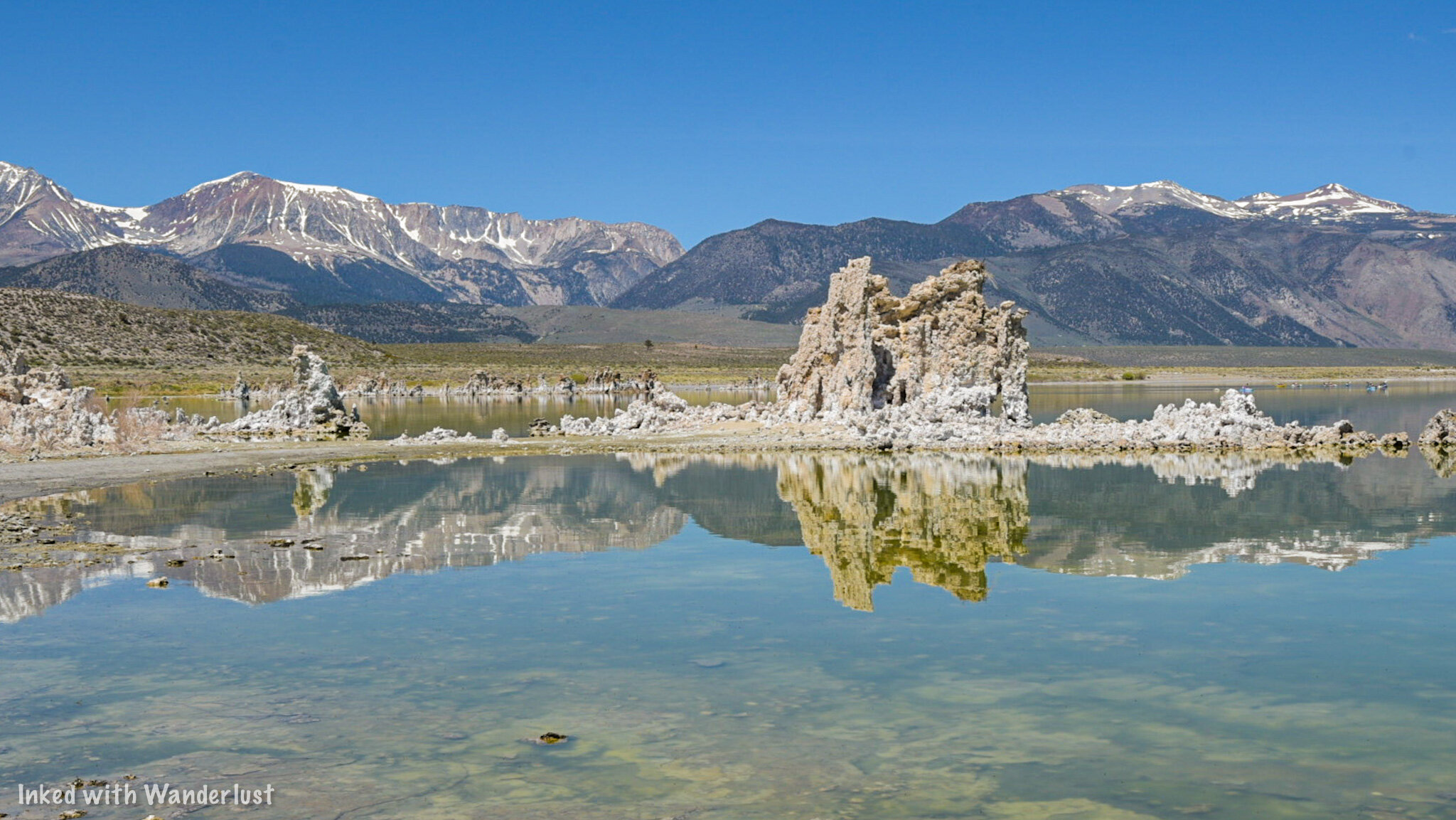
Mono Lake Tufa State Natural Reserve
The reserve was established in order to protect the tufa formations found along the shore. This small section of the lake contains the largest concentration of the tufas and features a 1-mile interpretive loop trail with signage detailing the formation of the tufas, the local wildlife, and more.
Directions
Both Apple and Google maps seem to be confused on how to get here and give wildly different directions depending which you use. For example, I typed in, “Mono Lake Tufa State Natural Reserve”, which is what this park is called, and Google directions wanted to take me in the opposite direction to the visitor center. For simplicity, here are the two routes you can take to get there:
From Lee Vining, travel south on highway 395 for a few miles and turn left (or right from the opposite direction) on Picnic Grounds road.
Just before reaching the campground, you’ll turn right on Test Station road (turns to gravel).
Continue straight on this road until you reach the parking lot on the left. You’ll know you’re heading in the right direction when you see the old house pictured below.

Old house near Mono Lake along Test Station road.
The other way you can get here is as follows:
From Lee Vining, travel south on highway 395 (passing Picnic Grounds road) and turn left (or right traveling north) on Mono Lakes Basin road.
Take this paved road for around 5-miles, then turn left on Test Station road (turns to gravel).
You’ll travel this road for a short time before turning left into the parking lot.
Neither way will take you very long and both will provide easy access to the reserve. The only real differences are the views coming into the park and access during winter. Mono Lakes Basin road is well plowed during the winter (unless it was a particularly heavy storm) and in my opinion, it would be the better option during that time.
READ ALSO: The Essential Guide To Visiting Burney Falls
Fees and Parking
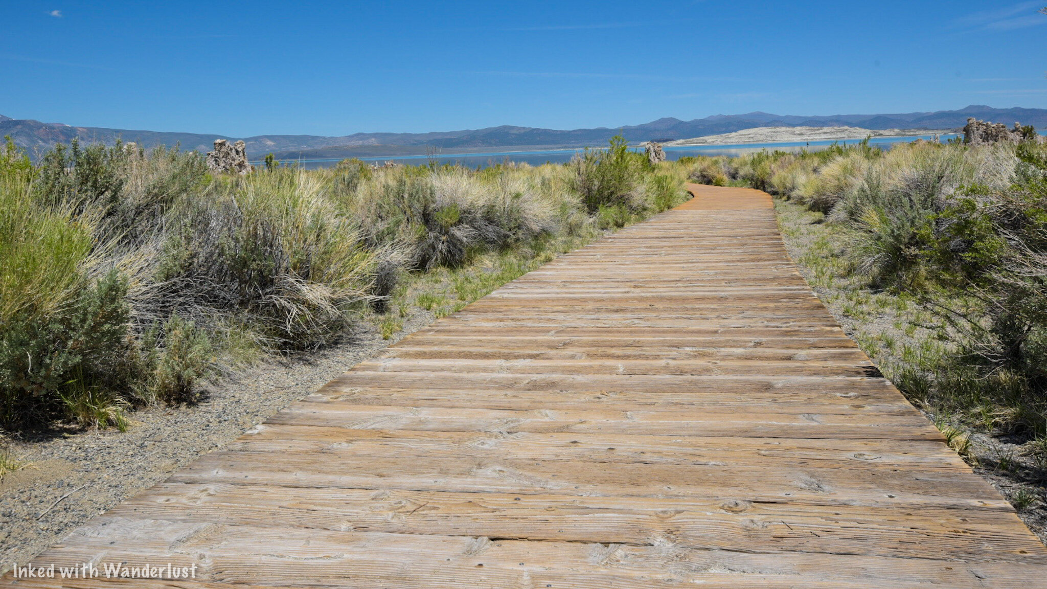
Mono Lake boardwalk.
As with most state and federal designated parks, there is a fee to come here and they are as follows:
$3.00 per person 16 and up
Kids 15 and younger are free
If you have the Interagency Pass, it is honored here
These days, the park seems to follow the honor system as there hasn’t been a heavy Ranger presence like in the past. There is a pay station with envelopes where you’ll fill out your vehicle information and insert your payment. You’ll rip off the tab to place on your dashboard and insert the envelope into the lockbox.
Keep in mind that there are no electronic pay stations where you can use your credit card. This is a cash only park and you’ll want to bring exact change (unless you’re willing to donate the difference). Park Rangers and Mono County Deputies do make regular rounds checking vehicles for pay stubs and will issue fines to those who haven’t paid.
The parking lot is fairly large and could hold a decent amount of vehicles. There’s space for RV’s to park as well. Bathrooms are located at the north end with the entrance at the center just beyond the perimeter of the lot. For those who just want a view, benches are placed to the left of the entrance and face the lake.
The Tufas and Loop Trail

The boardwalk at Mono Lake Tufa State Reserve.
The one-mile loop tail starts at the entrance and begins as dirt before moving you onto a wooden boardwalk. You’ll see the first major example of tufas on your left just before getting onto the boardwalk. On the right side of the trail, you’ll see markers indicating past water levels of that particular spot. Yes, you’re walking along what was once the bottom of the lake.

Your first glimpse of the Mono Lake tufas.
At the end of the boardwalk, you’ll step out onto the sandy shores of the park and start seeing the large tufa formations up close. From here, the trail continues to the right but you’re free to break off and explore the tufas at your leisure. Just be sure to not climb or stand on them as they are very fragile.
Along the water’s edge you’ll no doubt take note of the massive amount of tiny flies. These are Alkali Flies and are harmless. They spend 3 of their 4 stages of life beneath the surface of the lake (contributing to the formation of tufas in the process) and spend their adult stage at the surface feeding off algea.

A tufa with a window at Mono Lake.
Interpretive signs dot the trail and further explain the history of the area. From this point, the official trail can be a little difficult to follow as you’ll be presented with many opportunities to explore the tufas up close. Just keep an eye out for those little brown trail markers indicating the path.

Tufas at Mono Lake.

Tufas beneath the surface of Mono Lake.
Tufas that are above the surface of water have stopped developing and are now at the mercy of the elements (and us). The one’s beneath the surface can still be in active development. In fact, if you look closely enough, you’ll see bubbling in the water in some spots. This is indicative of underwater hot springs rich in calcium interacting with the lake water to form the tufas.
So if you do see bubbling, that’s nature at work still developing these amazing limestone formations. We managed to spot a few examples of this at the south end of the park at the water’s edge. I’ve also read that kayakers and swimmers have come across large bubbling events further out into the lake.
Other Activities

Kayakers on Mono Lake.
Kayaking
While motorized water crafts are prohibited, human-powered vessels such as kayaks are permitted. If you have your own kayak, you can launch from nearby Navy Beach at the south end of the lake. If not, several outfitters provide kayak rentals and organized tours. One such outfit is Caldera Kayak.
Swimming
Swimming is also permitted in the lake (just not from the state reserve). You’ll just need to be sure to avoid hitting the tufas. Before diving in, be certain you have no cuts or sores on your body and keep the water out of your eyes. Mono Lake has 2.5 times the salt concentration as the ocean. It WILL hurt.

Mono Lake from above.
Birding/Photography
Another popular activity here is bird watching/photography. The lake contains no fish at all but is home to the aforementioned Alkali Flies and Brine Shrimp. Due to this, Mono Lake attracts around 300 species of birds that feed on the flies/shrimp and use the tufas to nest. So if that’s what you’re into, you can’t go wrong here.
Photography is another favorite. Photographers from all over the world have come to Mono Lake to capture its beauty, particularly at sunrise and sunset. Drone use at the state reserve and directly above the surface of the lake is prohibited. However, there are other parts of the lake where you could launch from provided you don’t fly over the surface.
Viewpoints
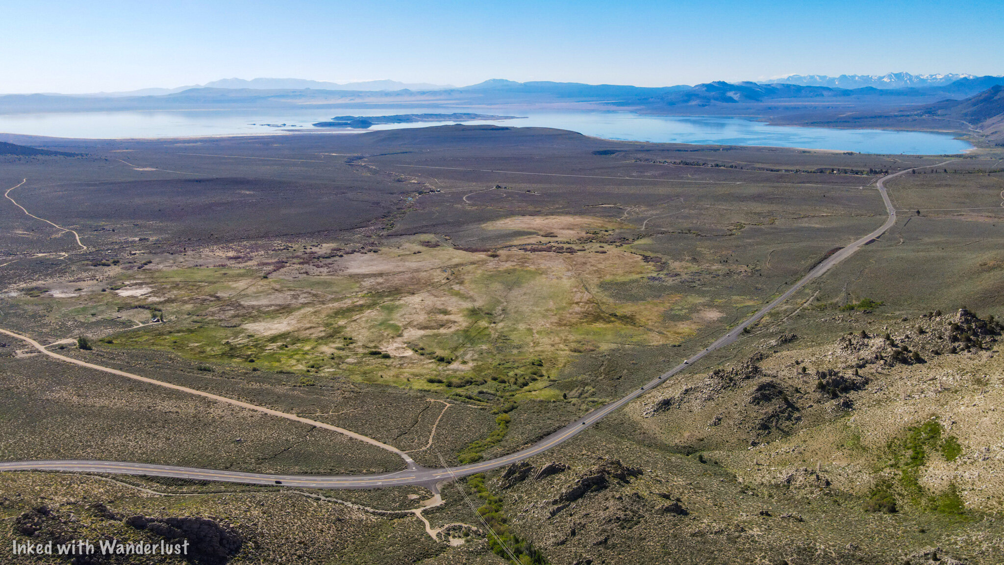
Mono Lake from the Highway 395 viewpoint.
There are a few other viewpoints but the one I feel is worth pointing out is the pullout from highway 395 coming into Lee Vining from Bridgeport. You get a “from above” view (even more so with a drone) and there’s more interpretive signs as well. They don’t say anything different than what the ones at the lake and at the visitor center say, though.
Coming from Bridgeport, you’ll find the pullout on your right shortly after passing Virginia Lakes road (just before you start descending). To get here from Lee Vining, travel north of highway 395. As you near the top of your ascent, you’ll see the pullout on your left.
Nearby Attractions

There are many additional attractions located near Mono Lake. We wrote two articles entitled, “7 Things You Will Love About Lee Vining” and “7 Things You Will Love About Bridgeport” that give examples of things you can do or see in those respective towns. Mono Lake is located in Lee Vining while Bridgeport is just a short drive north on 395.
Below, we’ll list a few of the major attractions you MUST see while you’re in the area and the links to our articles on them:
Conclusion
We hope you enjoyed this article about Mono Lake and that it was helpful to you in planning or inspiring your travel plans. If so, please consider support this site by sharing it with your friends and family on social media. Thank you and safe travels!

Visit Devil's Postpile National Momument in California
Formed roughly 80,000 years ago, the up to 60 foot basalt columns of Devil’s Postpile National Monument are a sight to behold. The saying, “you won’t believe it until you see it”, holds
Formed roughly 80,000 years ago, the up to 60 foot basalt columns of Devil’s Postpile National Monument are a sight to behold. The saying, “you won’t believe it until you see it”, holds true in this case. Pictures do no justice to this natural masterpiece.
Read along to find out how you can see it for yourself and witness one of the best examples of how much of a role Volcanos played in shaping the Sierras as we know it today.
Mammoth Mountain
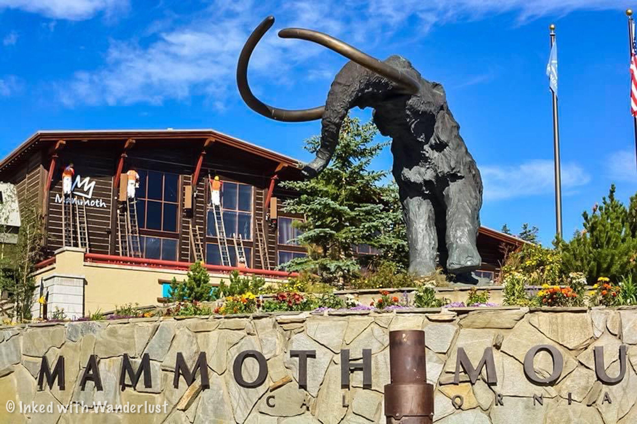
Mammoth Mountain Adventure Center.
Your journey to Devil’s Postpile begins at the base of Mammoth Mountain in Mammoth Lakes, CA. With few exceptions, most visitors will be required to utilize the Monument’s shuttle that takes you down the access road to the valley.
The Shuttle
While the Monument itself is free, there is a fee to use this mandatory shuttle. Tickets can be purchased at the Adventure Center day of and as of 2019 it is $8.00 per person 15 and older, $4.00 per person between 3-15 years old, and free for those aged 2 and under (The shuttle rule was suspended in 2020 due to COVID-19).
As stated above, there are a few exceptions to this rule. They are:
Arrive before 7am or after 7pm
Have a handicap placard or plate
Are staying at either the valley campground or Red Meadow’s Resort.
You’re arriving after shuttle operating hours or season
You’re a hunter transporting game or weapons
You’re towing livestock and are using the livestock on valley trails
You have a cartop boat and are using it in valley lakes
READ ALSO: 7 Things You Will Love About Lee Vining

Shuttle line at Mammoth Mountain.
The shuttle runs on average every 45 minutes and usually takes 30 minutes or so to reach the valley. The line moves quickly due to plenty of seating on each shuttle along with some standing room (pro tip: If you’re standing, avoid locking your knees. Someone on the bus with me ate floor because of this).
Much like Yosemite’s east side, the Monument is seasonal and typically opens in mid June and closes in mid to late October. Be sure to keep this in mind when planning your trip.
Devil’s Postpile

Devils Postpile Monument.
The shuttle will make multiple stops along the access road. While you can reach the columns from Red’s Meadow, you’re going to want to get off at the Valley stop as this is the most direct and shortest route.
The valley is where you’ll find the campground, ranger station, bathrooms, and Soda Springs Meadow (which is where the trail to the columns begin). You can find the trailhead to the columns just beyond the Ranger Station.

Devils Postpile Monument.
It is just shy of .05 mile from the start of the trailhead to Devil’s Postpile. The trail is well maintained through Soda Springs Meadow but beyond this, you’ll start noticing thick tree roots and rocks getting in the way.
From here, it won’t be long before you get your first glimpse of Devil’s Postpile and when you do, you’ll be blown away. The columns formed around 80,000 years ago (give or take) after flowing lava cooled and cracked into what we see today.

Top of the Devils Postpile Monument.

Section of the San Joaquin River.
Just as you come upon it keep an eye out for a side trail to your left. This trail will take you to the top of the columns and allow you to touch their smooth, hexagon shaped surface. The trail is a bit steep but freight not, it’s short.
Take all the time you want to admire and photograph this amazing sight. The sun rises above the columns so the morning light tends to be harsh. I found the light much better on my way back out when the sun had time to move on. So if you want to get some good pictures, keep this mind.
Rainbow Falls

Rainbow Falls. Mammoth Lakes.
You now have two choices. You can either stop here and head back to the shuttle once you’ve spent enough time admiring the Postpile or you can press on and head out to the other natural feature of the Monument; Rainbow Falls.
From here, it is another two miles to the falls. While that isn’t a lot and the trail is mostly flat with the occasional dip, there isn’t much in the way of shade. You’ll have a few opportunities here and there but for the most part, it’s exposed. So if you’re going to continue on, be sure that you brought plenty of water with you.
Between the postpile and the falls you’ll have amazing views of the San Joaquin River as you follow along side of it. Eventually, you’ll come out into a vast clearing (where a massive fire tore through) and be able to see the beautiful Minerats out in the distance to your right.

Me at Rainbow Falls.
Soon enough, you’ll start to hear the roaring of the beautiful Rainbow Falls. Your first glimpse will come as you approach the main (and largest) concrete viewpoint.
If you’re looking for a better viewpoint with a more straight on angle of the falls, keep going down the path and you’ll eventually see it off to your right. When I was here, this one had far less people than the first one.
There are also stairs that lead down the base of this 101-foot beauty where you can get some amazing photos but unfortunately, these stairs were closed to the public for maintenance when I was there. More of a reason to go back, right?
Lower Falls

Lower Falls. California.
Located about a mile further down the trail from Rainbow Falls and outside the boundary of the Monument is Lower Falls. Lower Falls drops just 15 feet over smooth granite rocks and into the perfect swimming hole for overheated hikers.
My friend and I debated over whether or not to include this on our visit. Ultimately, we decided to do it and I was sure glad we did. Lower Falls is comparatively unknown to most visitors so we only had to share it with a few others (we were here in August). I highly recommend going for it.

Devils Postpile Monument.
Things to Know
Mileage will vary. If you only hike to the columns, you’re looking at just under a mile from the valley to the columns and back. If you go to Rainbow Falls, that’ll make it 5 miles round trip and if you include Lower Falls, it’s about 7 miles round trip.
The Monument is free, but the shuttle isn’t. If you manage to arrive outside the operating hours of the shuttle, you’re free to drive down to the valley. Otherwise, you must pay for and use the shuttle.
The Monument is seasonal. Due to heavy snowfall, the Monument is only accessible from mid June to around mid to late October. So plan your visit accordingly.
Crowds get heavy. Devil’s Postpile is one of the most popular attractions in the Sierras. As such, crowds tend to be heavy. Your best bet for light crowds is in the morning because later in the day, lines for the shuttle will rival those of Space Mountain.
Your annual parks pass won’t waive the shuttle fee. Keep this in mind if you’re a pass holder. Everyone pays for the shuttle.
The trail to Devil’s Postpile is (kind of) wheelchair and stroller friendly. I know of people who have pushed strollers along this trail and others who have used a wheelchair, but they did struggle. As you approach the columns, there’s a ramp to help circumvent the rocky stairwell but you will encounter thick tree roots and rocks along the trail. Beyond the columns to the falls, wheelchairs and strollers won’t be possible.
Bring plenty of water. Seriously. I underestimated this trail due to it being short but didn’t realize how exposed the trail to Rainbow Falls is and was nearing dehydration. Learn from my screw up.
Conclusion
Whether you decide to just see the columns or include Rainbow and Lower Falls in your visit, you’re sure to enjoy the time you spend at Devil’s Postpile National Monument.
We hope this article has inspired you to want to visit this beautiful place. If so, please support us by sharing it with your family and friends on your favorite social media site.
Thanks for reading and safe travels!

Travertine Hot Springs: A Relaxing Soak With Mountain Views
There’s nothing like taking a dip in a natural hot spring after a long, grueling day or two hiking in the wilderness. Luckily for us, there are many hot springs located within the Sierra Mountains but there’s one in particular we’re going to cover in this article; Travertine Hot Springs.
There’s nothing like taking a dip in a natural hot spring after a long, grueling day or two hiking in the wilderness. Luckily for us, there are many hot springs located within the Sierra Mountains but there’s one in particular we’re going to cover in this article; Travertine Hot Springs.
~ Getting There ~

Bridgeport, California mountain range.
Here’s the good news; Travertine is super easy to access. Here’s the bad news; Travertine is super easy to access. No, that wasn’t a typo. It can be both a good or bad thing depending on your preference.
The dirt road leading to the springs can be rough depending on which season it is but overall, most vehicles will be able to get through it. My Chevrolet Cruz made it just fine so having a high clearance vehicle isn’t necessary (unless a winter storm recently hit).
Due to this, Travertine sees its fair share of visitors and quickly fills up in the summer months (hence why it could be a bad thing). There are, however, a few things you could do to avoid the crowds which we’ll cover in the next section.
If you’re coming from Bridgeport: Get on Highway 395 south. Shortly after leaving town and just before the Ranger Station, turn left on Jack Sawyer road. Keep heading straight up over the hill and continue until you reach the terminus.
If you’re coming from Lee Vining: Get on Highway 395 north for about 25 miles. Shortly after passing the Bridgeport Ranger Station, turn right onto Jack Sawyer road and follow the same directions above.
As stated in the directions, you just keep following the dirt road until it ends at the parking lot. There’s a restroom available for use on the right. It’s of the vault variety and as far as cleanliness is concerned, it’s been hit or miss in my experience. Better than nothing, right?
~ The Pools ~

Travertine Hot Springs. Bridgeport, CA.
From the lot, it isn’t much of a hike to get to the pools. In fact, if the main pools are too crowded, there’s a small man-made pool right in the parking lot. This one could get especially hot, though. As in, you could boil in it. So dip your least favorite toe in first just to be safe.
You’ll find the four main pools after a short walk along the trail leaving the lot. By short, I mean around 2-3 minutes. The first pool you’ll see is the largest and hottest. From there, they get progressively smaller and cooler.
There’s an additional pool further down the trail that, if you’re lucky enough to get there first, you’ll enjoy relative seclusion. It is much smaller (can fit 3-4 and that’s assuming you’re comfortable with one another), but has an unobstructed epic view of the mountains before you.
~ When to Go ~

Soaking in the hot springs at Travertine Hot Springs.
Honestly, any time is a good time but largely depends on your preferences. If your goal is to enjoy some relative peace and be alone, you’ll want to get here pre-sunrise (as in, still dark) or come during the winter time.
The summer months are the busiest. No matter what time of day you arrive, you’ll likely be sharing the pools with at least one or two others. Though I have had luck getting here during the week in August and managed to have it all to myself for a couple hours.
During winter you’ll have better luck avoiding crowds. However, it’s also possible that the road will either be closed or difficult to pass due to heavy snow or rain. High clearance vehicles may be necessary during this time.
If you arrive during the day in the summer, you WILL arrive to a full lot and pools full of bodies. As mentioned above, arrive pre-sunrise to increase your odds. This is what I always do and I almost always have it to myself for a while. You’ll be cold at first but that won’t matter once you’re in the spring.
~ Additional Info ~

Travertine Hot Springs main pool.
The springs are located on California park land. While not a state park, it is state park land and is managed by local rangers. A bonus feature to this is there is free, dispersed camping along the road leading to the springs. It is primitive and there are no showers, restrooms, etc. Also, there is no fee to access the springs.
Travertine is clothing optional. While families and singles alike are welcome here, do keep in mind that you may see some nudity. The people that come here are usually respectful about it but if it’s something that you’d be uncomfortable with, you may want to visit a different hot spring.
These are natural springs, not man-made. Aside from the pool in the parking lot, the springs are nature made over thousands of years and the bottom of the pools are muddy, not made of concrete like established springs. So be sure to rub some of that mud on your body for some natural healing.
Be sure to watch for debris. While most who come here respect nature, unfortunately, there are some that couldn’t care less. It isn’t uncommon to find beer bottles and other trash in and around the pools. It would probably be wise to wear water shoes to avoid possible broken glass.
*Please, be sure to pack out whatever you brought in.
Safe travels & thanks for reading!
Please support this site by sharing this article with your friends & family on Pinterest, Facebook, or your favorite social media channel.
Furthermore, you can show your support by reading one or more of the related articles below.