Hike the Wilson Canyon Loop Trail near Yerington
Situated between the small town of Yerington and the even smaller community of Smith Valley, Wilson Canyon is a recreational paradise with something for everyone. Hiking, horse riding, river tubing, camping, motor sports, fishing, etc. You name it, you can do it.
Even though there are plenty of activities to take part in, this article is going to focus on the 3.5 mile interpretive loop trail on the west side of the canyon. If you want to use your dirt bike, quad, etc, you can do so on the opposite side of the highway at the dunes.
The trail is considered moderate in difficulty. The very beginning and end (where you climb in and back out) are short but steep sections. The rest is mostly flat with the occasional gradual ascent/descent that’ll ultimately lead you to an epic payoff at the viewpoint.
At the end of the article I’ve included a screenshot of the route we took that was recorded by my watch. That combined with the included images will give you a pretty good idea of what you’ll be dealing with.
Wilson Canyon Trail Trailhead

The interpretive loop trail begins and ends in the small parking lot located at the west end of the canyon. The decently maintained dirt lot can hold a couple dozen vehicles and features two shaded picnic tables. The trail begins just behind these.
If you’re coming from Yerington, the lot will be at the end of the canyon on your left. If you’re coming from Gardnerville or Topaz, the lot will be on your immediate right as you’re coming into the canyon (shortly after passing the rest stop).
The Loop

This first section of the trail leading up to the ridge of the canyon is the second steepest of the whole thing (the first being the opposite side coming back out, but more on that later). It isn’t difficult by any means, but if you’re not used to hiking at higher elevations, you may have a slow go at it.

When you get to the top of the ridge, be sure to turn around and take in the views. In a single frame of view you’ll see a portion of the west fork of Walker River with Mount Siegel and the Pine Nut Mountain Range providing the backdrop.
From here, you have two choices. You can go further up the ridge to the left and check out the vertigo inducing views of the river below or, once you’ve gotten your fill of the views, you can continue down the trail proper leading into the canyon.

Going down this section of the trail will mean you’re going to lose all the elevation you just gained. It’s frustrating, I know, but it’s the only way in. On your way down, you’ll get a vast view of the desert valley below that was once an ancient lake.
If you look closely to the upper left of the image above you’ll faintly see a sign along the trail just before it veers to the right. This sign indicates that you would be under water at that point had the lake still been there.

At the bottom of the trail you’ll reach a dry river bed that cuts through the trail you’re on. You’ll also see two pointed signs with one directing you to the left and another directing you forward. This is where the actual loop begins.
You could go in either direction and end up at the same spot. Going left will take you along the river before turning into and up the canyon. After reaching the viewpoint above, you’ll descend back into the canyon and here is where it’ll ultimately spit you out at. In our opinion, this is the better way to go.


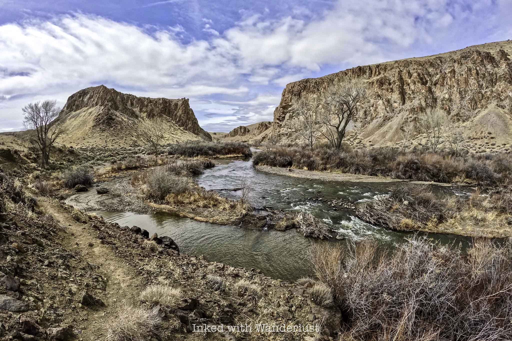
After turning left at the juncture, you’ll follow the dry river bed for a short time before before running into Walker River. At the right time of year, this section of the river doesn’t move very fast. So if you brought your swimsuit, this would be a great spot to take a dip or maybe partake in some fishing.

The trail continues to the right and follows the river for about a quarter mile before finally cutting back into the canyon. When we did this hike it was still early spring, so the trees that dot the river weren’t yet blooming, unfortunately. When they do, it’s a sight to behold (especially in the fall).
Shortly after turning right into the canyon (roughly one mile into the hike), you’ll come across your first of only two opportunities for shade during this stretch of the trail. The next one is 3/4’s of a mile further. So if you’re feeling the need to rest for a bit, do it here.
This stretch of the trail starts from the time you leave the river to the time where you reach the viewpoint at the top and is almost exactly one mile in length. It is very exposed and as stated above, has only two opportunities for shaded rest breaks.
At first glance, you might think there isn’t much to look at here, but you’d be wrong. Thanks to the volunteers that maintain this trail, small informative signs dot the trail pointing out the several examples of desert flora, rock formations, and petrified wood.

Not long after the second shaded area of the trail, you’ll begin your ascent to the viewpoint. This ascent, while still requiring a fair amount of effort, is nowhere near as steep as the one you took to get into the canyon at the beginning.


At the top of the viewpoint, you’ll see a large informative sign detailing the history of the area and what you’re looking at. On your far right, you’ll see Mount Wilson, Singatse Range, and Shamarak Hill. Toward the middle and left you’ll see Ancient Lake Wellington, the Pine Nut Mountain Range, and Mount Siegel.
Once you’ve gotten your fill of the views and took your pictures, you’ll continue down the trail as you descend back into the canyon. This section of the trail is my personal favorite as you go from sweeping mountain views to feeling like you’ve stepped into a scene out of Star Wars.
READ ALSO: Visit Dayton State Park and Rock Point Mill

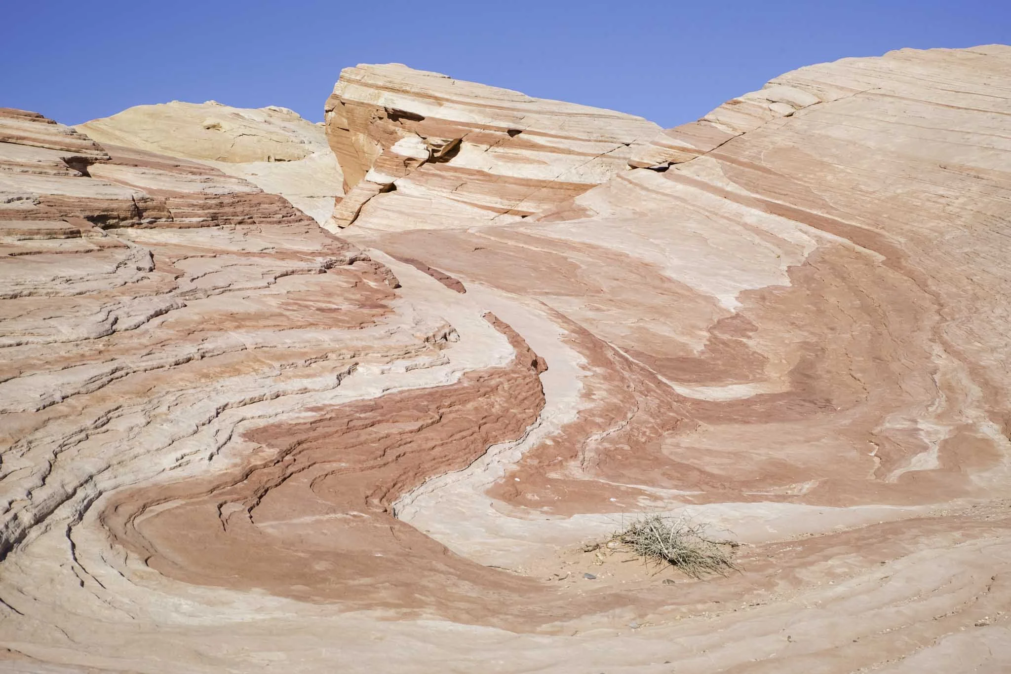
If you’ve ever seen the tufa’s at Mono Lake in California, the canyon walls that surround you will look similar to that environment. After all, all of what you see here was formed over millions of years of volcanic activity and water movement.
Towards the end, you’ll see examples of what are called, “Hoodoos”. Hoodoos are rock formations that were once solid pieces of land that were carved out by rain, snow melt, and wind leaving the pieces you see today. One of them, as pictured below, resembles a dragon.


Near the end of the Wilson Canyon trail.

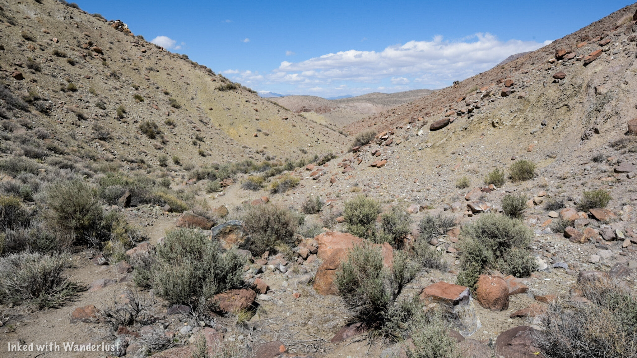
The climb out of Wilson Canyon.
As you make your way through the canyon walls and Hoodoos, you’ll come out into an opening signaling the near the end of the hike. You’ll eventually reach a sign (similar to the one at the beginning) stating that you would be under water had the ancient lake still been here. At this point in the hike, you’re at the 3-mile mark.
From here, simply continue on the trail until it spits you out at that same junction you came to at the beginning. Now that you've completed the loop, you can either head back towards to the river to recreate in there or you can go straight up and over the ridge back to your vehicle. Remember the very beginning of this article when I stated the hardest part of the whole hike is the climb out? Well, there it is pictured above. Prepare yourself.
Wilson Canyon Trail - Things to Know

This is an all season trail. Rain and/or snow can make this trail incredibly muddy and hard or even dangerous to traverse. However, this area doesn’t receive a lot of either so it is accessible anytime of year. I do recommend checking the weather before heading out, though.
Wildlife hazards are present. As with any venture into the wilderness, potential conflicts with wildlife are possible. While I have never seen anything more menacing than deer out here, others have spotted both Cougars and Rattlesnakes. As with anything, use common sense, be prepared, pay attention to your surroundings, and know what to do in case you cross paths with one of them.
The majority of the trail is rocky. The volunteers who maintain this trail do a great job, but they can only do so much. At certain points at both ends of the trail it does get rather rocky and the potential of rolling an ankle is ever present. Watch your step, keep to steady surfaces as much as possible, and you’ll be fine.
The trail is very sun exposed. The descent back into the canyon from the viewpoint has more shade than the way up does. It’s a 3.5-mile trail and for the first two or so, you’re only going to have a couple opportunities for shade. If you’re doing this trail in the summer, we highly recommend getting an early AM start and as always, bring plenty of water and salty snacks with you.
We would rate this hike as family friendly. While it does have steep sections, the trail is mostly flat with occasional gradual inclines/declines. It is our opinion that everyone from adults to children can do this hike. If your kid has never hiked before, it would be a great way to introduce them to it.