How to Spend a Few Hours at Valley of Fire in the Summer
Disclosure: This post contains affiliate links. If you make a purchase through these links, I may earn a small commission at no additional cost to you. I only recommend products or services that I believe will add value to my readers.
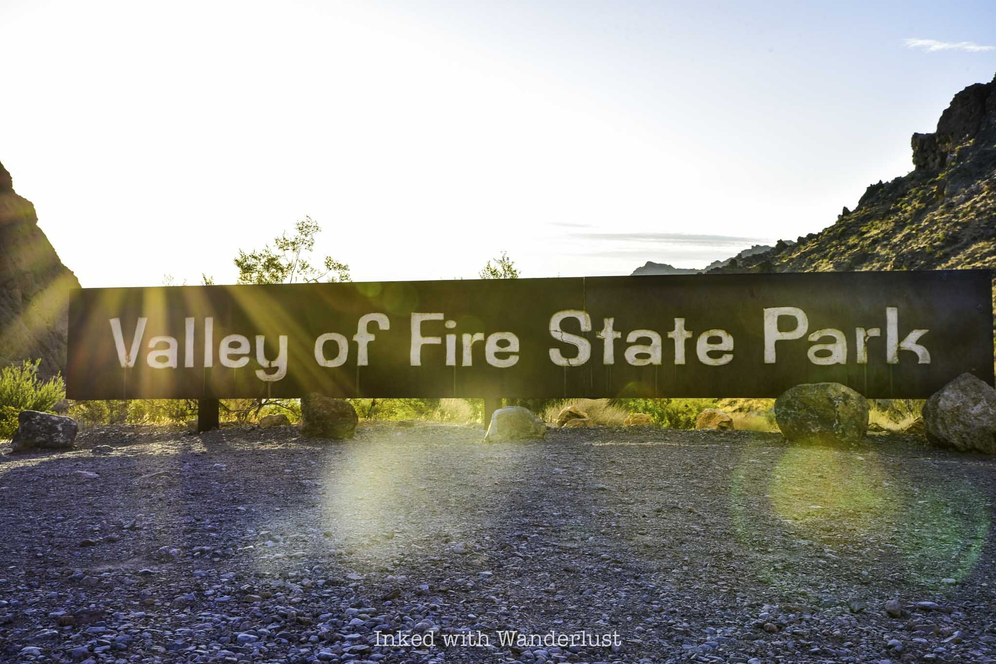
Established in 1935 as Nevada’s first state park, Valley of Fire attracts thousands of hikers, photographers and overall nature enthusiasts annually. It’s located in southern Nevada, just an hour so from the bright lights of the strip and is one of the most popular things to do near Las Vegas.
Valley of Fire offers a variety of hiking trails, a visitor center with informative exhibits and many historical sites. There’s literally something for everybody in this geological wonderland.
While I always recommend spending at least a full day at the park, the reality is, the extreme heat that Valley of Fire sees in the summer is simply too much for many people. It’s quite common to see high triple digits consistently.
Thankfully, Valley of Fire offers many attractions that are easy to see, with most only requiring a small commitment of thirty minutes or less, allowing you to see many of the highlights in a short amount of time.
So if you’re thinking about visiting Valley of Fire in the summer, but you can’t stand the heat and only have a few hours to spend, you’ve come to the right blog. Let’s get into it!
Valley of Fire Entrances, Fees & Reservations
Before we get into the fun stuff, there are a few things you need to know before traveling to Valley of Fire. For starters, no, day-use reservations are NOT required at Valley of Fire at this time. However, with the recent launch of the Reserve Nevada website, I wouldn’t be surprised to see it happen eventually as it’s the most popular state park in the state.
On the flip side, yes, you will have to pay an entrance fee. Thankfully, the fees aren’t all that high and if you’re driving a car with a Nevada license plate, you’ll get a discount! As of 2024, day-use entry fees are as follows:
$15 - Non-Nevada vehicles
$10 - Nevada vehicles
You can pay with a credit/debit card or cash. If the ranger booths aren’t staffed when you arrive, simply pull into the parking lots to the right to pay. If paying with cash, insert cash into the provided envelope and slip that into the iron ranger.
Conversely, you can still pay with a credit or debit card at the digital self-pay stations. Keep in mind that there’s always a chance that those pay stations will be offline, so it’s best to bring cash with you just in case (it happens more than you think).
There are two entrances at Valley of Fire; the east entrance and the west entrance. If you’re coming from Las Vegas, you’ll likely drive through the west entrance. Conversely, if you’re driving from Lake Mead/Hoover Dam, Arizona or Utah, you’ll likely go through the east entrance.
Additionally, there are only two main roads in the park; the Valley of Fire Highway (or, Valley of Fire Scenic Byway) which runs east to west, and Mouse’s Tank Road (or, White Domes Road) which takes you to the northern section of the park.
Navigating the park is easy, so you don’t need to rely on GPS too much. Keep in mind that cell service in the park is spotty to non-existent in most areas of the park. There are roadside signs all along the road announcing which attractions you’re approaching, though.
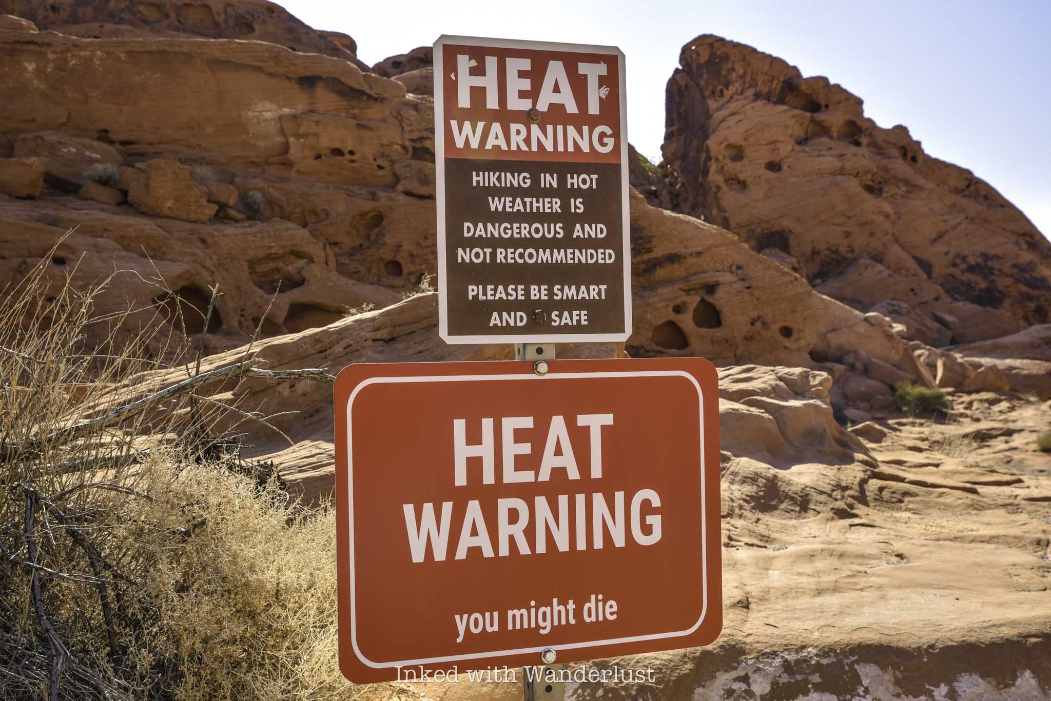
Lastly, be sure to heed the ominous signs at the park’s trailheads. They may seem dramatic, but many heat-related deaths have occurred in the park over the years. There isn’t much shade on any of the trails. I had my own scary experience while hiking in Red Rock Canyon, making me a believer.
For pleasant, somewhat cooler weather, early October to April are the best times to visit Valley of Fire. Though fall and spring sees the biggest crowds for that very reason.
If your aim is to visit with the least amount of people around as possible, then the summer months are your best bet. You will be contending with peak temperatures, though, so an early arrival is paramount to an enjoyable experience in the summer.
Here are some products that I recommend bringing to the park with you to help combat the heat:
Things to See at Valley of Fire in a Few Hours
While it would be easy to spend two or three days at this beautiful park, you can just as easily spend a few hours due to the park’s many easily accessible attractions. Below, I’m going to provide a list of things to see and do in Valley of Fire that will allow you to see many of the highlights in a relatively short amount of time.
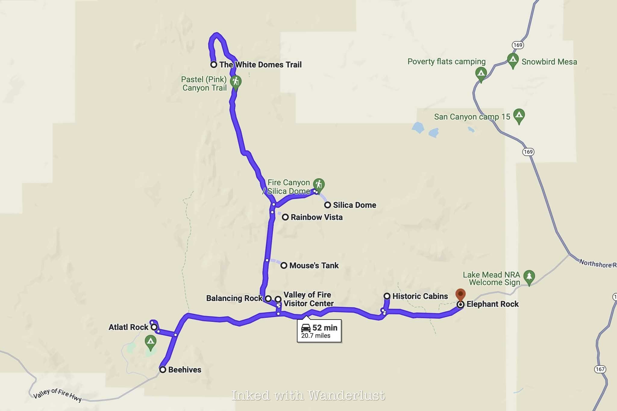
This itinerary will list the attractions in the order that they appear in the park and will assume you’ll be driving in from Las Vegas, through the west entrance (if you’ll be driving in through the east entrance, just complete this itinerary in reverse order).
Remember, the goal is to arrive at the park as close to sunrise as possible. This will allow you to see everything listed below and be out of the park by 11am or so, when the heat and crowds are at their worst.
Keep in mind that certain trails are closed in the summer months due to extreme heat, so in respect to responsible travel, I will be omitting those from the list. For informational purposes only, the following trails are closed from mid-May to October:
Seven Wonders Loop
Pinnacles Loop
Prospect Trail
Arrowhead Trail
Natural Arch Trail (excluding Natural Arch itself)
Charlie’s Spring
The Beehives
After driving in through the west entrance, the Beehives will be the first major attraction you’ll see and the large parking lot will be on your right.
The Beehives themselves are located right off the parking lot. There’s no designated path to follow, so feel free to explore them at your leisure.
You’ll quickly realize why they were named, “Beehives”, as you’ll see many honeycomb-like formations in the sandstone rocks. I feel that they’re the perfect introduction to Valley of Fire and a great place to watch the sunrise.
Atlatl Rock
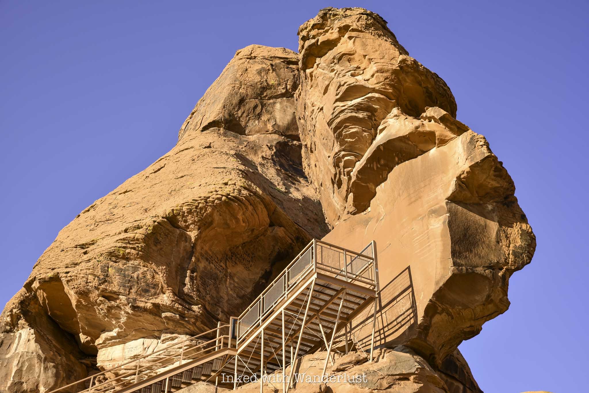
From the Beehives parking lot, drive east for a couple of miles until you see the turn-off for Campground road on your left. You can see Atlatl Rock from the highway but as you get closer, its commanding presence becomes more and more clear.
Aside from the large rock itself, the main draw to Atlatl Rock are the petroglyphs on the smooth rock face near the top. Simply take the steel staircase to the viewing deck above to see them.
The parking lot is fairly large, located just off the road, and features a restroom as well as a half a dozen or so shaded picnic tables. This makes Atlatl Rock an ideal spot for a quick break.
Atlatl Rock doesn’t take long to explore, as most of the petroglyphs are located in one central location. Though there are others scattered through the neighboring campground as well.
For more information, read my comprehensive guide on Atlatl Rock here.
Natural Arch
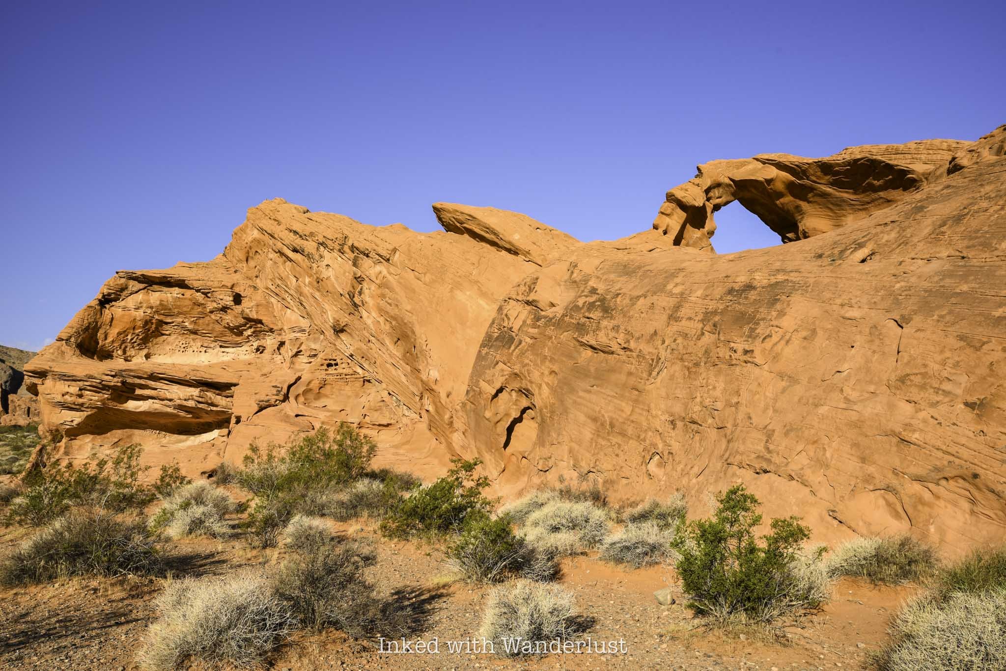
To see Natural Arch, turn left onto Campground road going out of the Atlatl Rock parking lot and follow it for about a mile. It’ll be on the left side of the road.
There’s no real parking lot, just a small pull-out style, dirt and gravel lot. In the morning, the view from the roadside will be dulled by the shade but if you walk behind it, you’ll discover a brilliantly lit Natural Arch in front of you.
Natural Arch isn’t the most impressive sight you’ll see at the park, but there aren’t many of them here and this one is the easiest to access. It’s small, but a sight to behold nonetheless.
To continue on your journey, simply turn back towards Atlatl Rock and the Valley of Fire Highway. If you continue down the road in the opposite direction, the road will become harder to pass as it isn’t well maintained (or even paved).
There are other formations down that road, such as Piano Rock, that are worth seeing but as stated above, the road becomes difficult (though not impossible) for those without high clearance. If you do go that way, the road will eventually loop you back to the highway, just before the Beehives. Turn left to continue.
Historic Cabins
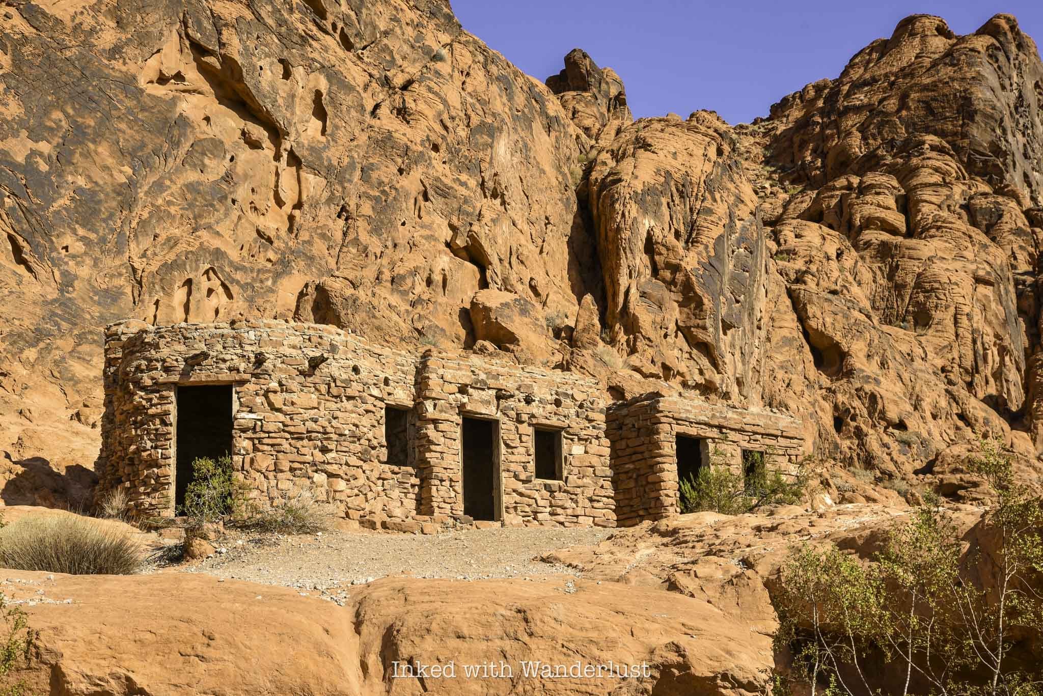
After leaving Natural Arch, turn left to get back onto Valley of Fire Highway to continue onto next attraction; the Historic Cabins. You’ll travel another five miles or so until you reach an un-named road on your left that leads to the cabins (there will be sign indicating the cabins are down that road).
The well maintained road will terminate at an eventual dead end lot, with the cabins out in front of you. There will also be another restroom and picnic area.
The cabins were built by the Civilian Conversation Corps (C.C.C) shortly after Valley of Fire became a state park in 1935 and were made with native sandstone. Their intended use was to provide shelter to travelers.
You can explore the exterior and interior of the preserved cabins. You’ll take notice of the built-in fireplaces and windows overlooking the valley in the distance.
Elephant Rock
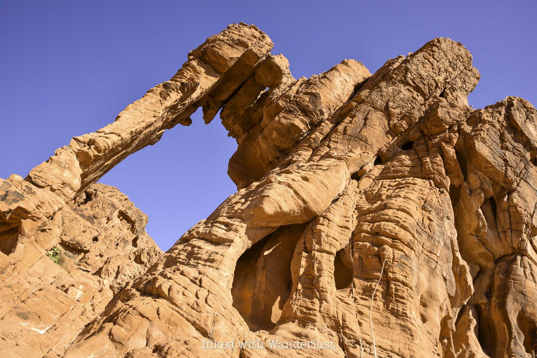
Elephant Rock is one of the most infamous, Instagram worthy rock formations in Valley of Fire. Seeing it in person, it won’t take you long to make out the shape of the trunk, head, body and legs.
From the cabins, turn left onto the highway and follow it for a few more miles until you see the east entrance ahead of you. The parking lot for Elephant Rock is to your left, just before the exit.
The trail to Elephant Rock is a short, 0.3-mile jaunt that leads you right up to it. From there, you can scramble your way up for a closer look (but don’t climb on it).
To read more about Elephant Rock, read my comprehensive guide here.
Visitor Center and Balanced Rock
By now, you’ve undoubtedly worked up a sweat. It’s time to get out of the sun and head to the Visitor Center. To get there, travel west from Elephant Rock (the way you came) for three and a half miles. You’ll eventually come up upon Mouse’s Tank road on your right. Turn here and keep straight at the fork to get to the parking lot.
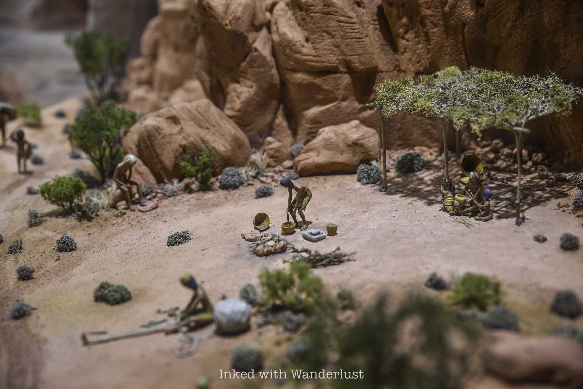
The Visitor Center is a great way to escape the heat for a bit. While the A/C is great, the best part about it are the exhibits that detail the extensive history of Valley of Fire. From Native American artifacts and geological education, to examples of native flora and fauna, there’s much to learn here.
Once you’ve cooled off, head back outside to the short but sweet trail to Balancing Rock. Facing the Visitor Center, you’ll find the trailhead on the left side of the parking lot. As stated above, the trail is short, even more so than Elephant Rock’s trail. It’ll terminate at a small viewing area that puts you front and center to Balancing Rock.
Much like Natural Arch, Balancing Rock isn’t the most impressive thing you’ll see at Valley of Fire, but it’s so easy to see that it would be a crime not to check it out. When you’re done, head back to your car and drive north on Mouse’s Tank road.
Mouse’s Tank Trail
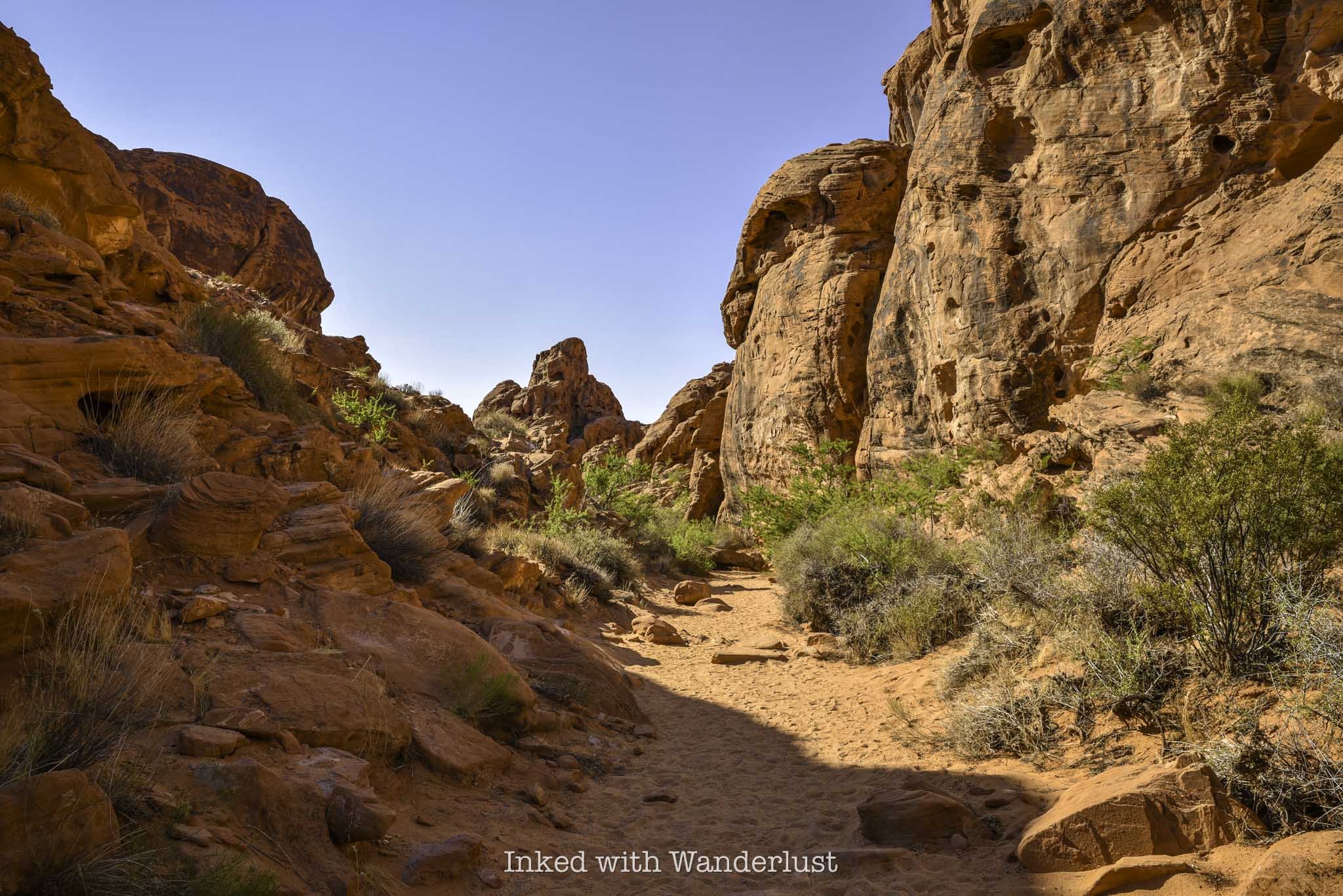
The trailhead for Mouse’s Tank Trail (or, Petroglyph Canyon) is located just off of Mouse’s Tank road on your right. I found more shade on this trail than any other I went on during my visit.
Mouse’s Tank Trail (along with the road) is named after, “Little Mouse”, a Southern Paiute Indian renegade who hid in areas of Valley of Fire after being accused of the murders of two prospectors (among other crimes).
The trail takes you through a canyon, with walls loaded with prehistoric petroglyphs. It terminates at Mouse’s Tank, which is a natural basin inside the rock that collects water after each rainfall.
Mouse’s Tank Trail is only half a mile, roundtrip, and if you get on the trail prior to 11am like I did, you’ll have plenty of shade throughout much of it.
The ‘Instagram View’ of Mouse’s Tank Road
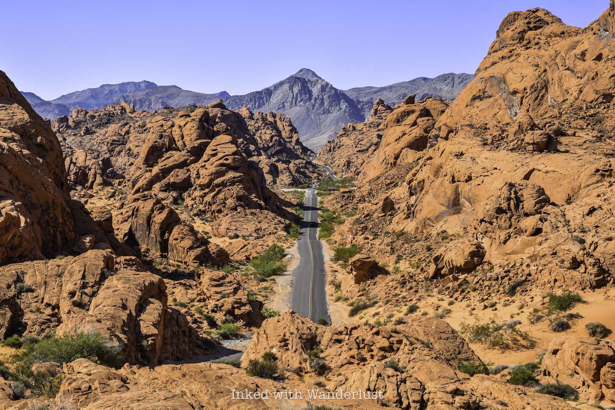
Mouse’s Tank road is undoubtedly one of the most scenic roads in all of Nevada. You’ve seen it all over social media, Instagram specifically, and it’s been plastered all over ads on TV, casino wall posters, etc.
If you’re wanting to get your own photo of this magnificent sight, there’s a much simpler way to do it than what other websites specify. You won’t need coordinates or have to pull over into one of the narrow slots on the side of the road.
Simply drive along Mouse’s Tank road until you see the parking lot for the Rainbow Vista Trail on your right (you can’t miss it). Park your car here, cross the road and walk along the rock until you reach the overlook perch at the end. Voila, you’re there.
Other sites I’ve seen overcomplicate it way too much. Doing it this way is way easier and it’s mostly the exact same view, albeit a bit higher. I feel it’s superior to other angles I’ve seen,
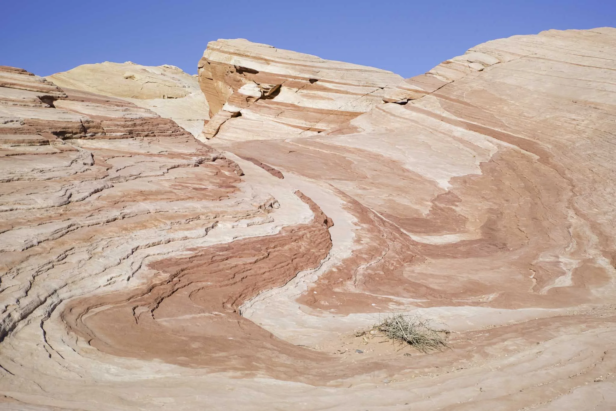
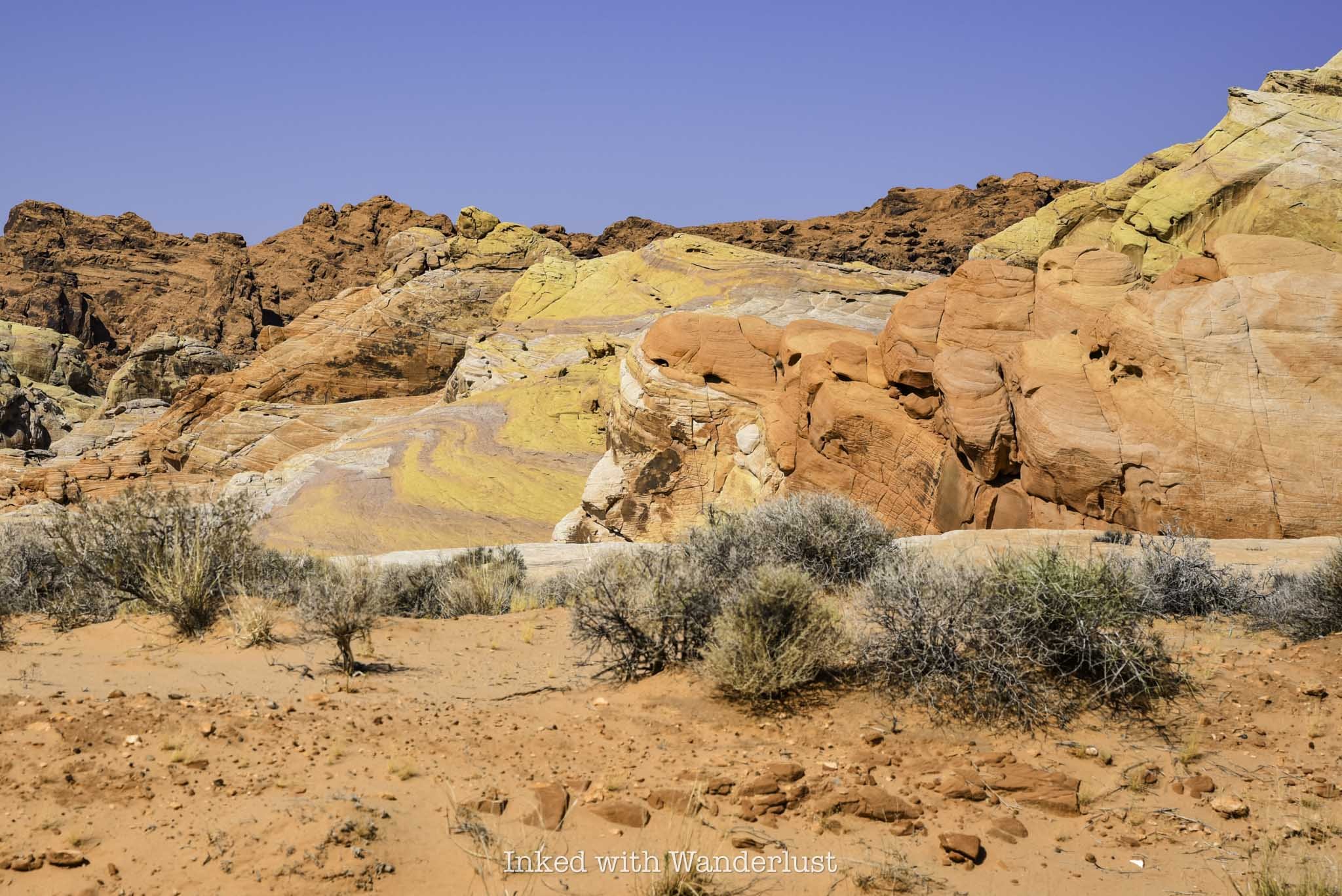
Fire Canyon/Silica Dome Viewpoint

To get to the next stop, head north from the Rainbow Vista parking lot (turn right). Shortly thereafter, you’ll make a right turn onto Fire Canyon road and follow it to its terminus at the parking lot.
There are a number of trails that begin here but for my money, the main attraction is the view. In front of you are examples of sandstone and silica rock. The multi-layer, contrasting reds of the sandstone on top of the yellow/tan tint of silica with the browns of the mountain range in the distance make a stunning sight.
You can walk out onto the dirt path that leads to a viewing area or simply take a gander from the parking lot. Either way, it doesn’t take much time to enjoy the sights at this lookout.
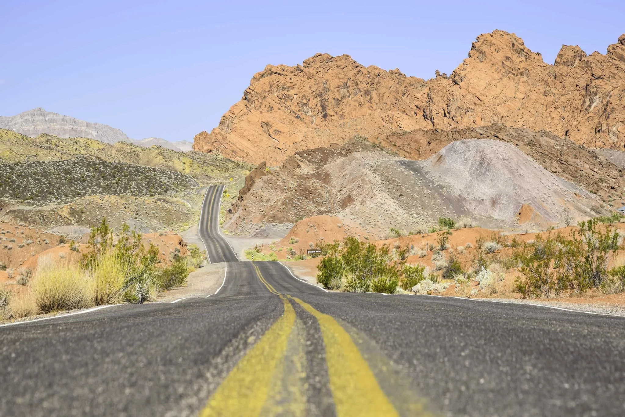
Drive the Remainder of Mouse’s Tank Road and Take in the Views
To complete your visit, turn right onto Mouse’s Tank road and drive it for 4.5-miles to its terminus at the White Domes parking lot. The trails in this area of the park are closed in the summer, mind you, but you can still drive the highly scenic road.
From the road, you’ll see teasing glimpses of Pastel Canyon, White Domes and Fire Wave. You cannot park alongside of the road on this stretch, but there are multiple parking lots dotted along the road where you can stop to take pictures.
From here, simply head back towards whichever exit you need to leave from. Remember, this itinerary is assuming you’re driving in through the west. If coming in through the east, simply begin at Elephant Rock and end at The Beehives, before making your way up Mouse’s Tank road.
Conversely, if you’re driving in through the west entrance but exiting the east, simply knock out the sights along Mouse’s Tank road after visiting Natural Arch and then work your way east to the cabins and Elephant Rock.
The route above is the one I followed during my first visit. I was able to see and do everything listed above, while being out of the park by noon. Good thing, because it got up to 113 degrees that day (I went in August).
Your milage will vary depending upon how much time you spend at each site. In general, though, you shouldn’t have much of an issue. If you need to shave even more time, I recommend skipping Natural Arch, Balancing Rock and perhaps even the Visitor Center.