
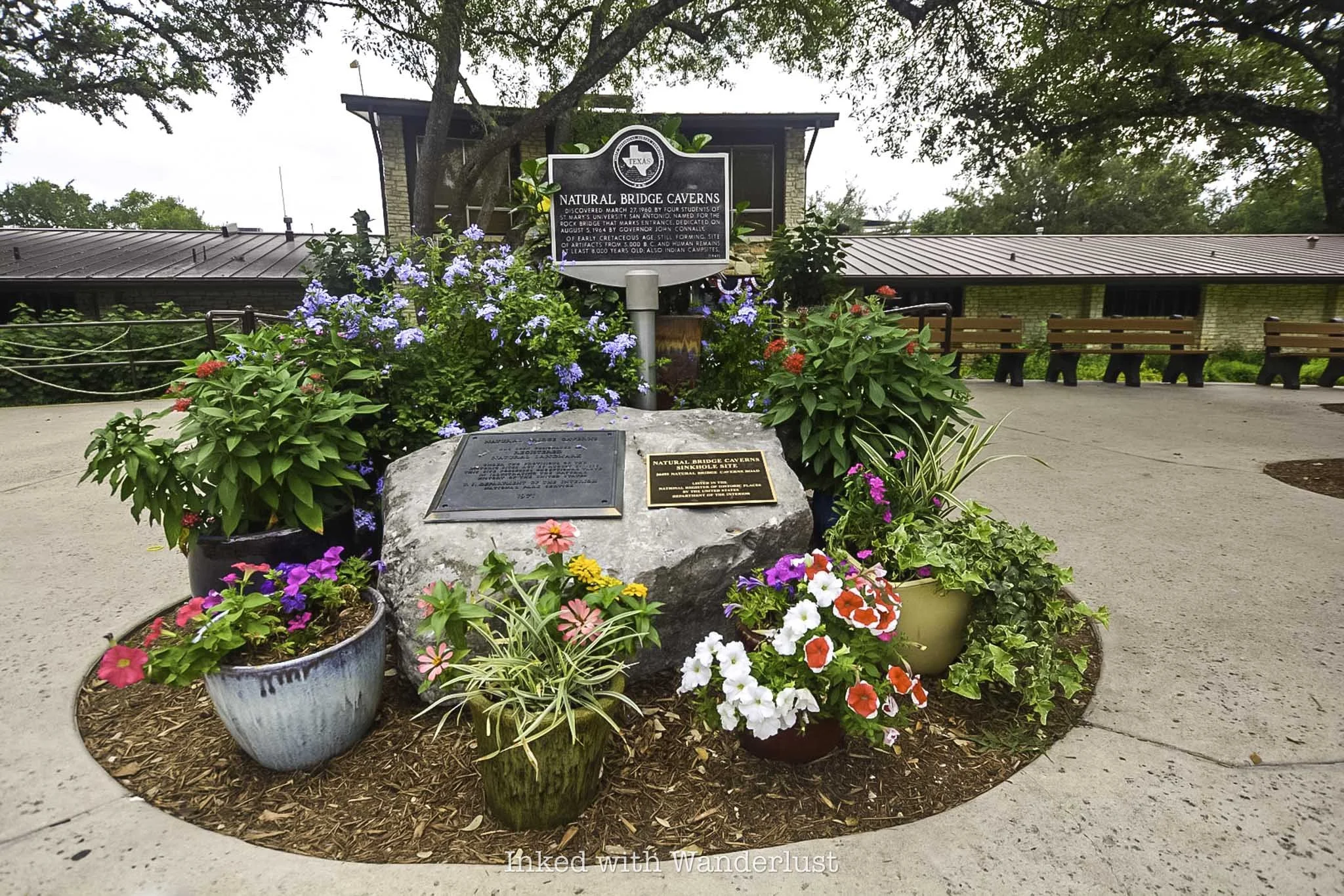
Natural Bridge Caverns Tour in San Antonio
Discovered in 1960 by a group of collage students on what was then vast ranch land, Natural Bridge Caverns has grown to become…
Disclosure: This post contains affiliate links. If you make a purchase through these links, I may earn a small commission at no additional cost to you. I only recommend products or services that I believe will add value to my readers.

Discovered in 1960 by a group of college students on what was then vast ranch land, Natural Bridge Caverns has grown to become one of the premiere natural attractions in Texas.
Not only is it the largest cavern by volume in the state, but it’s also the 7th longest and the most explored cavern. New chambers are being discovered, the most recent in 2022.
In addition to the caverns, the land also features several surface attractions such as a rope course, a series of zip lines, concert venue, gift shop and more.
If you’re planing a visit to San Antonio, taking a tour of the caverns is a must. In the post below, I will discuss tour pricing, options, what’s included, parking, and more. Let’s get into it!
Natural Bridge Caverns Ticket Prices, Tours and Parking
There are several tour options at Natural Bridge Caverns. The Discovery Tour, which is the most common, takes visitors through a series of chambers in the caverns. You’ll see several types of rock formations, including flowstone, soda straws, stalagmites, and more.
For the more adventurous, you can opt for the Hidden Wonders Tour. This tour takes you through newly discovered chambers not accessible on the Discovery Tour, a natural ballroom, and a captivating sound and light show.
In addition, you can opt for the combo ticket, which includes both the Discovery and Hidden Wonders Tour at a discount. Additional options include a lantern tour and an Adventure Tour for those who want to experience real-life caving.

Current pricing of the two main tours is:
Discovery or Hidden Wonders Tour: Starting at $37 per adult / $24 for children ages 3-11
Combo Ticket: Starting at $63.50 per adult / $41.25 for children ages 3-11
Do note that the surface attractions are not included with your cavern tour admission. These are priced individually or in a combo ticket. You can view further information for cavern tours and surface attraction pricing here.
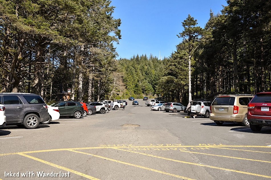
Parking is free and abundant. There’s a large, paved lot right in front of the entrance of the property. This entrance is also where you’ll find the gift shop and the various food options available.
Natural Bridge Caverns Discovery Tour

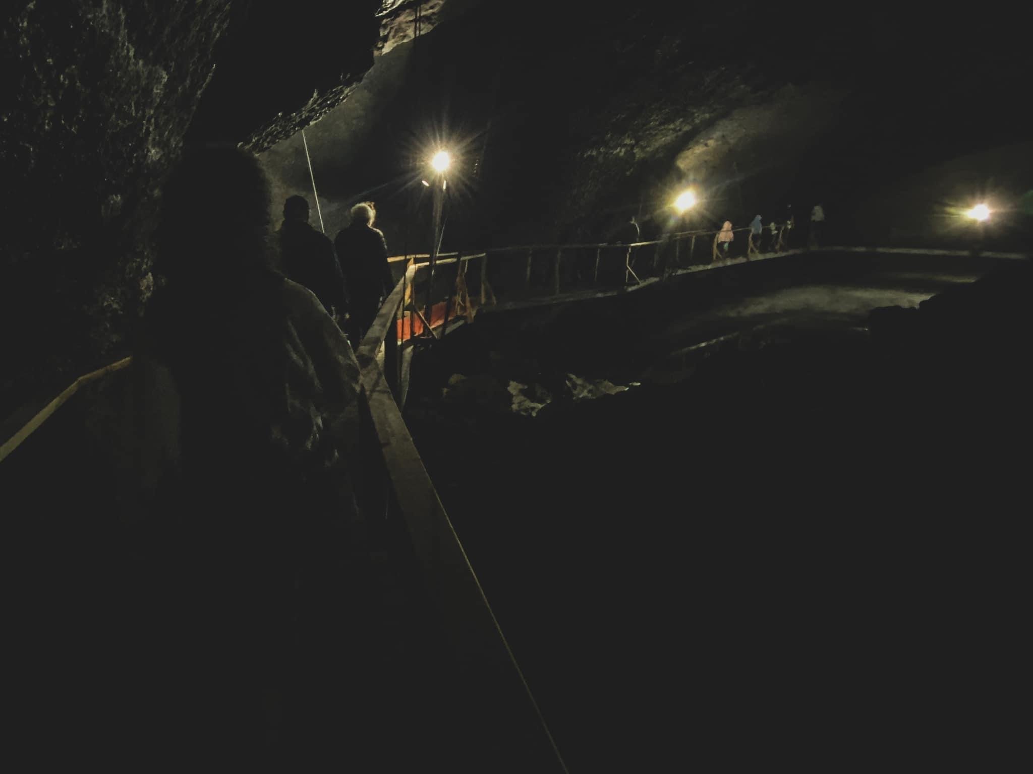
When my wife and I went to Natural Bridge Caverns, we opted for the Discovery Tour. After purchasing your tickets, you’ll make your way from the main entrance and over to the cavern entrance under the namesake natural rock bridge.
Your tour guide will make their introduction and explain to the history of the caverns, the natural bridge, the people involved in its discovery and more. As you make your way into the cavern’s narrow entrance, you’ll almost immediately notice the temperature change.


Regardless of when you visit, the caverns remain at a comfortable 70 degrees year-round. However, the humidity hovers around 99%, making a walk through the caverns a sweaty endeavor.
Your tour guide will, well, guide you through several rooms (or, chambers) in the caverns. Your group will be stopped in each one and be given information on what you’re looking at.


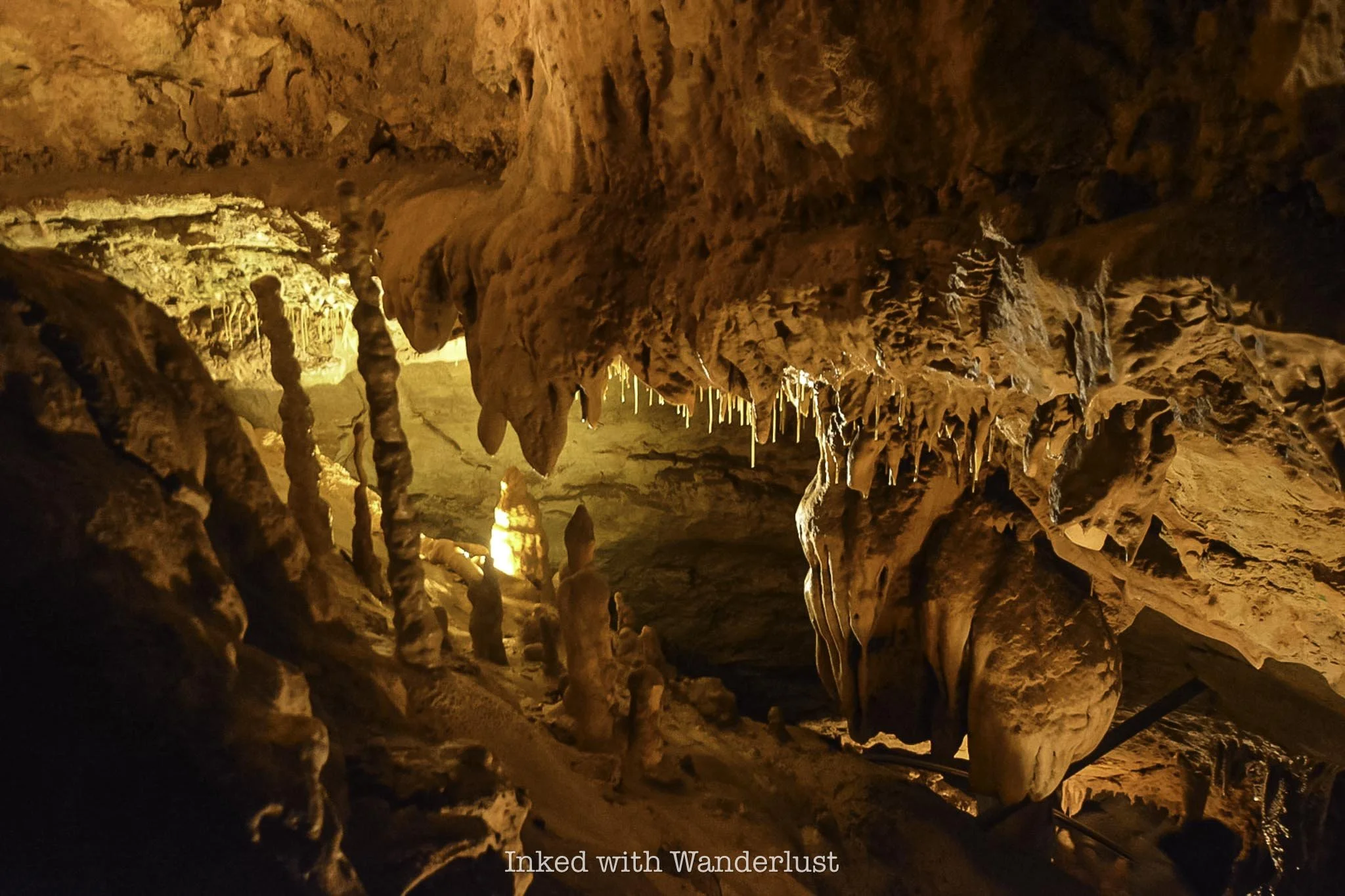
The tour takes about one hour and guides you through a well-maintained pathways. Initially, you’ll descend 180-feet into the cavern. After which, you’ll slowly ascend and descend again as you make your way through the varying chambers.
Each chamber has its own name, which is fitting because they’re totally unique in their own right. Some of these chamber names include:
Discovery Passages
Jaremy Room
Pluto’s Anteroom
Sherwood Forest
Emerald Lake
Grendal’s Canyon
As stated above, the pathways are well maintained but you’ll still need to watch your step and head. You are in a natural cavern, after-all. The chambers are well-lit, so there’s no need to bring a flashlight.


I’ve been to a number of caves but this one was easily one of the best. The cave formations are insane and often difficult for your eyes to process just how large they are.
As you reach the final chamber, you’ll be presented with dozens of soda straw formations, many of which exceed six feet in height. Here is where you’ll begin the final ascent to the surface.


The final ascent begins with a series of switchbacks to the top of the chamber room. After taking in the views from the top, your tour guide will then take you up a slightly steep ascent back to the surface.
Once you’re there, you can opt to check out some of the surface attractions or if you’re like me, head straight to the cafe to replenish the calories you’ll undoubtedly burn.
I highly recommend visiting Natural Bridge Caverns. Sure, it’s a ways away from other San Antonio attractions like the Alamo and River Walk, but it’s worth the effort to get to.
PSALM 32:8


The Ultimate Snoqualmie Falls Guide
Nestled just 30-minute or so drive from the hustle and bustle of downtown Seattle in the beautiful Snoqualmie…
Disclosure: This post contains affiliate links. If you make a purchase through these links, I may earn a small commission at no additional cost to you. I only recommend products or services that I believe will add value to my readers.
Nestled just a thirty minute drive from the hustle and bustle of Seattle in the beautiful Snoqualmie Mountains is one of Washington State’s most popular attractions, the 270-foot tall, Snoqualmie Falls.
While the falls have always been an amazing sight to see, an explosion of popularity occurred in the early 1990’s when the waterfall was prominently featured in the hit TV series “Twin Peaks”. It now brings in 1.5-million visitors, annually.
No visit to the area would be complete without at least making a quick stop to view it from the upper deck. Whether you spend ten minutes or two hours, coming out is worth the effort.
So whether you're looking for great day trips from Seattle or you want to spend a day away from the city, this guide has you covered. Let’s get into it.
Getting to Snoqualmie Falls

If you’re like most people, you’ll be coming to the falls from Seattle. It’s a fairly straight forward drive from the city to the upper plaza, making it the perfect day trip.
The exact milage will vary depending on where you’re starting from generally, it's a bit more than thirty minutes, one-way, with only a few turns.
From Seattle, the directions are as follows:
Look for signs pointing you to I-5 South and get on it.
Follow the signs to the I-90 East turn off and stay on it.
Take exit #25 toward Snoqualmie Pkwy and turn left on WA-18E
Turn left on Railroad Ave then stay on Railroad Ave after the traffic circle (3rd exit)
Shortly after, you’ll see the entrance for the falls on your left.
Parking at Snoqualmie Falls

You’ll have two options for parking and they’re both incredibly easy:
Option #1 would be the main lot right off the rim. It’s large enough to accommodate many vehicles but since it’s closest to the falls, there’s a fee. It’s $7 for a two hour period and $5 for each additional hour. The fee can be paid at the self-serve kiosks near the Visitor Center (you will need to know your license plate number).
Option #2 is the larger parking lot across the road that connects to the park via an overhead bridge. This lot can accommodate many more vehicles and is free. It’s also ADA accessible. So if the main lot is full, fret not. Just head across the street.
The recently renovated Visitor Center and Gift Shop are fully open to the public. It includes new exhibits, restrooms and an ice cream shop. Their hours are as follows:
Monday - Friday: 10am - 4pm
Saturday & Sunday: 9am - 4pm
Snoqualmie Falls Upper Viewing Deck

If you type “Snoqualmie Falls” into your phone’s GPS, it’ll likely take you the parking lot at the Upper Plaza. It’s the most visited area of the park as it provides that classic view of the falls from the rim.
Here is where you’ll see an exhibit of an old, used turbine. These are used in conjunction with the force of the falls to generate energy for the surrounding area.
We’ll go over this further into the post as it’s the Lower Plaza where you’ll see a grandeur example of this at work.

To the right of the turbine is where you’ll find the beginning of the trail that leads to another viewpoint and to the Lower Plaza below.
This trail is less than half a mile but you will drop you nearly 300 feet. While it’s fairly easy going down, coming back up will be challenging, unless you’re in decent shape.
Before descending the trail, there’s another viewpoint worth checking out. This is called the, “Peregrine Viewpoint”. Named after the birds who inhabit this area. It’s a little further down and it’s a slightly more straight-on view of the falls.
Lower Park Plaza

The Lower Plaza is not as well known. It is here where you’ll get the “down below” view, access to the Snoqualmie River and see the energy producing turbines up close and personal.
You have two options to get the lower plaza from above:
As stated above, you can hike the roughly half mile trail. It’ll take you straight to it but you will have a jaunt going back up. It’s not advisable if you’re not in decent shape and/or don’t have the proper footwear.
Your other (much easier) option would be to drive to it. Turn left out of the main lot or right out of the free lot and head down the road for a few miles. You’ll turn left on Fish Hatchery road and follow that until it terminates at the lower plaza parking lot.

You’ll find the trail leading to the lower viewing deck to the right of the visitor center. Before reaching the boardwalk, you’ll see further examples of turbines and other process equipment with literature explaining how they were used.
Past here, you'll head down a series of stairs and onto a scenic boardwalk with the roaring Snoqualmie River on one side and beautiful moss covered trees on the other. This short journey to the deck is worth the visit all its own.
I didn’t check the exact amount of time it took to reach the deck from the parking lot but including stops to check out the turbines and take photos, it probably took me less than 10 minutes.


The deck is fairly small and can comfortably fit a dozen or so people at a time. Keep this in mind if you’re visiting on a particularly busy day.
The view of the falls from the deck is unique compared to the top. In my opinion, it’s superior to the rim view, as you get the river and surrounding greenery creating a magical scene.
Once you’ve gotten your fill of the views and took your pictures, simply turn around and head back the same way you came in.
Best Time to Go

That’s relative to your personal tastes. Most will tell you spring is the best time due to the fresh run-off from the mountains. If your goal is to see Snoqualmie at its fullest, spring would be the time.
I was here in early March (not quite spring). The runoff was decent and there were no crowds to deal with. Weather wise, the warmth of summer would be the way to go, but it’ll be the most crowded.
Late September and October will bring beautiful fall foliage to complement the scenery around the falls. Winter, while easily the least crowded of any season, brings cold weather with possible snow and ice.
My personal recommendation would the months of eMarch or April. Chances of snow and ice are minimal, as are the crowds. The runoff, in my experience, is good but your results may vary. It was a bit chilly during my visit, but the lack of crowds made it worthwhile.
Nearby Attractions

While making the trip from Seattle to Snoqualmie to see the falls is more than worth the effort, it isn’t exactly an all-day outing.
We were able to see the falls and what it had to offer in a couple hours. Since you’re heading out there anyway, may as well see what else Snoqualmie has to offer.
Hiking Trails

There are many hiking trails in the area. The most popular being Rattlesnake Ledge. The trailhead is located about 10 minutes from the falls in Snoqualmie Point Park and while it requires some effort to complete, it’s short and sweet with an epic payoff. Check out AllTrails for more information on that.
Historic Train Museum

Located on the side of the road heading into downtown Snoqualmie is a line of preserved, historic trains, free for public viewing.
There’s an easy, paved trail that runs alongside all of them and makes for an excellent outing for families with small children.
Local Shops & Restaurants

Along the main road that cuts through town you can find many local shops and eateries to dine at. Supporting local businesses, especially now, is a great way to complete the experience. My personal favorite, Caadxi Oaxaca, serves up amazing spicy pork and fish tacos
Lodging
If you’re keen on staying in the area, you have a few options. You have your standard chain options such as Holiday Inn and SpringHill.
If you’re a Marriott Bonvoy member, you have a couple options in nearby Redmond and Bellevue. The best option, however, would be the Salish Lodge and Spa. It overlooks the falls at the rim and is an utterly beautiful property.

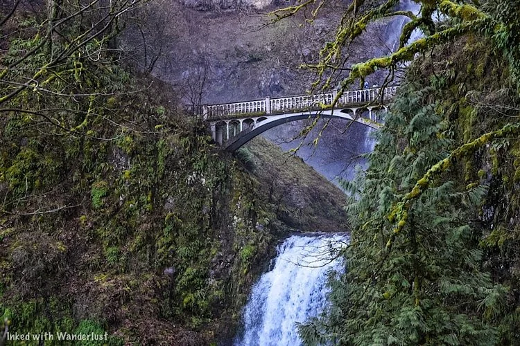
The Ultimate Multnomah Falls Guide
At 611-feet (between the upper and lower portions), Multnomah Falls is the tallest waterfall in Oregon and the crown jewel…
Disclosure: This post contains affiliate links. If you make a purchase through these links, I may earn a small commission at no additional cost to you. I only recommend products or services that I believe will add value to my readers.
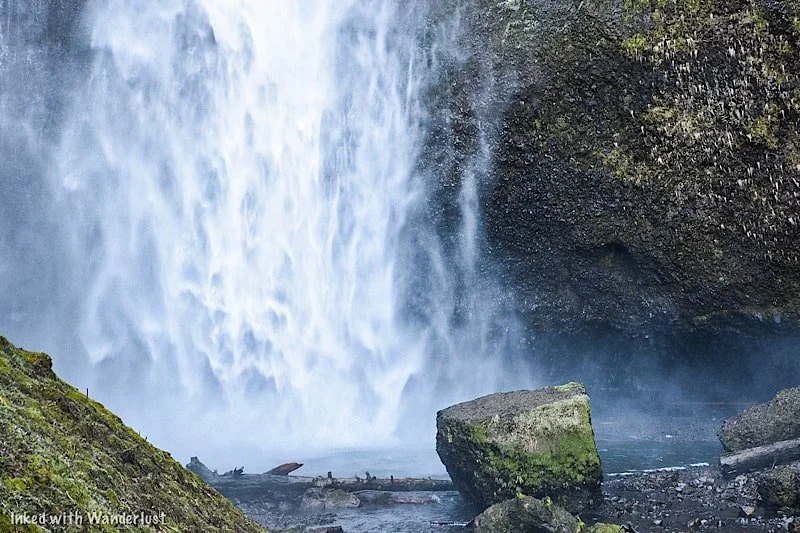
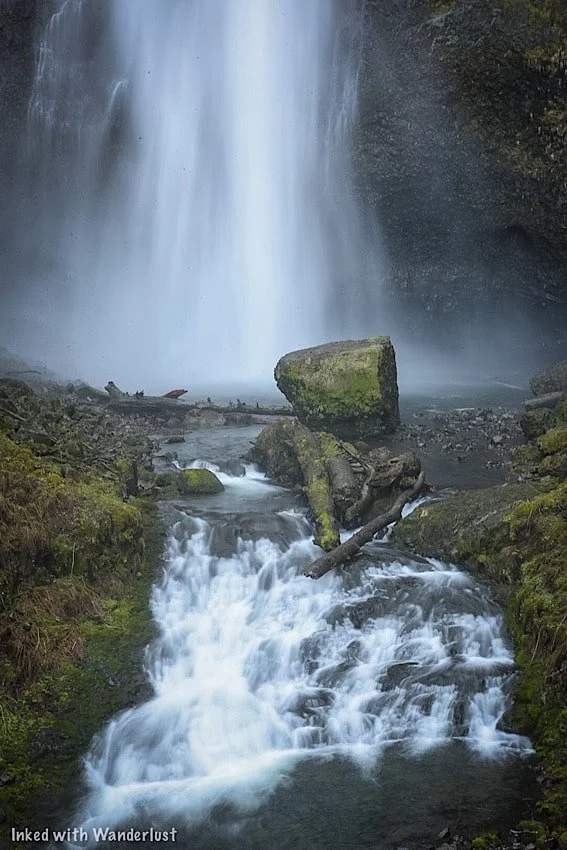
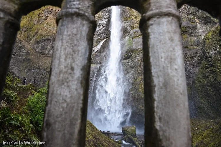
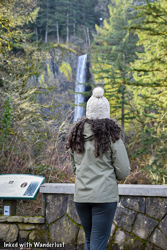
At 611-feet (between the upper and lower portions), Multnomah Falls is the tallest waterfall in Oregon and the crown jewel of the state.
It’s been on our bucket list for quite some time and recently, we were fortunate enough to finally see it for ourselves. Let me tell ya, it was every bit as epic as we were expecting.
We discovered, however, that depending what time of year you go, it isn’t as simple as just, ‘showing up’. You will have a few things to iron out before going.
So what do you need to know before going? Will you need a permit? Is there an admission fee? How do you get there? We cover all of that and more below. (Updated for 2025.)
*A big fire ripped through this area a few years ago and severely damaged many trails. Some have been repaired and reopened, but others remain closed. For up-to-date information on trail closures and what’s open, refer to the website, “Ready Set Gorge”.
*Multnomah Falls, including its trails, are open to the public.
Directions To Multnomah Falls
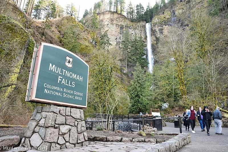
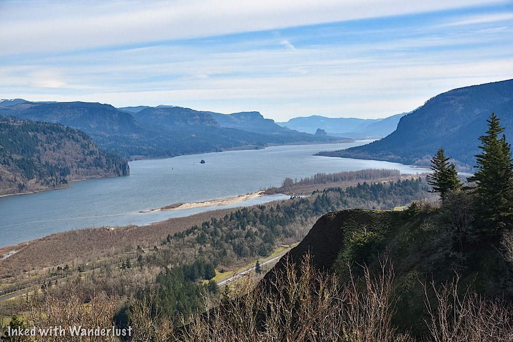
Multnomah Falls is easy to get to and is conveniently located right off of the Columbia Gorge Historic Scenic Byway.
The nearest town to it is Troutdale, Oregon, but it isn’t far from major cities like Portland and Vancouver. In fact, it’s only a 30-minute(ish) drive from either.
Distance to Multnomah Falls
From downtown Portland: 32 miles or a 35 minute drive
From Portland Airport: 26 miles or a 30 minute drive
From downtown Vancouver: 34 miles or a 40 minute drive
From Salem, Oregon: 75 miles or a 1 hour and 20 minute drive
From Eugene, Oregon: 140 miles or a 2 hour and 15 minute drive
It’s one of the most visited natural sites in the Pacific Northwest, so road signage is plentiful. Plugging in, ‘Multnomah Falls”, into your GPS of choice will get you there easily.
What we suggest you do, especially if you’re coming from Portland, is to start at Vista House and then work your way from waterfall to waterfall along the Historic Columbia River Highway.
Multnomah Falls Parking

There are two parking lots at Multnomah Falls. The closest is the small one directly across the street from the lodge along the historic highway. By our estimate, it can hold around fifty vehicles.
If you’re able to snag a spot here (like we did), it’ll grant you the fastest and most convenient access to the falls. Just cross the street and you’re there. In addition, you won’t need a parking permit.
It’s a small lot, though. We were here in March, arrived early, and got the second to last available spot. In the summer months, it can and does fill quickly.
The larger lot is right off of I-84 via exit 31. A walking path leads you from the lot, under the highway and to the crosswalk. There’s no fee during the off-season. However, between May and September, you’ll need a timed use permit (more on that below).
Multnomah Falls Timed-Use Permits
During the summer months, you will need a timed reservation in order to park at the I-84 lot (exit 31). In 2024, the official timeframe is May 26th - September 4th.
*Note: There hasn’t been an announcement as of yet pertaining to timed reservations for 2025. However, considering the program’s success over the prior two seasons, I expect more of the same for 2025.
Timed reservations are made through Recreation.gov and there are two options to consider:
Option One: Timed reservations become available 14-days from your desired date, starting at 7am PST, on a rolling daily period. For example, if your desired date is August 15th, reservations become available August 1st. at 7am PST.
Option Two: A certain (unspecified) amount of timed reservation permits will be available for same-day, in person pick up at the Gateway to the Gorge Visitor Center in Troutdale and at the Cascade Locks Historical Museum.
The fee for a reservation is $2.00, per permit. You’ll only need one permit, per vehicle. This is NOT a per person charge. If you arrive early enough and find parking at the small lot along the historic highway, a timed use permit is NOT required.
In 2022, Oregon officials decided to restrict access to the historic highway (waterfall corridor) between Bridal Veil Falls and just past Multnomah Falls via a timed use permit during the summer months.
For 2023 (and presumably beyond), they’ve decided to contain the permit requirement to just the I-84 parking lot for Multnomah Falls. You will NOT need an additional permit to access the waterfall corridor.
Some other things you’ll need to know:
You must arrive at the time stated on your reservation. You’ll be given a one-hour grace period. After that, your reservation becomes invalid.
You can show either a printed copy or the digital version (preferred).
Drop-offs in front of the Lodge will not be allowed.
Once you’re there, you can stay for as long as you like.
Timed reservations are NOT required if you arrive via shuttle, bicycle, or tour.
Shuttle Service To Multnomah Falls
Taking a shuttle to Multnomah Falls is an excellent alternative to driving and dealing with the traffic congestion.
There are numerous operators, each with their own fees, operation schedules, and pick-up locations. All, however, offer hop-on/hop-off privileges at all the main sites.
These include:
Multnomah Falls
Crown Point (Vista House)
Latourell Falls
Bridal Veil Falls
Wahkeena Falls
Horsetail Falls
And more!
Fares vary, but between the three that we’ve found, it seems to be a range of $15 - $21, per adult. Some include one child in the price.
Here are the shuttle operators. Tap or click the name to go to their website:
The cost of shuttles are way more than the reservation fee for sure, but the advantages of not having to worry about getting one at all or dealing with parking may be worth it to you.
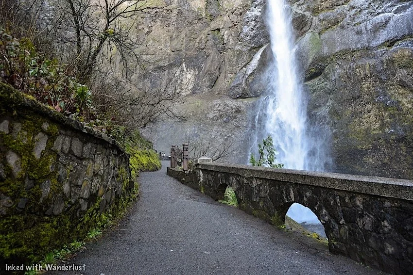
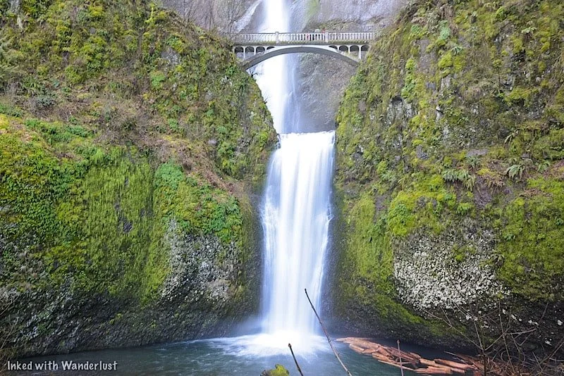
Lower Viewing Deck

The main viewing deck is in front of the lower section of the falls. It’s the easy to get to as it’s just to the left of Multnomah Falls Lodge.
There’s a ramp to the right of the stairwell enabling access for wheelchairs and strollers. You can enter the ramp near the lodge’s snack bar.
It’s where most people view and photograph the falls from and is open year round. Even on a busy day, there’s plenty of elbow room.
Benson Bridge
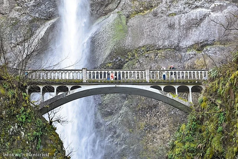
The footbridge is a unique feature of Multnomah Falls. It is named after a man named Simon Benson, who is the person responsible for the bridge’s conception.
It was built in 1914 and is made of reinforced concrete. It spans across Multnomah Creek, between the waterfall’s two cascades, 105-feet above the base of the lower fall.
It provides unparalleled views of the upper section and connects visitors to the trail leading to the top of Multnomah.
To access the bridge, you’ll see an iron gate to the side at the lower viewing deck. Go through the gate and continue up the Larch Mountain trail.
*During winter, the bridge is known to freeze over. If this occurs, that gate will be closed and visitors are not allowed past that point.
From the lower viewing deck, it’s a 2/10’s of a mile, steadily uphill walk to the bridge. It is paved and the falls are within view nearly the entire route.
Hiking Trails To The Top & Beyond
If you’re feeling up to it, you can continue for another 8/10’s of a mile (one-mile from the bottom) to the top of Multnomah Falls.
You’ll be going up switchbacks the entire way and there’s a small viewing deck at the end overlooking the top of the falls.
We decided against this as the bridge was fairly iced over and we were told by others coming back down that the trail itself was worse.
If it’s warmer while you’re here, we definitely recommend going up there. We’ll be doing it on our next visit for sure.
There are two other destinations you can reach from this trail. They are:
Wahkeena Falls: Via the Wahkeena Trail portion, you’ll continue past the upper deck of Multnomah Falls and will eventually reach Wahkeena Falls, passing multiple other waterfalls along the way. Total milage from the bottom is 1.8-miles.
Larch Mountain: For those looking for a challenge, hike up to Larch Mountain. Based on the pictures we’ve seen, the views are spectacular. Total milage from the bottom is 6.8-miles.
SEE MY TOP RECOMMENDATION FOR A DAY HIKE BACKPACK ON AMAZON HERE!
Multnomah Falls Lodge

Multnomah Falls Lodge is an authorized concessioner providing many amenities to visitors. It features a gift shop, restroom, restaurant, and espresso bar.
If you want to dine here, specifically in the summer months, reservations are highly ecouraged. If you want to check out their menu, go here.
If you’re like us and visit during the off-season, you shouldn’t have a problem getting a table. We walked in and we’re seated right away.
The service was great, we were seated at a table with a great view of Multnomah, the beer was cold, and the food was good.
Nearby Lodging
Despite the name suggesting so, Multnomah Falls Lodge doesn’t have a hotel attached to it.
If you’ll be spending the majority of your vacation in the Columbia River Gorge, here are a few hotels located nearby:
Columbia Gorge Hotel: In Hood River, Oregon, 25-miles east
Best Western Columbia Inn: In Cascade Locks, Oregon, 11-miles east
Edgefield Manor: In Troutdale, Oregon, 18-miles west
So where should you stay? That’s dependent on your preferences, plans, and budget. If you’re coming strictly for the gorge, we would recommend staying in Troutdale or Cascade Locks.
If you plan to visit Portland as well, basing yourself in the downtown area and driving/shuttling into the gorge may make more economic sense.
Weather and Best Time To Go
We visited Multnomah Falls in March of 2022. The weather, while a bit chilly in the morning, was great and we experienced very little in the way of crowds.
If your goal is to see Multnomah at its peak flow and the least amount of visitors possible, we recommend visiting in either winter or mid-spring.
Just keep in mind that due to the mist from the upper fall, Benson Bridge often freezes over and thus, the bridge and trail closes to the public for safety.
In winter, the lower viewing deck could also be frozen over due to snowy conditions.
During our visit, the bridge was partially frozen, but open. We witnessed more than a few people nearly eat concrete (including us) because of it.
If you want to ensure that you can access the bridge, then summer or fall would be the times to go. However, these months come with their own downsides:
Crowds get thick.
Parking can be difficult to come by.
You’ll need a timed reservation to go.
The flow dies off a little bit (winter/spring is the peak).
It’s hot (summer)
If you can stomach the above challenges, then visiting during summer or fall would be the way to go if Benson Bridge is important to you.
For our next visit, we plan to go during the fall. We’ve seen photographs of the fall foliage in the gorge and it is simply stunning.
Additional Information & Reminders
There are no EV charging stations. The nearest ones are in Troutdale, Oregon, west of Multnomah Falls.
Drone use is prohibited. It’s painful, but true. As of January, 2022, the use of drones at Multnomah Falls is prohibited.
Reservations may be required. If your visit coincides with the mid-May to mid-September timeframe, you will need a reservation through recreation.gov.
There are amenities. There’s a clean restroom, gift shop, ATM, snack bar, and restaurant on-site, but no lodging. The closest hotels are in either Troutdale or Cascade Locks.
The bottom platform is handicap accessible. There’s a ramp adjacent to the stairs leading to the bottom platform. All of it is paved. The trail going to bridge, while paved, is not accessible.
Pets are allowed. As long as they’re leashed, you can bring your pet.
Benson Bridge may be closed during your visit. If it freezes over, Benson Bridge closes to the public.

A Quick Note…
We’re often asked about the equipment we use to capture the photos on our website. Below, we’ve added Amazon links to those products and others we recommend.
If you decide to purchase, Amazon will pay us a small commission at no additional cost to you.
“Understanding Exposure” by Bryan Peterson (this book is a great resource for anyone starting out in photography)
“The Landscape Photography Book” by Scott Kelby (another great resource for beginners)

Take A Self-Guided Tour of Pittock Mansion in Portland
Welcome to the historic splendor of Portland’s crown jewel - Pittock Mansion. Perched atop the West Hills, this elegant…
3 minute read | contains affiliate links
Welcome to the historic splendor of Portland’s crown jewel - Pittock Mansion. Perched atop the West Hills, this elegant chateau beckons visitors with its captivating architecture and breathtaking views.
Embark on a journey through time as we delve into the rich history and opulent charm of Pittock Mansion, offering a glimpse into the lives of Portland's most influential family.
Join us as we uncover the fascinating stories and hidden treasures that await behind the doors of this iconic landmark.
As I usually am with these types of posts, I’m going to be vague when discussing the tour and what you’ll see as I don’t want to spoil everything.
I’ll first go over the parking situation at Pittock Mansion, as well as tours offered and admission fees. Then, I’ll discuss the history of the mansion and its former owners, while showcasing photos I took that’ll provide a glimpse into what you’ll see on the tour.
Let’s get into it!
Disclosure: This post contains affiliate links. If you click through and make a purchase, I may earn a commission at no additional cost to you. Thank you for supporting us!
Pittock Mansion Location, Parking & Admission Fees

Pittock Mansion (pronounced Pit-Tick) is located within one of Portland’s Forest Park, and is near many popular attractions such as the Portland Japanese Garden, Oregon Zoo, and the Wildwood Trail (which will also take you to the famed Witches Castle).
For GPS purposes, its address is:
3229 NW Pittock drive
Parking at Pittock Mansion is easy with its large, paved lot near the mansion’s entrance. The mansion is part of Portland’s “Pay to Park” program.
The parking rate here is $2 per hour with a daily maximum of $8. The enforcement hours are between 9:30am - 8:00pm, inclusive of holidays. You can see up to date rates and additional information at Portland.gov.
Currently, the only tour offered is self-guided and you’ll need to pay for admission. Pittock Mansion tour prices (as of July 2023) are:
$14.50 (Adults)
$12.50 (Seniors 65 & up)
$10.50 (Children 6 - 18)
Free (Children 6 & under)
During the self-guided tour, you’ll have access to the mansion itself and the grounds. Currently, there is no access to the Gate Lodge. You can check the status of that here.

Tour tickets can be purchased on site (not recommended during summer months) or online. You’ll be asked to choose your date of visit and an entry time.
Keep in mind that you don’t need to purchase a ticket in order to visit the grounds. You’ll only need one if you actually want to see the interior of the mansion.
Pittock Mansion History & Tour Photos

Pittock Mansion was built in 1914 by Henry and Georgiana Pittock, who are considered to be the founders of Portland as we know it.
Henry and Georgiana would arrive to Portland (separately) in the mid-1850’s. Henry would go on own the successful newspaper, The Oregonian (which prints to this day), and become a savvy investor in industries such as real estate, silver mining and the railroad.
Georgiana would become an influential leader and figurehead in Portland, founding many local charities and organizations, such as The Ladies Relief Society, Women’s Union, and The Martha House.

The 16,000 square foot, French Renaissance style home was designed by architect Edward T. Foulkes with all the latest (of the time) technology.
As you’ll likely notice, the mansion was built in an oval shape with 45 degree angled wings. This was done to enable a commanding view of downtown Portland and the beautiful Cascade Mountains.

There are 23 rooms contained within the mansion, of which include; a sewing room, smoking room, music room, library, five large bedrooms and two sleeping porches.
You’ll have access to view many of the rooms listed above. You’ll also ascend the multi-level dueling grand staircase, with marble flooring throughout, as part of the tour.


Henry and Georgiana weren’t the only two that lived here. In fact, many members of their extended family moved in with them when construction completed.
This included their two daughters and their husbands, as well as their three grandchildren, Rhoda, Georgiana, and Peter (who was born in the mansion). Their two orphaned nieces also took up residence in the hilltop home.

As fate would have it, Henry and Georgiana would only enjoy the mansion and its splendors for four years. Georgiana would pass away in 1918 from stroke complications, with Henry following suit just a few months later.
The family continued to live in the mansion well into the 1950’s, with grandson Peter and his father, Edward, being the final residents.
In 1958, they moved out of the mansion and put it up for sale. After sitting empty for four years, the mansion was heavily damaged by a hurricane-like storm and consequently fell into disrepair.
By 1964, developers set their sights on the mansion, wanting to bulldoze it to make way for a new housing development. Portlanders, however, had something else in mind.
Citizens rallied against the idea of a development and instead demanded the mansion be repaired and preserved. The city agreed, paying a cool $225,000 for the property ($67,500 of which was raised by citizens).

Repairs took fifteen months to complete but by late 1965, Pittock Mansion opened to the public. The transformation from a private, luxurious residence to a historic museum was complete.
Today, the Pittock Mansion Society, a local non-profit, manages the day-to-day operations of the property and ensures it’s preservation for all.

I hope you’ll consider visiting and taking a tour of Pittock Mansion during your trip to Portland. It’s truly a beautiful property and a classic Portland experience.
Please support this website by subscribing to the newsletter below.
Thank you for reading.

Gilda’s: A Wonderful Italian Restaurant in Portland
During our trip to Portland last year, my wife and I were looking for a nice Italian restaurant for our anniversary…
2 minute read | may contain affiliate links
During our trip to Portland last year, my wife and I were looking for a nice Italian restaurant to host our anniversary dinner. After scouring Yelp, we landed on Gilda’s.
Based on reviews, locals and visitors alike seemed to enjoy it (which is rare) and the dimly lit, semi-casual atmosphere seemed right up our ally.
Additionally, it isn’t a chain. It’s locally owned and operated, which is something we make a point of supporting during our travels.
Take all that and combine it with the fact that it was a quick 15 minute walk from our downtown area hotel and it was a no-brainer.
So if you’re looking for an Italian restaurant in Portland, read on to find out about our experience, what we ordered, our recommendations and more!
Restaurant Info
Location: Portland, OR
Address: 1601 SW Morrison Street
Cost: Mid - high range
Food: Italian
Open: Lunch & dinner (closed for a couple hours in between)
Seating: Indoor. Dining room and lounge available
Alcohol: Extensive beer, wine and cocktail offerings
Website/Menu: www.gildasitalianrestaurant.com
Our Visit: March 2022
Disclaimer: I am not a professional restaurant critic, nor has this restaurant offered me any incentive to write this post. My opinions are my own and are based on my personal experience only.

Gilda’s is located in the Portland neighborhood of Goose Hallow, on the ground level of the historic Commodore Hotel.
It was opened by Chef Marco in 2010 and expanded in 2012 with the opening of the lounge in the adjacent space.
Chef Marco received his culinary training at Apicious International School of Hospitality in Florence, Italy. He credits his mother and grandmother (Gilda) as his early culinary influences.

As you may have guessed, the restaurant is lovingly named to honor Grandma Gilda, who sadly passed away in 2008, just two years before its opening.
According to the website, Grandma Gilda was known for her love of cooking homemade pasta, pizzas, soups and desserts for family and friends.
To her, food equalled love, and that’s the same passion for cooking Chef Marco committed to bringing to the City of Roses.


The dining room is dimly lit with Italian themed decor throughout, giving off a romantic, yet cozy atmosphere. A large photo of Grandma Gilda hangs deservedly near the entrance.
The menu consists of many Italian classics you know and love such as rigatoni, spaghetti and meatballs, and pappardelle, as well as rotating specials.
They also have an extensive libations menu consisting of a variety of beers, wines and cocktails. I deviated from my usual Old Fashion to try their Blackberry Lemon Drop (and I have no regrets).

Its base is Tito’s Vodka (a popular brand out of Austin, Texas) mixed with fresh lemon juice and blackberry coulis, finished with a lemon wedge and sugared rim.
I may or may not have ordered a few of these as I found the drink delicious, never mind smooth and perfectly crafted.


We were served a starter of their garlic bread with a side of tomato sauce. If you like garlicky-garlic bread, this is for you.
For our entrees, my wife ordered their special at the time, an oxtail dish. Speaking truthfully, she was let down by it as she felt the oxtail was overcooked and lacked sufficient flavor.
I kept it simple by ordering the Rigatoni Alla Bolognese, a house staple that I thoroughly enjoyed. The housemade pasta was perfectly cooked, the sauce had excellent flavor and I received a generous heaping of parmesan.

To finish the meal, we ordered the Italian classic, Tiramisu. I’ve yet to have a bad Tiramisu and Gilda’s was no exception (I bit into it before getting a picture).
Aside from my wife’s dish, we had a great experience at Gilda’s. If we’re ever in Portland again (and we definitely will be), we wouldn’t hesitate to book a table.
Whether you’re a visitor looking for a great place to eat in Portland or a local looking for a date night meal, I hope you’ll consider Gilda’s.
Please support this website by subscribing to the newsletter below.
Thank you for reading.

Shoshone Ice Caves: A Unique Family Activity in Southern Idaho
Welcome to a chilling adventure into the depths of Southern Idaho's mesmerizing Shoshone Ice Cave! In this guide…
3 minute read | may contain affiliate links
Welcome to a chilling adventure into the depths of Southern Idaho's mesmerizing Shoshone Ice Cave! In this guide, I invite you to join us on an extraordinary tour through this natural wonder.
Discover the hidden marvels and geological wonders that lie beneath the Earth's surface as you delve into the mysterious corridor and icy formations of the Shoshone Ice Cave.
Unveil the fascinating history, unique features and breathtaking beauty of this subterranean wonderland. Prepare to be awestruck as we explore the secrets of this icy realm and provide you with all the essential information you need to plan your own unforgettable journey.
Let's embark on an exploration like no other and uncover the enchantment of the Shoshone Ice Cave!
Disclosure: This post contains affiliate links. If you click through and make a purchase, I may earn a commission at no additional cost to you. Thank you for supporting us!
Shoshone Ice Cave Location, Parking & Fees

The Shoshone Ice Cave is located in the Southern Idaho city of Shoshone, about 20-minutes from the downtown area.
It’s about two hours southeast of Boise and slighty less than an hour north of Twin Falls (an equally great area to visit).
You can see the entrance from the highway as the red logged structure makes it easy to spot (never mind the giant green dinosaur).
That red structure is where you’ll check in and present/purchase your tickets and is also where the tour will begin. Parking is abundant and free.

The only tours available are guided. Self-guided tours are not permitted. Fortunately, the prices for the tour are reasonable.
As of July 2023, tour ticket prices are:
$12 (Adults - age 13 years & up)
$8 (Child - ages 4 - 12)
Free (Children ages 3 & under)
Keep in mind that while children are welcomed, the trail to and inside the cave isn’t stroller (or wheelchair) friendly.
The cave is open to the public May 1st - September 30th each year. Tours are available every hour between 9am and 7pm during peak season.
Shoshone Ice Cave Tour
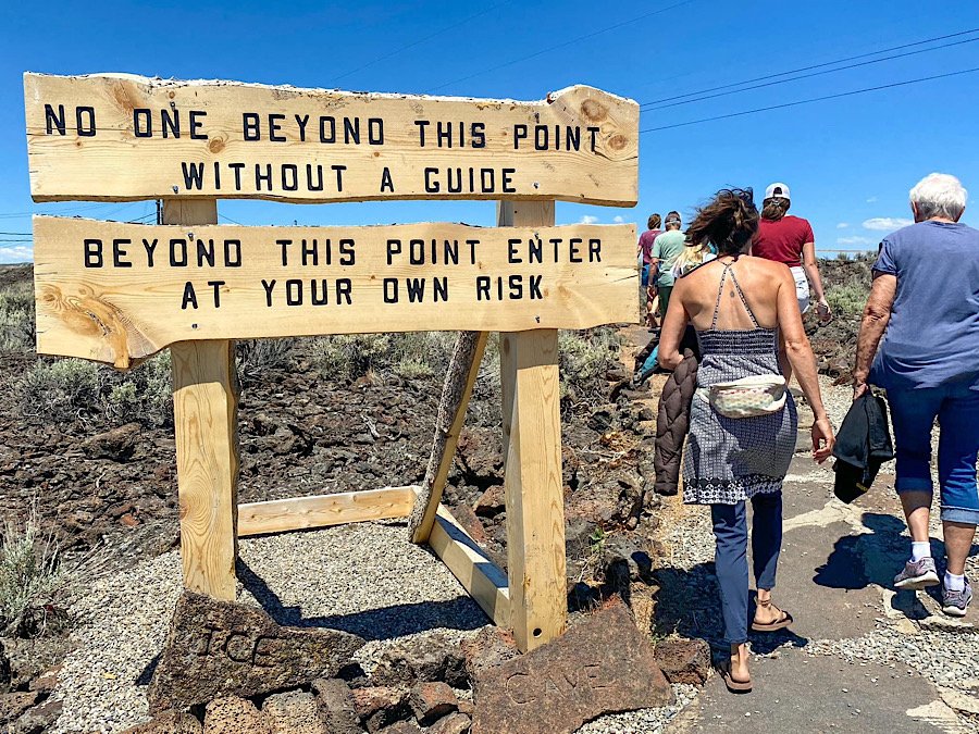
Your tour will begin behind the gift shop through the back door. Your knowledgable tour guide will go over a brief safety discussion and breakdown the history of the area.
You’ll follow your guide along a short trail through a lava field as you make your way to the mouth of the cave.


If there’s another group still in the cave, your guide will have you wait while they make their way out. The trail inside is narrow, so they keep it to one group at a time.
As you make your way down the rocky stairwell towards the mouth of the cave, you’ll immediately notice the temperature difference as it gradually cools.

It’ll become more apparent as you enter the cave proper. No matter how hot it is outside, the temperature of the cave varies between 23 - 33 degrees, year round.
*Pro Tip: Even if you’re here in the dead of summer, bring a hoodie
After entering, you’ll make your way down a wooden staircase which will lead you to the wooden boardwalk that traverses above the 1,000 foot long ice block.


The ice block varies in depth from 8 to 30 feet thick and runs nearly the entire length of the cave. Some additional stats of cave are:
It is 100 feet under the surface
1,700 feet long
50 feet wide
and 45 feet in height
The only light in the cave is artificial and minimal. It’s lit up just enough to allow you to see where you’re going.
You’ll eventually reach the dead-end where your guide will further discuss the cave and demonstrate how dark the cave naturally is by briefly turning the lights out.

From here, you’ll turn around and go back in the same direction you came. After exiting, you’ll return to the gift shop via another trail and get brief views of additional cave entrances.

Before leaving, feel free to support them by browsing the gift shop and checking out the statue attractions in the parking lot.
I hope you’ll consider taking a tour of the ice cave. My wife and I enjoyed it immensely and thought it was a cool experience.
Consider visiting another exciting cave just a few miles away from this one:
Please support my website by subscribing to the newsletter below.
Thank you for reading.

Latourell Falls: A Stunning Waterfall Near Portland Oregon
Of all the waterfalls in the Columbia River Gorge, Latourall Falls, a 224-foot single-plunge fall, is the closest to Portland…
2 minute read | contains affiliate links
Of all the waterfalls in the Columbia River Gorge, Latourall Falls, a 224-foot single-plunge fall, is the closest to Portland.
It’s also your first introduction to what is known as the, “Waterfall Corridor”, a miles-long road featuring an endless amount of waterfalls.
So how do you get to Latourell Falls? How long is the trail? We answer all these questions and more below.

Quick Stats
Location: Guy W. Tolbot State Park (Corbett, OR)
Fee: None
Permit: If you’re here during the summer season, you’ll need a permit to access the waterfall corridor
Open: Year round
For: Hikers
Restroom: In the parking lot
Parking: Large lot at the trailhead
EV Stations: None
Difficulty: Easy
Popularity: High
Trail Type: Loop
Mileage: 0.2 - 2.4 miles (depending how far you take it)
Elevation Gain: Up to 639-feet
Condition: Maintained
Features: Two waterfalls if you complete the loop
Pets: Allowed on leash
Drones: Not permitted
Hazards: During winter or late spring, the trail can be dangerously icy
Our Visit(s): March 2022
Getting There & Parking

If you’re like most people, you’re probably coming from Portland. If so, then plug, “Vista House”, into your phone’s GPS.
Be sure to pull over and spend some time taking in the views of the Columbia River Gorge from here. They’re stunning.
When you’re done, get back on the road and continue going around the Vista House. From there, it’s only 2.5-miles to Latourell Falls.
Shortly after crossing a moss-covered bridge, you’ll see the parking lot on your right. It’s a fairly large lot with restrooms.
Decide Between The Loop or The Base
Latourell Falls can be partially viewed from the handicap accessible viewing deck adjacent to the parking lot.
For the full experience, though, take either the paved, short trail to the base or complete the full loop.
The trail to the base of the falls is just 0.2-miles (or about a 5-minute walk)
The loop trail is 2.4-miles and takes you up and over to another waterfall (Upper Latourell) and then down to the base of Lower Latourell.
If at first you decide to go to the base but later change your mind and want to do the loop, cross the footbridge at the base and continue on.
If you want to begin with the loop, you’ll see the trailhead to the left of the base trail. It’s an immediate climb from the get-go.

We were here in March and it was especially rainy and cold that morning. Due to this, much of the loop was iced over. So we just did the base.
As stated above, the trail to the base of the falls is mostly paved and only takes about 5-minutes.
This portion of the trail ends at a small look-out directly next to the waterfall. It enables you to get very close.


Due to this, expect it to be misty and on top of that, icy if you’re here in winter or early spring.
The area around the falls is like a fairytale with all the moss covered trees. Even the fall’s basalt-rock wall has moss all over it.
To your right, you’ll notice a footbridge crossing over the creek. This is where you’ll continue along the loop if you wanted.


This footbridge can be especially icy in the right conditions. It was when I was there. I almost biffed it a few times trying to take these photos.
If you don’t want to continue onto the loop, simply head back the same way you came to return to your vehicle.

Additional Waterfalls Nearby
Latourell Falls is only the beginning. There are many, many more waterfalls as your progress further down the corridor.
A few of those are:
Bridal Veil Falls: Read about our visit here
Wahkeena Falls: Read about our visit here
Multnomah Falls: The tallest waterfall in Oregon! Read about our experience here
Your Thoughts…
Does Latourell Falls seem like a place you and your family would enjoy?
Let us know in the comments below! We love hearing from our readers.
Please support our website by subscribing to our newsletter below.
Thank you for reading.
Check Out These Amazing California Destinations!


Hug Point Waterfall and Sea Caves: How To Get There, Timing The Tide, and More
Ever wanted to check out a waterfall that feeds directly into the ocean? If you’re near the beautiful coastal town of Canon Beach…
4 minute read | Contains affiliate links
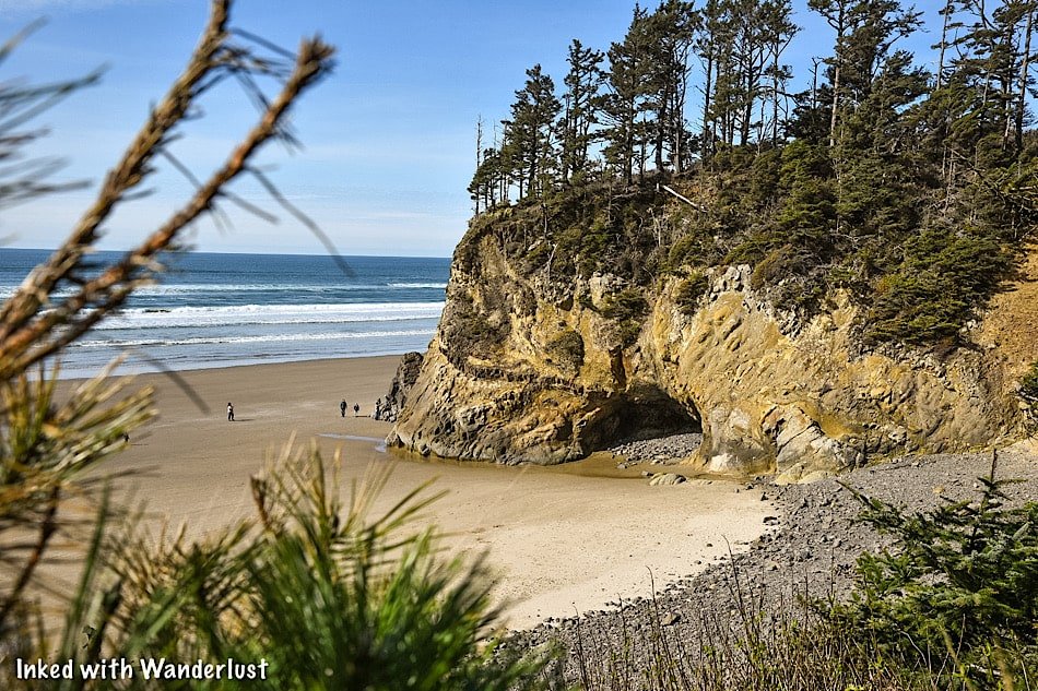
Ever wanted to check out a waterfall that feeds directly into the ocean? If you’re near the beautiful coastal town of Canon Beach, you won’t have to look far.
Just four or five miles south on Highway 101 is Hug Point State Recreation Site. This gorgeous 43-acre stretch of Oregon coastline is not to be missed.
The site features the namesake waterfall, a bounty of sea caves carved into rugged sandstone, and jaw-dropping coastal views.

Many people come to Hug Point to see this rare phenomenon for themselves but as some find out, it isn’t as simple as just showing up. You need to know a couple things first.
Thankfully, seeing the waterfall and sea caves is easy as long as you know what you’re doing and are prepared. Things can go south rather quickly otherwise.
In this guide, we’ll provide you with all the necessary information you’ll need to ensure a successful visit (and remain safe at the same time). Let’s get into it!
Here’s some great beach gear we recommend…

Getting Here
The Hug Point waterfall can be found at Hug Point State Recreation Site, just five or so miles from the equally must-see attraction, Haystack Rock.
Getting here from other cities is simple as it’s located along Highway 101. Since it’s a popular spot, any GPS system would easily get you there.
If you’re staying in Portland, it’s an easy day trip. If you brought your own vehicle or can rent one, the drive from downtown to Hug Point is only 83-miles (one-way).

If you don’t have access to a vehicle, there’s a bus that provides twice-daily service from Portland to Canon Beach.
Something you should know, though, is the bus does not service Hug Point directly. It drops off near Haystack Rock’s public parking area in Canon Beach.
So you’ll either need to hitch-hike, walk from Haystack Rock to Hug Point on the beach, or try your luck with ride-sharing options.
Parking
There’s a narrow, but large parking lot at Hug Point that leads straight down to the beach. There are public restrooms and walkways on either side.
We were here in March and arrived at around 1pm. To our surprise, we had no issue getting a parking spot. If you’re here in the summer, though, plan to arrive early.
There were, “no parking”, signs all along the road outside the lot so if it’s full, you may have to circle around a few times until a spot opens up.

As you make your way to the stairs leading to the beach, keep an eye out for a lookout point on your right. There’s a small, short spur trail that’ll lead you to it.
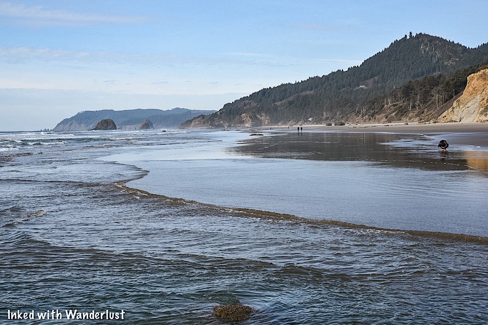
This view gives you a great idea of how inaccessible Hug Point is during high tide; as you can easily see the wave lines up to the rocks.
Hug Point Tide Times
Before we get to the waterfall, we want to reiterate the importance of checking the tide before you go, as the waterfall is 100% inaccessible during high tide.
Timing low tide is important, but knowing when high tide comes back in is even more so. You do NOT want to get stuck out there.
To check tide times by specific dates, check this website. Be sure to bookmark it and check again before your visit.

Hug Point Waterfall
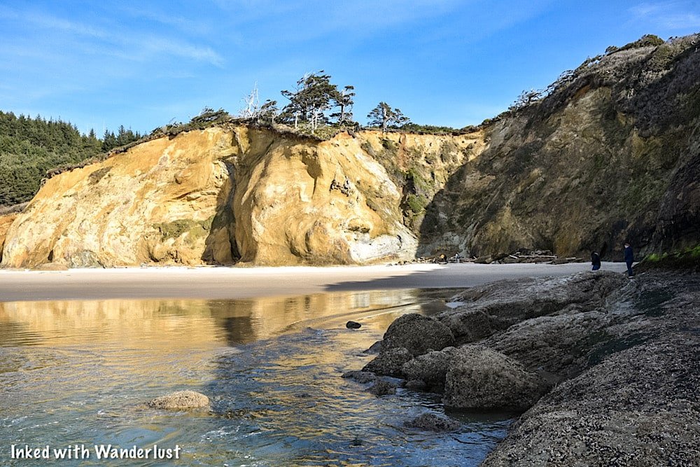
From the stairs leading to the beach, getting to the waterfall is simple and straight forward. Simply go north (right) from the stairs, towards the large sea cliff ahead.
You’ll go around the sea cliff at the point (the side closest to the water) and continue straight. As you get around it, you’ll see the waterfall about 200 yards out.


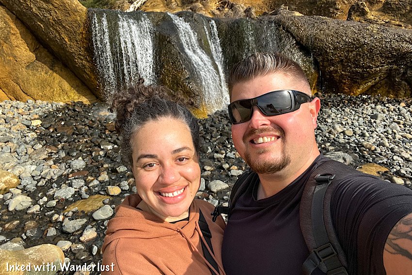
When Hug Point waterfall came into view, I was floored by the amazing scenery. Even though it wasn’t at peak flow (more on that later).

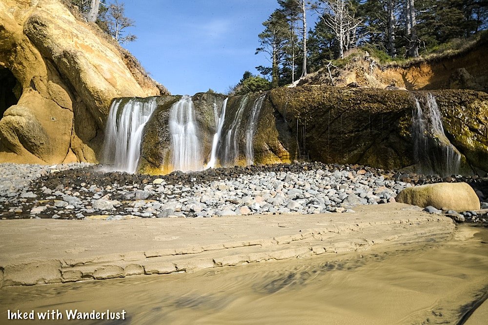


In case you’re wondering, yes, you can climb up to the top of the falls. There isn’t much to see and the rocks on the way up are slick, but you’re ok to go up.
Facing the beach from the top provides a unique perspective that most don’t see (most people look at the waterfall and move on).
Just know that at peak flow, it may be too dangerous to go up to the top. Just use common sense and you should be fine.


The beach in front of the waterfall makes for a great spot for a family picnic or recreating. During our visit people were flying kites, picnicing, etc.
Just around the way from the waterfall are a handful of caves carved into the limestone by waves over thousands of years.
Definitely check these out but as stated above, be mindful of high tide. Getting stuck in one of those caves wouldn’t end well.
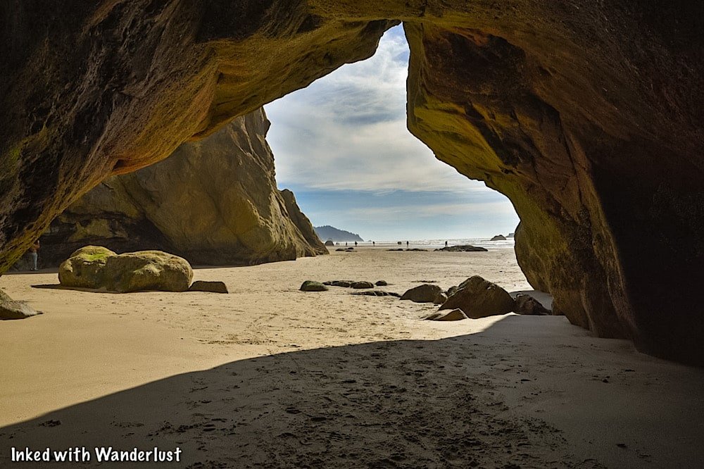
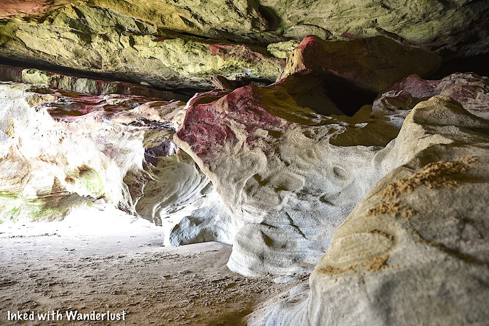
The largest one we had found is at the back of the cliffs and has multi-colored patterns on the limestone. You can see, in great detail, the pattern of the waves in the rock.
When we got around to the other side, though, it was pitch black and the flashlight on our phones didn’t suffice. So bring a good flashlight if you wish to explore further.

To the left of the caves, you’ll see a shelf that literally “hugs” the cliffside. Take this to go to the other side to another beach and a beautiful enclave.
The shelf is covered with thousands of mussels and unfortunately, you can’t walk here without crushing at least a handful of them.
*Fun Fact: Early Oregon pioneers used this shelf to cross from one end of the beach to the other in stagecoaches.

At the end of the shelf, if you look out into the distance, you’ll see Haystack Rock. If you have the time, you could walk all the way to it from here.

As long as the tide remains low, you can explore all you want. When you’re done, simply head back in the same direction you came.
When To Go
If your main goal is to see the Hug Point waterfall at full flow, then you’ll want to visit in the winter or in very early spring after a healthy rain or snowfall.
When we visited in mid-March, it definitely wasn’t at peak flow. So November - February would probably be your best bet.
There isn’t much rain in the summer so obviously, the later into summer it is, the less flow there will be. Plus, summer is swarming with people.
If you just want to see it and don’t care about how heavy the flow is, then anytime is a good time, really. It just depends on your tolerance for crowds.
A Quick Note…
We’re often asked about the equipment we use to capture the photos on our website. Below, we’ve added Amazon links to those products and others that we recommend.
If you decide to purchase, Amazon will pay us a small commission. This helps us keep Inked with Wanderlust running and doesn’t cost you anything extra.
“Understanding Exposure” by Bryan Peterson (this book is a great resource for anyone starting out in photography)
It is our hope that this article was helpful to you in planning your next adventure. If so, please share it with your family and friends on Facebook or Pinterest.
You can further show support by subscribing to our newsletter below. In it, you’ll receive a once weekly newsletter containing announcements, new post alerts, news, and more!
If you have any questions, comments, or suggestions, please engage with us in the comment section below.
Thanks for reading and safe travels!

Haystack Rock in Oregon: Directions, Parking and More
Haystack Rock is one of Oregon’s most recognizable landmarks and has been featured in countless publications, TV shows, and…
Disclosure: This post contains affiliate links. If you make a purchase through these links, I may earn a small commission at no additional cost to you. I only recommend products or services that I believe will add value to my readers.
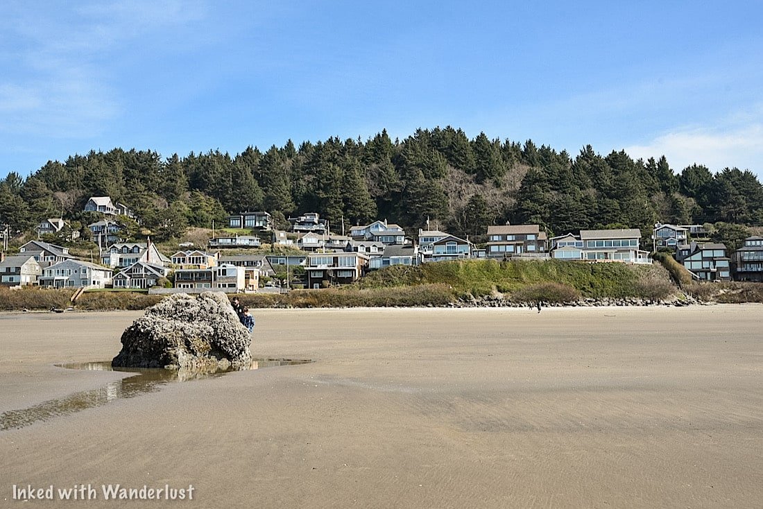
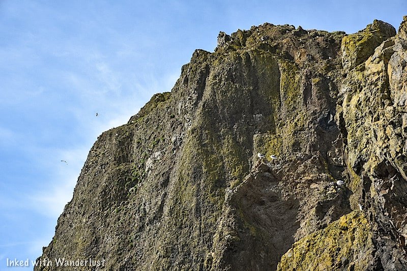
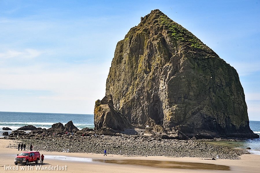
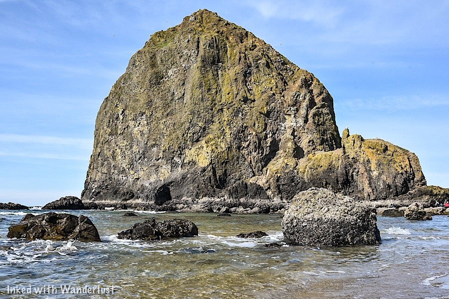
Haystack Rock is one of Oregon’s most recognizable landmarks and has been featured in countless publications, TV shows, and movies (The Goonies being the most infamous). Rising 235-feet above this beautiful stretch of coastline, this huge stack of basalt rock features amazing geology, colorful tide pools, and is the seasonal home to the Tufted Puffin.
Haystack Rock has been on our Oregon wish list for a while now and recently, we were finally fortunate enough to visit. We had a great time and were in awe of its commanding presence, but there were a few things we wish we’d known before going.
With that in mind, we wrote this comprehensive guide to help your visit go much smoother. In it, we’re going to cover: finding parking, it’s history, hotels, when to go and more!
Directions to Cannon Beach
Haystack Rock is located in the coastal community of Cannon Beach, Oregon. Many films and TV shows, such as The Goonies and Kindergarten Cop were filmed here. It’s no wonder, as Cannon Beach features miles of pristine, breathtaking coastline views, beaches, and waterfalls, in addition to multiple shops, restaurants, and hotels.
If you’re planning to visit Portland, Oregon’s most visited city, Cannon Beach is only a 80-minute drive away (or about an hour and a half), making it a great day trip to escape the hustle and bustle of a downtown environment. Additionally, Haystack Rock is close to many other destinations in the PNW.
From Portland:
Make your way to US-26. Take the westbound section for roughly 75-miles
You’ll then begin seeing signs for US-101 south towards Cannon Beach/Tillamook. Take that for about 5-miles
When you see the exit sign for Sunset blvd, take it and merge onto the main road
From Astoria:
Take US-101 south for about 26-miles
Take the Sunset blvd exit
From Vancouver:
Take I-5 south into Portland (about 2-miles)
Take I-405 across the Fremont Bridge
Merge onto US-26 west for 75-miles
Take US-101 south towards Cannon Beach/Tillamook for 5-miles
Take the exit for Sunset blvd
Haystack Rock Parking & Entrances

This is a point of contention amongst people visiting Haystack Rock and is one of the things we wish we’d known before going. There are two main parking areas and entrances to the beach that Haystack Rock is located on. One is a small, hidden pathway just off of Hemlock Street. This is the one you’ve likely seen on social media.
This (admittedly cool) entrance can be found near the corner of South Hemlock Street and View Point Terrace in a residential neighborhood. Next to the corner of these two streets is a small pullout, big enough to accommodate about three normal sized vehicles. There is no other legal parking here, so arrive in you want to use this entrance.
Directly across the street from this pullout you’ll see a wooden deck, stairwell and bench situated in between two beach homes. At first, it’ll come across as a private entrance for the residents of the houses but fret not, it is 100% a public-use, legal entrance to the beach.
As you walk along the dirt path, Haystack Rock will come more and more into view. The path terminates at the top of another wooden stairwell which leads to the beach. At the top of said stairwell, there’s an informational board detailing Haystack Rock’s history and development.
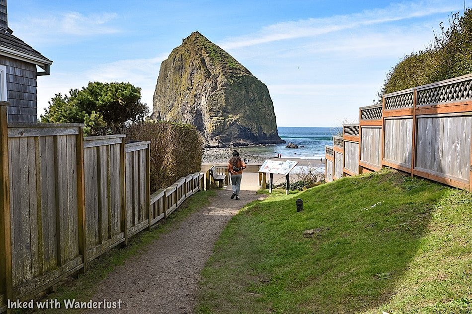
The main, much larger entrance is off of Ecola Court. This entrance, while nowhere near as scenic as the one on Hemlock Street, will still get the job done as it provides quick and easy access to Haystack Rock and comes with a plethora of parking.
The Haystack Rock Park & Ride parking lot is located along South Hemlock Street at the corner of Gower Ave. It’s a large lot that has three spaces for recreational vehicles. Simply park, walk down Gower Avenue towards the beach and turn left on Ecola Court. You’ll see the entrance and Haystack Rock straight ahead.
Haystack Rock Tide Pools
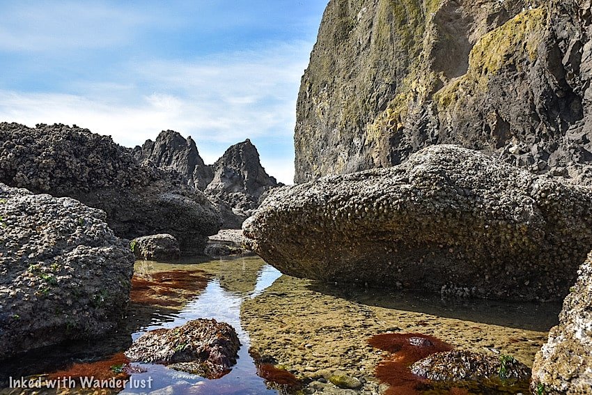
This is something else we didn’t think to check before going but fortunately, we arrived right at low tide when the tide pools were visible. This marine garden is flushed with sea life. During our visit, we spotted crabs, starfish, mussels, and anemones.
You’re allowed to enter and explore the tide pools, but only during low tide. This is the only time they are visible and accessible. Volunteers from the Haystack Rock Awareness Program are there from Spring to Fall to show you around and answer questions (they’ll be the ones in the red jackets).
Be sure to time your visit by visiting during low tide. You can check tide times here.
Wildlife at Haystack Rock
We were here in March, so the Tufted Puffins, who are quite popular here, hadn’t yet made their way to Haystack Rock. They usually arrive in April and leave in September. So while we were mostly treated to garden-variety seagulls, mother nature did provide us with a special treat; a Bald Eagle.
When it landed on the rock, the Seagulls went ballistic (according the volunteer, they don’t get along all too well). Unfortunately, my lens couldn’t zoom in enough to get a shot, but it was awesome to see nonetheless.
In 2023, Haystack Rock made headlines when a Mountain Lion decided to climb onto it and hang out for a while. City officials ended up closing the beach to the public until the cougar moved on, which it did the next day. Goes to show that even in populous places, you should always pay attention to your surroundings.
Best Time to Go
There’s no real bad time to go, as each season has its own positives and negatives. It really just boils down to your personal preferences and travel style.
Winter: While not an ideal time due to the cold and potential for snow, you’ll experience little to no crowds (which isn’t a bad thing). You may also experience the rarity of seeing Haystack Rock with a coating of snow blanketing it.
Spring: This is when my wife and I were here and found the weather to be perfect. It was a bit chilly in the morning but it warmed up quickly. Best of all, crowds were minimal and parking was plentiful.
Summer: Do we even need to say it? Yes? Ok…It’s hot, crowded and lodging rates are at their peak. Try to avoid visiting in the summer if you can avoid it. Though, one positive to summer is it doesn’t see much rain, so there’s that.
Fall: It starts raining regularly again, but summer crowds start tapering off and lodging becomes a little more affordable. Additionally, the fall colors begin setting in, taking the beauty of the scenery up a few notches.
Hotels
We visited Haystack Rock and Cannon Beach as a day trip from Portland, so we didn’t stay in any of the hotels.
However, we did research a few of the top rated ones near Haystack Rock and can recommend some of them. They are:
Hallmark Resort & Spa Cannon Beach: This is a beautiful hotel super close to the beach with rooms offering amazing views of Haystack Rock and the ocean.
Surfsand Resort: Another beautiful that offers rooms with a view of the beach. This one is also super close to the Ecola Court entrance to Haystack.
The Courtyard: This charming hotel features cozy rooms, a cafe, and is perfectly situated between Haystack Rock and the many shops/restaurants of Cannon Beach.

A Quick Note….
I’m often asked about the equipment we use to capture the photos on our website. Below, we’ve added Amazon links to those products and others that we recommend.
If you decide to purchase, Amazon will pay us a small commission. This helps us keep Inked with Wanderlust running and doesn’t cost you anything extra.
“Understanding Exposure” by Bryan Peterson (this book is a great resource for anyone starting out in photography)
A Quick Guide To Visiting The Beautiful Wahkeena Falls (Oregon)
Wahkeena Falls (Wa-Kee-Na) is a multi-tired waterfall along Oregon’s famed, ‘Waterfall Corridor’, in the awe-inspiring Columbia River…
5 minute read | Contains affiliate links
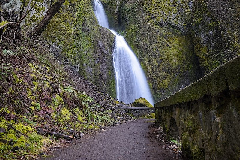
Wahkeena Falls (Wa-Kee-Na) is a multi-tired waterfall along Oregon’s famed, ‘Waterfall Corridor’, in the awe-inspiring Columbia River Gorge.
Named after the Yakama word for, “most beautiful”, Wahkeena Falls has a total height of 242-feet. It may not be as tall as its neighbor, Multnomah Falls, but it’s no less gorgeous.
In this quick guide, we’ll show you a few of the photos we took during our visit and fill you in on some details you’ll want to know before visiting. Let’s do this!
Here’s some great hiking equipment we recommend…
Wahkeena Falls Information

Getting To Wahkeena Falls
Distance from:
Portland: 29 miles east (30 minute drive)
Troutdale: 14 miles east (17 minute drive)
Vista House: 8 miles east (19 minute drive)
Multnomah Falls: 8.5 miles west (15 minute drive)
Cascade Locks: 14 miles west (22 minute drive)
Vancouver: 32 miles west (33 minute drive)
Bend: 162 miles north (3 hour and 15 minute drive)
Coming from Portland or Troutdale, you’ll be on I-84 east for most of the drive. You’ll take exit #28 to Bridal Veil and continue straight on the Historic Columbia River Highway.
From Cascade Locks or further, you’ll travel on I-84 west before taking exit #35 and merge onto the Historic Highway.
If you’re coming from the west, Wahkeena Falls will be after Bridal Veil Falls on your right. If you’re coming from the east, it’ll be after Multnomah Falls on your left.

Parking
Even during the off-season, parking can be scarce at Wahkeena Falls. There’s a small pull-out style lot across the street and an even smaller one in front of the entrance.
When we arrived, both were full. We were here in March, which isn’t a particularly busy time. So in the summer, we can imagine how insane it gets.
If you find yourself in the same situation, do what we did and circle around. This is a spot where most people get out of their car, check it out, and move on.
Chances are good that if you circle around - or even just come back to it later - you’ll snag yourself a spot. Patience will take you far, here.

Hiking At Wahkeena Falls
You can partially view the waterfall from the main viewing deck below, like most people. If you want a great view, though, take the trail up to the footbridge.
While not as famous as Benson Bridge over at Multnomah, Wahkeena Falls has a bridge of its own and yes, you can walk up to it!
Standing in the parking lot and facing Wahkeena Falls, the trail is to your right. If you take the one to your left, you’ll end up at Multnomah.
The trail is part dirt, part gravel and is a 2/10’s of a mile, uphill walk (can’t really designate this as a hike). We would rate the trail as easy for most.

Wahkeena Falls To Fairy Falls
From the footbridge, you can hike a little further up Wahkeena Canyon to another beautiful waterfall, Fairy Falls. It is less than a mile from here.
Due to icy conditions on the trail, we decided to skip it and bank it for our next visit. If you’re here when its warmer, though, you should definitely go for it.
*To see what Fairy Falls looks like, check out the website, The Outbound
Wahkeena Falls To Multnomah Falls Loop
Multnomah Falls and Wahkeena Falls are connected by a network of hiking trails. One of them runs parallel to the Historic Highway between the two waterfalls.
The other trail takes you up to the footbridge, past Fairy Falls, and eventually reaches the top of Multnomah.
From there, drop down to the base of Multnomah Falls and continue left on the trail parallel to the highway, completing the loop.
One-way milage for this hike is 1.8 miles and based on what we’ve been told, the hike is moderate for most. So just use your best judgement.

Is Wahkeena Falls Open?
That’s a question often asked. A big fire ripped through Oregon’s side of the gorge a few years ago and heavily damaged numerous trails and foliage.
To answer your question, yes, Wahkeena Falls IS open. As is the entire loop trail to Multnomah Falls. To get current information on closures, check out the website, Ready Set Gorge.
Weather and Best Time To Go
A lot of this is based on your personal preferences and ability to deal with weather conditions.
Summer: It’s warm/hot with little to no rain. So you won’t have to worry about icy conditions. However, you will be dealing with heavy crowds and needing a permit to access the Historic Highway.
Winter: Crowd levels will be low, but you’ll be dealing with snow and ice conditions. Benson Bridge will be closed for the majority of the season due to it icing over.
Spring: The weather improves, but you’ll be dealing with on and off again rain showers. Mornings are chilly, with ice still present at certain points along the trail. Crowd levels begin to pick up.
Fall: When they peak, fall colors in the gorge are breath taking. Crowds start tapering off from the summer and the weather, while still rainy, is mostly mild.

It is our hope that this article was helpful to you in planning your next adventure. If so, please share it with your family and friends on Facebook or Pinterest.
You can further show support by subscribing to our newsletter below. In it, you’ll receive a once weekly newsletter containing announcements, new post alerts, news, and more!
If you have any questions, comments, or suggestions, please engage with us in the comment section below.
Thanks for reading and safe travels!

Oregon's Waterfall Corridor Permit: Everything You Need To Know To Get One
If you’re planning to visit the many waterfalls, State Parks, and trails along Oregon’s famed, Waterfall Corridor, and you intend…
5 minute read | Contains affiliate links
If you’re planning to visit the many waterfalls, State Parks, and trails along Oregon’s famed, Waterfall Corridor, and you intend to drive, you’re going to need a permit.
The Historic Columbia River Highway (aka, Waterfall Corridor) is a narrow, two lane road that allows visitors easy access to the multiple natural attractions in the area.
The problem is, during the busy summer months, this road has been known to experience heavy traffic congestion. On top of that, parking is nearly impossible to find.
Due to this, the Oregon Department of Transportation decided to implement a vehicle access permit system this year in an effort to reduce the amount of vehicles on the road at a time.
In order to help make your visit go as smoothly as possible, we wrote this comprehensive guide to bring you all the information you’ll need to either get a permit or avoid it all together.
Permit Information

How To Get A Permit, Dates, & Cost
*Official information is a bit scarce at the moment. This article will present current information provided by the Oregon Department of Transportation. As more information gets released, it will be added to this article.
A permit will be required for anyone planning to drive on the Historic Columbia River Highway between May24th and September 5th, 2022, between the hours of 9am and 6pm.
Thus far, no details have been given as to going about obtaining one.
However, considering permits for other area attractions like Multnomah Falls are obtained through Recreation.gov, one could assume that will be case here as well.
As far as cost goes, a representative of the Oregon DOT was quoted as saying, “we anticipate the fee to be around $2”. This will be per vehicle, not per person.
So while not set in stone, the fee is likely to be low and to simply cover the operational costs.
Checkpoint Locations
Per the Oregon DOT, there will be checkpoints at:
Exit #28 near Bridal Veil Falls
Exit #35 near Ainsworth State Park
For context, Bridal Veil Falls is on the west side of this area with Ainsworth State Park being on the east side.
At these checkpoints is where you’ll present your timed permit. You can either show a printed copy or the digital version on your mobile device.
On your permit will be a specific time for you to enter. You will NOT be granted access prior to that time. You can, however, stay for however long you like.
*Also, you will only be able to come through one time. Once you exit through one of the checkpoints, you will NOT be able to re-enter.
*If you accidentally leave, you’ll either need another valid permit or come back after 6pm.

What To Do If You Don’t Have A Permit
The whole point to this program is reduce traffic and its impact on the Gorge. Implementing the permit system allows for the number of vehicles along the highway to be reduced.
To assist in this goal, there are other ways you can visit the Waterfall Corridor without needing to worry about obtaining a permit.
They are:
Taking part in an organized tour
Utilizing one of the various shuttles that service the Gorge.
Park at or near Vista House and use a bicycle to get around.
Arrive by vehicle BEFORE 9am or AFTER 6pm.
One thing to keep in mind that walking along the Historic Highway is not an option. The road is simply too narrow and dangerous for pedestrians.
A few of the notable shuttle companies that service the Gorge are; Sasquatch Shuttle, Columbia Gorge Express, and Explore the Gorge.
*Having a permit only guarantees access. It DOESN’T guarantee parking. It would be wise to at least consider taking a shuttle in.

Attractions Affected (and not affected)
This may be your first time to the beautiful stretch of road and you may not know which attractions are and are not affected by this.
Below is a list of the most popular attractions that you will NOT be able to drive to without obtaining a permit:
Bridal Veil Falls (read our post about this waterfall, here)
Angel’s Rest hiking trail
Wahkeena Falls (read our post about this waterfall, here)
Multnomah Falls (requires a permit of its own)
Oneonta Gorge (currently closed)
Horsetail Falls
Ainsworth State Park
That said, there are multiple attractions you can still visit even if you don’t have a vehicle permit. Some of the most popular ones are:
Portland Women’s Forum State Scenic Viewpoint
Vista House
Latourell Falls
Elowah Falls
Upper McCord Creek Falls
Wahclella Falls
Bridge of the Gods
As you can see, there is still plenty to see. So if you weren’t able to get a permit, spend time at these and then make your way to the others after 6pm.

Multnomah Falls Permit
There are two parking lots at Multnomah Falls; a small one right across the street along the Historic Highway and a second, large one off I-84.
If you manage to snag a spot in the smaller lot, then your vehicle permit will be the only one you’ll need.
Chances are though, you’ll need to park in the larger lot. If so, you’ll need a timed reservation in order to visit Multnomah.
We wrote a comprehensive guide on visiting Multnomah Falls. It covers their timed reservation policy, hiking trails, and more! Check it out here.

The Parking Situation
As stated above, your timed permit to access the Historic Highway doesn’t guarantee you a parking spot at any of the above attractions.
With the exception of the large lot at Multnomah, the parking lots at the waterfalls are small. Even with the permit system in place, available parking will be scarce.
To save yourself the hassle, you may want to consider taking part in a tour or taking a shuttle in.
A Quick Note…
We’re often asked about the equipment we use to capture the photos on our website. Below, we’ve added Amazon links to those products and others that we recommend.
If you decide to purchase, Amazon will pay us a small commission. This helps us keep Inked with Wanderlust running and doesn’t cost you anything extra.
“Understanding Exposure” by Bryan Peterson (this book is a great resource for anyone starting out in photography)
It is our hope that this article was helpful to you in planning your next adventure. If so, please share it with your family and friends on Facebook or Pinterest.
You can further show support by subscribing to our newsletter below. In it, you’ll receive a once weekly newsletter containing announcements, new post alerts, news, and more!
If you have any questions, comments, or suggestions, please engage with us in the comment section below.
Thanks for reading and safe travels.

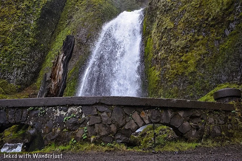
How To See Bridal Veil Falls In Oregon
Located in the awe-inspiring Columbia River Gorge right off of the Historic Highway is the beautiful, easily accessed 120-foot waterfall…
6 minute read | Contains affiliate links
Located in the awe-inspiring Columbia River Gorge right off of the Historic Highway is the beautiful, easily accessed 120-foot waterfall, ‘Bridal Veil Falls’.
It’s part of the Oregon State Scenic Viewpoint and is on the site of an old lumber mill. The park is open year round and there are no entry or parking fees.
*If you’re visiting between May and September, you’ll need a vehicle permit to enter the Waterfall Corridor.
We were fortunate enough to discover this waterfall during our visit in March 2022. We learned quickly that Multnomah Falls wasn’t the only amazing waterfall around here.
In fact, there are MANY gorgeous waterfalls on the Oregon AND Washington side of the river. This post, though, will focus on Bridal Veil.
So are the trails difficult or easy? What can you expect once you reach the falls? How do you get there? We’ll answer these questions and more below!
Here’s some gear we recommend…
Getting To Bridal Veil Falls and Permits
Getting There
Bridal Veil Falls can be found along Oregon’s Waterfall Corridor inside the Columbia River Gorge. It’s super easy to find as its parking lot is right off the highway.
The exact address is E Crown Point HWY, Bridal Veil, OR 97010. Simply plugging, ‘Bridal Veil Falls’, into your GPS will suffice.
From Vista House: Leaving the Vista House lot, drive east on Historic Columbia River Highway for 4.5 miles. It’ll be the next waterfall AFTER Latourell Falls and the parking lot will be on your left (across from the Lodge).
From Cascade Locks: Travel west on Interstate 84. Take exit 35 to the Historic Columbia River Highway. It’ll be the next waterfall after Wahkeena Falls and the parking lot will be on your right. Total milage is around 18 miles.
From Portland: Make your way to Interstate 84 east and stay on it for about 25 miles. You’ll take exit #28 (look for signs stating Bridal Veil and/or Angel’s Rest) and follow the signs for the Historic Highway. The parking lot will be on your right.

You’ll know you’ve arrived to the correct lot (aside from the signage) when you see Bridal Veil Falls Lodge across the street.
The park is located in between two equally beautiful waterfalls, Latourell Falls and Wahkeena Falls. Unlike them, though, Bridal Veil is on the north side of the highway.
Fees
There are no fees for Bridal Veil Falls, but if your visit coincides with the May through September timeframe, you will need a permit to access the Historic Highway.
The fee for this permit is $2 per vehicle and they will be verified by State Parks Staff between Bridal Veil (near exit 28) and Ainsworth State Park.
Trails to Bridal Veil Falls
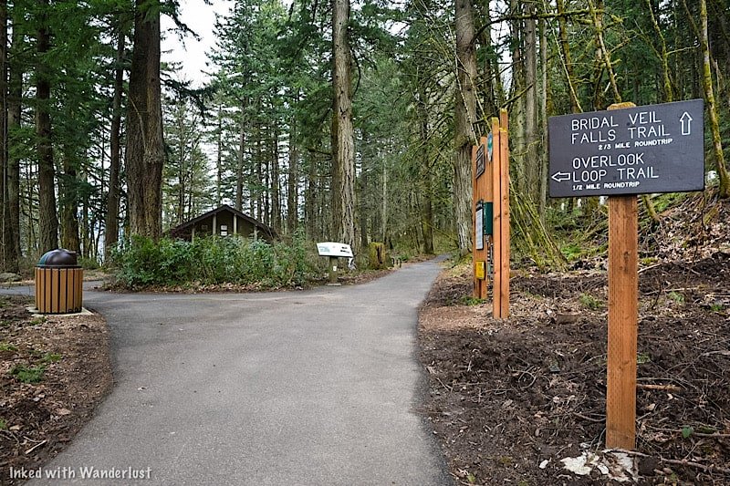
Overlook Loop Trail
On arrival, you’ll have a choice to make. You can go straight on the traditional Bridal Veil Falls trail or you can bear left to the overlook.
Initially, we had every intention of doing both (they are not connected). We were going to do the main trail, come back, and then go to the overlook.
However, we spent more time than we thought we would down there and by the time we got back to the split, we had run out of time.
We had dinner reservations in downtown Portland and if we didn’t leave at that moment, we would’ve missed it. So we had to bank it for next time.
Based on pictures we’ve seen, the trail is half a mile (roundtrip) and terminates at a wooded platform overlooking the top of the falls (similar to the one we went to).
*At the split (just off from the parking lot) you’ll find a restroom open to public use
Bridal Veil Falls Trail
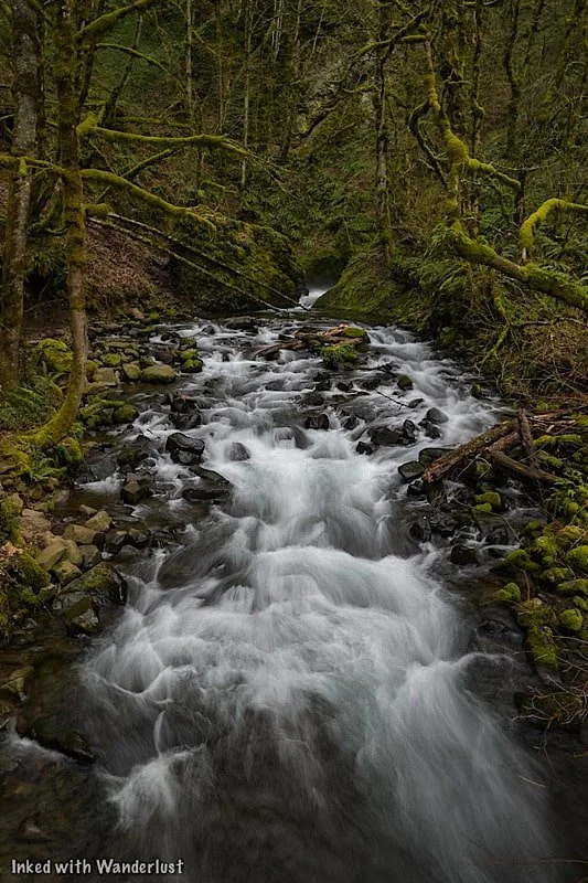
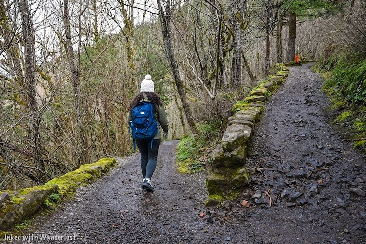
The main trail to the base of falls is 3/4’s of a mile (roundtrip) on a slightly steep decent to Bridal Veil Creek and the falls.
It had just rained during our visit so the trail was a little muddy, but we had no problem navigating it. We would rate it as easy going down and easy to moderate going up.

Soon after the second switchback is when you’ll run into the first of two bridges on the trail. This bridge is followed by a concrete stairwell leading you to the next bridge.
The second bridge takes you across Bridal Veil Creek and leads you to yet another stairwell, this one taking you up to a wooded viewing deck for the waterfall.

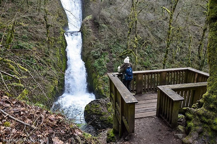
Take the stairwell to the viewing deck overlooking Bridal Veil Falls. The deck isn’t big so if it’s busy, you’ll have to hang out for a few minutes until a spot opens.
There are many different perspectives of the waterfall from here. If you’re into photography, you can get pretty creative here.


When you’re done, simply head back in the direction you came to the trailhead. From there, you can leave or see the top of the falls from the Overlook Loop.
Additional Things To Know
It is visible from the road, but don’t do it. That road is very narrow and the chance of a vehicle vs. pedestrian accident occurring is high. View the falls from one (or both) of the trails, not the road.
Drone use is prohibited. Like most of the gorge, drone use is not allowed at Bridal Veil.
No EV charging stations. The nearest ones are to the west of Bridal Veil in Troutdale.
Restroom is available. There is a restroom (vault variety) just ahead of the trail split near the parking lot.

Nearby Attractions
This area is littered with amazing natural sights, most of which require little to no effort to see (aside from driving around).
There’s so many that we couldn’t possibly list them all, but we will list a few of our favorites. If you’d like to see more, check out the website, Ready Set Gorge.
Multnomah Falls - The tallest waterfall in Oregon and one of the most visited natural sites in the PNW. Check out our guide by tapping/clicking on the link.
Vista House (Crown Point)
Wahkeena Falls
Oneonta Gorge (currently closed)
Bridge of the Gods (connects Oregon and Washington)
Latourell Falls
Ainsworth State Park
Horsetail Falls
Fairy Falls
Angel’s Rest (hiking trail)
And so much more!
A Quick Note…
We’re often asked about the equipment we use to capture the photos on our website. Below, we’ve added Amazon links to those products and others that we recommend.
If you decide to purchase, Amazon will pay us a small commission. This helps us keep Inked with Wanderlust running and doesn’t cost you anything extra.
“Understanding Exposure” by Bryan Peterson (this book is a great resource for anyone starting out in photography)
It is our hope that this article was helpful to you in planning your next adventure. If so, please share it with your family and friends on Facebook or Pinterest.
You can further show support by subscribing to our newsletter below. In it, you’ll receive a once weekly newsletter containing announcements, new post alerts, news, and more!
If you have any questions, comments, or suggestions, please engage with us in the comment section below.
Thanks for reading and safe travels!

How To Hike To Witches Castle (Stone House) in Portland
When we were planning our trip to Portland, we found many attractions we wanted to check out. Witches Castle, however, was…
Disclosure: This post contains affiliate links. If you make a purchase through these links, I may earn a small commission at no additional cost to you. I only recommend products or services that I believe will add value to my readers.
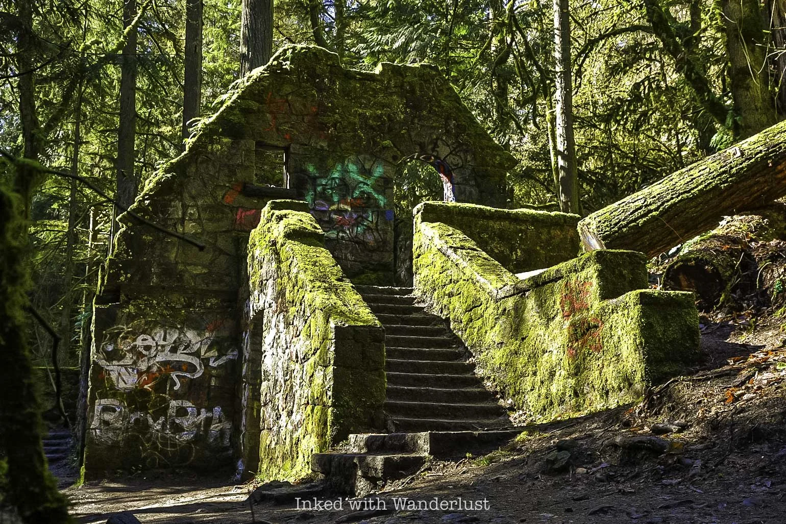
When we were planning our trip to Portland, we found many attractions we wanted to check out. Witches Castle, however, was near the top of the list. Officially called “Stone House”, it was given the name “Witches Castle” by a group of local teenagers many years ago and the nickname stuck.
You can find it in Macleay Park, which itself is located within the much larger Forest Park. All of this is just a mere few miles from downtown Portland, making it an easy way to escape the hustle and bustle of the city.
In this guide, I’ll discuss how to get to the trailhead, trail details, the history of Witch’s Castle, parking details and much more. Let’s get into it!
Getting To Witches Castle and Parking

You can find the castle by hiking the Wildwood Trail. It can be accessed by both Upper and Lower Macleay Park. Lower Macleay Park is located at the corner of NW 30th and Upshur, just outside of a residential neighborhood.
The parking lot is fairly large, but I can see it filling up quickly in the summer months, so plan accordingly. To reach Witches Castle from here, take the smooth, flat trail for 3/4’s of a mile. From what we were told, it is relatively flat and smooth.

You can find the upper parking lot just passed the Portland Audubon Society. You’ll see a sign (pictured above) indicating you’re in the right spot. The parking lot can hold a decent amount of vehicles but like the lower lot, it will probably fill quickly during summer time.
There’s a single, portable bathroom and off in the grassy area you’ll find a couple picnic tables. The trail starts where the parking lot ends.
Transportation To The Park
Public Buses: Buses run from the downtown area and throughout Forest Park with multiple stops. For detailed information on, follow this link.
Vehicle: If you have your own vehicle, simply punch “Upper Macleay Park” (or Lower) into your GPS of choice and follow the directions.
Uber/Lyft: Cell reception is good here, so utilizing ride-sharing options is an option (it’s what we did). Just be sure to specify Macleay Park as your drop-off location and not, “Witches Castle”.
The Wildwood Trail (Upper)

From the parking lot to Witches Castle it’s a half-mile, downhill hike up until you reach the bridge. After the bridge, it’s easy going with only minor, barely noticeable inclines and declines.
From the parking lot, you’ll head left on the trail. You’ll almost immediately begin your downhill descent through beautiful moss covered trees and rocks. As you descend, you’ll begin to hear the sounds of rushing water. That’s because there’s a beautiful creek running parallel to the trail at the bottom.
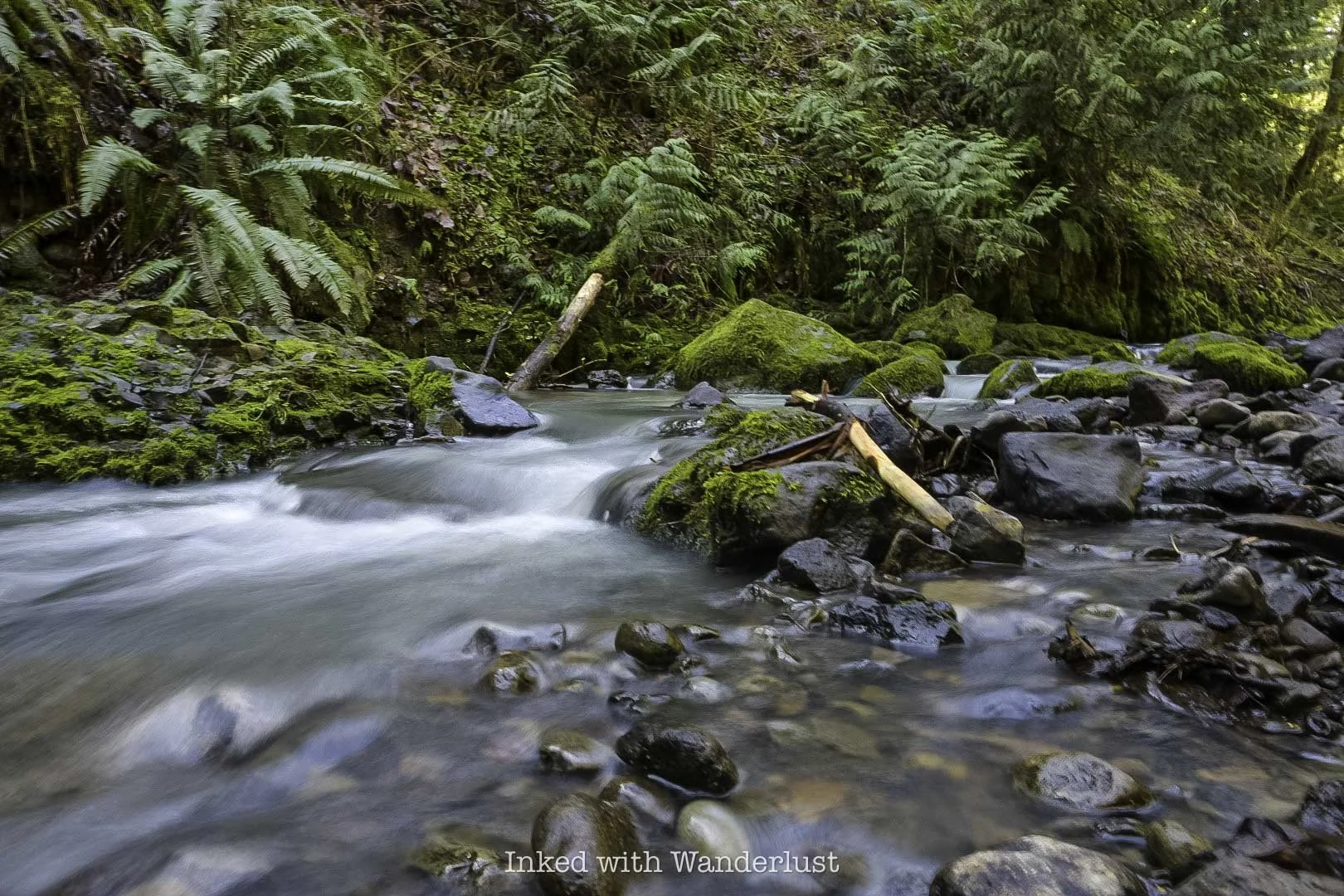
In a short time, the bridge will come into view. This bridge gets you across the creek and provides an epic view of a beautiful cascade as you cross.
Be sure to spend time here taking all the pictures you can. To me, it was just as much a highlight as Witches Castle. From here, you’re about halfway to the castle. The trail will mostly flatten out with only a few, hardly noticeable elevation changes.
On the way to the castle, you’ll be treated to non-stop views of multiple cascades running through moss covered rocks and downed branches. It’s like stepping into a fairytale novel (similar to Mossbrea Falls in California).
Witches Castle

Before you’ll know it, you’ll arrive at Witches Castle at around the quarter-mile mark (from the bridge). It kinda sneaks up on you through the trees. As you can see in the photo above, this is a popular place for taggers (graffiti). Every so often the city will clean it off but that’s happening less and less now.
When we were here (early March) we only had to share the space with a few others. If you come in the summer, though, prepare yourself for crowds. No matter when you decide to hike to Witches Castle, do it early for a near crowd-free experience.
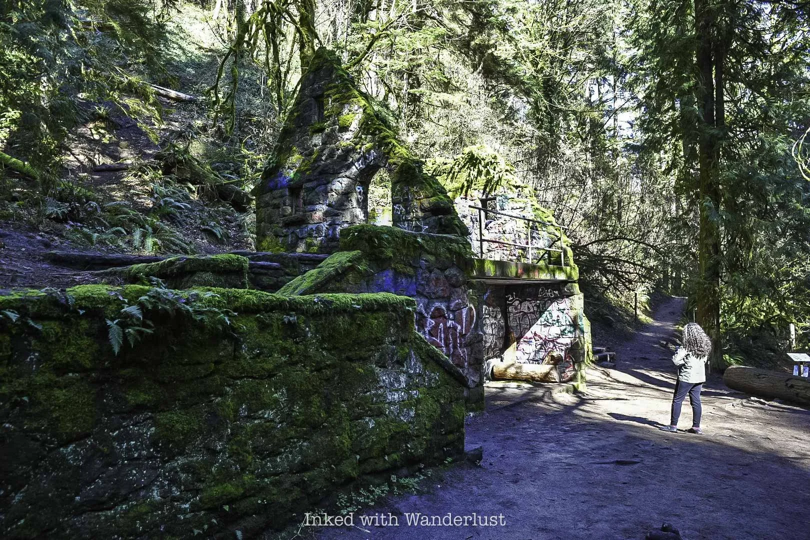
For being nearly one hundred years old, there’s a shockingly large amount of the structure remaining. There are two sets of stairs on each side, both leading to the main area of Witches Castle, which is open to the elements.
The castle is a hot spot for graffiti artists, much like another favorite spot of mine, the historic Donner Tunnels, in California. I’m not generally a fan of graffiti but much like the tunnels, it compliments and elevates the experience, instead of souring it.
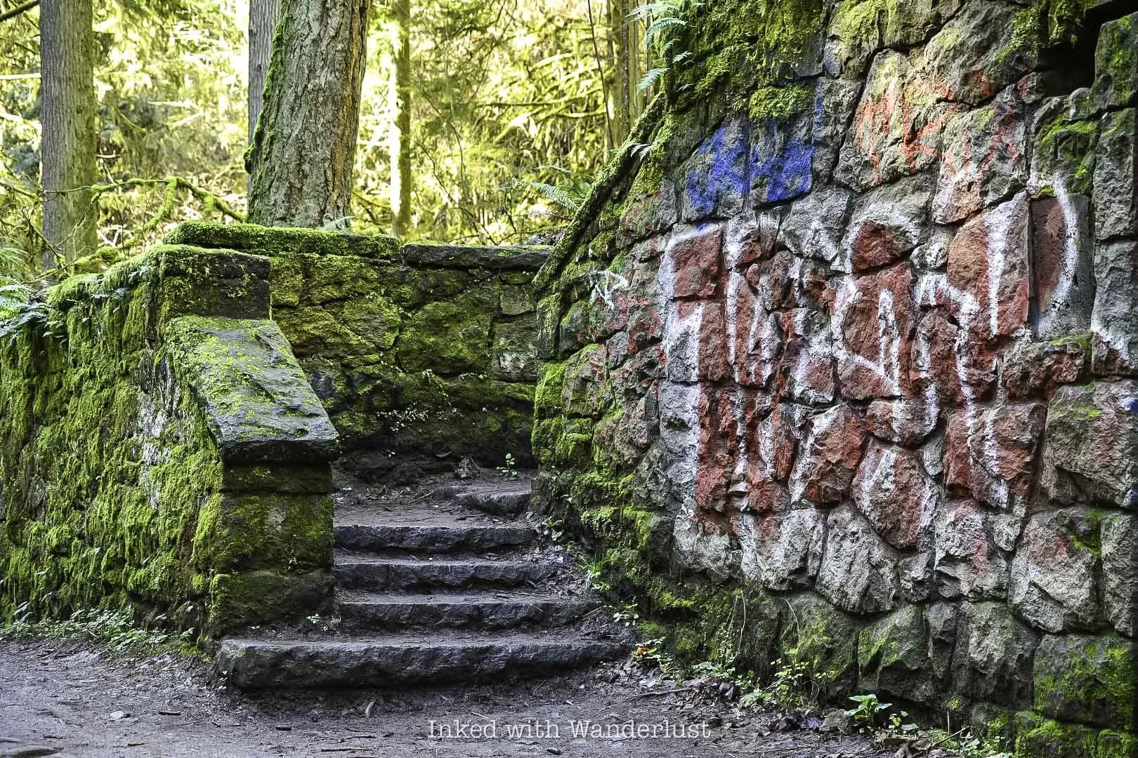
Much like the graffiti, moss dominates the stone walls of the castle, providing a pleasant and photographically wonderful color contrast. You’re free to go up the stairs and explore the structure. Just be aware that there will likely be others trying to get their own pictures as well.
Once you’re done exploring the castle, either head back the way you came or keep hiking onward. Less than a mile hike from Witches Castle is the historically significant Pittock Mansion. Be sure to take a self-guided tour of the beautiful grounds and mansion.
Witches Castle History
By now, you’re probably dying to know how Witches Castle got its name and its backstory. It’s an age-old tale of romance, murder, and hauntings! Let’s get into it!
A Story of Love…and a Bullet
Danford Balch, who came to Oregon in 1850 with his family, claimed a large parcel of land in what is now Forest Park. He hired Mortimer Stump, a local man, to clean up the property and build a home.
When the home was finished, Mortimer moved in with the Balch family (this included Balch, his wife, and nine children). Eventually, Mortimer and Balch’s eldest daughter, Anna, would fall in love.
Their relationship would continue and eventually, Mortimer asked Balch for his blessing to marry Anna. I’ll give you one guess as to what his answer was…an emphatic “no!”
Balch felt that Mortimer wasn’t worthy of Anna and to drive his point home, he threatened to kill Mortimer if they ever eloped. Did that stop them? This wouldn’t be much of a story if it did, would it?

Long story short, they eloped in Vancouver in 1858 and came back shortly after to collect their belongings. Balch was waiting and would make good on his threat. He shot Mortimer dead…on sight.
Balch tried to make excuses for this but in the end, the police weren’t buying it. He was sentenced to death and hanged for his crime (which was the first legal hanging in Oregon, by the way).
Balch’s wife (who is often referred to as the “witch” in this story) stayed in the home and lived there until her death. Local lore says the spirits of Mortimer and Balch continue to haunt the property to this day.
The Stone House

When it comes to the actual structure we have today, well, it was never a home. The home that the Balch family lived in was demolished years ago. The stone structure, what we refer to as, ‘Witches Castle’, was built in 1930 and maintained by Portland Parks & Recreation. Originally, it was supposed to be a restroom and ranger station.
However, in 1962, a big storm came through and heavily damaged the structure. So much so, it was deemed useless and left abandoned. In the 1980’s, a group of local high school students re-discovered it and dubbed it, ‘The Witches Castle”. The rest, as they say, is history.
Things To Know Before Going
Park hours are between 5:00am and 10:00pm.
Dogs are permitted on the trail but you must pick up after them.
Much like other popular areas, vehicle break-ins are common here. We saw multiple piles of glass on the ground in the parking lot.
This trail is UBER popular. It was quiet when we were here, but it isn’t uncommon to see 150+ other hikers (or more) on this trail.
If you’re staying in downtown Portland and are looking for more weird Portland things to do, see 21 of them here! Also, for delicious Italian food, consider dinner at Gilda’s!

21 Weird, Unique, and Fun Things To Do In Portland Oregon
Portland, Oregon’s largest city, has long had a reputation for being, shall we say…weird. That’s no insult, either. Portlandiers wear…
3 minute read | contains affiliate links
Portland, Oregon’s largest city, has long had a reputation for being, shall we say…weird. That’s no insult, either. Portlandiers wear that badge with pride.
That weirdness the city is known for brings in tourists by the millions, annually. Recently, those millions included the two of us.
We visited a number of tourist attractions and local favorites during our visit in order to bring to you, dear reader, our list of twenty-one weird, unique, and fun things to do in Portland.
Some of these include links to their own, detailed posts we typed up. So if you’d like further information on that particular one, give that link a tap (psst, doing so also helps support this site. Thanks in advance).

Exciting news for our readers!
We’re excited to Introduce the all-new "Inked with Wanderlust" online store!
We're thrilled to bring you a fantastic collection of wanderlust-inspired merchandise. Celebrate your love for travel and exploration with our stylish apparel and accessories, designed to ignite your sense of adventure.
Discover a range of unique designs that capture the spirit of wanderlust, from cozy hiking-themed t-shirts to charming accessories that make your wanderlust spirit soar!
Visit our online store today and start your journey of style and adventure. Happy exploring!
A Quick Note About Portland…
It’s no secret. Portland has been in the news a lot recently and you’ve no doubt noticed.
Between the protests, homelessness, and crime, its been never ending.
For prospective, we stayed, ate, and walked around downtown Portland. Not once did we feel threatened and no one ever bothered us.
That said, there are homeless camps everywhere and crimes such as theft and vehicle break-ins are common.
Much like any city you visit, be aware of your surroundings and keep your valuables close by. You shouldn’t have a problem.
That being said, let’s get on with the list!
1) Voodoo Doughnuts

Much like you can’t visit Seattle without hearing about Amazon or Starbucks, chances are good that if you’re coming to Portland, someone will mention Voodoo Doughnuts.
They’re not the best doughnuts in the city (in our humble opinions), but they’re delicious and certainly the best at making creative, unique doughy treats.

A few of our favorites include the Bacon Maple Bar, Dirt, The Homer, Vicious Hibiscus, Maple Blazer Blunt, and the Voodoo Doll (their signature donut).
They have a couple locations but for the true experience, head to the Old Town store. This is the original location.

Get there early to avoid the line (it gets long). We arrived around nine and were able to walk right in but during the tourist season, that rarely happens.
They also accept online orders and offer delivery through DoorDash and Uber Eats if you don’t want to make the trip to the store.
2) Funhouse Lounge

Catching a comedy show at the Funhouse Lounge is one of those quintessential Portland experiences you must do.
They offer a variety of shows such as comedy musical parodies, stand-up comedy, improv, amateur nights, burlesque, and more.

They also have a clown room you can check out while you’re there. Unfortunately for us, it was being used as a storage room at that time, so we couldn’t see it.
The show we came for, however, was hilarious! It was a musical parody of the classic film, Pulp Fiction. The actors and actresses were superb.
To see their current schedule and purchase tickets, check out their website.
3) Mill Ends Park

This one definitely falls under the “weird” category of this article. Mill Ends Park is a tiny (and we mean, TINY) urban park in the middle of the street near an intersection.
With a total area of just 452 square inches in a two-foot circle, Mill Ends Park is likely the smallest park you’ll see anywhere in the world.

There’s only room to safely fit two to four people, max. So if there’s a group already there, hang out on the sidewalk until they’re done.
It is located near the intersection of SW Taylor and S Naito PKWY and can be easily accessed from the Tom McCall Waterfront Park (near the fountain).
4) The Freakybuttrue Peculiarium and Museum
Unfortunately, we ran out of time and couldn’t visit this awesomely weird place, but you definitely should!
This museum is packed with creepy exhibits, merchandise, and artwork. Per their website, it isn’t recommended for small children.
For further information, you can check out their website here.
5) Witch’s Castle
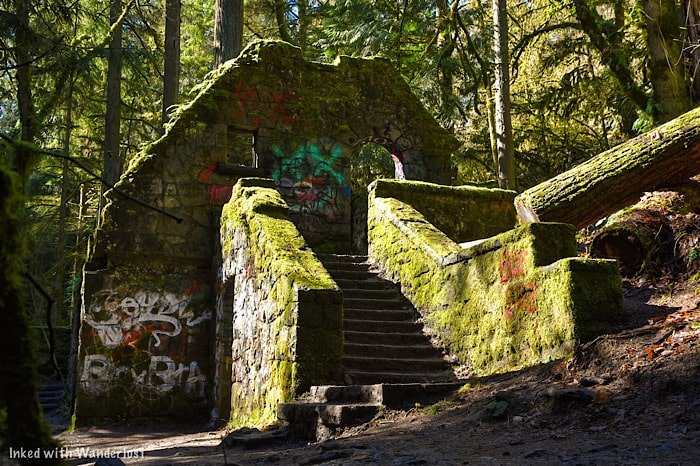
Witch’s Castle was one of the highlights for us. Not just because we got to explore the ruins of this local favorite, but because the hike on the way was stunning!
Located in the boundaries of Forest Park, the hike to Witch’s Castle (or Stone House) begins at either the Upper or Lower Macleay Park along the Wildwood Trail.

It’s a short, half-mile hike from the upper trail or a near equally short 3/4 mile hike from the lower trail to Witch’s Castle.
The lower portion of the trail was closed during our visit, so I can’t speak on what it’s like. The upper portion, however, is stunning.

If you’re in Portland and you’re even remotely into hiking, you need to check this one out. For more detailed information, read our guide here.
6) Pioneer Courthouse Square

Long known as, “Portland’s Living Room”, Pioneer Courthouse Square is a 40,000 square-foot public space in the center of Downtown Portland.
When there’s not a pandemic going on, the city holds many local events and concerts here. It also features a few local food trucks and a Starbucks.

Even when there isn’t an event going on, it’s still worth checking out. There’s plenty of artistic exhibits to see and during the holidays, the city Christmas Tree is on full display.
7) Wishing Tree
Since 2013, tourists and locals alike have been writing their wishes on little white tabs and hanging them from this special tree.
It’s located on the corner of NE Morris street and 7th avenue on private property. The owner of the property keeps blank tabs on the tree. Simply pick one and write down your wish.
8) McMenamins Kennedy School

Kennedy School was originally built in 1915 and served as a public elementary school until 1975. It closed and remained vacant for years.
The McMenamins brothers, who were the founder’s of Oregon’s first post-prohibition brewpub, purchased the property and began restoring it in 1997, saving it from demolishment.
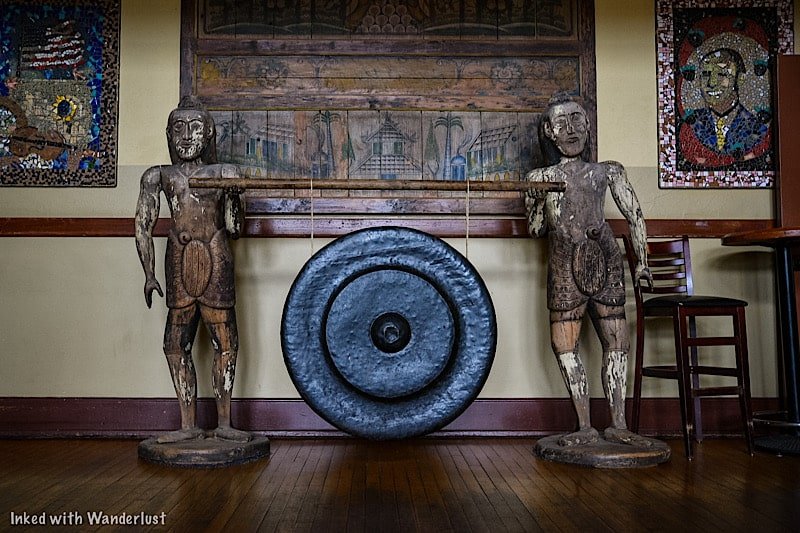
A lot of effort was made to preserve the building and its contents, such as; using school book pages as wallpaper, framing yearbook photos, and painting murals of former students.
These days, what was old is now new again as Kennedy School retains much of its original charm. In the former classrooms, you can now find bars, restaurants, lodging, shops, and more!
To get information on room rates and more, check out their website here.
9) Pittock Mansion

Pronounced, Pit-tick, this beautiful home was where Henry and Georgina Pittock lived in the early 1900’s. Henry Pittock was the owner of the newspaper, The Oregonian, and is often credited as the man who built Portland.
Georgina found her way to Portland along the Oregon Trail and would go on to find success in founding numerous charities and organizations such as Ladies Relief Society and Women’s Union.

The family would occupy the mansion until 1958, when the Grandsons of Henry and Georgina would put it up for sale. It sat empty for years and was heavily damaged by storms.
After holding fundraisers, the city would eventually acquire the property and restore it. Today, self-guided tours are offered to the public.
To purchase tickets or for more information, go here.
10) Portland Japanese Garden
Once dubbed by former Ambassador of Japan, Nobuo Matsunaga, as, “the most beautiful and authentic Japanese garden in the world outside of Japan”, the Portland Japanese Garden is a can't-miss destination.
Unfortunately, we were rained out on this day and couldn’t go (expensive cameras and water don’t mix). To see pictures of this beautiful place, head over to their website here.
11) Eat Gourmet S’mores at ‘1927 S’mores Company’

Remember sitting around the campfire and enjoying that sweet, chocolaty classic, S’more? Well, you can now enjoy one in a downtown setting as well.
Located on SW Alder street in Downtown Portland, 1927 S’Mores Company serves up amazing gourmet s’mores and hot chocolate.

In our travels, this is the first time we’ve encountered a place solely dedicated to s’mores, so we felt it deserved a spot on this list.
Be sure to get there early, as the interior isn’t spacious at all. You can view their Yelp profile here.
12) Powell’s Books
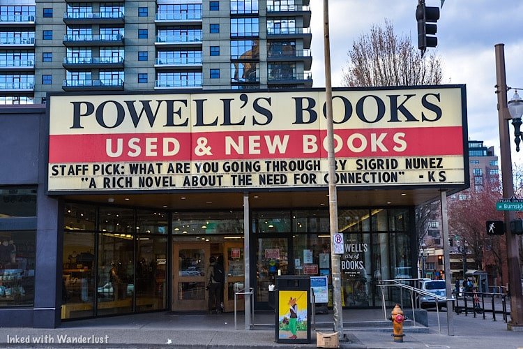
Powell’s Books is the largest independent bookstore in the world. It has served Portland since 1971 and is beloved by locals and tourists alike.
The store has multiple entrances, several levels (with elevators), and has over one million books for sale. You can find just about any book you could think of here.

The original, flagship location can be found on W Burnside street in the downtown area. If you’d like to browse their inventory online, you can do so here.
13) The ‘Keep Portland Weird’ Mural

Remember at the beginning of this article when I stated, “Portlandiers consider their weirdness as a badge of honor”? Here’s the proof.
It’s one of the many murals found throughout the city, but it’s special because it represents the city’s quirky nature and the individualism of its citizens.

It’s painted on the back of Dante’s Nightclub in Old Town, right across the street from VooDoo Doughnuts (making it an easy two-for-one trip).
The exact address is 350 West Burnside street.
14) The Redwoods at Hoyt Arboretum
This is another one we got rained out on and wish we had more time to explore. This short loop trail starts near Hoyt Arboretum and goes through a beautiful forest of redwood trees.
You can find it in Washington Park, not too far from the Japanese Garden and Portland Zoo.
15) Cartlandia

Since Kisha is a natural-born foodie, us coming here was a no-brainer. With over 30 food trucks to choose from, Cartlandia is every foodie’s dream come true.
It is located on SW 82nd avenue and is open daily from 7am to 9pm. Covered seating is plentiful and on-site parking, while limited, is available.

Here, you can find just about every category of food, including; BBQ, Mexican, Asian, Egyptian, breakfast, desert, and so much more.
For up-to-date information on which carts are currently on site, check out their website here.
16) White Stag Sign

This one is more for the Photographers out there (unless you happen to enjoy staring at signs in the middle of the night).

You could always photograph or see the sign during the day but at night, when it’s all lit up, is best, in our opinion.

The sign is viewable from the waterfront, but it is partially obstructed by trees. To get the best view, head up to the Burnside Bridge.
Either side results in a great photo but in my opinion, I liked the left side of the bridge (facing the sign) the best. This area can be a bit sketchy a night. So if you go, be cautious.
17) Tom McCall Waterfront Park
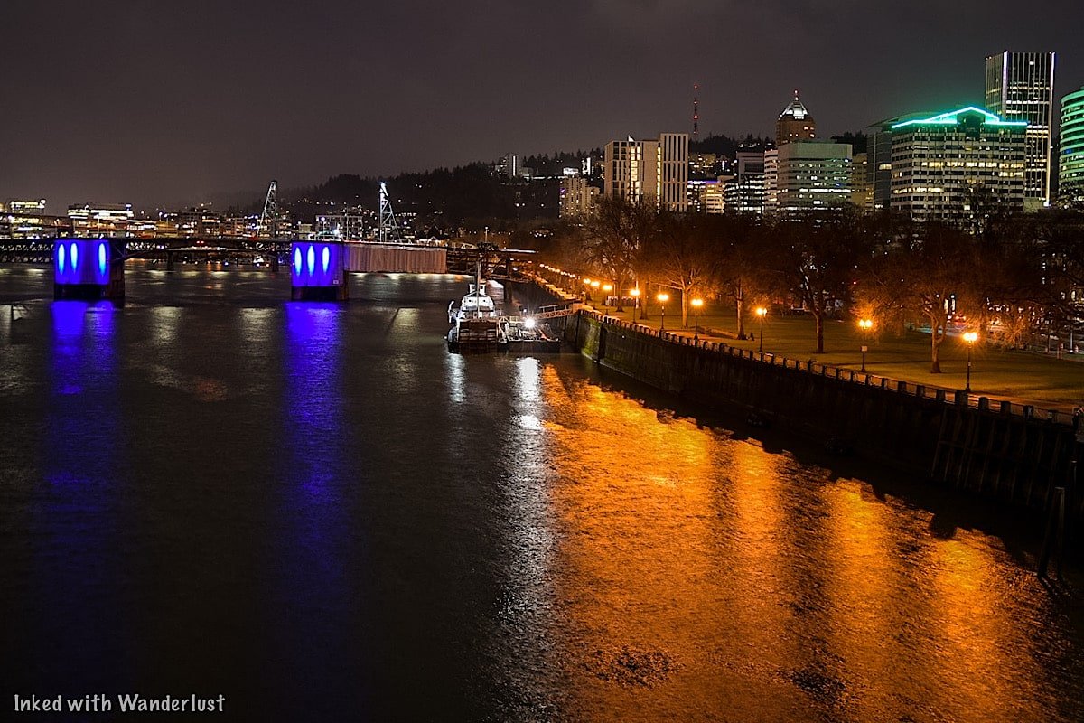
While you’re nearby checking out White Stag, be sure to spend some time exploring Tom McCall Waterfront Park.
It runs adjacent to the Williamette River and is around 36 acres in size. You’ll get amazing views of Portland’s many bridges and see many art installations along the way.
Cherry Blossom Trees dot the walking path and are a special treat for the eyes if you get here while they’re in full bloom.
18) Mount Tabor Park
Located just a short drive from the downtown area, Mount Tabor Park is a large forested park covering what was once an active volcano!
It has hiking trails, tennis courts, playgrounds, and amazing 360-degree views of the city and surrounding landscapes.
19) The Portlandia Statue

The Portlandia is a sculpture by Raymond Kaskey. It’s easy to find as it’s right along the sidewalk and above the entrance of the Portland Building on SW 5th avenue.
The sculpture was commissioned by the city in 1985, is 34-feet high, weighs 6.5 tons, and is based on the Portland city seal.

It is located just a few blocks away from Pioneer Courthouse Square, making it an easy jaunt once you’re done exploring that.
To get photos form an elevated position, head over to the building across the street and go up the escalator.
As it’s private property, I asked a Security Guard if it was ok and he let me go in. So keep that in mind if you decide to do the same.
20) Discover Art Murals

Portland, including and especially the downtown area, is littered with amazing art murals on the sides and rear of buildings and walls.

21) Chase ALL The Waterfalls

While you won’t find any in the city itself (aside from the few cascades in Forest Park), you’ll find a whole bunch of them just outside of it.
Just around 30-minutes or so up the Columbia River Gorge Scenic Byway is where you’ll find the majority of them.
A few of the most popular ones include Multnomah Falls (the tallest waterfall in Oregon), Bridal Veil Falls, Elowah Falls, Latourell Falls, Wahkeena Falls, and so much more!

List Recap:
VooDoo Doughnuts
Funhouse Lounge
Mill Ends Park
The Freakybuttrue Peculiarium and Museum
Witches Castle
Pioneer Courthouse Square
The Wishing Tree
McMenamins Kennedy School
Pittock Mansion
Portland Japanese Garden
1927 S’mores Company
Powell’s Books
The ‘Keep Portland Weird’ Mural
The Redwoods at Hoyt Arboretum
Cartlandia
White Stag Sign
Tom McCall Waterfront Park
Mount Tabor Park
Portlandia Statue
Art Murals
Chase Waterfalls
It is our hope that you’ve found this article helpful in planning your next adventure. If so, please consider supporting this site by sharing it with your friends and family on Facebook and Pinterest.
You can further support us by staying on and reading one or more of the related articles above.
Thanks for reading and safe travels!

The 5 Best Things to do in San Antonio this Saturday
In 2024, a whopping 40 million people visited the Alamo City and we were fortunate to be among them. San Antonio was one of those cities…

In 2024, a whopping forty million people visited the Alamo City, making it one of fastest growing cities in the United States. San Antonio is known for many things, including being the second home of the late, famed Tijana performer, Selena. In fact, parts of the 1997 movie of the same name was filmed along the banks of perhaps the city’s most popular attraction; the world-famous Riverwalk.
Whether you'll be visiting or you're a newly minted local looking for something to do on a Saturday, there are many local attractions with live music, culinary events, live entertainment, and more. Below are my five recommendations for best things to do in San Antonio on a Saturday.
1) San Antonio River Walk

One of the most famous attractions in the city, the San Antonio River Walk is 15-miles long and winds through roughly 5-miles of the downtown area. There is no fee to enjoy the River Walk and you can begin at any of the multiple starting points off the street.
Dotted along the river are local and brand restaurants, hotels, shops and various attractions that charge their own fees. The most popular being cruising the river itself. We took a cruise with Go Rio Cruises and found it be fun, informative and relaxing.

We didn’t try many restaurants on the river, as we tend to drift away from the touristy areas and dine where the locals do. There is one that I highly recommend, though, and that’s “Boudro’s on the Riverwalk”. Both the food and service were fantastic.
Throughout most of the year, you'll likely encounter live entertainment along the river's banks, including live music, performances, festivals, and other free events. There are also seasonal parades, including the Ford Parade of Lights in the summer and Day of the Dead parade in October. You can view the full schedule here.
2) Japanese Tea Garden at Brackenridge Park

The Japanese Tea Garden is located within the grounds of Brackenridge Park. Admission is free and it's not far from the downtown area, making it an easy drive or ride share away. It's open every day, between the hours of 7am and 5pm.
As stated above, admission is free but if you’re looking to do a professional photoshoot here, you’ll need to contact them to obtain a permit. Additionally, you can bring your dog here, provided you keep it on a leash.

You could easily spend hours here enjoying the year-round flora, stone walkways and bridges, the 60-foot waterfall, Japanese pavilion and more. When we were here (mid-day in July) there was only a few other people there. It was peaceful, tranquil and the perfect way to escape the hoards of tourists at the more popular spots.
Also located on Brackenridge Park grounds is the Witte Museum. It's the most visited museum in San Antonio, inspiring visitors and locals like to shape the future of Texas through relevant and transformative experiences in science, culture, and nature.
3) The Alamo

When planning a trip to San Antonio, especially for the first time, The Alamo is right up there with the River Walk as a must-see attraction. The Alamo is a significantly historic building where many people died during the Battle of the Alamo is 1836 (including Davy Crockett).
As with the prior two entries in this list, the Alamo is free to visit (timed reservations now required). I highly recommend paying a visit and seeing it for yourself. The interior is small and won’t take long to look through, but you’ll also be able to explore the beautiful grounds behind it that includes a mini museum, a water fountain dedicated to Davy Crockett and bronze statues of the most-known individuals who fought here.
4) Natural Bridge Caverns

The Natural Bridge Caverns gets its name from the 60-foot limestone bridge above it and was discovered in 1960 by four college students. It has since turned into a huge entertainment complex with zip lining, mazes, wall climbing, obstacle courses, restaurants and shops making up the surface activities.
Under the surface, however, is where the main attraction lies. There are two tours available. The first being the Discovery Tour, which is their most popular. You’re guided 180-feet below the earth’s surface through multiple cavern "rooms". For the more adventurous, the Hidden Passages Tour takes you through the natural darkness of the cave and into rooms not seen in the Discovery Tour.

Tickets can be purchased online or on-site (you’re better off with the former) and it seems that prices are determined by which day you want to come. Weekends are higher priced than mid-week. Adult tickets start at $37.75 with child tickets starting at $24.50. Note that these prices are for the cavern tour and do not include access to the surface activities. Parking is complimentary, so there's that.
I would avoid this tour in the summer, as the caverns remain at a year-round temperature of 70 degrees and a sweat-inducing 99% humidity. If you happen to be here outside of the summer when it's cooler, it's the perfect activity to get out of the elements for a while.
READ MORE: “Natural Bridge Caverns Tour in San Antonio”
5) The Historic Pearl District

We discovered the Pearl district by complete accident and it ended up becoming our favorite part of the trip. We were on our way to a great bakery in the area called, “Bakery Lorraine”, and after our brunch, we decided to abandon our plans and stay to explore the area.
The old Pearl Brewery building has since been converted into, “Hotel Emma”, and is a stunningly beautiful hotel. Stunning goth and industrial style decor come together to form the interior. The lobby is open to the public and we highly encourage you check it out. Next time we’re in San Antonio, we’re definitely booking a room here.
On Saturdays the Pearl hosts a famers market, the third campus of the Culinary Institute is here, as well as numerous restaurants, coffee shops, stores, and more! There’s also a small section of the river behind Hotel Emma. This vibrant community is well worth exploring. You could spend a couple hours or all day here.
Where We Stayed

JW Marriott
My wife and I very much enjoyed our stay here. They take great care of the property as everywhere you look you’ll find an abundance of lush greenery and flora. The lobby is huge and instead of just a pool, they have an entire water park out back that’s included in the price of your room.
The rooms were clean and well organized while the bedding was incredibly comfortable. The shower was walk-in style and the view from our balcony was amazing. The customer service from the staff was impeccable in every way possible. It’s truly a great property.
The only downside was how far away it was from literally everything in the city. Thankfully, the majority of the event we attended took place on property and transportation was provided to us for activities off property, so it wasn’t a huge issue. For clarity, it is a 30-minute drive from this hotel to the Riverwalk (one-way). Just something to keep in mind if you’re thinking of booking here.

Our Airbnb
Since the event was only going to be a few days, we decided to extend our time in San Antonio by booking an Airbnb that was closer to the action. After searching through all the listings, we decided on the, “Butler’s Attic”. It was located in a quiet neighborhood that’s just a short walk from the Pearl District and a quick ride share from just about everything else.
The owners took great care in designing this one. They managed to make this relatively small space feel roomy and comfortable. The shower is walk-in and all the amenities such as body wash and shampoo were provided. You can come and go as you please through the side door with coded, keyless entry. The only downside, to me, was the stairwell. Dragging our luggage up that thing wasn’t fun.
Stairs aside, this was one of the best Airbnbs were ever stayed in and would not hesitate to book it again. You can view the full listing here.
Tips For Your Trip

Avoid summer, if possible. We visited San Antonio in July and believe me, that would not have been our first, second or even third choice. The event we were attending was in July and it was that or nothing, so off we went. Summer is miserably hot, humid and attractions are crowded. We were told by multiple locals that spring and winter are the best times to visit.
Ride sharing is prevalent. Outside of any sponsored event activities in which transportation was provided to us, we utilized Uber for practically everything except for the Caverns (which was event sponsored). We never had an issue with any drivers and never waited longer than a few minutes for one to arrive.
Eat local. San Antonio has many, many solid local restaurants to choose from. Unfortunately, a lot of people stick to the branded ones located along the River Walk. With Boudro’s being the sole exception, we were told by multiple Uber drivers and locals to avoid the restaurants there as they cater to tourists and don’t have very high standards. A few places we can recommend are Bourdro’s, Bakery Lorraine (Pearl), and NOLA.
Take day trips! There are a few day trips you could take from San Antonio that I wish we had time for. Some of these include Austin, Fredericksburg, Guadalupe River State Park, New Braunfels, Gruene, and more! Be sure to look into some of these and include one (or more) into your plans.

Idaho’s Mammoth Cave: The Perfect Family Friendly Destination
Southern Idaho is so packed full of amazing natural wonders you could easily spend the entire month exploring it all. One of them can be conveniently found just 8-miles north of the historic town…
Southern Idaho is so packed full of amazing natural wonders you could easily spend the entire month exploring it all. One of them can be conveniently found just 8-miles north of the historic town of Shoshone.
We’re referring to, “Idaho’s Mammoth Cave”, a volcanic cave formed by a massive eruption millions of years ago. It was discovered in 1902 by settling sheepherders and is currently the largest volcanic cave in the world open to the public.
That’s not all this place offers, though. Also on site is what they dub, “Shoshone Bird Museum of Natural History”. It’s a massive collection of exotic animals, rare rocks, dinosaur fossils, and more!
Let’s get into it and fill you in on how you can visit this amazing place for yourself.
Mammoth Cave

Idaho‘s Mammoth Cave entrance sign. Shoshone, Idaho.
How To Get There
Address: 251 West Thorn Creek Street. Shoshone, ID 83352
If you’re coming from Shoshone or Twin Falls, Mammoth Cave will be on your left. You can’t miss it as you’ll see big blue wooden signs spelling out, “CAVE” (pictured above) just off the highway.

Idaho’s Mammoth Cave entrance. Shoshone, Idaho.
From here, continue another couple miles or so on a fairly well-maintained gravel/dirt road until you arrive at the pedestrian entrance and parking lot.
Find a spot to park along the fence line and walk through the entrance. You’ll see animal pens off to your left and a residential home up ahead. Continue walking until the path turns right to the Bird Museum. This is where you’ll pay the admission fee.
Admission Fees

Idaho’s Mammoth Cave. Shoshone, Idaho.
$12.00 per adult
$6.00 per child ages 6 - 12 years
Free for children 5 years and under
Your admission fee includes access to both the cave and museum. You can choose to skip the museum and only do the cave but it will not get you a discount. It’s also your choice on which order you’d like to do each attraction.
Bird Museum of Natural History

Idaho’s Mammoth Cave Bird Museum. Shoshone, Idaho.
After we paid, we choose to walk through the museum first. Initially, I wasn’t excited about it because I’m not into birds that much. However, after walking in, I quickly realized it was much, much more.
The museum is packed to the gills with all sorts of native and exotic animals, birds, dinosaur and fish fossils, art artifacts, Native American pieces, rare rocks, minerals, and much more.

Dinosaur fossil at Mammoth Cave Bird Museum. Shoshone, ID.
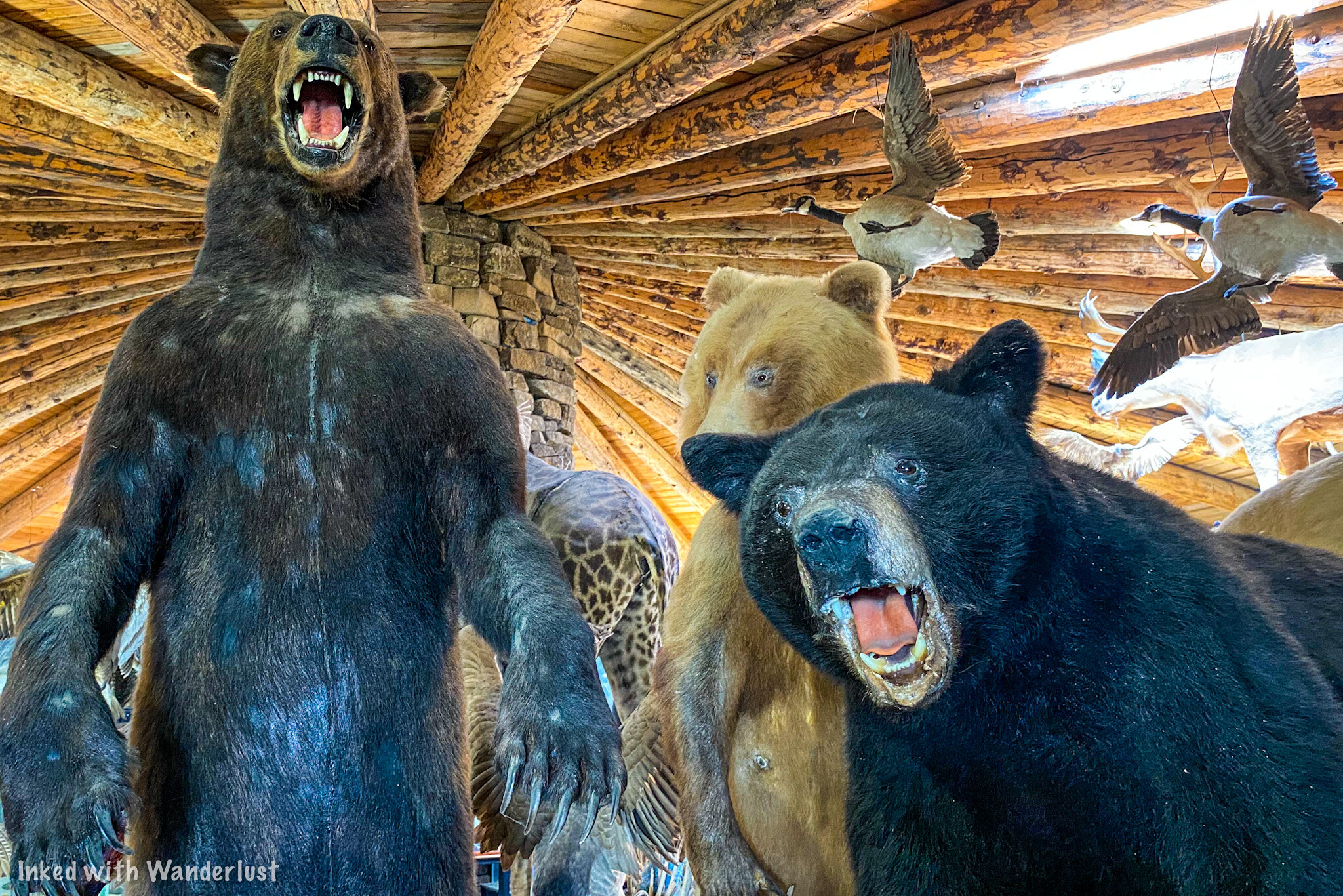
Bears at Mammoth Cave Bird Museum. Shoshone, Idaho.
It’s touted as being one of the largest private collections in the world and we don’t doubt it. You could easily spend a couple hours or more exploring all the displays and is worth the price of admission alone.
When you’re finished looking through the museum, simply head out the same way you came in and let the attendant know you’re ready to explore the cave.
Mammoth Cave

Entrance to Mammoth Cave. Shoshone, Idaho.
After notifying the attendant that you’re ready for the cave, they’ll give you a quick run down on what to expect and hand each person a lantern. If you have your own flashlight, you can use that instead.
(We should warn you that there is NO natural or artificial light once you get past the cave’s entrance. The lantern was the only source of light. We turned ours off and couldn’t see our hands in front of our faces).

Mammoth Cave entrance. Shoshone, Idaho.
After getting your lantern, you’ll be directed down a dirt path that does a half circle around the building you were just in and towards the cave’s one and only entrance/exit.
Watch your head and keep an eye on the little ones. The entrance is a bit of a squeeze and you immediately begin a descent into the cave via a narrow path.
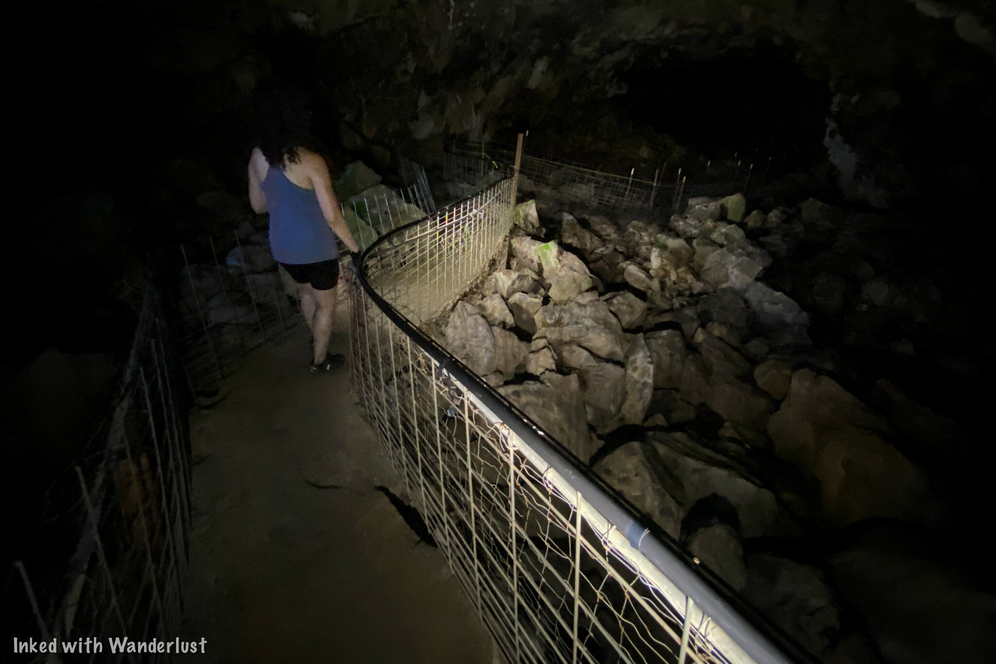
Inside Mammoth Cave. Shoshone, Idaho.

Inside Mammoth Cave. Shoshone, Idaho.
As you reach the bottom of the stairs and begin to make your way through the cave, you’ll begin to take notice of the unique color of the cave walls. This is due to a rare growth of mineral deposits that give the walls a look of pure silver.
You’ll also take notice of name markings on the walls. This was not due to vandalism (well, kind of). It was done by the early settlers who were the first to discover the cave back in 1902.

Silvery walls inside Mammoth Cave. Shoshone, Idaho.

Inside Mammoth Cave. Shoshone, Idaho.
Many different animals made use of the cave for shelter such as bears, buffalo, and horses. The bones of which have been discovered along the cave’s dirt floor.
The walk from the entrance to the end of the cave is only 1/4 of a mile. At the end of the designated path, you’ll see a sign describing the scene ahead of you. The ceiling of the remainder of the cave is about 50 feet high and surrounded by thick layer of lava rock.

End of the trail. Mammoth Cave. Shoshone, Idaho.
From here, you’ll simply turn around and go back in the direction from which you came. In and out, you’re looking at a half mile’s worth of walking along an easy dirt path.
Adults and children of all ages would be able to complete the trail. You’ll need to watch your footing, but the occasional rock is your only real hazard.
Unfortunately, the sheer nature of the cave floor and its entrance would make it difficult for those with certain handicaps and impossible for those in need of a wheelchair. The museum, however, can be enjoyed by all!
Conclusion
We hope this article about Idaho’s Mammoth Cave has inspired you to visit this wonderful place for yourself. If so, please consider supporting our website by sharing it with your friends and family on social media. You can further show support by staying on and reading one or more of the articles above.
Safe travels and thanks for reading!

How to Spend One Full Day In Twin Falls
Known as the gateway to the Snake River, Twin Falls lies in Southern Idaho not far from the Nevada border. It has a population just shy of 50K and is home to many amazing…
Known as the gateway to the Snake River, Twin Falls lies in Southern Idaho not far from the Nevada border. It has a population just shy of 50K and is home to many amazing attractions.
We recently paid a visit to this cool little city, spending a few days admiring its beautiful scenery and eating delicious food at a handful of its amazing restaurants.
After our trip, we were asked by family members (who were planning to visit) which attractions we would recommend the most as they were only going to be there for one day. That gave us the idea of putting this guide together.
The format will assume you’re spending a full day here. You’ll get a hotel or Airbnb the night before, spend the next day out and about, stay one more night, and head out the next day.
For simplicity sake, we’re going to skip our usual “how to get there” section as there are too many to list (depending where you’re coming from). We’ll also assume you’ll be driving in or will rent a car on arrival.
Let’s get into it!
Breakfast

Norm’s Cafe. Twin Falls, Idaho.
Time: 1 hour or less.
We’re firm believers in starting our day of adventure with a hearty breakfast. We also believe in supporting as many local restaurants as we can when we travel. Enter, “Norm’s Cafe”.
Norm’s was conveniently located just down the road from our Airbnb and had great reviews on Yelp, so it made for the perfect starting point for our day.
Norm’s is family owned and operated with friendly staff, delicious food, and speedy service. Options include omelettes, pancakes, waffles, chicken fried steak, breakfast burritos, and more!
Shoshone Falls

Shoshone Falls. Twin Falls, Idaho.
Time: 1.5 - 2 hours
Easily the most popular attraction in Twin Falls is the natural wonder known as, “Shoshone Falls”. It’s dubbed the, “Niagara of the West”, as it surpasses the height of its New York counterpart at 212-feet.
Due to its popularity, we recommend making it your first stop of the day (after breakfast) so you can beat the crowds. If you’re a sunrise or sunset person, this would make a great spot for either as well.
For information on how to get to the falls and when the best time to go is, read our complete guide here.
Evel Knievel Jump Site

Evel Knievel Jump Site. Twin Falls, Idaho.
Time: 1 hour or more (depending how much you do)
On September 8th, 1974, famed Daredevil Evel Knievel attempted to launch himself across the mile-wide chasm of this section of Snake River Canyon. The stunt failed, as the parachute malfunctioned and caused Evel to plunge into the canyon below.
Fast forward to present day and thanks to the generosity of current land owners, the ramp Evel used has been preserved as a monument, enabling visitors to see both it and the sheer magnitude of this attempted stunt for themselves.
The jump site is part of a local trail that zig-zags along the rim of Snake River Canyon and connects this to other area attractions like Shoshone Falls, Perrine Bridge, and the Visitor Center.
Visitor Center

Twin Falls Visitor Center. Twin Falls, Idaho.
Time: 1 hour or less
Get out of the sun for a bit and pay a visit to the city’s namesake Visitor Center. It’s a small but beautiful building that features local photography, art displays, an information booth, and gift shop.
If you’re looking for more information about the area, the employees are very knowledgable and can give you great tips and advice.
Outside, just beyond the parking lot, you’ll find a stone monument for Evel Knievel and a deck to view the Perrine Bridge. If you’re a Tesla owner, there are half a dozen or so charging stations here as well.
Perrine Bridge + Lunch

Perrine Memorial Bridge. Twin Falls, Idaho.
Time: 1 - 2 hours
Just a stone’s throw from the visitor center is Perrine Memorial Bridge. The bridge is named after L.B. Perrine who is considered to be the main founder of Twin Falls.
It spans 1500-feet across Snake River Canyon and stands at 486 feet above the river. Viewing decks are located on each side connected by pedestrian walkways offering epic views of the river and canyon features.
The south side viewing area is the easiest to access from the visitor center but the one on the north side was our favorite (pictured above). You can either walk across or drive to the small parking lot on the north side.
When you’re done here, simply pick and choose where you want to have lunch. There are many options nearby including Chick-Fil-A, Habit, Texas Roadhouse, and more.
Perrine Coulee Falls

Perrine Coulee Falls. Twin Falls, Idaho.
Time: 30 minutes or less
Shoshone Falls may be the most known of Southern Idaho waterfalls but when it comes to sheer beauty, in our opinion, Perrine Coulee Falls takes the cake.
We found it by pure accident while driving down the canyon into Centennial Park. A bit of luck plays into this as you will have to secure one of the few parking spots on the side of the road.
Perrine Coulee drops 200-feet into a half-bowl shaped portion of the canyon. A short trail takes you behind the falls (backside of water, anyone?) and over to the other side.
Balanced Rock Park

Balanced Rock Park. Southern Idaho.
Time: 2 -3 hours (including drive time and time spent at the campground)
Full disclosure, this one isn’t in Twin Falls. It’s near Buhl. However, it’s still in the same county and it’s too cool to miss, especially if you’re like me and really into weird rock formations.
As mentioned above, Balanced Rock can be found near Buhl, about 30-minutes or so from Twin Falls. The drive takes you through beautiful farm land before dropping you into Salmon Falls Creek Canyon.

Salmon Falls Creek Canyon. Southern Idaho.
The rock in question (pictured above) is wind-carved, 48-feet tall, weighs 40 tons, and sits precariously on a 3 foot by 17 inch pedestal. It’s truly an interesting sight.
There’s a fairly large parking lot with a singular picnic bench on the side of the road. From there, just pick one of the spur trails and head up. Or just check it out from the parking lot.

Balanced Rock Campground. Southern Idaho.
Just down the road from Balanced Rock is the campground of the same name. Simply put, this was one of the most purely beautiful campgrounds we’ve ever seen.
It features picnic tables, plenty of camping spots dotted along the canyon wall (no RV hook-ups), bathrooms, and fishing in Salmon Falls Creek. The best part? It’s first-come, first-serve and free.
Dinner

Scooter’s Chillin & Grillin restaurant. Twin Falls, Idaho.
Time: About 1 hour
You’ve been out and about all day long. Now it’s time for you to sit back, relax, and go to town on the most delicious burger in Twin Falls, “Scooter’s Chillin n’ Grillin”.
This sports bar has far more than just burgers, but it’s what they’re most known for. Add chipotle bacon and habanero cheddar for a kick and finish it off with their savory sweet potato fries. You won’t be sorry.
Conclusion
There it is. Your full day itinerary for Twin Falls. Obvisouly, these are just our suggestions. Feel free to tweak it to your preference and interests. After all, it’s your trip.
We hope this article about Twin Falls has inspired you to visit this wonderful place. If so, please support our website by sharing it with you friends and family on social media. You can further show support by staying on and reading one or more of the articles below.

Best Time to Visit Shoshone Falls in Southern Idaho
Coming in at a height of 212 feet and a width of 900, Shoshone Falls is one of Southern Idaho’s most popular natural attractions. Surpassing the height….
At a height of 212 feet and width of 900 feet, Shoshone Falls is one of Southern Idaho’s most popular natural attractions. Surpassing the height of its New York counterpart, Niagara Falls, it’s fittingly referred to as the Niagara of the West.
Shoshone Falls is located just 7 miles from Twin Falls proper, making it easily accessible to anyone with a car. Its natural beauty, impressive flow, and ease of access makes it abundantly popular, attracting more than five hundred-thousand spectators annually.
Despite its popularity, Shoshone Falls doesn't always flow at its fullest. This is due to both natural reasons, such as snowmelt, and agricultural reasons, as a portion of the river that feeds the falls is diverted for irrigation purposes, which reduces the flow over the falls.
There's nothing worse than arriving to the falls, expecting to see it in all its grandeur, and see nothing but a drip. That happened to me on my first visit, so I want to help reduce your chances of that happening. This post will cover (what I feel) is the best time to visit Shoshone Falls. I'll also discuss getting there, fees, what to expect, and more.
Getting to Shoshone Falls

As stated above, Shoshone Falls is located just seven miles outside the city of Twin Falls in Southern Idaho and getting to the falls is fairly straightforward. Starting from Twin Falls:
You’ll head northeast on Shonshone Street towards 2nd Ave
Take a slight right on Addison Ave
Turn left on Champlin road. Stay on for 2.5 miles and stay left at the junction before arriving at the parking lot
For GPS purposes, the exact address is 4155 Shoshone Falls Grade Road, Twin Falls, ID 83301
On the way, you’ll drive through beautiful farmlands before descending into an impressive canyon as you make your way to the falls. If you pay attention and you’re here at the right time of year, you’ll see little streams of water descending the canyon walls around you, making it an impressive sight. This usually occurs in early spring or late spring.
Parking and Entrance Fees

Between the months of March and September, there is a fee to visit the falls (and Dierkes Lake, which is also within the confines of Shoshone Falls Park). The fee is just $5 per vehicle. You'll pay at the toll booth near the entrance. You can pay with cash or credit/debit card. If you plan to visit five or more times during the season, consider purchasing an annual pass at just $25.
It’s worth mentioning that when we came here in late June (close to sunset), there wasn't anyone present collecting fees, nor was there a self-pay station. We just drove right in and parked, prepared for someone to approach us for the fee, but no one ever did. Not sure if this is a common occurrence, though.
The parking lot is fairly large and paved, capable of holding many vehicles, RVs, and tour buses. If you're here is the summer months, there's a good chance the lot could fill. Be prepared for that possibility. For weekends in the summer, I would plan to arrive early.
Shoshone Falls Observation Deck
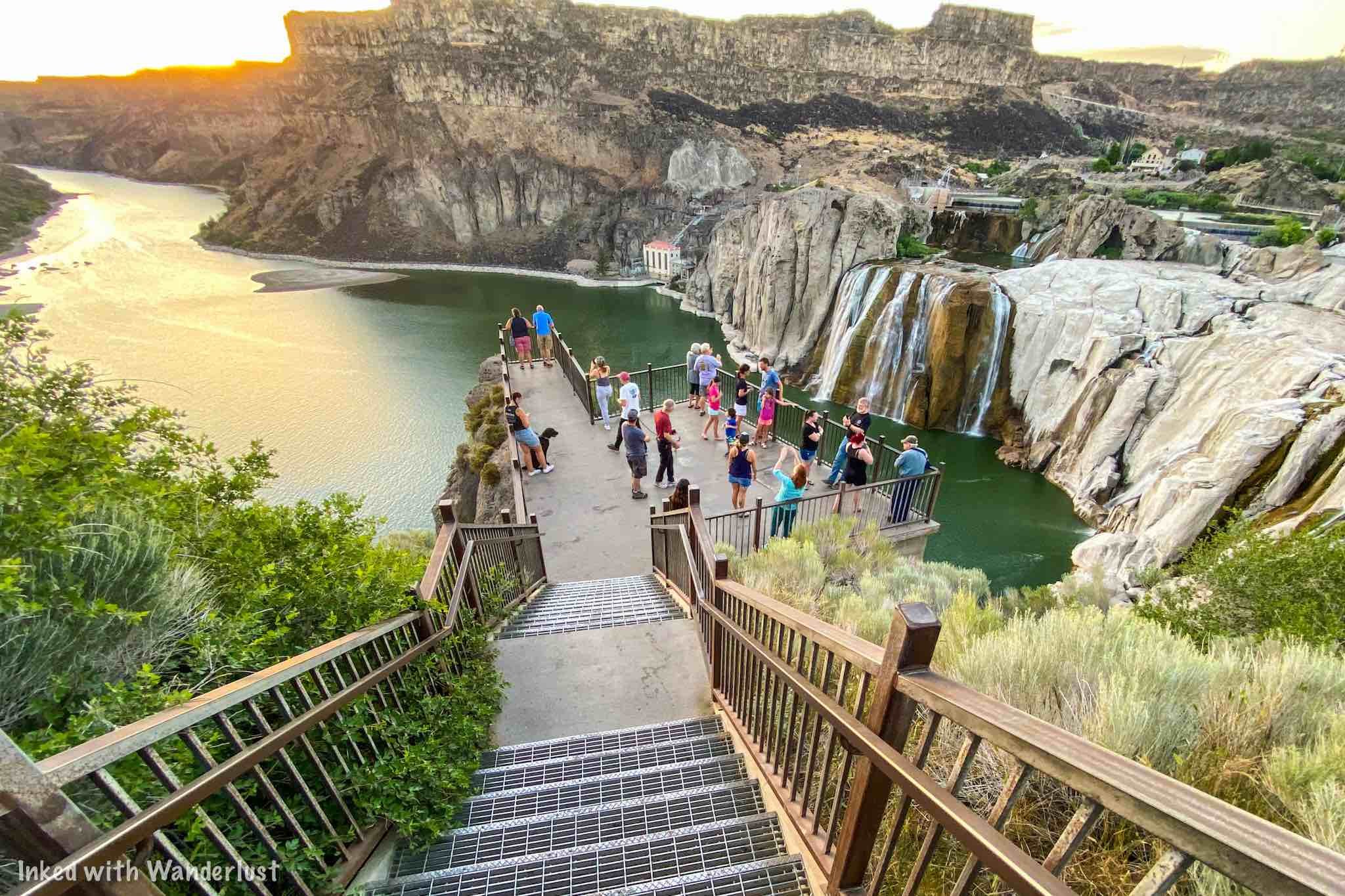
From the parking lot, there are a few viewing platforms to see the falls from. The middle one (the closest, most popular and largest) is right off the lot and is accessed by a stairwell. Uphill and to the right is where you’ll find another viewing platform. This one was our least favorite as there was lots of shrubbery blocking the view.
In the opposite direction, to the left, is a higher platform and was our favorite as it gave us a great view of not just the falls, but the Snake River as well. This viewing area was also muchless crowded than the main one.
If you're here at the right time of year when the spring runoff is at its peak, the roaring sound of the falls you'll hear from the observation deck is an unreal experience.
Best Time to Visit Shoshone Falls

This was something I wish I researched more before going. Starting in the summer, much of the river is diverted for irrigation purposes, and this causes the flow over the falls to dissipate to near dry levels (we were here in late June and flow was minimal). If there's a healthy amount of snowmelt, you'll still see a decent flow, though.
If you come in the fall, the falls will look nearly dry as the snow has mostly melted away by this point, as the remaining flow is used to recharge the reservoir system upstream. This process usually begins in late summer. If you must stick with the summer months, then early summer is your best bet.
Winter is a craft-shoot, as the flow can be decent. However, there's always the possibility of a portion of the falls freezing over, reducing the flow. In addition, you'll be dealing with potentially slick conditions on not just the road, but the viewing decks as well.
All that said, in my opinion, the best time to visit Shoshone Falls is between the months of April and early June. April is right about when the snowmelt begins to show itself and if it was a healthy winter, the impressive water flow will continue throughout spring.
Around late May to early June is when you'll begin to see a reduction in the flow of the river, as that's when the irrigation process begins. If you're here during these times (or later in the summer), your best bet would be to arrive early, as Idaho Power typically diverts later in the day, leaving the morning with decent flow.
Nearby Attractions in Twin Falls

Shoshone Falls may be the most known attraction in the area, as it’s Idaho’s largest waterfall, but you could easily spend a few days or more exploring everything Twin Falls (and the surrounding area) has to offer. Below are just a few of my top suggestions.
Evel Knivel Jump Site

Located downstream from Shoshone Falls is where you’ll find the location where famed daredevil, Evel Knievel, attempted to launch himself over the Snake River in a steam powered “skycycle”. You’ll scratch your head in disbelief when you see for yourself the sheer magnitude of this attempted jump and make you wonder what the @#$! he was thinking.
Perrine Bridge

Further downstream from the falls and jump site is the Perrine Memorial Bridge. This impressive bridge spans 1500 feet across Snake River Canyon and connects the cities of Twin Falls and Jerome. Both sides of the bridge have parking lots and viewing decks and much like most popular bridges, there’s a pedestrian walkway you can utilize.
Twin Falls Visitor Center

Near the Twin Falls side of the bridge is where you’ll find the city’s visitor center. It’s a beautiful building that features merchandise, knowledgeable employees, photography displays of local attractions, and its own viewing deck of the canyon, bridge, and river.
Shoshone Ice Caves

Located outside the town of Shoshone, Idaho (about 45 minutes from Twin Falls), the Shoshone Ice Caves tour is a MUST if you’re in the area. Your tour guide will take you through a 1,000 foot lava tube on walking planks above the ice. On a hot day, this is the perfect activity to take part in.

17 Free and Cheap Things to Do in Seattle
Let’s face it, Seattle is not a cheap city to visit. Hotels, restaurants, attractions, and the like. While a lot of them are worth what they cost…
Disclosure: This post contains affiliate links. If you make a purchase through these links, I may earn a small commission at no additional cost to you. I only recommend products or services that I believe will add value to my readers.

Let’s face it, Seattle isn't a cheap city to visit. Between hotels, restaurants, attractions, bars, etc, it adds up. While a lot of them are worth their cost, it helps to have free or cheap options to offset that.
We visited the Emerald City in 2020 and 2021. Between the two visits we experienced everything listed below and some! Because we saved so much doing these, we just had to share them with you.
The following list is of 17 attractions, activities, or eateries that are either free or close to it. In each listing we list the cost (or as close to it as we can) so you’ll have a good idea of what to expect.
1. The Fremont Troll
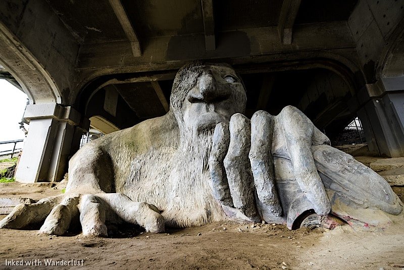
Cost: Free
If you’re going to visit Seattle, you’ll need to pay toll to the Fremont Troll. It was constructed by four local artists in an attempt to help rid the area of drug dealers and other undesirables.
It’s made up of steel rebar, concrete, and wire and weighs 13,000 pounds. While it’s free to check out, parking is limited and there are no public restrooms. You’ll also be contending with crowds during the tourist season as this spot is popular with Instagrammers.
2. Gas Works Park

Cost: Free
Located on the north end of Lake Union, Gas Works Park is a 19-acre public park that was once the site of the Seattle Gas Light Company. Nature has been slowly overtaking the rusted process equipment and makes for an excellent place to explore and photograph.
Near the entrance of the park is a small playground for kids, partially made up of the abandoned equipment. This park is a wonderful place to hang out, enjoy a picnic, or to take in the views of the downtown lights at night.
3) Eat Your Way Around Pike Place

Cost: Less than $10 per item
Man oh man. If you haven’t experienced any of the many awesome eateries in and around Pike Place, you’re missing out on some goodness. From Rachel’s Ginger Beer (pictured above) and Pike Place Chowder to Beecher’s and Piroshky Piroshky, you’ll never go hungry.
Best of all, most of these places offer small entrees below $10 bucks and they can be split between two people. When you compare that to most other restaurants throughout the city, it’s a cheap activity for the foodie in your group.
4) Photograph the City at Night

Cost: Free
My personal favorite activity in Seattle is grabbing my camera, heading out to nearly anywhere in the city, and photograph the area at night.
Yes, Seattle isn’t without its problems and you will need to be mindful of your surroundings, but I have never been in a position where I felt like I was in danger.
Pike Place and the surrounding downtown areas are my personal favorite locations. You will need the proper equipment but as long as you have those, this activity is totally free.
5) UPS Waterfall Garden
Cost: Free
Also known as UPS Park, this pocket park was built in the 1970’s in Pioneer Square near the original United Parcel Service building. It features a man-made, 22-foot waterfall surrounded by colorful floral and greenery. There is seating in the upper deck providing a wonderful place to sit and relax for a bit. The waterfall wasn’t operating when we were here so unfortunately, we have no photos to show you. You can follow this link to the official website of Pioneer Square to see one.
6) Downtown Murals

Cost: Free
There are murals literally all over the city. So much so, you’d be hard pressed to not see one. While my personal favorites are in the Greenwood neighborhood (as stated in this article), the downtown area has a lot worth searching for.
There’s no real starting point. Especially if you’re staying in the downtown area. If so, simply leave your hotel and start walking around. It won’t take long.
7) The Post Alley Gum Wall

Cost: Free
It may be called the gum wall, but it really should be called, “Gum Alley”, because it is far more than just one wall. A good chunk of this section of Post Alley is covered floor to ceiling, on both sides, in gum.
It’s quite gross if you think about it, especially considering the times we’re in. Regardless, it’s still something you have to see at least once. You can even add to it, if you wish. There’s a gumball machine further down the alley.
8) Support Local Coffee Shops
Cost: Around or less than $10
Supporting local restaurants, shops, operators, etc, is super important. Now more than ever. Even if you’re a Starbucks diehard, you’re in Seattle. The practical birthplace of the coffee shop.
There are dozens of amazing shops in the city. My personal favorite being, “Anchorhead”. Ever had a “Quaffle”? It’s a waffle and croissant combination. You’re not going to find anything like that at Starbucks.
9) Snoqualmie Falls

Cost: Free parking available and free entry. We spent just over $9 bucks in gas, round-trip
While not in Seattle, Snoqualmie Falls is a simple, 30-40 minute drive from the downtown area and is more than worth the trip.
If you’ll need to rent a car, then this would not be a super cheap outing (although our rental only costs us $45 bucks for 24 hours). If you already have a vehicle, it’s just gas.
There’s a free parking lot at the falls across the street, no entry fee, and it’ll cost you a minimal amount in fuel. Check out our article here for all the information you’ll need to plan a visit.
10) Take in the Views
Cost: Free (mostly)
I say ‘mostly’ because while you can go to dozens of spots throughout the city to get an amazing view, a lot of them will charge you for the privilege.
The Space Needle, Columbia Center, etc, all come at a fairly significant cost. If you want free views; the waterfront, Kerry Park, the ferry (small fee), Lake Union, and Gas Works Park are great options.
11) Seattle Public Library
Cost: Free
Chances are good that during your visit to the emerald city, it will rain at least once. That’s just a fact of life in Seattle. If the weather service is predicting a particularly heavy rain day during your visit, you may want to consider checking out the Seattle Public Library. There’s no admission fee and you’re free to read all you want while you’re there. What draws locals and visitors here is the architecture. The interior is simply stunning and unlike any Library you’ve seen.
12) Check out Historic Boats on Lake Union’s South Shore

Cost: Free
Located on the south shore of Lake Union you’ll find, “The Center for Wooden Boats”. They’re an indoor/outdoor museum showcasing the history and modern use of wooden boats.
They feature free programs for all such as providing a one-hour rental in one of their peapod rowboats that accommodate up to 5 and toy boat building lessons for kids.
Unfortunately, it was closed during our visit in 2021. You can visit their website for up-to-date information.
13) Take the Ferry to Bainbridge Island
Cost: $10.25 per adult, $5.10 for seniors (65+) and free for youth (18 and under)
A ride on the ferry from Seattle to Bainbridge Island and back is reasonably priced and once you’re on the island, it’s an easy walk from the terminal to the main strip where a lot of the shops, restaurants, and museum are.
There’s also a few taxi services available to take you around. We took “Viking Taxi” from the terminal to Bloedel Reserve and we paid $15 for a one-way trip.
If you have kids, the ferry ride alone will probably excite them. You can visit the Bainbridge Island website for a complete listing of all there is to do.
14) Bainbridge Island Museum of Art
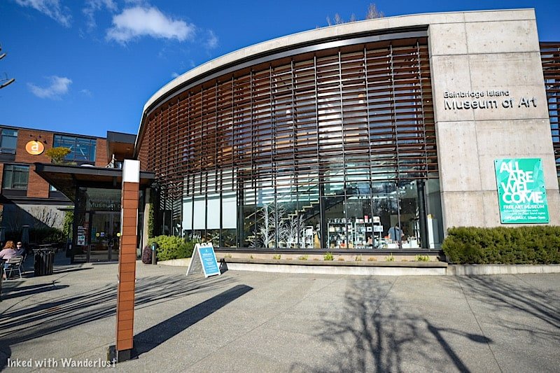
Cost: Free
Since we’re on the subject of Bainbridge Island, while you’re there be sure to stop by the Museum of Art. It is located at the beginning of the main strip and is a short walk from the ferry terminal.
On the second level, they have multiple paintings from Kimberly Trowbridge of the Bloedel Reserve and some Native American art pieces. The bottom floor features artwork inspired by social justice.
The pieces are truly beautiful and inspiring. Visit their website for current hours and exhibits. Admission is free but they do appreciate donations.
15) Tour the Amazon Spheres

Cost: Free
Amazon built the spheres for their employees as a place they can go to escape the typical office environment and be inspired by this urban jungle that houses over 40,000 plants from 30 countries.
Non-employees (tourists) are allowed to visit this amazing place on the weekends and can take part in guided, informative tours. Currently, due to covid, the spheres are temporarily closed to the public.
16) Shop the Pike Place Vendors

Cost: Varies, but usually not much
Pike Place has a variety of vendors and after a rough 2020, they need your support now more than ever. You’ll find vendors of all kinds here.
Produce, jams, artwork, jewelry, spices, seafood, flowers, and more! If you can think of it, Pike Place will likely have it.
17) Stroll the Waterfront
Cost: Free
There a fewer things more beautiful than Seattle’s waterfront. Especially at night. With so many shops, restaurants, and attractions to choose from, you could spend a full day here.
No money is required to walk along the multiple piers, go for a jog, or break out your camera and shoot away. Currently, there is a lot of construction going on as the city works to improve and add to the area.

Complete Guide to Visiting the Seattle Space Needle
The Emerald City has so much to offer its visitors. So many parks, museums, coffee shops, and more to choose from, you’ll never be able to…
The Emerald City has so much to offer. With many parks, museums, coffee shops and more to choose from, you’ll never be able to see it all in just one trip. There's one attraction however, that stands out from the rest. That attraction is the 605-foot tall, historic Seattle Space Needle.
Initially constructed for the World’s Fair in 1962, millions of visitors have stood atop its 520-foot indoor/outdoor, saucer-shaped observation deck that offers an unparalleled view of Seattle, the Puget Sound, Mount Rainier, cascade mountains, downtown Seattle and the Olympic mountain range.
I visited it for myself for the first time in 2020 (just before covid began to run rampant) to document and gather all the necessary information to help you plan a visit to this historically significant Seattle landmark. So read on below to find out how you can experience it for yourself.
Seattle Space Needle Tickets and Location

The Seattle Space Needle is located within the grounds of Seattle Center, which is an arts, entertainment, tourism and education center spanning 74 acres housing several attractions, such as the needle, Chihuly Garden and Glass, and the Museum of Popular Culture. If you’re driving, the needle’s address is 400 Broad Street.
If you’re walking from your hotel, utilize Google or Apple directions on your phone and hit the walking tab for step-by-step directions. Likewise, if you’re using Uber or Lyft, simply punch, “Space Needle”, into the search bar.
Purchasing tickets is a simple endeavor at the needle. Your first and best option would be to purchase tickets online in advance of your trip. Just go to the official website, select your date and time of arrival, pay and you’re done.
Conversely, you could also purchase tickets at the kiosks on site at the ticket window. Keep in mind, if you wait until the day of, you may experience a lengthy wait or even worse, no availability. This is especially true in the summer months when demand is high, as it’s a popular tourist attraction.
Space Needle General Admission Price
If all you’re looking to do is the Space Needle, this is the ticket option for you. It comes with access to the observation deck, the Loupe with glass floor and the ground level. Prices range depending on season and are as follows:
$35-$42 (ages 13-64)
$29-$37 (ages 65 and up)
$26-$32 (ages 5-12)
Space Needle/Chihuly Garden and Glass Combo Ticket
This is my top recommendation as it grants you access to not only the Space Needle, but the Chihuly Garden and Glass Museum as well. You save twenty percent versus buying them separately and since they’re right next to each other, it makes perfect sense to see both. Prices are as follows:
$64 (ages 13-64)
$55 (ages 65 and up)
$48 (ages 5-12)
Hours of Operation
The Space Needle is open year-round, which includes all major holidays. The best time to visit, in my opinion, is on a weekday during the off-season. The weather may not be great, but you’ll experience the least amount of crowds and still get breathtaking views.
It opens everyday at 10am, but the time it closes varies. As of 2025, on Mondays, Tuesdays and Wednesdays the needle closes at 7pm. On Thursdays it closes at 8pm, followed by 9pm on Fridays, Saturdays and Sundays.
Seattle Space Needle Observation Tower

With tickets in hand or on your phone, you’ll arrive to the entrance on the date and time you selected. If your visit is outside the busy summer months, chances are good that you'll experience a minimal wait.
Shortly after entering the building, you’ll go through a security check point where they’ll check for prohibited items such as weapons, drones, etc. In my experience, the process was quick and painless. It isn't as stringent as airport security, for example.

If you end up having to wait, there are informational boards throughout the queue detailing the Space Needle's history, its construction and milestones, accompanied by photographs. There’s a lot of interesting information here so be sure to check them out even if there's no wait.
The end of the queue is where you’ll enter the elevator. This is an experience all itself especially, if your operator has a sense of humor. The first couple hundred feet or so is enclosed but before long it’ll open up to clear glass, giving you an amazing view as your ascent continues.
The Top House
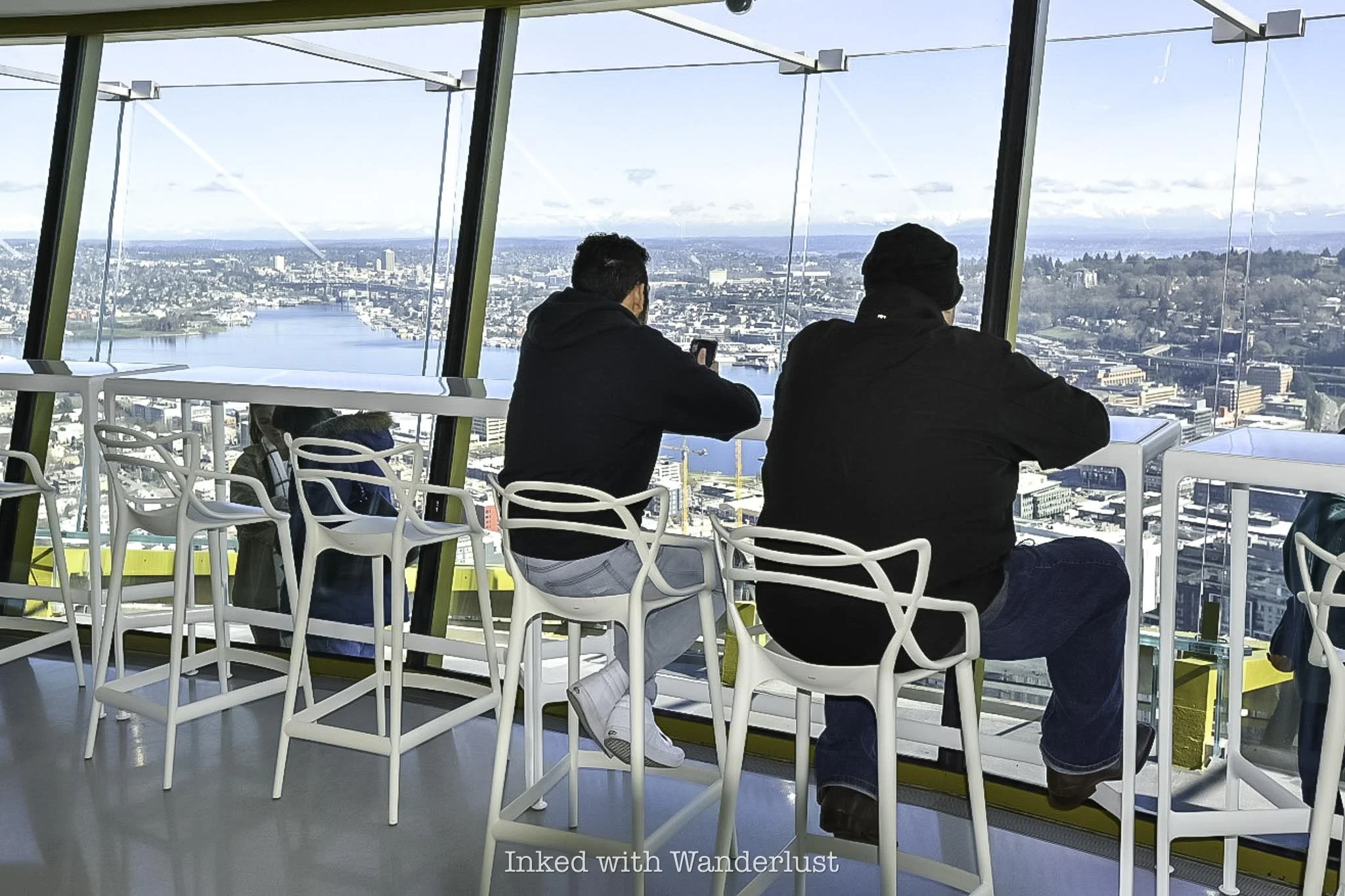
At the end of the ride, you’ll step out of the elevator and into what’s referred to as The Top House. Here, you’ll find an abundance of seating throughout and viewing areas for those who don’t want to go outside or if the weather isn't favorable. There’s also a refreshment stand featuring select snack items and Starbucks coffee.
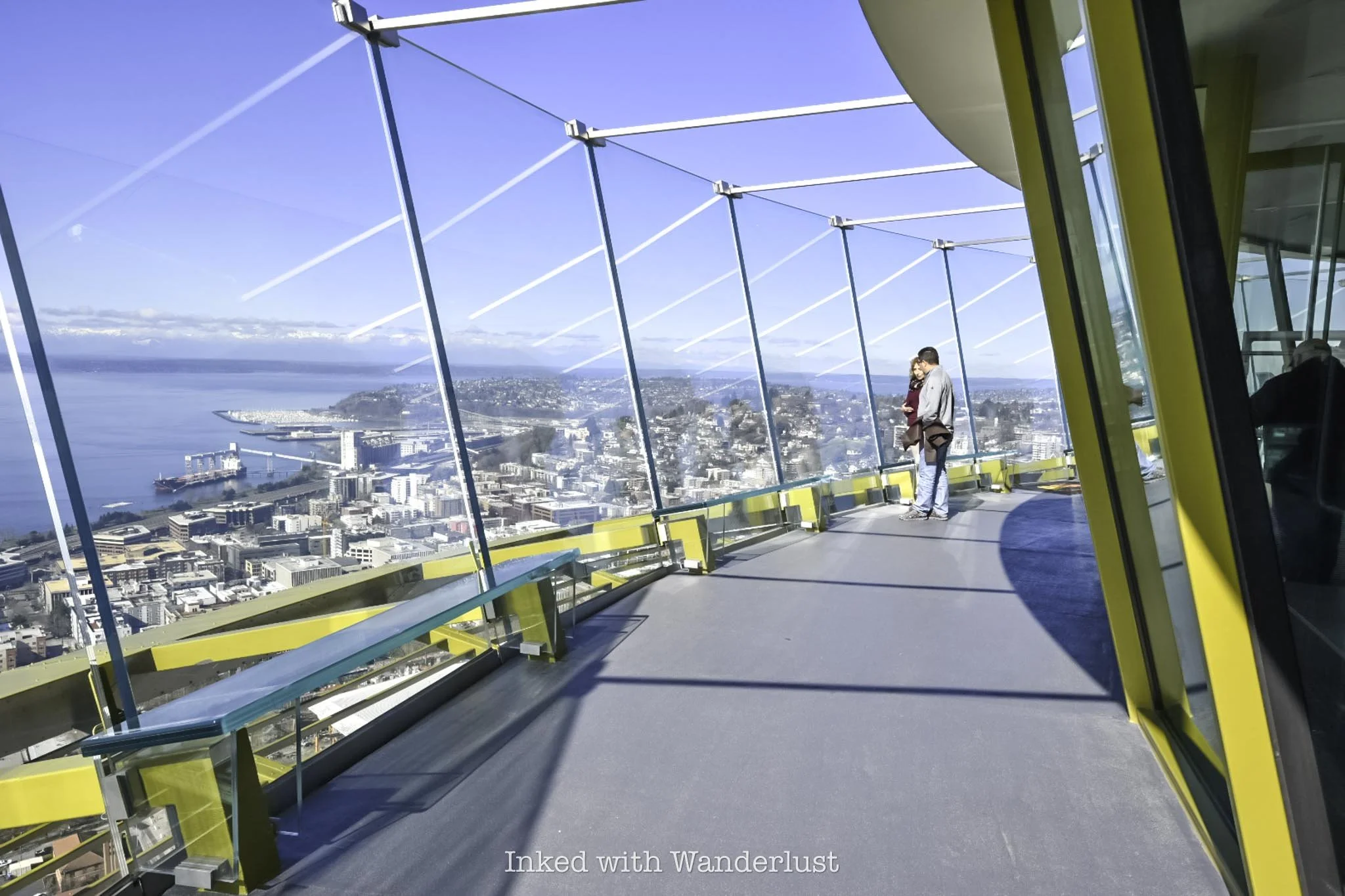

Outside on the observation deck is where you’ll get those breathtaking, 360-degree views of downtown Seattle and beyond. There are benches all along for those brave enough to lean back on, in addition to automated camera stations where you can snag souvenir photos from.
For first-time visitors, the top of the Space Needle is quite a unique experience with multiple interactive exhibits, including a digital guestbook, high-definition screens detailing the history of the needle, and virtual reality stations.
The Revolving Glass Floor at ‘The Loupe’

The observation deck is cool and all, but perhaps the best feature of the needle is The Loupe, featuring the world's first rotating glass floor. If you’re afraid of heights or prone to vertigo, you may want to skip this as it's quite jarring.
If you’re not, then definitely do it as it's one of the coolest experiences you’ll ever have and alone is worth the price of admission on its own. Also here is the Loupe Lounge, a unique dining experience featuring a multi-course meal, crafted cocktails and delicious desserts.
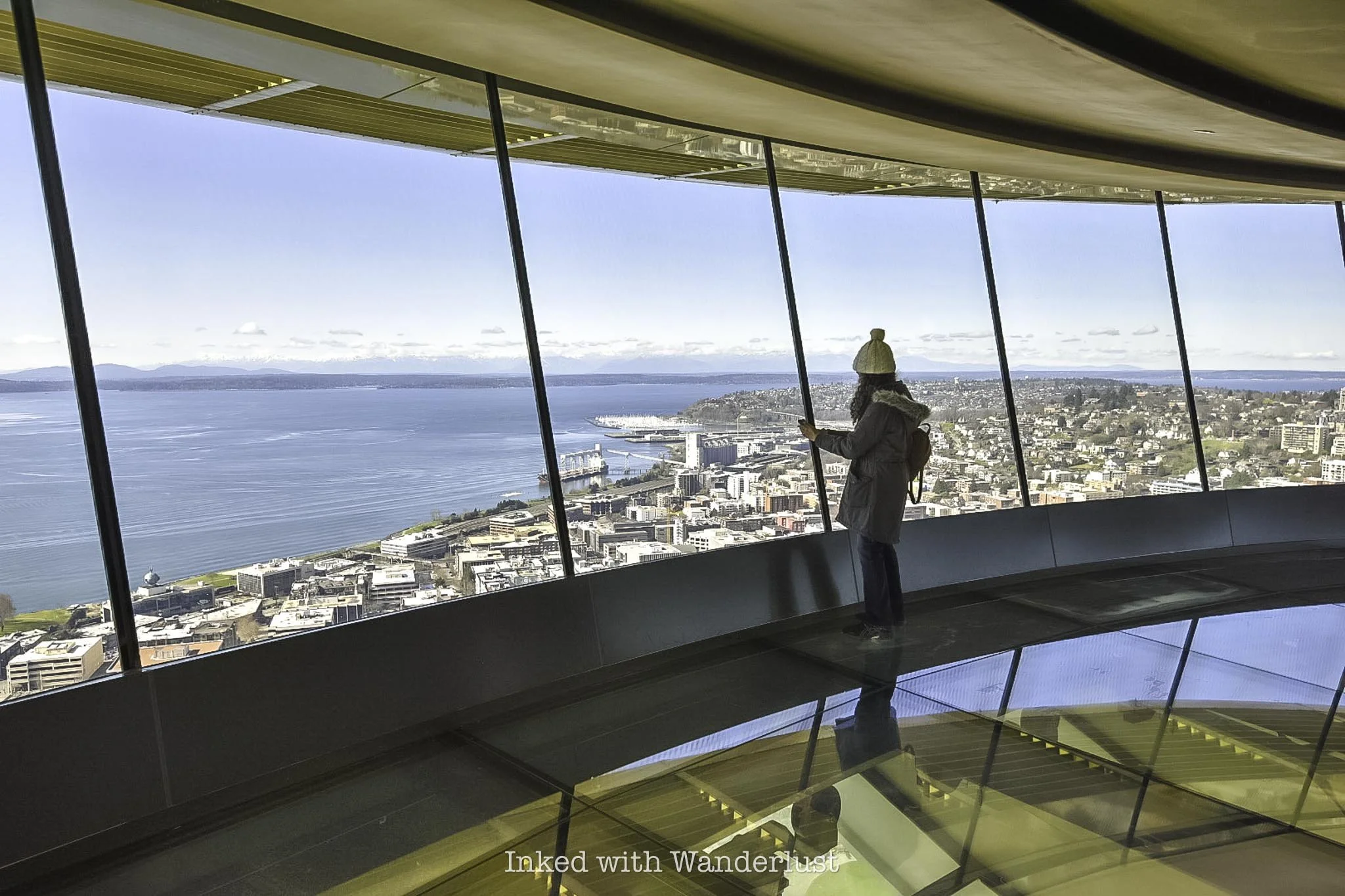

To get to the Loupe from the observation deck, simple use the staircase adjacent to the refreshment stand. Called the, “Oculus”, this grand staircase is beautifully made with wood, steel, and glass. By the way, the area in between these two floors is where you’ll find the rest rooms.
Once you're finished with your visit at the top of the tower, consider heading next door to the Chihuly Garden and Glass Museum. From there, be sure to experience the many other great Seattle attractions, such as Pike Place Market, the famous waterfront, the Gum Wall at Post Alley, the Original Selfie Museum, and more.