Hike the Fire Wave Trail at Valley of Fire State Park
Disclosure: This post contains affiliate links. If you make a purchase through these links, I may earn a small commission at no additional cost to you. I only recommend products or services that I believe will add value to my readers.
Located in the northern section of Valley of Fire State Park along White Domes Road lies one of the park’s most fascinating and photographed formations - Fire Wave. Best of all, it doesn’t require a whole lot of effort to see!
Known for its ultra-colorful swirls of red, white, and orange Aztec sandstone out-crops, Fire Wave offers park goers a picturesque, wavy formation resembling a fiery sunset. Due to this, it’s become one of the most popular attractions in the park.
If you’re heading out to Valley of Fire, Fire Wave should most definitely be on your list. There are a few things you’ll need to know before going, however. In this post, I’ll cover topics such as trail closures, parking, what to expect and more. Let’s get into it!
Trail Stats
Location: Valley of Fire State Park (north section)
Fee: None for the trail, but standard park entry fees apply
Open: Between October and mid-May
Family Friendly: Yes
Cell Service: Spotty (based on Verizon service)
Restroom: None (nearest is at White Domes Day Use Area to the north or Rainbow Vista to the south)
Parking: Two lots at the trailhead
EV Stations: None
Difficulty: Easy to moderate (depending on temperature)
Popularity: High
Mileage: 1.3 miles, out and back
Time: 30 minutes to one hour
Condition: Maintained and easy to follow
Features: Colorful sandstone formations
Best Viewed: Either sunrise or sunset
Pets: Not allowed
Drones: Not allowed
Hazards: Heat exposure, potential wildlife encounters, and rolled ankles
My Visit(s): November 2024
Is Fire Wave Trail Open?
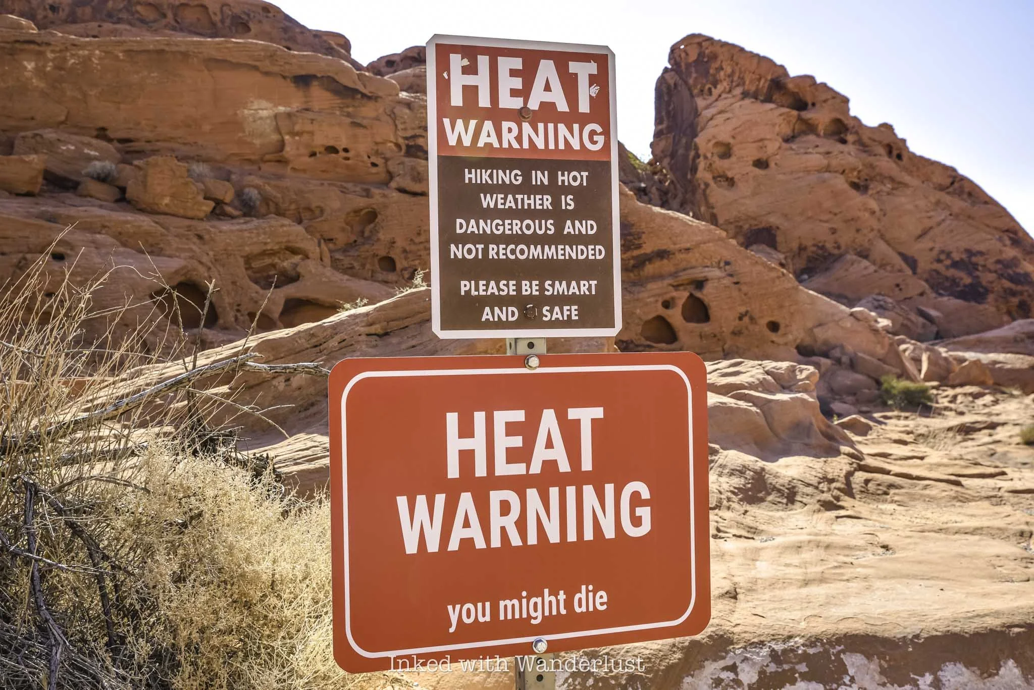
The temperature at Valley of Fire State Park often exceeds tripe digits, necessitating the need to close select trails during parts of the year. This is done to protect visitors from heat-related illness and/or death, as the affected trails are exposed and pose significant danger to hikers. Fire Wave is one of them.
Even though it’s one of the shorter hiking trails in Valley of Fire, it’s mostly all rock and radiates heat like you wouldn’t believe. Thus, Fire Wave is on the annual list of closures, which take place between mid-May and the beginning of October.
If your visit coincides within that timeframe, you won’t be able to see Fire Wave, unfortunately. There is still plenty more to see and do, though. You can read my posts about how to spend a few hours at the park during summer and my pick of ten Valley of Fire short hikes, many of which are open year-round.
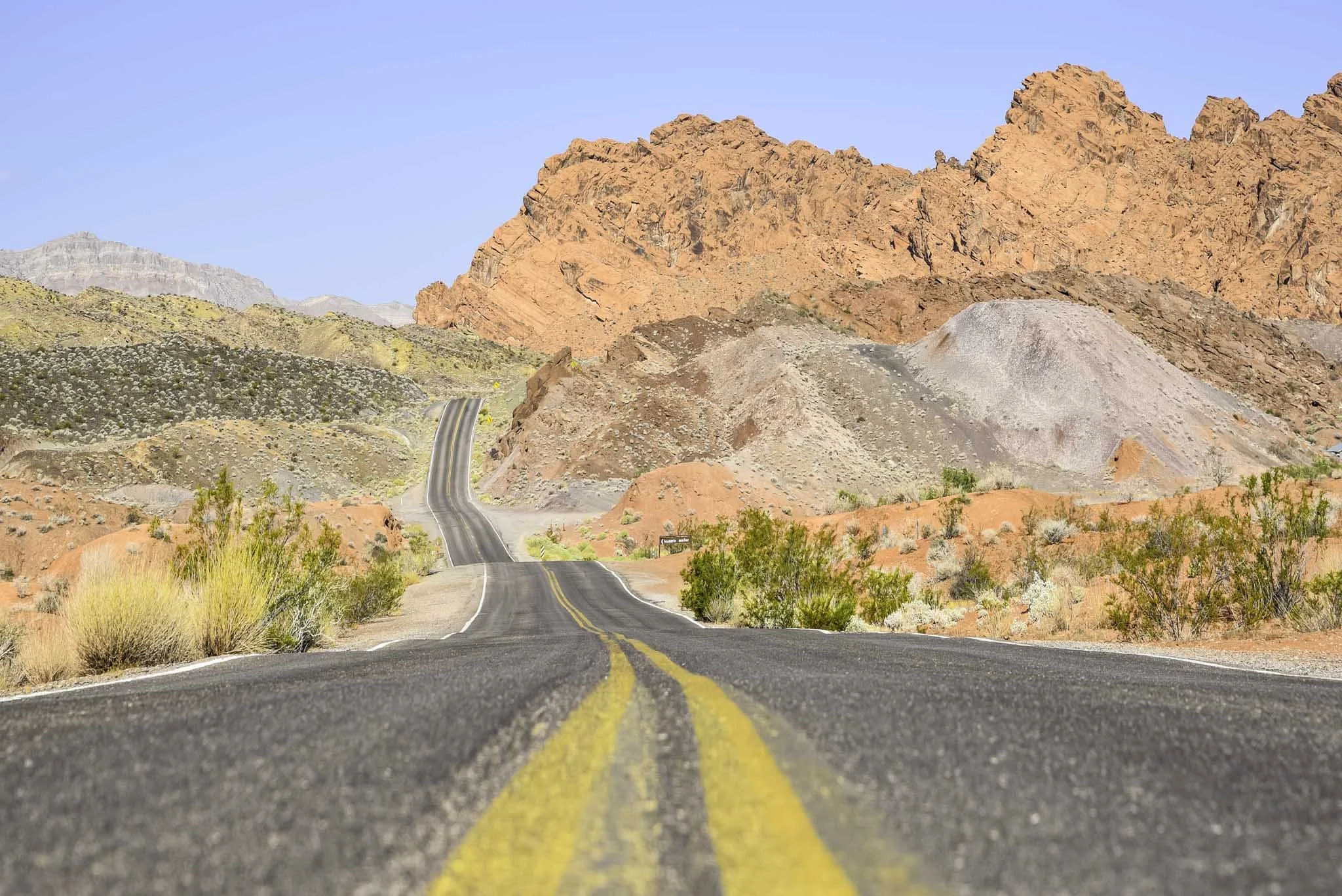
Fire Wave Parking and Getting There
Getting to Fire Wave trailhead (and around the park in general) is easy. There are only two entrances (west and east) and two main roads in the park. Valley of Fire Scenic Byway, the park’s main artery, runs between the two entrances.
To the north is Mouse Tank Road, which itself becomes White Domes Road just beyond Rainbow Vista Trailhead. This road dead ends at White Domes Day Use Area, which is also the trailhead for White Domes Loop, another hugely popular trail.

No matter which entrance you use, simply keep driving until you reach the turnoff for Mouse Tank Road and continue straight. A couple miles after it becomes White Domes Road, you’ll arrive to the parking lot on the left side of the road.
There are two gravel lots where you can park for Fire Wave, one on either side of the road. They’re both gravel and dirt, and are large enough to accommodate many vehicles. Sunrise and (especially) sunset are times when parking can be most competitive, as those are Fire Wave’s most popular times.
Even though the lots are large, it’s best to arrive early, especially during the trail’s peak visitation timeframe of October through mid-May. As the day progresses and the park gets busier, Fire Wave and nearby White Domes are usually the first lots to fill.
Fire Wave Trail
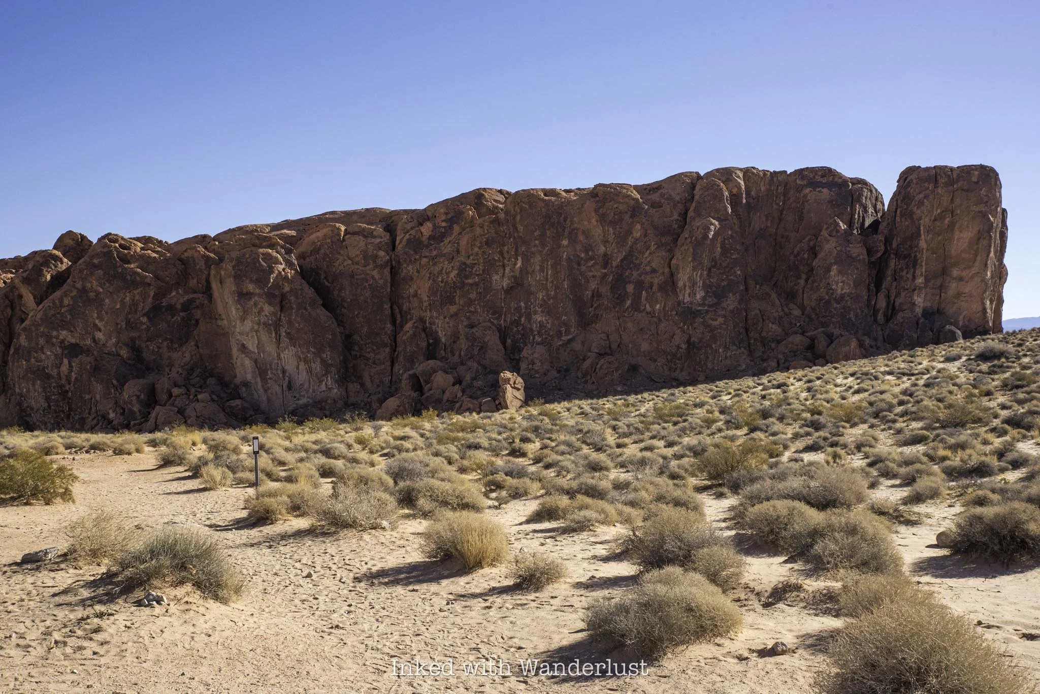
To find the start of the Fire Wave Trail, look for the huge sandstone rock in the picture above and head towards it. You’ll start out in a field condensed in sagebrush, with a sandy trail cutting through it.
The trail is mostly maintained, but does have spots where it seemingly vanishes. Don’t fret, though, as there are also trail markers indicating the correct path. So even in the spots where there doesn’t appear to be a trail, it’s still easy to follow.
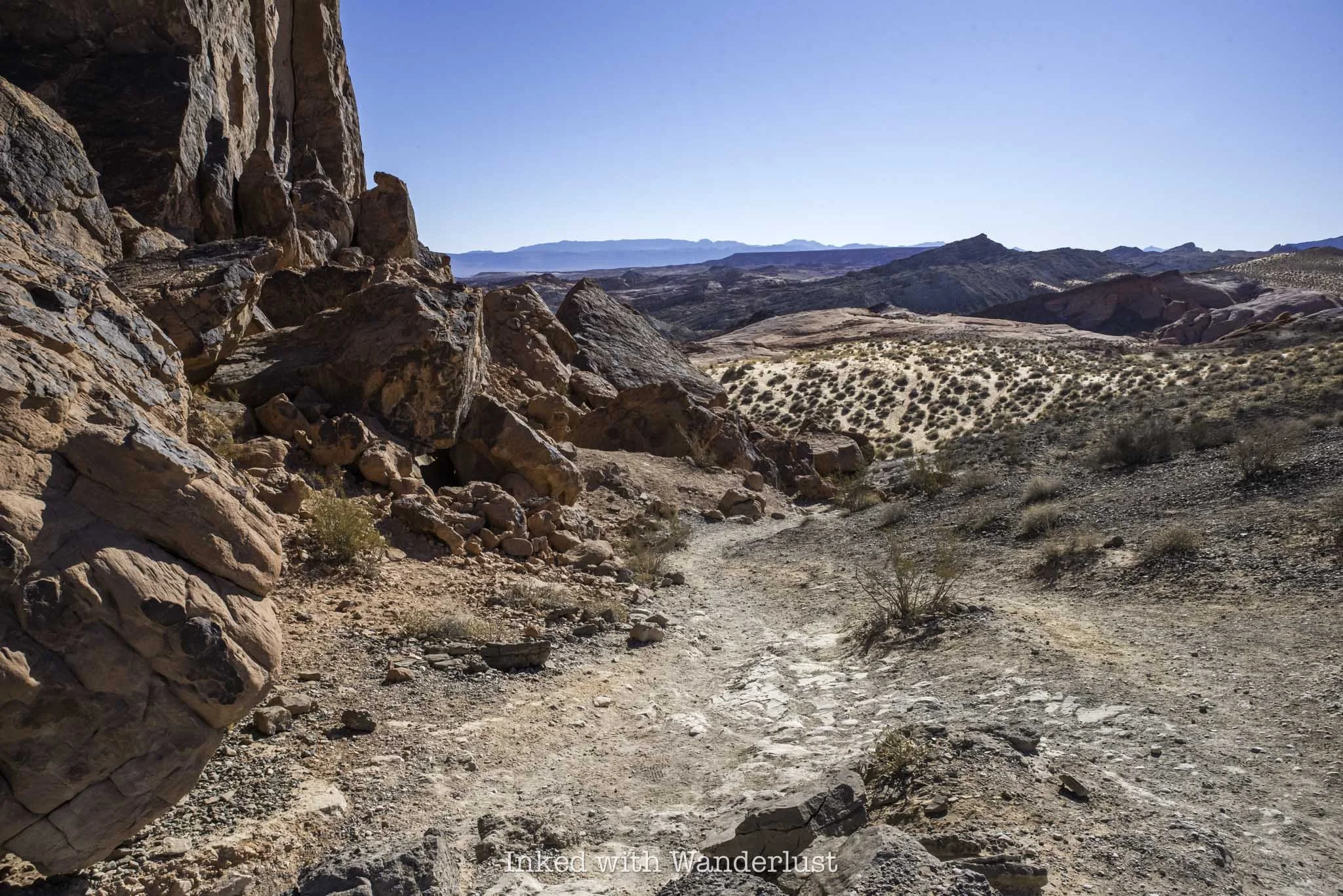
As you get up against the huge sandstone rock, the trail turns to dirt and begins a slight descent to the right. You’re still cutting through heavy sagebrush fields, but you’ll also start to see more of the unique sandstone rock formations Valley of Fire is famous for.
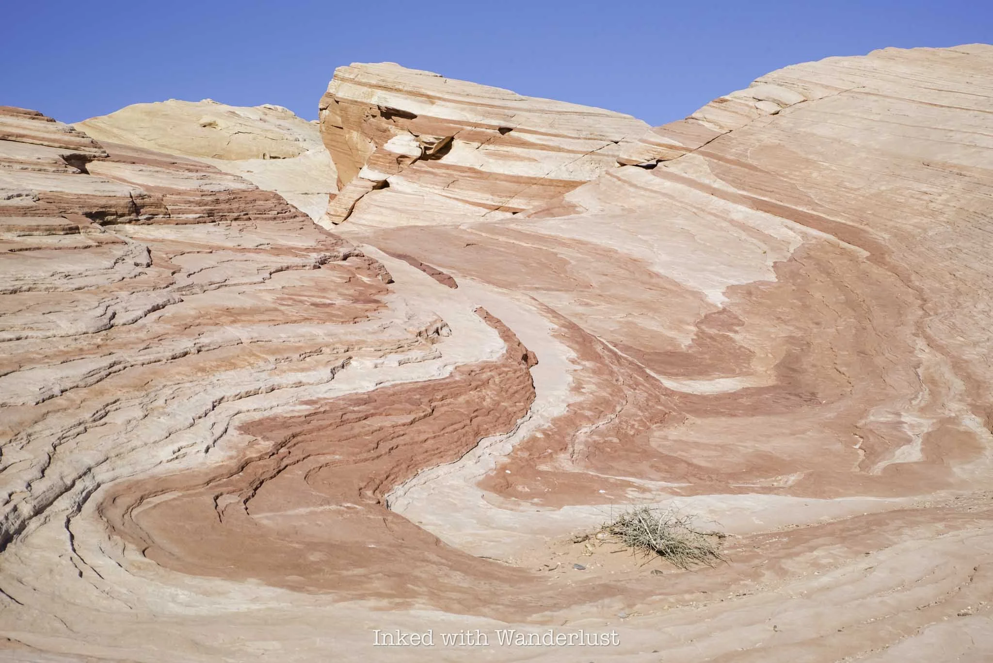
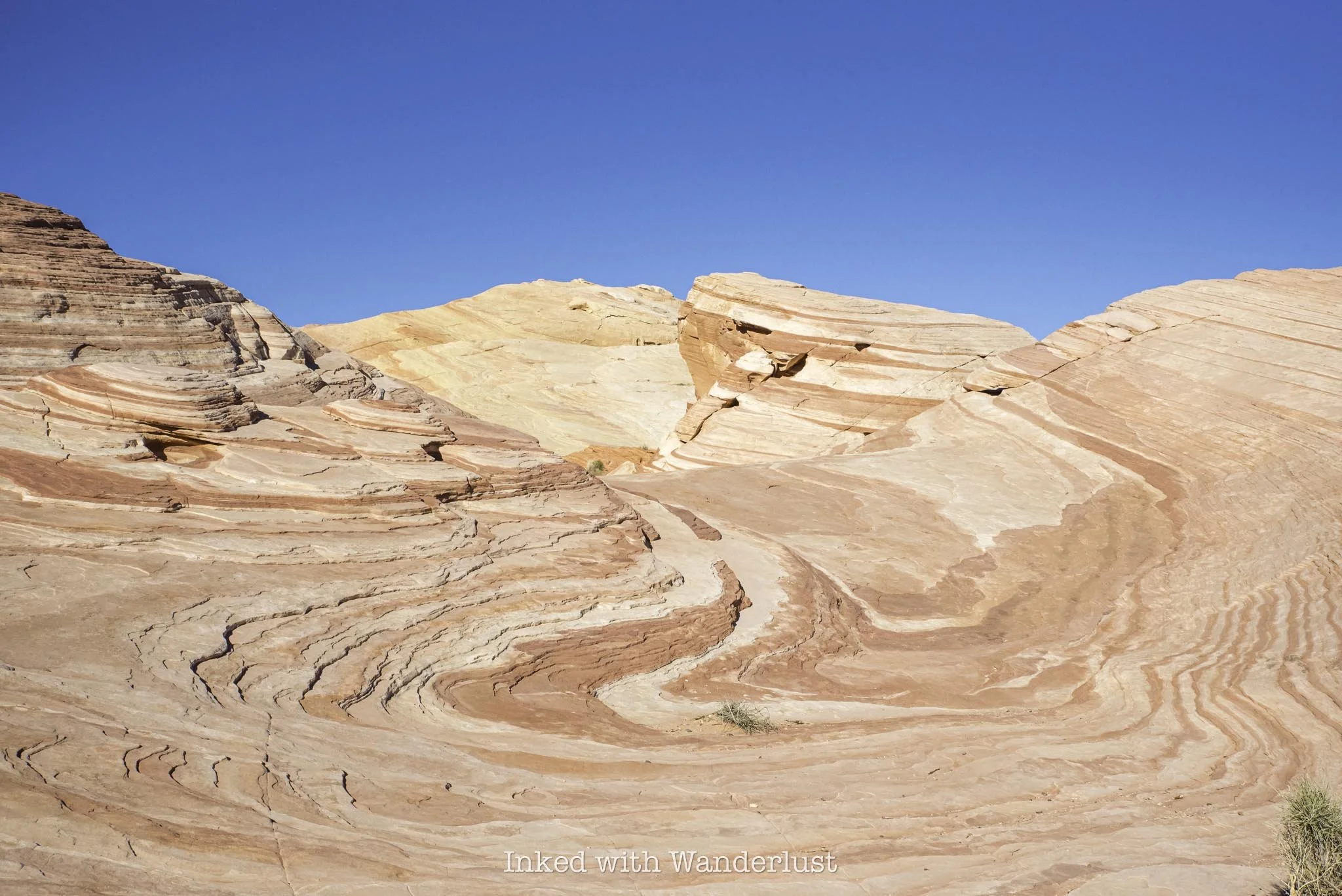
When the trail flattens out again, it’ll become sandy once more and will be lined with rocks, making it incredibly difficult to get lost. You’ll now see far more sandstone rock than sagebrush and the first teasers of Fire Wave and its color patten will become visible.
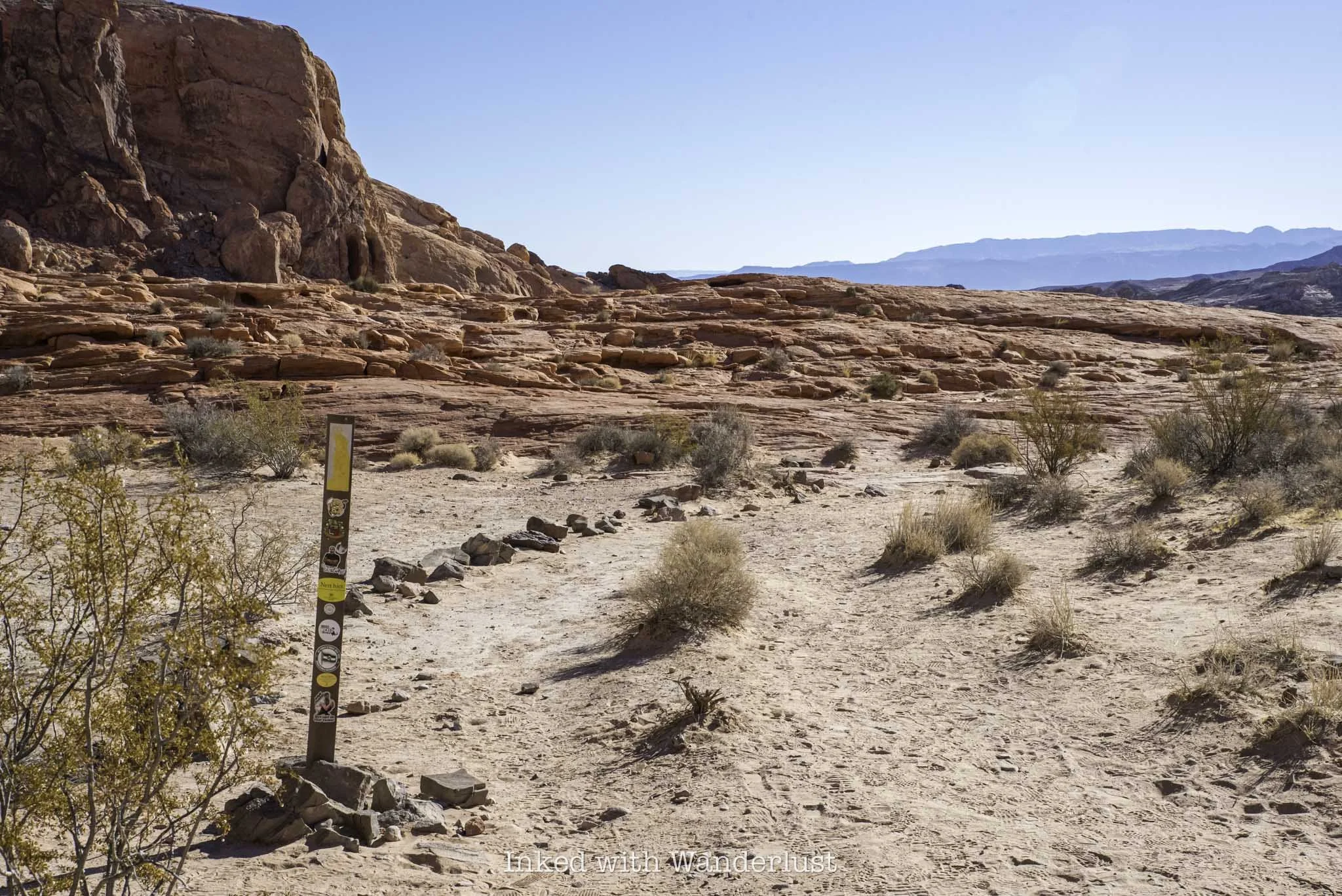
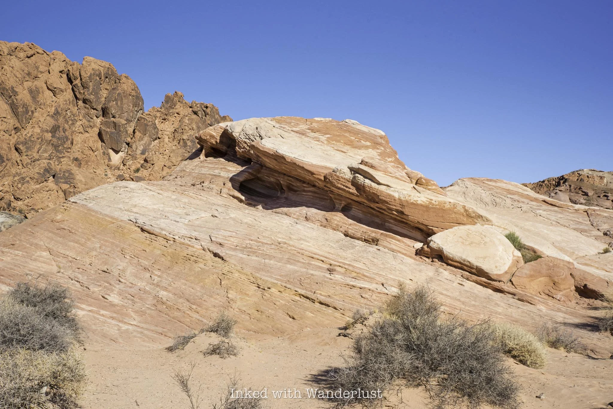
As you start seeing those wavy colors on the rocks, the trail will go from sand/dirt to pure sandstone. From here, there’s no proper trail and you’ll simply keep an eye out for the trail markers and follow them. Don’t worry, each one is easy to spot from the first.
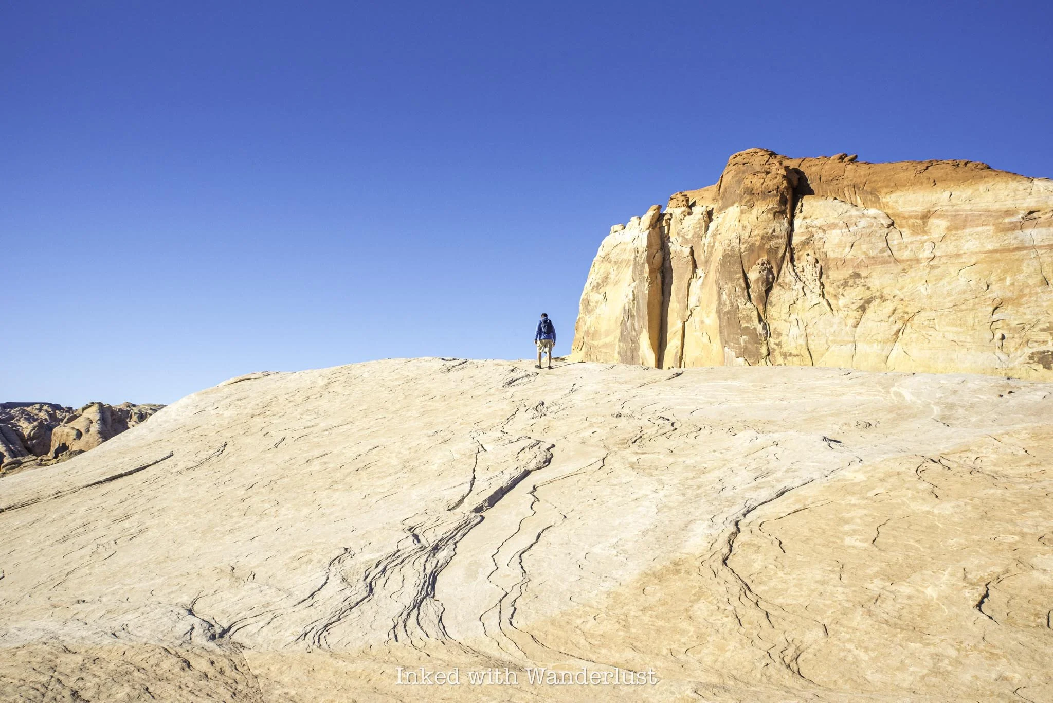
From the last trail marker is where you’ll get your first glimpse of Fire Wave. Simply keep descending on the sandstone rock until it comes into full view. Once you’re there, you’re free to explore at your leisure.
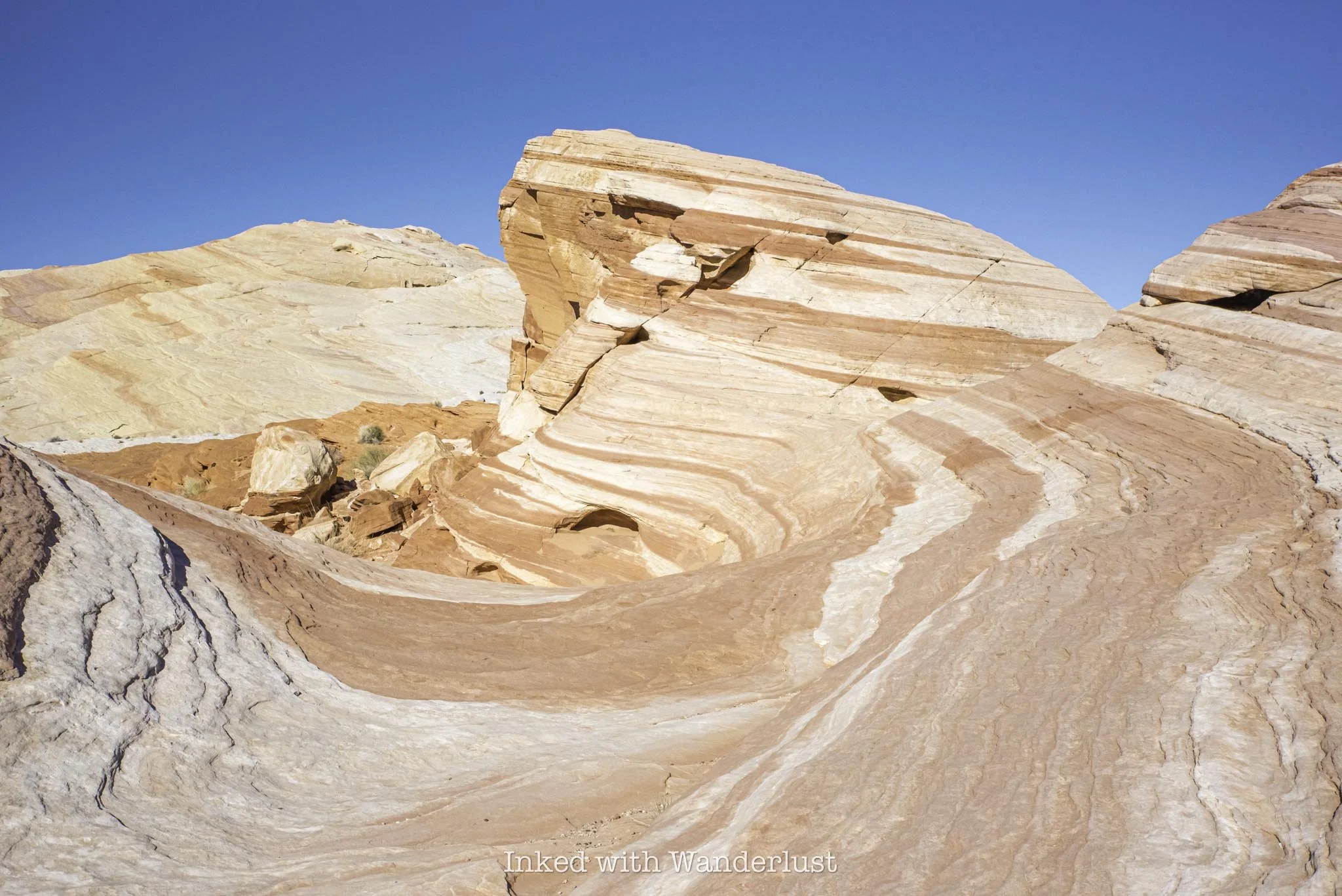
Pictures do no justice to how beautiful Fire Wave is. As stated above, sunrise and sunset are the best times to view it, as that’s when its colors really pop. Even during mid-day, though, like when I went, it’s still a sight to behold.
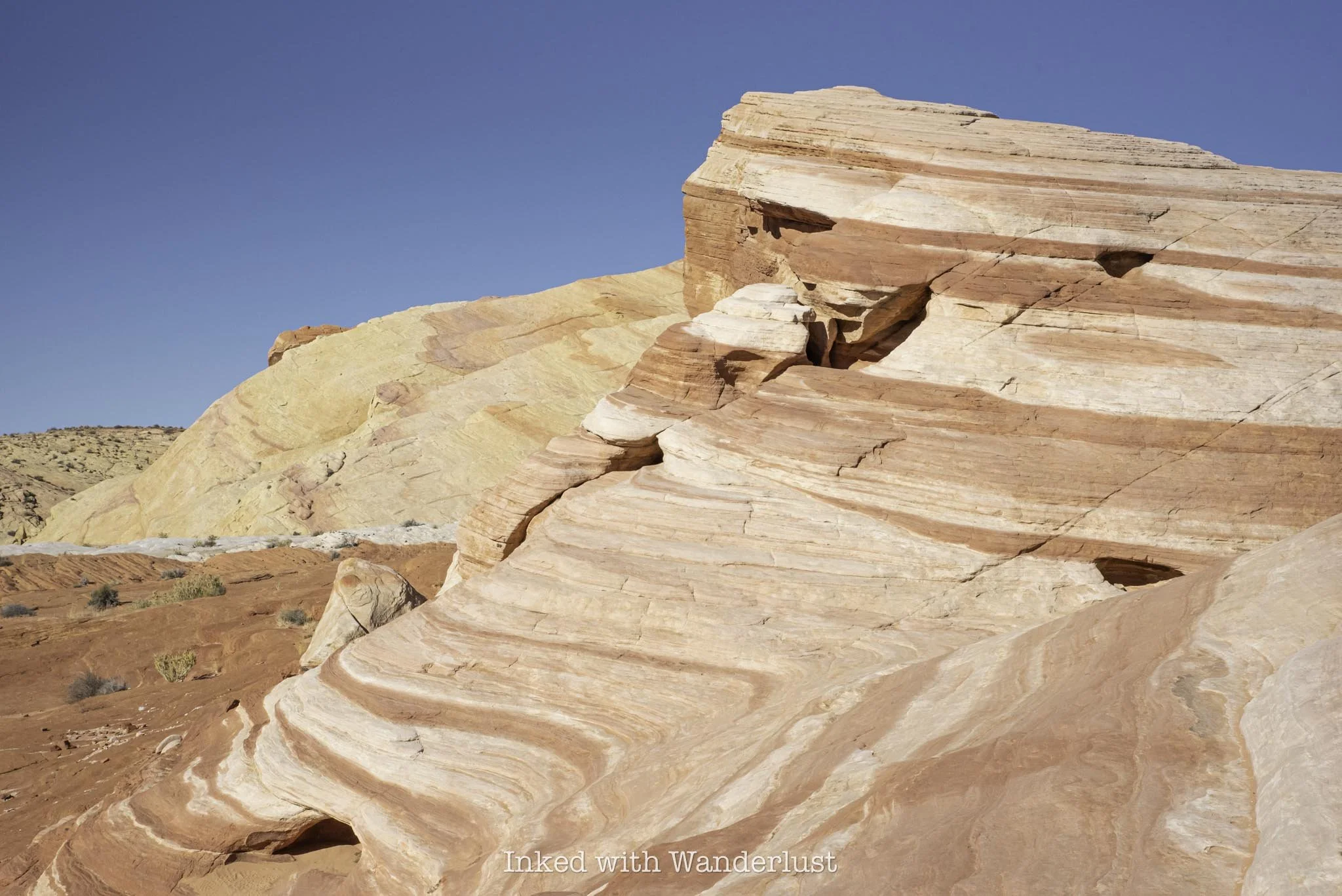
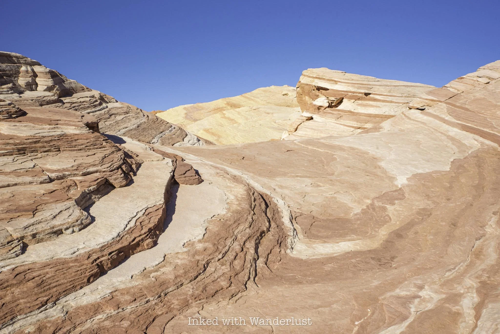
The swirling reds, oranges, and whites blend so perfectly with one another. The leading lines make it a wonderful photography subject, or to simply stare at in admiration. Either way, you need to see Fire Wave in person.
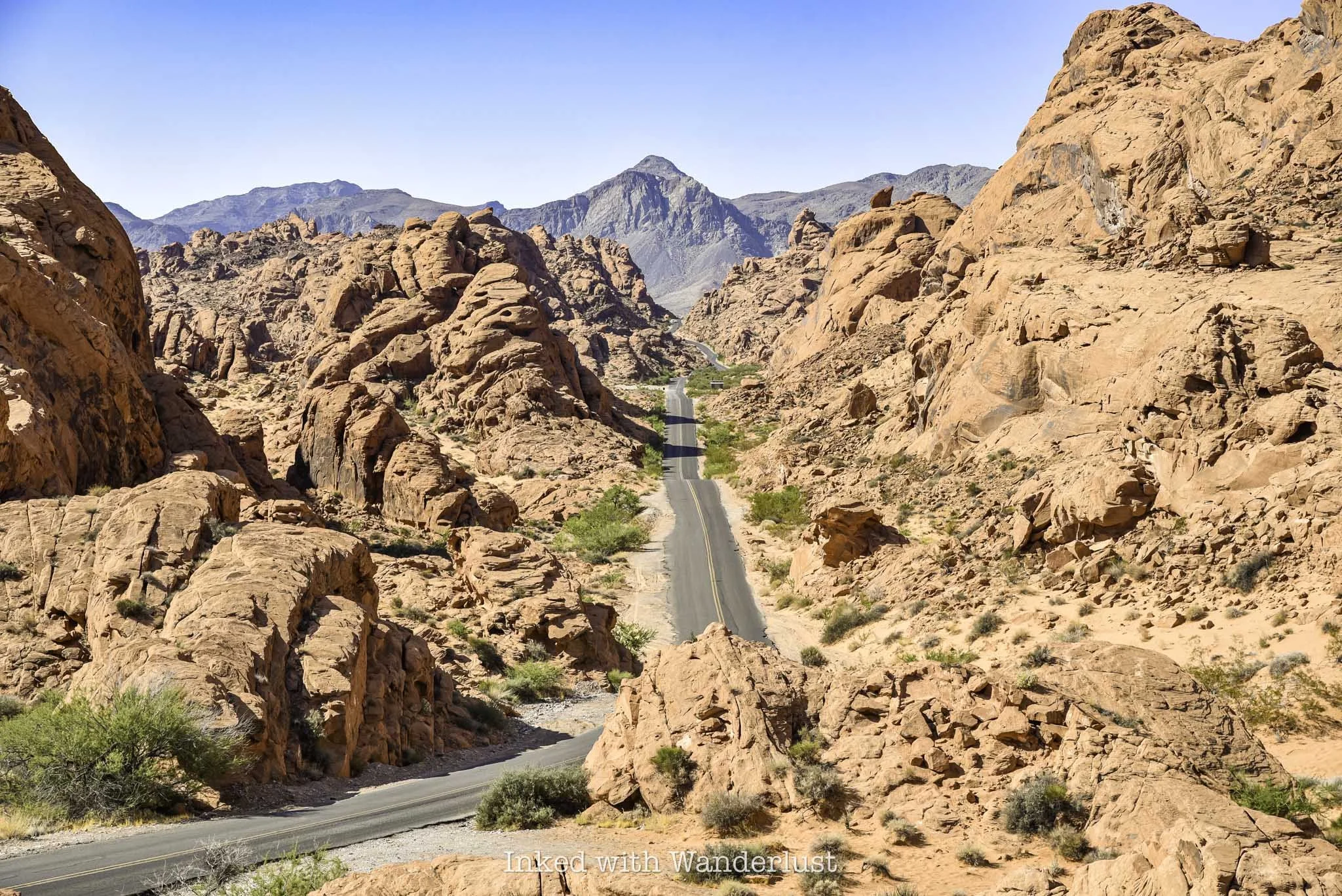
At Fire Wave is where the official trail ends. Simply turn back around and head in the same direction you came to your car. From there, continue driving north to hike White Domes Loop, an equally beautiful trail, or drive south to Mouse’s Tank Trail through Petroglyph Canyon. Or…
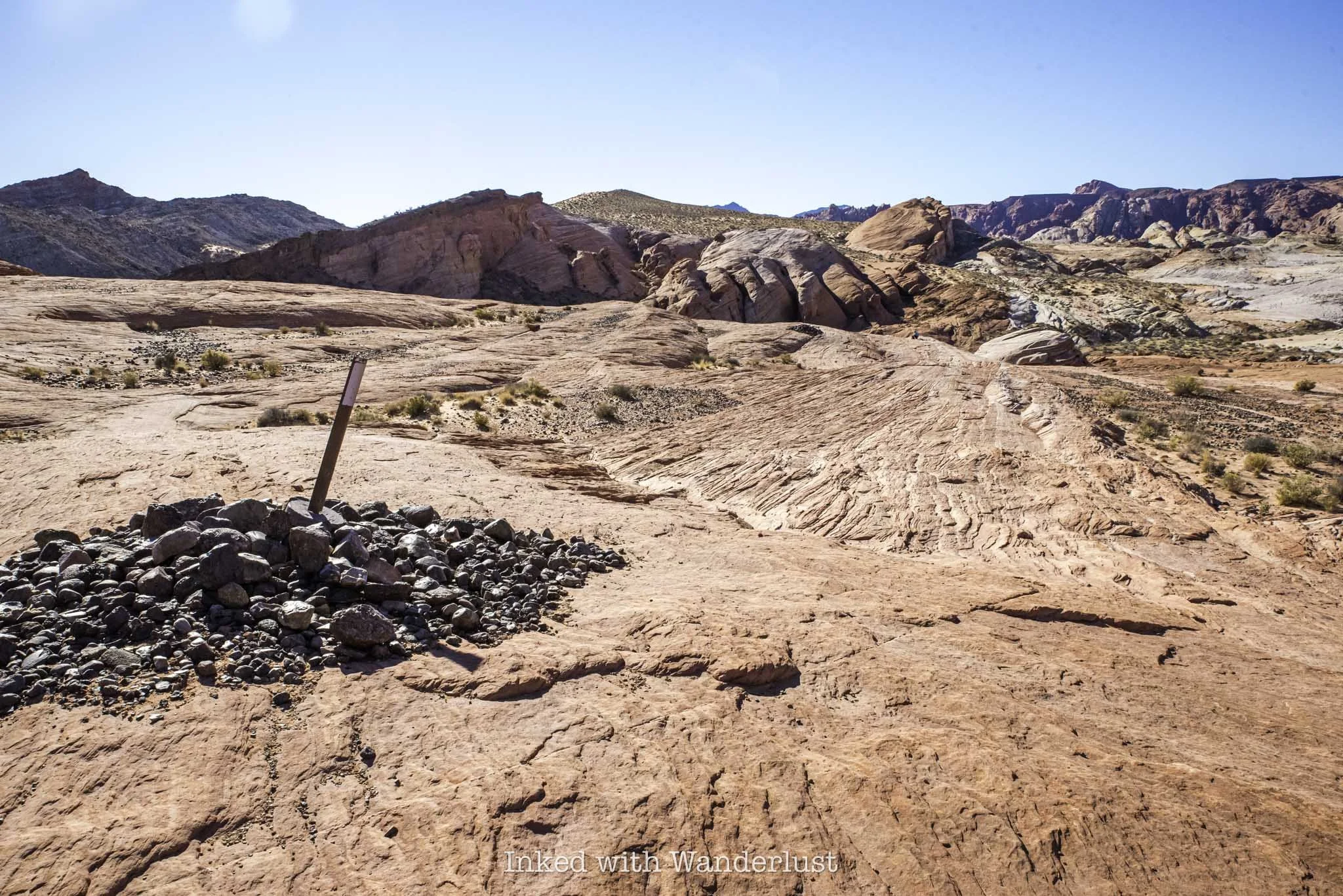
Seven Wonders Loop Extension
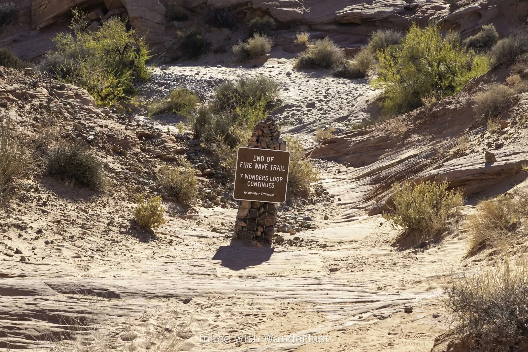
Just beyond Fire Wave, you’ll notice a pile of rocks with a sign atop indicating the end of the Fire Wave Trail. That same sign also marks the extension of the Seven Wonders Loop, if you have energy left over, that is.
Continuing will add another mile or so to your hike and will take you on a complete loop that’ll eventually spit you out to where you’ve parked. It’s definitely worth doing, provided it isn’t scorching that day and you’ve come prepared.
It’s a moderate-level trail and can be easy to lose at times. Due to that, I recommend coming prepared with a downloadable GPS map, like what AllTrails provides. Along the way, you’ll see several Valley of Fire attractions, such as Pastel Canyon, Crazy Hill, Thunderstorm Arch, and more.
Whether you do the full loop or just stick with Fire Wave, you’re sure to have a great time either way. Just remember to steer clear of this trail during the summer months and adhere to the trail closures. It isn’t worth the risk.
If you do find yourself here during the closure period, check out the following trails and attractions listed below, as they’re open all year: