
Hike the Wilson Canyon Loop Trail near Yerington
Situated between the small town of Yerington and the even smaller community of Smith Valley, Wilson Canyon is a recreational paradise with something for everyone. Hiking…
Situated between the small town of Yerington and the even smaller community of Smith Valley, Wilson Canyon is a recreational paradise with something for everyone. Hiking, horse riding, river tubing, camping, motor sports, fishing, etc. You name it, you can do it.
Even though there are plenty of activities to take part in, this article is going to focus on the 3.5 mile interpretive loop trail on the west side of the canyon. If you want to use your dirt bike, quad, etc, you can do so on the opposite side of the highway at the dunes.
The trail is considered moderate in difficulty. The very beginning and end (where you climb in and back out) are short but steep sections. The rest is mostly flat with the occasional gradual ascent/descent that’ll ultimately lead you to an epic payoff at the viewpoint.
At the end of the article I’ve included a screenshot of the route we took that was recorded by my watch. That combined with the included images will give you a pretty good idea of what you’ll be dealing with.
Wilson Canyon Trail Trailhead

The interpretive loop trail begins and ends in the small parking lot located at the west end of the canyon. The decently maintained dirt lot can hold a couple dozen vehicles and features two shaded picnic tables. The trail begins just behind these.
If you’re coming from Yerington, the lot will be at the end of the canyon on your left. If you’re coming from Gardnerville or Topaz, the lot will be on your immediate right as you’re coming into the canyon (shortly after passing the rest stop).
The Loop

This first section of the trail leading up to the ridge of the canyon is the second steepest of the whole thing (the first being the opposite side coming back out, but more on that later). It isn’t difficult by any means, but if you’re not used to hiking at higher elevations, you may have a slow go at it.

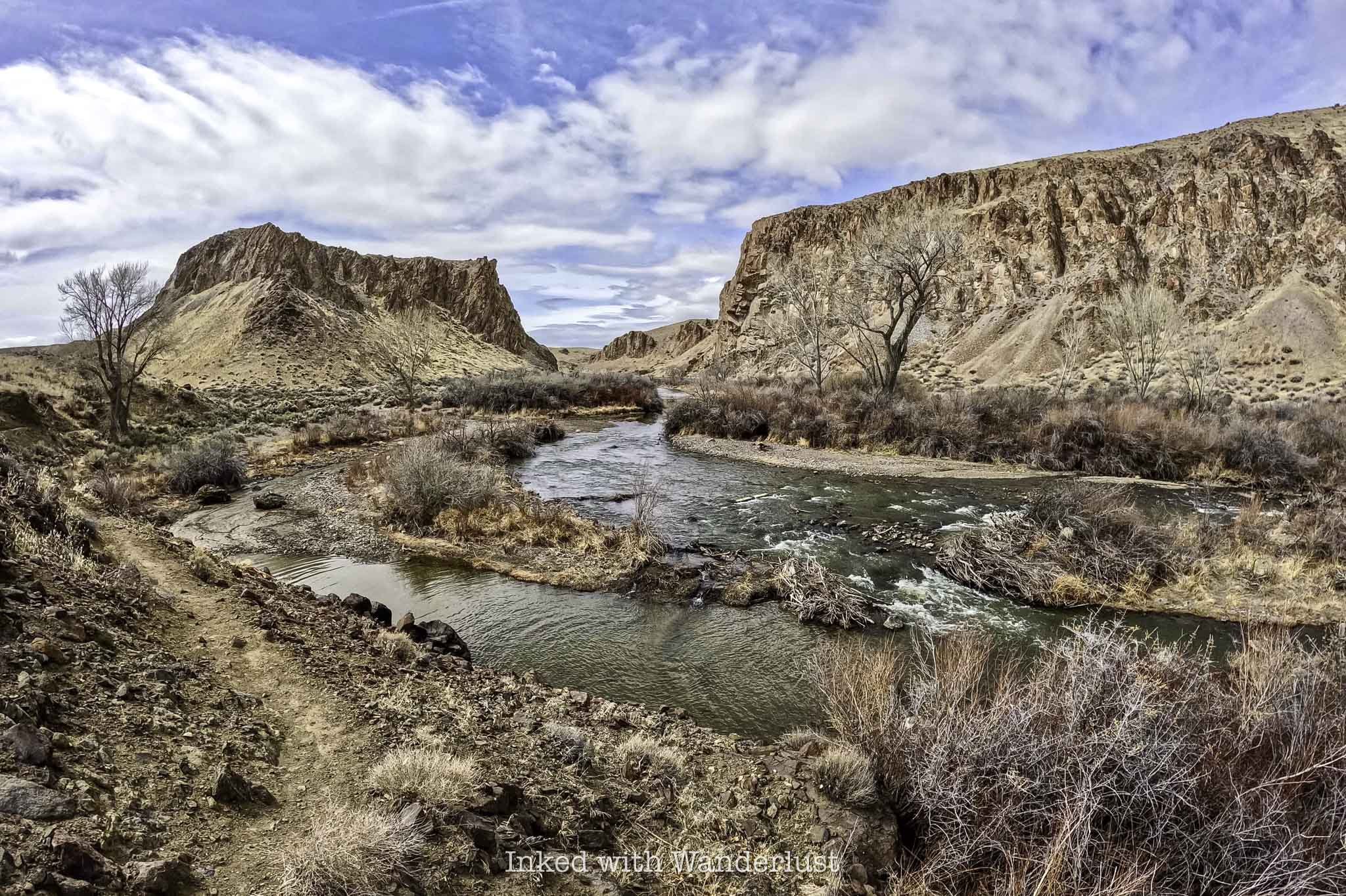
When you get to the top of the ridge, be sure to turn around and take in the views. In a single frame of view you’ll see a portion of the west fork of Walker River with Mount Siegel and the Pine Nut Mountain Range providing the backdrop.
From here, you have two choices. You can go further up the ridge to the left and check out the vertigo inducing views of the river below or, once you’ve gotten your fill of the views, you can continue down the trail proper leading into the canyon.

Going down this section of the trail will mean you’re going to lose all the elevation you just gained. It’s frustrating, I know, but it’s the only way in. On your way down, you’ll get a vast view of the desert valley below that was once an ancient lake.
If you look closely to the upper left of the image above you’ll faintly see a sign along the trail just before it veers to the right. This sign indicates that you would be under water at that point had the lake still been there.

At the bottom of the trail you’ll reach a dry river bed that cuts through the trail you’re on. You’ll also see two pointed signs with one directing you to the left and another directing you forward. This is where the actual loop begins.
You could go in either direction and end up at the same spot. Going left will take you along the river before turning into and up the canyon. After reaching the viewpoint above, you’ll descend back into the canyon and here is where it’ll ultimately spit you out at. In our opinion, this is the better way to go.


After turning left at the juncture, you’ll follow the dry river bed for a short time before before running into Walker River. At the right time of year, this section of the river doesn’t move very fast. So if you brought your swimsuit, this would be a great spot to take a dip or maybe partake in some fishing.

The trail continues to the right and follows the river for about a quarter mile before finally cutting back into the canyon. When we did this hike it was still early spring, so the trees that dot the river weren’t yet blooming, unfortunately. When they do, it’s a sight to behold (especially in the fall).
Shortly after turning right into the canyon (roughly one mile into the hike), you’ll come across your first of only two opportunities for shade during this stretch of the trail. The next one is 3/4’s of a mile further. So if you’re feeling the need to rest for a bit, do it here.
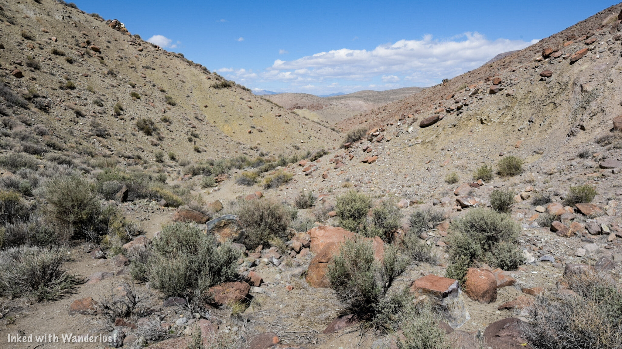
This stretch of the trail starts from the time you leave the river to the time where you reach the viewpoint at the top and is almost exactly one mile in length. It is very exposed and as stated above, has only two opportunities for shaded rest breaks.
At first glance, you might think there isn’t much to look at here, but you’d be wrong. Thanks to the volunteers that maintain this trail, small informative signs dot the trail pointing out the several examples of desert flora, rock formations, and petrified wood.

Not long after the second shaded area of the trail, you’ll begin your ascent to the viewpoint. This ascent, while still requiring a fair amount of effort, is nowhere near as steep as the one you took to get into the canyon at the beginning.


At the top of the viewpoint, you’ll see a large informative sign detailing the history of the area and what you’re looking at. On your far right, you’ll see Mount Wilson, Singatse Range, and Shamarak Hill. Toward the middle and left you’ll see Ancient Lake Wellington, the Pine Nut Mountain Range, and Mount Siegel.
Once you’ve gotten your fill of the views and took your pictures, you’ll continue down the trail as you descend back into the canyon. This section of the trail is my personal favorite as you go from sweeping mountain views to feeling like you’ve stepped into a scene out of Star Wars.
READ ALSO: Visit Dayton State Park and Rock Point Mill

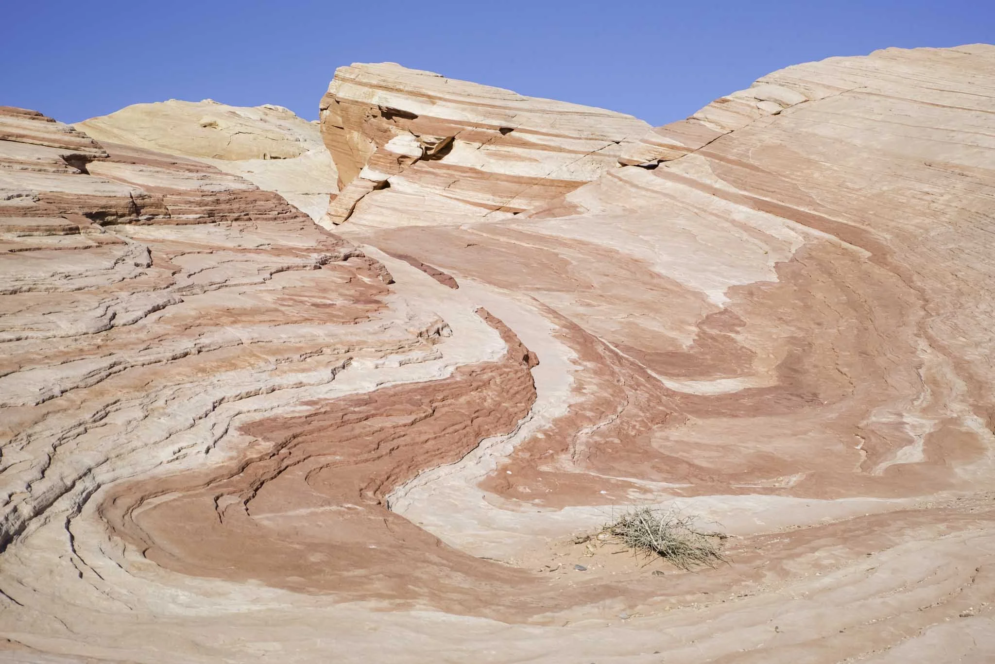
If you’ve ever seen the tufa’s at Mono Lake in California, the canyon walls that surround you will look similar to that environment. After all, all of what you see here was formed over millions of years of volcanic activity and water movement.
Towards the end, you’ll see examples of what are called, “Hoodoos”. Hoodoos are rock formations that were once solid pieces of land that were carved out by rain, snow melt, and wind leaving the pieces you see today. One of them, as pictured below, resembles a dragon.


Near the end of the Wilson Canyon trail.

The climb out of Wilson Canyon.
As you make your way through the canyon walls and Hoodoos, you’ll come out into an opening signaling the near the end of the hike. You’ll eventually reach a sign (similar to the one at the beginning) stating that you would be under water had the ancient lake still been here. At this point in the hike, you’re at the 3-mile mark.
From here, simply continue on the trail until it spits you out at that same junction you came to at the beginning. Now that you've completed the loop, you can either head back towards to the river to recreate in there or you can go straight up and over the ridge back to your vehicle. Remember the very beginning of this article when I stated the hardest part of the whole hike is the climb out? Well, there it is pictured above. Prepare yourself.
Wilson Canyon Trail - Things to Know

This is an all season trail. Rain and/or snow can make this trail incredibly muddy and hard or even dangerous to traverse. However, this area doesn’t receive a lot of either so it is accessible anytime of year. I do recommend checking the weather before heading out, though.
Wildlife hazards are present. As with any venture into the wilderness, potential conflicts with wildlife are possible. While I have never seen anything more menacing than deer out here, others have spotted both Cougars and Rattlesnakes. As with anything, use common sense, be prepared, pay attention to your surroundings, and know what to do in case you cross paths with one of them.
The majority of the trail is rocky. The volunteers who maintain this trail do a great job, but they can only do so much. At certain points at both ends of the trail it does get rather rocky and the potential of rolling an ankle is ever present. Watch your step, keep to steady surfaces as much as possible, and you’ll be fine.
The trail is very sun exposed. The descent back into the canyon from the viewpoint has more shade than the way up does. It’s a 3.5-mile trail and for the first two or so, you’re only going to have a couple opportunities for shade. If you’re doing this trail in the summer, we highly recommend getting an early AM start and as always, bring plenty of water and salty snacks with you.
We would rate this hike as family friendly. While it does have steep sections, the trail is mostly flat with occasional gradual inclines/declines. It is our opinion that everyone from adults to children can do this hike. If your kid has never hiked before, it would be a great way to introduce them to it.


10 Unique Places to Visit in Nevada
When thinking about Nevada, if you’re like most people, you’ll generally think of labels like “weird” or “haunted” when describing its wide variety…

When thinking about Nevada, if you’re like most people, you’ll generally think of labels like “weird” or “haunted” when describing its wide variety of destinations. However, us locals tend to prefer referring to our state as “unique”, more than anything.
Don’t get me wrong, we do have some arguably weird things here. Additionally, with our history being intertwined with the pioneer days, wild west, and early mining efforts, we definitely have our fair share of haunted buildings.
In my opinion, though, those myths or beliefs (whatever you want to call them) only add to the overall uniqueness of this state. If you look outside of Las Vegas and Reno, I believe you’d be genuinely surprised at all of what Nevada has to offer (I know I was when I first moved here nearly twenty years ago).
If you’re eyeballing Nevada for your family travel plans but want to go outside of the box, read on to discover my recommendations for ten unique places to visit in Nevada. This list is by no means exhaustive, but it’s a great place to start. Let’s get into it!
1) Berlin-Ichthyosaur State Park

Located 20 miles up the road from the small town of Gabbs, the abandoned ghost town of Berlin gives visitors a glance of what life was like in Nevada’s gold rush era. Many of the original buildings, including the mill, still remain.
The other awesome feature of the park is the large concentration of Ichthyosaur fossils on display inside the fossil house. The fossils were first discovered in 1928 and excavations continued until the mid-60’s. All told, 40 near complete fossils were found here.
READ ALSO: “How to Visit Berlin-Ichthyosaur Historic State Park”
2) Wilson Canyon
At first glance, Wilson Canyon may seem like it offers nothing more than a beautiful section of Walker River to gaze at. That couldn’t be further from the truth as the canyon offers hiking, camping, fishing, and motor bike opportunities.
Wilson Canyon can be found roughly 12 miles from the town of Yerington. There are plenty of pull outs for you to use and towards the end of the canyon just before and after the bridge are large dirt lots. Coming from Yerington, the left side of the canyon is for hikers while the right side is where you can use your motorbikes and ATV’s.
READ ALSO: “Hiking Wilson Canyon: A Hidden Gem in The Nevada Desert”
3) Fly Geyser
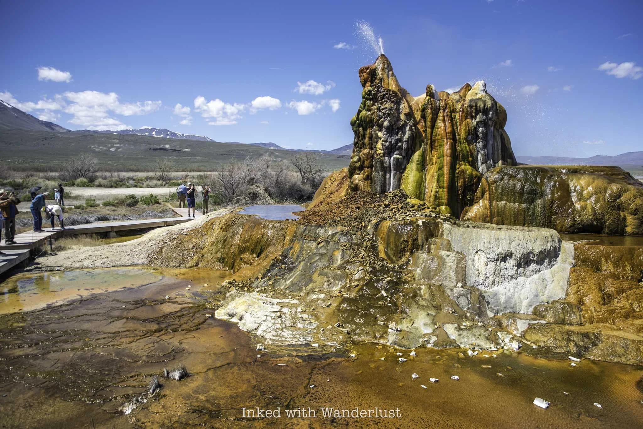
It doesn’t get much more unique than Fly Geyser. Situated right outside the tiny town of Gerlach (near where the annual Burning Man Festival is held), is an ever evolving, sulphuric formation that was initially and accidentally created by humans, but over time has been formed and perfected by nature.
Currently, Fly Geyser is only accessibly via a tour with the Friends of Black Rock, a local non-profit. Included in your tour is a visit to historic Fly Ranch, which has numerous art installations from Burning Man on display. You can read more about the tour in the post below.
READ NEXT: “The Ultimate Guide to Visiting Fly Geyser in Gerlach”
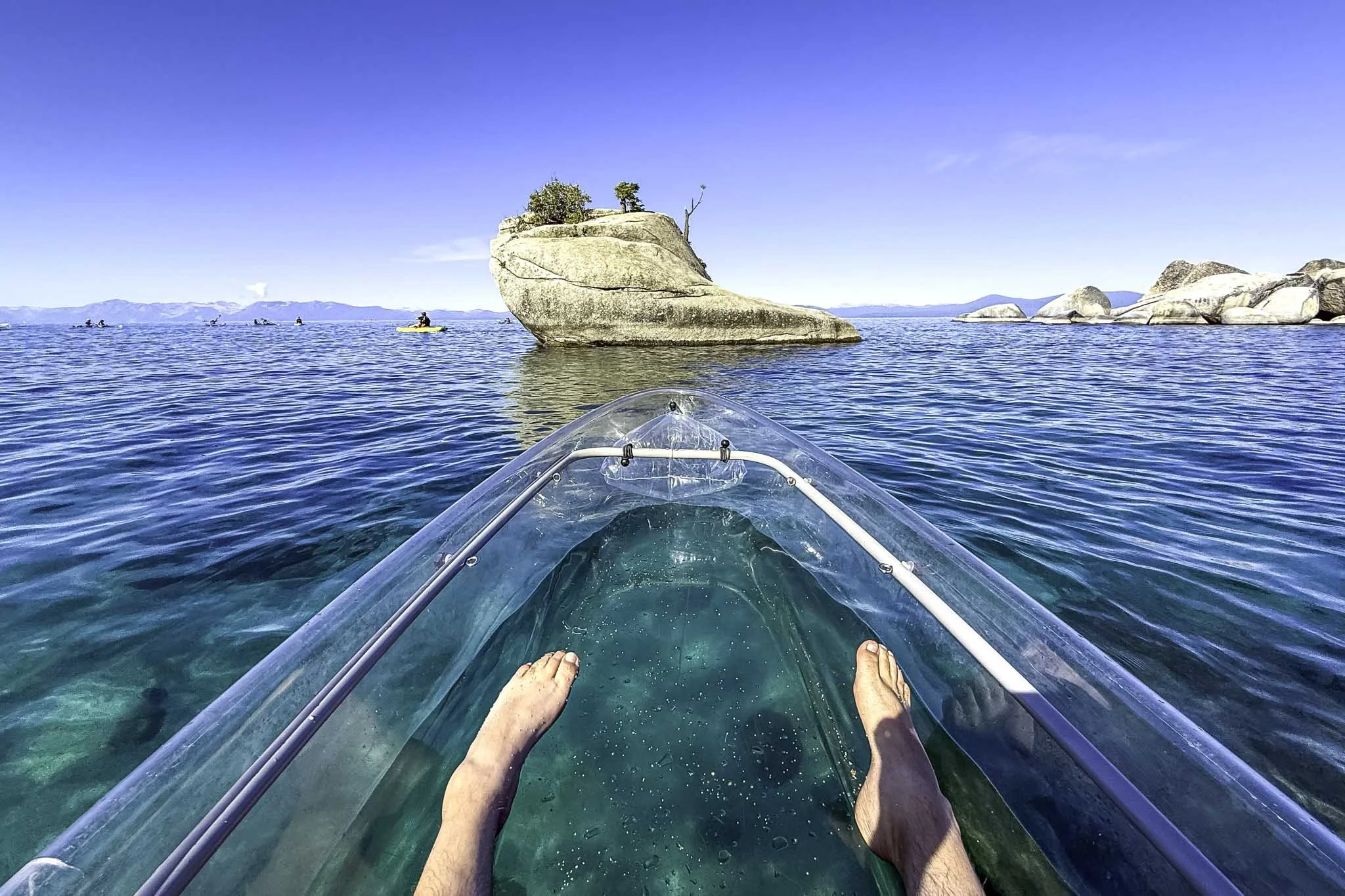
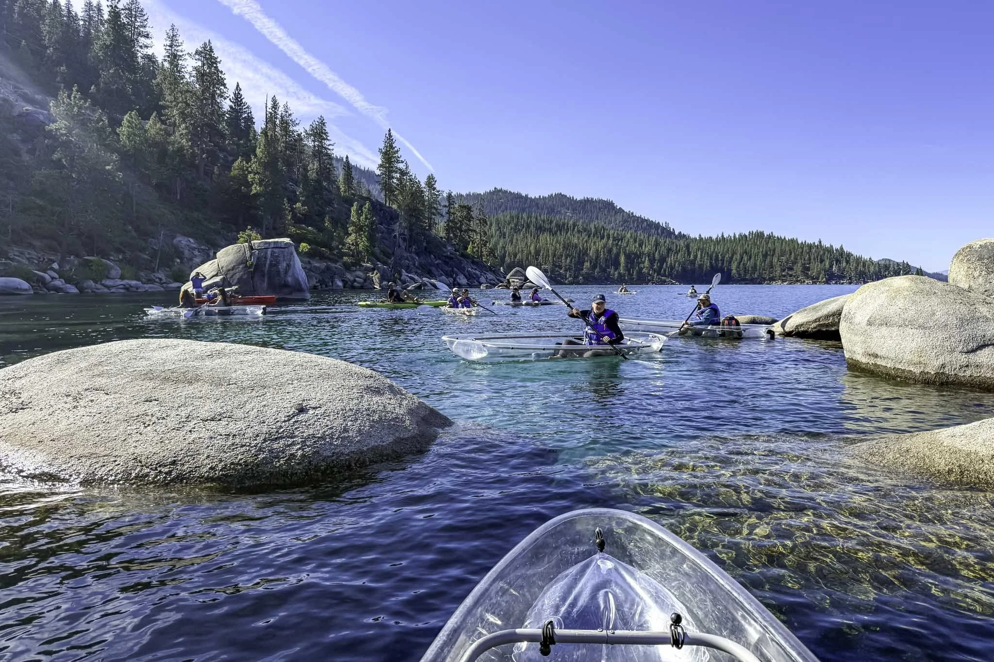
4) Pyramid Lake

If you’re an avid fisherman, there’s a good chance you’ve at least heard of Pyramid Lake. Located on Paiute Tribe land, and not very far from Reno and Carson City, this beautiful desert lake is home to some of the best fishing in the state.
If fishing isn’t your thing, then it’s gorgeous landscape, captivating sunsets, and eye-catching geology will leave you wanting to return again and again. Photographers, drone operators, kayakers, history buffs, and more, will love recreating here.
5) Historic Genoa

When it comes to Genoa, an argument could be made that it’s the most historically significant site in the entire state. After all, Genoa is the location of the very first settlement in Nevada. It was founded with the opening of the Mormon Station in 1851, which was a full thirteen years before Nevada earned statehood.
These days, visitors of Genoa can explore a full scale replica of the aforementioned Mormon Station, the town’s preserved courthouse and jail at the Courthouse Museum, enjoy a drink at Nevada’s oldest operating thirst parlor, enjoy a family meal at The Pink House, and more.
6) Rhyolite & Goldwell Open Air Museum

When it comes to unique places to visit in Nevada, Rhyolite and the Goldwell Open Air Museum are up there with the best. After the discovery of high grade ore in 1905, Rhyolite stood out among the rest of the mining camps of the time. Even attracting the attention of Charles M. Schwab in 1907. Despite its success, the town’s quick decline was just as impressive as it’s rise. By 1920, all but 14 people had moved on.
The Goldwell Open Air Museum was established in the 1980’s as a direct result of the increase in tourism at nearby Death Valley. Artist Albert Szukalski created the museum’s most famous sculpture, a ghostly take on the, “The Last Supper”, painting. Both of these attractions are located just a few miles outside the town of Beatty.
READ ALSO: “Visit Rhyolite Ghost Town and Goldwell Open Air Museum in Beatty”
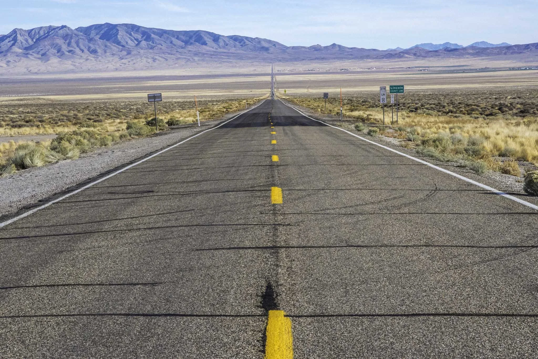
7) Extraterrestrial Highway

Officially known as Nevada State Route 375, the Extraterrestrial Highway is a near 100-mile stretch of desolate road between State Road 318 in Crystal Springs and U.S Route 6 in Warm Springs. The highway was given its official nickname in 1996, following the success of the Hollywood blockbuster, Independence Day, which was partially filmed in the area.
There isn’t much in the way of sights, aside from the dramatic landscapes and various mountain passes. The main attraction, the tiny town of Rachel, features a motel called Little A’Le’Inn, various Alien-related art, a monument given to the town by the producers of ID4, and more.
8) Lovelock Cave

While not big and expansive by any means, the cave near the tiny town of Lovelock is both easy to get to and rich in history. It doesn’t seem like much at first glance, but read about its history before visiting and you’ll see it in a whole new perspective.
It was once home to Northern Paiute American Indians and during an archaeological dig in 1912, skeletal remains of ancient giants and artifacts were discovered, making this cave popular with historians, scientists, and history buffs alike.
READ ALSO: “How to Visit the Historic Lovelock Cave”
9) International Car Forest of the Last Church

The International Car Forest of the Last Church (mouthful, isn’t it?) in Goldfield is a collection of dozens of vehicles, most of which are planted halfway into the ground, covered in a variety of painted art and general graffiti.
The car forest can be accessed right off of Highway 95 and there are no entry or parking fees, but they do accept donations if you feel inclined. It’s a great way to stretch your legs during a road trip. If you or someone with you is an artist of any skill level, you’re invited and encouraged to leave your own mark here.
READ ALSO: “How to Visit the International Car Forest in Goldfield”
10) Valley of Fire State Park

Of all the unique places to visit in Nevada, Valley of Fire should be at the top of every traveler’s “must-see” lists. Valley of Fire became the first state park in Nevada in 1935 for its captivating landscapes of red and white sandstone rock, creating stunning formations and insane color swirls of red, white, and even pink hues.
There are many popular attractions and hiking trails to experience at Valley of Fire, including Atlatl Rock, Mouse Tank Road, White Domes Loop, Fire Wave, Elephant Rock, and more. If you’re considering visiting for the first time and are short on time, see my itinerary below on how to see many of the above attractions in just a few hours.
READ ALSO: “10 Must-Do Short Hikes in Valley of Fire State Park”