Hike The Virginia Lakes Trail In Mono County
4 minute read | contains affiliate links
There are numerous trails in Mono County that stand out from the crowd. Robinson Creek, Lundy Canyon, Twenty Lakes Basin, Crown Point Loop, and Virginia Lakes round out our personal top five in Mono County.
The Virginia Lakes trail is a great option for everyone from total beginners to seasoned backpackers as you can customize it to your comfort level.
You can keep it semi-shot only only hiking from the trailhead up to Frog Lakes. Then turn around. This will be about 6-miles, out-and-back.
If you want to push further, head past Frog Lakes up Burro Pass to higher elevation lakes like Summit Lake and Hoover Lakes.
So how do you go about hiking this beautiful trail? How do you get to the trailhead? What can you expect? We answer these questions and more below.

Quick Stats
Location: Mono County, CA (between Lee Vining and Bridgeport)
Fee: None
Permit: None
Open: Usually opens late spring and closes around November
For: Hikers
Restroom: At the trailhead
Parking: Large parking lot at the trailhead
EV Stations: None
Difficulty: Moderate
Popularity: Moderate to high
Mileage: 6-8 miles, out-and-back
Elevation Gain: 571 to 2,329 feet (depending how far you go)
Condition: Rocky, but maintained
Features: Numerous lakes and old mining cabin structures
Pets: Allowed on leash
Drones: Not allowed in Hoover Wilderness
Hazards: Nothing aside from usual wilderness hazards
Our Visit(s): 2018 & 2022

Getting to the Trailhead
Getting to the trailhead is pretty simple. If you’re coming from:
Bridgeport: You’ll travel on Highway 395 south for about 13 miles and turn right on Virginia Lakes road. From there, travel 5.5 miles until you reach the parking lot at the end of the road.
Lee Vining: Travel on Highway 395 north and turn left on Twin Lakes road (this will happen shortly after passing the Mono Lake Viewpoint) and follow the same directions above.
Virginia Lakes road is mostly paved and well maintained until around the last quarter mile or so. After passing Virginia Lakes Resort the road turns to gravel (don’t worry, compact cars will have no issues here).

Shortly after the start of the gravel section, you’ll reach the road’s terminus at the parking lot for Big Virginia Lake.
Parking is plentiful on both the upper and lower sections. The lower portion has picnic tables and the upper portion has the restrooms.

Speaking of the restrooms, look for the Hoover Wilderness information post behind them. This post is directly adjacent to the trailhead.
Before you head off, be sure to spend some time checking out Big Virginia Lake. This lake is VERY popular with fisherman.
There’s a short trail to Red Lake heading south away from Big Virginia you could use as a warm-up if you’d like to check it out.
The Trail
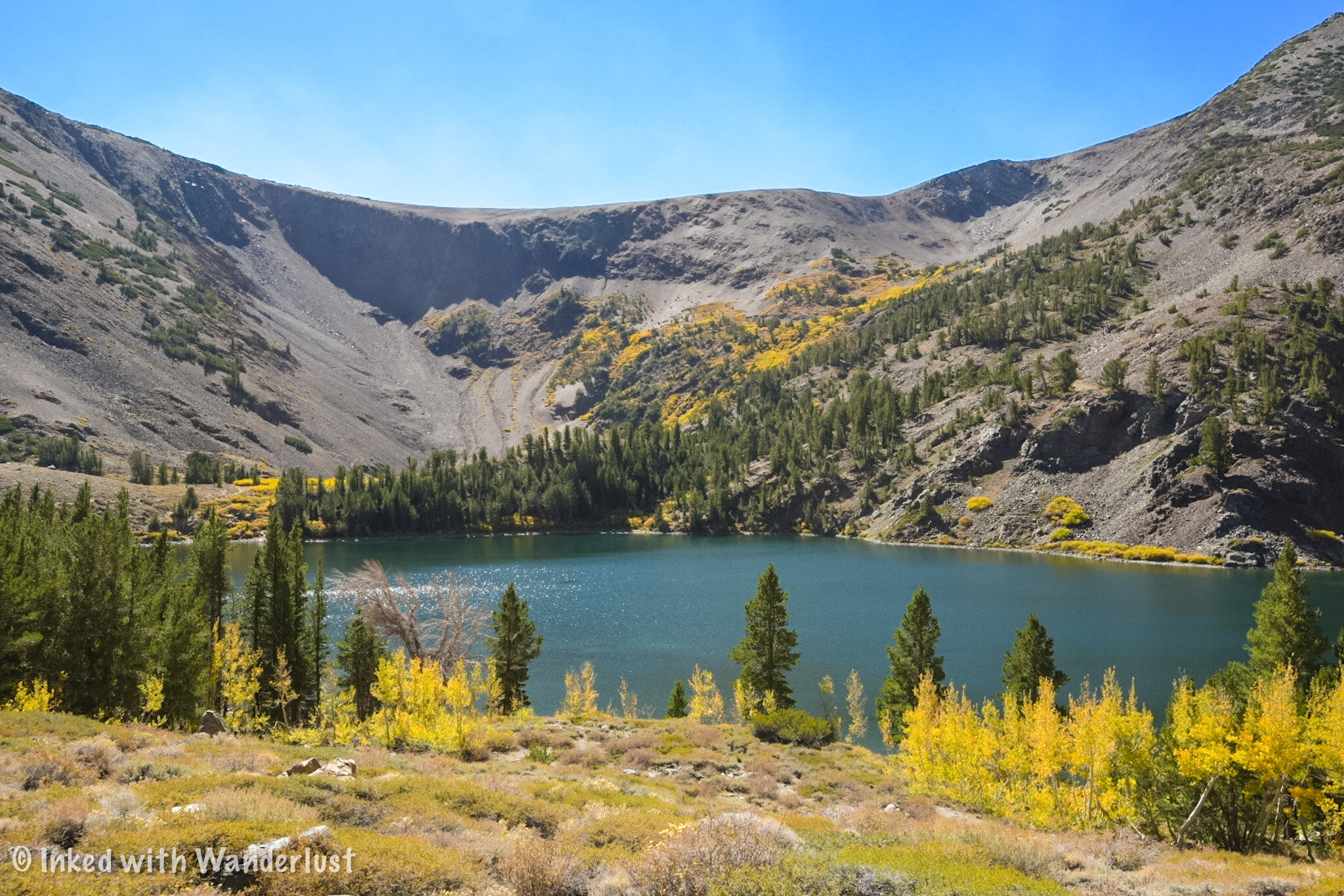
You’ll begin at 9,800 feet at the trailhead and trek an uphill slog right from the start. You can skip this by turning right on the trail along the lake (by the restroom) but if you do, you’ll miss out on an amazing view of Big Virginia (pictured above).

The trail will drop you back down a bit before flattening out. Around a quarter of a mile in, you’ll come to a sign announcing your official crossing into Hoover Wilderness and offers you two directions to go in.

Going in either direction will keep you on the trail but the one to the left hugs the lake while the one to the right takes you a bit up and around it. You can’t go wrong with either as both will eventually intersect again at Blue Lake.
Blue Lake

Shortly after crossing into Hoover Wilderness you’ll get your first glimpse of Blue Lake on your left.
This would make for an excellent place to stop for a quick break to take pictures. There’s a few spur trails leading to the lake’s rocky shore.

You’ll begin your ascent through a large scree field (don’t worry, the trail is obvious). Using trekking poles might be beneficial.
The trail flattens out at the top for a brief reprieve. While there, go off trail a bit to the rocky shelf to get an unparalleled view of the lake.
Miners Cabin & Cooney Lake

After some more climbing the trail will smooth out once again (this is common on this trail) and you’ll soon come across an old miner’s cabin.
Gold & silver mining was huge in this area in the late 1800’s. There are more cabins on other trails such as Lundy Canyon, Gaylor Lakes, and Mono Pass.
Support beams on the left side of the cabin keep it from falling over and rocks help keep the roof intact. It’s an interesting, unexpected find.

After the cabin you’ll begin to hear running water as you inch your way closer to the second lake; Cooney Lake (10,244 feet). Cooney was our favorite of the three.
Just before you arrive, depending on the time of year, you may find a small waterfall near the lake’s outlet. In spring and early summer it’s quite the sight. In fall, however, it’s a trickle.
Frog Lakes

Just a short distance from Cooney Lake is Frog Lakes. If you could view them from above you’ll see that they’re three lakes shaped in a triangular pattern.
We’re almost certain that they begin the season as one giant lake (right as the snow pact begins to melt).

To the north, picturesque granite crags make up the backdrop for these beautiful lakes. To the northeast, Dunderberg Peak (12,374 feet) fills in the skyline.
At this point, you’ve hiked about two miles and are at an elevation of 10,371 feet which gives you 571 feet of elevation gain from the trailhead.
Where to go From Here

This is usually the point where people decide what they want to do. Some choose to call it a day (which is what we did) and some decide to head up to Burro Pass (11,120 feet).
This would add another 1.2 miles up a rocky, barren series of switchbacks. From what i’ve been told by others who have do it, it’s challenging.
From there, you can hike to Summit Lake (10,183) and make it a four and half mile hike. You could also go right and hike to Hoover Lakes.
Your Thoughts…
Does the Virginia Lakes trail sound like one you and your family would enjoy? Let us know in the comments below! We love hearing from our readers.


Please support our website by sharing it with your family and friends.
Thank you for reading.
Editor’s note: This post was originally published in October 2020 and has been recently updated for comprehensiveness and accuracy.