
Sassafras Eclectic Food Joint: A Quirky Eatery In Carson City
Welcome to Carson City's deliciously hidden gem - Sassafras Electric Food Joint! In this article, we delve into the…
2 minute read | may contain affiliate links
Welcome to Carson City's deliciously hidden gem - Sassafras Eclectic Food Joint! In this article, we delve into the vibrant world of dining at this local’s favorite.
From the moment you step through our doors, you'll be greeted with a captivating atmosphere that sets the stage for an exceptional dining experience.
Discover the creatively curated menu that showcases a fusion of flavors, expertly prepared by talented chefs. Join us as we showcase a few of their many delicious offerings.
Whether you're a local food enthusiast or a curious traveler looking to dine with the locals, prepare to indulge your senses and savor the unique delights that await you in Carson City, NV.
Restaurant Information
Location: 1500 Old Hot Springs road, Carson City, NV
Cost: Mid range
Food: Globally inspired menu
Seating: Indoors. Wait to be seated
Alcohol: Full bar
Website/Menu: www.sassafrascarsoncity.com
Our Visit: June 2023

Whether you’re a local or you’re visiting from out of town and are looking for a locals spot to eat in Carson City, this is your sign to try Sassafras.
Their full name is, Sassafras Eclectic Food Joint, and they’re located directly adjacent to the historic Carson Hot Springs.
When you walk up, there will be two entrances. One for the bar and one for the restaurant. During my visit, the entrance on the right was closed off.


Interesting wall art adorns nearly every square inch of the bar and dining areas. Speaking of the bar, they offer draft beers and crafted cocktails.
Their entree and appetizer options are extent. From pork belly stir fry and cheeseburgers to salads and fish tacos, there’s something for everyone on this globally inspired menu.

Whenever my wife and I eat out somewhere we usually go all-in and order more food than we should (YOLO). We ordered the following dishes:
Baked Cheese Curds w/ Chorizo (appetizer)
Pork Belly Stir Fry Bowl (entree)
Salmon Tacos (entree)
Deep Fried Ice Cream (dessert)
Lemon/Strawberry Cheesecake (dessert)


Honestly, we didn’t have many complaints about the food. My pork belly was cooked perfectly, was packed with flavor and had a great crisp to it.
She loved the flavor of her salmon tacos, but did mention that she wished the salmon pieces were smaller so they’d be easier to eat. Aside from that, she enjoyed them.


Both desserts were delicious but the lemon/strawberry cheesecake was the clear winner. The flavor combination was out of this world.
They were tremendously generous with the portion size of the deep fried ice cream, though. I paid $9 and it could’ve easily been split between two, maybe three people.
If you’re a fan of quirky, outside-the-box restaurants you can’t try anywhere else, I encourage you to give Sassafras Eclectic Food Joint a shot.


Please support my website by subscribing to the newsletter below.
Thank you for reading.

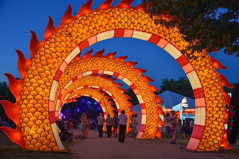
Dragon Lights Festival Reno (2023): Ticket Prices, Themes, Parking and More
Experience the annual Dragon Light Festival in Reno, a spectacular event that will ignite your imagination and illuminate
Experience the annual Dragon Light Festival in Reno, a spectacular event that will ignite your imagination and illuminate your senses.
Prepare to be mesmerized as you enter a world of enchantment, where intricate lanterns and larger-than-life creatures come to life with a symphony of lights.
Whether you're a local or a visitor, this extraordinary celebration offers an immersive experience for all.
In this guide, I’ll cover everything you’ll need to know to attend this unforgettable summer-time event. Let’s get into it.
Dragon Lights Reno 2023 Dates & New Additions

The Dragon Lights Festival is an annual summer time event in Reno and features hundreds of themed, illuminated lanterns along a trail just shy of a mile.
It’s held at Rancho San Rafael Park in the Wilbur D. May Arboretum and Botanical Gardens and features a new theme with accommodating lanterns each year.
In 2023, the theme is, “Nature’s Glow”, with several creatures typically found in gardens and tropical settings. Such as:

Honey Bees
Wasps
Ants
Tucson Birds
Lemurs
Peacocks
Parrots
Dragonflies
and more!
Also new in 2023 is the brand new presentation of the iconic Chinese Dragon and the expanded interactive playground featuring a swing set, drums, lighting effects and more.
The festival runs nightly from June 30th to August 13th, 6pm to 10:30pm.
Tickets & Parking

Parking at the event is included in the price of your admission ticket. There are several lots at the park you can utilize. They are:
Lot A: This is the lot nearest the entrance and exit. This lot is reserved for disability parking.
Lot B: This is the first lot you’ll come across and is smaller than Lot A. It typically fills quickly.
Lot C: The largest lot, but furtherest from the entrance, it is located down San Rafael drive on the eastern edge of the park.
Lot D (or '“green” lot): This lot is located at the UNR campus off Comstock Dr. and is utilized for overflow parking on the weekends.

If you park in A or B, you’ll be within walking distance of the festival entrance. If you end up in C, you can still walk or take advantage of the free shuttle service (runs Thursday - Sunday).
The D lot also offers free shuttle service to the entrance, but only on Saturdays and Sundays.
Tickets can be purchased either online (through this link) or in person at the gate. If you opt to purchase at the gate, be aware that you’ll pay a surcharge of $5 - $15, per ticket.

Purchasing online is easy and convenient. You’ll select your desired date, your ticket type, and once your purchase is complete, save the tickets to your phone to be scanned at the gate.
The 2023 festival ticket prices are as follows:
$20 per adult (age 12+)
$15 per child (age 3 -11)
Free for children under 3
$55 family pack (includes two adult and two child tickets)
$55 season pass (unlimited entry all season for ONE person)

When purchasing your tickets, you’ll be asked to select an entry time. They are 6:00, 7:00, 8:00 and 9:00. You’ll have one hour from your selected entry time to arrive and can stay as long as you wish.
We arrived 20-minutes early to our entry time and were still granted entry. No one batted an eye. If you arrive late, they’ll make every effort to accommodate you but there’s no guarantee.
There are no refunds, but they will allow you to change the date/time of your ticket up to one hour prior to your entry time. You can do so in the account you made while making your purchase.
The Lantern Trail & Amenities

After entering, you’ll come into an opening and see the iconic Chinese dragon ahead of you. To your right will be the interactive playground and to your left will be the food vendors.
To find the trail that winds through the lantern displays, follow the path through the dragon and go right (keeping the interactive playground to your right).
The trail is less than a mile and is on fairly even ground. There are some grade changes along the way but they’re barely noticeable. It’s mostly paved, but there are some dirt/gravel patches.


If you’re bringing little ones along, both strollers and wagons are permitted. They should have wheels appropriate for the terrain, though.
You’ll find dozens of illuminated lanterns along the trail. From beautiful floral themes to giant frogs and armadillos. Some are interactive and many have moving parts.

There are also a couple make-shift tunnels with special lighting affects you’ll get to walk through. Additionally, themed music plays throughout the length of the trail.
As you reach the end of the trail, it’ll split. If you’re done for the night, go left to exit. If you want to remain in the festival, go right to loop back in to where you entered earlier.
When Should You Enter & Tips

We arrived at around 7:45pm and there was still plenty of light left. When we did our first walk through the trail, we were impressed by how illuminated the lanterns still were, despite it not being dark.
However, once the night sky set in, that’s when the lanterns popped and were the most impressive and fun to look at. Consequently, that’s also when the crowds got thick.
Clearly, you’re going to want to be there when it’s dark. That’s the whole point. My suggestion, though, would be to select an entry time prior to sunset.
The reason for this is because it’ll allow you to get a feel for the festival and see the top attractions without having to worry about big crowds. The later it gets, the heavier the crowds get.
This way, you can do a second loop around the trail once it gets dark. You’ll already know what the best exhibits are, so you won’t waste time on the ones you don’t care about and can get through the crowd faster.
It’s also advantageous if you have small children tagging along. It’ll be a lot easier to keep track of them in the interactive playground while there’s still some light.

If you’re coming with a group consisting of two or more adults and two or more children, save money by purchasing the family ticket option. You’ll save at least $15.
If your group is 10 people or more, you’ll enjoy additional savings of 20% off each ticket. That discount will reflect in the cart when you’re checking out.
For more savings, take advantage of their policy of allowing outside food and beverages. There are plenty of areas in the festival to set up a picnic. The only exception is alcohol.

I hope you’ll consider attending the 2023 Dragon Lights Festival in Reno. It’s a fantastic event for the whole family. We had much more fun than we thought we would and can’t wait to attend in 2024.
Please support this website by subscribing to our newsletter below.
Thank you for reading.

How to Hike To Skunk Harbor In Lake Tahoe
You may be asking why I’m making a post about Lake Tahoe and putting it in the “Nevada” section. Many people don’t actually…
2 minute read | contains affiliate links
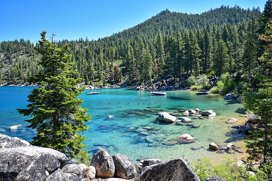
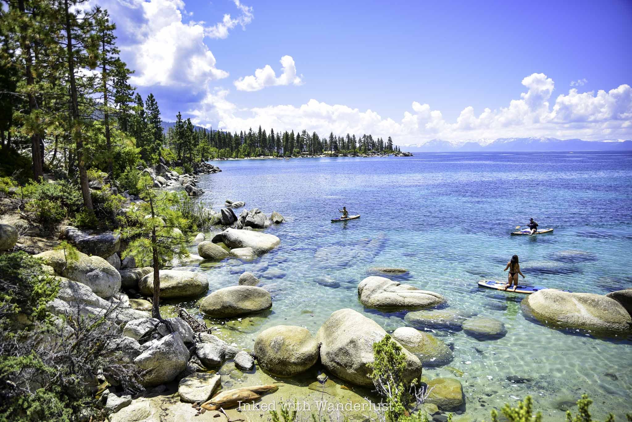
Welcome to my comprehensive guide on visiting Skunk Harbor, a hidden(ish) gem nestled along the picturesque shoreline of Lake Tahoe.
Skunk Harbor offers a unique combination of breathtaking scenery and a tranquil hiking trail that’ll leave you in awe of its natural splendor.
Located on the eastern side of Lake Tahoe, Skunk Harbor is a welcomed break from the hectic, overly touristy southern portion of Tahoe.
As you arrive, you’ll be greeted by a sense of serenity, surrounded by towering pine trees, crystal-clear turquoise water and panoramic views of the Sierra Nevada mountains.
In this guide, I’ll cover many topics such as parking, the hiking trail, the cove itself and what to expect along the way. Let’s get into it!

Exciting news for our readers!
We’re excited to introduce the all-new "Inked with Wanderlust" online store!
We're thrilled to bring you a fantastic collection of wanderlust-inspired merchandise. Celebrate your love for travel and exploration with our stylish apparel and accessories, designed to ignite your sense of adventure.
Discover a range of unique designs that capture the spirit of wanderlust, from cozy hiking-themed t-shirts to charming accessories that make your wanderlust spirit soar!
Visit our online store today and start your journey of style and adventure. Happy exploring!
Trail Stats
Location: Lake Tahoe (east shore)
Fee: None
Permit: None
Open: All year, but difficult to access in winter
For: Hikers
Restroom: None
Parking: Two small pull-out style lots along the highway
EV Stations: None
Difficulty: Easy going in, moderate going out
Popularity: Medium to high
Mileage: 2.8-miles, RT
Time: 2-3 hours
Elevation Gain: 567 feet
Condition: Maintained, easy to follow
Features: A cove with clear waters and a historic cabin
Pets: Allowed, but must be leashed
Drones: Allowed, per the B4UFLY App
Hazards: Hike out is steep and sun exposed
Our Visit(s): 2016, 2017, 2019 and July 2023
Skunk Harbor Parking
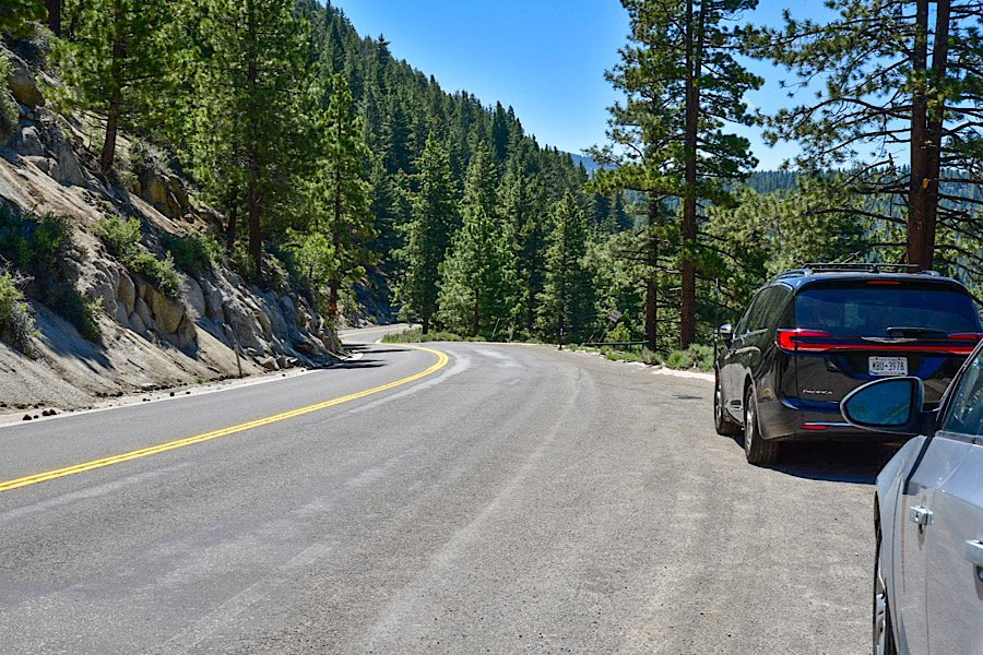
Lake Tahoe in general is notorious for its parking issues, but the eastern shoreline along Highway 28 is in a league all its own.
There are two small, pull-out style lots along the side of Highway 28 specifically for Skunk Harbor. However, they’re difficult to spot as they’re not signed.
Your best bet is to utilize a GPS device to locate them. That way you’ll know when they’re coming up.

If you’re coming from Carson City or the south shore, keep an eye out for the gate pictured above. Just past that gate is the first lot with a second, slightly larger one further up.
If you’re coming from Incline Village, you’ll know you’ve gone too far if you’ve reached Spooner Lake. Turn around a try again.
There is no parking fee (yet) but as of June 2023 and for the foreseeable future, construction on Highway 28 could damper, or even block your ability to park here.
There is ongoing efforts to improve the parking situation along this stretch of the lake. I’d wager that once they're done, there will be parking fees implemented.
The Trail To Skunk Harbor

If you parked in the lot near the gate, the trail begins past the gate along a forest service road. If you parked in the second one, the trail is a semi-steep descent on a dirt path that’ll soon intersect with the main trail.
For a short time the trail is gravel but soon turns to dirt. It’s much wider than your standard hiking trail, though. So it’s perfect for groups and pets.
Before the trail descends towards Skunk Harbor, you’ll be presented with a fork in the trail. Take a slight left to continue on the trail proper (don’t take the sharp left down the forest road).
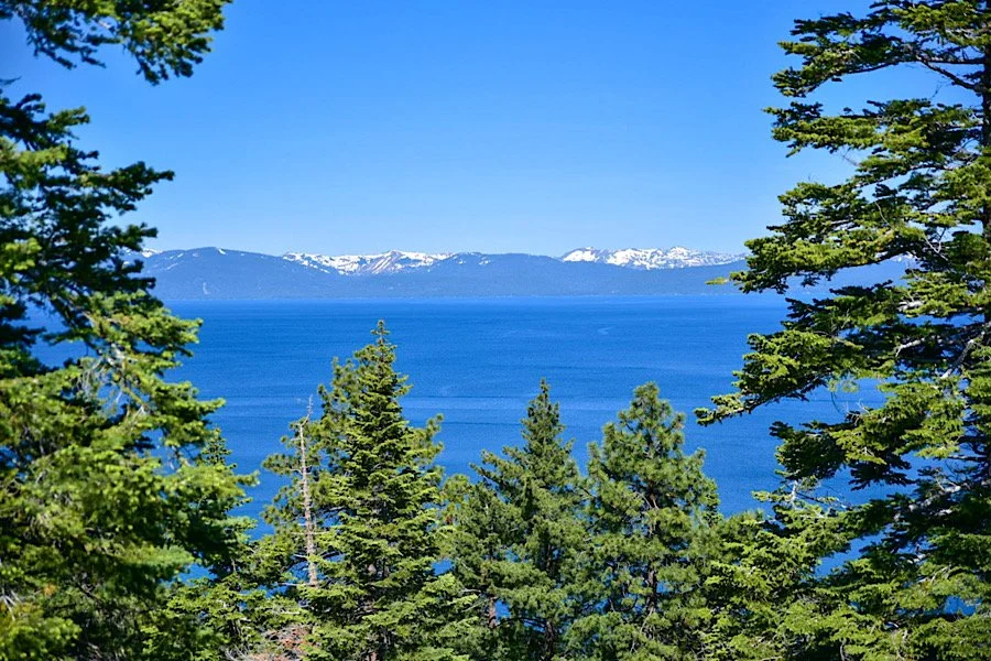
Shortly after this fork, you’ll walk between a couple of boulder stacks. Here, you’ll get a commanding view of Lake Tahoe and the mountains. Past here, you’ll begin your descent.
You’ll hit a few switchbacks before reaching the bottom. The initial half loop to the first switchback is steep, but they become more level after that.
As you approach the cove, you’ll see a stone stairwell with a trail marker indicating the correct path. You’ll know you’re in the right spot if you see a small wooden bridge ahead of you.
Skunk Harbor

If you get an early start, you’ll likely have Skunk Harbor largely to yourself. If you come later in the day, though, the cove and its beach will likely be inundated with anchored boats and beach goers.
Early in the season, there won’t be much a beach but as snowmelt eases, it’ll become more exposed. The boulders near the mouth will be accessible as well.

SEE MY TOP RECOMMENDATION FOR AN INFLATABLE STAND-UP PADDLE BOARD!
To the right of where you came in is a old stone cabin that was built in the early 1920’s by a wealthy family who purchased Skunk Harbor.
The interior of the cabin isn’t accessible but can be viewed through the grating in the window. You can explore all angles of the exterior, though.

Behind the cabin is a dirt path that’ll lead you to an overlook of Skunk Harbor. There are a lot of downed trees and boulders here, so you’ll need to navigate those.

From here, you’re able to better see the remains of the cabin’s boating dock submerged in the water.
CHECK OUT THIS GREAT CAMERA TO DOCUMENT YOUR OWN TRAVELS WITH!
I hope you’ll consider hiking to (or boating into) Skunk Harbor during your visit to Lake Tahoe. Get there early and you’re guaranteed to spend a serene morning in nature.
Disclosure: This post contains affiliate links. If you click through and make a purchase, I may earn a commission at no additional cost to you. Thank you for supporting us!
Please support this website by subscribing to my bi-weekly newsletter below.
Thank you for reading.

Hike the Tahoe East Shore Trail to Sand Harbor
Nestled amidst the picturesque Sierra Nevada Mountains, Lake Tahoe is a natural gem that beckons adventurers with its awe-inspiring…
Disclosure: This post contains affiliate links. If you make a purchase through these links, I may earn a small commission at no additional cost to you. I only recommend products or services that I believe will add value to my readers.
Nestled amidst the picturesque Sierra Nevada Mountains, Lake Tahoe is a natural gem that beckons adventurers with its awe-inspiring beauty. Known for its crystal-clear waters and stunning alpine landscapes, this iconic destination offers an abundance of outdoor activities for nature enthusiasts.
Among the many trails that wind their way through this pristine wilderness, the Tahoe East Shore Trail stands out as an enchanting path that leads hikers on a captivating journey to Sand Harbor State Park.
Stretching along the eastern shoreline of Lake Tahoe, the East Shore Trail is a remarkable testament to the region's commitment to preserving its natural wonders.
Spanning approximately three miles, this meticulously crafted trail offers an unparalleled immersiveness into the splendor of the surrounding environment.
The pinnacle of this remarkable journey lies at the destination—Sand Harbor State Park. This iconic gem is renowned for its pristine sandy beaches, hidden coves, and dramatic rock formations that emerge from the lake's depths.
Whether you're a solo adventurer or a family looking to create memories, hiking the Tahoe East Shore Trail to Sand Harbor State Park promises an escape from the day-to-day normalities.
In this guide, I’ll cover many must-know topics such as where to find parking, the length of the trail, which offshoot trails are the best and more!


Trail Stats
Location: Incline Village, NV
Fee: None for the trail, but there are variable parking fees and entry fees to Sand Harbor
Permit: None
Open: All year, but can be icy in winter
Restroom: At the Tunnel Creek parking lot, multiple throughout the trail and multiple at Sand Habor
Parking: Large(ish) paved lot at the Tunnel Creek parking lot and a huge lot at Sand Harbor
EV Stations: None
Difficulty: Easy
Popularity: High
Mileage: 2.5 miles (one-way) but can add more with the many offshoot trails
Time: 2-3 hours
Condition: Meticulously maintained
Features: The eastern shoreline, many coves/beaches and Sand Harbor State Park
Pets: Dog friendly, but must be leashed
Drones: No signs stating you can’t. The Nevada side of the lake is fairly drone friendly. No drone use allowed in Sand Harbor, though
Our Visit(s): June 2023
Trailhead, Parking & Fees

Construction on the Tahoe East Shore Trail took decades to complete, but officials knew right away how popular it would become. So ample parking was a major focus of the project.
On the north end of the trail are the Tunnel Creek and Bullwheel parking lots. They’re right off highway 28 and are adjacent to the Tunnel Creek Cafe and Monkey Rock trailhead.
In peak season, these lots tend to fill quickly. I arrived at 9:30 am and found only a few open spaces. So plan for an early arrival.
If the lots are full, you can drive to and park at the old Incline Elementary School and take the East Shore Express shuttle in. Fares are $3 per person (half that for seniors and those with disabilities).
Also during peak season, you’ll need to pay to park. Fees are charged per hour and depend on timeframe, day, month, etc. For reference, the photo below shows the fees as of June 2023.

You can pay via one of the digital pay stations or by texting the phone number in the picture below. If you intend to use the pay station, these are the steps:
Enter your license plate number
Insert your card (you’ll be charged an initial one-hour fee)
Select the amount of hours you want (go with more than what you’ll think you’ll need)
You’ll be charged upfront for the amount of hours selected and be given a receipt
If you’re not feeling up to hiking the trail, there’s a vendor called Flume Trail Bikes located adjacent to the parking lot where you can rent bicycles from. Additionally, if you’re feeling hungry, the Tunnel Creek Cafe is also right next to the parking lot.
Also at the trailhead is your first opportunity at using a restroom. It’s a port-o-potty set up and wasn’t maintained all that well, so come prepared.
SEE MY TOP RECOMMENDATION FOR THIS COMMON PROBLEM! (you’ll thank me later)
You’ll find the official start of the trail just past the informational display. I highly suggest giving it a read before heading out. It details the history of the trail, its construction and future plans.
The Tahoe East Shore Trail

You’ll start out on the opposite side of highway 28 (or the, “Mountain Side”). This section of the trail is the only one where there’s some elevation change.
When you get up the hill, you’ll be treated to epic views of the north side of the lake. This section is still wheelchair and stroller friendly as the grade never exceedes 8%.
This section is only a half mile or so, but the views are outstanding. It’s also the only section that has some shade provided by the tall pine trees.
As you reach the peak, you can look out ahead of you and get a glimpse of Sand Harbor State Park in the distance. From here, you’ll dip down and realign with the highway.


The second half of the trail continues along the shoreline on the other side. You won’t need to cross the highway, though, as the trail was built to go underneath.
The interior walls of the tunnel are covered in beautiful murals, each side depicting Lake Tahoe and its surrounding mountains.
Coming out of the tunnel you’ll arrive to a clearing where there’s more informational signage, views of the lake and another restroom.
If you’ll be taking the above mentioned shuttle to the trail, this is where they’ll drop you off. So you’ll effectively save yourself a half mile by doing so.

From the tunnel, you’re about 1.5 miles from Sand Harbor. To continue along the trail, go left coming out of the tunnel. This is also where you’ll come across your first offshoot trail.
There are many offshoots leading to a variety of beaches and coves that were once not as easily accessible as they are now. Each one only takes a minute or less to reach.
The first of which is the ever popular Hidden Beach. It’s small in comparison at just 750 feet, but it sees far less people than nearby Sand Harbor.
It’s also dog friendly and aside from parking, there are no fees associated with it. I highly recommend spending some time here.

Continue further down the trail and arrive to the next offshoot; Balancing Rock. There are two entry/exit points here so there’s no need to go back up the same way you came in.
The main feature here is the flat(ish) granite boulder balancing on a smaller pile of granite boulders beneath it in the water. It’s nothing spectacular but still worth a look.

Past Balancing Rock, the next few offshoots I either skipped or simply viewed from the trail (there was a storm coming in that afternoon and I wanted to beat it). Those offshoots include:
Granite Cove
Artist’s Point
Mountain Vista
Dipper Point
At Artist’s Point is another opportunity at using a restroom. This one is shared between trail users and people traveling on highway 28. From Artist’s Point, you’re about a half mile from Sand Harbor.
There are two more offshoots before you arrive to Sand Harbor, both of which I highly recommend visiting as I feel they both rival Sand Harbor in terms of beauty. They are Sunset Cove and Emerald Cove. Both are similar in that they’re dotted with granite boulder shorelines, have crystal clear turquoise water and require a hike down a quick trail.

CHECK OUT THIS HIGHLY RATED INFLATABLE STAND UP PADDLE BOARD ON AMAZON!
If you must choose, I recommend Sunset Cove as it’s much easier to access and has an actual beach, whereas Emerald Cove was lined with boulders.
From here, continue down the trail for another 2/10’s of a mile before getting your first glimpse of the mega popular and beautiful Sand Harbor State Park. As you approach the entrance to Sand Harbor, you’ll start seeing signs stating as such and the fees associated with entering.
To walk or bike into Sand Harbor you’ll need to pay the $2 per person fee. You can pay cash or utilize the digital pay station near the ranger shack. If you’re paying with a card, be sure to select “other” rather than the “day-use” option to avoid over paying. The ranger helped me to avoid that mistake.

Once in the park, you can stay for as long as you like. Your ticket is good until one hour past sunset. There are many beaches and coves to explore.
Sand Harbor has many restrooms available and an on-site restaurant. The larger beach is located at the far end of the park from where you’ll enter.
From here, simply head back in the same way you came. If you like, you can utilize the above mentioned shuttle to take you most of the way back. You’ll still need to walk the final half mile, though.

Your Thoughts…
Since this trail is popular and follows highway 28, this isn’t a peaceful hike through the woods. On the flip side, this shoreline is perhaps the most beautiful in all of Tahoe and is a must-see for any visitor.
Up until Sand Harbor, the entire trail is wheelchair accessible and is pet, stroller, bicycle and family friendly.
Does this sound like something you and your family would enjoy? Are you planning a trip to Tahoe soon? Let us know in the comments and in the meantime, check out our other Tahoe related posts below!

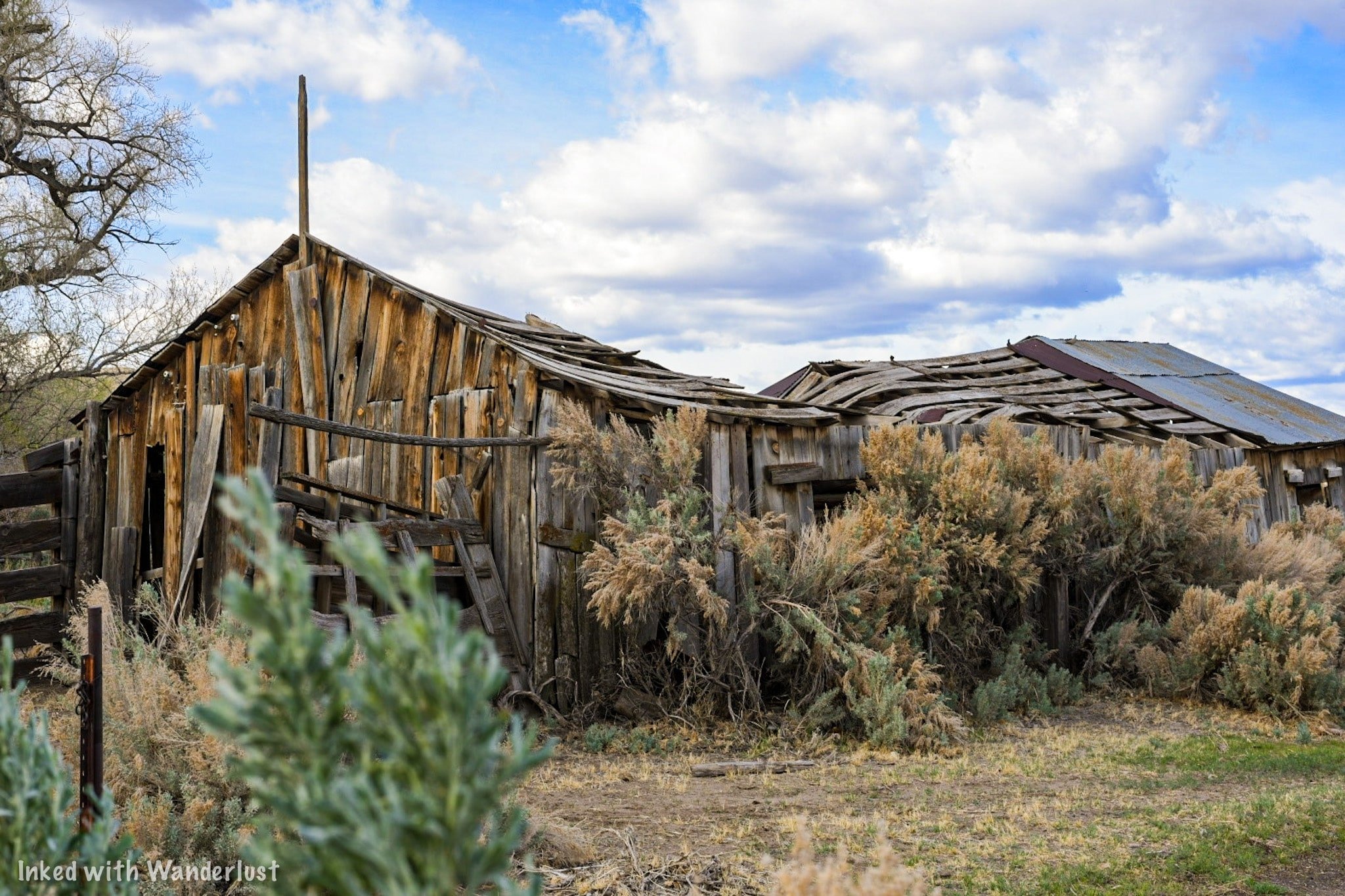
Anaconda Mine: See This Abandoned Open Pit Copper Mine In Yerington
Nestled in the picturesque landscapes of Yerington, Nevada, lies a hidden gem that takes visitors on a journey…
3 minute read | contains affiliate links
Nestled in the picturesque landscapes of Yerington, Nevada, lies a hidden gem that takes visitors on a journey through time.
Anaconda Mine, with its rich history and captivating allure, offers an unforgettable experience for those seeking a glimpse into the region’s mining legacy.
In this post, I take you to Weed Heights, an unincorporated community adjacent to Yerington, where the miners and their families once called home.
There, you’ll find the viewing platform where you can see the near entirety of the water-filled pit and on the way, get a distant view of the former processing plant.
Let’s get into it!

Exciting news for our readers!
We’re excited to Introduce the all-new "Inked with Wanderlust" online store!
We're thrilled to bring you a fantastic collection of wanderlust-inspired merchandise. Celebrate your love for travel and exploration with our stylish apparel and accessories, designed to ignite your sense of adventure.
Discover a range of unique designs that capture the spirit of wanderlust, from cozy hiking-themed t-shirts to charming accessories that make your wanderlust spirit soar!
Visit our online store today and start your journey of style and adventure. Happy exploring!
Anaconda Mine History & Stats

Anaconda Mine holds a significant place in Nevada’s mining history. Originally established in the mid 20th century, it played a pivotal role in the copper mining boom that shaped the region.
The mine was named after the Anaconda Copper Mining Company, who purchased the site in 1942. They were one of the most prominent mining companies of the time.
Anaconda’s initial 26-year run took place between 1952 and 1978, with secondary milling and processing until the year 2000. At which point, the newest owner, Arimetco, declared bankruptcy and abandoned the site.
During its run, Anaconda Mine produced:
1,744,237,000 pounds of copper
103,834,000 tons of oxide ore
58,589,000 tons of sulfide ore
189,034,000 tons of waste
The total market value from its operation is estimated to be $765,504,000, with total net profits exceeding $200-million. A staggering amount for the time.
At its peak, Anaconda employed 450 people, operated six-days per week and produced 13,000 tons of ore to the crushers daily.
Directions to Anaconda Mine

To see the water-filled open pit, you’ll need to make your way to the small Nevada town of Yerington and then up to the even smaller community of Weed Heights.
Much like other mining sites, such as Bodie, Weed Heights was built directly adjacent to the site for the purpose of housing miners and other employees.
Simply typing, “Anaconda Copper Mine”, into your GPS of choice will get you there. The main road leading to Weed Heights is just off the highway (US-95A).
After turning onto the road, continue straight. Keep in mind that during winter, this road is known to be icy at times.

About halfway up the road, prior to driving under the overpass, you’ll see the old processing plant on your right. There’s a large dirt/gravel area to pull into.
The buildings are gated off and unfortunately there are no tours or public access offered, so you’ll have to settle for admiring them from a distance.
From here, continue up the road until you reach a stop sign. Turn left and soon thereafter, you’ll see the fenced-in viewing platform with a small parking area on your left.
Anaconda Mine Viewing Area

In front of the entrance to the viewing platform are two informational boards detailing the history and production of Anaconda Mine.
To see the pit, continue past the signs along the dirt path between the fences. There’s lots of barbwire here so watch where you put your hands.


From the viewing area, you’ll be able to see the pit (or lake, as some locals refer to it as) in all its glory, including the hauling roads circulating around it.
Here are some interesting stats of the pit:
It’s one mile long
A half mile wide
810 feet deep
Water level is approximately 450 feet deep


To some, it’s just a giant hole with water in it. For those who appreciate mining/local history, or who enjoy roadside stops like this, it’s a fascinating sight.
Unfortunately, this is all you’ll be able to legally view. There’s no public access to the haul roads or even in the perimeter of the mine for safety reasons.
All told, Anaconda Copper Mine makes for a quick but fascinating stop for those traveling through or for locals who want a glimpse into the area’s past.
Travel safe, travel responsibly,
Kevin
Check Out These Amazing Nearby Destinations!
Please support this website by subscribing to the newsletter below.
Thanks for reading.
7 Things You Will Love About Reno: Family Friendly Things To Do
Reno was long known as a miniature version of Las Vegas, but it hasn’t always had the greatest reputation. The downtown…
3 minute read | contains affiliate links
Reno was long known as a miniature version of Las Vegas, but it hasn’t always had the greatest reputation. The downtown area, specifically, was associated with seedy hotels, rampant crime and homelessness.
While some of those elements still exist, there’s been a solid effort in recent years to spruce up the area and make it more appealing (and safe) to visitors.
Additionally, city officials have been making moves to market the city as a place for families and adventurers, not just those who like to partake in the casino lifestyle.
That topic is what this post will focus on. Nothing listed here has anything to do with gambling or bars. They’re all 100% family friendly.
So if you’re contemplating a vacation to Reno but you’re not sure what activities there are to do with you’re family, read on.
*NOTE: This is the newest installment of our “7 Things” series. At the end of the post, we’ve listed the other ones currently live on the website. Be sure to check them out!

Exciting news for our readers!
We’re excited to Introduce the all-new "Inked with Wanderlust" online store!
We're thrilled to bring you a fantastic collection of wanderlust-inspired merchandise. Celebrate your love for travel and exploration with our stylish apparel and accessories, designed to ignite your sense of adventure.
Discover a range of unique designs that capture the spirit of wanderlust, from cozy hiking-themed t-shirts to charming accessories that make your wanderlust spirit soar!
Visit our online store today and start your journey of style and adventure. Happy exploring!
1) Proximity to Lake Tahoe

One of Reno’s biggest claims to its, “outdoor recreation haven” banner, is its proximity to Big Blue herself; Lake Tahoe. In fact, the downtown area is just about an hour’s drive from South Lake.
It’s also the closest city with a major airport to Tahoe so if that’s where you’re ultimately ending up, Reno is likely where you’ll be flying into.
Getting to Tahoe’s most beautiful state park, Emerald Bay, is a simple 1.5-hour drive from your downtown hotel. If you’ve never been to Emerald Bay, you need to add it to your list, pronto.
READ: “Emerald Bay State Park Guide: Hiking, Camping, Vikingsholm, Kayaking and More”
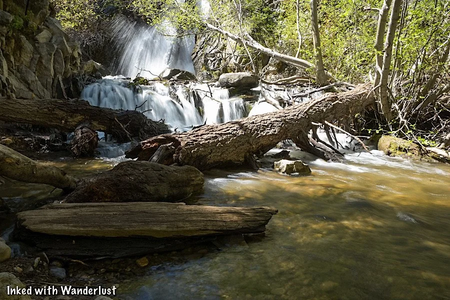
2) Hunter Creek Waterfall Trail
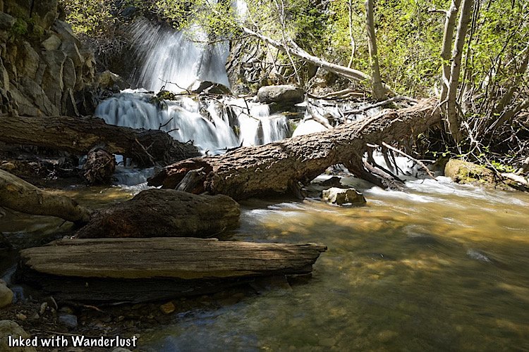
You won’t need to travel to Tahoe in order to partake a blissful stroll through nature. There are many hiking trails in Reno with a wide variety of difficulties and features.
Of all the said trails in Reno, the Hunter Creek Falls trail is probably the best known to locals and visitors alike.
The trail is 6.5 miles, roundtrip, and is considered moderate. It terminates at the beautiful, 30-foot Hunter Creek Falls.
While it’s rocky, narrow and fairly lengthy, if you and your family have experience hiking, you shouldn’t have any trouble. It’s dog friendly as well.
READ: “Hunter Creek Falls: An Epic Hike Just Outside Of Reno”
3) Local Restaurants

Reno is filled to the brim with dozens of great, non-chain local eateries offering a wide range of cuisine for all kinds of palates.
A few examples of Reno’s fine dining options include; Bricks Restaurant & Wine Bar, Atlantis Steakhouse, Sierra Street Kitchen & Cocktails and Marolina’s Italia Restaurant.
A few examples of mid-range sit-down restaurants include, Arario Midtown, Wild River Grille, Washoe Public House, Great Full Gardens and Old Granite Street Eatery.
You’ll find great eateries all over the city but some of the best ones are found in either Midtown or Sierra Street (in downtown).
4) The Basement

The Basement is a literal hidden gem in the heart of downtown. It’s located in the - you guessed it - basement of the historic 1932 Post Office. The space has been repurposed into a marketplace of local businesses.
The Basement consists of several small businesses, each of which are 100% local. These include handcraft shops, a male-inspired nail salon, barbershop, coffee shop, restaurants, a shared space with seating and more.
The street level space (where the actual post office was) is now in the process of also being repurposed into a merchant space. Be sure to stop by and find out for yourself why it’s so beloved by locals.
5) The Truckee River Walk

Stretching from the western edge of Idewild Park into the lovely Wingfield Park in downtown, Reno’s River Walk celebrates Reno’s reputation of culture, arts and heritage.
The space between Virginia Street and Wingfield Park, in particular, is teething with picturesque scenery, local restaurants and shops.
Just up the street from the river walk is the infamous Reno Arch. In City Plaza, you’ll find numerous permanent and temporary art installations used at the Burning Man festival on display. Plus, just beyond the Virginia Street bridge, you’ll find the street level entrance to The Basement.
No visit to Reno would be complete without a stroll along the river walk. It’s easily in the top three of things to do and see in Reno. Best of all - there’s no admission fee.
6) Art Murals

Arts and culture have a big presence in Reno. One of the things that city officials have done right is give local artists a chance to showcase their skills via wall murals.
They’re literally all over the city, but the majority (and best) are in downtown and midtown. A notable one to mention is the giant women mural on the side of the parking garage next to the arch.
7) The National Automobile Museum
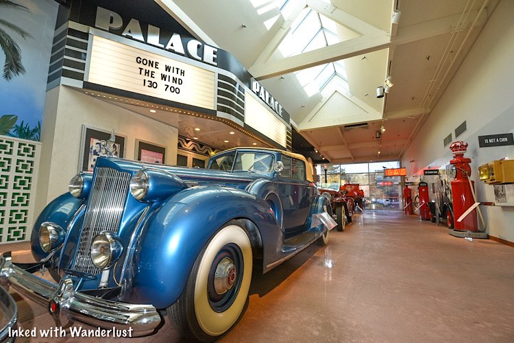
The National Automobile Museum opened in 1989 and features a massive collection of classic cars, most of which once owned by local gaming pioneer, Bill Harrah.
At the time of his death in 1978, Harrah’s collection reached a staggering 1,400 cars! Holiday Inns purchased Harrah’s Casino and car collection in 1980.
Before selling off the majority of the collection, Holiday Inns donated 175 of those cars to what is now the museum. They’ve been on display, with additional rotating exhibits, ever since.
The sheer volume of cars in this collection is enough to impress those who’re not “car people”. If nothing else, it’s a great way to spend a few hours inside if the weather isn’t ideal.
READ: “National Automobile Museum: A Huge Classic Car Collection In Reno”
Your Thoughts…
What’re your thoughts on Reno for a family vacation? Did you know it’s no longer just about the casinos and bars? Which topic on this list interests you most? Let us know in the comments below! We love hearing from our readers.
*Tip: As stated at the top of this post, below are the links to our other “7 Things” posts that might interest you. Additionally, i’ve included a couple more Reno based posts.
Please support this website by subscribing to our newsletter below.
Thank you for reading.

Fort Churchill State Park: Nevada History, Fees, Parking, Hiking and More
Nevada has no shortage of historic, abandoned sites to explore. Fort Churchill State Historic Park is one of many you need to add…
3 minute read | contains affiliate links
Nevada has no shortage of historic sites to explore. Fort Churchill State Historic Park is more than deserving of a spot on your list. Particularly if you’re into military history.
Fort Churchill sits on 3,200 acres of protected land. It features several structures, a cemetery, museum, campground, group area and Buckland Station (which is located across the highway from the park).
If you’re going to be driving through, Fort Churchill is an easy to visit as it’s just off the highway. It’s a great way to get out and stretch your legs or to let the kids burn off some energy.
In the guide, we’ll cover how to get there, the parking situation, crowd levels, fees and more. Lets get into it!

Exciting news for our readers!
We’re excited to Introduce the all-new "Inked with Wanderlust" online store!
We're thrilled to bring you a fantastic collection of wanderlust-inspired merchandise. Celebrate your love for travel and exploration with our stylish apparel and accessories, designed to ignite your sense of adventure.
Discover a range of unique designs that capture the spirit of wanderlust, from cozy hiking-themed t-shirts to charming accessories that make your wanderlust spirit soar!
Visit our online store today and start your journey of style and adventure. Happy exploring!
Fort Churchill History

Construction on the post was completed in 1861 and was named after Sylvester Churchill, an Inspector General for the Army.
Its original purpose was to provide protection for this section of the Pony Express. Later, the fort was used to store supplies for the Union Army during the Civil War.
Though many Soldiers came and went, it’s believed to have housed around 200 at any give time. Despite its importance, it wasn’t active for long as it was abandoned shortly after the conclusion of the Civil War.

Since the state declined to take ownership, the fort’s structures were auctioned off for $750. For decades, the structures just sat as nothing was done with them.
It wasn’t until 1932 that the National Park Service took control of the property and began restoration efforts on the structures. Additionally, the visitor center was built at this time.
Then, in 1957, Fort Churchill became part of the Nevada State Park system. In 1966, it was added to the National Register of Historic Places.
Getting To Fort Churchill, Parking, Fees & Museum

The park is located between the towns of Silver Springs and Yerington along the highway. From either town, get on highway 95 and keep an eye out for Fort Churchill road and turn there.
Park fees are as follows:
$5.00 - Nevada Resident (day use)
$10.00 - Non-Nevada Resident (day use)
$15.00 - Per Night, Nevada Resident (camping)
$20.00 - Per Night, Non-Nevada Resident (camping)
$2.00 - Bike In
The park accepts cash and credit cards for fees. As you drive up to the entrance, you’ll fee the pay station on your right. There’s an area where you pull-off to do so.
Whichever payment method you use, be sure to place the receipt (face-side up) on your dashboard in case the park ranger needs to verify payment.

The parking lot and museum will be to your left after driving in. The cemetery is off to your right (above the pay station). The parking lot is small, capable of holding a dozen vehicles or so.
There are additional lots on either side of the structures further down the road if this one is full or closed off.
The entrance to the museum can be found just off of the parking lot. It’s small, but contains quite a few artifacts from both the fort and the general area.


While the park itself is open 24/7, the museum is not. It’s open daily from 8am to 4pm.

The trailhead to the structures below is located adjacent to the museum. There are two additional parking lots closer to them if you prefer to skip the trail.
Fort Churchill Historic Structures

From the trailhead near the museum and back, the trail is roughly one mile. It’s a fairly even grade and is easy to follow as it’s lined with rocks.
Most people, including children, would have no issue on this trail. Using strollers and/or wheelchairs on it, though, would be challenging.


With the exception of a couple off-shoots, the trail makes a perfect circle to each of the featured structures. There are around a dozen or so.
There are signs posted in front of most stating what the structure was, such as the Hospital. A few have bigger informative boards with broader details.
One important thing to note is to be sure to keep out of the structures and remain on the trail. The structures are old and in a state of arrested decay.


There are no doors or windows on the structures so if you’re curious as to what the inside of them look like, they're easy to see/photograph from the trail.
Something else to keep in mind is that there isn’t any shade or water fountains along this trail. So be sure to come prepared, particularly in the summer.
Fort Churchill Campground & Group Area

The campground is open throughout the year and operates on a first come, first serve basis. It’s located along the Carson River on the east side of the park.
There are 20 spots featuring a table, fire ring and plenty of shade from the dozens of cottonwood trees that dot the landscape.
Each site can accommodate RV’s or a tent. There are no hook ups, but there’s a dump station located nearby. The only real amenity are the bathrooms (no showers).
To reach the campground, drive past the main parking lot on the road and continue until you see the sign to turn right. Simply follow that road.

The group use/picnic area is a serene, often crowd less area of the park. There are many picnic tables, lots of shade, a bathroom, water bootle refill station and easy access to the Carson River.
To get to the river, walk on the paved path next to the bathroom and keep going through the grove of Cottonwood trees until you reach a gate. Go through the gate and enjoy the river.
To reach the group use area, drive past the main parking lot at the entrance and take the first left after that (the historic structures should be on your right).
Once you see the sign, turn left and follow the gravel road. At the point where it splits, turn right and continue until you reach the parking lot.
Buckland Station

Buckland Station. Fort Churchill State Park. Nevada.
Buckland Station was built in 1870 out of materials from the abandoned fort. It was first used as a boarding house and the home of the Buckland Family. Beginning in 1885, it served as a supply stop on the Pony Express.
Self guided tours are available of the interior of the recently remodeled building. The fee is $1 per person with free parking.

The fee goes towards ongoing maintenance and upkeep of the property. Bathrooms are available behind the house.
Across the street are more historic structures. These are of the farm variety. I wasn’t able to find any information on them but they’re cool to check out, nonetheless.
Additional Info, Tips & Reminders

Do not climb on or go inside the remains. The remains are fragile and entering or climbing on them could cause irreversible damage and most importantly, your safety would be at risk.
Watch out for wildlife. Rattlesnakes have been known to frequent the park so please, watch your step, stay on the trail and keep an eye on the little ones.
Buckland Station is across the highway. To visit this historic station, you’ll need to leave the park proper and drive south on highway 95. You can either drive there or you can utilize the 2 mile trail that connects Buckland to Fort Churchill.
Please support this website by subscribing to the newsletter below.
Thank you for reading.

Cave Rock Trail: A Short Hike To An Epic View Of Lake Tahoe
Located on the Nevada side of the lake, the Cave Rock trail may seem uneventful at first, but the mind-blowing view…
3 minute read | contains affiliate links
Located on the Nevada side of the lake, the Cave Rock trail may seem uneventful at first, but the mind-blowing view at the end will prove that assumption wrong.
This trail is great for hikers, families and everyone in between. If you happen to be driving through on a trip, it’s an excellent way to stretch your legs for an hour or so.
Note that this post is about the actual trail to the top of Cave Rock and not the state park on the other side of the highway. Those are two different things.
In this post, we’ll cover topics such as parking, how to find the trailhead, what to expect along the trail and more. Let’s get into it!
Here’s some great hiking products we recommend…

Quick Stats
Location: Stateline, NV (Tahoe)
Fee: None
Permit: None
Open: Year round
For: Everyone
Restroom: None
Parking: Tiny lot with enough room for 4-5 vehicles
EV Stations: None
Difficulty: Easy (though there’s some scrambling involved)
Popularity: Medium to high
Mileage: Less than a mile, roundtrip
Time: One hour
Elevation Gain: 137-feet
Condition: Maintained (not signed)
Features: Cave Rock & view of Lake Tahoe
Pets: Allowed on leash
Drones*: Allowed on the trail and Cave Rock itself (not within the state park boundaries, though)
Hazards: You’ll need to scramble up Cave Rock to get to the top. It’s nothing too difficult, though.
Our Visit(s): 2016 & 2022
*We refer to the app, “B4UFLY”, to help determine if we’re legally allowed to launch our drone from a particular location. We suggest you do the same to ensure you’re flying responsibly.
Cave Rock Trailhead & Parking

When looking for the parking lot and trailhead for the Cave Rock trail, many people mistakingly go to Cave Rock State Park along the shore of the lake.
Unfortunately, there is no access to the trail from there. That area is for swimming, kayaking and other types of recreating.
For the trail to the top of Cave Rock, you’ll need to drive up Cave Rock road, just off the highway. You’ll see a, “Cave Rock Estates”, sign indicating the correct road.
About a quarter-of-a-mile up the road (as it elbows), you’ll see a tiny, pull-out style lot on the left side of the road. This is the parking lot for the trail (pictured above).

As you can see, there isn’t a whole lot of room. It’s a stretch to even call it a parking lot. There’s room for maybe four or five vehicles.
On top of that, there’s no parking allowed along the street (you could get towed). If there’s no space, you may have to circle around a couple times.
Due to this, we recommend getting here early. We arrived at around 8am and there was just one other couple at the rock.
Cave Rock Trail

The trail is a well maintained, compacted dirt path that’s less than a mile, out and back. You will be walking at an incline but it’s barely noticeable.
Along the way, you’ll be treated to periodic views of Cave Rock and the lake itself. There’s a few spots to get creative with your camera by using the trees to frame the rock.

As you get further up the trail, you’ll see a large set of boulders on the right side of the trail (pictured below).

Shortly after these boulders, you’ll come to an unsigned junction. Keep left (in the direction of Cave Rock) to remain on the trail.
Almost immediately after bearing left, the base of Cave Rock will come into view.


If you or someone in your group isn’t up for scrambling up the rock, you can get a similar view as the one up top.

For an even better view, though, you’ll want to get to the top. To begin, make your way around the rock-wall to begin your climb.
Scrambling Up Cave Rock

There’s no actual trail or path to the top. Take a minute to scan the boulders around you, use common sense and scramble your way up.
If we had to rate it, we’d both say it’s an easy, beginner level scramble. Or the lower end of moderate, at worst. It only took us about five minutes.


The views from the top are simply jaw-dropping, no matter which direction you look. Being up here for sunrise or sunset would be even more amazing.
There isn’t a lot of room up here. So if you’re here on a particular busy day, expect it to be a bit cramped. In our experiences, though, its never been an issue.

When you’re done taking in the views, safely scramble back down the rock and head back to your car. If you’re up for more adventures, see our posts below for a few other Lake Tahoe hikes.
“Hike To Eagle Falls and Eagle Lake In Lake Tahoe”
“Hiking To Cascade Falls Near Emerald Bay”
“How To Kayak To Fannette Island Tea House In Emerald Bay”
Your Thoughts…
Does this sound like a trail you and your family would enjoy doing? Have you been to the top of Cave Rock? Let us know in the comments below. We love hearing from our readers!
Please support our website by sharing it with your family and friends.
Thank you for reading.

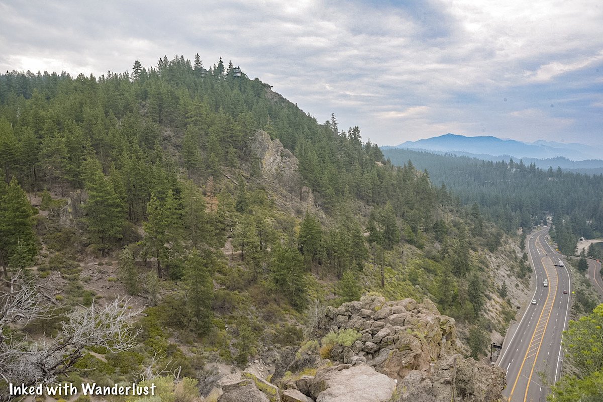
Thunder Mountain Monument: A Deeply Meaningful Roadside Oddity In Nevada
Imagine you’re on a road trip through the Northern Nevada desert along Interstate 80. You go miles seeing nothing but rolling…
4 minute read | Contains affiliate links
Imagine you’re on a road trip through the Northern Nevada desert along Interstate 80. You go miles seeing nothing but rolling mountains, vast openness and the occasional small town.
You eventually reach one of those small towns; Imlay. A former railroad station 130-miles east of Reno with a population of 178 (as of the 2020 census).
You look around and at first, nothing sticks out. But soon after getting past the main stretch of town, something catches your eye on the side of the freeway. Something strange, but unique. That something is Thunder Mountain Monument.

We recently visited Thunder Mountain, not knowing much about it and thinking it was just another cool (and weird), roadside oddity.
As we explored the property, though, we discovered how meaningful this property was to the original owner, Frank Van Zant, and the current owner, his son, David.
In this post, we’re going to cover some quick details about the property, what you can expect and some other important information.
However, we’re going to encourage you to visit the monument’s website for a more detailed account of its history and background. We will share the link at the end of this post.

Quick Stats
Location: Imlay, NV
Fee/Permit: None, but a $2 donation per group is requested (cash or check)
Open: Year round, from dusk to dawn
For: All visitors
Parking: Semi-large, dirt lot.
Restroom: None
EV Stations: None
Drone Use: Not allowed
Difficulty: Easy
Popularity: Low
Time: An hour or more
Milage: N/A
Elevation Gain: N/A
Trail Condition: Somewhat maintained pathway.
Main Feature(s): The monument and art installations
Pets: Not allowed
Special Notes/Hazards: Broken glass scattered throughout the property. Rattlesnakes have also been spotted here
Our Visit(s): June 2022.

Directions, Parking, & Fees
Thunder Mountain Monument may be located in the middle of nowhere, but it’s easy to reach as it’s located directly off Interstate-80 in Imlay, NV.
There isn’t a whole lot to do, see and eat in Imlay. So if you’re making the trip here from a larger area, you may want to ensure your tank is full and bring plenty of water/food with you.
Additionally, the nearest EV charging stations to Thunder Mountain are in Lovelock (40-miles west) and Winnemucca (35-miles east).

From Reno (133-miles, one way)
From wherever you are in Reno, make your way to I-80 eastbound and continue straight for 133-miles.
Take exit #145 for Frontage road.
At the stop sign, turn right and then make an (almost) immediate left on Frontage road.
You’ll follow this road for slightly less than a mile and it’ll terminate at the monument’s parking lot.
From Winnemucca (36-miles, one way)
Start by jumping on I-80 westbound and continue straight for roughly 36-miles.
Take exit #145 for Frontage road.
At the stop sign, turn left and go under the freeway.
Turn left on Frontage road and continue straight until it terminates at the parking lot.

Shortly after turning onto Frontage road, it’ll turn into dirt. No need to worry if you have a compact vehicle, it’ll make it just fine. Our Chevrolet Cruze made it without issue.
The parking lot is fairly large and entirely dirt. There are no official parking spaces so just find a spot that makes sense and go with it.

There are no parking or hard entry fees. They do request a (totally reasonable) $2 donation per group. There’s nobody on site collecting these donations but they do have an iron ranger adjacent to the picnic table.

It’s cash or check only. So if you don’t have either on hand, you can send a donation to the following address when you get home:
Thunder Mountain Monument, LLC
P.O Box 162 Imlay, Nevada 89418
Any donations left at or mailed to the monument go towards to continued growth, rehabilitation and maintenance of the property.

Exploring Thunder Mountain Monument
To begin exploring the monument, simply look for the official entry to the grounds (pictured above). You can easily spot it from the parking lot.
If your only interest is the monument itself, turn left along the dirt/gravel path as you approach the picnic table. If you have the time though, we recommend heading right and exploring the rest of the grounds in a loop.

At the picnic tables, you’ll find binders containing printed information about the monument’s history and development, as well as information about its founder, Frank Van Zant.
We highly encourage you to stop here and learn about the monument. Its history is fascinating. This is also where you can drop your donation (if you’re able to).

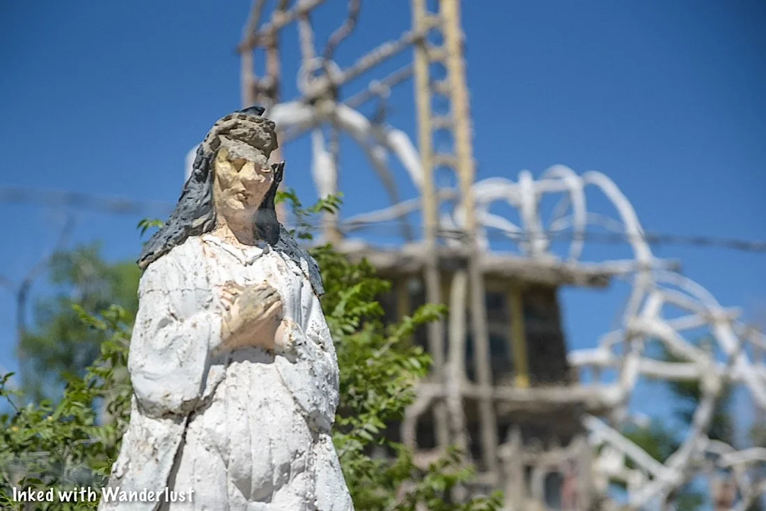
From the picnic table, go right along the path (away from the monument) to check out a cool, but admittedly creepy, art installation on the far side of the property.
Over here, you’ll find rusted vehicles lined up like a barricade of sorts, a swing set made out of wood and mud, a model airplane also made from mud/plaster and a de facto fort in front of all that. It’s weird, but so cool at the same time.


After exploring this area, simply follow the dirt path running parallel to the freeway. After a short distance, you will arrive at the monument itself.
The monument was conceptualized and built by Frank Van Zant (with the help of hippies and passerby’s) after being inspired by a visit to a bottle house in Death Valley.


As you walk up to the monument, the first thing you’ll notice is it’s fenced off with ‘no trespassing’ signs dotted along the fence. This was done to protect the monument from vandalism.
Based on our research, once upon a time the general public was allowed to explore the interior of the monument, but weather damage to the roof has made it too dangerous.
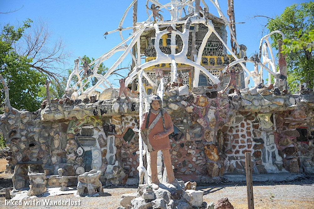
The monument was once lived in by its founder, Frank Van Zant and his family and initially started out as a one-room travel trailer. Over time, it was rocked over and additional features like bedrooms, corridors, stairwells and levels were added.
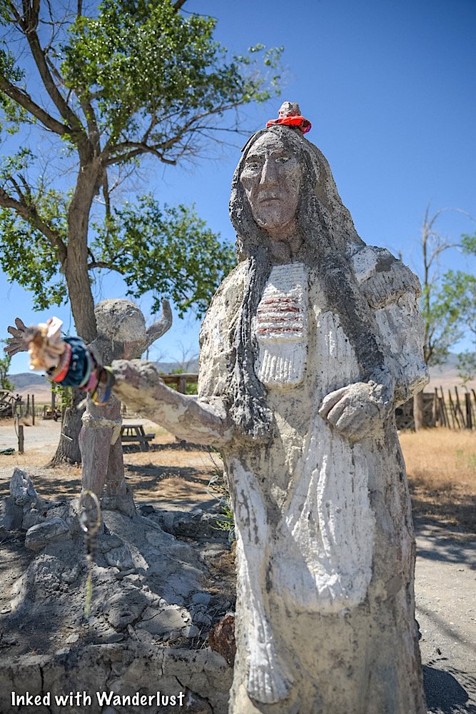
The roof is adorned with multiple statues and arches, the tallest of which stands fifty-feet. The exterior walls are covered in bas-relief tableaux depicting many historic events, betrayals and massacres of the American Indian.

If you know your history, you’ll no doubt recognize the depictions in some of the statues. Some notable figures include Standing Bear, Quietzalcoati, and Sarah Winnemucca. There’s even one honoring Franks’s late son, Sid.
It’s important to note that the vast majority of the materials used to construct the monument was “trash” Frank found discarded in the desert. This was done to honor the Native Indian tradition of using what you have and not be wasteful.


Many of the windows are windshields from old cars, glass bottles line much of the top end of the monument and a wooden Eagle is perched at the very top.
Some other material used in the monument includes galvanized pipe, scrap iron, chicken wire and concrete. It’s truly amazing what Frank was able to accomplish with what many perceived to be trash.
When you’re done exploring the monument, simply head back up the trail towards the entrance where you came in and back to your vehicle.
There are a few other nooks and features of the property, but we want to leave those things a surprise when you visit for yourself. We highly encourage you to do so.
As promised at the beginning of the post, be sure to visit the monuments official website for more in-depth information of its history and the background of its creator, Frank Van Zant, as well as photos of the interior.
Your Thoughts
Have you visited Thunder Mountain Monument before? We’d really like to know what you thought of it. Or if you’ve never been there, have you been wanting to visit or have you even heard of it?
Either way, let us know in the comments below. We LOVE hearing from our readers!
Please support our website by sharing it with your family and friends.
Thank you for reading.

Hunter Creek Falls: An Epic Hike Just Outside Of Reno
Up until fairly recently, people would generally associate Reno solely with gambling, bars, and being the (much) smaller sibling…
5 minute read | Contains affiliate links
Until fairly recently, people would generally associate Reno solely with gambling, bars, and being the (much) smaller sibling to Las Vegas.
In recent years though, Reno has been earning a reputation for being more than that. You may not realize it, but Reno is an outdoor recreational haven.
Activities like skiing, hiking, white water rafting, and camping can all be done in Reno. This article, however, will focus on Reno’s most popular hiking trail; Hunter Creek Falls.
This trail is spectacular! It parallels Hunter Creek the entire way through rocky terrain, before taking you through crisp-smelling pine trees and terminating at the namesake thirty-foot waterfall.
Despite living near Reno, I’ve only just recently hiked this gem. If you haven't, there’s a few things you should know before hitting the trail. Let’s get into it!
Quick Stats
Location: Reno, Nevada
Fees/Permit: None
Open: April through October
For: Hikers, Mountain Bikers, & Equestrians
Parking: Large, paved lot.
Restroom: At the trailhead
EV Stations: None
Drone Use: No signage stating you can't
Difficulty: Moderate
Time: Three to four hours for most
Mileage: 6.4 miles, RT
Popularity: Heavily trafficked
Elevation Gain: 1,023 ft
Trail Condition: Maintained and easy to follow
Main Feature(s): 30-foot waterfall
Campground: None nearby
Pets: Allowed on leash
Special Notes/Hazards: 1) Sun exposed throughout the majority of the trail. Bring lots of water and sunscreen. 2) Several heavily rocky sections that pets and small children may have a hard time navigating without assistance. 3) A good portion of the trail is narrow along a steep ravine.
Our Visit: June 2022
*Please practice leave no trace principles and keep to the trail*

Trailhead and Parking
Getting to the trailhead for this spectacular hike is easy and straight-forward. It’s just 20-minutes from the downtown area and midtown at the end of a beautiful housing development called, “Jupiter Ridge”.
*Tip: Simply punch “Hunter Creek Falls trailhead” into any GPS system for easy directions
You’ll arrive at a well maintained parking lot large enough to hold a few dozen vehicles. GPS directions will try to take you to a dirt pull-out but this isn’t it. Go a little further up the road and take the first right out of the roundabout. The lot will be right there.
In it, you’ll find trail/area information signage, a picnic table, trash cans, and a well-kept restroom. If you must, utilize before you head down the trail as there are no other restrooms beyond this point.

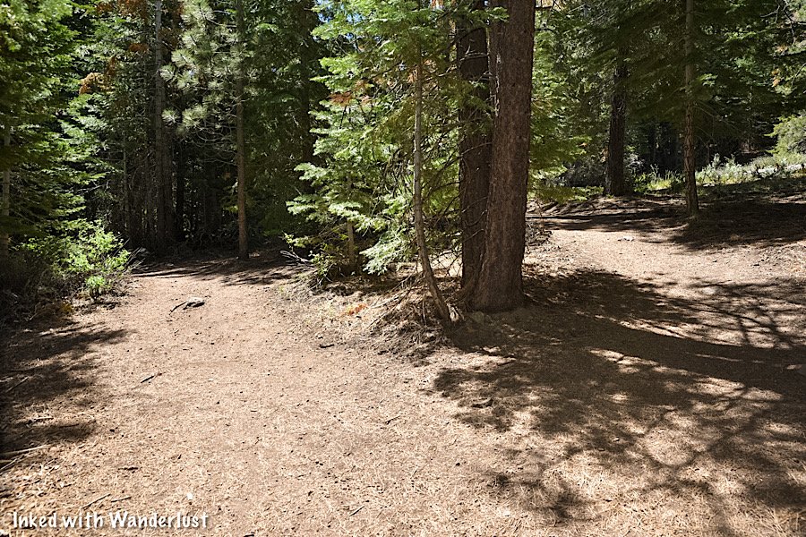
The Trail
Facing the restroom, you’ll find the start of the trail on your left (pictured above). On it, you’ll descend a short distance to Hunter Creek before coming up on a wooden bridge.
Note: If you’re an Equestrian, there’s signage asking you to cross through the creek (there’s an opening to the right) instead of crossing the bridge.


After crossing the bridge, you’ll see a split. To continue to Hunter Creek Falls, go left. You’ll be hiking parallel to the creek along this short stretch.
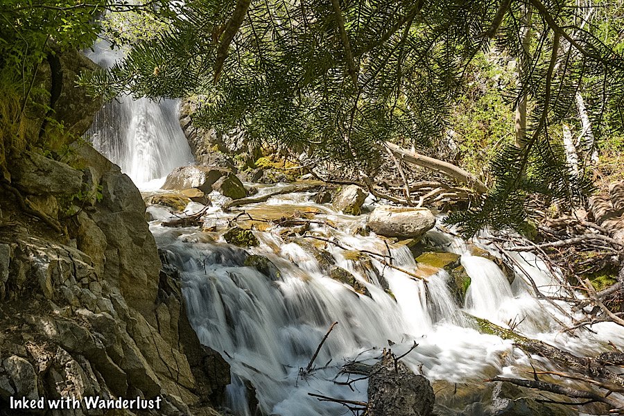
There are many spur trails leading you to the waterline. Throughout the entirety of the trail the creek is covered by trees, providing a plethora of shade.

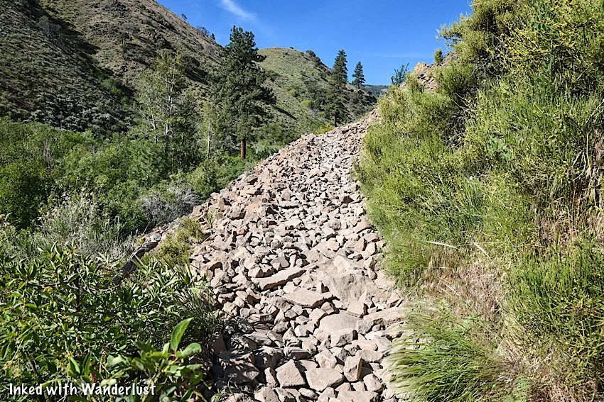
Soon, you’ll begin to ascend above the creek and tree line. Here, the trail narrows, gets rockier, and is completely sun exposed. It maintains all three of these elements (for the most part) until you get closer to the waterfall.

At the top of your first ascent, look to your left for a rocky ledge and take in the view ahead. You’ll get a glimpse of Downtown Reno in the distance.
From this point, the trail gets VERY rocky. There’s more than a few sections of trail that are nothing but loose rock (pictured below). This is where pets and kids may have a hard time navigating.

On the plus side, here is where the scenery around the trail moves into a proper wilderness setting as you put the view of Reno behind you.
If you’re here at the right time in the season you’ll see lots of flora and fauna, along with pine trees and mountains that still have snow on them.


As stated at the beginning of this post, the trail is very narrow. If you’re hiking in a group, you’ll need to hike single file throughout the majority of it.
On the way up and back, there were a few instances where finding a safe spot to stand as another hiker passed was quite the challenge.

It’s not impossible or inherently dangerous by any means, but it’s something to be mindful of. How hikers get around Equestrians on this trail is beyond me.

Pictured above, you’ll see the beginning of the most intense part of the trail. Up until now, it has ascended fairly evenly. Here, it’s a semi-sharp ascent. This is about two miles into the hike.
Personally, I wouldn’t rate it as difficult. It will, however, take the breath out of most people (it did to me). Take your time, catch your breath when needed, and you’ll get up there just fine.
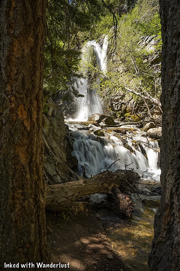
Hunter Creek Falls

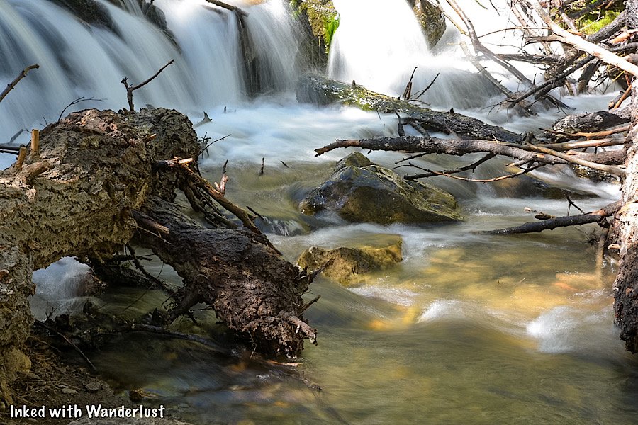
You’ll know you’re getting closer to the waterfall when you enter a thick section of pine trees and re-align with Hunter Creek. There are two final spots on this trail I felt should be pointed out as it isn’t entirely clear which direction to go.
Every other blog post or review I read of this trail stated it was well-signed. This is emphatically false. Past the bridge at the beginning, I didn’t see a single sign. So I’ll do my best to help you avoid going in the wrong/least convenient direction.

The first one you’ll come to (pictured above) seemingly continues forward. When you come up on this, those two boulders in the picture will be on your right. Straight ahead, you’ll both see and hear the creek.
DO NOT continue straight. Instead, turn right, in between the boulders. The one going straight isn’t the official trail. After turning right, the trail becomes obvious again.
*Tip: Essentially, if you come right up on the creek, you went too far.
The second one (pictured above) presents itself about a quarter-mile after the right turn you made. Here, you have two options:
Option #1: Continue straight and arrive at the waterfall shortly. However, on this side of the falls, there’s nowhere to sit, you won’t have a good view and you’ll need to cross a log to get to the other side.
Option #2: Go left and cross the creek via the make-shift bridge made from sketchy tree branches people randomly found. Shortly after making it to the other side, you’ll arrive at the falls in an area with a plethora of seating, shade, and space.
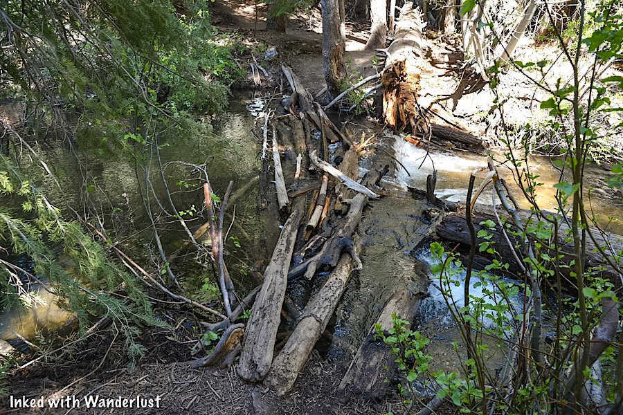
I recommend taking the second option. Worst case, you could cut straight through the creek. I estimate this part of the creek was about half shin deep when I hiked it (early June).
*Note: There used to be a solid bridge here for people to cross but it was destroyed a few years ago by heavy water flow and debris.
Regardless of which direction you take, you’ll soon arrive at the beautiful Hunter Creek Falls. If you take my recommendation and go left, you’ll come to a large area with lots of seating and shade.
When I was here, there was a tree branch that collapsed and was partially blocking the view of the first section of the waterfall. Still an awesome view, regardless.

Stay as long as you like. Get all the pictures you can. When you’re ready, simply turn around and head back in the same direction you came.
Have you hiked Hunter Creek Falls before? If so, did you find the trail pretty easy or more towards the moderate/difficult side? If not, do you have plans to hike it now or have any further questions? Shoot us a note in the comment section below!


Please support our website by sharing this article with your family and friends.

13 Awesome Nevada State Parks Near Reno
While not as large or famous as its Las Vegas counterpart, Reno, the biggest little city in the world, is quickly re-gaining ground…
While not as large or famous as its Las Vegas counterpart, Reno, the biggest little city in the world, is quickly re-gaining ground as a vacation destination.
Sure, you’ll find all the usuals like bars, casinos, and shows. However, what Reno is becoming most known for is family friendly attractions like the Truckee River Walk, National Automobile Museum, and more!
To make Reno even more worthy of your precious vacation time, there are a multitude of outdoor destinations you can easily access from Reno.
So we counted and found not one, not two, but THIRTEEN of Nevada’s awesome state parks just an easy day trip away. Most are within an hour or so.
So we’ve decided to put this list together and show which ones are near Reno, how long it takes to get to each, and what makes them great.
1) Berlin-Ichthyosaur Historic State Park

Distance from Reno: 158 miles (2.5 hours, one-way)
This is the furthest park on the list but trust us when we say, it’s worth the effort to get out to it. Especially if you’re into ghost towns.
Not only does park feature the remnants of one of Nevada’s best mining towns, but it also has the largest concentration of, wait for it, Ichthyosaur fossils!
Berlin is one of the state’s most unique state parks, making visiting a must-do. To read more details about this amazing place, check out our article here.
2) Buckland Station
Distance from Reno: 48 miles (50 minutes, one-way)
Just down the highway from Fort Churchill (coming up later) is Buckland Station. It was built in 1870 and served as a supplier to western emigrants along the Pony Express.
You can tour the interior of the building for just $1.00 per person. Hours for the tour are:
10am to 2pm (Saturdays & Sundays)
10am to 2pm (Thursdays & Fridays between Memorial Day and Labor Day, only).
Across the highway from Buckland is the Orchard Day Use area. Here, you’ll find old farm buildings and equipment along with picnic tables, grills, and a nature trail leading to the Carson River.
3) Cave Rock

Distance from Reno: 52 miles (55 minutes, one-way)
Cave Rock is located in Lake Tahoe, on the Nevada side, along the southeastern shore. It’s small, but the most popular activities here include swimming and boating.
Outside the park boundaries, you can hike a short trail that leads to the top of Cave Rock. Eventually, you’ll reach the base of the rock and then scramble up. The view from there is amazing!
4) Dayton State Park

Distance from Reno: 43 miles (46 minutes, one-way)
Located in the historic mining town of Dayton, this beautiful state park features multiple nature trails, access to the Carson River, and the remains of Rock Point Mill.
The mill was built in 1861 and was one of the first to process ore from the Comstock Lode. The stone walls and mine entrance make it a fun place to explore.
In our opinions, the best to visit this park is during fall when colors are at their peak. It’s simply breathtaking. To read more about Dayton, read our article here.
5) Fort Churchill State Historic Park

Distance from Reno: 48 miles (53 minutes, one-way)
Fort Churchill was an Army fort built in 1861. It provided protection to early settlers and helped guard Pony Express mail runs.
The park features many buildings preserved in a state of arrested decay, a small museum detailing the park’s history, and campground with access to the Carson River.
As with most of Nevada’s state parks, sunrise and sunset are when it really comes to life, especially where photography is concerned. Check out our article about Fort Churchill, here.
6) Lahontan State Recreation Area
Distance from Reno: 50 miles (1 hour, one-way)
The park is named after what was once a massive, ancient lake that covered a good portion of the state and some. These days, it’s much smaller, but serves a purpose.
In the summer, people flock to Lahontan for it’s fishing, swimming, and boating opportunities. During winter, however, the water levels are so low that boat access isn’t possible.
7) Mormon Station

Distance from Reno: 47 miles (50 minutes, one-way)
Originally built in 1851 as a trader post for the Carson Route of the California Trail, Mormon Station is the site of Nevada’s first permanent, non-native settlers.
The post is located in the charming town of Genoa and is surrounded by a beautiful landscape of mountains, mature trees, and lush-green grass.
The post you see today is reconstructed, as the original unfortunately burned down in 1910. It’s a beautiful area where you can gather with family and explore.
8) Rye Patch State Recreation Area
Distance from Reno: 119 miles (1.45 hours, one-way)
The second furthest on this list, Rye Patch Reservoir offers visitors 72-miles of shoreline and, when full, 11,000 acres of water surface.
Ardent Fishermen will revel in Rye Patch’s fishing offerings. Species such as Catfish, Black Bass, Walleye, and White Bass can be found here.
Other activities that are popular here include water skiing, camping, picnicking, and wildlife spotting.
9) Sand Harbor

Distance from Reno: 40 miles (55 minutes, one-way)
Much like Cave Rock, Sand Harbor is located in beautiful Lake Tahoe on the Nevada side of the lake. Popular actives here include water boarding, boating, swimming, and hiking.
This park experiences outstandingly high levels of visitation in the summer months. So much so, that the parking lot often fills within the first couple hours of opening.
Planning accordingly and arriving early is the key to success if you want to visit Sand Harbor.
10) Spooner Lake & Backcountry
Distance from Reno: 47 miles (50 minutes, one-way)
Located in the Lake Tahoe Basin, the Spooner Lake backcountry is a hiking oasis surrounded by 12,000 acres of forest.
With more than 50-miles of hiking, mountain biking, and equestrian trails, you’d be hard pressed to not have a good time here.
A few of the most popular trails include the Tahoe Rim Trail, Marlene Lake, and Red House. There is also a campground and cabins you can rent.
11) Van Sickle Bi-State Park
Distance from Reno: 59 miles (1 hour, 6 minutes, one-way)
Nevada shares Van Sickle with California, as it’s located just a short walk away from the casinos in Stateline and intertwines with the state.
The park offers trails with non-stop rock outcroppings offering endless views of Tahoe’s beautiful blue waters and surrounding mountain-scape.
12) Walker River State Recreation Area

Distance from Reno: 85 miles (1 hour, 38 minutes, one-way)
Located along the East Walker River and just outside the small town of Yerington, Nevada’s newest state park features over 12,000 acres of recreational bliss.
Camping, fishing, hiking, photography, and more can be enjoyed here. It’s truly a beautiful park and criminally underrated. To read our guide about Walker River, go here.
13) Washoe Lake State Park
Distance from Reno: 23 miles (30 minutes, one-way)
Washoe Lake is nestled in a valley surrounded by three gorgeous mountain ranges; Sierra Nevadas, Carson, and Virginia.
It isn’t uncommon to spot Bald Eagles over the lake, making it the perfect location for wildlife photographers to go. You’ll also spot White Pelicans, Canadian Geese, and Waterfowl.
Since the lake is located nearly directly between Reno and Carson City, it makes for the perfect lake to enjoy if you’re trying to avoid the crowds of Tahoe.
*Side Note: We’re often asked about the equipment we use to capture the photos you see on this site. Below, we’ve included links to that equipment on Amazon. If you purchase, we receive a small commission from Amazon. This helps keep our site running and doesn’t cost you anything extra.
Conclusion
It is our hope that you’ve found this article helpful in planning your next adventure. If so, please support our site by sharing it with your friends and family on Pinterest and Facebook. You can also show support by reading one or more of the related articles above.
Thanks for reading and safe travels!

How To Visit Walker River State Recreation Area: Camping, Fishing, and More
This gorgeous stretch of the East Walker River is made up of four historic ranches; Pitchfork Ranch, Flying M Ranch, Rafter 7 Ranch, and…

On September 22nd, 2018, Nevada unveiled its newest State Park, Walker River State Recreation Area (mouthful, isn’t it?) This gorgeous stretch of the East Walker River is made up of four historic ranches; Pitchfork Ranch, Flying M Ranch, Rafter 7 Ranch, and Nine Mile Ranch.
Thanks to these acquisitions, the nearly 30-miles of river and picturesque 12,856 acres of rangeland will be open for the public to enjoy for generations to come. Of the four, Pitchfork is the only one developed and open to the public. The Elbow at Nine Mile, while publicly accessible and popular with Fishermen, isn’t developed. The others will be developed in phases.
Walker River is an outdoorsman’s paradise, offering many recreational opportunities such as hiking, fishing, hunting, camping, photography, and more! In this guide, we’ll go over topics such as where you can camp, park fees, nearby attractions and restaurants, and how to get there.
Park Information

Directions
Getting to Walker River State Park is relatively simple. The turn-off is right off Highway 208 just 10-miles or so from the town of Yerington.
From Downtown Yerington, head west on highway 208 for 10-miles and turn left onto E. Walker road for 4-miles until you reach the park entrance.

E. Walker road is a 4-mile, well maintained dirt road. It’s the road you’ll be on after turning off the highway and will take you to the park.
Our Chevrolet Cruz made it just fine, so a truck or some other high clearance vehicle isn’t required. RV’s can also navigate it easily.
While it is maintained, if wet weather recently happened, you may experience some difficulty. It would be best to call the park ahead of time to check road conditions.
Pitchfork Ranch


Pitchfork is the main area of the park and is an outdoorsman’s paradise. You’ll know you’ve arrived when you see the giant arch entrance. Turn right here.
About half a mile after turning right you’ll see your first right turn into a huge dirt parking lot. This is the group-use area with picnic tables, restrooms, and handicap parking.
Parking & Park Fees

As with most state parks, there are fees associated with visiting. The pay stations can be found on the left side of the visitor center in the smaller parking lot. *The pay station has recently been moved to just off the main road before reaching the visitor center.
There are two ways you can pay your fee:
Cash: You’ll slip the cash into the provided yellow envelope, fill out the necessary information, and drop it in what’s called the, “Iron Ranger” (Don’t forget to tear off the receipt section of the envelope).
Debit/Credit Card: Adjacent to the cash station you’ll see an electronic pay station. Here, you’ll select your fee amount, swipe your debit/credit card, and take the printed ticket. You’ll then place this ticket on your dashboard.
Park fees are as follows:

Nevada Resident
Day Use: $5.00 per vehicle
Camping: $15.00 per vehicle, per night plus $10.00 per night for sites with RV hook-ups
Non-Nevada Residents
Day Use: $10.00 per vehicle
Camping: $20.00 per vehicle, per night plus $10.00 per night for sites with RV hook-ups
Also, if you bike in (non-motorized), it’s a $2.00 day-use for no matter your state residency.
Visitor Center

The visitor center is centered in the Pitchfork Ranch entrance of the park in a beautiful, Spanish style building with western flare.
Inside, you’ll find the staff office where a Park Ranger is often stationed and a mini museum featuring multiple exhibits detailing the park’s history and local wildlife.
Unfortunately, during our visit, it had closed for the day. The Ranger did offer to let us in to look around but we left our masks in the car (this was before the mandate was lifted).

Visitor Center Hours
While the park itself is open 24/7/365, the visitor center is not. The hours for the visitor center are as follows:
9am to 5pm - Monday - Friday
10am - 2pm - Saturday & Sunday
*Note - Despite the hours listed above, the visitor center has not been open the last three to four times I have gone, despite being there during the listed hours. Your milage may vary.
Exterior Features

Outside the rear entrance of the visitor center is a rentable event space featuring picnic tables, a propane grill, and fireplace.
Adjacent to the event space is a beautiful grassy area with many trees and a man-made pond (not filled in the winter).
Camping at Walker River State Recreation Area

Camping at Walker River State Park is a wonderful, hassle-free experience. Unlike other parks, there isn’t a whole lot of red tape to jump through to camp here.
Some things you’ll need to know are:
Camping sites, both RV and primitive, are first-come, first-serve. They cannot be reserved ahead of time.
You’re limited to 14-days in a 30-day period. This policy is strictly enforced.
If you’re using an RV site, you’ll pay an additional $10 per night. This is true for Nevada residents and non-residents alike.
The RV sites include shaded picnic tables, grills, a communal restroom, and dump site.
Campground Locations
There are three designated campgrounds (so far) in the park. They are:
Riverbend Campground: There are 16 sites able to accommodate RV’s, Motorhomes, or tents. Sites come with shaded ramada, fire ring, and table. No hook-ups available.
Quail Run Campground: Site features include everything above, but come with power hook-ups.
Bighorn Campground: This campground is located up the load in the unspoiled Nine Mile section of the park. Sites include a table and fire-ring. This campground is primitive and has only a pit-toilet (BYO TP).
Squeeze Chute River Access

An additional three miles up the road from Pitchfork Ranch is where you’ll find a quaint, quiet area of the park known as, Squeeze Chute.
You’ll need to keep your eyes open for the turnout as it isn’t obvious. You’ll see a sign on your left pointing the way through a small entrance on your right. Turn here.

At Squeeze Chute, there’s a small parking area with a sole, uncovered picnic table. From here, you can access the river for fishing, swimming, etc.
As you drive in, take note of the gate on your right. This is the start of a hiking trail and follows the river through a beautiful tree-covered meadow.

Just keep in mind that cows do graze this area. So be sure to give them plenty of space and watch your footing (if you know, you know).
Walker River State Recreation Area Fishing
Fishing is the undisputed king of activities at the park. If you’re from out-of-state or a resident, you will need to have a Nevada fishing license.

If you don’t have one, you can scan the QR code near the pay station at the park with your smart device and purchase one.
Keep in mind that cellular service at the park can be spotty at best. To avoid disappointment, it would be wise to purchase one prior to arriving.
River Access

There are multiple river access points throughout the park, specifically in Pitchfork Ranch and The Elbow. You can swim and float to your heart’s content.
The Squeeze Chute area offers free, fly fishing introductory classes (you just need a fishing license). You can check this link for available dates.
Photography

Our personal favorite! Photographers of all kinds will love this photogenic oasis. For maximum results, definitely come during sunset.
River and mountainous landscapes plus ample wildlife such as; Deer, Antelope, Big Horn Sheep, Water Fowl, and Chukar provide endless photographic opportunities.
Nearby Attractions & Restaurants

Attractions
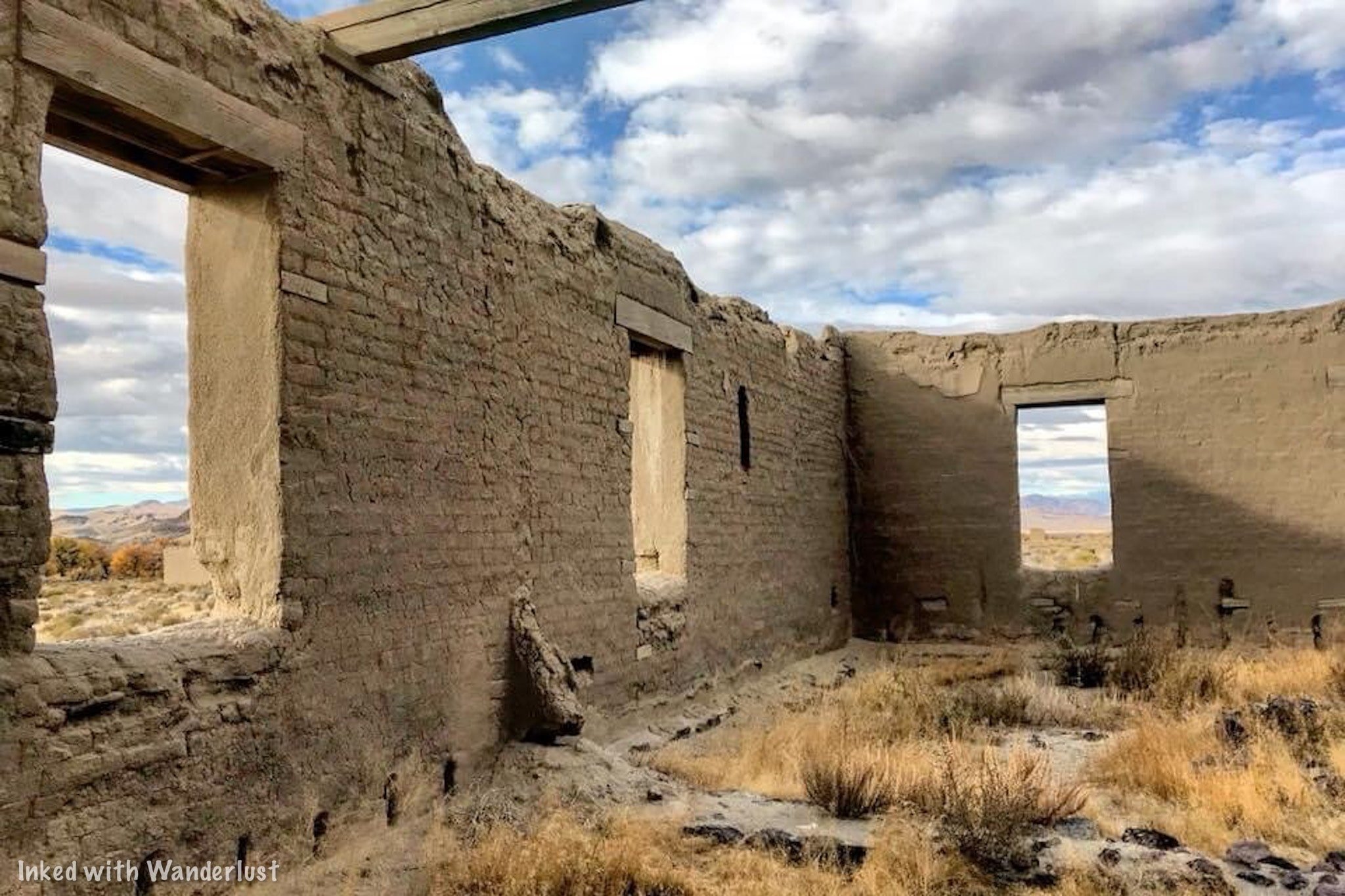
While the park itself offers plenty of fun activities all its own, if you’re planning on an extended stay, you may want to know what else the area offers.
Thankfully, there are many wonderful parks and destinations to visit that are within an easy drive from Walker River:
Berlin-Ichthyosaur State Historic Park: This one is the furthest away at about 2 hours (one-way). However, it’s more than worth the effort. It’s a preserved, mining ghost town and is also the site with the most Ichthyosaur fossils in the state. To read more about it, check out our article here.
Fort Churchill State Historic Park: If you’re into military history, this park is mandatory. Located just 30-minutes or so from Walker River, this state park features the ruins of an old military post. It also features a museum and campground all its own. You can read our article about it here.

Wilson Canyon: Wilson Canyon is a recreation destination all its own. Since it’s BLM land, camping is free and plentiful. You can hike, fish, and use motorized vehicles such motorbikes, side-by-sides, and more! You can read our article on its hiking trail here.
Bridgeport, CA: Bridgeport is a charming town in eastern California right next to the mighty Sierra Nevada Mountains. It’s our favorite town in California due to its proximity to amazing hiking trails, Yosemite, lakes, hot springs, and more! Check out our article about Bridgeport here.
Virginia City: About an hour from the park is the famed mining town, Virginia City. Step back in time and explore this wonderfully preserved and highly historical place. You can tour awesome attractions like MacKay Mansion , Chollar Mine , and more! Check out our article here.
Restaurants & Supplies
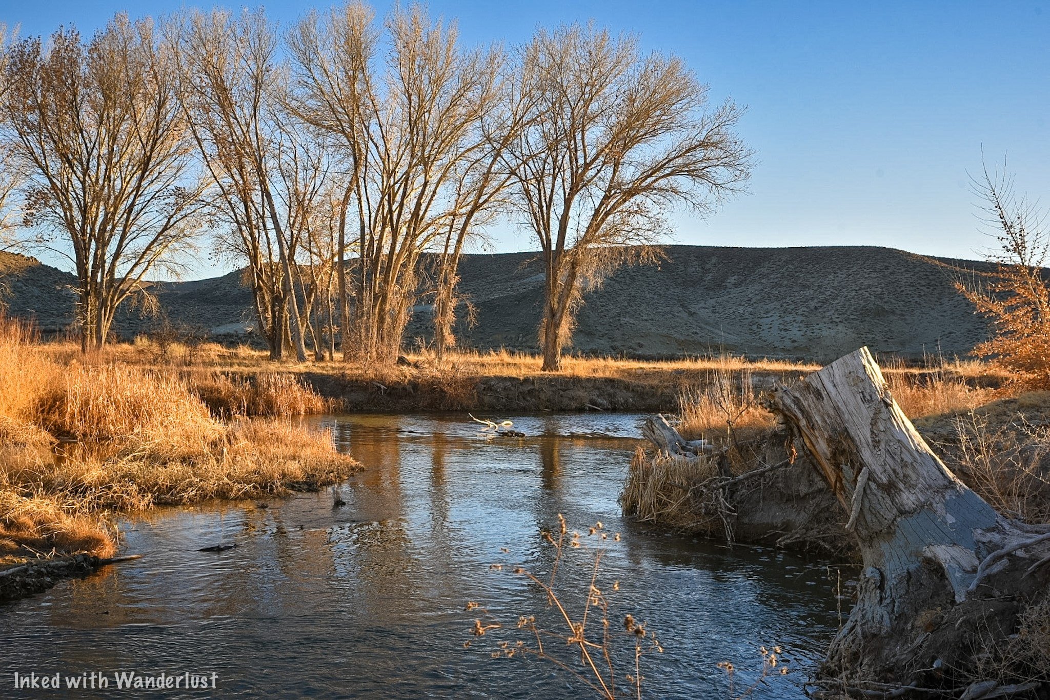
The small town of Yerington is a short drive away from the park and is a great place to pick up supplies or get something to eat. When camping, it’s always preferable to eat your meal over a fire but in the case of an extended stay, you may want to sit down at a restaurant.
For supplies, the one and only traditional grocery store is Raley’s. There’s also a Dollar General located on Main Street that offers limited grocery supplies. As far as restaurants go, there are three fast food joints if all you’re looking for is a quick bite. They are:
McDonalds
Port of Subs
Subway
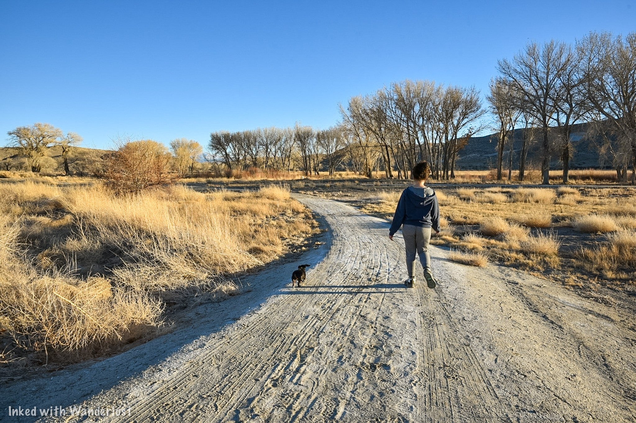
If you’d rather support a local business and sit down to eat, there are a few local places we can personally recommend. They are:
Country Sunflower: It’s slightly out of town but this small, charming, local spot serves up amazing breakfast and lunch. It’s our personal favorite in the area.
Tailgaters Sports Bar: Open for lunch and dinner, Tailgaters offers traditional fare like cheeseburgers, sandwiches, pizza, salads, and more in a sports themed setting.
El Alteno: If you’re craving hot and fresh Mexican food, head to El Alteno. It’s the closest restaurant to the park and has great food and service (Note: They are closed on Saturdays and close at 6pm on Sundays).
Additionally, Yerington has a Raley’s, Dollar General, and Family Dollar where you can pick up supplies like ice, firewood, s’mores kits, and more. Of the three, I would recommend Raley’s, as the two other stores are often cluttered and dirty.

National Automobile Museum: A Huge Classic Car Collection in Reno
Situated in Downtown Reno and just a stone’s throw from the river walk, the National Automobile Museum showcases a massive collection of over 200 classic…
Situated in Downtown Reno and just a stone’s throw from the Riverwalk, the National Automobile Museum showcases a massive collection of over 200 classic vehicles, most of which were once owned by Bill Harah (Founder of the former Harrah’s Casino).
We recently visited during a rainy, gloomy day in Reno. A lot of local businesses took a beating during the 2020 pandemic (and continue to) so we wanted to support them and showcase this awesome museum on our website.
You don’t have to be a car person to enjoy yourself here. On top of Harrah’s massive collection, the museum also showcases many cars that were used in movies and TV shows such as; Titanic, Batman & Robin, Back to the Future, and more!
Additionally, you’ll also see the vehicles that celebrities drove such as; Elvis Presley, Frank Sinatra, and John F. Kennedy! Whether you’re a local with an appreciation for the classics or a family on a Reno vacation, the National Automobile Museum is the perfect activity for you.
Let’s get into it!
Visitor Information

Directions
The National Automobile Museum is conveniently located near Downtown Reno. It’s just an 11-minute walk (or 4-minute drive) from the Reno Arch and is literally down the street from the Truckee River Walk. To get there from the Reno Arch (walking):
Head south away from the arch.
Go left on E. 2nd Street
Go right on Lake Street
Go left on the Tahoe - Pyramid Bikeway (you’ll see the old Reno Archway ahead of you and the Renaissance Hotel on your right).
Go right on Museum Drive and look for the entrance on your right.
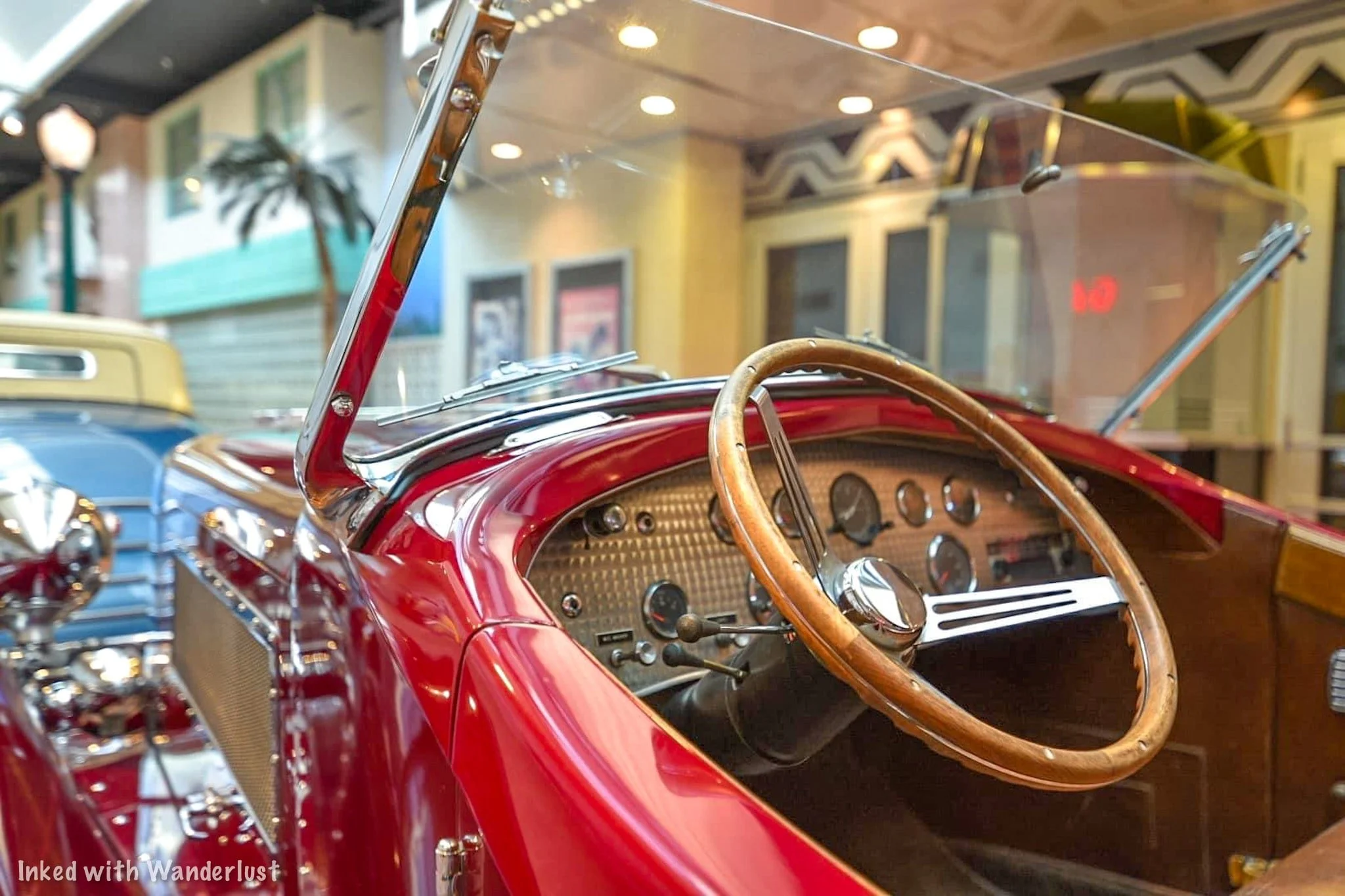
Driving from the Reno Arch has similar directions with just two minor differences:
Instead of turning left at the old archway, you’ll go straight through it and turn left on Mill Street.
Shortly thereafter, you’ll turn left on Museum Drive and pull into the parking lot.
For those of you who just want your GPS to do the work for you, the museum’s is as follows:
10 South Lake Street. Reno, NV 89501
There’s also the option of taking a Taxi or Uber from your hotel. Most drivers know exactly where this popular attraction is so you won’t have to worry about it.

Parking & Admission
The parking lot can accommodate quite a few vehicles and the best part? Parking is included in your admission! Just select any available space and head towards the entrance (pictured above).
Admission prices for the museum are as follows:
Adult: $15
Senior: $13
Active Military: $10
Youth (6 - 15): $10
Children (5 or younger): Free
Admission tickets can be purchased upon arrival. Online tickets are not yet available. Your ticket comes with in and out privileges for the day of purchase. So if you get board later and want to go back, just show them your ticket and you’re good.
Tours

Guided Tour
Guided tours of the museum are offered daily (based on volunteer availability) at 1:30pm and are 90-minutes in length. Your knowledgeable guide will tell you unique stories about some of the amazing antiques you’ll be seeing and learn little-known facts along the way as well.
The guided tours are included in the price of admission, so no worries there. If you have your heart set on one of these, you can call the museum and ask if they have volunteer availability for that day.
Self-Guided Tour
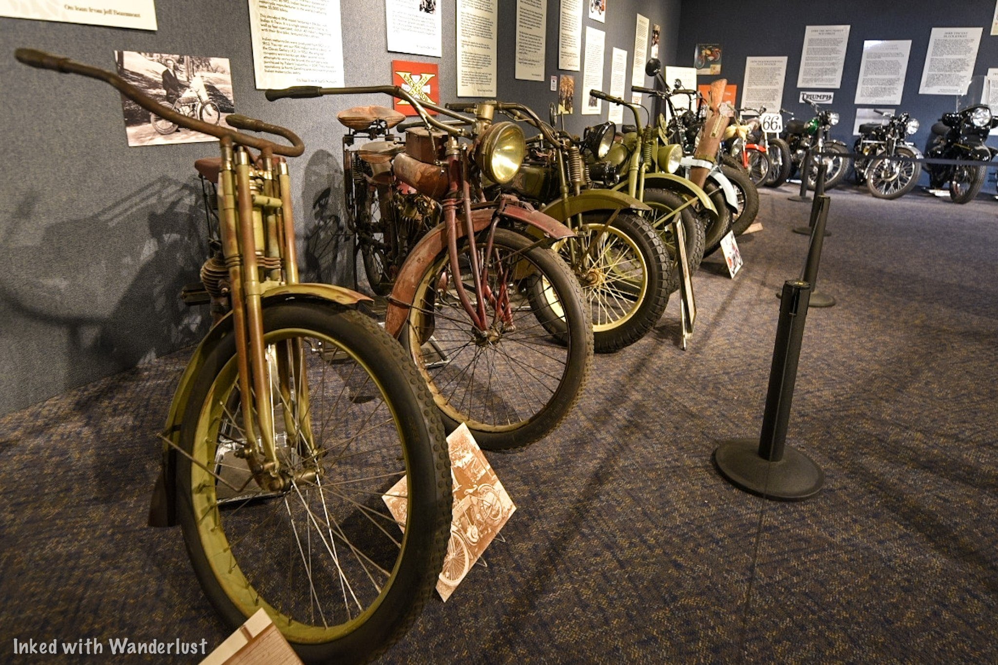
If you’d rather go it yourself (like us) you can take part in the self-guided tour and go at your own pace. There are a total of four rooms to explore, each featuring unique vehicles in specific eras. To start the tour, simply head down the hallway to the left of the ticket counter.

The first exhibit at the end of the hall is where they put their temporary, special exhibits. On display through December 31st, 2021 is the, “America and the Motorcycle: 1900 - 1990”, exhibit. You get real-life examples, in order, how motorcycles have evolved throughout the century.
Special Note - If you’re an AMCA member, show your membership at the ticket counter for a $3 discount on your admission.

Gallery #1 - Turn of the Century (1890’s - 1910’s)
This is where it can get a little hard to follow the correct path. My first time here, I was all over the place. I was going through doors I wasn’t supposed to and doing the tour out of order. This time around, I actually looked at the map, which made it much easier to navigate.
We highly recommend downloading the app to your phone. There’s a QR code you can scan with your phone at the ticket counter and on sporadic signs throughout the tour. Once you reach the end of the hallway, you’ll see the Blacksmith Building (pictured above). This is the first gallery and features cars from the years 1900 to around 1912 or so.
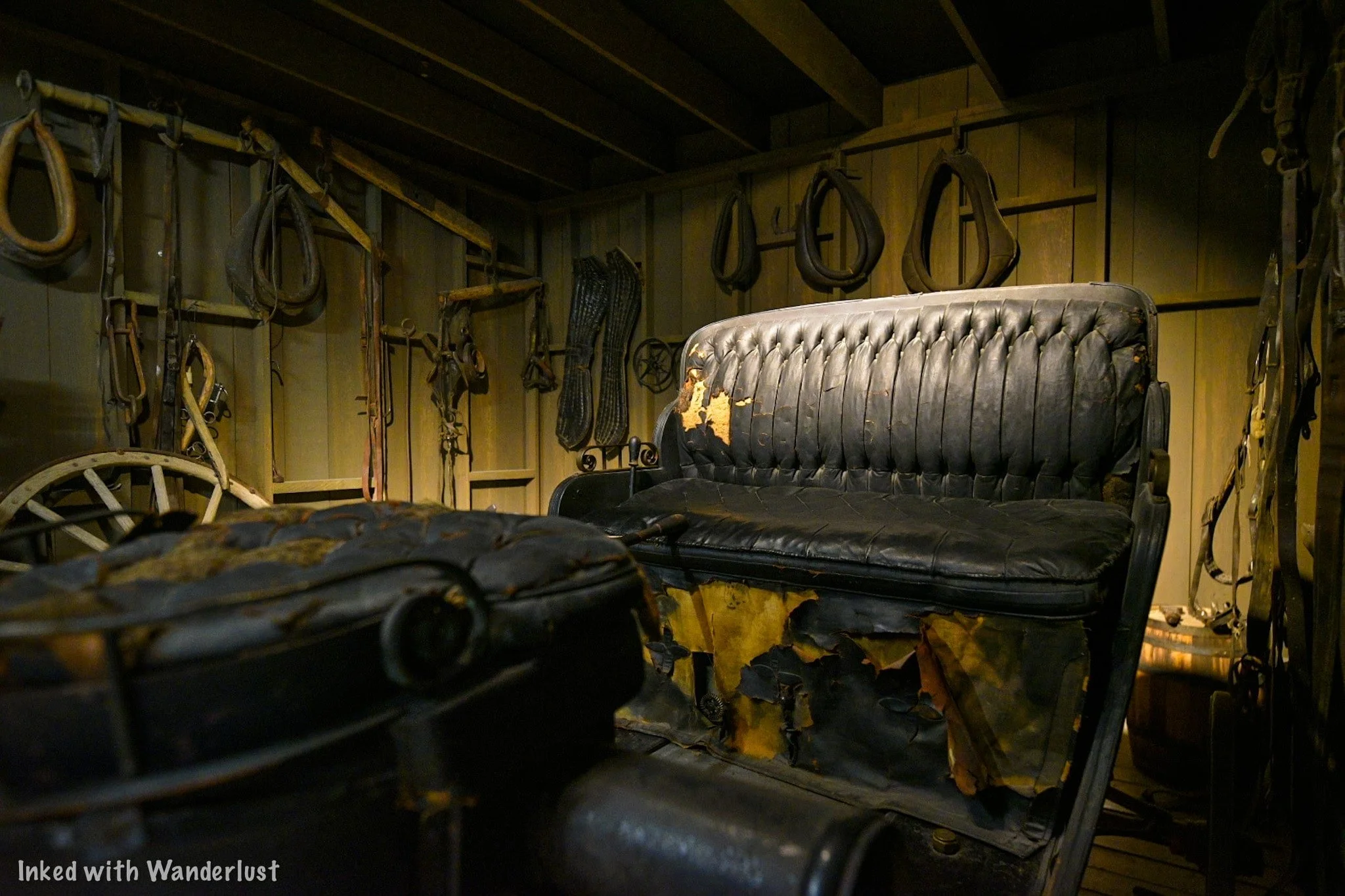

You’re in for quite a treat in this room. A few examples of classics you’ll find here are a 1908 Franklin, 1912 Rambler, and a 1910 Rolls-Royce. Each vehicle has an informative display in front of it describing its history, its original price, and interesting facts.
Our favorite was seeing the 1907 Thomas Flyer. It’s registered as a National Historic Vehicle for being the winner of the 1908 New York - Paris Race. The Rolls-Royce, our other favorite, was originally sold for $7500 in 1910. That would be north of $250,000 today.


You’ll also see the very vehicle that was used in one of the first scenes of the blockbuster movie, Titanic. It’s truly an awesome mix of classic vehicles….and you still have three more rooms to go! Once you’re ready for the next room, exit out onto 1930’s Street.
1930’s Street


1930’s street serves as a buffer between rooms one and two and has a 1932 Lincoln and a 1938 Packard on display, among other vehicles. They’re parked outside a recreated movie theatre facade with Gone with the Wind as the feature film.
The theming of this exhibit was awesome to me. For me, it was the most photogenic of any exhibit in the museum and the cars were beautiful.

Once you feel ready to move onto room two, walk down the street and hang a left on Main Street. Here, you will see the one and only vehicle you’re allowed to get into for a photo opportunity (I was asked to take pictures for a couple and by the time I was done, I completely forgot to get one for myself. You can’t miss it, though).
Gallery #2 - The Roaring Twenties (1920’s - 1930’s)
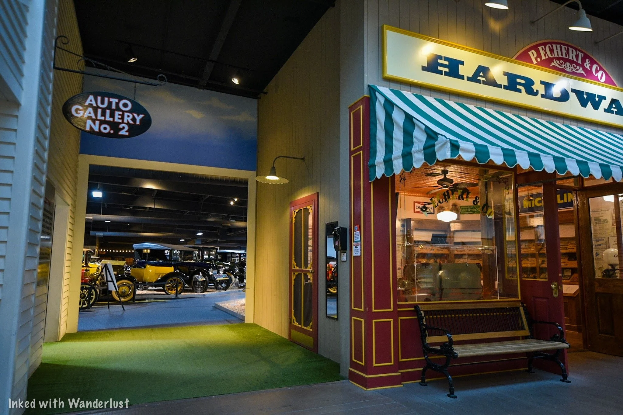

To find the entrance to the second gallery, look out for the Hardware Store. Immediately to the right of it (pictured above) is the entrance. By the way, you can and should go inside the store. The theming and detail inside is very reminiscent of old time Mom & Pop shops.
After checking out the hardware store, head through the short hallway into the next gallery which showcases cars made during the 1920’s (that said, we did see quite a few cars on display that were made prior to the 20’s).

A few examples of vehicles you’ll see here are a:
1920 Ford converted to an RV (considered to be the first iteration of the RV)
1921 Sheridan
1921 Rolls-Royce
1924 Wills St. Claire


You’ll also see an exhibit of an early day used-car dealership towards the back of the room cheekily titled, “Honest John’s”. Pictured below is the (very expensive) 1921 Rolls-Royce fully decked out in copper.

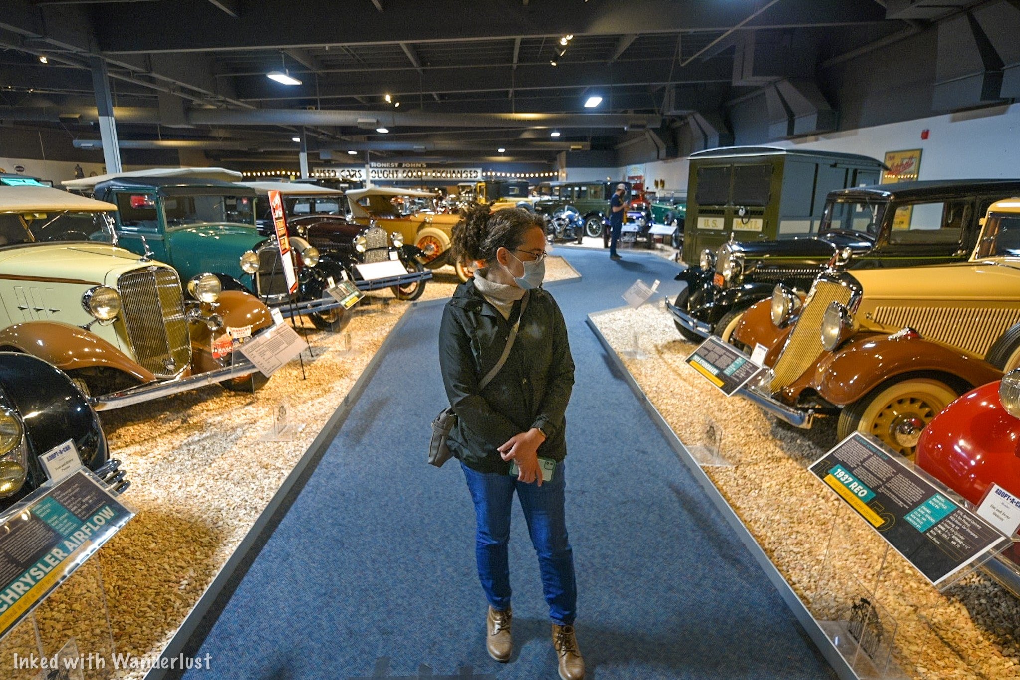
As you head away from the dealership you’ll see the first interactive displays. There’s two display cases with working motors inside. If you press the button, the motor runs. Showing you up close how motors worked back then (and largely still do today).
Once you’ve finished looking around, head out the exit ahead of you (you’ll know you’ve gone the right way if you’ve made a horseshoe lap around the room). Exit back onto Main Street by the Hardware Store and head left towards the next gallery.
Gallery #3 - The Classic Collection (1930’s - 1950’s)

As you exit Gallery #2, turn left and you’ll see the entrance to Gallery #3. The facade is made to look like you’re walking into a mechanic’s garage. You’ll see a light blue 1954 Buick with white wall tires on your right. As you enter the gallery proper, you’ll notice a miniature NASA Mission Control exhibit on your left (NASA was founded in 1958).

This gallery is the final one featuring a permanent collection and is named after Ranson & Norma Webster (the former sits as the Chairmen on the Board of Trustees for the museum). A few examples of cars you’ll see in this room are a:
1933 Auburn
1938 Phantom Corsair
1939 Ford
The 1938 Phantom Corsair is the only one of its kind and is the creation of Rust Heinz (Heinz Ketchup). The car was praised for being ahead of its time due to its futuristic design aesthetics but due to Rust’s death in 1939, it never entered mass-production. Making this prototype the only one in existence.


Much like the other rooms, you’ll do a half circle around the room at your leisure. At the end of the loop, you’ll end up near where you entered at the NASA exhibit. Here, there are multiple interactive elements for kids (or you) to enjoy. Due to the ongoing pandemic, many of these are closed right now.


When you’re done, simply walk through the NASA exhibit and out through the same way you came in (through the garage). To find the fourth and final gallery, take a right turn out of the exit and walk past the Speedway exhibit. You’ll see a facade of a home garage with a Basketball hoop above it (pictured below). Just walk on through.
Gallery #4 - Cars of the Stars (1950’s & Beyond)

Gallery four is the room that doesn’t have a full, permanent collection inside. It’s essentially a revolving door of themed exhibits (much like the Motorcycle exhibit at the beginning). It does feature cars that were driven by a variety of celebrities that are always there, but the other part of the room displays special exhibits.
The first car you’ll see as you walk through the garage is the infamous 1981 Delorean from the Back to the Future move franchise. If you’re a fan of the films, you’ll certainly appreciate this. Immediately afterwards on your right is a 1973 Cadillac driven by Elvis Presley.
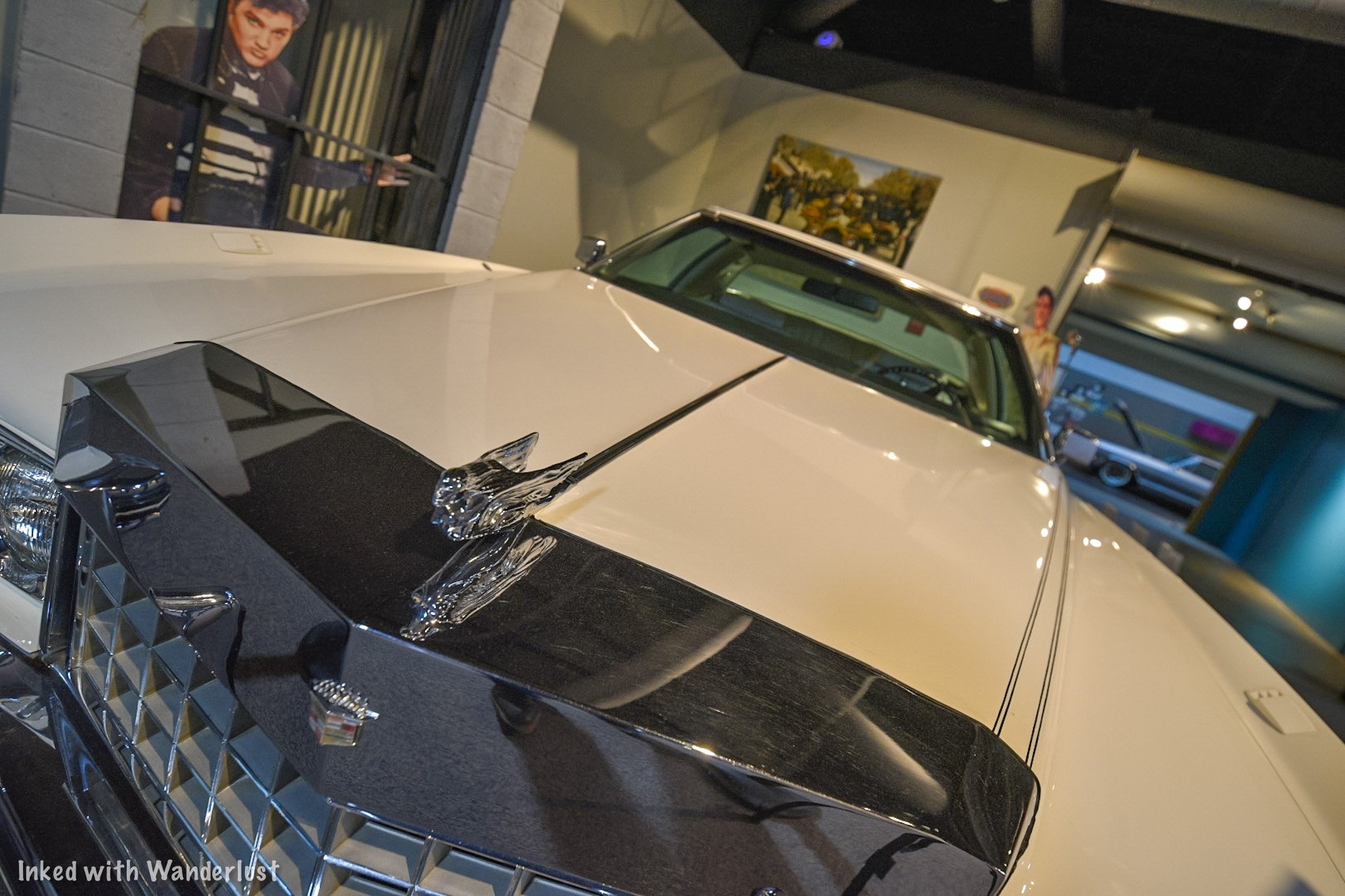
To your left, there’s more examples of celebrity classic cars. You’ll see a 1953 Chevrolet driven by John Wayne, a 1961 Ghia driven by Frank Sinatra, and a 1949 Mercury driven by James Dean, among others.

This room is also an event space. Meaning you could rent it out for a variety of reasons. Due to this, the gallery may not be open during your visit but in all the times we’ve been here, it has never been an issue. You could always call ahead to confirm.
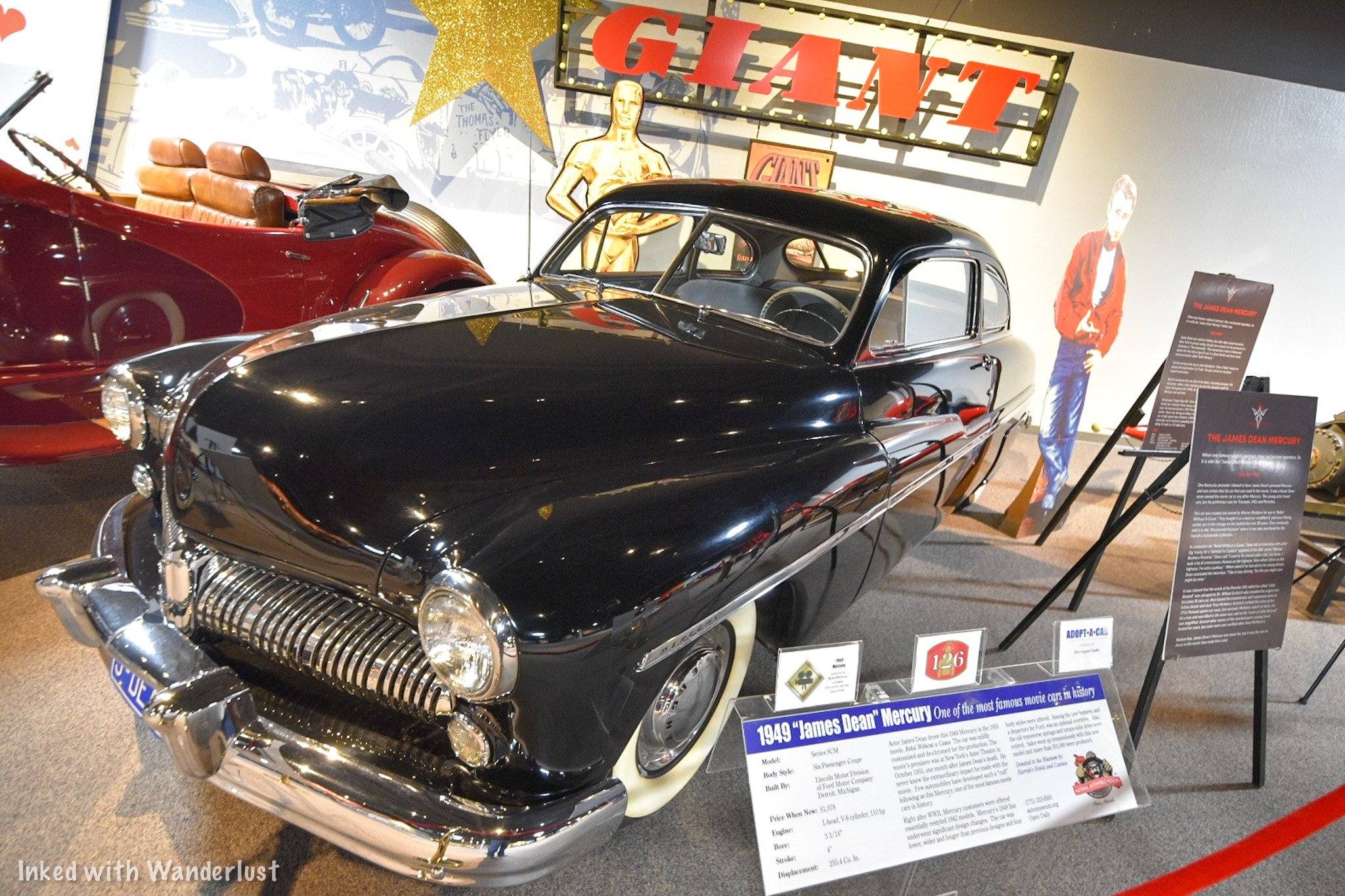
Unlike the prior three galleries, there’s no clear-cut path. It’s all open floor. So feel free to bounce back and forth between vehicles before making your exit. During our most recent visit, there was a first model Tesla on loan to the museum. It is right next to the exit. If you’re done, simply turn right out of the exit and head down “Speed Ally”. On display is a variety of race cars and their evolution throughout the years.

Conclusion
From here, you’re welcome to go back to any one of the galleries or streets to check out the cars again or you can call it a day. To find the exit, head back towards to gallery #3 (the one with the mechanic’s garage). Facing the entrance, the door to the museum lobby is on your right (look for the bathroom sign).
We hope you enjoyed this article and it inspired you to visit this awesome place for yourself. If so, please support our website by sharing it with your friends and family on Facebook, Pinterest, or your favorite social media site. You can further show support by staying on and reading one or more of the related articles above.
Thanks for reading and safe travels!

Mackay Mansion: How To Tour This Real-Life Haunted House in Virginia City
If you’re into visiting historic places - specifically ones that supposedly still house the original occupants - look no further…
2 minute read | contains affiliate links
If you’re into visiting historic places - specifically ones that supposedly still house the original occupants - look no further than Mackay Mansion in Virginia City.
Mackay Mansion was built in 1859 by a man named George Hearst (five years before Nevada became a state). This was the same year silver was discovered here.
Twelve years later in 1871, Hearst would sell the property to Irish immigrant and one of Virginia City’s four “Silver Kings”, John Mackay. Mackay would later go on to be the richest man to come out of the Comstock.

The former occupants have long since passed on, but they are believed to still roam the halls. The spirits of two little girls, an Army cornel, a shadow man, and Mr. & Mrs. Mackay themselves have all been seen.
Over the years, the mansion has been preserved well and year-round, daily tours are conducted detailing the history of this - even by today’s standards - lavish abode.
In this article, we’re going to give you all the information you’ll need to see it for yourself. We’re not going to spoil the tour, but we will show some pictures we took to give you an idea of what to expect.

Exciting news for our readers!
We’re excited to Introduce the all-new "Inked with Wanderlust" online store!
We're thrilled to bring you a fantastic collection of wanderlust-inspired merchandise. Celebrate your love for travel and exploration with our stylish apparel and accessories, designed to ignite your sense of adventure.
Discover a range of unique designs that capture the spirit of wanderlust, from cozy hiking-themed t-shirts to charming accessories that make your wanderlust spirit soar!
Visit our online store today and start your journey of style and adventure. Happy exploring!
Getting To Mackay Mansion

The Mackay Mansion is located in the heart of one of Nevada’s most historic towns; Virginia City. It is right off and can be seen from the main strip through town.
For GPS purposes, the official address is:
291 S. D Street, Virginia City, NV 89440
As you’re driving on the main road, keep an eye out for a blue, 3-story house. There’s a road going down a steep hill right by this house and the mansion is right at the end of this road.
Parking
There’s plenty of parking around the mansion but as you’ll see when you get there, they’ve coned off the area directly in front of it. There’s plenty of street parking on D Street or on the main road above.
Admission Fees & Hours of Operation
The hours and admission fees vary and are dependent on the type of tour and time of year. There are two types of tours available:
Day Tour
The day tour is the one you’ll likely be doing and is the one with the most available time slots. This is also the most affordable option. The day tour schedule is as follows:
Summer
Friday & Saturday between the hours of 10am and 6pm
Sunday - Thursday between the hours of 10am and 5pm
Winter
Sunday - Saturday between the hours of 10am and 5pm (weather permitted).
The fees for day tours during the summer and winter are the same. They are:
$8.00 per adult
$5.00 for kids 5-12 years old
Free for kids under 5
There are several ways you can pay for your admission fees:
You can pay cash (I asked and this was their preferred method of payment).
They will also accept debit/credit cards.
Or you can purchase a Comstock Adventure Pass at the Virginia City Visitor Center. This will also include other local attractions.

Tours run about 30-minutes in length and the final tour will leave 30-minutes before closing. If a tour is running as you arrive, you’ll find the front door locked. Have a seat on the porch and the guide will come get you when they’re ready.
After Hours
We haven’t done an after hours tour (yet), but we’ve heard it’s a lot of fun. You’ll hear a lot of the same information you would during the day, but this one focuses more on the paranormal side of it.
After hours tours run on the same schedule as above but only take place between 5-6pm.
Reservations are highly recommended for the after hours tour as they cannot guarantee you a spot otherwise. To make a reservation, call this number.
The admission fees for this tour are:
$10.00 per person (adult or child)
Mackay Mansion Tour Experience

When it’s your turn to join a tour, your guide will open the door and invite you inside the office. Here, he or she will collect your admission fees and go over some quick safety information.
Our Tour Guide, Megan, was wonderful. Super friendly, knowledgeable, and enthusiastic. We hear this isn’t the exception as all the other guides are exactly the same.

The tour begins with your guide detailing the history of Mackay Mansion and its purpose back in the heyday of the Comstock. You’ll be shown examples of real silver ore, pictures of the time, and the vault where payroll and bullion was kept.
The Living Room

After checking out the vault, you’ll be instructed to head into the next room; the living room. This was my favorite of the tour due to the decor and the hand carved framing around the fireplace.

Here, your guide will tell you more about the personal lives of John Mackay and his wife, Marion. Among other things, Marion was a well known seamstress and would often design and sow her own dresses with the intention of, “stopping the show”.

Also, this room is where your guide will delve into the paranormal aspect of the mansion by showing you verified, non-doctored photos of Marion Mackay in that very room and another of a little girl.
The Stairwell

After the living room, you’ll temporarily move into the hallway adjacent to the stairwell. As you can see in the photo above, this wooden stairwell is both narrow and steep.
Here, your guide will go over what to expect on the second level where the bedrooms are. You’ll also see the Tiffany window pane above the door and see more photos of spirits.
The Upstairs Bedrooms

According to our guide, Johnny Depp stayed in John Mackay’s room while filming a movie. He was supposed to stay for 30-days but on the third night, he woke up to a little girl in a white dress jumping on his bed.
After that episode, he refused to stay another night or even step foot back into the mansion. The film crew had to go in to gather his things and move him to a hotel.


Back then, it was common place for a husband and wife to sleep in their own, separate rooms and the Mackay's were no exception. They each had their own adjoining rooms.
Across the hall are the children’s rooms and bathroom. All rooms are roped off except for one of the girls rooms. You’re able to go in and look around but you’re asked not to touch anything.

The late-1800’s era bathroom was a trip. The bathtub was the first in town to be plumbed and the toilet has gold leaf paint on both the outside and inside of it.
This is where the guided portion of your tour will conclude. You’ll be free to continue exploring the rooms at your leisure and to leave, you’ll go down both stairwells and out the door to the grounds out back.

Just before leaving the mansion, look to your left to see the dining room with original table, carpet, and chandelier. To see the grounds, go out the door and turn right.
Don’t forget to tip your guide on the way out or as the tip jar says, “Ghosts will follow you home”.
The Grounds


After finishing the tour, you’re welcome to explore the grounds in the back of the property at your leisure. We highly advise you to do this as it is simply beautiful back there.
To start touring the grounds, simply follow the brick path through some thick greenery. When weddings are held here, this is the pathway Brides take to get to the archway during the ceremony.


Beyond this area is where you’ll find the Gazebo which is original to the property. To get to it, you’ll need to go through a white gate. At first, it’ll appear as if that area is off limits, but you are able to go through.
Events

Events of all kinds can be held here. Weddings are the most common but you could also celebrate birthdays, family reunions, company events, etc. We don’t know the number of people the space can hold but it looks like it can accommodate a decent sized group.

For your event, the space comes with the gazebo, hanging lights, tables, chairs, a bar area, heaters, space for seating, and a grill (you’ll need to provide propane).
If you’re interested in holding an event at Mackay Mansion, you can contact them directly for prices and availability. Be sure to give them our regards!

Once your done, you’ll simply head out the gate and back to the front of the mansion. Afterwards, consider touring another great local destination, Chollar Mine. Read about it in our post below!
Paranormal Activity

According to our tour guide, Mackay Mansion is the 5th most haunted place in the state. We didn’t see any spirits ourselves, but others have reported seeing children, a shadow man, and John Mackay.
Consequently, the mansion has been the subject of many popular shows such as, “Ghost Adventures”, and “Dead Files”. We were told one of the crew members was knocked down by a spirit after trying to access the attic (which is off limits to the public).

The owners decided to open the mansion up to amateurs and professionals alike by offering the opportunity to hold their own paranormal investigations inside this real-life haunted house.
You can the listing for hours, fees, and how to set an appointment for one here.
We had a great time touring Mackay Mansion and we have no doubt you’ll also enjoy it. Even if you don’t believe in the paranormal, the sheer amount of history behind this place will peak your interest.
We hope you enjoyed this article and that it inspired your travels. If so, please support us by sharing it with your friends and family on your favorite social media site. You can further show support by staying on and reading one or more of the related articles above.
Safe travels and thanks for reading!

Tour The Historic Chollar Mine in Virginia City
Established in 1859, Chollar Mine was one of Virginia City’s highest producing mines. Eventually producing 17 million in silver and gold ore over the course of its 80-year…
Established in 1859, Chollar Mine was one of Virginia City’s highest producing mines. Eventually producing 17 million in silver and gold ore over the course of its 80-year operation.
These days, there isn’t any mining going on in VC, but Chollar Mine has stood the test of time and has been preserved to offer daily tours. Visitors will get a rare glimpse at mining life in the 1800’s during this 30-minute adventure.
We recently paid a visit here and took part in a tour. Being a local historian and former miner himself, our tour guide provided tons of interesting information throughout and made it a fun, memorable experience.
While we won’t spoil the tour, we will provide you with all the information you’ll need to plan a visit. We’ll also give you some examples of topics covered during the tour.
Let’s get into it!

Location
The Chollar Mine is located in the historic Nevada town of Virginia City and right off the main strip. The exact address for GPS purposes is:
615 South F Street. Virginia City, NV 89440
If you’re one of the few that doesn’t own a smartphone with GPS capability, here’s a some visual help. Regardless of which direction you’re coming into town from, look out for the Fourth Ward School (pictured above).

Directions
As you’re approaching the school:
If you’re coming from Silver City, you’ll turn right on Occidental Grade (just before the school)
If you’re coming from the opposite direction, turn left just after the school.
You’ll drive a couple hundred yards before seeing a sign for Chollar Mine. Turn left here.
After another 100 yards you’ll see another sign (pictured above). Turn right here and go down the driveway to the parking lot.

Fees
As with most tourist attractions, there are fees to be paid in order to take part in the tour. You can feel good about it, though, as this money goes towards supporting local and preserving the mine itself.
The tour prices are as follows:
$15.00 - Per Adult
$10.00 - Per Child (age 5 - 12)
Free - Children under 5 years old
You should note that tour fees are cash only at this time. There is no ticket booth or window, rather, you’ll be greeted by the operator as you drive up and he will collect the fees.
Special rates are available for large groups from schools, churches, etc. It is also possible to arrange a private tour. You can contact them directly to inquire.

The Tour
Tours are held daily during the months of May through October between the hours of 10:00am - 4:00pm and are roughly 30-minutes in length. Depending on when you arrive, there may be a bit of a wait for the current tour to end.
After paying, your tour will begin at an old barn where you’ll all gather to listen to the tour guide describe the history of Chollar Mine. You’ll also be given a chance to look at the many artifacts that surround you.

You’ll then be taken to the entrance of the mine and hear more descriptive history of it, the miners themselves, and what life was like back then. Your tour guide will also go over some safety information with you during this time.
You will then be guided through the entrance of the mine. You’ll need to watch your head and your step as you go through the mine tunnel. For clarity, I’m 5’9 and I needed to duck to go through.

Going Inside
The tunnel is 400-feet in length and throughout the majority of it, dark. There is a rope light that runs the length of the tunnel but provides only just enough light for you to get through it. It’s as close to authentic as you can get.

The original mine cart track still runs along the floor so you’ll need to watch your footing around that. There’s also portions of the tunnel where that infamous blue/gray mud that stuck to the miners’ tools and boots is still ever present. Wear shoes that you don’t mind getting dirty.
Near the end of the tunnel is where it’ll start getting cramped. When the tunnel was constructed, it was much larger. Over the years with normal wear and damage from earthquakes, the tunnel has gotten smaller. Don’t worry, though. It is safe.
If you’re claustrophobic, have a hard time bending, or have back problems this is not the tour for you. It does get uncomfortable at times and it caused my anxiety to kick in towards the end. Just something to keep in mind.
The Stope (Mining Room)

At the end of the tunnel, you’ll reach a room known as a “stope”. This is the very room where miners worked day in and day out mining for silver ore.
(As stated at the beginning of this article, we’re not going to spoil the tour. We want you to experience it for yourself. So we’re just going to give you a few examples of what to expect):

You’ll be shown examples of tools used by the miners.
You’ll see how the miners communicated with the outside world.
You’ll find out how rats were essential to miners and how they used them.
The lights will be turned off so you can get a sense for what it was like for them if a gust of wind came through and blew out the candles.
You’ll hear stories of local superstitious.
And much, much more.

Once your tour guide is finished, you’ll be given the opportunity to ask your own questions, move around parts of the room you couldn’t see, and take photographs.
The room is small and tight so depending on the amount of people in your group, you won’t be able to move around much until the end. You’ll also have a hard time standing up straight. So be prepared to sit or crouch down.

After spending 15-minutes or so in the room, your tour guide will take you back the same way you came through the tunnel.
As you’re going out be sure to keep your head down. Your eyes have adjusted to the darkness so the sudden rush of light at the end could prevent you from seeing the wooden frames above.

After you exit the tunnel, your tour guide will take any questions you may have and offer to take pictures of you and your group in front of the entrance. This is where you can give a tip if you feel inclined.
At this point, you can continue on with your vacation to other great attractions in the area. If you need suggestions, here’s a list of seven things we think you would love in Virginia City
Conclusion
We highly recommend going on a tour of Chollar Mine (provided you’re ok with tight spaces). It’s an intimate and interesting look at Virginia City’s history. This is something the whole family could take part in.
If you’ve found this article helpful in planning your trip to VC, please support us by sharing it with your friends and family on your favorite social media site. You can further show support by staying on and reading one or more of the related articles above.
Thanks for reading and safe travels!

7 Things You Will Love About Virginia City
If you’re an avid reader on this site, you’d probably be familiar with our “7 Things” series, where we list seven of our favorite features of a particular town or area. The other two…
If you’re an avid reader of this site, you’d probably be familiar with our “7 Things” series, where we list seven of our favorite features of a particular town or area. The other two in the series, Bridgeport and Lee Vining, are proving to be popular so we decided we would bring the series over to the Nevada section.
After discussing a few Nevada towns that are more than worthy of being featured, we decided to go with Virginia City as the first. There’s so much to love about this little town in the Nevada mountains but for the purpose of this article, we’re going to list seven of our personal favorites.
Virginia City became a bustling mining town in June of 1859 when land owner Henry Comstock discovered a rich deposit of silver ore. Comstock is also credited as being the first to discover gold in nearby Gold Canyon (just south of VC). From there, mansions, churches, saloons, hospitals, schools, and mining companies began popping up as the population exploded to around 25,000.
These days, active mining is long gone in VC. Locals have done a great job preserving the many historic buildings and mines contained here. Most offer guided tours. On top of that, the main strip is now filled with quirky shops, restaurants, bars, and hotels. Tourism is the boom here now. So sit back and relax while we present you with seven things you will love about Virginia City.
1) The Way It Was Museum
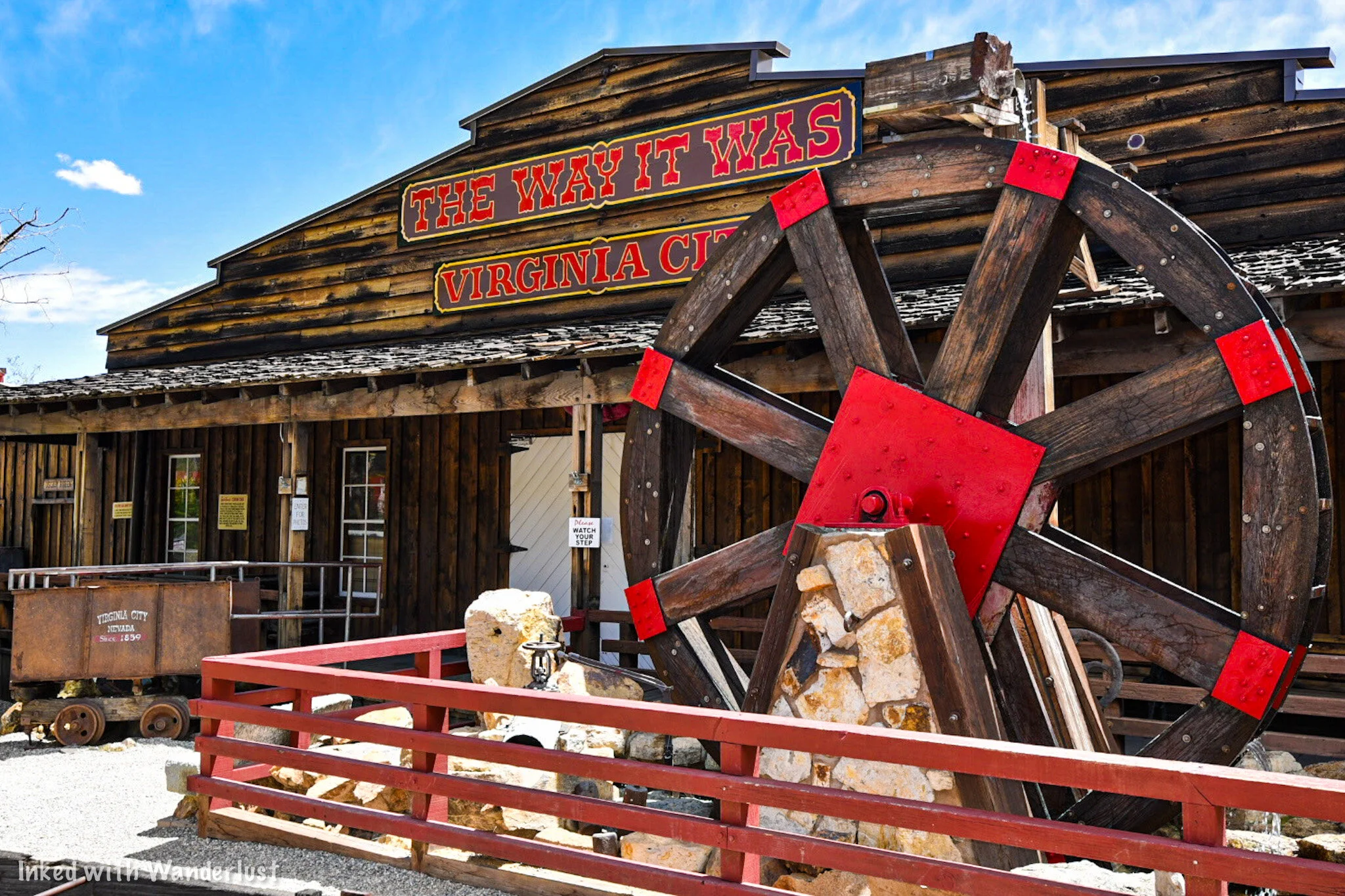
If there’s one attraction in VC that corners the market on local advertising, its the “Way It Was” Museum. Multiple signs dot the roads coming into town from either direction proudly disclaiming it a, “must-visit”. That’s hard to argue as this museum contains the most complete collection of Comstock material in the world.
It is open seasonally from 10:30 - 4:30 and costs a mere $4 per person. Visitors can purchase tickets at the museum itself or at the visitor center on the main strip. The self guided tour of the exhibits are perfect for families and history buffs alike.
2) Mackay Mansion Tour

Originally build in 1860 to be the headquarters of the Gould and Curry Mining Company and later purchased by one of VC’s “Silver Kings”, John Mackay, seasonal guided tours are offered at this hauntingly beautiful mansion and its grounds.
During the tour, you’ll see many historical artifacts such as mining equipment, original furnishings, Tiffany silver, and other historic anecdotes. Weddings and other special events may be held here as well. If you’re into conducting paranormal investigations, you can arrange one.
Information for guided tours is as follows:
Day Tours
Summer: Daily, 10am to 5pm
Winter: Weekends, 12pm tp 5pm (weather dependent)
Duration: 30 minutes
Cost: $7 per adult/$4 per child aged 5-12/free for children under 5
Night tours
Weekends: 5pm to 7pm (must call to reserve)
Cost: $10 per person
READ: “Mackay Mansion: How To Visit This Real-Life Haunted House”
3) Silver Terrace Cemetery

Life in Virginia City during its heyday wasn’t easy. Life expectancy was short due to dangerous working conditions in the mines, harsh weather, and other 1800’s era problems like disease, so the need for an official city cemetery became more and more apparent. Thus, the Silver Terrace Cemetery was born.
The cemetery is located on the north end of town on Old Cemetery road and is free to visit. It was common for the locals back then to flaunt their wealth and many did so both in life and death. Many beautiful hand carved headstones, many as tall or taller than a person, dot the hillside and are surrounded by iron fencing.
The majority of the grave sites date back prior to 1920 and a few are cracked and in a state of disrepair, but the site as a whole is beautiful and has amazing views of the mountains. You can visit daily from sunrise to sunset but a trespass warning is in effect outside of those hours and yes, it is taken seriously.
4) Chollar Mine Tour

Our personal favorite on this list, this guided tour of Chollar Mine will take you 400-feet into Mount Davidson through a dark and claustrophobic walk along the rail once used to transport silver ore and will end at a room carved out by miners in the 1800’s.
You’ll hear historical facts about both the mine and area by your knowledgable tour guide. You’ll also learn about how the miners communicated to those on the outside, how they depended on rats as both a food source and warning system, how they navigated their way out if their only light source (wax candles) were to go out, and more.
This tour operates daily (seasonally) between the hours of 10am and 4pm and is cash only at this time. Prices are as follows:
Adults: $15
Children 5-12: $10
Children under 5: Free
5) Nevada’s Oldest Hotel

The Gold Hill Hotel & Saloon is the oldest hotel in the state of Nevada. So old, it was operating as a hotel even before the state became part of the union. The exact year it opened is debated as either 1859 or 1861 but either way, Nevada didn't become a state until 1864 so that fact still holds.
It is located just one-mile south of Virginia City and is the only full service hotel in the immediate area. Original flooring, walls, and plaster still adorn the interior and you can even reserve rooms that are exactly as they were back in the 1800’s. It’s truly astonishing this property is still thriving all these years later.
This hotel also has quite the reputation among the paranormal crowd as it’s considered one of the most haunted places in the state. This is due to the fire that took place in 1869 at the Yellow Jacket Mine located just behind the property. This fire claimed the lives of 35 miners and is considered the worst mining accident in Nevada history.
6) Quirky Shops and Bars

The main strip through the center of town is a tourism mecca and thus, it’s jam packed with unique shops, bars, restaurants, and hotels. Many of the original buildings from the town’s early days have been re-purposed to house these.
Such examples include Virginia City Mercantile (pictured above), Silver Queen Hotel & Wedding Chapel, Forever Christmas Gift Shop, Bucket of Blood Saloon, Kettle Corn Depot, Primrose Lane Antiques, Grant’s General Store Museum, The Washoe Club, Silver Sadie’s Old Time Photos, and many more. There’s simply too many to list.
Strolling by these shops on the wooden boardwalks is part of the appeal of visiting Virginia City. Actors and Actresses in western attire typically walk around greeting people and thanking them for visiting. The people who live and work here truly care about their town and want you to feel as welcomed as possible.
7) That 100-Mile View

From the main strip and other points, you can look east towards the mountains at what locals refer to as the, “100-mile view”. This number is fudged a bit as it’s really about 90-miles but hey, who’s counting? Seriously though, the views of the mountains are outstanding and truly show how remote of a place Virginia City used to be (and still kind of is).
The church you see in the image above is Saint Mary in the Mountains. It is still an active church where services take place on Sundays. During the week, visitors are welcomed inside to tour the interior and museum but they do ask that you be respectful by remaining quiet and removing hats/sunglasses upon entering.
Too Many To List

It was hard narrowing all there is to do in VC into a 7 list article. We definitely listed some favorites but people will no doubt question why this or that wasn’t listed. Simply put, this list is a small sample of all there is to do here. So much so, we very well may do a sequel to this post.
Other favorite attractions include the V&T Railway, the various parades and special events that place throughout the year, Piper’s Opera House, Ponderosa Mine Tour, Virginia City Trolley Tour, The Pit Stop, VC Outlaws Comedy Show, Mark Twain Museum, and so much more.
Getting To VC
From Reno:
Head south on I-580
Take exit 25B
At the round-a-bout, take the NV-341 exit and follow this for about 24-miles. It’ll take you straight to VC
From Carson City:
Head east on US-50
Turn left on NV-341 and continue straight
You’ll pass through Silver City and Gold Hill before arriving at VC
From Las Vegas:
Go north on US-95 for about 350 miles
As you approach Schurz, turn left on US-95 ALT North towards Yerington
Continue on US-95 ALT North towards Silver Springs (turn right from Yerington)
Turn left on Ramsey Weeks cutoff
Turn left on US-50 and continue for 16-miles
Turn right on Six Mile Canyon road for about 8-miles before arriving at VC
READ ALSO: How To Visit Berlin-Ichthyosaur State Park
Conclusion
We sincerely hope this article was helpful to you in planning your travels to Virginia City. If so, please support our website by sharing it with your family and friends on your favorite social media site. Every view helps.
You can further show your support by staying on and reading one or more of the related articles above. Thank you and safe travels!

How To Visit The Historic Lovelock Cave
Nestled within the Humbolt Mountain range and located 20 miles outside the small Nevada town of Lovelock, the Lovelock Cave is a small, but significally historic landmark…
Nestled within the Humbolt Mountain range and located 20 miles outside the small Nevada town of Lovelock, the Lovelock Cave is a small, but significally historic landmark. It’s an easy, straight-forward drive along the Backcountry Byway and once there, it’s a quick hike to the cave entrance from the parking lot.
As stated above, it is small. This is not the kind of cave where you’ll be able to go from room to room deep into the earth. It’s a small entrance leading to a viewing deck inside an area barely bigger than a modern day studio apartment. Don’t let this stop you, though. The historical significance of the cave more than makes up for its lack of size.
Some 22,000 years ago, Lake Lahontan covered this entire area. As water levels began to recede, wave action started to interact with the limestone, resulting in little pocket caves like this one. Lovelock Cave is just one of many in the area that came to be because of Lahontan. Hidden Cave near Fallon is another example.
In later years, Northern Paiute Indians would utilize this cave for storage and shelter between the timeframe of 2,000 B.C and 1,000 A.D and it would go undiscovered until 1912 when bat guano miners found it and began operations. Shortly after, archeological digs would commence and regularly occur for around 60 years, resulting in the discovery of thousands of artifacts and human remains.
Read on below as we give you a detailed summary on how you can make your way out here and see it for yourself. In the second half of the article, we will briefly cover the legend of the cannibalistic giants that lived here as well as the discovery of the oldest known duck decoys in the world. Enjoy!
Directions

Your journey to the cave begins and ends in Lovelock, NV. Thankfully, it’s easy to get there as your journey begins almost as soon as you exit the freeway. Whether you’re coming from the direction of Winnemucca or Reno, these are the easiest directions to follow:
You’ll take exit #106 towards Downtown.
As you’re taking the exit, you’ll notice a McDonalds.
If you’re coming from Winnemucca, you’ll turn right on Main then left on Amherst (just before McDonalds). If you’re coming from Reno, you’ll turn left on Main, go under the overpass, and left on Amherst.
This road will eventually turn into S. Meridian and becomes a well maintained dirt road as you pass through a beautiful agricultural area.
You’ll stay on this road until you reach Derby road at a two-way intersection. You will go left here.
You’ll cross over the Humbolt River and shortly after, come to a point where the road splits in three directions (as pictured below). You’ll want to continue to the right.
Continue going straight until the road terminates at the parking lot.
Even though it is fairly straight forward, you may feel a little lost at times (we did). Just keep an eye out for those “Lovelock Cave Byway” signs. They’re dotted along the entire stretch of this drive. If you haven’t seen one in a while, you may want to turn around.

Pictured above is a beautiful section of the Humbolt River we ran into along the byway. This view was on our left shortly after turning on Derby. Pictured below is where the road splits into three directions shortly after the river crossing. You’ll turn right to continue towards the cave (though we were curious as to what the other roads led to. If you happen to know, please let us know in the comments).

Between here and the cave, you’ll get amazing views of the Humbolt Mountains on your left and the Humboldt State Wildlife Management Area on your right. We observed many species of birds in this area and even spotted a Rattlesnake sun-bathing in the middle of the road. If you’re into birding, you would do well here.
The road you’ll be on is well maintained with only a few parts that get a bit rough for those driving a compact vehicle. For clarity, our Chevy Cruze made it just fine (though there were a few times we had to slow down due to rough bumps in the road). If you have a truck or jeep, you’ll have no issues.

The road will start to go left and up towards the cave and soon, you’ll see the entrance sign and the parking lot ahead of you. The lot is a decent size that could easily accommodate a few dozen or so creatively parked vehicles. There is also a covered picnic table and one restroom. Fair warning, the restroom isn’t very well maintained (better than nothing, though).
The Nature Trail
At the trailhead, you’ll find an informative board describing the history of the cave and the area as a whole. You’ll find the start of the trail just behind here. If you wanted to complete the trail proper (and you should) you’ll start by heading upwards. If you just want to get to the cave, head left.
The nature trail is short, coming in a just over half a mile for the whole loop. In the beginning there is a bit of an uphill climb but it’s on gentle switchbacks and doesn’t require a whole lot of effort. If you took a brochure along with you (at the trailhead), it’ll describe the mountains, plants, and other features as you go.

If you’re on the trail proper, it’ll take you up, over, and around the cave before dropping you off at the entrance. Just before this, you’ll come to another informative board with an expansive view of what was once ancient Lake Lahontan (now Humbolt Sink). The board details the plant, animal, and fish life that once called this area home.

From here, you’ll continue left on the trail until you reach the entrance to the cave. You’ll go down a little bit before working your way back up. This section of the trail does have sheer drop offs on your right, so be sure to watch your footing. Once you get to the entrance, you will see a few spur trails. There’s no right or wrong here. Just pick one and go up.
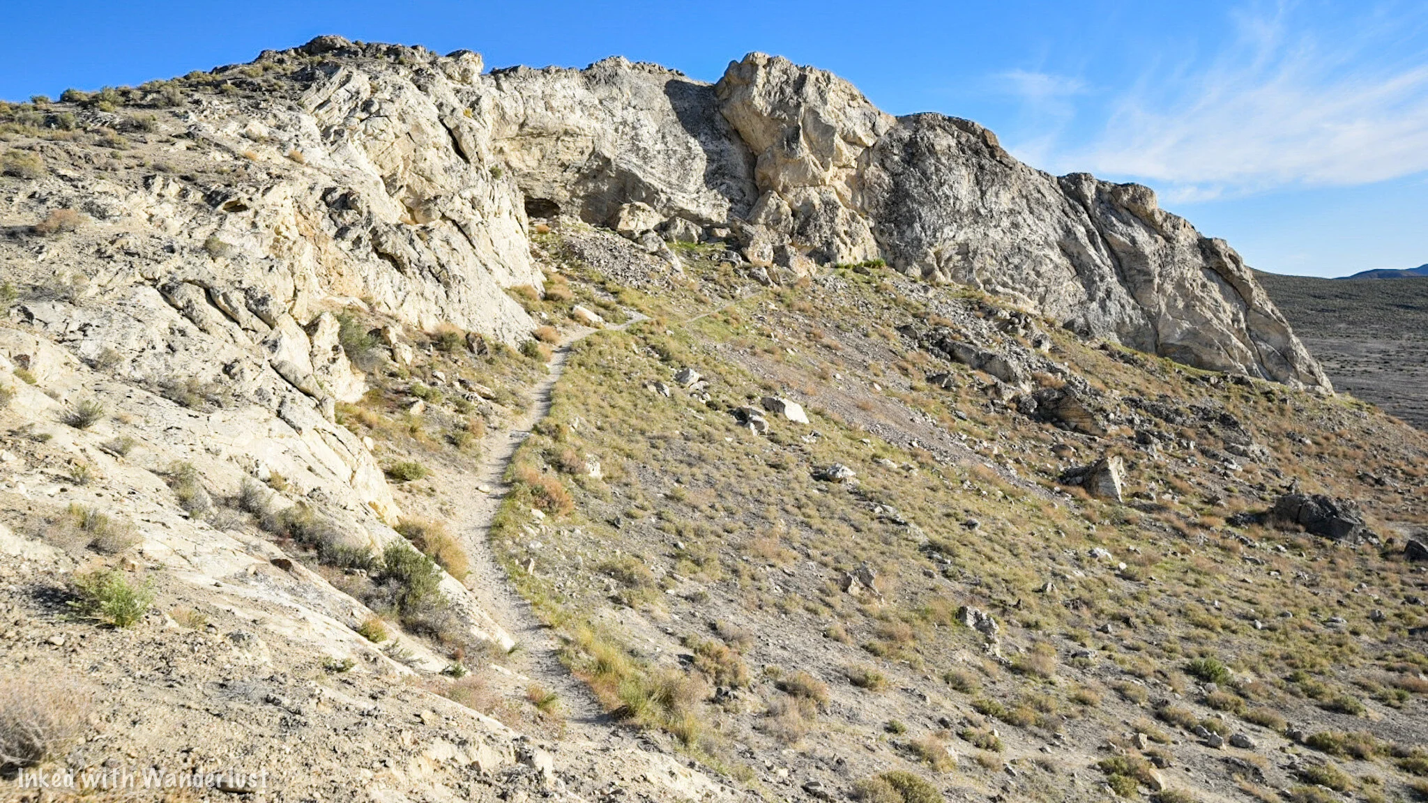

When you arrive at the entrance, you’ll see what we mean by how small it is. In fact, it used to be MUCH wider, but an earthquake caused a large rock to collapse into the mouth of the cave, leaving the tiny entrance we have today. You can still see how large it was by looking to the far right of the entrance.
Lovelock Cave

From here, simply head into the cave. Watch your footing as you descend as it’s a rocky and uneven surface. In front of you, you’ll see a wooden deck. This is where you can enjoy the cave from. This deck was installed around 10 years ago to help maintain the integrity of the cave. The BLM does ask that you stay on the deck as archeological digs do still occur here from time to time.
In the photo below, you will see a brightly lit photo of the viewing deck. I used my camera’s flash to attain this photo. It is NOT this bright inside. It isn’t pitch black or anything as you are able to see where you’re going, but it is much darker than what this photo shows.


All around you, you’ll see burn marks at both the entrance of the cave as well as nearly the entire interior. It is believed that this was due to fires being set by Native Americans for warmth, cooking food, etc. There’s also the legend of Natives setting fire to the entrance of the cave to “smoke out” cannibalistic giants that once lived in this area (more on that later).
There’s a lower portion of the deck to the right that takes you slightly further into the cave. It’s much darker on this side as it’s further from the entrance. Seeing a bat or two is a possibility. The brochure we had stated bats were rare in this cave these days but during our visit, we saw two flying around.

From either side of the deck, you can see the areas where both bat guano miners and archeologists dug through. Guano mining took place in the early 1900’s while archeology digs began later and still occur from time to time. Many historical items were discovered here including multiple bones, mummified remains (unconfirmed), weapons, tools, duck decoys (oldest known in the world), clothing, and other artifacts.
Per my research, a total of 10,000 human remains and cultural artifacts have been discovered in this small cave. Prior to the mining and digging, the floor of the cave was much higher than it is today, specifically the left side (which was where most of the digging took place).
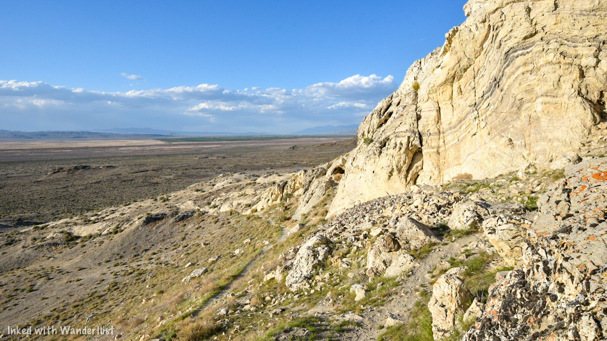
Once you’re done enjoying the cave, simply exit and head to the left back on the loop trail to complete your journey. On this section of the trail, you’ll get more expansive views of the Humbolt Sink and see up close the amazing limestone rock formations that make up the exterior. If you’re a rock nerd (like me) you’ll enjoy it.


From here, you just keep going straight until the trail spits you back out to the parking lot. You’re total milage on the trail will be around 6/10’s of a mile and with time exploring the interior of the cave, it shouldn’t take you more than an hour or two to complete.
Legend of the Giants
Now that we’ve gotten the “how to” part of this article out of the way, lets move on to some history. We have heard the legends and rumors surrounding what was and wasn’t found inside this cave. One of those legends pertains to the red-haired, cannibalistic giants that allegedly lived here while ancient Lake Lahontan was still present.
Native Paiutes described these giants (called, “Si-Te-Cah” and translates to, “tule eaters”) as upwards of 12-feet tall with reddish-brown hair all over their bodies and faces (think modern-day Bigfoot descriptions). They would sail across the sink to tribe villages, kidnap native women and children, and would take them back to this cave (and others) to be eaten.
Sick of their people being kidnapped and eaten (understandably), multiple tribes banded together with the purpose of killing these giants once and for all. So they chased them into the cave and after refusing to come out and fight, they set fire to the entrance of the cave. Some of the giants stayed inside, falling victim to burns and smoke inhalation. Others ran out and died after being hit with a hail of arrows.
It is said that many bones were discovered in the cave, some being split down the middle with the bone marrow extracted (which is probably something a giant cannibal would do). Furthermore, legend has it that mummified remains of these giants were found here. I was unable to find anything conclusive that confirmed the existence of these remains, so take it for what it’s worth.
The Duck Decoys
Among the confirmed artifacts unearthed here, the most known has to be the duck decoys. These decoys date back to between 400 B.C - 100 A.D. They’re made of bundled Tule (a desert plant which grows in marshy wetlands), are painted, and have actual Duck feathers still attached. In all, 11 were found with 8 being complete and 3 being unfinished.
These decoys have the distinction of being the oldest known in the world. They went undiscovered and untouched inside the cave for over 2,000 years. It’s truly amazing. Fittingly, they’re currently on display at the National Museum of the American Indian in Washington, D.C.
Conclusion
It is our hope that you found this article helpful in planning your travels. If you enjoyed it, please support our website by sharing this article with your friends and family on Pinterest, Facebook, or your favorite social media channel.
You can further show your support by staying on and reading one or more of the related articles above and by subscribing to our newsletter. Thank you and safe travels!
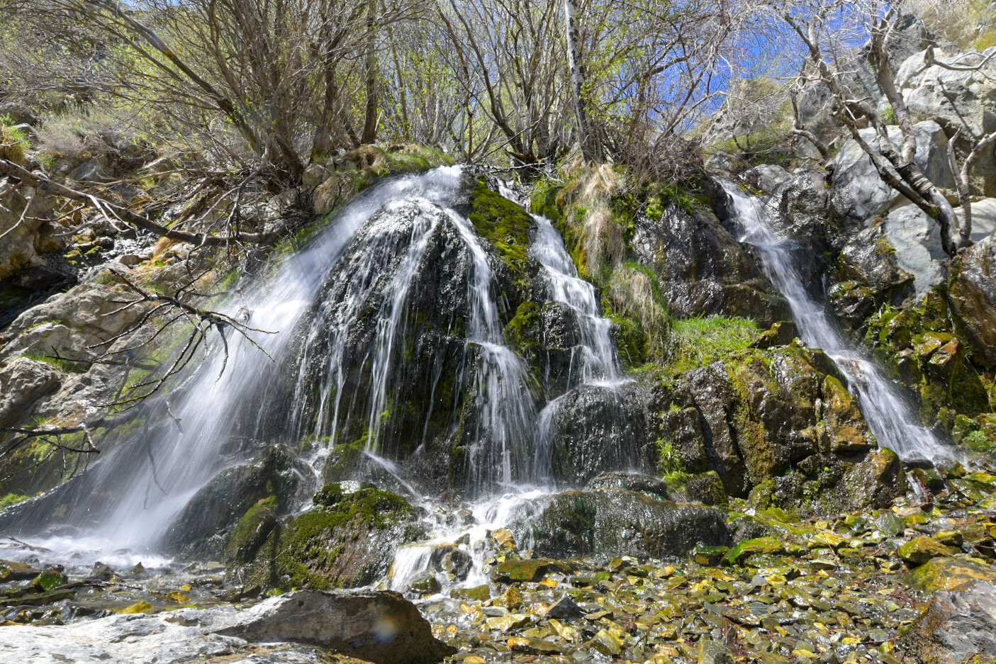
Take An Easy Hike To King’s Canyon Falls in Carson City
Located in Carson City at the end of King’s Canyon road, this 25-foot cascading waterfall offers families and solo hikers alike easy access to a natural oasis
Located in Carson City at the end of King’s Canyon road, this 25-foot cascading waterfall offers families and solo hikers alike easy access to an oasis away from the hustle and bustle of downtown.
We have been here numerous times and have almost always had the falls to ourselves at least part of the time. It is known mostly to locals, so your chances of not having to deal with hoards of tourists are decent.
If you’re planning a trip to Carson City or Reno, we highly recommend adding this place to your list of must-do activities. Below, you’ll find the information you’ll need for your visit.
The Trailhead

Kings Canyon Falls trailhead.
Getting to the trailhead from the downtown area is straightforward and simple. From the capital, you’ll do the following:
Turn onto East Musser street
Turn left onto N. Division street
Turn right onto W. King street
Continue on King’s Canyon road for about two miles
Keep left to stay on King’s Canyon road for about a third of a mile until you hit the dead end.
At the dead end, you’ll see a small dirt lot ahead of you with informative signage on both sides. This is the lot you’ll use. It can comfortably hold around 6-8 vehicles but if it’s full, you can simply park on the side of the road.

Kings Canyon Falls trailhead.
After you park, you’ll see a dirt road heading off to the left and a set of stairs leading up to some signage on your right. You’ll want to take the latter as that’s the most direct route to the falls.
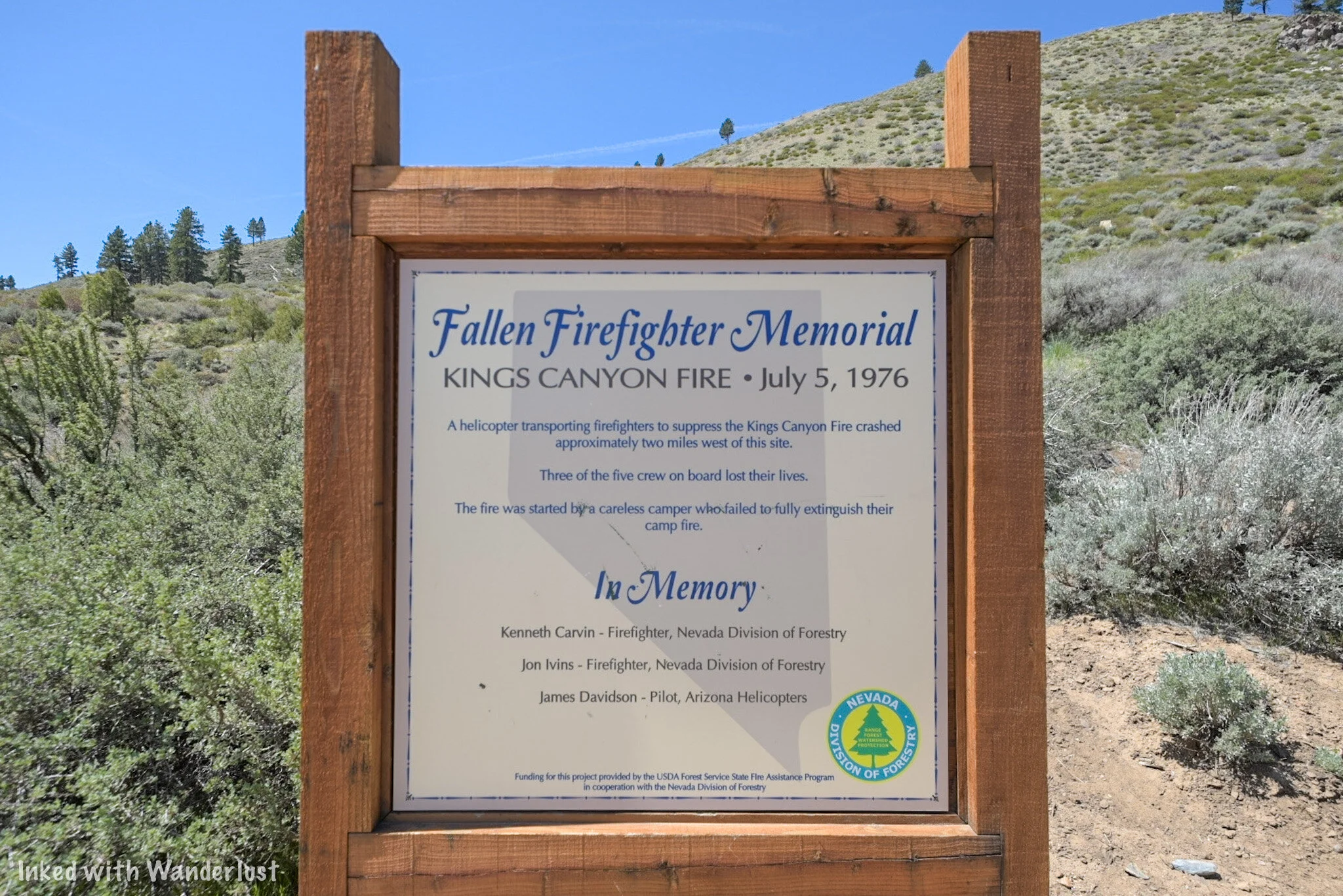
Firefighter memorial. Kings Canyon Falls.
You’ll also want to take note that this trail is for hikers only. Equestrians and biking are not permitted. If you’re looking for a trail that can accommodate one or both of those activities, check here.
Be sure to stop at the sign and read about the fire that took place in this area in 1976 and the resulting deaths of three Firefighters who bravely fought it. There’s a memorial plaque on the left of the trailhead listing the names of those of perished.
The Trail

As stated in the title, this would be considered an easy trail just based on length alone. From the trailhead to the falls, it’s just about a quarter mile over just two quick sets of switchbacks.
Don’t be fooled, though, because it is deceptively steep in some sections. It isn’t hard, but if you’re not in decent shape or you’re not used to the elevation, you’ll definitely feel it.

Trail to King’s Canyon Falls.

Kings Canyon Falls trail.
Along the trail you’ll see sporadic signs asking you to remain on the trail and not cut through. It may be tempting in some spots but please obey the signs and stay on the trail. There’s been a lot of effort in recent years to restore the area.

View of Carson Valley from the trail.
As you near the top of the trail you’ll be rewarded with sweeping views of Carson Valley below. This view is also an indication that you’re close to the falls and that the “hard” part of the trail is over with.
Also around this part of the trail is where you’ll see the junction (on your left) that leads to the 1.8-mile North Kings Loop. This trail goes over and around the falls, not to it. So you’ll want to continue straight on the trail.
The Falls

Kings Canyon Falls.

Kings Canyon Falls.
As you turn the corner into the canyon, you will run right into the falls. In fact, like most waterfalls, you’ll hear it before you see it. As you arrive, you’ll notice boulders off to the left that make for the perfect spot to get off your feet.
The falls flow year round, but spring time is when it’s at its best while getting reduced greatly in the fall. Winter is the one season we haven’t been up here but from what I hear, there is water flowing and the trail, while snow covered and icy in some spots, is still accessible.
READ ALSO: Your Complete Guide To Visiting Burney Falls

Kings Canyon Falls.

Kings Canyon Falls.
If you’re here during a particularly heavy flow, the pool at the base of the falls will be around ankle deep, at best. Prior visitors have set up rocks to step on to get across to the other side so you can avoid stepping into the water.
If you’re feeling particularly adventurous, there are boulders off to the right of the falls that you could use to scramble up to the top. From what I hear, there are small cascades you could check out up there. We have yet to do this so I can’t vouch for it, unfortunately.

Kings Canyon Falls.

Kings Canyon Falls.
Take as long as you like to hang out. People will come and go but if you’re patient, chances are good you’ll have it to yourself at some point. When you’re ready, simply turn around and head back in the same direction you came.
On the way back, you’ll again be presented with the opportunity to extend your hike via the North Kings Loop. This will add 1.8 miles to the overall hike. This is something I plan to do on my next visit so I’ll be sure to update this post when that happens.
Conclusion
Kings Canyon Falls.
We hope you’ve found this article useful for planning out your adventures. If you enjoyed it, please support us by sharing this article with your friends and family on Facebook, Pinterest, or your favorite social media site.
You can further show your support by staying on and reading one or more of the related article above. You can also subscribe to our newsletter below. Thanks!
Safe travels.
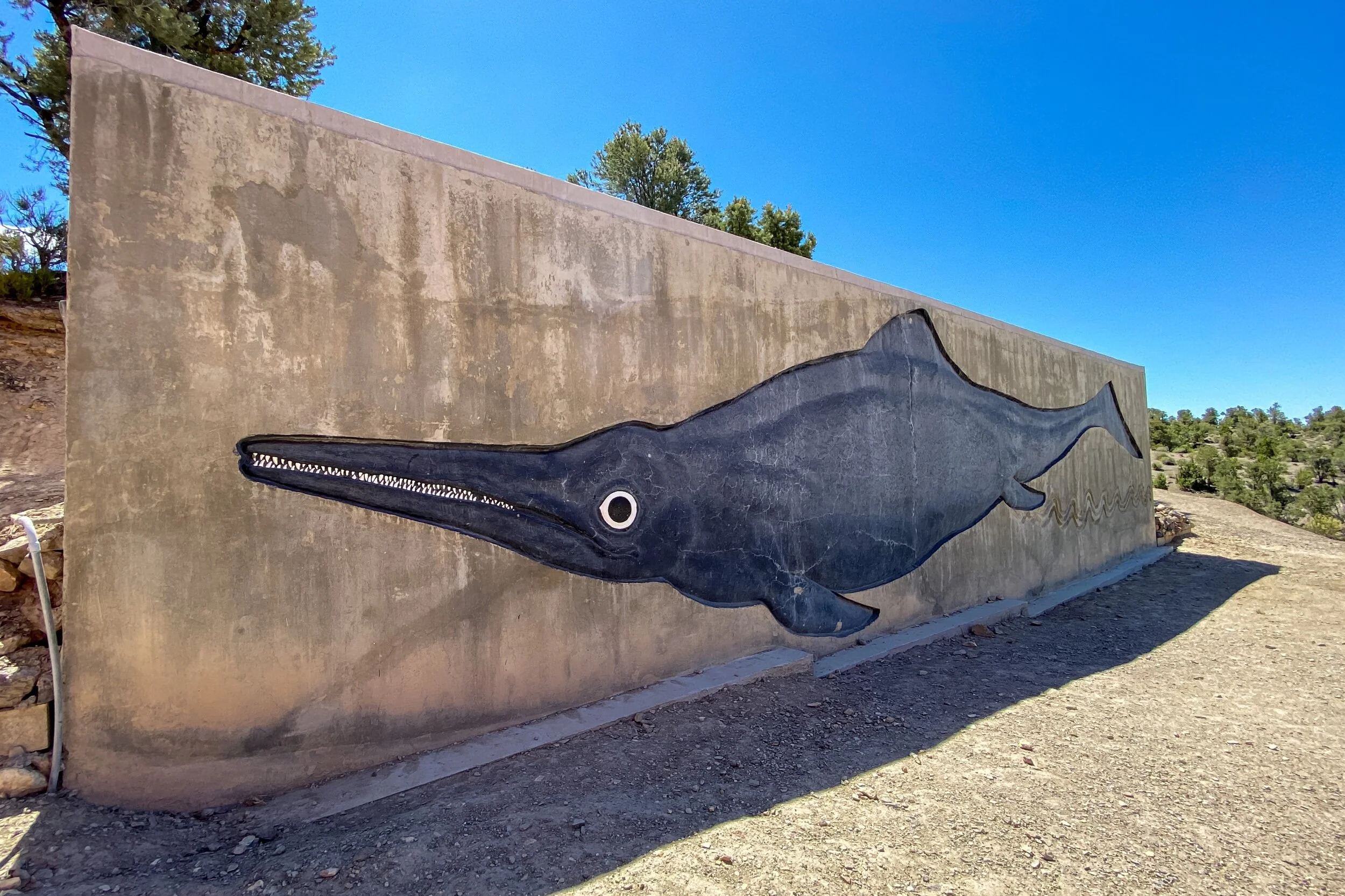
How to Visit Berlin - Ichthyosaur Historic State Park
If you love ghost towns and dinosaurs then you need to head out to this little known town in Nevada’s expansive catalogue of State Parks. Berlin-Icthyosaur (say that 10 times fast) is located
If you love ghost towns and dinosaurs then you need to head out to this little known town in Nevada’s expansive catalogue of State Parks. Berlin-Icthyosaur (say that 10 times fast) is located just outside the (very) small town of Gabbs, NV. It has been dubbed as the, “Bodie”, of Nevada and not only contains remnants of an old mining town (Berlin), but it’s also the site of some of the largest Ichthyosaur fossils ever discovered.
Berlin can be a difficult park to find as it is tucked away deep into the Shoshone Mountain Range and doesn’t receive a lot of publicity as some of the other state parks, but it is more than worthy of your efforts to get out and explore it. So read on and discover how you too can visit Berlin-Ichthyosaur State Park.
How to Get There
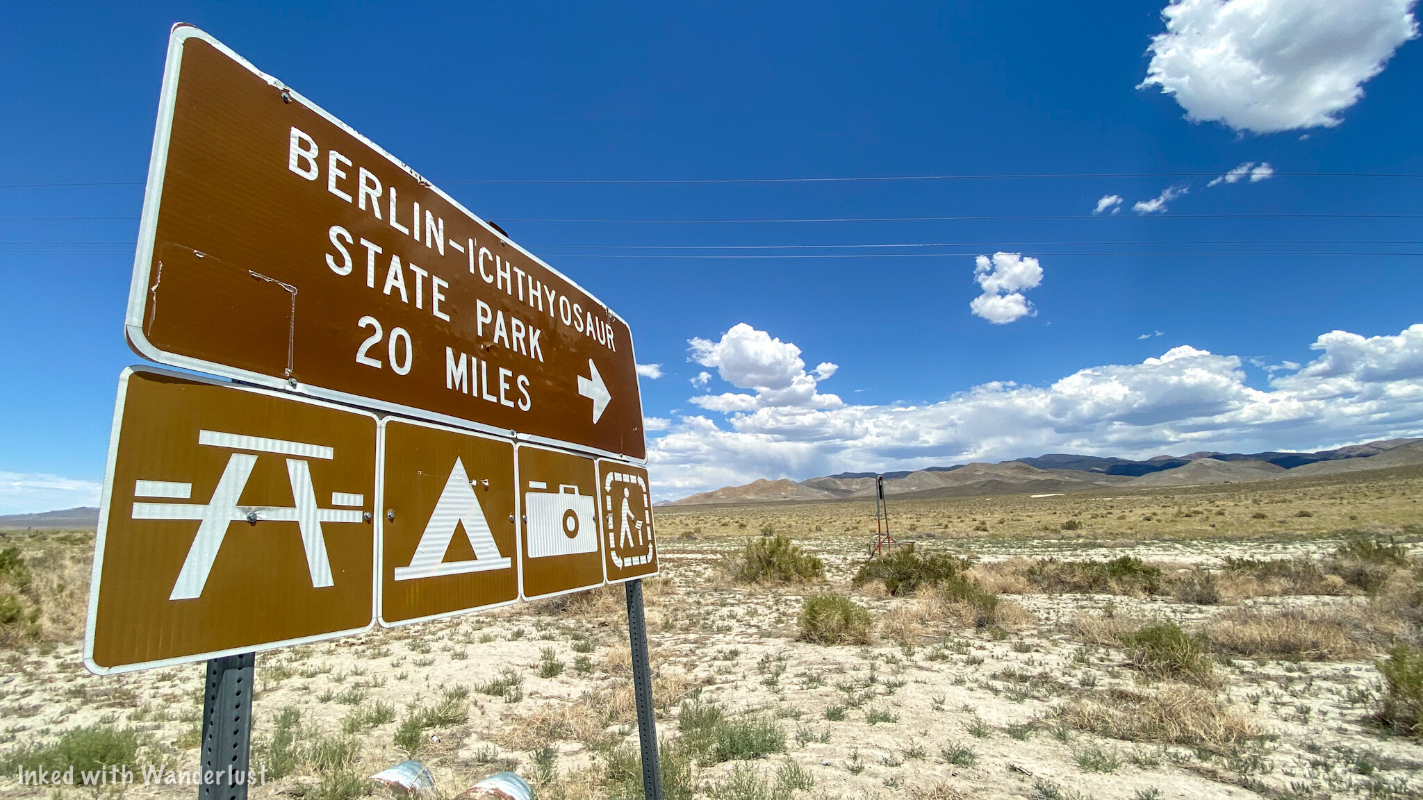
Berlin-Ichthyosaur State Park sign.
As stated above, Berlin is a bit out of the way and takes some effort to get to from either direction. It is located in Nye County and the nearest anything to it is the small, unincorporated town of Gabbs (population 155 as of this writing). If you’re coming from:
Reno: Take I-80 east towards Fernley. You’ll then take U.S 50 east for about 70 miles before turning right onto highway 361 and follow that for about 35 miles before finally arriving in Gabbs. From this direction, you’ll take a left on NV-844 east for 16 miles. This road will take you directly to Berlin.
Las Vegas: Make your way to U.S 95 north and follow that for roughly 215 miles. You’ll then veer right onto Route 89 to Gabbs and once there, you’ll follow the same directions above. The only difference is you’ll turn right on NV-844 to the park.
Salt Lake City: You’ll get onto I-80 west and follow that for 300 miles. You’ll then take the exit for NV-305 south heading for the town of Austin. Once in Austin, you’ll briefly turn left on the Lincoln Highway before exiting to NV-722 (you’ll pass the Austin airport). Then, turn left on NV-21 before turning right onto Forrest Developed Road 024 (this will be the back way into Berlin).

Berlin-Ichthyosaur State Park entrance.
As you can see, no matter which direction you are coming from, it’s going to be an adventure just getting to Berlin. So whichever way you’re coming from, be sure to stop at one of the bigger towns and fuel up before arriving in Gabbs or Berlin as there are no services in either. It also wouldn’t hurt to make sure your tires are properly inflated and all your fluids are good.
With the exception of the final few miles and coming in through the back way, all roads leading to Berlin are paved and well maintained. The last stretch is on a maintained gravel road. My Chevrolet Cruze made it up there perfectly fine. Potholes and dips were minimal. Keep in mind that if you’re using GPS, it may or may not have you go right at the split. Don’t. Keep to the left road and that will take you straight to the main entrance.
The Fossil House

The Fossil House.
It’s totally up to you on where you want to start. Once you’ve paid your entry fee, you’re free to enjoy the park at your leisure. However, we visited during the covid-19 crisis and one of the ways they were trying to prevent the spread at this particular location was to close the Fossil House. Thankfully, we were one of only two cars that came through this day so the Ranger was kind enough to open it up for us to check out. So we started our day here.
To get to the Fossil House, simply stick to the main road. You’ll eventually pass by the campground and will see a narrow road on your right with a sign pointing the way. Take this road. Be warned, this road is VERY narrow and there isn’t a whole lot of room for two vehicles to pass each other. At the top of the hill, you’ll come to the road’s terminus at the parking lot for the Fossil House. You’ll see a giant mural of an Ichthyosaur to the right of the lot to make it fairly obvious that you’re in the right spot. This mural represents the actual size of the largest, intact fossil inside the house.

Mural of an actual sized Ichthyosaur.
As you can see from the above photo, Ichthyosaurs were known to get huge. Some coming in at over fifty feet in length. The fossils found at this location were discovered in 1928 with excavations beginning in 1954 and running through the 1960’s. After it was all said and done, there were 40 near-complete Ichthyosaurs found at various locations throughout the park.
Tours of the Fossil House are 40 minutes in length and offered during the following times:
Daily, Memorial Day through Labor Day at 10am and 2pm with an additional noon tour offered on Saturdays and Sundays.
From March to Memorial Day and Labor Day to late November, there is no noon tour.
FOR THE REMAINDER OF 2020 AND UNTIL FURTHER NOTICE, TOURS OF THE FOSSIL HOUSE ARE CANCELED! I will update this once official information from park officials are provided. There are viewing windows at the Fossil House that you are free to use.
There is a fee to take this tour. It is $5.00 per person while kids 12 and under are free.

The excavation site inside the fossil house at Berlin State Park.
Inside the Fossil House, there’s a small loop trail and takes you around the excavation site with actual fossils in the middle of it. There are numbered, white markers next to certain sections of the fossil that explain which part of the Ichthyosaur you’re looking at. At first, it won’t make any sense but eventually you’ll see it and that “ah hah” moment will hit you.
I’m grateful to the Ranger that opened the house and allowed us to explore it at our leisure. Normally, as stated above, this is part of a tour. The Ranger gave us the booklet he uses during the tour that matches up to the markers on the fossils and explains everything. Once we were done, we chatted with him a bit and then left to explore Berlin proper.
To the Ranger that did this for us; If you’re reading this, thank you so much.
Berlin: A True Nevada Ghost Town

Berlin-Ichthyosaur State Park.
Once we got our fill of Ichthyosaurs, it was now time to explore the ghost town portion of the park. We drove back down to the town proper and found a small parking space near the visitor center and flag pole. In case you’re here during a particularly busy day, just know that parking can be a little scarce here. You may have to get creative.
Berlin was a true, turn-of-the-century mining town. The height of its peak ran from 1898 to its death in 1911. However, mining activity began in the area as early as 1863 when silver was discovered in Union Canyon resulting in the formation of the Union Mining District and included the towns of Berlin, Grantsville, Ione, and of course, Union. A few years later in 1896, the Berlin Mine was established.
By the time mining concluded in 1911, the estimated total production of Berlin was $849,000 with a price of $20 per ounce of gold. Around 250 people including Miners, Wood-Cutters, Charcoal Makers, a Doctor, Nurse, Forest Ranger, and Prostitute made up the town. The cool thing about this abandoned town is that not some, but MOST of the original buildings are still standing and there are even some original residents still buried in the town cemetery.
Here are a few of the highlights you’re able to check out on this self-guided tour:

The Machine Shop
This was what we know now to be a Maintenance Shop. Here, Blacksmiths and Mechanics worked to keep the machinery of the mine in working order.
Every so often, a passer-by would have his vehicle towed here to be worked on after breaking down.

The Assay Office
Here, samples of rock, ore, and concentrates from the mill would be sent for processing (assayed) to determine the values they contained.
The furnace used charcoal because it was the only clean burning fuel available locally. The night watchmen would use this office to keep warm and eat their meals.
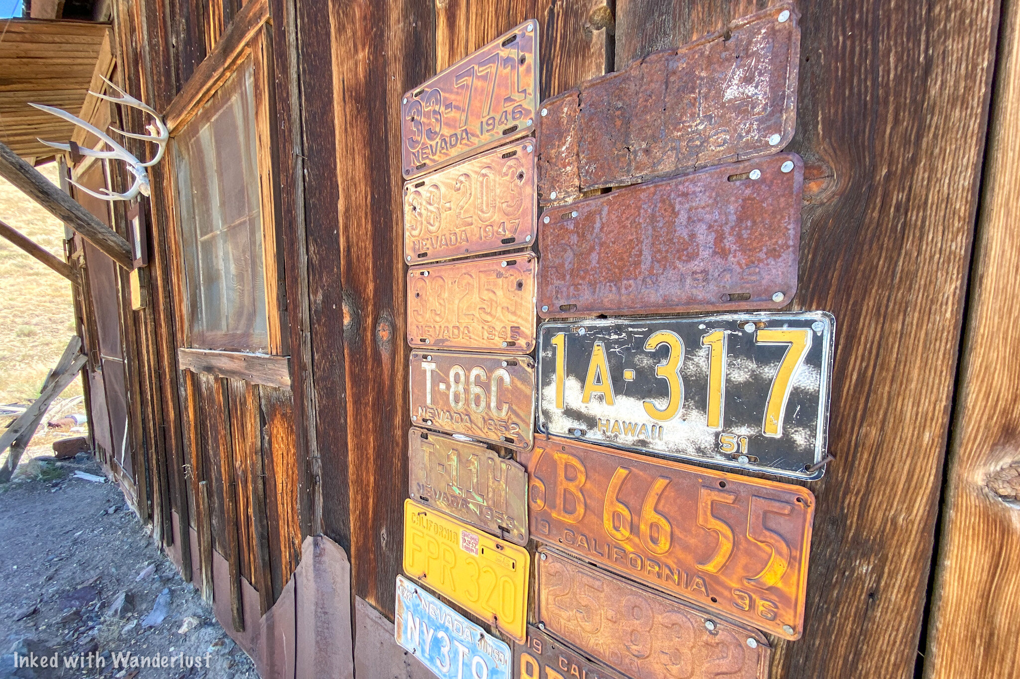
The Stage Station
This is where the stage driver and his horse would live…together. A partition inside separated the living quarters from the barn section of the building.
The men who drove stage during this time was John Mullin, Ed Dieringer, and Alex Dyer.

Company Store
There’s nothing much left now, but this was once the site of the company store. Here, they sold everything from mining equipment, clothing, groceries, and drugs to locals and workers.
During labor troubles in 1905, the store also served as a jail. The building you see in the background was a storage warehouse.

Superintendent Home
This was the home of the mine’s superintendent and now serves as a small welcome center.
During a labor strike in 1907 when the miners wanted a raise from $3.50 to $4.00 per day Mr. Bowen, the Super, shut the mine down.
To counter, the miners teamed up and forcefully escorted Mr. Bowen off property. He then drove to the town of Tonopah and brought back a Sheriff to help re-gain control.

The Berlin Mill
During the heyday of Berlin’s production, you’d see a beehive of activity here.
One man would be operating the crusher, another tended the 30 stamps and concentration tables, while another looked after the boilers and steam engines.
This is by no means an exhaustive list of features found in Berlin. Other cool things to check out include the town cemetery, mine foreman’s house, miner’s dugout, entrance to the Berlin mine, doctor’s house, and more! As you can see, you could easily spend a full day or more checking everything out in Berlin.
Lodging & Fees

The nearest hotels and/or Airbnb’s you’ll find are in the bigger towns nearby. These include Fallon, Austin, and Hawthorne. If you want to stay in the park, they have an established campground you could utilize. It contains 14 well-spaced units, some being able to accommodate RV’s up to 25 feet long. Each unit comes with a fire pit, BBQ grills, covered picnic tables, and drinking water (outside of winter). Restrooms and an RV dump station are located nearby.
The fee to camp is $15.00 per night with a 14 night maximum (30-day window). Keep in mind that this per night fee is in addition to your entry fees which are:
$5.00 per vehicle
$2.00 per bike (motorcycle)
When you arrive, someone may or may not be at the gate collecting entry fees. We arrived just before the Ranger was about to take off so he was kind enough to take our money and fill out the envelope for us. If there is no one there, simply stop at the gate to fill in the envelope and drop it into the red deposit pole (with your fee included, of course). Much like most Nevada State Parks, only cash is accepted for entry fees.
There are also no restaurants or vending machines in the park. So be sure to bring snacks and water with you. There is one restaurant in Gabbs (the gateway town to Berlin). It is called, “R&D’s Bar”, and serves up burgers, fries, hot dogs, chicken wings, and similar fare. Aside from that, you’ll need to get to the bigger towns listed above.
Directly adjacent to the pay station at the main entrance is a restroom of the pit toilet variety. I must admit that of all State and National Parks I’ve been to, Berlin had THE cleanest restroom of its kind. There is another restroom located near the campground.
Conclusion

Berlin Mill. Berlin-Ichthyosaur State Park.
Berlin is perhaps Nevada’s most intriguing and unique state park. The combination of an abandoned mining town and the discovery of a massive amount of Ichthyosaur fossils should put Berlin at or near the top of any traveler’s list of places to explore. It’s also a great place to shoot dark sky photographs if you have the gear. I highly recommend and encourage you to visit this amazing place for yourself. Thanks for reading!
Safe Travels.
Have you visited Berlin? Do you plan to? Tell me about it in the comment section below!
Support this site by sharing this article with your friends and family on your favorite social media page.
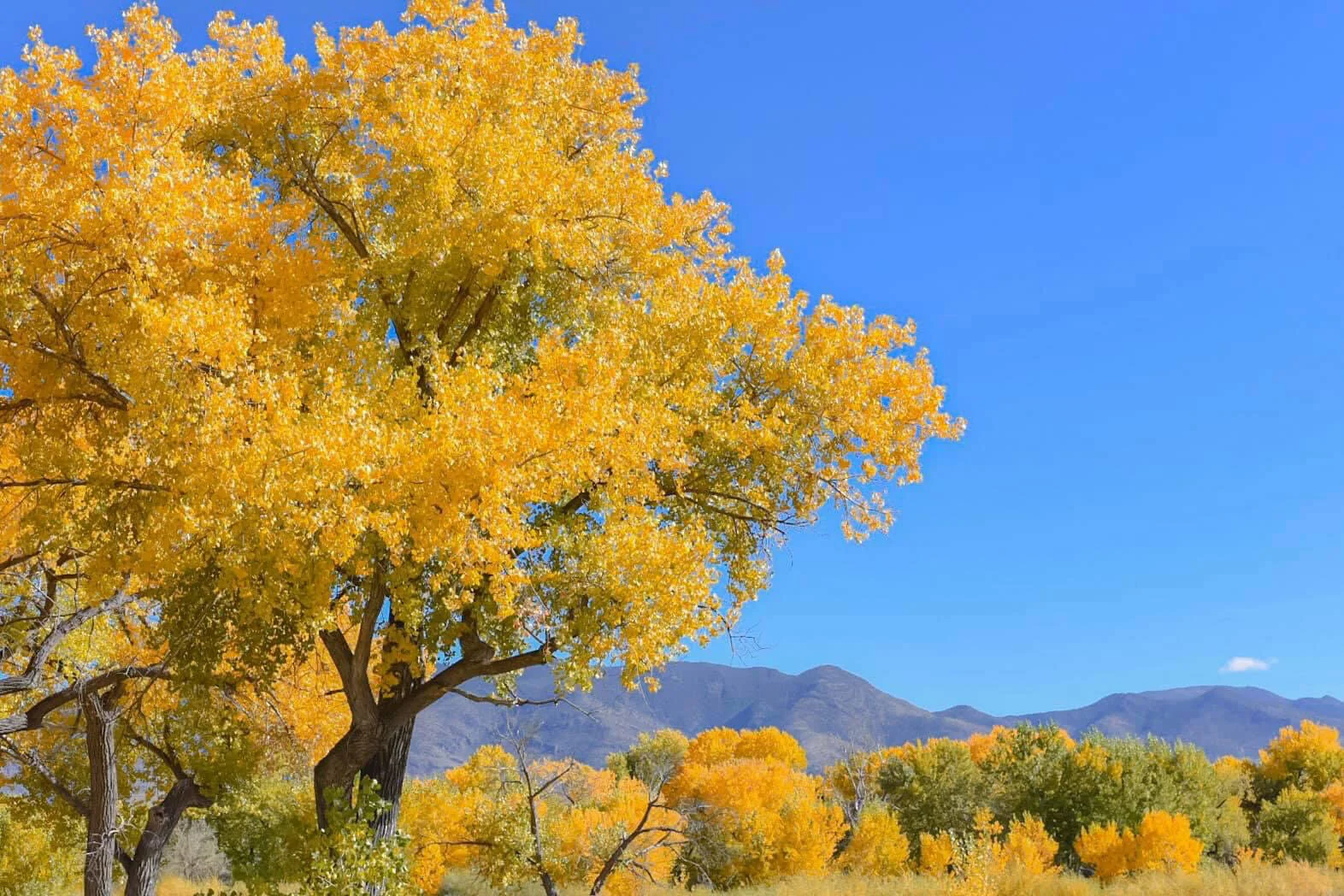
Visit Dayton State Park & Rock Point Mill
Established in 1977 and originally used as a Paiute fishing camp, Dayton State Park is 160 acres in size and located in the highly historic Nevada town of the same name. It features hiking trails
Established in 1977 and originally used as a Paiute fishing camp, Dayton State Park is 160 acres in size and located in the highly historic Nevada town of the same name. It features hiking trails, picnic areas, camping, fishing opportunities, and the remnants of the abandoned, “Rock Point Mill”.
Getting Here

Dayton State Park. Dayton, NV.
Dayton State Park is not too far from two of Nevada’s larger cities; Carson City and Reno. From Carson, you’ll travel east on Highway 50 for about 11 miles before turning right at the entrance.
From Reno, you’ll travel south on I-580 for 30 miles before joining US-50 east for, you guessed it, 11 miles before turning right into the park.
Things to Do

Hiking trail in Dayton State Park.
As mentioned at the beginning of this post, there are many activities for you to partake in. For starters, there are two hiking trails in the park. One begins near the campground and winds through the foliage as you make your way to the banks of the Carson River.
The other also begins near the campground but goes in the opposite direction and across the highway to the ruins of an old abandoned stamp mill (more on that later).

Picnic area. Dayton State Park.
There are several picnic areas located throughout the park proper and near the mill site. In addition, the group area provides shade and 10 picnic tables that you can reserve for birthday parties, reunions, etc.
You can also camp here. The campground is located near the entrance and contains 10 sites with fire rings, grills, and picnic tables. In addition to tent camping, each site can accommodate RV’s up to 34 feet in length. Dump stations and restrooms are located nearby.

Small garden. Dayton State Park.
Park fees are as follows:
$5.00 per vehicle for day use
$15.00 per night for camping (this is in addition to the day use fee)
Like most Nevada State Parks, fees getting collected are largely dependent on the honor system via self register. Both day use and camping fees are to be paid at the register station located at the entrance. Park Rangers do make regular checks throughout the day.
Rock Point Mill

Rock Point Mill. Dayton State Park.
For me and many others, the main attraction of this park is the opportunity to explore the remains of Rock Point Mill, an old stamp mill that first operated in 1861, was destroyed in a fire in 1909, was rebuilt in the same year, and closed for good in 1920.
Rock Point was built by Charles C. Stevenson (who from 1887 to 1890 was Governor of Nevada) at a cost of $75,000. There were originally 40 stamps that crushed silver and gold ore from the Virginia City and Gold Hill mines but was eventually expanded to 56 at its peak.
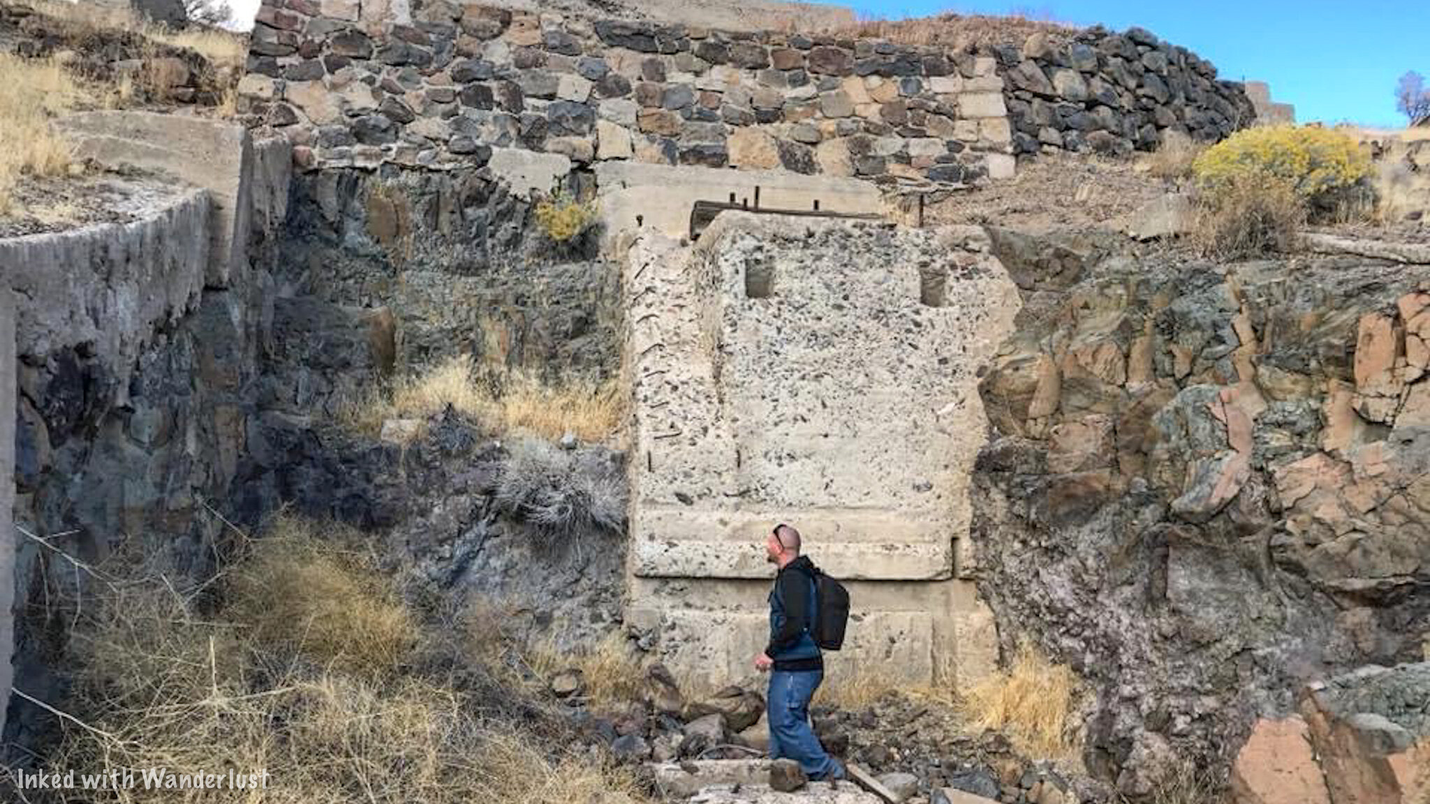
Rock Point Mill. Dayton State Park.
As mentioned earlier, Rock Point was destroyed by a huge fire in 1909 but was almost immediately rebuilt with galvanized iron. This new version of the mill (which are what most of the remains are from) ran until its permanent closure in 1920.
You’re free to wander about the ruins at your leisure. Here you’ll find the stamp remains, mill foundations, and a small rock hole cut out in the base of the mill. It’s not much (only around 5 feet), but it is cool to see.

Rock Point Mill. Dayton State Park.
There are two ways to reach the Rock Point ruins. One way is to utilize the trail that leaves from the campground in the state park proper that runs parallel along US-50. You’ll eventually reach a tunnel that goes underneath the highway and spits you out at the ruins.

The tunnel at Dayton State Park.
If you don’t feel like walking, your other option would be to hop in your car and drive there. You’ll turn left onto US-50 from the park exit and turn right into the Gold Ranch Casino parking lot. You’ll find the entrance to this section of the park to the right of the casino.

Rock Point Mill remains. Dayton State Park.
From your car, there will be a short stroll through cottonwoods and another picnic area before reaching the ruins. The whole walk will take you around 5 minutes or so.
When to Go

Fall colors at Dayton State Park.
The park is open 365 days a year so really, anytime is a good time. However, if you’re asking my personal opinion, I would highly recommend you pay a visit in the fall. Specifically when the fall colors are at their peak (as you can see in the photo above).
Dayton State Park, as told to me by the Ranger, is on the list for the top 10 places in the entire state for fall colors and I won’t argue with him. If you arrive at peak time, it is drop dead gorgeous.
Summer, as always, will see the most amount of visitors but even then, the park doesn’t get very busy. Chances are good that no matter when you decide to visit, you’ll be able to snag yourself a campsite and enjoy the park with minimal crowds.

Safe travels & thanks for reading!
Please support this site by sharing this article with your friends and family on Pinterest, Facebook, or your favorite social media site.
Furthermore, you can show your support by reading one or more of the related articles above. Thank you.
