
Anaconda Mine: See This Abandoned Open Pit Copper Mine In Yerington
Nestled in the picturesque landscapes of Yerington, Nevada, lies a hidden gem that takes visitors on a journey…
3 minute read | contains affiliate links
Nestled in the picturesque landscapes of Yerington, Nevada, lies a hidden gem that takes visitors on a journey through time.
Anaconda Mine, with its rich history and captivating allure, offers an unforgettable experience for those seeking a glimpse into the region’s mining legacy.
In this post, I take you to Weed Heights, an unincorporated community adjacent to Yerington, where the miners and their families once called home.
There, you’ll find the viewing platform where you can see the near entirety of the water-filled pit and on the way, get a distant view of the former processing plant.
Let’s get into it!

Exciting news for our readers!
We’re excited to Introduce the all-new "Inked with Wanderlust" online store!
We're thrilled to bring you a fantastic collection of wanderlust-inspired merchandise. Celebrate your love for travel and exploration with our stylish apparel and accessories, designed to ignite your sense of adventure.
Discover a range of unique designs that capture the spirit of wanderlust, from cozy hiking-themed t-shirts to charming accessories that make your wanderlust spirit soar!
Visit our online store today and start your journey of style and adventure. Happy exploring!
Anaconda Mine History & Stats

Anaconda Mine holds a significant place in Nevada’s mining history. Originally established in the mid 20th century, it played a pivotal role in the copper mining boom that shaped the region.
The mine was named after the Anaconda Copper Mining Company, who purchased the site in 1942. They were one of the most prominent mining companies of the time.
Anaconda’s initial 26-year run took place between 1952 and 1978, with secondary milling and processing until the year 2000. At which point, the newest owner, Arimetco, declared bankruptcy and abandoned the site.
During its run, Anaconda Mine produced:
1,744,237,000 pounds of copper
103,834,000 tons of oxide ore
58,589,000 tons of sulfide ore
189,034,000 tons of waste
The total market value from its operation is estimated to be $765,504,000, with total net profits exceeding $200-million. A staggering amount for the time.
At its peak, Anaconda employed 450 people, operated six-days per week and produced 13,000 tons of ore to the crushers daily.
Directions to Anaconda Mine

To see the water-filled open pit, you’ll need to make your way to the small Nevada town of Yerington and then up to the even smaller community of Weed Heights.
Much like other mining sites, such as Bodie, Weed Heights was built directly adjacent to the site for the purpose of housing miners and other employees.
Simply typing, “Anaconda Copper Mine”, into your GPS of choice will get you there. The main road leading to Weed Heights is just off the highway (US-95A).
After turning onto the road, continue straight. Keep in mind that during winter, this road is known to be icy at times.

About halfway up the road, prior to driving under the overpass, you’ll see the old processing plant on your right. There’s a large dirt/gravel area to pull into.
The buildings are gated off and unfortunately there are no tours or public access offered, so you’ll have to settle for admiring them from a distance.
From here, continue up the road until you reach a stop sign. Turn left and soon thereafter, you’ll see the fenced-in viewing platform with a small parking area on your left.
Anaconda Mine Viewing Area

In front of the entrance to the viewing platform are two informational boards detailing the history and production of Anaconda Mine.
To see the pit, continue past the signs along the dirt path between the fences. There’s lots of barbwire here so watch where you put your hands.


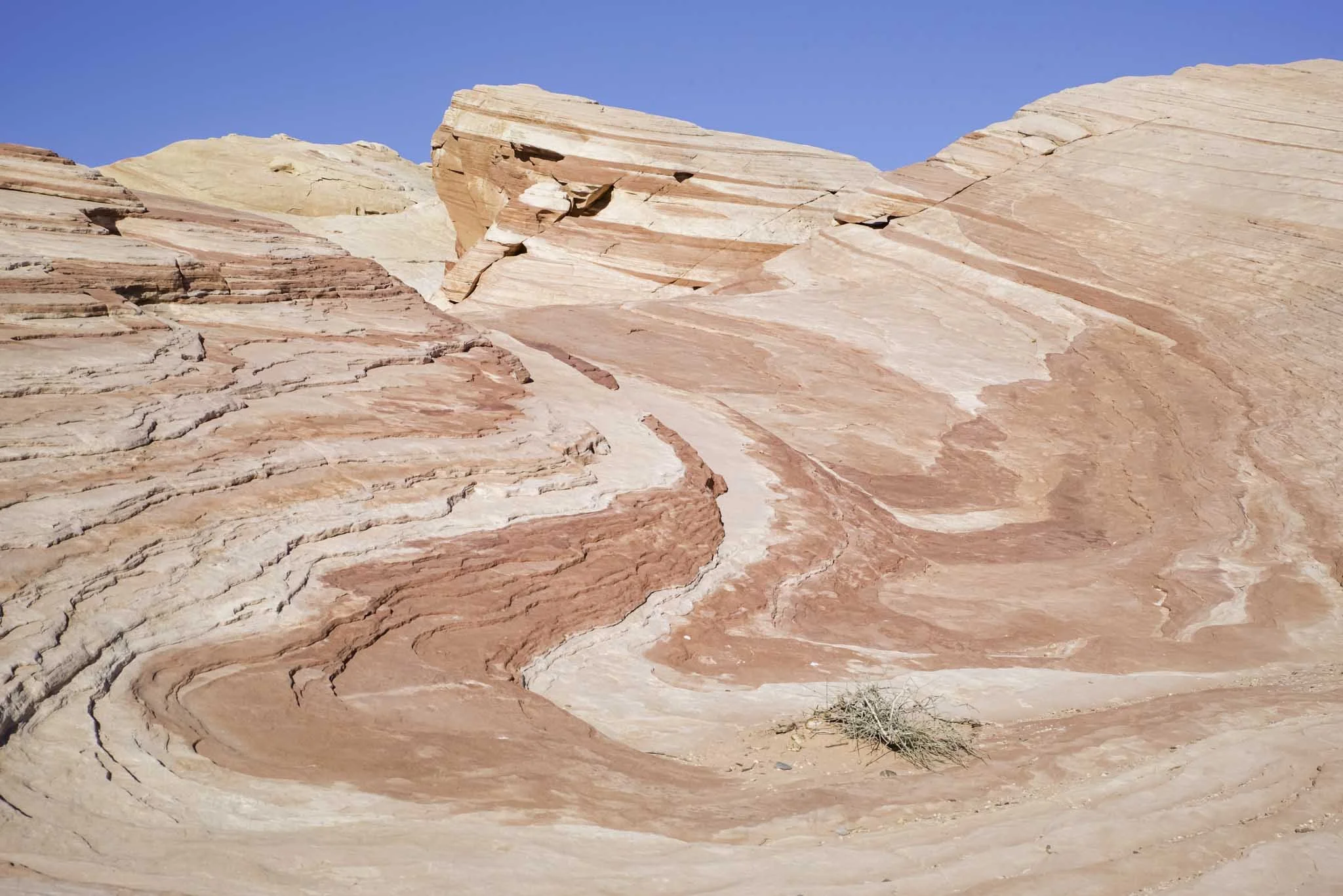
From the viewing area, you’ll be able to see the pit (or lake, as some locals refer to it as) in all its glory, including the hauling roads circulating around it.
Here are some interesting stats of the pit:
It’s one mile long
A half mile wide
810 feet deep
Water level is approximately 450 feet deep


To some, it’s just a giant hole with water in it. For those who appreciate mining/local history, or who enjoy roadside stops like this, it’s a fascinating sight.
Unfortunately, this is all you’ll be able to legally view. There’s no public access to the haul roads or even in the perimeter of the mine for safety reasons.
All told, Anaconda Copper Mine makes for a quick but fascinating stop for those traveling through or for locals who want a glimpse into the area’s past.
Travel safe, travel responsibly,
Kevin
Check Out These Amazing Nearby Destinations!


Please support this website by subscribing to the newsletter below.
Thanks for reading.

Fort Churchill State Park: Nevada History, Fees, Parking, Hiking and More
Nevada has no shortage of historic, abandoned sites to explore. Fort Churchill State Historic Park is one of many you need to add…
3 minute read | contains affiliate links
Nevada has no shortage of historic sites to explore. Fort Churchill State Historic Park is more than deserving of a spot on your list. Particularly if you’re into military history.
Fort Churchill sits on 3,200 acres of protected land. It features several structures, a cemetery, museum, campground, group area and Buckland Station (which is located across the highway from the park).
If you’re going to be driving through, Fort Churchill is an easy to visit as it’s just off the highway. It’s a great way to get out and stretch your legs or to let the kids burn off some energy.
In the guide, we’ll cover how to get there, the parking situation, crowd levels, fees and more. Lets get into it!

Exciting news for our readers!
We’re excited to Introduce the all-new "Inked with Wanderlust" online store!
We're thrilled to bring you a fantastic collection of wanderlust-inspired merchandise. Celebrate your love for travel and exploration with our stylish apparel and accessories, designed to ignite your sense of adventure.
Discover a range of unique designs that capture the spirit of wanderlust, from cozy hiking-themed t-shirts to charming accessories that make your wanderlust spirit soar!
Visit our online store today and start your journey of style and adventure. Happy exploring!
Fort Churchill History

Construction on the post was completed in 1861 and was named after Sylvester Churchill, an Inspector General for the Army.
Its original purpose was to provide protection for this section of the Pony Express. Later, the fort was used to store supplies for the Union Army during the Civil War.
Though many Soldiers came and went, it’s believed to have housed around 200 at any give time. Despite its importance, it wasn’t active for long as it was abandoned shortly after the conclusion of the Civil War.

Since the state declined to take ownership, the fort’s structures were auctioned off for $750. For decades, the structures just sat as nothing was done with them.
It wasn’t until 1932 that the National Park Service took control of the property and began restoration efforts on the structures. Additionally, the visitor center was built at this time.
Then, in 1957, Fort Churchill became part of the Nevada State Park system. In 1966, it was added to the National Register of Historic Places.
Getting To Fort Churchill, Parking, Fees & Museum

The park is located between the towns of Silver Springs and Yerington along the highway. From either town, get on highway 95 and keep an eye out for Fort Churchill road and turn there.
Park fees are as follows:
$5.00 - Nevada Resident (day use)
$10.00 - Non-Nevada Resident (day use)
$15.00 - Per Night, Nevada Resident (camping)
$20.00 - Per Night, Non-Nevada Resident (camping)
$2.00 - Bike In
The park accepts cash and credit cards for fees. As you drive up to the entrance, you’ll fee the pay station on your right. There’s an area where you pull-off to do so.
Whichever payment method you use, be sure to place the receipt (face-side up) on your dashboard in case the park ranger needs to verify payment.

The parking lot and museum will be to your left after driving in. The cemetery is off to your right (above the pay station). The parking lot is small, capable of holding a dozen vehicles or so.
There are additional lots on either side of the structures further down the road if this one is full or closed off.
The entrance to the museum can be found just off of the parking lot. It’s small, but contains quite a few artifacts from both the fort and the general area.


While the park itself is open 24/7, the museum is not. It’s open daily from 8am to 4pm.

The trailhead to the structures below is located adjacent to the museum. There are two additional parking lots closer to them if you prefer to skip the trail.
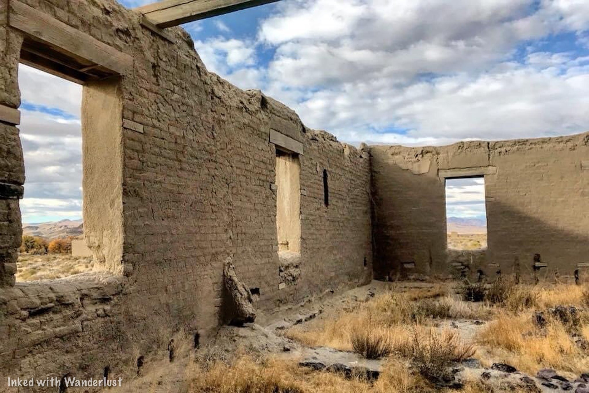
Fort Churchill Historic Structures

From the trailhead near the museum and back, the trail is roughly one mile. It’s a fairly even grade and is easy to follow as it’s lined with rocks.
Most people, including children, would have no issue on this trail. Using strollers and/or wheelchairs on it, though, would be challenging.


With the exception of a couple off-shoots, the trail makes a perfect circle to each of the featured structures. There are around a dozen or so.
There are signs posted in front of most stating what the structure was, such as the Hospital. A few have bigger informative boards with broader details.
One important thing to note is to be sure to keep out of the structures and remain on the trail. The structures are old and in a state of arrested decay.


There are no doors or windows on the structures so if you’re curious as to what the inside of them look like, they're easy to see/photograph from the trail.
Something else to keep in mind is that there isn’t any shade or water fountains along this trail. So be sure to come prepared, particularly in the summer.
Fort Churchill Campground & Group Area

The campground is open throughout the year and operates on a first come, first serve basis. It’s located along the Carson River on the east side of the park.
There are 20 spots featuring a table, fire ring and plenty of shade from the dozens of cottonwood trees that dot the landscape.
Each site can accommodate RV’s or a tent. There are no hook ups, but there’s a dump station located nearby. The only real amenity are the bathrooms (no showers).
To reach the campground, drive past the main parking lot on the road and continue until you see the sign to turn right. Simply follow that road.

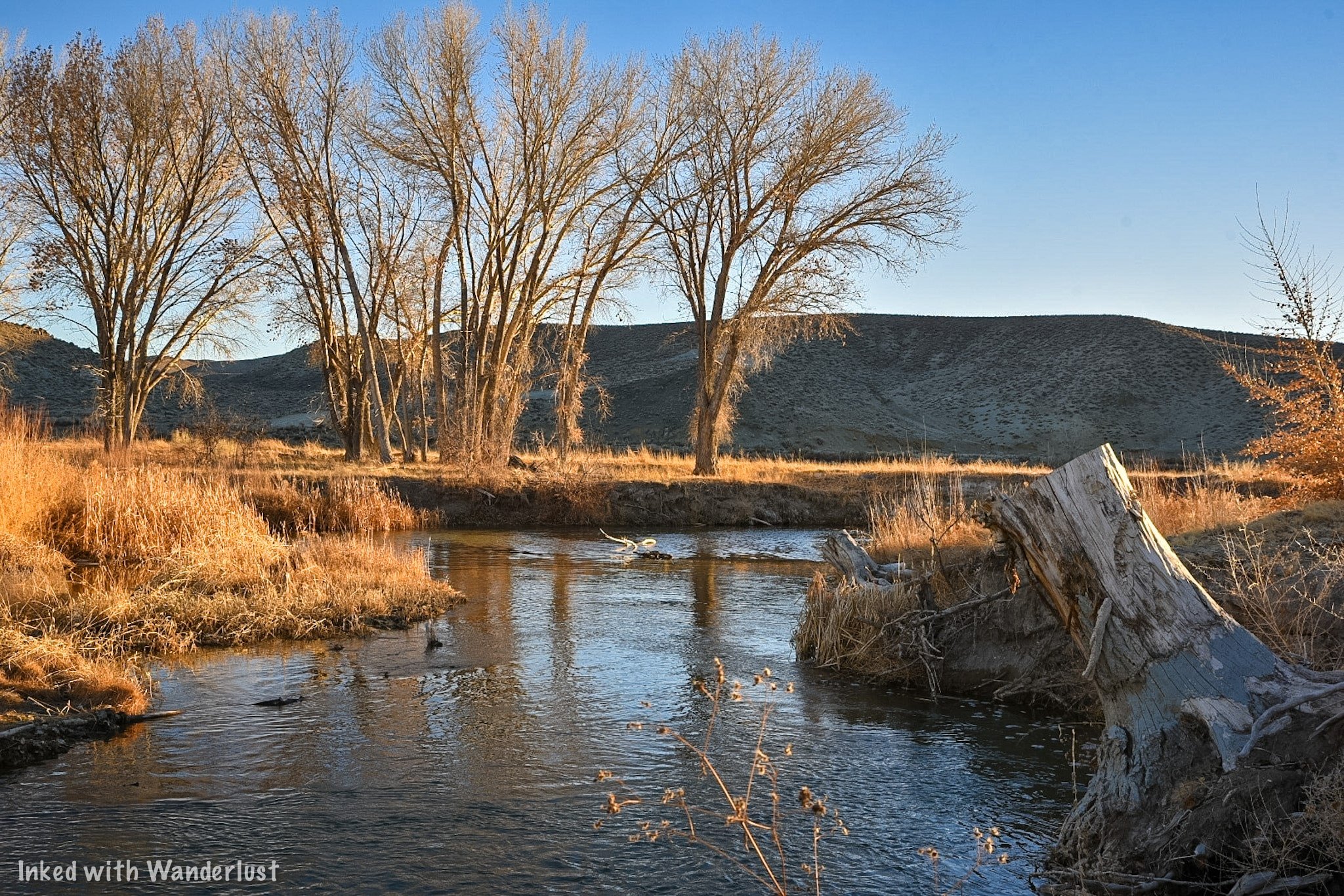
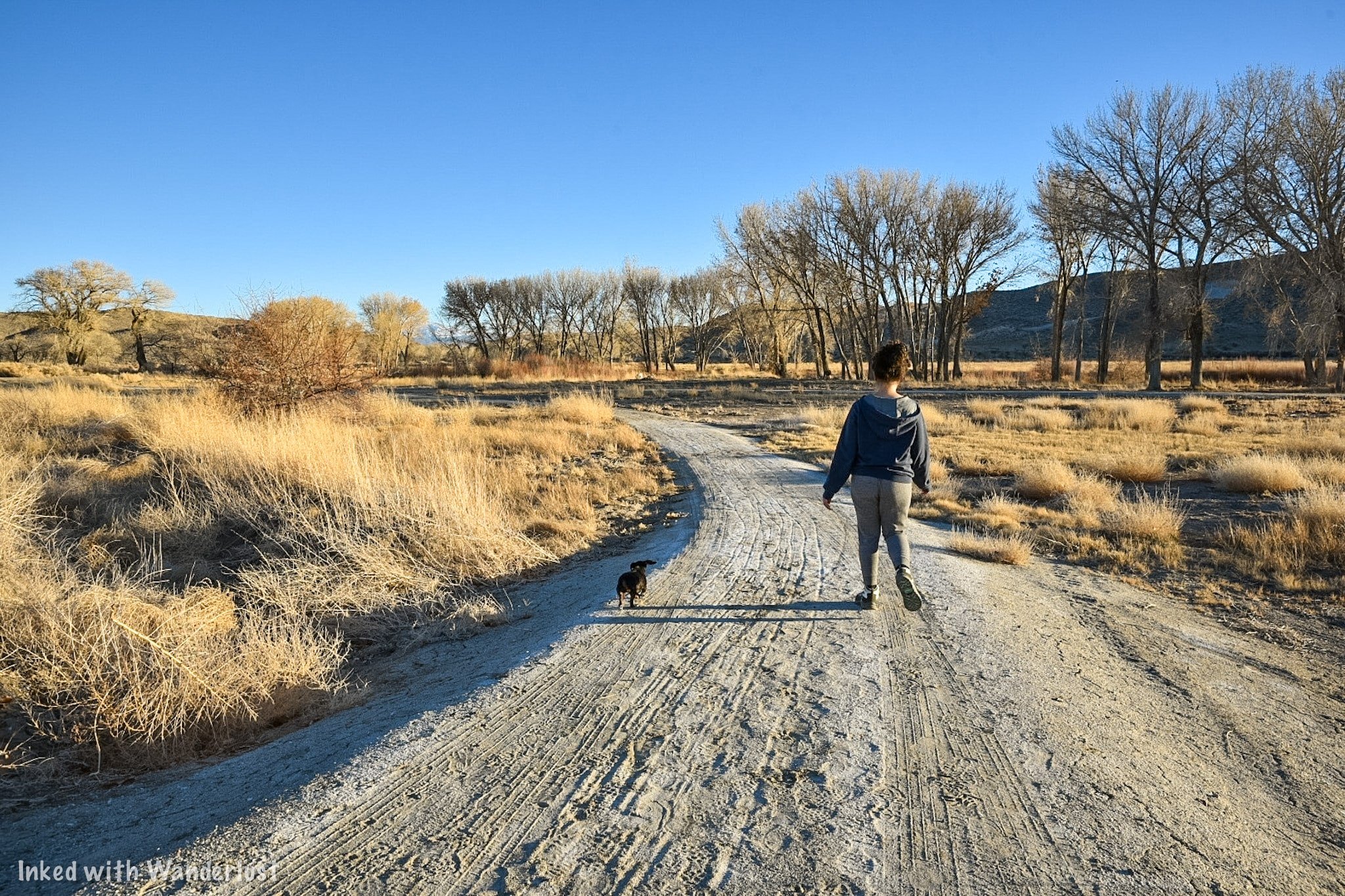
The group use/picnic area is a serene, often crowd less area of the park. There are many picnic tables, lots of shade, a bathroom, water bootle refill station and easy access to the Carson River.
To get to the river, walk on the paved path next to the bathroom and keep going through the grove of Cottonwood trees until you reach a gate. Go through the gate and enjoy the river.
To reach the group use area, drive past the main parking lot at the entrance and take the first left after that (the historic structures should be on your right).
Once you see the sign, turn left and follow the gravel road. At the point where it splits, turn right and continue until you reach the parking lot.
Buckland Station

Buckland Station. Fort Churchill State Park. Nevada.
Buckland Station was built in 1870 out of materials from the abandoned fort. It was first used as a boarding house and the home of the Buckland Family. Beginning in 1885, it served as a supply stop on the Pony Express.
Self guided tours are available of the interior of the recently remodeled building. The fee is $1 per person with free parking.

The fee goes towards ongoing maintenance and upkeep of the property. Bathrooms are available behind the house.
Across the street are more historic structures. These are of the farm variety. I wasn’t able to find any information on them but they’re cool to check out, nonetheless.
Additional Info, Tips & Reminders

Do not climb on or go inside the remains. The remains are fragile and entering or climbing on them could cause irreversible damage and most importantly, your safety would be at risk.
Watch out for wildlife. Rattlesnakes have been known to frequent the park so please, watch your step, stay on the trail and keep an eye on the little ones.
Buckland Station is across the highway. To visit this historic station, you’ll need to leave the park proper and drive south on highway 95. You can either drive there or you can utilize the 2 mile trail that connects Buckland to Fort Churchill.
Please support this website by subscribing to the newsletter below.
Thank you for reading.

How To Visit Walker River State Recreation Area: Camping, Fishing, and More
This gorgeous stretch of the East Walker River is made up of four historic ranches; Pitchfork Ranch, Flying M Ranch, Rafter 7 Ranch, and…

On September 22nd, 2018, Nevada unveiled its newest State Park, Walker River State Recreation Area (mouthful, isn’t it?) This gorgeous stretch of the East Walker River is made up of four historic ranches; Pitchfork Ranch, Flying M Ranch, Rafter 7 Ranch, and Nine Mile Ranch.
Thanks to these acquisitions, the nearly 30-miles of river and picturesque 12,856 acres of rangeland will be open for the public to enjoy for generations to come. Of the four, Pitchfork is the only one developed and open to the public. The Elbow at Nine Mile, while publicly accessible and popular with Fishermen, isn’t developed. The others will be developed in phases.
Walker River is an outdoorsman’s paradise, offering many recreational opportunities such as hiking, fishing, hunting, camping, photography, and more! In this guide, we’ll go over topics such as where you can camp, park fees, nearby attractions and restaurants, and how to get there.
Park Information

Directions
Getting to Walker River State Park is relatively simple. The turn-off is right off Highway 208 just 10-miles or so from the town of Yerington.
From Downtown Yerington, head west on highway 208 for 10-miles and turn left onto E. Walker road for 4-miles until you reach the park entrance.

E. Walker road is a 4-mile, well maintained dirt road. It’s the road you’ll be on after turning off the highway and will take you to the park.
Our Chevrolet Cruz made it just fine, so a truck or some other high clearance vehicle isn’t required. RV’s can also navigate it easily.
While it is maintained, if wet weather recently happened, you may experience some difficulty. It would be best to call the park ahead of time to check road conditions.
Pitchfork Ranch


Pitchfork is the main area of the park and is an outdoorsman’s paradise. You’ll know you’ve arrived when you see the giant arch entrance. Turn right here.
About half a mile after turning right you’ll see your first right turn into a huge dirt parking lot. This is the group-use area with picnic tables, restrooms, and handicap parking.
Parking & Park Fees

As with most state parks, there are fees associated with visiting. The pay stations can be found on the left side of the visitor center in the smaller parking lot. *The pay station has recently been moved to just off the main road before reaching the visitor center.
There are two ways you can pay your fee:
Cash: You’ll slip the cash into the provided yellow envelope, fill out the necessary information, and drop it in what’s called the, “Iron Ranger” (Don’t forget to tear off the receipt section of the envelope).
Debit/Credit Card: Adjacent to the cash station you’ll see an electronic pay station. Here, you’ll select your fee amount, swipe your debit/credit card, and take the printed ticket. You’ll then place this ticket on your dashboard.
Park fees are as follows:

Nevada Resident
Day Use: $5.00 per vehicle
Camping: $15.00 per vehicle, per night plus $10.00 per night for sites with RV hook-ups
Non-Nevada Residents
Day Use: $10.00 per vehicle
Camping: $20.00 per vehicle, per night plus $10.00 per night for sites with RV hook-ups
Also, if you bike in (non-motorized), it’s a $2.00 day-use for no matter your state residency.
Visitor Center

The visitor center is centered in the Pitchfork Ranch entrance of the park in a beautiful, Spanish style building with western flare.
Inside, you’ll find the staff office where a Park Ranger is often stationed and a mini museum featuring multiple exhibits detailing the park’s history and local wildlife.
Unfortunately, during our visit, it had closed for the day. The Ranger did offer to let us in to look around but we left our masks in the car (this was before the mandate was lifted).

Visitor Center Hours
While the park itself is open 24/7/365, the visitor center is not. The hours for the visitor center are as follows:
9am to 5pm - Monday - Friday
10am - 2pm - Saturday & Sunday
*Note - Despite the hours listed above, the visitor center has not been open the last three to four times I have gone, despite being there during the listed hours. Your milage may vary.
Exterior Features

Outside the rear entrance of the visitor center is a rentable event space featuring picnic tables, a propane grill, and fireplace.
Adjacent to the event space is a beautiful grassy area with many trees and a man-made pond (not filled in the winter).
Camping at Walker River State Recreation Area

Camping at Walker River State Park is a wonderful, hassle-free experience. Unlike other parks, there isn’t a whole lot of red tape to jump through to camp here.
Some things you’ll need to know are:
Camping sites, both RV and primitive, are first-come, first-serve. They cannot be reserved ahead of time.
You’re limited to 14-days in a 30-day period. This policy is strictly enforced.
If you’re using an RV site, you’ll pay an additional $10 per night. This is true for Nevada residents and non-residents alike.
The RV sites include shaded picnic tables, grills, a communal restroom, and dump site.
Campground Locations
There are three designated campgrounds (so far) in the park. They are:
Riverbend Campground: There are 16 sites able to accommodate RV’s, Motorhomes, or tents. Sites come with shaded ramada, fire ring, and table. No hook-ups available.
Quail Run Campground: Site features include everything above, but come with power hook-ups.
Bighorn Campground: This campground is located up the load in the unspoiled Nine Mile section of the park. Sites include a table and fire-ring. This campground is primitive and has only a pit-toilet (BYO TP).
Squeeze Chute River Access

An additional three miles up the road from Pitchfork Ranch is where you’ll find a quaint, quiet area of the park known as, Squeeze Chute.
You’ll need to keep your eyes open for the turnout as it isn’t obvious. You’ll see a sign on your left pointing the way through a small entrance on your right. Turn here.

At Squeeze Chute, there’s a small parking area with a sole, uncovered picnic table. From here, you can access the river for fishing, swimming, etc.
As you drive in, take note of the gate on your right. This is the start of a hiking trail and follows the river through a beautiful tree-covered meadow.

Just keep in mind that cows do graze this area. So be sure to give them plenty of space and watch your footing (if you know, you know).
Walker River State Recreation Area Fishing
Fishing is the undisputed king of activities at the park. If you’re from out-of-state or a resident, you will need to have a Nevada fishing license.

If you don’t have one, you can scan the QR code near the pay station at the park with your smart device and purchase one.
Keep in mind that cellular service at the park can be spotty at best. To avoid disappointment, it would be wise to purchase one prior to arriving.
River Access

There are multiple river access points throughout the park, specifically in Pitchfork Ranch and The Elbow. You can swim and float to your heart’s content.
The Squeeze Chute area offers free, fly fishing introductory classes (you just need a fishing license). You can check this link for available dates.
Photography

Our personal favorite! Photographers of all kinds will love this photogenic oasis. For maximum results, definitely come during sunset.
River and mountainous landscapes plus ample wildlife such as; Deer, Antelope, Big Horn Sheep, Water Fowl, and Chukar provide endless photographic opportunities.
Nearby Attractions & Restaurants

Attractions
While the park itself offers plenty of fun activities all its own, if you’re planning on an extended stay, you may want to know what else the area offers.
Thankfully, there are many wonderful parks and destinations to visit that are within an easy drive from Walker River:
Berlin-Ichthyosaur State Historic Park: This one is the furthest away at about 2 hours (one-way). However, it’s more than worth the effort. It’s a preserved, mining ghost town and is also the site with the most Ichthyosaur fossils in the state. To read more about it, check out our article here.
Fort Churchill State Historic Park: If you’re into military history, this park is mandatory. Located just 30-minutes or so from Walker River, this state park features the ruins of an old military post. It also features a museum and campground all its own. You can read our article about it here.

Wilson Canyon: Wilson Canyon is a recreation destination all its own. Since it’s BLM land, camping is free and plentiful. You can hike, fish, and use motorized vehicles such motorbikes, side-by-sides, and more! You can read our article on its hiking trail here.
Bridgeport, CA: Bridgeport is a charming town in eastern California right next to the mighty Sierra Nevada Mountains. It’s our favorite town in California due to its proximity to amazing hiking trails, Yosemite, lakes, hot springs, and more! Check out our article about Bridgeport here.
Virginia City: About an hour from the park is the famed mining town, Virginia City. Step back in time and explore this wonderfully preserved and highly historical place. You can tour awesome attractions like MacKay Mansion , Chollar Mine , and more! Check out our article here.
Restaurants & Supplies
The small town of Yerington is a short drive away from the park and is a great place to pick up supplies or get something to eat. When camping, it’s always preferable to eat your meal over a fire but in the case of an extended stay, you may want to sit down at a restaurant.
For supplies, the one and only traditional grocery store is Raley’s. There’s also a Dollar General located on Main Street that offers limited grocery supplies. As far as restaurants go, there are three fast food joints if all you’re looking for is a quick bite. They are:
McDonalds
Port of Subs
Subway
If you’d rather support a local business and sit down to eat, there are a few local places we can personally recommend. They are:
Country Sunflower: It’s slightly out of town but this small, charming, local spot serves up amazing breakfast and lunch. It’s our personal favorite in the area.
Tailgaters Sports Bar: Open for lunch and dinner, Tailgaters offers traditional fare like cheeseburgers, sandwiches, pizza, salads, and more in a sports themed setting.
El Alteno: If you’re craving hot and fresh Mexican food, head to El Alteno. It’s the closest restaurant to the park and has great food and service (Note: They are closed on Saturdays and close at 6pm on Sundays).
Additionally, Yerington has a Raley’s, Dollar General, and Family Dollar where you can pick up supplies like ice, firewood, s’mores kits, and more. Of the three, I would recommend Raley’s, as the two other stores are often cluttered and dirty.