
How to Visit and Tour Hidden Cave in Fallon
Hidden Cave, located within Grimes Point Archaeological Area on the outskirts of Fallon, is a prehistoric archaeological site containing thousands…
Disclosure: This post contains affiliate links. If you make a purchase through these links, I may earn a small commission at no additional cost to you. I only recommend products or services that I believe will add value to my readers.
Hidden Cave, located within Grimes Point Archaeological Area on the outskirts of Fallon, is a prehistoric archaeological site containing thousands of years of human and geological history.
Pounding waves from ancient Lake Lahontan, a massive body of water in the last ice age, carved and developed the cave some 20,000 years ago. As the lake receded, the cave became exposed and started being used by animals.
Around 3,800 years ago, human activity began in the cave, as the Toi-Ticutta peoples used the cave not as a dwelling, but as a cache site. Pits were created, storing a variety of tools and supplies for safe keeping.
Today, the cave is open to the public for twice-monthly guided tours. During the tour, your guide educates you on the cave and area, taking you along a trail pointing out petroglyphs, additional caves, tufa formations and more.
Trail Stats
Location: Fallon, Nevada
Fee: None
Open: Trail is open year-round. Hidden Cave only accessible via guided tour, every 2nd and 4th Saturday of each month
Family Friendly: Yes
Cell Service: Good (Verizon)
Restroom: At the visitor center and trailhead
Parking: Large dirt/gravel lot
EV Stations: None
Difficulty: Easy to moderate
Popularity: Low to moderate
Mileage: 0.7 mile loop (not counting optional spur trails)
Time: Two hour tour
Elevation: 6,700 feet
Condition: Well maintained and easy to follow
Features: Multiple prehistoric caves, hundreds of tufa formations and ancient petroglyphs
Best Viewed: Spring or fall
Pets: Allowed on trail, but not inside Hidden Cave
Drones: Allowed in area
Hazards: Potential rattlesnake encounters, head injuries in the cave and exposed trail
My Visit(s): April 2025
Churchill County Museum - Hidden Cave Tour

All public tours to Hidden Cave begin at the Churchill County Museum in downtown Fallon. Tours are guided by a Bureau of Land Management (BLM) representative on the 2nd and 4th Saturday of each month, with the exception for holiday weekends. You can view current dates here.
You’ll want to arrive by 9:15am, as orientation begins promptly at 9:30am. There is no fee to enter the museum or to take the tour, nor are there any parking fees. The address for the museum is:
1050 South Main Street, Fallon, Nevada


If you can, I recommend arriving to the museum even early than 9:15 to give you more time to explore the it. For being a small museum, it’s packed with exhibits of Native American and pioneer history.
I believe they open at 9am on tour days, which gives you time to check out the exhibits (though not enough to see it all). If you don’t arrive early, consider heading back to the museum after the Hidden Cave tour.

When orientation begins, your tour guide will make their introduction and give you a brief breakdown of what to expect on the tour and provide some historic context of what you’ll see.
Then, you’ll watch a roughly 20-minute video which dives deeper into the Native American history of the cave, how it formed and what archeologists eventually discovered in the cave.
At the conclusion of the video, your guide will answer any final questions from the group and provide everyone time to use the restroom. You’ll then return to your vehicle and caravan to the cave.
Hidden Cave Trail

You can follow your tour guide there or simply punch “Hidden Cave” into your GPS of choice and go. The cave is about 15-minutes from the museum. When you turn left onto the dirt road, keep left at the junction. Going right will take you to Grimes Point.
The dirt/gravel road is riddled with potholes, but my sedan made it through just fine. Just take it slow if you need to. You’ll soon arrive at the trailhead. There, you’ll find a restroom (vaulted) and informational signs.

Once everyone in the group has arrived, your guide will again explain what to expect. To avoid the rocky portion of the trail, you can opt to head up the direct path to the cave and wait for the rest of the group there.
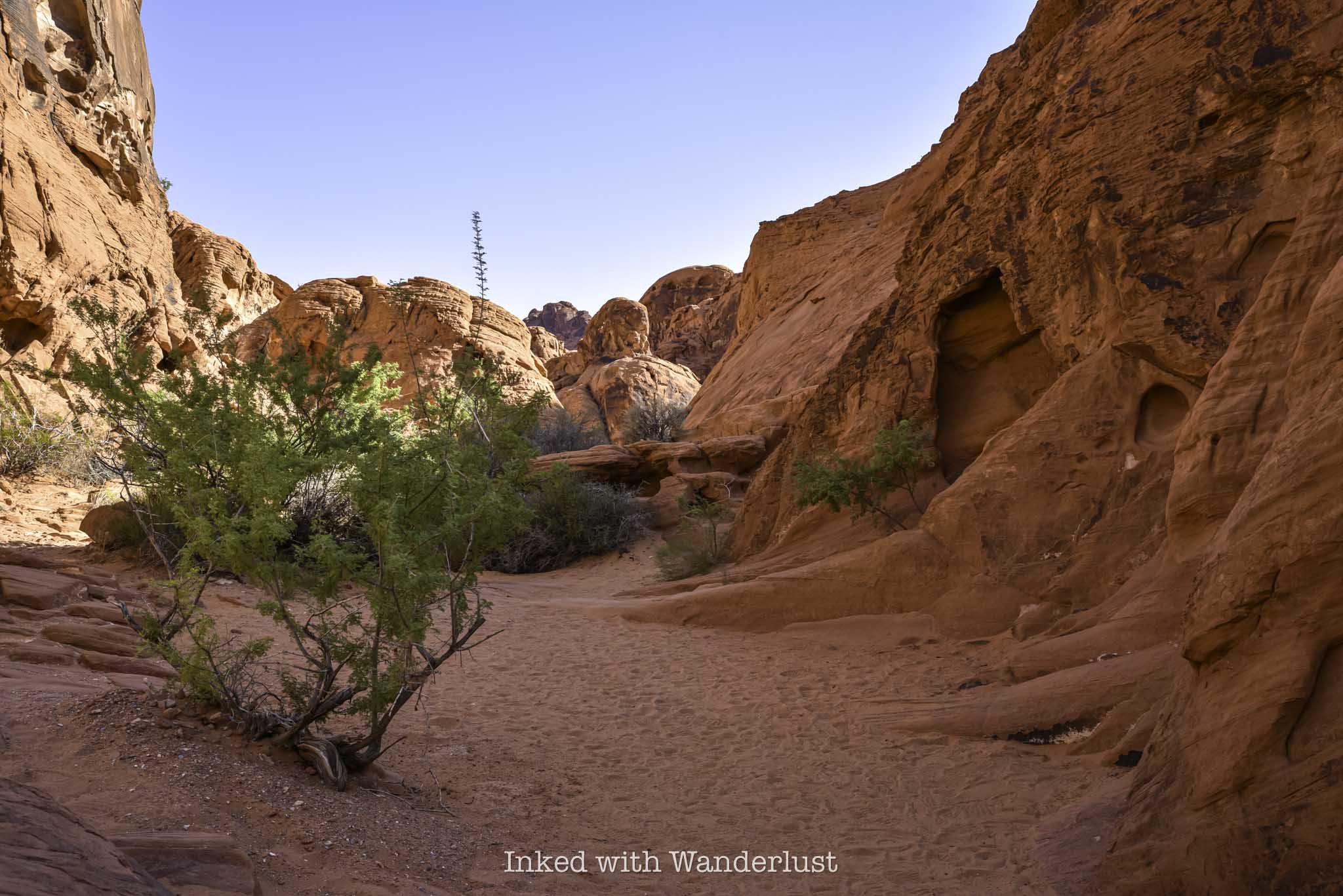
However, if you can, I recommend doing the entire trail. It is rocky, but only at certain points and is easily navigable, in my opinion. You’ll go right at the trailhead and the first feature you’ll see are petroglyphs on multiple rocks.
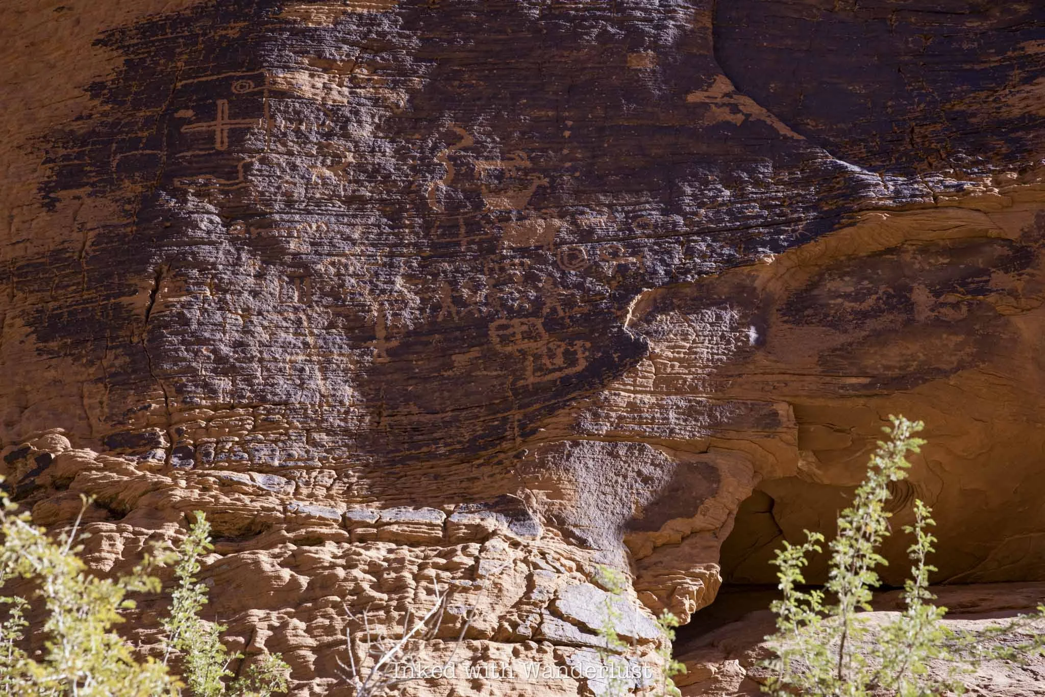
Petroglyphs

Your guide will explain the history of petroglyphs in the area and what ancient Indians may have been trying to convey with them. You’ll find many more at nearby Grimes Point, which I highly suggest stopping there after the tour.

From here, you’ll continue up the trail. Feel free to take your time and stop to take as many pictures as you want. The tour guide was good about waiting for everyone to get the next point before speaking.
Picnic Cave
The next stop on the Hidden Cave trail is another cave called Picnic Cave. This cave isn’t closed off like Hidden Cave is and you can visit it anytime you like, with or without a tour guide.
The best feature of this cave is the large amount of tufa formations around the entrance and roof. If you don’t know, tufa is a porous sedimentary rock composed of calcium carbonate or silica, and is formed under water.


In this case, the tufa in this area formed when Lake Lahontan covered this entire region. Keep in mind, Hidden Cave is at 6,700 feet elevation. Picnic Cave isn’t much lower. Literally all of this was submerged at one point.
Another great example of tufa formations is a couple hours away in Lee Vining, California, at the Mono Lake Tufa Natural Reserve. However, the examples here are more in abundance, covering nearly the entire cliffs and mountainsides around you.
A Quick Rest with a Great View

After Picnic Cave, it’ll be an uphill slog until you reach the entrance to Hidden Cave. Due to this, the tour guide will stop the group a couple times to allow time for rest. At the second stop, you’ll have a commanding view of what was once marsh land.
Take a look around you when you’re up here. You’re at around 6,500 feet elevation at this point. You’ll notice the cliffs above you that are easily 7,000 feet and up with more tufa formations on them.
Remember, tufa only forms under water with the right amount of minerals. Photos can’t do it justice, but getting that perspective from here really shows just how massive and deep Lake Lahontan was.
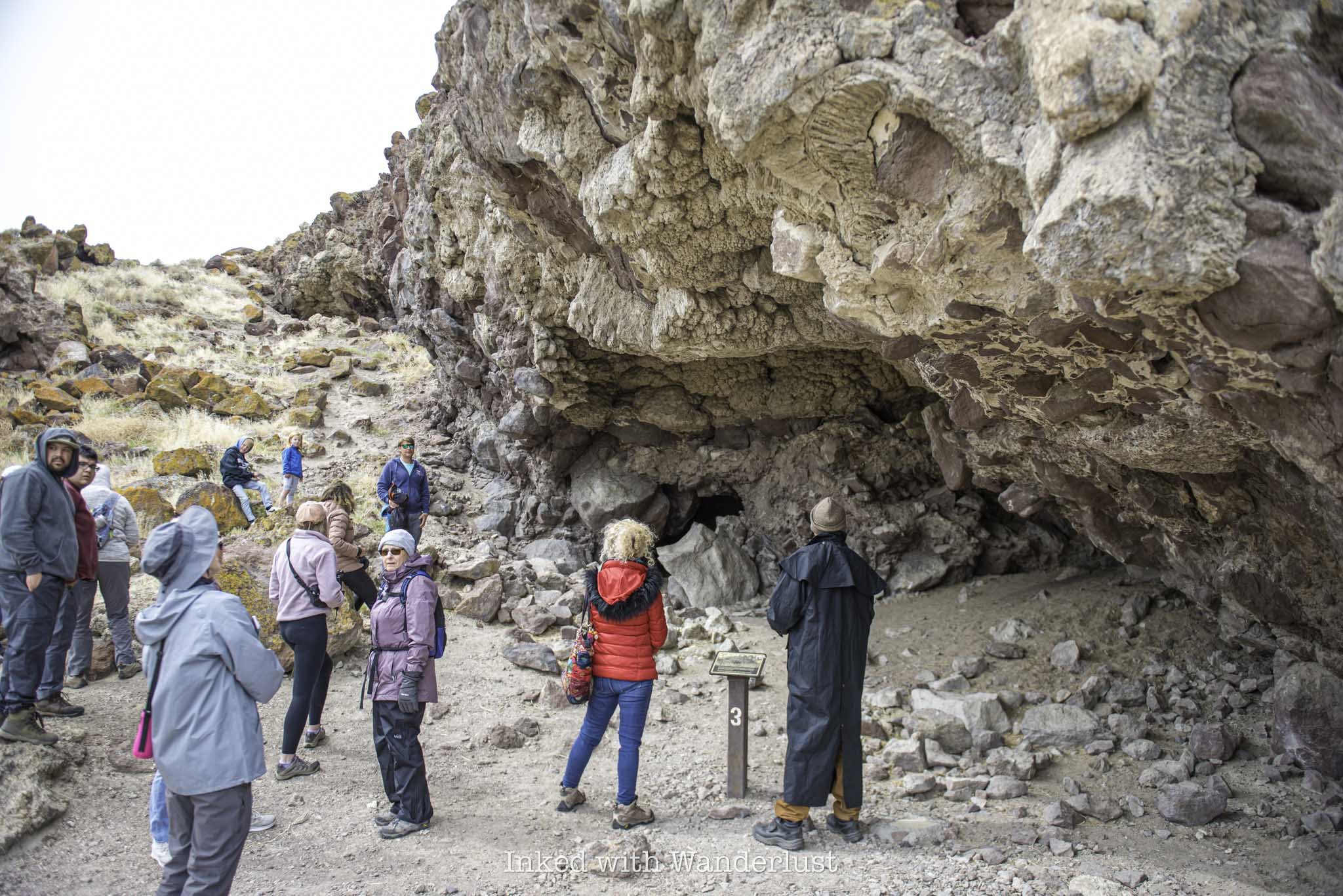
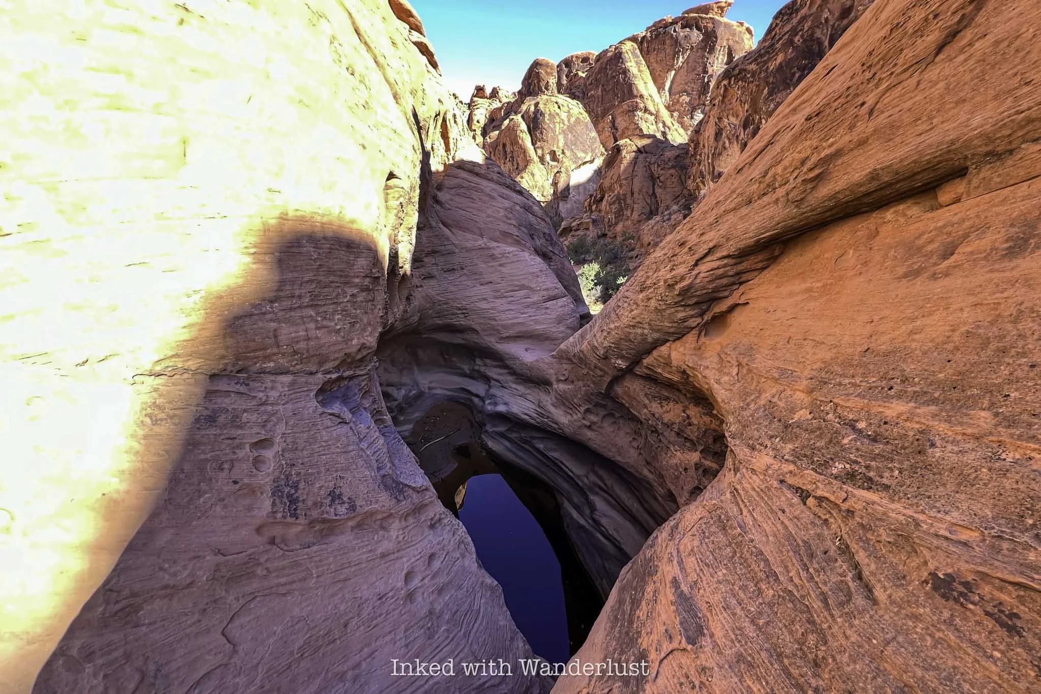
Hidden Cave

After a brief rest, the group will continue up another incline until you reach the entrance to Hidden Cave. The entrance is small, requiring all but small children to crotch down to get through it.
For context, I’m 5’9 and I had get down pretty low to get in. For anyone six feet or taller, I would imagine this being challenging for them. When you get through the entrance, keep your head down for a few feet as there are low-hanging rocks.

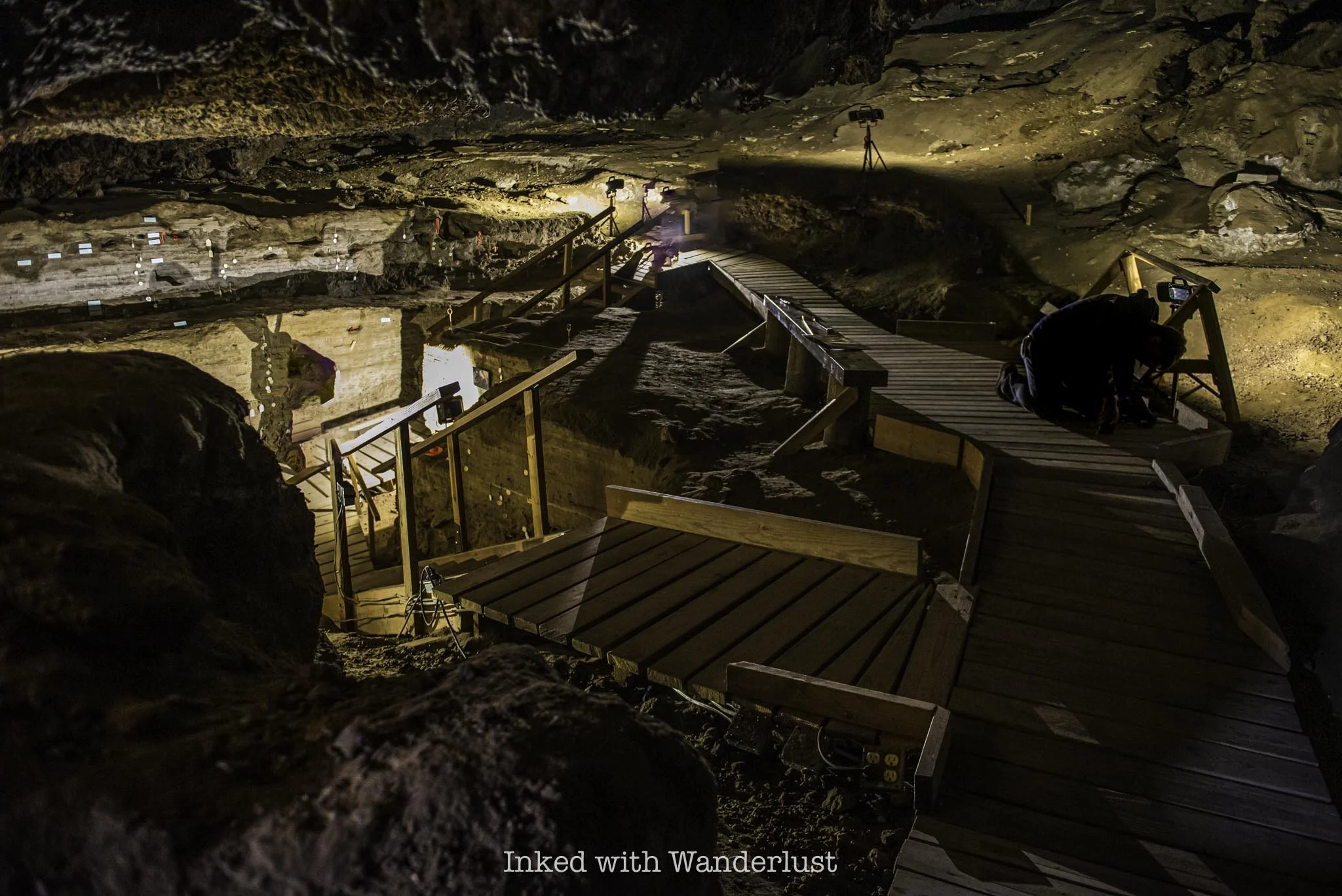
Once you get past the first few feet, you’ll arrive to an open chamber on a wooden boardwalk. As you can see in the photo above, you’ll be able to fully stand once inside, no matter your height.
In the video at the museum, it was stated you could fit two NBA-sized courts in the cave and have room for spectators on the side. I’m not so convinced of that, as it didn’t appear to be that roomy. It was still impressive, though.

The amount of walkable space on the boardwalks is small and you cannot walk on the cave floor at all. So if you’re part of large or even semi-large group (like I was), it can be tough to navigate.
Once folks start leaving, though, you’ll have more elbow room to explore. My tour guide said he would stay for as long as anyone wanted to explore, so there was no rush. I simply waited for most of the group to leave to look around.


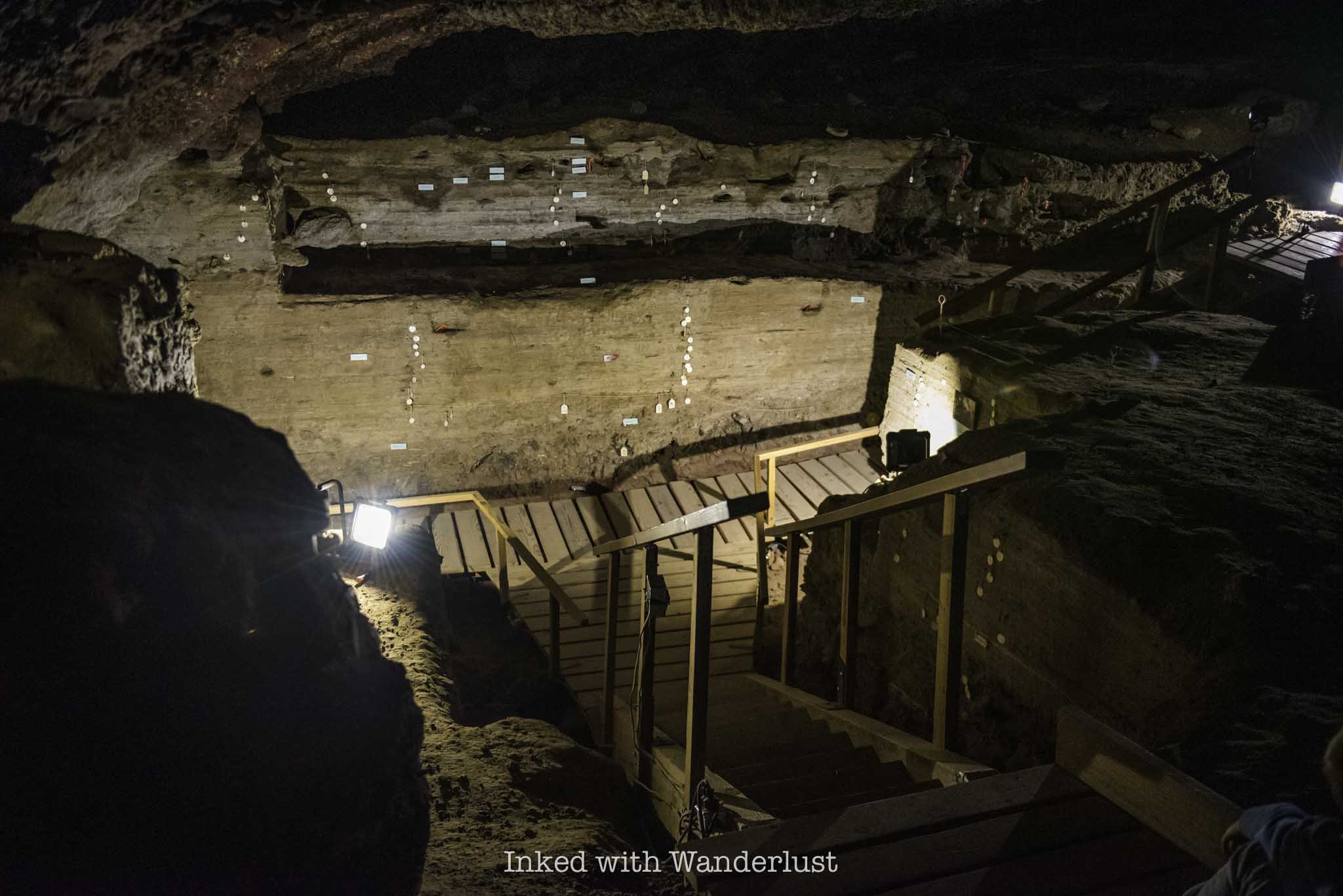
On the walls in the lower portion of the cave are markers. Some mark the age of each layer of rock you’re looking at and others indicate where certain animal fossils were found and their age.
Spend some time looking at these markers and getting photos, then make your way out of the cave. The entrance is also the exit. From here, the tour is over and you’re free to explore on your own.
Side Quest - Burnt Cave

When the tour was over, our guide tipped me off to another cave to check out that also had pictographs on the walls. To get there, head back down the trail until you reach the junction you see in the photo above.
Going right (where you just came from) will take you back to Hidden Cave. Take the trail on the left. You’ll start winding your way back down the mountain and see more examples of tufa formations and dramatic cliffs on the way.

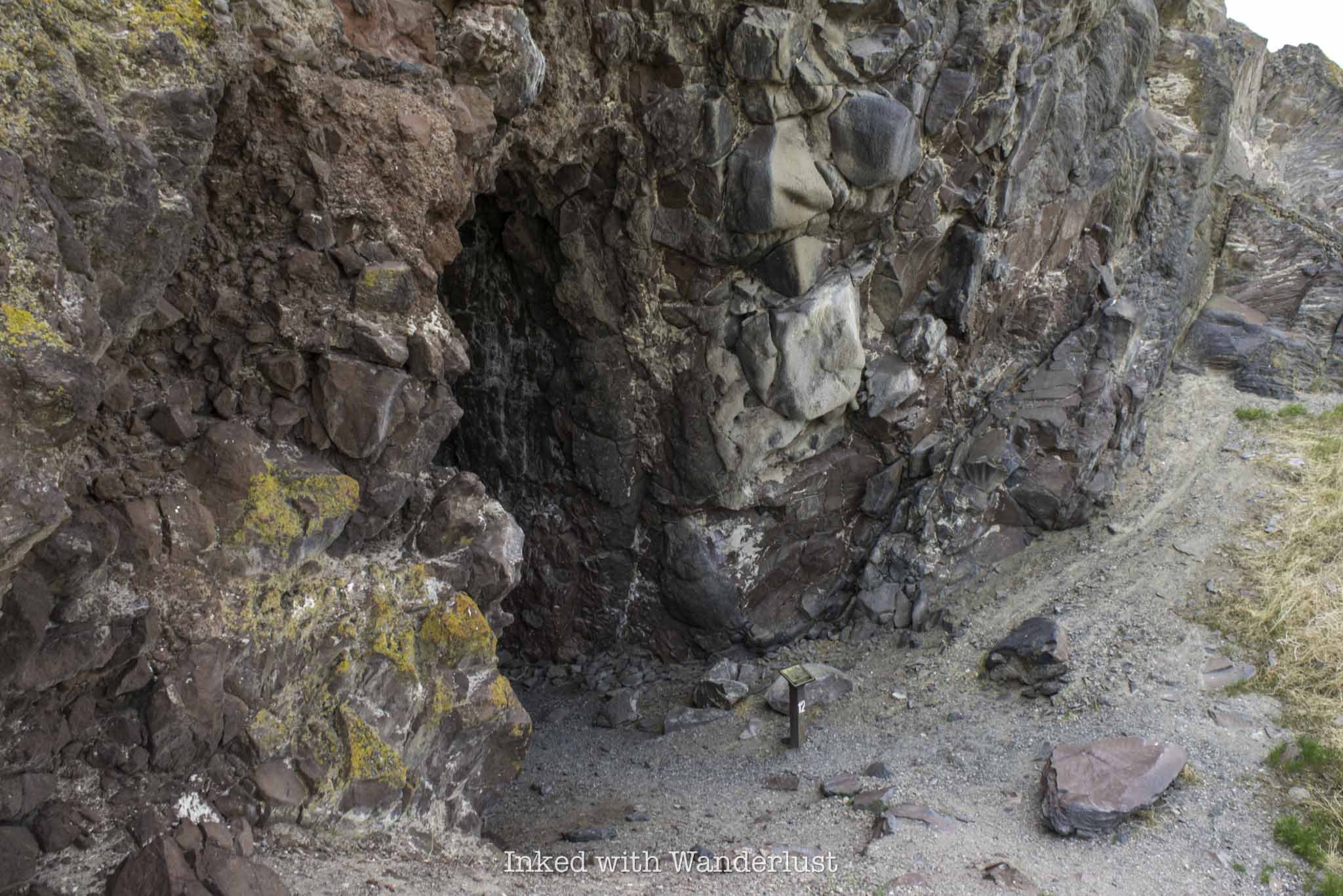
After about a quarter-mile, at trail marker twelve, you’ll see a series of wooden steps leading up an incline. When you get to the top, Burnt Cave will come into view. It’s more an indent into the mountain than a cave, but still cool to see.
This cave was excavated in 1971. Looking at the cave, you’ll notice the red pictographs that were unfortunately partially covered by modern vandalism. By the way, Hidden Cave is locked behind a gate now for that very reason. It was also vandalized back in 2014.
Go a little further up the trail to the other side of Burnt Cave to see even more tufa formations. The ones over here are even crazier than those at Picnic Cave. One almost looks like a mushroom-like formation.

The trail keeps going from here, but I didn’t go any further. To get back to your vehicle, simply head back down the trail. You won’t need to climb back up to Hidden Cave as the trail splits again towards the parking lot. Take a right at the junction to get there.
From here, I recommend driving down the road to Grimes Point and taking time to explore that. The amount of petroglyphs along that short trail is mind boggling. For places to eat, I recommend Pho, The Slanted Porch, and Middlegate Station.
If you’re on a road trip heading towards Interstate-80 east, you can make another stop at Lovelock Cave (near Lovelock) and Thunder Mountain Monument in Imlay. Heading towards Yerington? Consider stopping at Fort Churchill or hike the Wilson Canyon Loop.
JEREMIAH 29:11


Hike Petroglyph Canyon via Mouse’s Tank Trail in Valley of Fire
One such hike is Petroglyph Canyon via Mouse’s Tank Trail. It’s less than a mile (0.7 mile, to be exact) roundtrip along relatively flat…
Disclosure: This post contains affiliate links. If you make a purchase through these links, I may earn a small commission at no additional cost to you. I only recommend products or services that I believe will add value to my readers.

Valley of Fire State Park in Southern Nevada is a recreational paradise and escape from the noise and chaos of the Las Vegas Strip. In fact, it’s only a one hour drive (or less) from Vegas!
The park is chock-full of shorter hikes, giving families with small children and those who’re less experienced a chance to witness epic landscapes, mind-boggling geology, and a serene environment.
One such hike is Petroglyph Canyon via Mouse’s Tank Trail. It’s less than a mile (0.7 mile, to be exact) roundtrip along relatively flat and sandy ground through a canyon dotted with hundreds of ancient petroglyphs.
What are petroglyphs, you ask? Petroglyphs are images created by carving, etching, or scraping designs into rock surfaces. This form of rock art is often associated with Native American tribes. Which is the case here.
The petroglyphs in this canyon, much like at nearby Atlatl Rock, are believed to be between 2,000 and 4,000 years old and are associated with the Basketmaker and Early Pueblo cultures.
So what can you expect on this hike? Where in the park is it located? Is it worth it? I answer all of these questions and more in the post below. Let’s get into it!
At A Glance…
Location: Valley of Fire State Park
Fee: Standard park day-use fee
Open: Year-round
For: Hikers and families
Cell Service: None
Restroom: At the trailhead
Parking: Large gravel/dirt lot
EV Stations: None
Difficulty: Easy
Popularity: Moderate
Trail Condition: Easy to follow / soft sand
Elevation: 2,024 feet
Stoller Friendly: No
Kid Friendly: Yes
Mileage: 0.7 mile, out and back
Features: Ancient petroglyphs, visually striking rock formations, and natural water basin
Best Viewed: Spring and fall months
Pets: Allowed on leash
Drones: Prohibited
Hazards: Sun exposure and extreme heat (especially in the summer months), potential wildlife encounters
My Visit(s): August 2023 and November 2024
Petroglyph Canyon Trailhead and Parking

The parking lot and trailhead for Mouse’s Tank Trail is located just off of the park’s infamous Mouse’s Tank Road. To get there, you’ll need to drive through either the west or east entrance on the Valley of Fire Scenic Byway and make your way to the visitor center.
Once there, continue up Mouse’s Tank Road for just over a mile, at which point the parking lot for Mouse’s Tank Trail will be on your right. The parking lot is of the dirt/gravel variety and is rather large. There are restrooms here.


The official trailhead is just to the left of the restroom. Keep in mind that while this trail is open year-round, the extreme heat of the summer at Valley of Fire can make this otherwise easy hike a potentially dangerous one.
If you are here in the summer, it might be a good idea to do this one in the morning or later in the evening, as the canyon walls provide a decent amount of shade from the sun at these times.
Petroglyph Canyon

The trail begins via a short descent into the mouth of the canyon on a paved ramp. At the end said ramp, you’ll be hiking on soft sand, which will continue throughout the remainder of your hike.
After a short distance, you’ll soon be surrounded by those reddish/orange rock canyon walls Valley of Fire is famous for. There isn’t much in the way of trees or greenery, just the usual desert brush.

The petroglyphs start popping up almost immediately. There are no signs pointing the way and they’re fairly easy to miss if you’re not paying attention. That said, they’re literally all over the canyon walls.
The first set of petroglyphs I spotted were just a few minutes into the hike. When you come to the sign in the photo above, look for an unmarked path on your left (right about where my Dad is standing in the photo).

Facing that unmarked path, you’ll notice a large rock in front of you and on the left side of that rock you’ll notice what looks like a large burn mark. That’s actually patina and in that patina is where you’ll find petroglyphs.


This is the largest concentration of petroglyphs on one rock that I’ve seen on this trail. The patina-heavy area of the rock is literally covered in them. I wasn’t able to spot any more in the area, but that doesn’t mean they’re not there.
Continue down the trail and keep your eyes peeled for patina on the canyon walls. Whenever you see patina, there will likely be petroglyphs there. However, there are some on non-patina’d rocks as well, so look out for those.


Before long, you’ll come upon a sign stacked onto a pile of stones pointing left, indicating the end of the trail. Turn left here and walk for about 100 feet to a natural basin of water, otherwise known as the “Mouse Tank”.

The “Mouse Tank” is a natural feature in the rocks that collects water after rainfall. It forms a natural basin where water collects. There are a few of these in the park, but this one is named for an Indian outlaw who hid out in this area named, Little Mouse (more on him momentarily).
Walk down to the end of the trail to view the tank. There isn’t always water in it, and sometimes you’ll need to lean over a fair amount to see it. Watch your footing, as it wouldn’t be fun to fall into that…water or not.

In addition to the water tank, there are more petroglyphs in this area. Some are high up on the rocks, so they’ll be a bit difficult to see. There are plenty others at eye level as well, though.
Throughout this post, you may have been wondering why they named this trail “Mouse’s Tank”. It’s named for a Southern Paiute Indian outlaw by the name of “Little Mouse” who hid in this area after being accused of and wanted for a number of crimes.
The Story of Little Mouse - A Southern Indian Paiute Outlaw

It’s said that Little Mouse - or simply, Mouse - hid in this area of the park after being implicated in the murders of two white prospectors (among other crimes). A posse gathered to find him, but they weren’t as familiar with the area as he was.
Walking through Petroglyph Canyon reveals many potential hiding spots in the walls. Whether or not Little Mouse used any of these spots is up for debate, but the sheer possibility is fascinating.


Little Mouse managed to successfully evade capture by hiding in this canyon for several years, utilizing the tank at the end of the canyon as a water source. How exactly he did that without falling is beyond me.
The posse did end up catching up to Little Mouse, though several miles away from this location near the Muddy River. He was surrounded and killed by the posse. Little Mouse’s guilt of the murder of those prospectors was never fully proven.

I hope this post inspired you to hike Mouse’s Tank Trail and explore all of the petroglyphs. When you’re done here, there are many other hiking trails nearby I recommend. White Domes Loop, Fire Wave and Elephant Rock, just to name a few.
Additionally, you can read this post to see a full list of 10 short hikes in Valley of Fire that I recommend. Additionally, if you have extra days and want to see more petroglyphs, check out nearby Atlatl Rock and the historic Petroglyph Wall in Red Rock Canyon.

Titanic: The Artifact Exhibition in Las Vegas
Located on the second level promenade of the Luxor Hotel, the Titanic museum features dozens of real artifacts recovered from the Titanic’s wreckage…
Disclosure: This post contains affiliate links. If you make a purchase through these links, I may earn a small commission at no additional cost to you. I only recommend products or services that I believe will add value to my readers.
If you’re a fan of the Titanic and you’re planning a vacation to Las Vegas, you’ll want to make your way to the southern end of the strip and tour Titanic: The Artifact Exhibition.
Located on the second level promenade of the Luxor Hotel, this Las Vegas museum features dozens of real artifacts recovered from the Titanic’s wreckage site, 2.5 miles below the surface of the Atlantic Ocean.
The museum’s most famous artifact, the “Big Piece”, is an actual section of the Titanic’s hull, formally located near the center of the ocean liner. It hangs in one of the final rooms of the museum, along with several other displayed pieces.

If you’re not aware, Titanic, formally referred to as the, “Unsinkable Ship”, indeed sunk during its maiden voyage across the Atlantic after striking a rouge iceberg. More than 1500 people lost their lives either during the sinking or by freezing to death in the bitterly cold water.
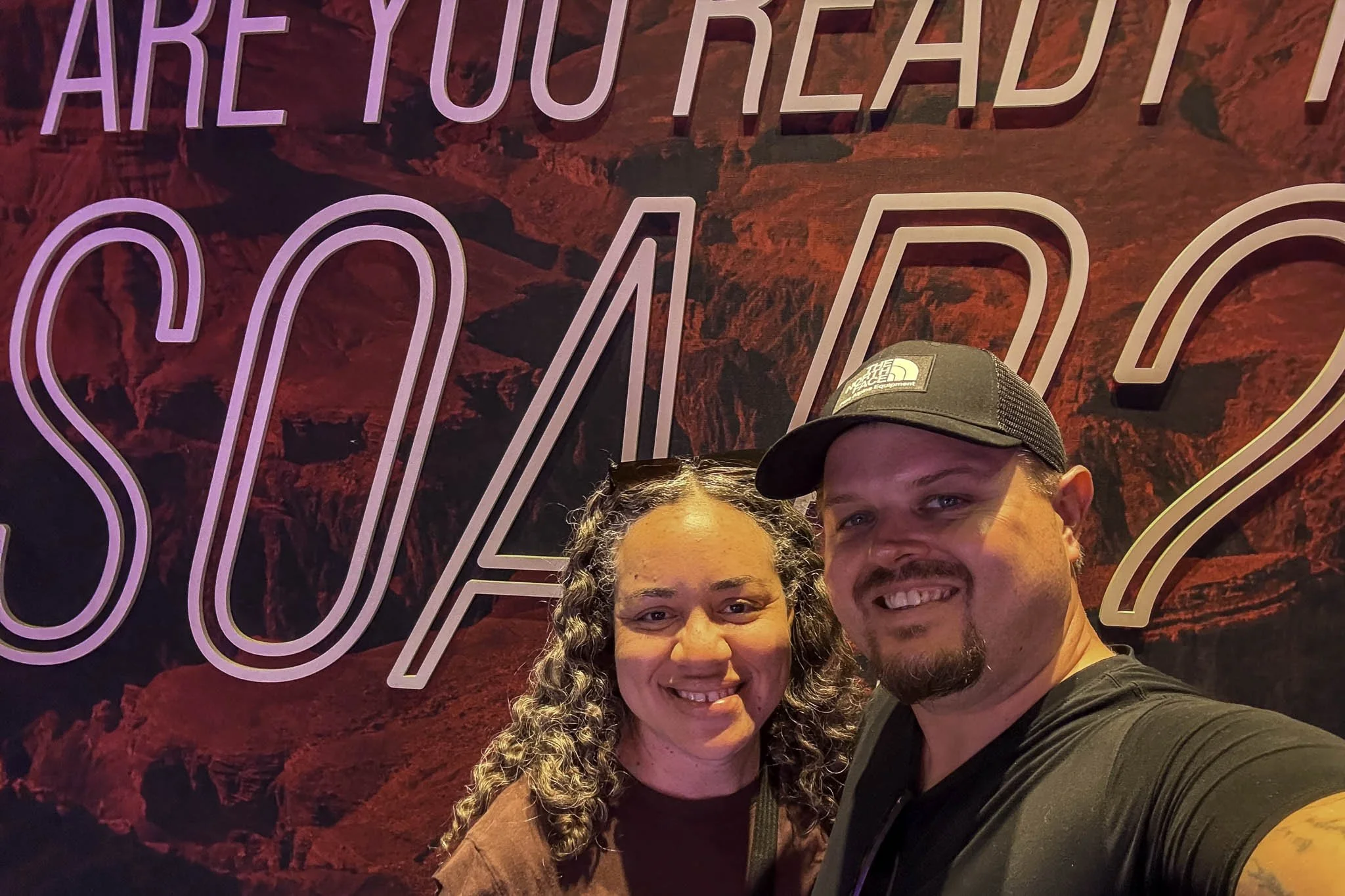
As a long-time Titanic aficionado, I’ve always wanted to tour this museum and see the artifacts for myself. I did so recently, along with my Dad, and it was a somber, yet epic experience. In this post, I’ll discuss what it costs, where to find it, what to expect during the tour, the museum rules, and more.
Quick Stats
Location: Inside the Luxor Hotel in Las Vegas
Fee: $27 - $34 per person
Open: Seven days a week, even on holidays
Family Friendly: Yes
Cell Service: Yes
Restroom: Outside the museum
Parking: Paid parking at the Luxor
EV Stations: Yes
Popularity: Moderate
Features: Numerous artifacts recovered from the wreckage site
Pets: Not allowed
Cameras: Allowed, but a few off-limit areas (explanation below) and no video or live feeds
My Visit(s): November 2024
Titanic Exhibit Las Vegas Price, Location & Hours

To find the Titanic museum, you’ll need to make your way to the Luxor Hotel, which is the big black pyramid-shaped hotel on the southern end of the strip. Trust me, you can’t miss it. There’s plenty of parking available, though you’ll likely have to pay.
Current parking rates are $18 to $40, dependent on where and when you park. If you’re a Nevada resident, you can get free parking for three hours by showing the attendant your Nevada drivers license. If you’re an MGM Rewards member with a ranking of Pearl or higher, you’ll receive free self-parking. Otherwise, you’ll have to pay.
Once inside the Luxor, take the escalators to the second level promenade. This is where you’ll find the Titanic museum, Bodies exhibition, restaurants, and more. The escalators are located to the right of the giant Egyptian statues and across from the check-in desk.

When you get to the second level, you should have no problem spotting the museum’s entrance. Look to your right and you’ll spot a giant, billboard-like sign with a huge mural of the Titanic indicating the correct spot.
To the right of this sign is where the ticket booth is. If you’ve purchased your tickets online, simply get in the queue and they’ll scan your phone. If not, head to the ticket booth first. Ticket prices to the Titanic Artifact Exhibition are currently:
$34 - General Admission
$32 - Seniors (65+)
$27 - Military (w/ ID)
$27 - Nevada Residents (w/ ID)
$26 - Child (4 - 12)
$0 - Child (0 - 3)
Additionally, you can purchase combo tickets, which include access to the Titanic Artifact Exhibition and Bodies..The Exhibition. The combo tickets are only available at the booth. My Dad and I passed on “Bodies”, but if you’re interested, combo ticket prices are $44 for adults and $38 for children.
Also, you can opt for the recording device for an additional $5. It includes headphones and a narrator who guides you through the museum, explaining things along the way. It’s not a requirement, though, as there’s plenty of signage you can read in the museum.
Titanic Artifact Exhibition Photography Rules

Photo copyright - Titanic Artifact Exhibition, Las Vegas, Nevada
To answer the question on if cameras are allowed in the museum, the answer is “yes”, but with a few caveats. For starters, you are allowed to bring your cell phone and/or DSLR to capture photos of the exhibits. However, there’s no video and/or live streaming allowed.
The only area inside the museum “off-limits” to photos is the replica of the Grand Staircase. I put “off-limits” in quotations because it’s only “off-limits” to your camera. The only way to get a photo of or with the staircase is through their photographer, and you’ll have to pay for it. No, the photographer won’t take your picture with your camera.
Turning to commentary, I never participate in these, as I view them as cash grabs for something that should be included with the money you’ve already spent. Conveniently, they don’t advise you of this until after you’ve purchased your ticket. I declined the employee’s request to take my photo and continued on. If you want your photo here, though, they’ll happily oblige.
Titanic: The Artifact Exhibition in Las Vegas

After they’ve scanned your ticket, they’ll have you go through the obligatory photo opp, where one of their employees takes your photo in front of a giant green screen. At the conclusion of your tour, these photographs will be available to purchase.
Normally, when I do things like this on my own, I decline the photo and move on. However, my Dad was me and he actually had a great idea for photo of the two of us, so we opted to do it. If you don’t want to, simply advise the employee of such.

Additionally, you’ll be given a card that resembles a boarding pass. On the flip side of the pass will be the name and details of a real-life Titanic passenger. Hang on to this because at the end, you’ll discover the fate of that passenger.
The first room you’ll enter is lined with burnt-orange walls and features numerous artifacts from Titanic’s boiler room, as well as information about the doomed ship’s construction and the people who worked on it. You’ll then walk down a short hallway before turning into a re-creation of the third-class level of the ship.
Third-Class Level

Along the hallway, you’ll see signs with details on individual passengers. This will be a common theme throughout the museum that I thought was a great way to honor their memories. Learning how they ended up on the Titanic, some by pure chance, stirred up emotions at times.
At the end of the hallway, there’s a re-creation of a third-class passenger stateroom. It’s small, no bigger than a walk-in closet, and contains four bunk-style beds. It wasn’t uncommon for ships in this era to place complete strangers together in the same room.
Second-Class Level

In the next room, you’ll see recovered artifacts from the second-class level of the Titanic. The stark differences between third-class and second-class quickly becomes apparent just by looking at the dish ware. You won’t see a re-creation of any staterooms here, as they were starkly similar to first-class, which you’ll see up ahead.
One of the featured passengers you’ll learn about is the Laroche family. The Laroche’s initially booked a passage on the steamship France, however, due to that ships’ policy of not allowing children in the dining room, they were transferred to second-class accommodations on the Titanic. While his wife and children survived the sinking, unfortunately, Joseph Laroche did not.

After the second-class room, you’ll enter a white-walled hallway with a quote from the shipbuilder on the wall. At the end of this hallway through the exit on the right, you’ll come up on the museum’s replica of the grand staircase.
As mentioned above, there are no photos or video allowed here, unless their employee does it. There are also two or three artifacts on display in this room but unless you’re wanting to take the photo, bypass the queue and head straight into the first-class room.
First-Class Level

In the first-class room, opulence is the name of the game. In the re-created first-class stateroom, you’ll immediately notice the size difference from its third-class counterpart. I didn’t measure, but it appears as though you could fit three or four third-class staterooms in just one first-class room.

One of the featured artifacts in this room is a gold-plated chandelier that once hung from the ceiling of the first-class men’s Smoking Room. Additionally, there’s a wall-sized display case showcasing many of the first-class dish ware and eating utensils recovered.
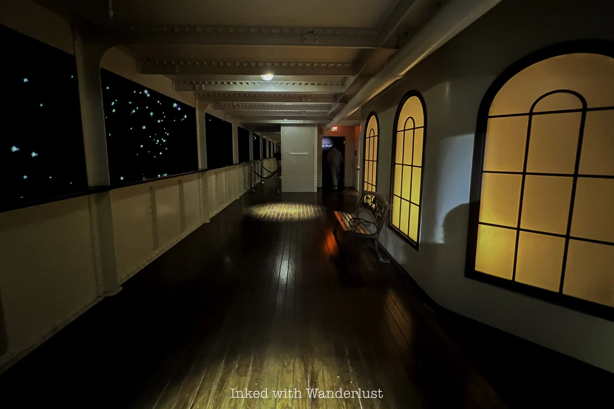
Beyond the first-class room, you’ll step out onto a re-creation of the outdoor promenade, complete with a view similar to what passengers would’ve seen that fateful night. Looking out beyond the guardrail, all passengers would’ve seen is pure darkness in the middle of the Atlantic.
After the promenade, you’ll enter a darkened, chilly room, meant to mimic the sound and feel of a windy evening on the ocean. On the wall to your immediate right are a few signs with the timestamped words of several iceberg warnings sent to the Titanic the day it sunk.
April 14, 1912 - The Fateful Day

Up to this point, you’ve been shown examples of the various levels of Titanic’s accommodations and amenities. No matter the class, the first four days of the ship’s maiden voyage had been nothing short of spectacular for her passengers. Marking what should’ve been a happy memory for all.
However, the evening of that fourth (and final) day would warp feelings of happiness and excitement into those of horror and panic. Shortly before midnight on April 14, 1912, Titanic struck an iceberg, forever changing the course of its brief history.
The next series of rooms are dedicated to the events between the collision and the ship’s eventual sinking. Despite Titanic’s false reputation as unsinkable, it took less than three hours from the time it struck the iceberg to smash into the ocean floor.
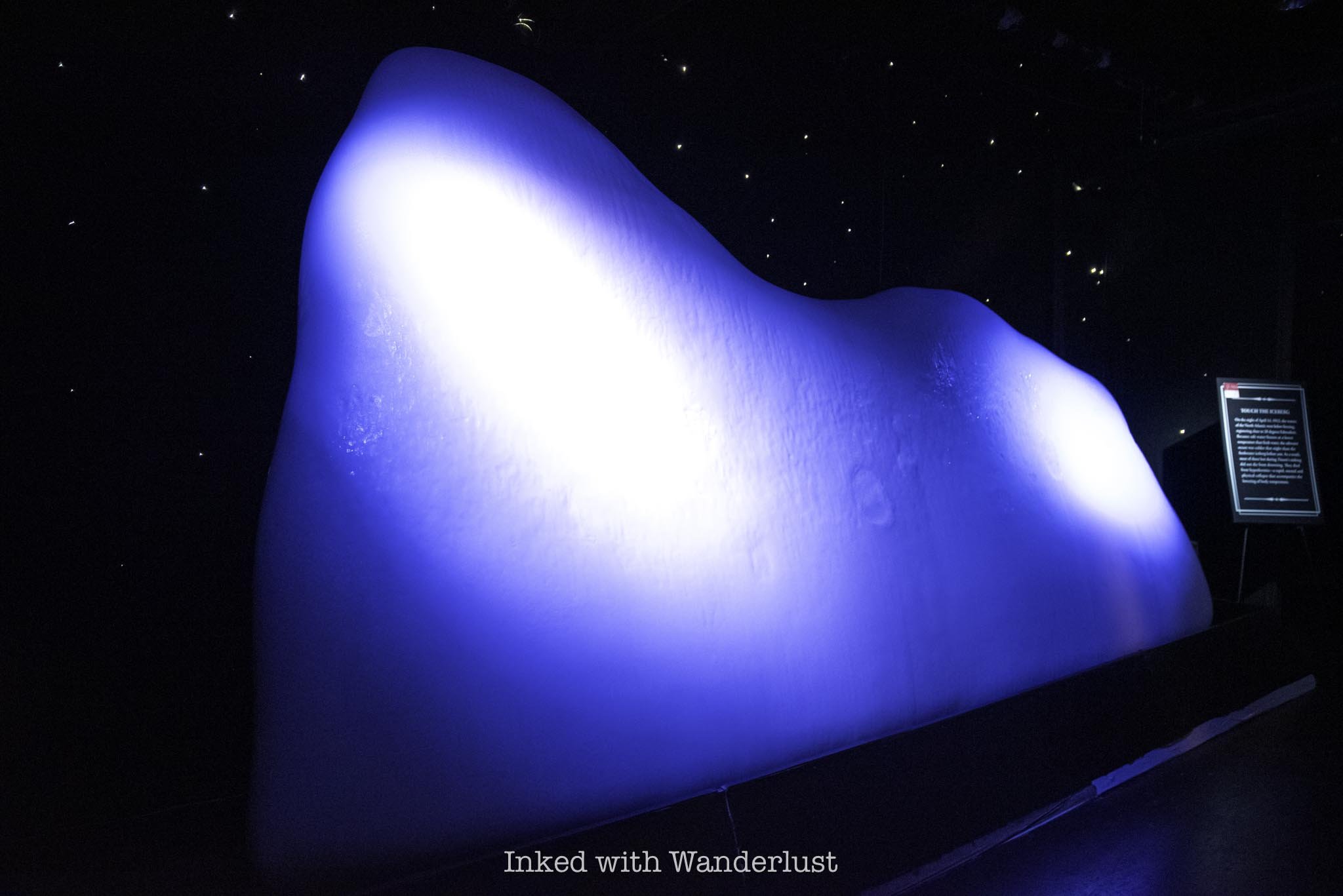
In one of the rooms, the main attraction is an example of an iceberg made of actual ice, maintained at a temperature similar to the stinging cold of the water passengers experienced when they jumped in to escape, or worse yet, unexpectedly fell into.
Unlike the other exhibits, you’re allowed to touch it. In fact, they encourage you to do so in order to get an idea of what passengers went through. It was so cold, I could only keep my hand pressed against it momentarily. Knowing the water that night was even colder than that really put things into perspective.

You’ll then walk down a dark hallway, illuminated by several display cases, each showcasing a single artifact. At the end of that hallway, you’ll enter another room. This one features several more artifacts, such as a few dozen au gratin dishes.
These dishes were discovered stacked neatly together in the sand, much like they appeared in the case. This happened when the cabinet they were stored in remained intact after hitting the ocean floor, but rotted away over the years, leaving the dishes almost perfectly in place.

Another featured display in the same room is a scale-sized model of the bow (front) half of Titanic as it appears on the ocean floor. During the sinking, Titanic was going down by the bow but before going near vertical, the stern (back) split, leaving the two halves only loosely connected.
After the split, the stern crashed back into the water, before being lifted again by the still sinking bow. This time, the ship went completely vertical. The bow, now completely submerged, broke free of the stern and began its descent. The stern would bob around momentarily before it too sunk.
This left the Titanic with two wreck sites 2,000 feet (600 meters) apart, roughly 12,500 feet (or nearly 2.5 miles) beneath the surface. At some point, a sizable chunk of the ship’s hull would break off and eventually, would go on to become the largest piece of the Titanic ever recovered.
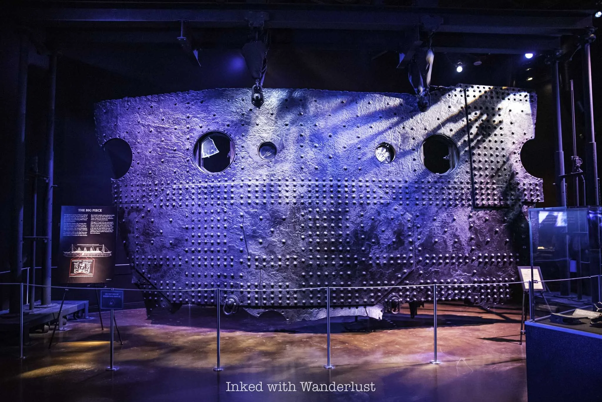
The Big Piece
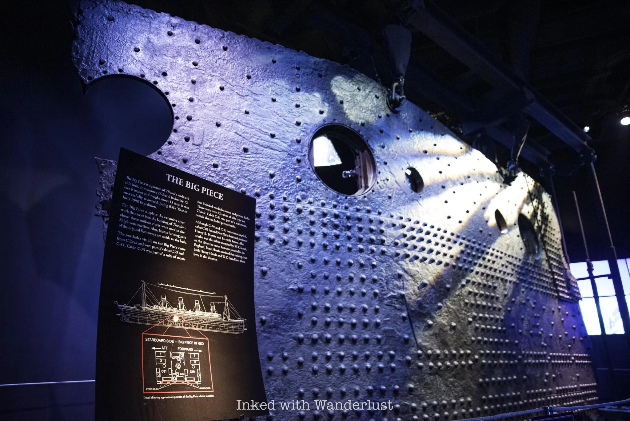
First discovered in 1994, nine years after Titanic’s wreck site was first discovered, the Big Piece was brought to the surface in 1998 after several failed attempts, with the intention of making it the centerpiece for a planned exhibition.
The piece, formally located around the mid-point of Titanic’s starboard side hull, weighs fifteen tons and is twenty-six feet, six inches across and twelve feet, six inches high. The extensiveness of the rivet work is on full display, showing a mere fraction of the three million rivets used to build the Titanic.

The portholes on the Big Piece came from C deck and were part of cabins C-79 and C-81, both of which were suites (presumably second class). Both of these suites were unoccupied but the neighboring suite, C-83, was occupied by Henry B. Harris, a famous New York theatre producer. He did not survive the sinking.
To date, the Big Piece is the largest artifact ever recovered from Titanic’s wreck site. Given the quickly deteriorating state of the ship, it’ll likely remain as such. Due to strong currents and rust-eating bacteria, it is estimated that the Titanic will completely collapse by 2030.
Titanic’s Death Toll

In the final exhibit room will be a giant wall-sized display. On this display will be the names of every Titanic passenger and crew member, separated by class and whether or not they survived. As you can see in the photo above, Titanic’s crew suffered the greatest loss with 701 perishing. Interestingly, they also had the most survivors at 209.
Of the passengers, third-class suffered the greatest loss at 529, with only 181 surviving. In stark contrast, the overwhelming majority of the Titanic’s first-class passengers survived, with about 200 surviving and 125 perishing, most of those being men. This was largely due to the “women and children first” rule of the time.
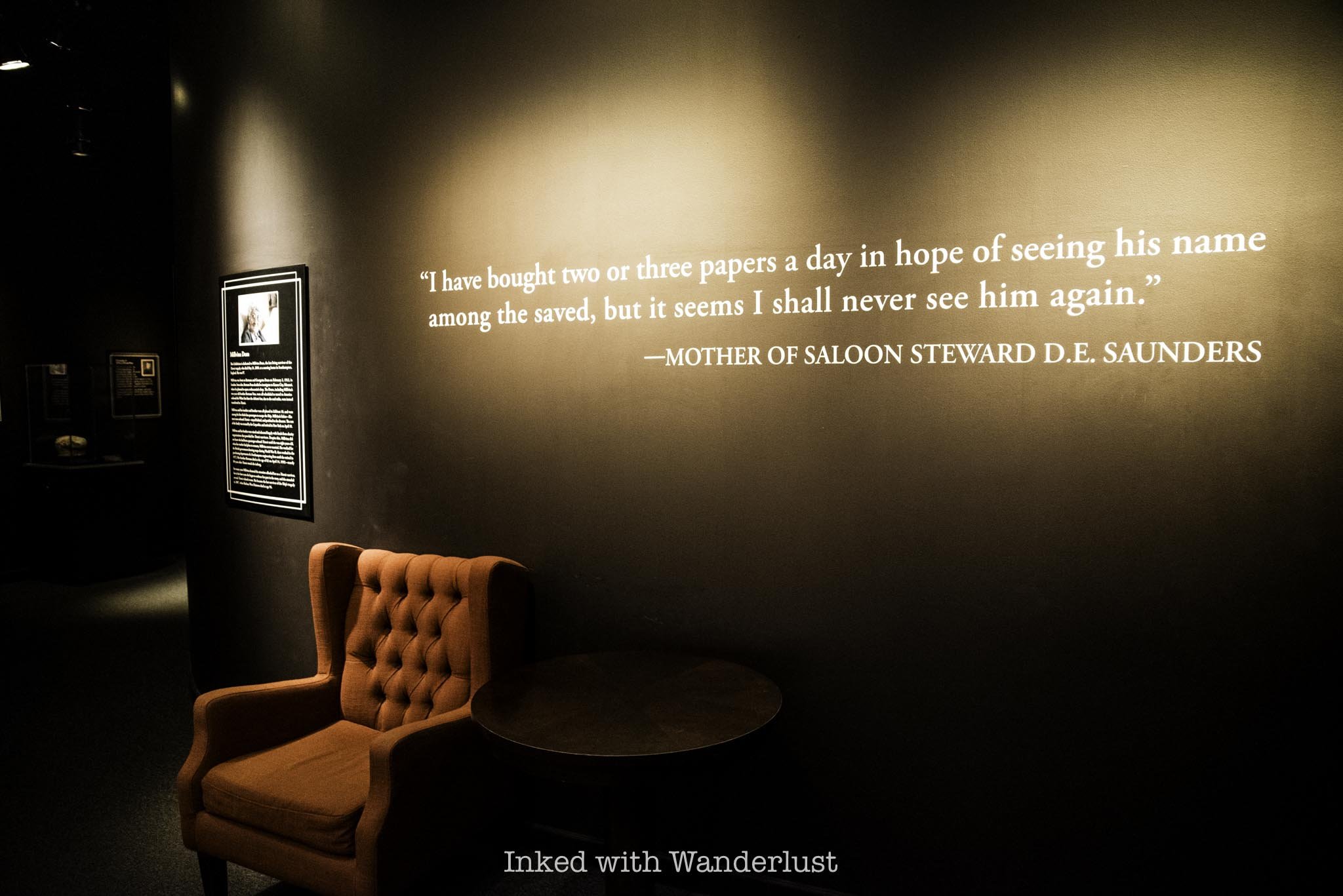
Remember the “boarding pass” you’re given at the start of your tour with a passenger’s name on it? Here is where you’ll scan the back of it to discover the fate of your passenger. Mine was a man named Johannes Joseph Van de Velde, a native of Belgium.

Not much is known about him, but we do know he did not survive. We only know this because a survivor named Theodor De Mulder visited Johannes’ family and relayed to them the final days he spent with him.
While the exact number varies, it is believed that over 1,500 passengers and crew lost their lives in the early morning hours of April 15, 1912. Many, including the ship’s captain, went down with the ship, but the vast majority was due to drowning or freezing to death in the icy Atlantic waters.
Perhaps the largest contribution to the high death toll was an insufficient amount of life boats. Titanic had only twenty, capable of holding only 1,178 of the 2,240 passengers and crew, if filled to capacity (and none of them were).
Of the 1500 victims, most were third-class passengers and/or men, as well as crew. As mentioned above, Captain Smith was thought to have given the order of “women and children” first.
It is now believed that first officers mistook this as, “no men until all women and children are off the ship”. Consequently, the lifeboats were lowered with plenty of room available, some at just half capacity.
Additionally, many third-class passengers were largely prevented access to top deck, where the lifeboats were located, to allow the wealthier passengers to board them first. This delay meant that many in third-class were doomed from the start. May they all rest in peace.
PSALM 23:3-4

7 Historical Sites in Genoa You Should Explore
The small community of Genoa, Nevada, set in the beautiful Carson Valley, is one of, if not the, most historically significant sites in the state...
Disclosure: This post contains affiliate links. If you make a purchase through these links, I may earn a small commission at no additional cost to you. I only recommend products or services that I believe will add value to my readers.

The small community of Genoa, Nevada, set in the beautiful Carson Valley, is one of, if not the most historically significant sites in the state. This is because the town was founded as the first pioneer settlement in Nevada in 1851, a whopping thirteen years before it even gained statehood.
This happened when the John Reese Party, a group of Mormons from Utah, emigrated to what was then an area within the territory of Utah to set up a trade post to sell much needed goods and services to pioneers before they begin the final, most challenging leg of their journey to riches in the gold-dense California mountains.
That trade post would eventually become what we know today as “Mormon Station”. Prior to Reese establishing his trade post, pioneers were forced to stock up at the former final trade post before California’s infamous Sierra Nevadas in Salt Lake City, a hearty 500 miles away. You can see how it became so popular and successful.

As time went on, and especially with Nevada completing its statehood campaign in 1864, more and more of the town began to develop with additional residents moving here to stake their own claims with varying businesses and accolades. Some of which would stand the test of time and remain to this day, though many aren’t operating as they did in the 1800’s and early 1900’s.
If you’re a fan of Nevada history, a visit to Genoa is a must. There are many historical sites within Genoa, Nevada itself that are worthy of your time and in this post, I will discuss and recommend seven of them, and provide some context as to their historical significance. Let’s get into it.
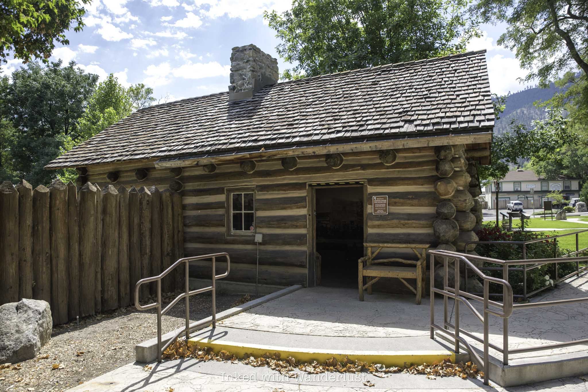
1) Mormon Station Historic State Park

We’ll begin with the most historically significant site in Genoa - Mormon Station Historic State Park. As stated above, this is the site where it all began for Genoa and no visit to this charming town would be complete without it.
You’ll find it on the corner of Genoa Lane and Jacks Valley Road shortly after driving into town. There’s ample (and free) parking and best of all, the exterior portion of the former stockade is free to explore, while the accompanying museum only charges a paltry $1 to enter.
The museum is small, but packed with historical items germane to the site and area. A few items include wooden skis used by Snowshoe Thompson to traverse the California mountains, actual makeshift escape keys used by prisoners of the jail, a burnt piece of log from the original stockade, and more. The museum’s structure is a replica of a cabin, similar to the one lived in by Mormon Station’s founder, John Reese.
Throughout the grounds, you’ll also see the original structures of a former blacksmith’s shop and chicken coop, as well as examples of pioneer-era wagons, tools, a memorial statue of Snowshoe Thompson, numerous informational boards detailing the area’s history, and more.
READ MORE: “Visit the Historic Mormon Station in Genoa”
2) Snowshoe Thompson’s Grave Site

John A. “Snowshoe” Thompson, also known as the, “Mailman of the Sierras”, was an important figure in mid-to-late 1800’s Genoa, Nevada. When no one else would (or even could) Thompson, without ever being formally compensated, delivered the mail over the Sierras between Genoa, Nevada and Placerville, California through the heavily snow-packed mountains, using nothing but homemade skis (known as “snowshoes” back then).
This journey took him an average of three days when traveling west to California, and about two days when going back to Nevada. He was uniquely skilled to complete this demanding task, as Thompson was a native of Norway, and traversing mountains in this manner came naturally to him. In fact, on one occasion, Thompson was credited for saving the life of a man who was stranded in this portion of the Sierras.
Thompson passed away on May 17, 1876 after a brief illness and was buried in what is now the historic Genoa cemetery, a half mile north of town, in a shared plot with his family. His grave has become a tourist attraction of sorts, with signs pointing the way as soon as you drive into the cemetery grounds. Fittingly, a plastic toy of a USPS truck remains at his tombstone, a subtle nod to his sacrifice and service to a community in need.
3) Genoa Bar - The Oldest Bar in Nevada

You may not be into bars, I’m not either, but there’s no way you can pass up the chance to enjoy a drink at the oldest bar in Nevada. Genoa Bar opened in 1853, not long after Genoa was first settled and a full eleven years before Nevada was granted statehood.
Many celebrities and dignitaries frequented this bar, including the likes of Mark Twain, Teddy Roosevelt, John Wayne, Raquel Welch, Snowshoe Thompson, and more. The interior walls are adorned in quirky items, such as buffalo heads, old photographs, bottle caps, paintings, and more.
They feature a menu consisting of specialty cocktails, including their world-famous Bloody Mary. However, they do have a full bar and can make you just about anything you’d want if you’d rather have something simpler. There’s no food service inside, but there’s usually a food truck parked outside during the peak travel season.
READ MORE: “Enjoy a Drink at Genoa Bar: The Oldest Bar in Nevada”
4) The Hanging Tree

The Hanging Tree in Genoa Nevada is a morbid, yet historically significant site. Known as the “blackest day in Nevada history”, it is where Adam Uber, a drifter from California, was hung after shooting and killing local teamster Hans Anderson during a drunken fight at a local bar (not Genoa Bar discussed above).
Uber was taken into custody and thrown in a jail cell at the Genoa Courthouse that night. However, locals weren’t happy with the way Uber’s trial was going and instead, decided to take matters into their own hands.
Roughly a week or so after the killing, a drunken mob of vigilantes stormed the jail in the middle of the night, removed Uber from his cell, marched him down what is now Genoa Lane, and strung him from the tree you see in the photo above. To ensure he was dead, a vigilante then shot Uber in the head.
Just prior to his hanging, Uber was said to have cursed those in the crowd for, “several generations”. This was rumored to have actually come to fruition, as those who took part in the hanging began to die in suspicious ways. In an effort to quell the curse, locals cut down the branch Uber was hung from. The tree, however, remains standing to this day and a plaque was placed near the stump of the cut branch.
5) David Walley’s Hot Springs Resort

In the late 1850’s, a young New Yorker by the name of David Walley came to Genoa to do what many came here to do - strike it rich. However, his luck didn’t come from the golden hills of California or the Comstock Lode in Virginia City, like it did for so many others. Instead, it came from the earth’s mantle just a mile and half from town.
While digging a tunnel nearby, Walley stumbled upon the hot springs. Once he took a dip and experienced the benefits of the springs for himself, he purchased the land and began charging folks fifty cents to experience it for themselves. Later, in the early 1860’s, an opulent 40-room resort hotel was built on the property, playing host to numerous celebrities and dignitaries over the years.
The property has had numerous owners throughout its history, including the current owner, IHG Resorts and Hotels. Today, a few original aspects of the resort remain, including one of the stone pools. Additional rooms and suites have been added, in addition to an on-site restaurant, 1862 Restaurant and Saloon. You can find rates and booking information here.
6) The Pink House

This Gothic Revival-style house was built in 1855 and was home to many Genoa families, the most notable of which include the Reese family, who were the founders of the original settlement. The most known resident, however, was Lillian Finnegan, who went on to found the annual Candy Dance festival.
Today, the former house serves as a restaurant, offering guests a variety of tasty dishes, including pizzas, burgers, sandwiches, steaks, and more. There’s plenty of seating throughout the property, including on the front porch, in the living room, and outside in the side yard.
There are a few notable places to eat in Genoa, but The Pink House is the only one listed on the National Register of Historic Places for its significance and importance to Genoa and Nevada as a whole. It’s a great place to eat after working up an appetite exploring the area.
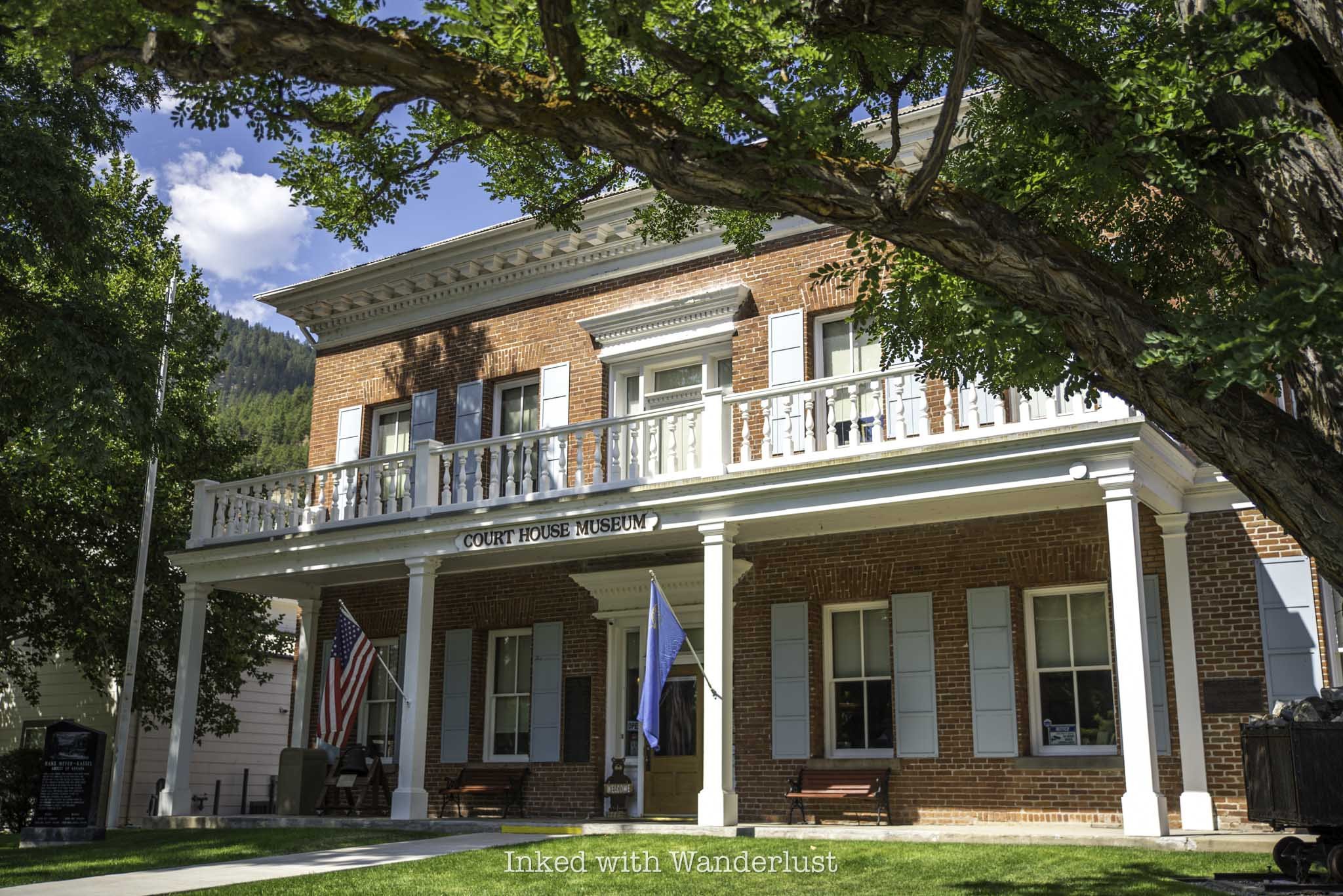
7) Genoa Courthouse Museum

In my opinion, one of the best things to do in Genoa, Nevada is exploring the many exhibits at the Genoa Courthouse Museum. It’s easy to get to as it’s right across the street from Mormon Station State Park and just down the street from The Pink House.
Entrance fees to the museum are minimal and include access to both levels. A few of the exhibits include a recreation of Snowshoe Thompson’s cabin with items actually owned by him, the refurbished Genoa courthouse, and the downstairs jail, with the original cells included.
In case you’re wondering, yes, one of the cells you’ll see here is where Adam Uber, the drifter from California discussed above, was taken from by the group of vigilantes and hung at the Hanging Tree. It was an eerie feeling stepping inside those cells.
I thoroughly enjoyed my time in the Genoa Courthouse and have no doubt you would as well. Keep in mind that they’re only open seasonally and even then, their hours are minimal. Check out my post about the Genoa Courthouse Museum for all of those details.
READ ALSO: “Step Back in Time at the Genoa Courthouse Museum”

Visit the Historic Mormon Station in Genoa
When searching for historic places in Nevada to visit, it doesn’t get much more historical than visiting the site of the first settlement in the state, Mormon Station Historic State...
Disclosure: This post contains affiliate links. If you make a purchase through these links, I may earn a small commission at no additional cost to you. I only recommend products or services that I believe will add value to my readers.

Mormon Station History
When searching for the best historic places in Nevada to visit, it doesn’t get much better than the site of the first settlement in the state, Mormon Station Historic State Park in the charming town of Genoa city, Nevada.
It was here in 1851 where the John Reese Party emigrated from Utah to construct the Mormon Station. While often referred to as a “fort”, it, in fact, never served as such. There was never a military presence, nor did any battles take place here.
Instead, it was actually a stockade, which is defined as an enclosure of walls built with logs placed vertically, side by side. Instead of cannons and officer’s quarters, you would often see grazing oxen, stable sheds, bails of hay, and a small vegetable garden. In addition to the stockade, John Reese also built a hotel and blacksmith shop near the stockade.

The purpose of the stockade was to house oxen and other farm animals, in hopes to sell them to other emigrants traversing the trail. Additionally, the stockade provided protection from thieves, as these animals were highly valuable, while also providing refuge in the event of an attack.
In addition to the stockade, John Reese and party cultivated about thirty acres of land and planted many fruits, vegetables, and grains. Many emigrants coming through were astounded to see fresh crops, as many claimed it was the first bit of cultivated land they’ve seen since leaving the Missouri River - a distance of nearly 2,000 miles!
Thanks to James Marshall and his discovery of gold in California in 1848, the rush was on, and Mormon Station served as an important supply stop for those braving the mighty Sierra Nevada Mountains with gold in their eyes. The station was badly needed as the final supply station prior to Mormon Station was in Salt Lake City, nearly 500 miles away.
Mormon Station Fees and Parking

Parking is both plentiful and free at Mormon Station Historic State Park. There’s a small gravel lot in front of the side entrance, just off of Genoa Lane. If this is full, additional parking can be found along Jacks Valley Road in front of the museum and/or the Snowshoe Thompson memorial statue.
If on the off-chance both of these areas are full, you can park across the street on either Genoa Lane or Jacks Valley Road, or in a small parking area adjacent to the Genoa Bar and Saloon. From the saloon, it’s a quick walk to the station.
The only fee you’ll have to pay is the meager price of $1 per person to enter the museum. Entry into the exterior portion of the station is free, though. So if all you want to do is walk the path and check out the displays, you can do so free of charge. Though I do recommend popping into the museum, as there is a lot to look at in there.
Mormon Station Exterior Path and Displays

The exterior pathway and its displays can be accessed from either side of the log-built wall, in addition to the main entrance adjacent to the museum. Again, access to this portion of the park is free. One thing to keep in mind is that, unfortunately, the station you see today isn’t original, but a replica.
In 1910, a massive fire ripped through Genoa city, Nevada, and destroyed many of the original structures in town. There wasn’t much left of the original station so in the late 1940’s, the replica was built in order to honor and help preserve what is essentially the birthplace of Nevada.
*Fun Fact: Nevada didn’t become a state until 1864, thirteen years after Mormon Station was built. Since Nevada became a state during the Civil War, it earned the moniker, “Battle Born State”

That shouldn’t stop you from visiting, though, as there are many artifacts on display that were used during that period, as well as those actually owned by John Reese and Snowshoe Thompson, Genoa’s mailman who traversed the Sierras using skis to deliver the mail between Genoa and Placerville, California.
The paved pathway within the log-built walls of the former trade post leads around the beautiful green grounds and features numerous informative boards that detail the history of both the station and the area. You’ll also see an example of a pioneer camp set up, a replica of a covered wagon, and a stagecoach used by pioneers.
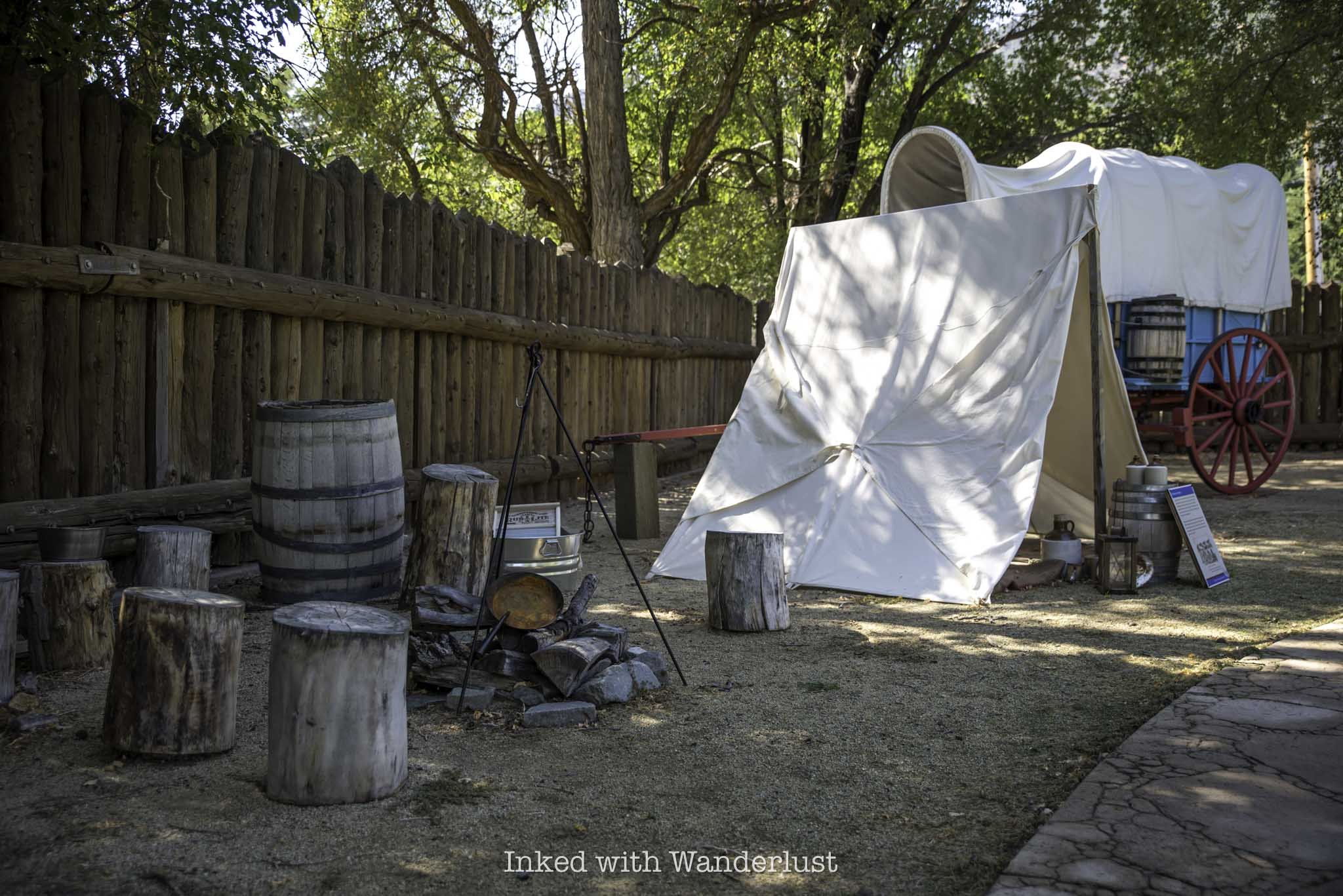

On the other side of the station in the wagon shed, near the official entrance closest to the museum, are more examples of wagons and tools used at the station and elsewhere. The wagon on the left side of the photo below was actually used to traverse the Sierra Nevada Mountains. You must see it in person to truly appreciate how hard the pioneers had it as it pertained to travel.

To continue to tour the grounds, keep on the paved pathway and walk beyond the walls towards the other side of the grounds. On that side is a historical home, that was built on the site once occupied by the hotel John Reese built, and an early 1900’s chicken coop and blacksmith’s shop.


This isn’t the blacksmith’s shop that John Reese built, rather it was built and owned by a man named, Nels Morrison, who in 1908 used material from the former White House Hotel, which sat on the site where the shop is now, to build the structure.
By the time Nel’s shop opened, the days of Genoa being a transportation hub for pioneers were finished. Instead of repairing wagons and stagecoaches, his work typically involved repairing a variety of farm machinery, horse shoeing, and forging branding irons.

As far as the exterior grounds area of the park is concerned, that’s about it as far as things to see. Once you’ve checked everything out, now would be a good time to head over to the Mormon Station Museum and explore the exhibits inside.
Mormon Station Museum
The Mormon Station museum is a near exact replica of the log cabin built and lived in by John Reese and his family. While the park itself is always open, the museum’s hours vary by day and season. They are:
May - September: 10am - 4pm, daily
October - April: 11am - 3pm, closed Tuesdays and Wednesdays
As stated above, the cost to enter the museum is only $1 per person and I highly encourage you to visit it. When you first walk inside, you’ll immediately see a full-size replica of Reese’s rock-built fireplace and next to it, the sole surviving piece of wood from the original stockade lost by the 1910 fire.

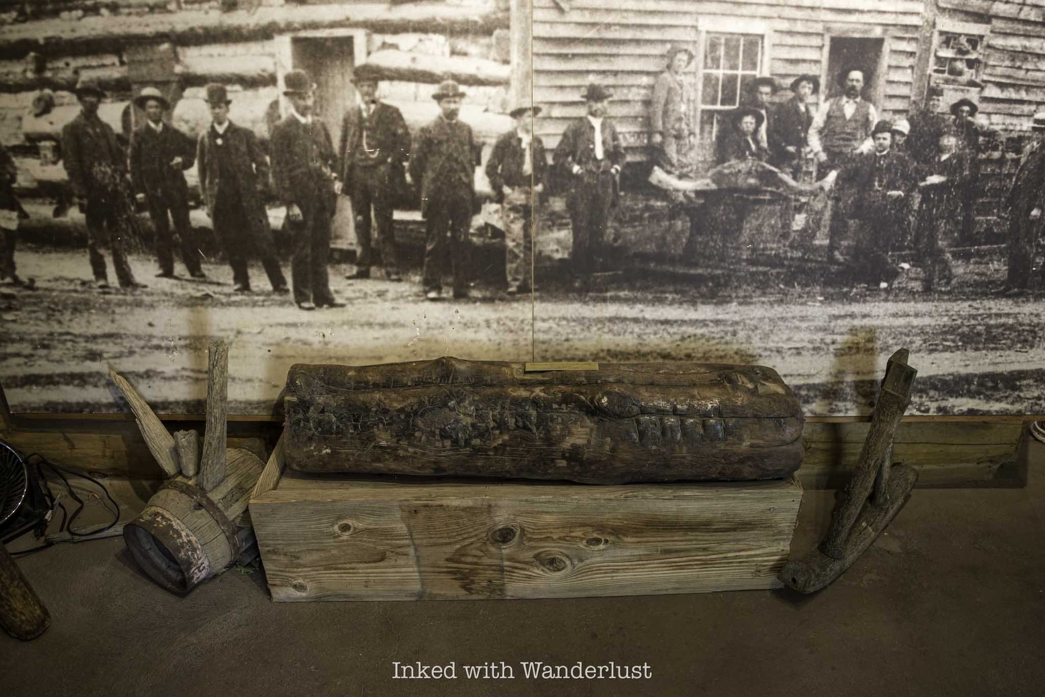
There about four rooms in the museum, each with a variety of artifacts ranging from the actual skis used by Snowshoe Thompson to deliver the mail over the Sierra Nevadas to California and his mail bag, to an interesting range of keys used by prisoners to escape their cells at the old Genoa jail.
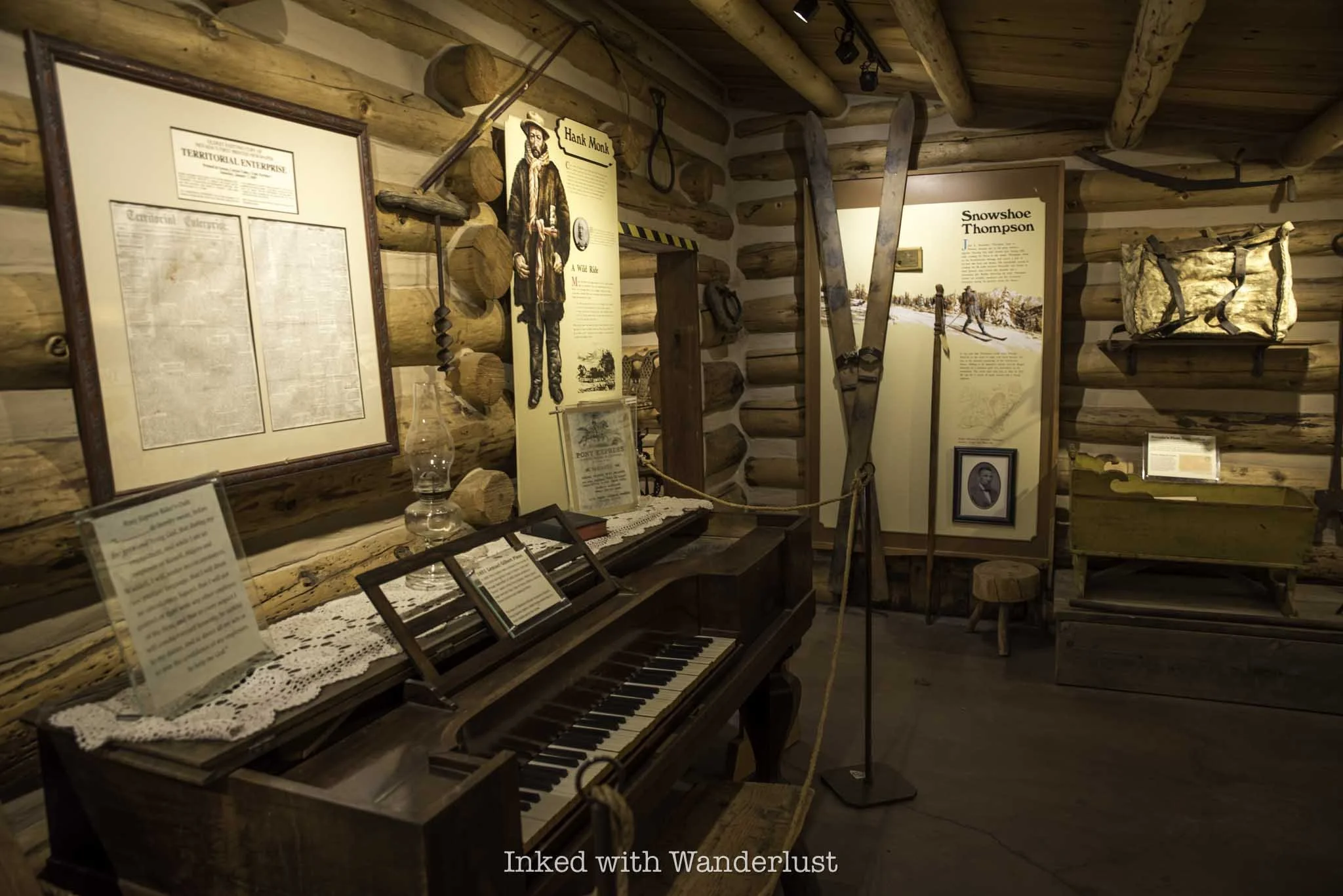

Once you’re finished looking around the museum, head outside and take a look at the memorial statue of Snowshoe Thompson and read the two or three historical markers that detail the founding of Mormon Station and Genoa, in general.

If you look at the statue from the right angle, it almost appears as though Thompson is looking out towards Genoa Canyon, which is fitting as that was one of the routes he would take to work his way to California with his mail bag in tow.
From here, continue your history tour of Genoa by crossing the street and taking a self-guided tour of the Genoa Courthouse Museum. When finished there, walk a few minutes down Jacks Valley Road and enjoy a drink at the historic Genoa Bar and Saloon, the oldest bar in Nevada. Then, walk a couple minutes down Genoa Lane and enjoy lunch at The Pink House.
PSALM 91

Enjoy a Drink at Genoa Bar & Saloon: The Oldest Bar in Nevada
Genoa Bar and Saloon opened back in 1853, a whopping eleven years before Nevada even became a state, in the charming town of Genoa, which two years prior in 1851 became the first settlement...
Disclosure: This post contains affiliate links. If you make a purchase through these links, I may earn a small commission at no additional cost to you. I only recommend products or services that I believe will add value to my readers.

Genoa Bar and Saloon History
Genoa Bar and Saloon opened back in 1853, a whopping eleven years before Nevada even became a state, making it the oldest bar in Nevada. It was opened in Genoa city, Nevada, which two years prior in 1851 became the first settlement for white settlers in Nevada.
Thousands of people from all walks of life enjoyed a drink (or two) on its historic bar top, from early locals such as Snowshoe Thompson, Genoa’s mailman who delivered mail over the mountains between Genoa and Placerville, California, to well-known celebrities and dignitaries such as actor John Wayne, President Teddy Roosevelt, and author Mark Twain.
Even the prohibition era couldn’t stop the bar, as it managed to survive the devastating years (for alcohol) between 1920 and 1933 by operating under the guise of a soda fountain shop. You have to give the owners at the time points for creativity.

Genoa Bar Hours, Drink Menu, and Food Offerings
The Genoa Bar in Nevada operates every day of the year, opening at 10am with no set closing time, simply stating they’ll, “close when the last patron leaves”. That could be 5pm or 2am. If you’re here during Genoa’s peak season, I wouldn’t worry too much about showing up and finding a locked door (unless you show up during Vegas hours).
However, if you’re visiting during their off season, I would recommend showing up around opening time or soon after if you had your heart set on visiting. While there are plenty of locals in Genoa to keep the bar busy, I’m sure their traffic ebbs and flows with tourism levels, so they likely close earlier than usual during that time.


Their drink specials menu is posted on both the outside and inside of the bar. Many of these drinks are crafted cocktails, including their famous Bloody Mary. Their prices are actually reasonable, as I’m used to seeing prices for cocktails reach the $20 mark and their most expensive (listed) drink costs $11.
During my visit, they had a food truck parked outside of the bar near the parking lot. I’m not sure if this is a regular thing or not but if it is, I’d imagine it’s only during the peak tourism season. There is no food served at the bar itself, just drinks.
I didn’t eat here as my friend and I were holding out for lunch at The Pink House, but I looked them up and it appears as though they offer a variety of burgers and sandwiches, along with optional sweet potato fries.

Genoa Bar and Saloon Interior
As you walk up to the front door, you’ll see historical markers proudly displayed on the brick walls, as well as old signage with vague directions to various places such as Virginia City, Dayton, and Hangtown (Placerville). This is in addition to the, “No Horses Allowed”, sign that’s hung in the window.
Once inside, you’ll immediately take note of the cluttered (in a good way) walls. The historic bar top will be to the left and to the right is some additional seating, a pool table, and select merchandise for sale.


Aside from the collection of random decor on the walls, another thing you’ll take notice of is the smell. It isn’t a bad smell, but you’ll immediately know you’re in a very old building. If I had to describe it, it smells like old cedar wood. Again, not a bad smell, just a distinctive one.
Looking around the walls, you’ll see taxidermist deer and buffalo heads, old clocks, signage with quirky quips, old black and white photos, chandeliers with obvious patina, faded but still very visible boudoir paintings, and more.


They don’t charge you to enter the bar, but it’s always good idea to support local businesses, so my friend and I decided to try one of their featured drinks. I went with the Lavender Lemon Fizz ($9). It’s made with Tahoe Blue vodka, lavender syrup, fresh lemon juice, and lavender aroma sugar.
I’ve been into lemon and lavender drinks lately and considering this was already a hot day, I found it deliciously refreshing. I’m definitely going to come back, though, as I live relatively close by and there’s a couple other drinks I want to try. When I do, I’ll be sure to update this post.

You don’t have to order one of the featured drinks if you don’t want to. They have a full bar and can make just about anything. My friend ordered a simple vodka cranberry, for example. They also have most of your usual beers on tap as well.
Even if you’re not a drinker, I highly recommend paying Genoa Bar and Saloon a visit for the historic value alone. While you’re there, be sure to visit the historic Mormon Station across the street, the Genoa Courthouse Museum down the street, and enjoy lunch at the historic Pink House nearby.
PSALM 91

Step Back in Time at the Genoa Courthouse Museum
Located in the small, highly historic town of Genoa is the equally historic Genoa Courthouse Museum. This museum is packed with Genoa history, displaying the original courthouse...
Disclosure: This post contains affiliate links. If you make a purchase through these links, I may earn a small commission at no additional cost to you. I only recommend products or services that I believe will add value to my readers.

Located in the small, highly historic town of Genoa is the equally historic Genoa Courthouse Museum. This museum is packed with Genoa history, displaying the original courthouse with restored furniture, the ground-floor jail, a blacksmith shop, a Snowshoe Thompson exhibit, and more.
Considering most people visit Genoa in order to invoke the feeling of nostalgia, it would be criminal not to visit the museum. If you want to take it a step further, you could even retrace the steps of the, “blackest day in Nevada history”.
In 1897, the murderer of a local teamster met a violent end when an angry mob of locals took the man from his jail cell in the courthouse and marched him to a tree a quarter-mile away, where he was ultimately hung. Both the cell and tree involved in the hanging remain to this day.
With all of the history contained in this building, I believe it’s one of the best historical places in Nevada to visit. So what are the museum’s hours? How much does it cost to visit? What’s the parking situation like? I answer all of these questions and more in the post below. Let’s get into it.
Products I recommend bringing with you to Genoa…
Genoa Courthouse Museum Hours, Location, and Fees
As stated above, the museum is located in Genoa, which itself is located within Carson Valley, between the larger cities of Gardnerville and Carson City. From Gardnerville, it’s about 8.5 miles away. From Carson City, it’s just about 13 miles.
If you’re driving in on Jacks Valley Road from the north (Carson), you’ll arrive to the museum shortly after entering Genoa city limits. It’ll be on your right, across the street from Mormon Station. From the south on the same road, you’ll find it just after the one and only intersection in town on your left.
If you’re driving in from the highway on Genoa Lane, you’ll turn right at the stop sign at the intersection. The courthouse will be on your left shortly after turning. There isn’t much of any parking in front of the courthouse, but there’s plenty right across the street along the road.

One thing to keep in mind is the museum is only open seasonally, between the months of April and October. In those months, it’s open daily between the hours of 11am and 3pm. Occasionally, the museum offers docent led tours but more often than not, tours are self-guided.
I found the entry fees to be reasonable. They accept both cash and credit cards as payment. As of 2024, the fees are as follows:
$5.00 - Adults
$2.00 - Youth (there wasn’t a defining age cut-off for what’s considered “youth” posted)
Free - Kids aged 0 - 6
Genoa Courthouse Museum Tour (Ground Level)

As stated above, tours of the museum are largely self-guided, though they do offer docent led tours from time to time. If you’re interested in that, it’s best to contact the museum directly to inquire about docent tour schedules. Also, I will only give minor details about the exhibits as to not spoil your visit.
When my friend and I visited the museum we did the self-guided option, so that’s what this post will focus on. There are two levels to the museum, each featuring their own exhibits. You can start and end your tour however you wish, and even go another round if you wanted.


On the ground level are four rooms (not counting the bookstore) that feature multiple exhibits. The first two rooms, which are located directly next to the stairwell, feature a classroom exhibit and a set up of what the recorder’s office looked like. All of which contain artifacts that were used in each respective environment, including actual court case records and property deeds from the period.
An interesting feature of this museum is that almost none of the exhibits are roped off and you’re free to wonder about them. Of course, they do ask that you not touch anything but aside from that, there are very few restrictions. This is rare as at most museums, you have to stand behind a rope and view exhibits from a distance.

The next room displays many photos and artifacts of the Wa She Shu tribe, who inhabited the area near Lake Tahoe near the Nevada and California border, including what is now Genoa, prior to the arrival of white settlers. The most prevalent artifact are the many examples of hand-woven baskets and hand tools.
In the room behind this one is an example of a local blacksmith shop and the exhibit perhaps most people come here to see - the historic jail. The two cells and accompanying bathroom aren’t recreations. These are the actual cells that people were detained in.


It was one of these cells that Adam Uber, the man who killed teamster Hans Anderson in 1897, was kept in. In a fit of rage on November morning, an angry mob of locals stormed the courthouse, overtook the Sheriff and Undersheriff, marched Uber a quarter-mile away to a tree and hung him from it.
This would become known as the, “blackest day in Nevada history”. While the branch he was hung from was cut down, the tree still remains and is identified by a plaque. To get there, walk or drive down Jacks Valley Road and turn left onto Genoa Lane. The tree will be on your right and marked by the plaque pictured below. You can’t miss it.

This isn’t meant to glamorize what happened, as it’s an unfortunate part of the state’s history. In order to learn from it, though, it’s important to preserve sites such as this tree and these cells. To access the next floor, walk back into the bookstore area of the museum and head up the stairwell near where you paid to get in.
Genoa Courthouse Museum Tour (Second Level)

The main attraction in the upstairs portion of the museum is the courthouse. This is the actual room where trails took place and most of the displayed furniture is of the period, though most of them have been restored.
Much like the rooms downstairs, you’re free to walk about the courthouse, including the area where the attorneys and defendants used to sit. The only roped off area is behind the bench, where the judges would preside over trials.


The room directly across from the courthouse is an exhibit on John “Snowshoe” Thompson, who made regular trips over the Sierra Mountain Range to deliver the mail from Genoa to Placerville, California, using a pair of homemade, wooden skis.
*Note: You can see the actual skis he used in the museum at Mormon Station State Historic Park across the street
In this exhibit, the main draw is a recreation of his cabin, complete with actual furniture and other household items which belonged to him. On the walls, you’ll find letters written by him, photos, and a map showing the routes he would take when delivering the mail.


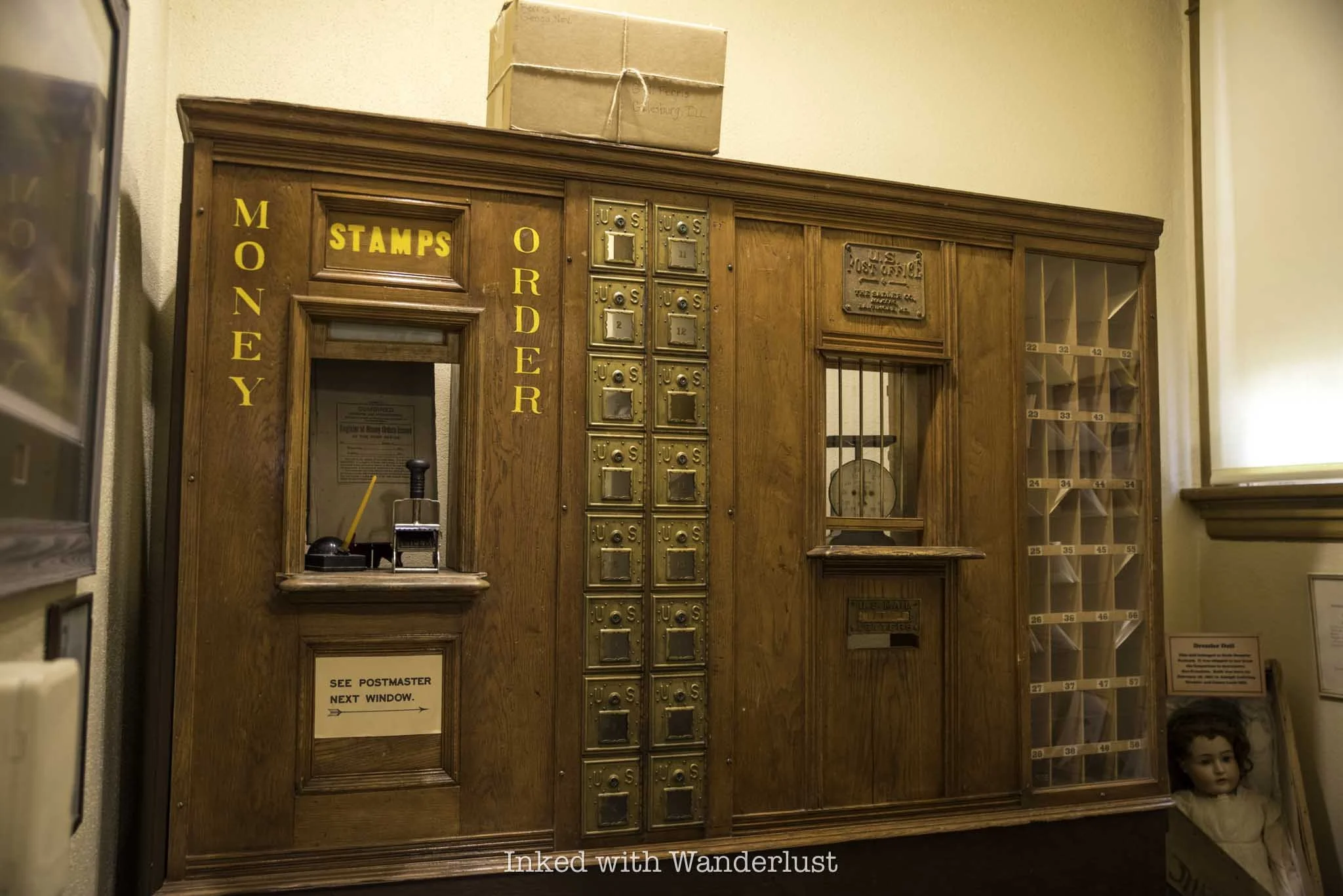
Other exhibits in the upstairs portion of the museum include the front panels of the Genoa post office counter and accompanying mail slots, both of which predate Nevada as a state. You’ll also see an example of what a child’s room looked like in Genoa’s early days, and one on George Washington Gale Ferris Jr - a Carson City native and inventor of the Ferris Wheel attraction.
As you can see, there is much more to this museum than just the jail and courthouse exhibits. There’s so much local history packed into this relatively small building, that you could literally spend hours looking around. If you ask me, it’s well worth the five bucks.
When you finish up at the museum, walk across the street and explore the historic Mormon Station State Park, the site of the first settlement in Nevada. Then, take a few minutes walk down Jacks Valley Lane to enjoy a drink at the oldest bar in Nevada, the Genoa Bar and Saloon. From there, head over to The Pink House for a delicious meal.
PROVERBS 16:9

Exploring Yellow Jacket Mine: Site of Nevada’s Worst Mining Disaster
All told, between 35-40 miners (and potentially more) lost their lives that day. To make matters worse, up to eleven of those perished miners’ remains are still entombed in the depths...
Disclosure: This post contains affiliate links. If you make a purchase through these links, I may earn a small commission at no additional cost to you. I only recommend products or services that I believe will add value to my readers.
Yellow Jacket Mine Disaster
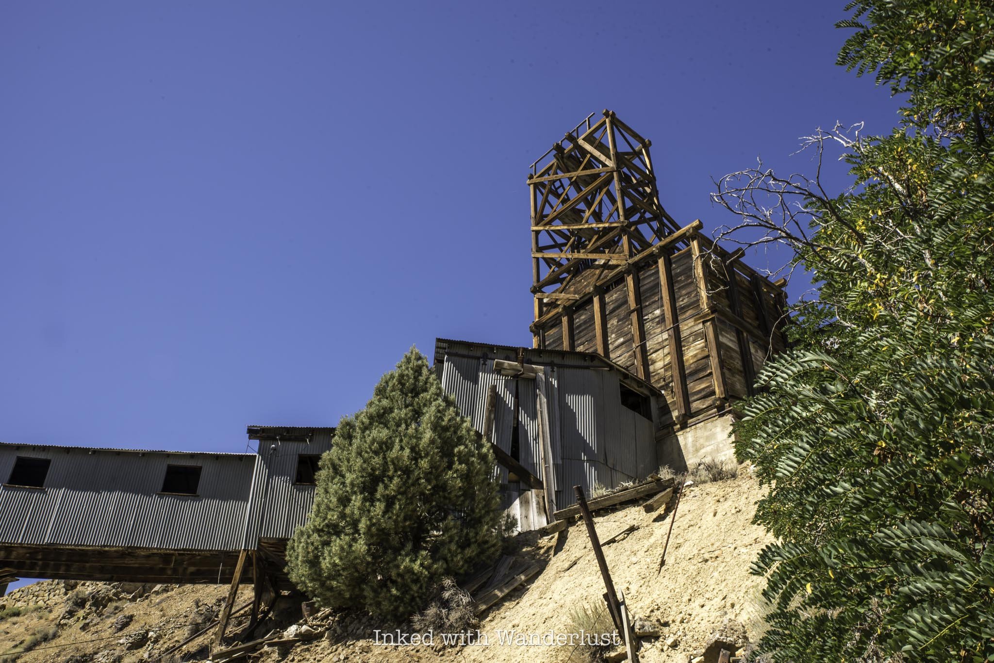
Located in the tiny community of Gold Hill, just down the road from Virginia City, sits the remnants of the abandoned Yellow Jacket Mine. While there are hundreds of abandoned mines in Nevada, the Yellow Jacket’s unfortunate claim to fame makes it stand out from the rest.
On April 7, 1869, the Yellow Jacket became the site of Nevada’s worst mining disaster when a fire broke out at the 800-foot level of the mine, entrapping dozens of miners. The cause of the fire is often debated, but the general blame points to an unattended lamp.
The honeycomb-shaped timbers burned and smoldered, eventually collapsing and flooding Yellow Jacket, as well as connecting Kentuck and Crown Point mines, with poisonous gas. Firefighters made several attempts to rescue the trapped miners, but kept getting pushed back by flames and smoke.

All told, between 35-40 miners (and potentially more) lost their lives that day. To make matters worse, up to eleven of those perished miners’ remains are still entombed in the depths of Yellow Jacket, as rescuers weren’t able to reach them due to the continuous fires, and had to seal them off.
While horrific, the timing of this fire was actually fortunate because it happened during a shift change and a minimal amount of miners were working at the time. Had the fire occurred in the middle of a shift, the body count likely would have been much higher.
A few weeks later, miners would return to work at Yellow Jacket, as it was considered safe due to the affected areas of the mine being sealed off. Although the mine produced over $16.5 million in ore by 1889, Yellow Jacket would suspend major operations by 1894, and shutter for good by the 1920’s.
I recently paid a visit to this abandoned Nevada mine with my wife and explored its remains. There wasn’t much left, but being able to retrace the history of the property with the equipment that did remain made it a great outing on a weather-perfect day. Let’s get into it.
Yellow Jacket Mine Location & Parking

As mentioned above, Yellow Jacket Mine is located in Gold Hill, which is just down the road from its better known counterpart, Virginia City. It sits on the property now owned by the Gold Hill Hotel.
While Yellow Jacket is technically on private property, the owners of the hotel don’t seem to mind people exploring it, as a couple employees walked by us while we were there and didn’t say anything. Additionally, online reports seem to indicate the same.

There is paved parking on a hill directly adjacent to the hotel and restaurant. Additional parking can be found by driving to the top of the lot and turning left. You’ll see a sign ahead indicating where to park. If you happen to be here during the restaurant’s operating hours, it’s probably best to park there to keep the lot open to its patrons.
There’s no fee to park. Nor is there a fee to enter the property. If you feel inclined to do so, you could always support the owners by dining in their restaurant, Crown Point. The hotel and bar have been opened since 1861, making it the oldest operating hotel in the state. In fact, famed novelist Mark Twain enjoyed a beverage (or two) in that very bar.
Exploring the Remnants of Yellow Jacket Mine

The first thing you’ll likely see upon driving in is the old miner’s cabin, which once served as a break room for miners in between shifts. It has since been converted into an Airbnb of sorts, and is rented out to guests through the hotel.
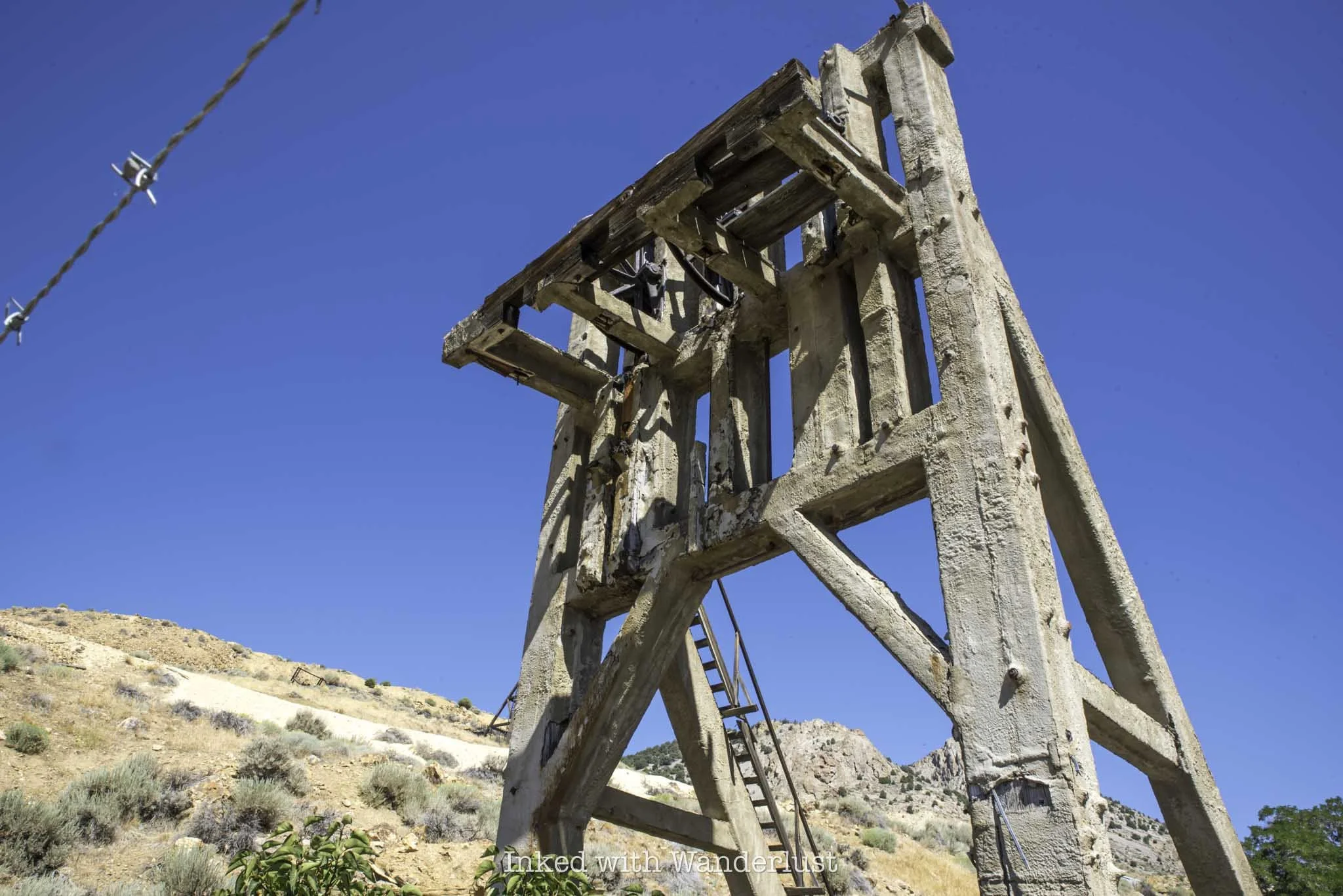
Behind it is the head frame for the elevator shaft, which lowered the miners into the mine. The entrance into the mine shaft has been completely filled and sealed off, but you can clearly make out its outline. Near the head frame are numerous pieces of rusted equipment you can check out as well.

To the left of the first structure is a second one that looks identical to the first. Based on my research, this building was used as the main office and assay. An assay was where ore samples were tested and processed. These days, they’re simply called, “labs”.
Off in the distance from there is another mill. This structure is the former Crown Point Mine, which was separate from (but connected underground to) Yellow Jacket. This mine was also affected by the fire. You can go inside and explore the structure. I attempted to, but kept getting chased away by angry hornets (an omen, perhaps?).

Just past the second structure, and before Crown Point Mine, you’ll notice a linear dirt path which works its way to the top of the hill. You’ll take this path to access the incline chute. When you get up there, you’ll notice the train tracks.
These tracks are active, so be sure to keep an eye out for trains. During our visit, we encountered the V&T Railway conducting a tour of the area. The train stopped, the conductor gave his spiel to their patrons, and moved on. If this happens during your visit, just wait it out for a few moments because they stop right in front of the chute.


Just across the train tracks is the incline chute used to deliver ore from within the mine to the surface and from there, onto train cars. The easiest way to access the top of the incline chute is by going up the path located to the right of it.
There is a chain between two concrete posts about halfway up the path. I’m assuming this is an attempt to block access to off-road vehicles, as there’s no presence of trespassing signs and the chain is easy to step over. It was maybe knee-high on me (for context, I’m 5’9).


When you reach the top of the hill, you’ll immediately take notice of the decaying structure with metal walls and a fenced-off area to the left of it. Inside the structure is the motor and lifting mechanism (with steel cable intact) for the incline chute.
On the other side is an unguarded doorway you can use to enter the structure. If you prefer to stay outside, the items inside are clearly visible through the windows and separations between the walls.

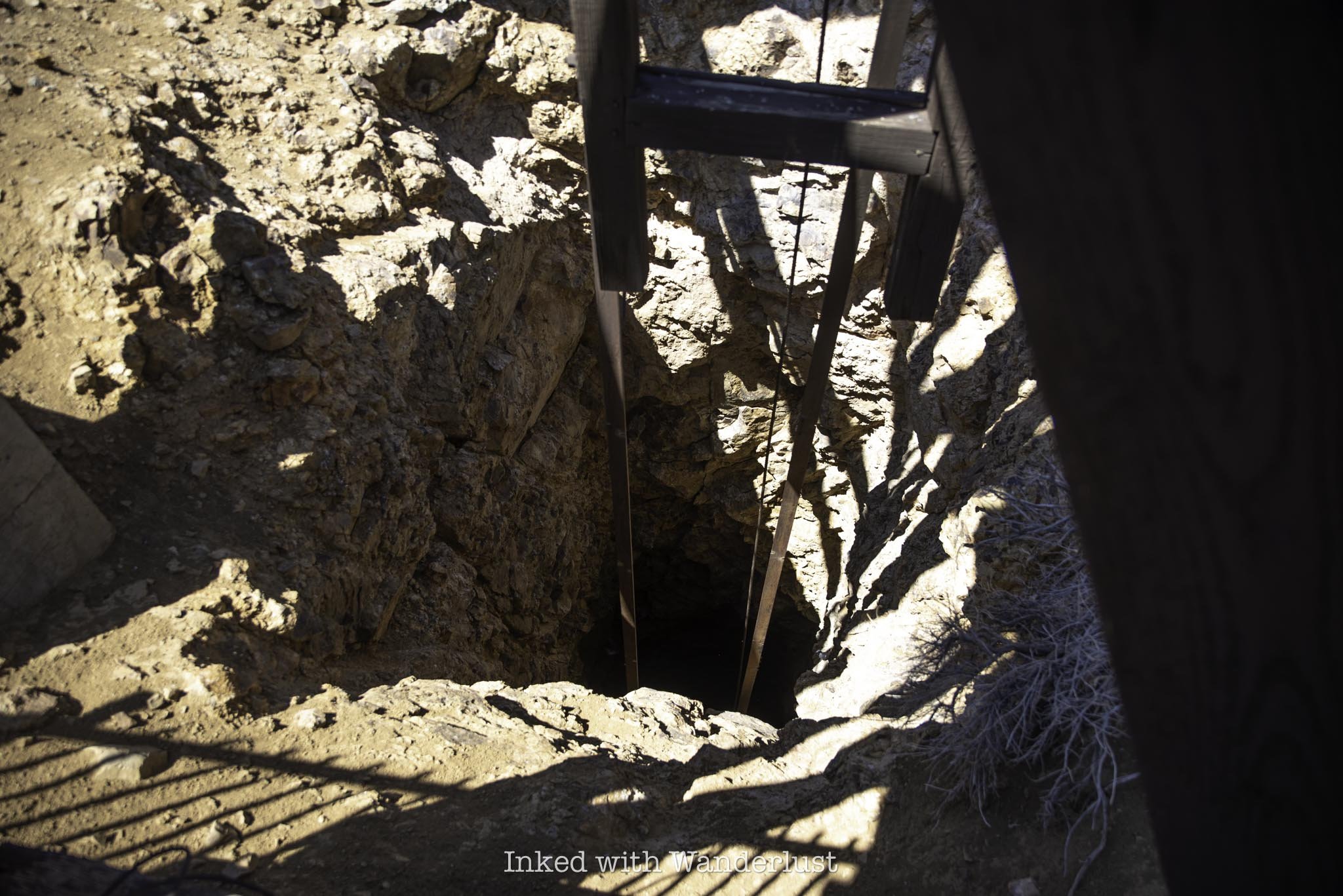
In the fenced-off area is a shaft where the ore was brought up to the surface from the different levels of the mine. After breaking the surface, it would then be sent down the incline chute and into a train or ore cart below.
I have no idea how deep it actually goes but by the time Yellow Jacket ceased operations, the mine reached a depth of 3,080 feet. Needless to say, it’s advisable to not jump the fence for a closer look. You could send a drone in there, but there were many birds moving around in the shaft.
From here, there isn’t much more to see aside from general exploring. Watch your footing around the area of the incline chute (both up top and along the bottom). I saw many holes along the rock wall near the chute. Some were guarded and some weren’t.
Is Yellow Jacket Mine Haunted?

The answer to that question all depends on perspective. I can say that during our visit, neither my wife or myself witnessed or heard anything unusual. At one point, when I was at the top of the incline chute, I thought I heard a voice. However, that was quickly debunked when I noticed the V&T Railway conducting a narrated tour in the distance.
Aside from exploring the remains of the property, that was the only excitement we experienced. Your milage may vary, though. This property is regarded as one of the most haunted places in Nevada, as many others have reported sightings of ghostly apparitions and voices.
That said, many men did perish inside the mine. Additionally, the Gold Hill Hotel itself has been subject to paranormal activity. So much so that the crew from the “Ghost Adventures” TV show have visited this location more than once. Take that as a grain of salt, though. It is a TV show, after all.
PSALM 121:8

The Ultimate Guide to Visiting Fly Geyser in Gerlach
Located roughly two hours from downtown Reno along the infamous Burner Byway is one of the weirdest, but most fascinating places you…
Disclosure: This post contains affiliate links. If you make a purchase through these links, I may earn a small commission at no additional cost to you. I only recommend products or services that I believe will add value to my readers.

Located roughly two hours from downtown Reno along the infamous Burner Byway is one of the weirdest, but most fascinating places you can see in Nevada; Fly Geyser. The geyser is located on a 3,800-acre parcel of land known as Fly Ranch in the outskirts of the small Nevada town of Gerlach.
Abutted against Nevada’s Black Rock Desert, the location of the annual Burning Man Festival, Fly Geyser has been attracting Nevadans and tourists alike for years due to its bright colors and its reputation as an accidental man-made wonder.
In the early 1960’s, a geothermal power company was drilling in the area when they accidentally penetrated a geothermal source. The workers attempted to plug it but were unsuccessful, which over time led to its development. Calcium carbonate deposits, in conjunction with the scolding hot water, began to form, creating the spectacle you see today.
Since it’s still active, the geyser is constantly changing. From its colors and width to its height and appearance, no two visits are the same. Even the docents, who conduct weekly tours of the geyser, often see changes in the geyser’s appearance.
In this post, I’m going to discuss several aspects of the Fly Geyser tour, such as how much it costs, what to expect and more. Additionally, I’ll cover other things to do in Gerlach, such as where to dine and stay the night. Let’s get into it.
How to Get to Fly Geyser
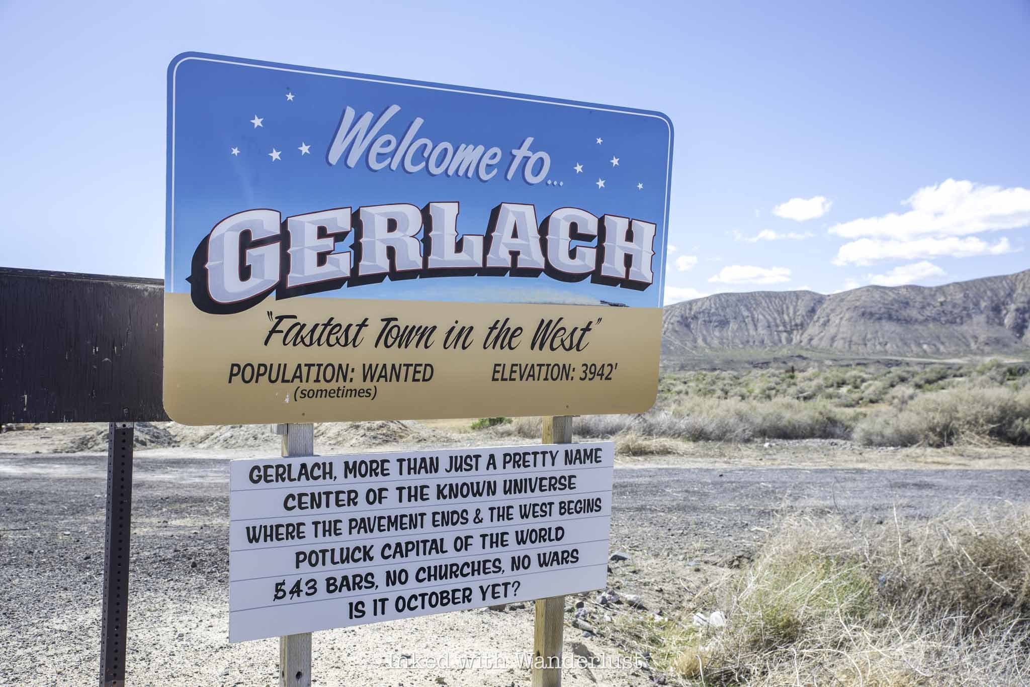
As stated above, Fly Geyser and Fly Ranch are located in the small town of Gerlach, Nevada, about two hours north of Reno and just over an hour from Fernley. Getting to the geyser requires more driving, as it’s about twenty miles from town.
The geyser is visible from the road, but barely. You can make it out and see the water shooting out from the top, but you won’t be close enough to see its details and truly appreciate it. Since it’s on private property, the only way to see it up close is to take a tour.
Fly Geyser 2025 Tour Price and Details
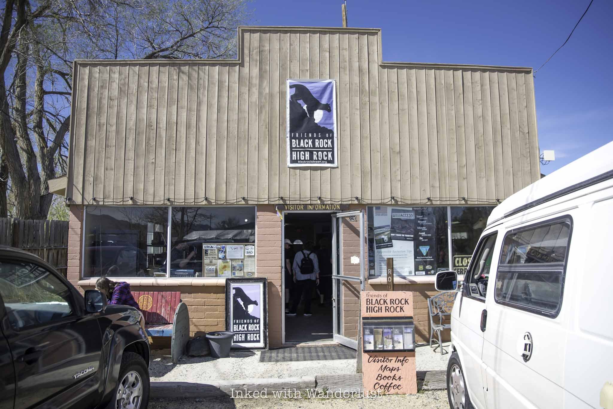
Access to Fly Geyser (and Fly Ranch in general) is only available through a tour conducted by Friends of Black Rock. In 2025, their tour season is April through October. Tours are conducted on Saturdays and there is only one tour each day. Prices for the tour are as follows:
$50 plus a $3.50 service fee
While tickets can be purchased on the day of the tour, it isn’t advisable to wait as tours often sell out. You can purchase your tickets ahead of time here. You can either print your tickets or simply save them to your device and present them upon arrival.
On the day of your tour, everyone will meet at the Friends of Black Rock visitor center at 320 Main Street to check in and sign waivers. From here, the tour group will caravan over to Fly Ranch and Fly Geyser with a docent at each end to ensure nobody gets lost.
Your tour will last approximately three hours and you’ll leave the visitor center between 10:30am and 11:00am. There is a bathroom at the visitor center you can use, but there will also be portaloos at the ranch and at the geyser.
Tour Stop One - Fly Ranch

The first of two stops you’ll make on your tour is the area of Fly Ranch where the former ranch home is located. From the parking lot, your tour guide will take you on a 45-minute to one hour nature walk through the property to multiple art installations built at and used for Burning Man.
Your tour guide will detail the region’s history and ecology as you walk. Aside from the burner art pieces you’re also likely to see wild horses, dramatic landscapes and migrating birds.


The tour of the ranch portion concludes at the famed Baba Yaga House located near the playa. Aside from the geyser, the Baba Yaga House is sure to the most interesting thing you’ve ever seen (or at least seen in a while).
It was built for Burning Man in 2018 and placed at Fly Ranch in 2019 with a five-year lease (meaning this could be its final year at the ranch). The house is supported by two huge chicken legs and despite its small appearance, has two levels. A bird cage outside the exterior of the second level acts as a deck of sorts.

Amazingly, tour participants are permitted to walk up the wooden stairwell to check out the inside of the house and I highly recommend doing so. It’s cramped and there’s only one way in and out, but there are colorful flowers and other decor draped everywhere.
Once everyone has had a chance to see Baba Yaga House, you’ll head back in the same direction you came. Once you’re back at the car, your tour guide will give the group a chance to use the restroom and then you’ll all drive further up the road to the geyser.
Tour Stop Two - Fly Geyser
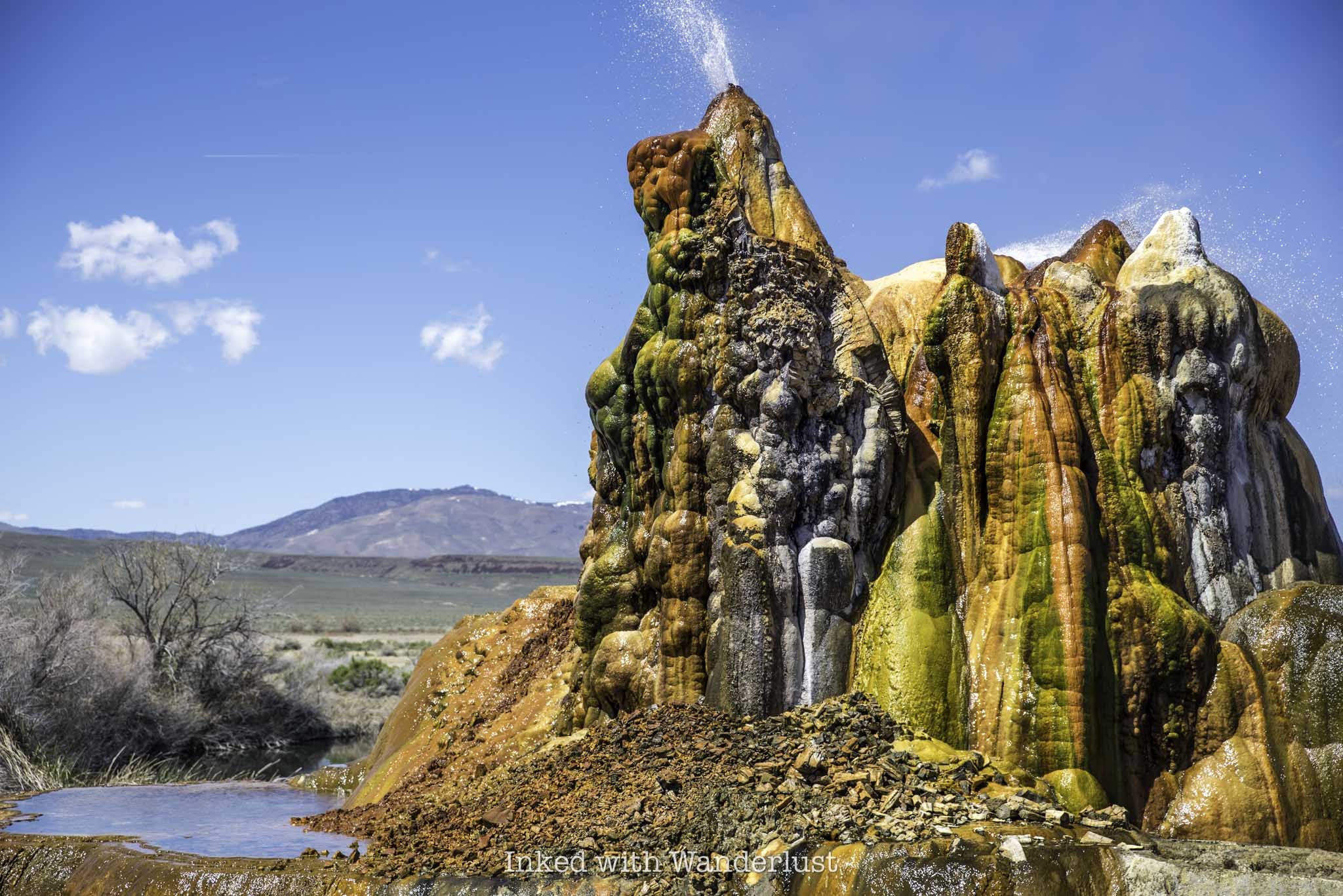
A few miles up the road from the ranch is Fly Geyser. The geyser will be within sight from where you park but as part of the tour, the docents will take the scenic route to continue educating you on the history and ecology of the area.
As you approach the geyser, you’ll be walking through tall grass where some people have had issues with ticks in the past. I was wearing shorts and didn’t have an issue with this but if you’re concerned about it, either wear long pants or tick repellant.
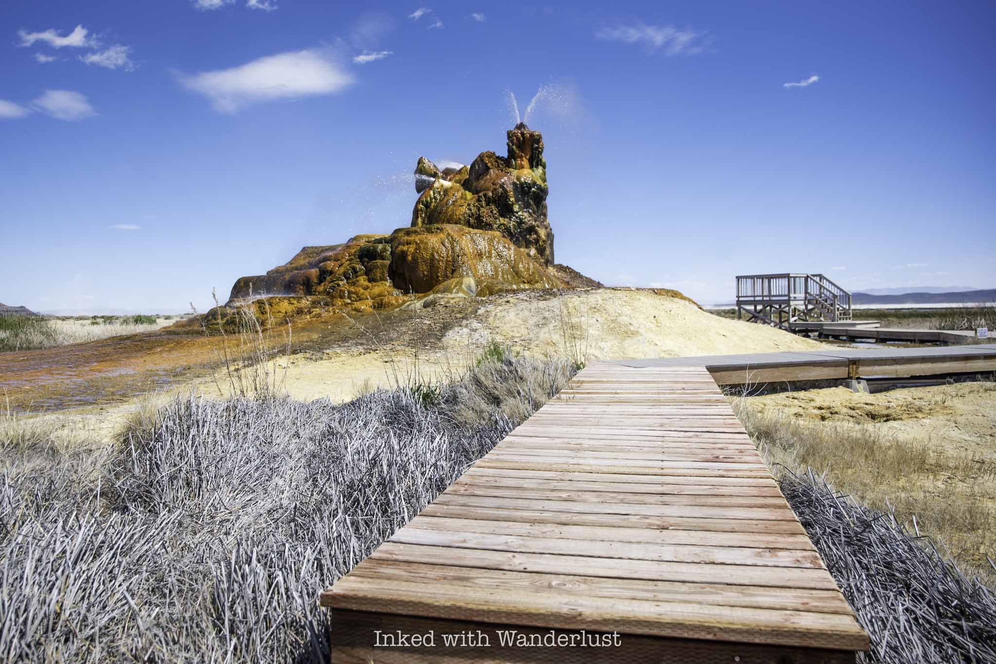
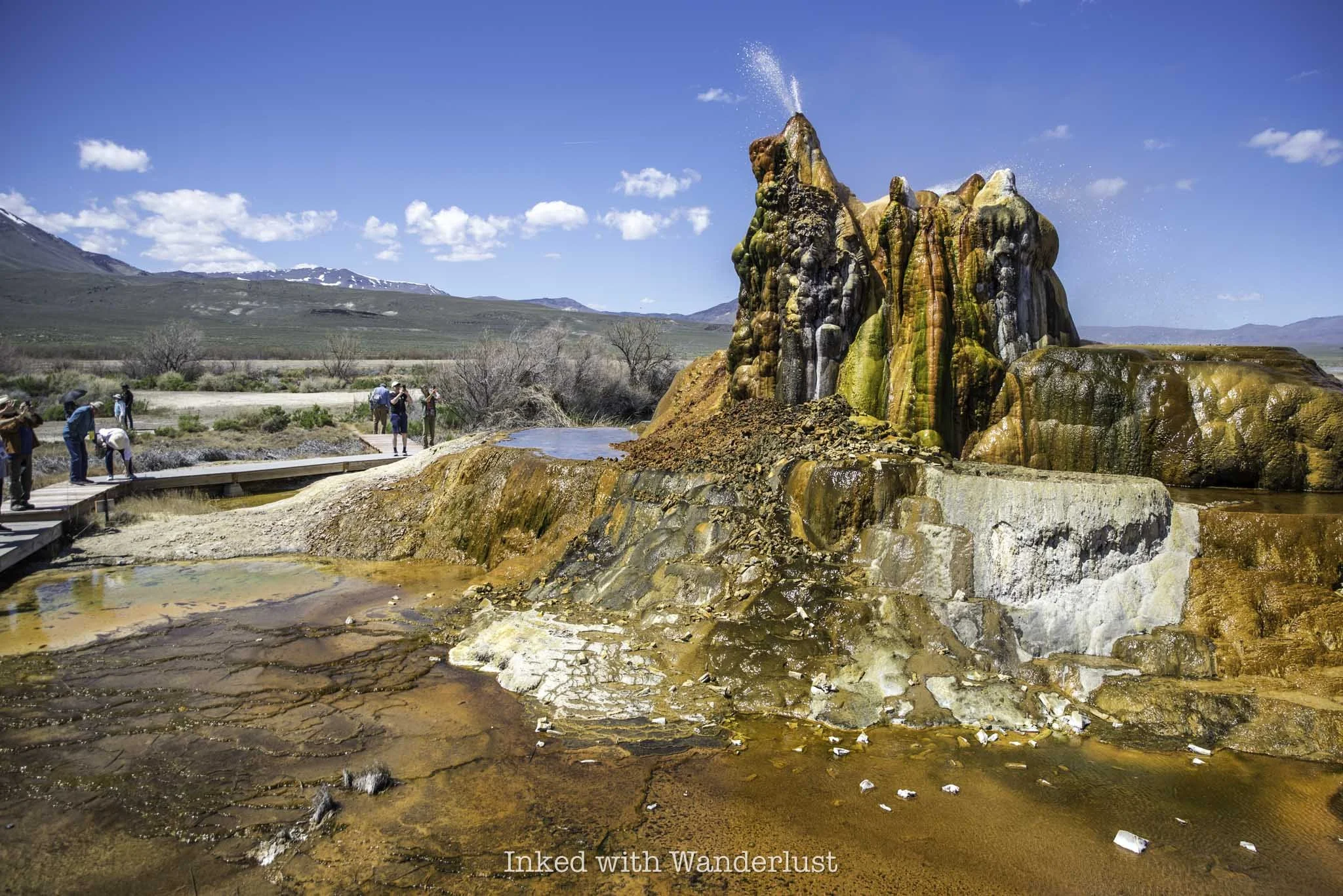
At the geyser there’s a wooden boardwalk flanking one side, concluding at an elevated platform. If your tour group is large, the docents will split the group in half so as to not overcrowd the boardwalk and the platform.
You’ll be given about thirty minutes to view the geyser and take all the photos and video of it you want. Afterwards, your tour guide will walk the group back to their vehicles and the tour is then concluded at that point.
Photography Rules at Fly Geyser
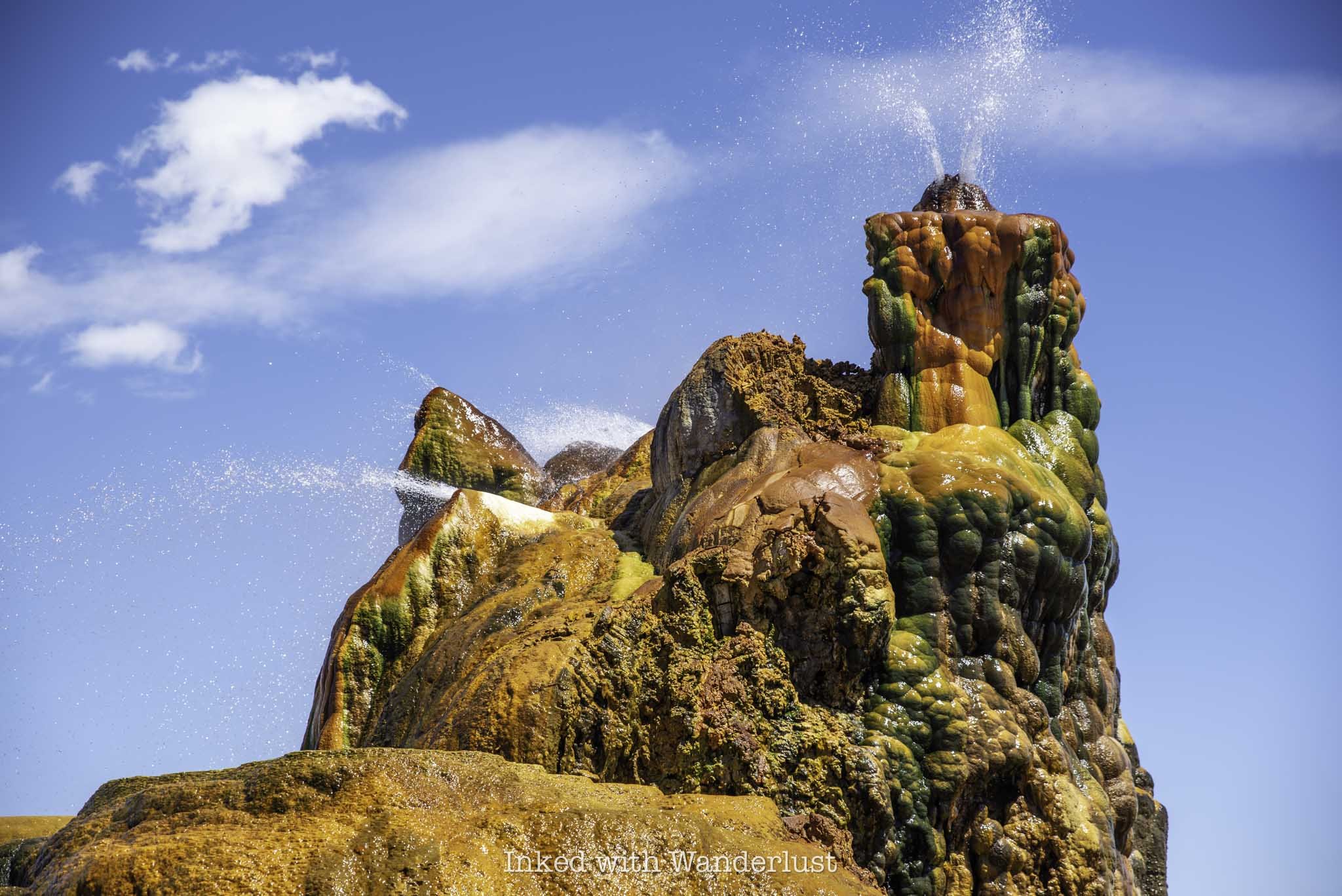
There’s much discussion online, including on the Friends of Black Rock website, about photography rules while on the tour. The website states, and I’m paraphrasing, that in order to connect with the land and get the most out of your tour, they request that you refrain from taking photos or video until the end of the tour.
People who have gone on the tour in the past echo this sentiment in their online reviews and fellow bloggers have mentioned it as well. While I don’t doubt what they’re reporting, what I can say is that wasn’t my experience at all during my tour.
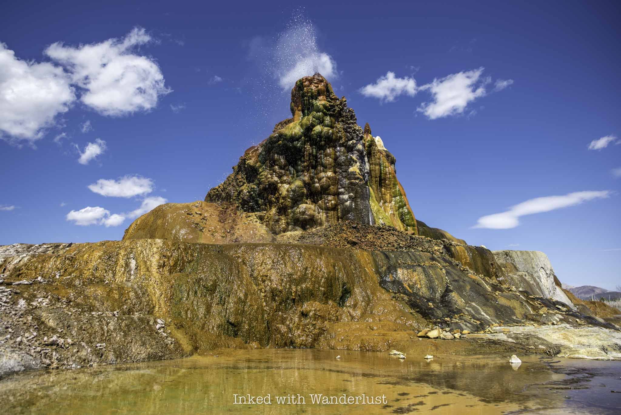
For starters, none of the three docents leading our group said anything about taking photos before we left the visitor center. Likewise, they said nothing about it at any point throughout the entire tour. Everybody in the group was taking photos throughout the tour without consequence.
The only instance when the docents mentioned photos was as we approached a hot spring near the geyser that they didn’t want posted online. They’ve been having an issue with trespassers as of late and didn’t want photos of this hot spring geotagged.
I’m not saying your experience will the same, but the docents on my tour took no issue with people having their cameras out. If yours does, please be respectful and honor their request. You’ll be on private property, after-all.
Where to Eat and Stay at Fly Geyser

With a population of only 21, Gerlach doesn’t have a whole lot of businesses. In fact, the ones that are here survive mostly on the crowds that Burning Man and Fly Geyser bring in. So as I usually do on Inked with Wanderlust, I encourage you to support local business during your visit. A few of Gerlach’s restaurants include:
Bruno’s Country Club
Miners Club
Joe’s Gerlach Club
High Rock Pizza
If you want to make a weekend out of it, you can book a room in Gerlach’s only lodging, Bruno’s Motel. Just down the road from the hotel is the town’s only gas stationed name, you guessed it, Bruno’s. I don’t know who Bruno is, but he seems to be the Walt Disney of Gerlach.
The gas station’s market is only open seasonally, but the pumps are open 24/7. They also offer tire service if you find yourself in that predicament. For souvenirs, be sure to stop by Plant X where you can find interesting and unique pottery and other gifts.
Other Things to Do in Gerlach
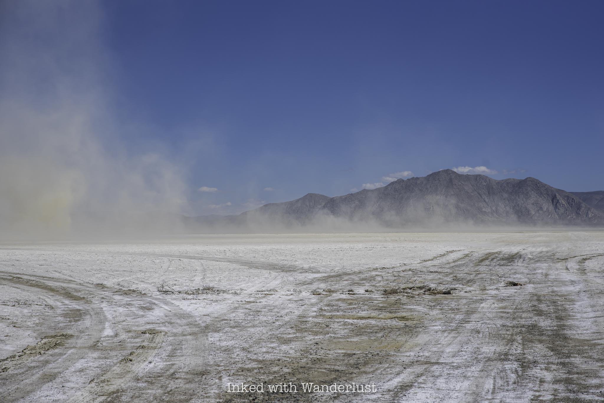
Aside from Fly Geyser and Fly Ranch, there are quite a few other things to do in the area. All of which are of the outdoor variety. On the way to Fly Geyser, you'll pass a few entrances to the infamous playa where the Burning Man Festival is held. If the playa is dry enough, you can drive on it if you wish. Some other activities include:
Rockhouding (Gerlach is a Rockhounder’s paradise)
Take a day trip to Pyramid Lake
Camping and RV’ing
Explore Doobie Lane (or as it’s officially referred to as, “Guru road”)
Take an ATV or side-by-side in the surrounding public lands
Soak in hot springs
Planning a trip to Northern Nevada? If so, be sure to read 13 Awesome State Parks Near Reno. Furthermore, check out the International Car Forest of the Last Church in Goldfield. Lastly, don’t forget to visit the Nevada side of Lake Tahoe by Hiking the Tahoe East Shore Trail.
PROVERBS 3:23

Discover Rhyolite Ghost Town and Goldwell Open Air Museum near Beatty
Nevada is known for many things, but one of the most popular among them being ghost towns. With its rich…
Disclosure: This post contains affiliate links. If you make a purchase through these links, I may earn a small commission at no additional cost to you. I only recommend products or services that I believe will add value to my readers.

Nevada is known for many things, the most popular among them being ghost towns. With its rich history in mining, there are dozens of examples of these once booming mining towns spread throughout the state, many with structural remains.
One such example is Rhyolite, located just off Highway 95, just a few miles outside the Death Valley gateway town of Beatty. If you’re traveling along the highway, Rhyolite is easy to get to as all you’ll need to do is make a couple of turns to reach it.
There are many remains of the former structures to explore, but the ghost town isn’t the only attraction here. There is also the Tom Kelly Bottle House and the Instagram infamous Goldwell Open Air Museum, featuring several sculptures.
In this post, I’ll discuss several aspects of a visit here, including what to expect, the parking situation, how much it costs to visit and I’ll even throw in a bit of history. Let’s get into it.

Click or tap on ad to view offer
Quick Stats
Location: Near the town of Beatty, NV
Fee: None
Open: All year, sunrise to sunset
For: Everyone
Cell Service: Spotty, at best
Restroom: At the end of the road near the train depot
Parking: Dirt lots at the museum and bottle house, “park where you can” in Rhyolite
EV Stations: None
Popularity: Medium to high
Time: One to two hours
Features: Desert art sculptures, a glass bottle house and historic building remains
Pets: Allowed
Drones: Allowed
My Visit(s): August 2023
Directions to Rhyolite,Parking & Fees

As mentioned above, despite its remote location, Rhyolite is easy to get to as there are very few turns to make to reach it. It’s a mostly straight shot.
Coming from either Northern or Southern Nevada, you’ll find your way onto Highway 95 and continue until you reach the town of Beatty. If you’re traveling north, take a left onto Highway 374 for about four miles, then take a right on Rhyolite road.
If you’re traveling south, continue straight when you come to the stop sign in Beatty for about four miles and then turn right on Rhyolite road. From the Furnace Creek Visitor Center in Death Valley, follow CA-190 west for about 48 miles, crossing the Nevada border in the process, before turning left onto Rhyolite road.

Once on Rhyolite road, it’s a short drive to the attractions. The first of which you’ll drive up on will be the Goldwell Open Air Museum, followed by the bottle house and finally, Rhyolite Ghost Town.
Both Goldwell and the bottle house have designated parking lots, though they’re of the gravel variety and aren’t maintained well. The road leading up to Goldwell is paved, then turns to gravel around the bottle house. Past there, the road returns to asphalt before going through Rhyolite.
My Chevrolet Cruz managed the road and parking lots just fine, as did several other small vehicles that were there at the time, so no need to worry.
Goldwell Open Air Museum

The Goldwell Open Air Museum will be the first attraction you’ll come across during your visit to Rhyolite. You’ll find the parking lot on your left, with the visitor center and sculptures just feet away from the parking lot.
It is 100% free to park and explore the museum, but they do accept donations in the visitor center and online if you feel so inclined. The sculptures are in fairly close proximity to one another, so there isn’t a lot of walking involved here.
The sculptures were made by a group of artists led by Albert Szukalski, a Belgian-born artist who’s behind the museum’s most recognizable sculpture, The Last Supper (pictured below). The colorful designs make a beautiful contrast against the vast landscape of the Mojave desert.
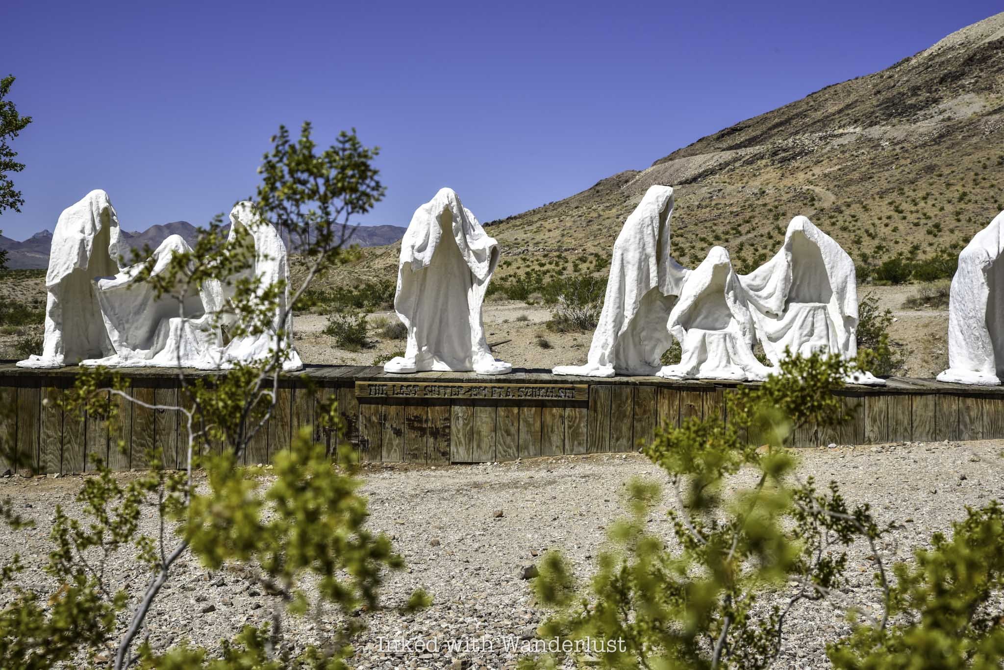

The First sculpture, The Last Supper, was installed in 1984, followed up by Ghost Rider, which is located just steps from the parking lot.
As time went on, additional sculptures were added, leading to the creation of the open air museum. Sculptures continue to be added to this day. A few more examples include:
Ghost Rider (1984)
Lady Desert: The Venus of Nevada (1992)
Icara (1992)
Sit Here! 2000 (2023)
Tribute to Shorty Harris (1994)

You can spend as much time as you want at the museum. While it is a popular place, it doesn’t seem to get too crowded, as I was here in August and there was only two other people here at the same time as me.
When you’re finished exploring the sculptures, take a left out of the parking lot and continue up the road for a few hundred feet before arriving at the Tom Kelly Bottle House parking lot.
Tom Kelly’s Bottle House

Just a bit further up the road on the right is the Tom Kelly Bottle House. It was built in 1906 by Australian-born Tom Kelly, who was a stonemason turned gold miner.
He built the house using over 50,000 beer, whiskey and medicine glass bottles, in which he obtained by paying local children ten cents per wheelbarrow full. In total, Kelly paid $2500 to construct the house.
While this one is the oldest and largest known glass bottle house in the United States, it isn’t the only one. Many don’t know that glass bottles were often used for home construction in the American West due to them often being cheaper than other material, such as stone or wood.

Another infamous example of glass bottles being used as construction material is Thunder Mountain Monument in Northern Nevada near Lovelock, though not nearly used as extensively as Tom Kelly’s.
Price wasn’t the only driver for using glass bottles. They do a great job at staying cool in the summer and retaining heat in the winter, a perfect recipe for Nevada desert living.
During filming for the 1926 film The Air Mail, Tom Kelly’s Bottle House, along with the rest of the structures in Rhyolite, were partially restored and featured in the film.

Unfortunately, due to past vandalism and theft, the bottle house has a locked fence surrounding the entire perimeter, making access to the house off-limits to the public.
You’re free to walk the perimeter, as there are numerous informational signs scattered about. At the rear of the home is where you’ll see the largest wall, almost entirely made with glass bottles and adobe mud.
As with the Goldwell Open Air Museum, there are no fees associated with Tom Kelly’s Bottle House. When you’re ready to proceed to the rest of Rhyolite, take a right out of the lot and continue forward.
Rhyolite Ghost Town Remains

The structural remains of a variety of Rhyolite businesses and public buildings can be found just up the road from the museum and bottle house. Until you reach the Train Depot at the end (which is also where a bathroom is located), there is no parking lot. Even then, parking is mostly just grabbing a spot that looks good.
The remains are dotted on both sides all along the road. If you see one you’d like to explore, just park on the side of the road and jump out. Most of the structures are fenced off for safety, though, so you can only explore so much.
Some of the historic buildings include:
Porter Brothers General Store (pictured below)
Caboose House
Local School
Cook Bank (pictured above)
Train Depot

Rhyolite was founded in 1905 in the heart of the Bullfrog Mining District. What began as a humble two-tent operation exploded into a town of 5,000 people in just six months.
Despite being one of many mining towns in Nevada, Rhyolite stood out for its high quality ore, producing a total of one million ($27 million by today’s standards) in its first three years.
As is the case with all boom towns, it didn’t last forever. Issues such as deteriorating ore quality and the 1906 San Francisco earthquake literally derailing operations by destroying the railroad, lead the town’s decline by 1914.
The entire town would lose its electricity supply, causing the banks, newspapers, post office and train depot to shutter. By 1920, all that would remain in the town were 14 residents.


At the end of the road is where you’ll find the train depot, the most intact structure left. The windows have been boarding up, but the stone structure is nearly 100% intact.
The building is fenced off, with warnings of cameras being present, but there’s an intentional opening near the depot’s original entrance where you can enter and explore.
It appeared as if they were doing some kind of restoration project, as I’ve seen fairly recent photos of the depot without the fence. I wasn’t able to determine that one way or another, though.
I hope you get a chance to visit Rhyolite as it’s uniquely Nevada in every possible way and an important reminder of the state’s history.
Planning a trip to Southern Nevada? Be sure to read How to Spend a Few Hours at Valley of Fire in the Summer. Also read Explore the International Car Forest of the Last Church in Goldfield.
PROVERBS 3:23

See The Historic Petroglyph Wall at Red Rock Canyon
Located within Red Rock Canyon Recreation Area, not too far from the Las Vegas strip, you can find an amazing…
Disclosure: This post contains affiliate links. If you make a purchase through these links, I may earn a small commission at no additional cost to you. I only recommend products or services that I believe will add value to my readers.
Located within Red Rock Canyon Recreation Area, not too far from the Las Vegas strip, you can find an amazing example of Native America history - the Petroglyph Wall.
It’s easy to find as the road leading to it runs just off of Scenic Drive, the main road that runs through the park. Additionally, it’s easy to get to as it’s less than a quarter mile to the wall and back.
So what’s the parking situation like? How do you get to the trailhead? Are there any fees involved? I answer all of these questions, and more, in the post below. Let’s get into it.

Click ad to view offer
Trail Stats
Location: Red Rock Canyon Recreation Site, Las Vegas, NV
Fee: None for the trail, but Red Rock charges an entry fee
Open: All year
For: Everyone
Cell Service: Spotty, at best
Restroom: In the trailhead parking lot
Parking: Semi-large, unpaved lot
EV Stations: None
Difficulty: Easy
Accessibility: Not wheelchair or stroller friendly
Popularity: Medium
Mileage: Less than a quarter mile, there and back
Time: 20-30 minutes
Condition: Semi-maintained (follow trail markers)
Features: Historic petroglyphs and mountain views
Best Viewed: Any time of year
Pets: Allowed, as long as they’re leashed
Drones: Allowed for recreational purposes
Hazards: None other than usual outdoor hazards
Our Visit(s): August 2023
Petroglyph Wall Parking, Trailhead and Getting There

While there are no fees associated with Petroglyph Wall directly, there are fees you’ll need to pay to enter Red Rock Canyon and depending on the time of year you visit, reservations may be needed as well. Fees for Red Rock Canyon are as follows:
$20 per vehicle
$10 per motorcycle
$8 per bicyclist
$5 per pedestrian
$50 for a Red Rock annual pass
$80 for the ‘America the Beautiful’ pass
Additionally, between October 1 and May 31, advanced reservations are required to enter the park between the hours of 8am and 5pm. Reservations are available 30-days in advance and no re-entry is allowed. Scenic Drive is only one-way, so arrive early and have a plan in place.


To get to the parking lot and trailhead for Petroglyph Wall, simply drive for about eight miles from the Red Rock Canyon entrance. You’ll see the road ahead turning into a tight horseshoe. As the road begins to horseshoe, you’ll see Rocky Gap Road on your right. Turn there.
You’ll first come upon another parking lot for a different trail on your left, bypass this and continue until you reach the second parking lot, where the Willow Springs Picnic Area is. This is where you’ll park for Petroglyph Wall.
The trailhead is located at the north end of the lot, on the far left corner, across from Willow Springs. There’s a sign indicating you’re in the right spot (pictured above).
Trail to Petroglyph Wall

The trail from the parking lot to Petroglyph Wall, one-way, is just a tenth of a mile across a wash. The trail isn’t maintained all that well, but it’s still easy to follow as it’s dotted with the same trail markers you’ll find on most Red Rock Canyon trails.
After a short time, you’ll arrive to at Petroglyph Wall. The area surrounding the wall is small, with a couple trees providing a smidgen of shade. Near the wall, you’ll find informational signage detailing the facts of the petroglyphs.

The rock art on Petroglyph Wall is estimated to be at least 800 years old. Most of the art is found on one section of the wall (the dark part), but there are a few others scattered about.
This is far from the only examples of petroglyphs in Red Rock Canyon, but it is the easiest to access. While the trail isn’t stroller or wheelchair friendly, it’s accessible to children, the elderly and everyone in between.
Unless you’re a huge fan of petroglyphs, I don’t recommend visiting Red Rock purely to visit Petroglyph Wall considering the fees to enter the park. This is more of a bonus if you’re already planning to be here.
Where Do You Go From Here?

As stated above, Petroglyph Wall serves as an excellent bonus to your already planned visit to Red Rock. Considering that Scenic Drive and there is no re-entry during the reservation period, I recommend checking out the Calico Tanks hiking trail first, as it’s before Petroglyph Wall.
Beyond Petroglyph Wall, there’s another amazing hiking trail by the name of Icebox Canyon you should check out, as well as Pine Creek Canyon.
If you want further examples of petroglyphs, I recommend driving east to famed Valley of Fire State Park. There’s an equally easy example of rock art on Atlatl Rock, among other areas of the park. While you’re there, there are many other highlights in the park you can see in a relatively short amount of time.

How To See Atlatl Rock in Valley of Fire
Valley of Fire is one of the most popular parks in the entire Nevada state park system, and for good reason. This beautiful…
2 minute read | may contain affiliate links
Valley of Fire is one of the most popular parks in the Nevada state park system, and for good reason. This beautiful park is littered with fire-red sandstone rocks that, with the help of erosion, have formed mind-boggling shapes and formations.
There are many attractions within Valley of Fire, but the one that stands out from the pack due to its historical value is Atlatl Rock. It’s one of the first things you’ll see if you’re driving in from the west entrance and is easily seen from the main road.
Aside from its unique formation, the big draw to Atlatl Rock are the petroglyphs located on the smooth rock face at the top of the stairwell and others scattered around the base of the rock. These petroglyphs are believed to over 4,000 years old!
So how do you get to Atlatl Rock? What’s the parking situation like? Are there any fees involved? I cover all of this and more below.
Trail Stats
Location: Valley of Fire State Park in Southern Nevada
Fee: $15 per vehicle ($10 for Nevada residents). This is to enter Valley of Fire
Permit: None
Open: All year
For: Anyone
Cell Service: Spotty
Restroom: In the parking lot
Parking: Medium sized paved lot
EV Stations: None
Difficulty: Easy
Popularity: High
Mileage: Walk-up
Time: At least 30 minutes
Condition: Well maintained and easy to follow
Features: Petroglyphs and unique rock formations
Best Viewed: In the morning (less crowded)
Pets: Not allowed
Drones: Prohibited
Hazards: No shade on the stairwell or platform.
Our Visit(s): August 2023
What is an Atlatl?
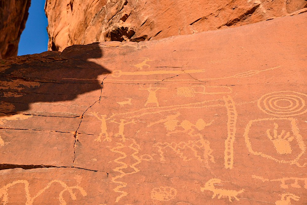
An atlatl, the namesake of this location, was an tool used by ancient tribes as a throwing stick or dart thrower. It allowed the user to employ more force to their spears or darts.
An atlatl was usually made of wood, about two feet long and had a handhold on one end with a hook on the other. A slot cut into the tail end of the dart was set against the nook enabling the dart to lie along the atlatl so that both could be grasped midway.
There was no signage explaining why this rock was named after this ancient tool, but one reason could be that there are multiple petroglyph illustrations of the tool on the rock.
Getting There & Parking
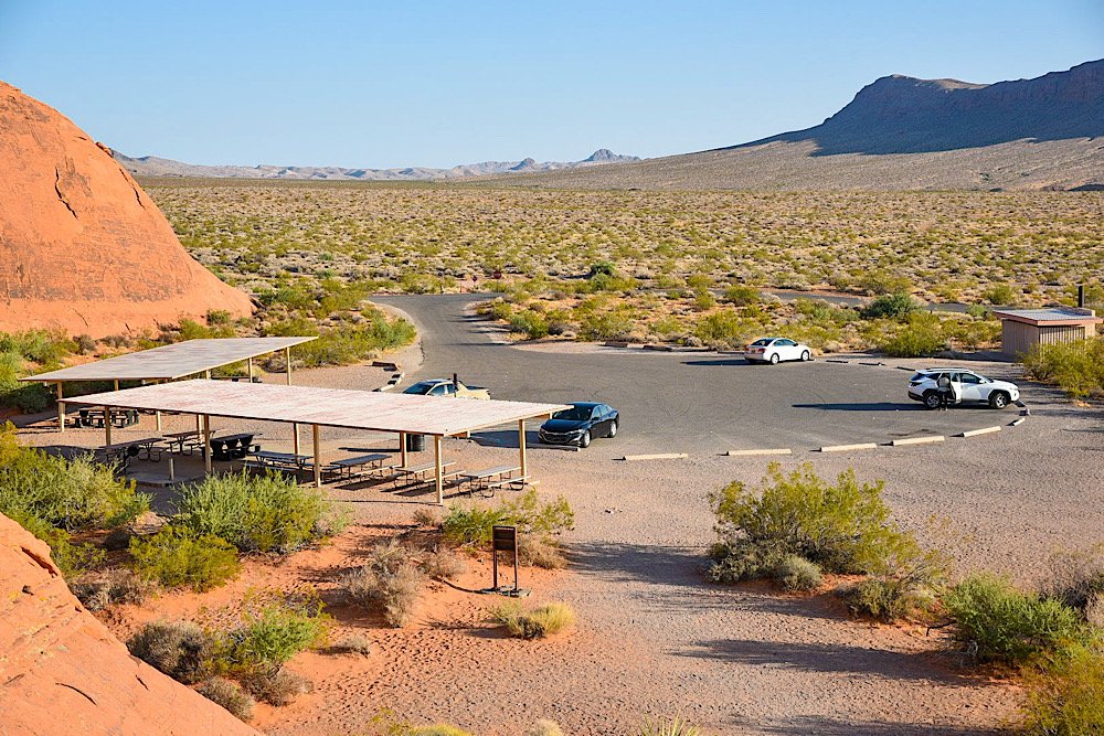
Getting to Atlatl Rock is easy, as it’s located just off the main road in the park. It’s closest to the west entrance of the park, but getting there from the east entrance is just as easy.
From the west entrance, drive for about 4 miles before turning left onto Campground road. You’ll keep straight for about a half mile before turning left into the parking lot. The directions are virtually the same coming from the east entrance. Though you’ll drive a few more miles.
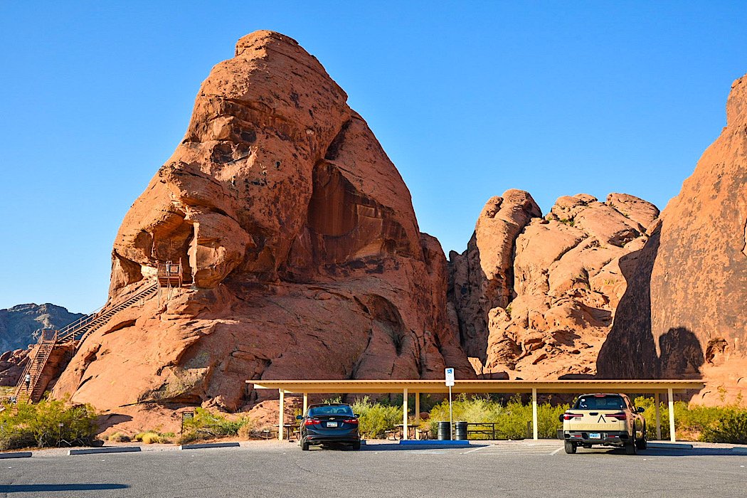
The parking lot is decently sized, but it will fill quickly as the day progresses. Your best bet is to arrive early in the morning. I was here about an hour after sunset and there were just a few others at the rock.
There are covered picnic tables near Atlatl Rock you can use, as well as a restroom at the far end of the lot. From what I could see, there was only one spot designated for disabled parking.
Atlatl Rock Petroglyphs
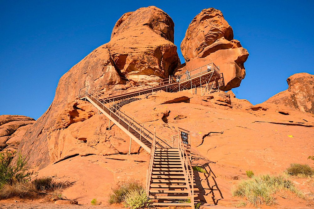
To reach the main petroglyphs on the smooth rock face at the top, you’ll need to go up the stairwell. There are three sets of stairs, totaling about 100 steps or so.
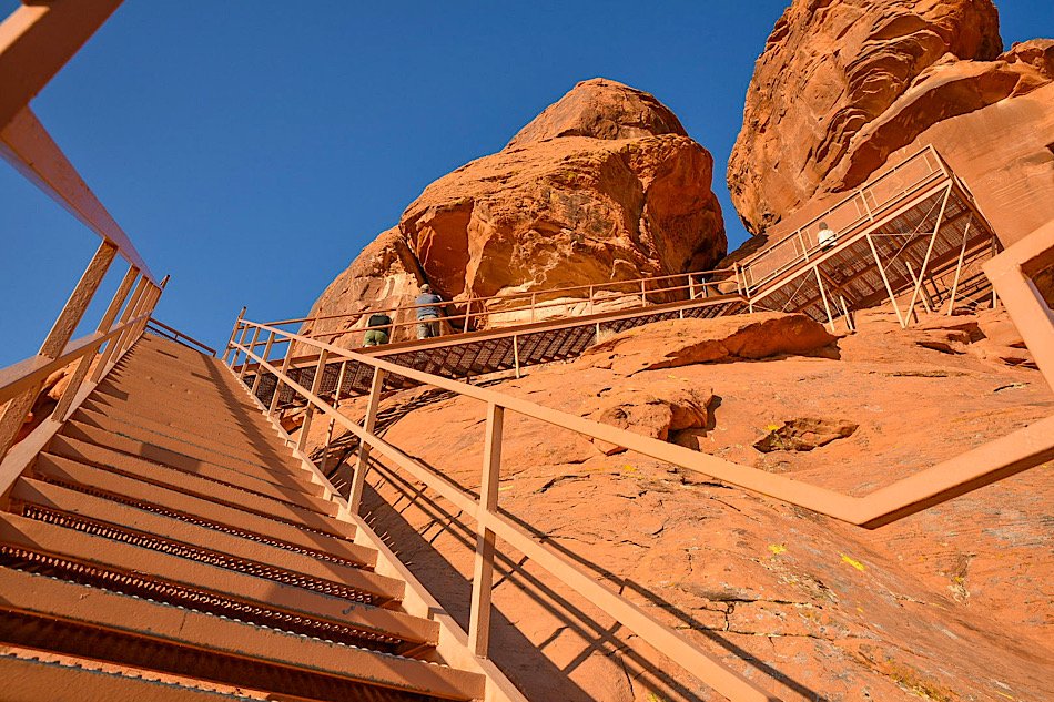
The downfall to being here early in the morning is you’ll be hit by the sun full-blast as it’s rising. There’s no real cover from the sun on the stairwell or on the viewing platform up top.
The upside is as the sun hits the rock, you get the full color show those fire-red sandstone rocks put on. It’s an amazing sight to behold.
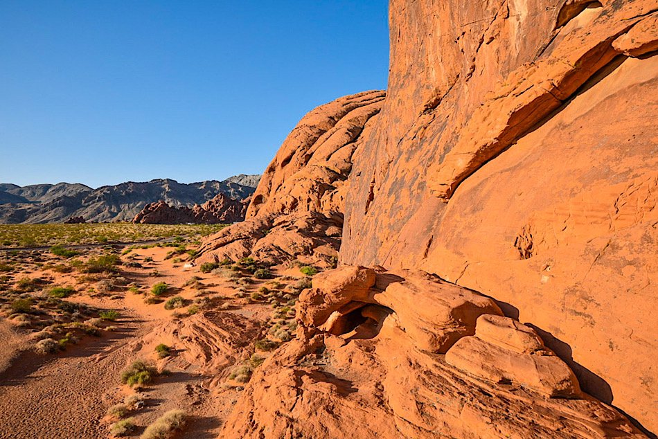
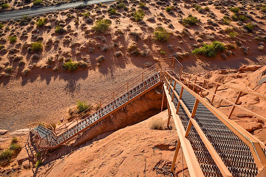
Before long, the petroglyphs come into view. From what I could see, the smooth rock face is the only location (at the top) where petroglyphs can be found.
Just above the smooth rock face on the bottom side of a rocky lip are dinosaur tracks. Unfortunately, the close up shot I got of them was lost, but you can see them in the photo below from further out.


As stated in the beginning of this post, these petroglyphs are over 4,000 years old. As such, there’s no way for us to know exactly what the ancient tribes were trying to convey, but you can see a mixture of illustrations of presumed animals, possible portraits of tribal members and other symbols.
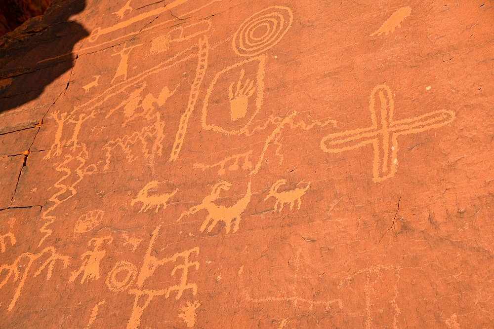
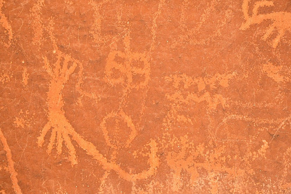
I stood and stared at these petroglyphs for a while, trying to come up with possible meanings or subjects behind them. There was one that looked like a goat. The squiggly lines, to me, indicate flowing water and another appeared to be the sun.
There was another near the top of the rock face that looked like a tribal member, possibly a warrior, holding what looks like an atlatl or some kind of weapon above their head in celebration.

Before leaving, be sure to explore the base of the rock to see more petroglyphs. Most people just go up the stairwell, come back down and leave. Don’t be one of those.
While it’s definitely one of the touristy areas of the park, these’s so much history on display in this single location that it would be a crime to skip it. Be sure to put Atlatl Rock on your ‘things to do’ list for your visit to Valley of Fire.
Please support this website by subscribing to the newsletter below.
Thank you for reading.

Anaconda Mine: See This Abandoned Open Pit Copper Mine In Yerington
Nestled in the picturesque landscapes of Yerington, Nevada, lies a hidden gem that takes visitors on a journey…
3 minute read | contains affiliate links
Nestled in the picturesque landscapes of Yerington, Nevada, lies a hidden gem that takes visitors on a journey through time.
Anaconda Mine, with its rich history and captivating allure, offers an unforgettable experience for those seeking a glimpse into the region’s mining legacy.
In this post, I take you to Weed Heights, an unincorporated community adjacent to Yerington, where the miners and their families once called home.
There, you’ll find the viewing platform where you can see the near entirety of the water-filled pit and on the way, get a distant view of the former processing plant.
Let’s get into it!

Exciting news for our readers!
We’re excited to Introduce the all-new "Inked with Wanderlust" online store!
We're thrilled to bring you a fantastic collection of wanderlust-inspired merchandise. Celebrate your love for travel and exploration with our stylish apparel and accessories, designed to ignite your sense of adventure.
Discover a range of unique designs that capture the spirit of wanderlust, from cozy hiking-themed t-shirts to charming accessories that make your wanderlust spirit soar!
Visit our online store today and start your journey of style and adventure. Happy exploring!
Anaconda Mine History & Stats

Anaconda Mine holds a significant place in Nevada’s mining history. Originally established in the mid 20th century, it played a pivotal role in the copper mining boom that shaped the region.
The mine was named after the Anaconda Copper Mining Company, who purchased the site in 1942. They were one of the most prominent mining companies of the time.
Anaconda’s initial 26-year run took place between 1952 and 1978, with secondary milling and processing until the year 2000. At which point, the newest owner, Arimetco, declared bankruptcy and abandoned the site.
During its run, Anaconda Mine produced:
1,744,237,000 pounds of copper
103,834,000 tons of oxide ore
58,589,000 tons of sulfide ore
189,034,000 tons of waste
The total market value from its operation is estimated to be $765,504,000, with total net profits exceeding $200-million. A staggering amount for the time.
At its peak, Anaconda employed 450 people, operated six-days per week and produced 13,000 tons of ore to the crushers daily.
Directions to Anaconda Mine

To see the water-filled open pit, you’ll need to make your way to the small Nevada town of Yerington and then up to the even smaller community of Weed Heights.
Much like other mining sites, such as Bodie, Weed Heights was built directly adjacent to the site for the purpose of housing miners and other employees.
Simply typing, “Anaconda Copper Mine”, into your GPS of choice will get you there. The main road leading to Weed Heights is just off the highway (US-95A).
After turning onto the road, continue straight. Keep in mind that during winter, this road is known to be icy at times.

About halfway up the road, prior to driving under the overpass, you’ll see the old processing plant on your right. There’s a large dirt/gravel area to pull into.
The buildings are gated off and unfortunately there are no tours or public access offered, so you’ll have to settle for admiring them from a distance.
From here, continue up the road until you reach a stop sign. Turn left and soon thereafter, you’ll see the fenced-in viewing platform with a small parking area on your left.
Anaconda Mine Viewing Area

In front of the entrance to the viewing platform are two informational boards detailing the history and production of Anaconda Mine.
To see the pit, continue past the signs along the dirt path between the fences. There’s lots of barbwire here so watch where you put your hands.


From the viewing area, you’ll be able to see the pit (or lake, as some locals refer to it as) in all its glory, including the hauling roads circulating around it.
Here are some interesting stats of the pit:
It’s one mile long
A half mile wide
810 feet deep
Water level is approximately 450 feet deep


To some, it’s just a giant hole with water in it. For those who appreciate mining/local history, or who enjoy roadside stops like this, it’s a fascinating sight.
Unfortunately, this is all you’ll be able to legally view. There’s no public access to the haul roads or even in the perimeter of the mine for safety reasons.
All told, Anaconda Copper Mine makes for a quick but fascinating stop for those traveling through or for locals who want a glimpse into the area’s past.
Travel safe, travel responsibly,
Kevin
Check Out These Amazing Nearby Destinations!
Please support this website by subscribing to the newsletter below.
Thanks for reading.

Fort Churchill State Park: Nevada History, Fees, Parking, Hiking and More
Nevada has no shortage of historic, abandoned sites to explore. Fort Churchill State Historic Park is one of many you need to add…
3 minute read | contains affiliate links
Nevada has no shortage of historic sites to explore. Fort Churchill State Historic Park is more than deserving of a spot on your list. Particularly if you’re into military history.
Fort Churchill sits on 3,200 acres of protected land. It features several structures, a cemetery, museum, campground, group area and Buckland Station (which is located across the highway from the park).
If you’re going to be driving through, Fort Churchill is an easy to visit as it’s just off the highway. It’s a great way to get out and stretch your legs or to let the kids burn off some energy.
In the guide, we’ll cover how to get there, the parking situation, crowd levels, fees and more. Lets get into it!

Exciting news for our readers!
We’re excited to Introduce the all-new "Inked with Wanderlust" online store!
We're thrilled to bring you a fantastic collection of wanderlust-inspired merchandise. Celebrate your love for travel and exploration with our stylish apparel and accessories, designed to ignite your sense of adventure.
Discover a range of unique designs that capture the spirit of wanderlust, from cozy hiking-themed t-shirts to charming accessories that make your wanderlust spirit soar!
Visit our online store today and start your journey of style and adventure. Happy exploring!
Fort Churchill History

Construction on the post was completed in 1861 and was named after Sylvester Churchill, an Inspector General for the Army.
Its original purpose was to provide protection for this section of the Pony Express. Later, the fort was used to store supplies for the Union Army during the Civil War.
Though many Soldiers came and went, it’s believed to have housed around 200 at any give time. Despite its importance, it wasn’t active for long as it was abandoned shortly after the conclusion of the Civil War.

Since the state declined to take ownership, the fort’s structures were auctioned off for $750. For decades, the structures just sat as nothing was done with them.
It wasn’t until 1932 that the National Park Service took control of the property and began restoration efforts on the structures. Additionally, the visitor center was built at this time.
Then, in 1957, Fort Churchill became part of the Nevada State Park system. In 1966, it was added to the National Register of Historic Places.
Getting To Fort Churchill, Parking, Fees & Museum

The park is located between the towns of Silver Springs and Yerington along the highway. From either town, get on highway 95 and keep an eye out for Fort Churchill road and turn there.
Park fees are as follows:
$5.00 - Nevada Resident (day use)
$10.00 - Non-Nevada Resident (day use)
$15.00 - Per Night, Nevada Resident (camping)
$20.00 - Per Night, Non-Nevada Resident (camping)
$2.00 - Bike In
The park accepts cash and credit cards for fees. As you drive up to the entrance, you’ll fee the pay station on your right. There’s an area where you pull-off to do so.
Whichever payment method you use, be sure to place the receipt (face-side up) on your dashboard in case the park ranger needs to verify payment.

The parking lot and museum will be to your left after driving in. The cemetery is off to your right (above the pay station). The parking lot is small, capable of holding a dozen vehicles or so.
There are additional lots on either side of the structures further down the road if this one is full or closed off.
The entrance to the museum can be found just off of the parking lot. It’s small, but contains quite a few artifacts from both the fort and the general area.


While the park itself is open 24/7, the museum is not. It’s open daily from 8am to 4pm.

The trailhead to the structures below is located adjacent to the museum. There are two additional parking lots closer to them if you prefer to skip the trail.
Fort Churchill Historic Structures

From the trailhead near the museum and back, the trail is roughly one mile. It’s a fairly even grade and is easy to follow as it’s lined with rocks.
Most people, including children, would have no issue on this trail. Using strollers and/or wheelchairs on it, though, would be challenging.


With the exception of a couple off-shoots, the trail makes a perfect circle to each of the featured structures. There are around a dozen or so.
There are signs posted in front of most stating what the structure was, such as the Hospital. A few have bigger informative boards with broader details.
One important thing to note is to be sure to keep out of the structures and remain on the trail. The structures are old and in a state of arrested decay.


There are no doors or windows on the structures so if you’re curious as to what the inside of them look like, they're easy to see/photograph from the trail.
Something else to keep in mind is that there isn’t any shade or water fountains along this trail. So be sure to come prepared, particularly in the summer.
Fort Churchill Campground & Group Area

The campground is open throughout the year and operates on a first come, first serve basis. It’s located along the Carson River on the east side of the park.
There are 20 spots featuring a table, fire ring and plenty of shade from the dozens of cottonwood trees that dot the landscape.
Each site can accommodate RV’s or a tent. There are no hook ups, but there’s a dump station located nearby. The only real amenity are the bathrooms (no showers).
To reach the campground, drive past the main parking lot on the road and continue until you see the sign to turn right. Simply follow that road.

The group use/picnic area is a serene, often crowd less area of the park. There are many picnic tables, lots of shade, a bathroom, water bootle refill station and easy access to the Carson River.
To get to the river, walk on the paved path next to the bathroom and keep going through the grove of Cottonwood trees until you reach a gate. Go through the gate and enjoy the river.
To reach the group use area, drive past the main parking lot at the entrance and take the first left after that (the historic structures should be on your right).
Once you see the sign, turn left and follow the gravel road. At the point where it splits, turn right and continue until you reach the parking lot.
Buckland Station

Buckland Station. Fort Churchill State Park. Nevada.
Buckland Station was built in 1870 out of materials from the abandoned fort. It was first used as a boarding house and the home of the Buckland Family. Beginning in 1885, it served as a supply stop on the Pony Express.
Self guided tours are available of the interior of the recently remodeled building. The fee is $1 per person with free parking.

The fee goes towards ongoing maintenance and upkeep of the property. Bathrooms are available behind the house.
Across the street are more historic structures. These are of the farm variety. I wasn’t able to find any information on them but they’re cool to check out, nonetheless.
Additional Info, Tips & Reminders

Do not climb on or go inside the remains. The remains are fragile and entering or climbing on them could cause irreversible damage and most importantly, your safety would be at risk.
Watch out for wildlife. Rattlesnakes have been known to frequent the park so please, watch your step, stay on the trail and keep an eye on the little ones.
Buckland Station is across the highway. To visit this historic station, you’ll need to leave the park proper and drive south on highway 95. You can either drive there or you can utilize the 2 mile trail that connects Buckland to Fort Churchill.
Please support this website by subscribing to the newsletter below.
Thank you for reading.

Thunder Mountain Monument: A Deeply Meaningful Roadside Oddity In Nevada
Imagine you’re on a road trip through the Northern Nevada desert along Interstate 80. You go miles seeing nothing but rolling…
4 minute read | Contains affiliate links
Imagine you’re on a road trip through the Northern Nevada desert along Interstate 80. You go miles seeing nothing but rolling mountains, vast openness and the occasional small town.
You eventually reach one of those small towns; Imlay. A former railroad station 130-miles east of Reno with a population of 178 (as of the 2020 census).
You look around and at first, nothing sticks out. But soon after getting past the main stretch of town, something catches your eye on the side of the freeway. Something strange, but unique. That something is Thunder Mountain Monument.

We recently visited Thunder Mountain, not knowing much about it and thinking it was just another cool (and weird), roadside oddity.
As we explored the property, though, we discovered how meaningful this property was to the original owner, Frank Van Zant, and the current owner, his son, David.
In this post, we’re going to cover some quick details about the property, what you can expect and some other important information.
However, we’re going to encourage you to visit the monument’s website for a more detailed account of its history and background. We will share the link at the end of this post.

Quick Stats
Location: Imlay, NV
Fee/Permit: None, but a $2 donation per group is requested (cash or check)
Open: Year round, from dusk to dawn
For: All visitors
Parking: Semi-large, dirt lot.
Restroom: None
EV Stations: None
Drone Use: Not allowed
Difficulty: Easy
Popularity: Low
Time: An hour or more
Milage: N/A
Elevation Gain: N/A
Trail Condition: Somewhat maintained pathway.
Main Feature(s): The monument and art installations
Pets: Not allowed
Special Notes/Hazards: Broken glass scattered throughout the property. Rattlesnakes have also been spotted here
Our Visit(s): June 2022.

Directions, Parking, & Fees
Thunder Mountain Monument may be located in the middle of nowhere, but it’s easy to reach as it’s located directly off Interstate-80 in Imlay, NV.
There isn’t a whole lot to do, see and eat in Imlay. So if you’re making the trip here from a larger area, you may want to ensure your tank is full and bring plenty of water/food with you.
Additionally, the nearest EV charging stations to Thunder Mountain are in Lovelock (40-miles west) and Winnemucca (35-miles east).

From Reno (133-miles, one way)
From wherever you are in Reno, make your way to I-80 eastbound and continue straight for 133-miles.
Take exit #145 for Frontage road.
At the stop sign, turn right and then make an (almost) immediate left on Frontage road.
You’ll follow this road for slightly less than a mile and it’ll terminate at the monument’s parking lot.
From Winnemucca (36-miles, one way)
Start by jumping on I-80 westbound and continue straight for roughly 36-miles.
Take exit #145 for Frontage road.
At the stop sign, turn left and go under the freeway.
Turn left on Frontage road and continue straight until it terminates at the parking lot.

Shortly after turning onto Frontage road, it’ll turn into dirt. No need to worry if you have a compact vehicle, it’ll make it just fine. Our Chevrolet Cruze made it without issue.
The parking lot is fairly large and entirely dirt. There are no official parking spaces so just find a spot that makes sense and go with it.

There are no parking or hard entry fees. They do request a (totally reasonable) $2 donation per group. There’s nobody on site collecting these donations but they do have an iron ranger adjacent to the picnic table.

It’s cash or check only. So if you don’t have either on hand, you can send a donation to the following address when you get home:
Thunder Mountain Monument, LLC
P.O Box 162 Imlay, Nevada 89418
Any donations left at or mailed to the monument go towards to continued growth, rehabilitation and maintenance of the property.

Exploring Thunder Mountain Monument
To begin exploring the monument, simply look for the official entry to the grounds (pictured above). You can easily spot it from the parking lot.
If your only interest is the monument itself, turn left along the dirt/gravel path as you approach the picnic table. If you have the time though, we recommend heading right and exploring the rest of the grounds in a loop.

At the picnic tables, you’ll find binders containing printed information about the monument’s history and development, as well as information about its founder, Frank Van Zant.
We highly encourage you to stop here and learn about the monument. Its history is fascinating. This is also where you can drop your donation (if you’re able to).

From the picnic table, go right along the path (away from the monument) to check out a cool, but admittedly creepy, art installation on the far side of the property.
Over here, you’ll find rusted vehicles lined up like a barricade of sorts, a swing set made out of wood and mud, a model airplane also made from mud/plaster and a de facto fort in front of all that. It’s weird, but so cool at the same time.


After exploring this area, simply follow the dirt path running parallel to the freeway. After a short distance, you will arrive at the monument itself.
The monument was conceptualized and built by Frank Van Zant (with the help of hippies and passerby’s) after being inspired by a visit to a bottle house in Death Valley.


As you walk up to the monument, the first thing you’ll notice is it’s fenced off with ‘no trespassing’ signs dotted along the fence. This was done to protect the monument from vandalism.
Based on our research, once upon a time the general public was allowed to explore the interior of the monument, but weather damage to the roof has made it too dangerous.
The monument was once lived in by its founder, Frank Van Zant and his family and initially started out as a one-room travel trailer. Over time, it was rocked over and additional features like bedrooms, corridors, stairwells and levels were added.
The roof is adorned with multiple statues and arches, the tallest of which stands fifty-feet. The exterior walls are covered in bas-relief tableaux depicting many historic events, betrayals and massacres of the American Indian.

If you know your history, you’ll no doubt recognize the depictions in some of the statues. Some notable figures include Standing Bear, Quietzalcoati, and Sarah Winnemucca. There’s even one honoring Franks’s late son, Sid.
It’s important to note that the vast majority of the materials used to construct the monument was “trash” Frank found discarded in the desert. This was done to honor the Native Indian tradition of using what you have and not be wasteful.


Many of the windows are windshields from old cars, glass bottles line much of the top end of the monument and a wooden Eagle is perched at the very top.
Some other material used in the monument includes galvanized pipe, scrap iron, chicken wire and concrete. It’s truly amazing what Frank was able to accomplish with what many perceived to be trash.
When you’re done exploring the monument, simply head back up the trail towards the entrance where you came in and back to your vehicle.
There are a few other nooks and features of the property, but we want to leave those things a surprise when you visit for yourself. We highly encourage you to do so.
As promised at the beginning of the post, be sure to visit the monuments official website for more in-depth information of its history and the background of its creator, Frank Van Zant, as well as photos of the interior.
Your Thoughts
Have you visited Thunder Mountain Monument before? We’d really like to know what you thought of it. Or if you’ve never been there, have you been wanting to visit or have you even heard of it?
Either way, let us know in the comments below. We LOVE hearing from our readers!
Please support our website by sharing it with your family and friends.
Thank you for reading.

How To Visit Walker River State Recreation Area: Camping, Fishing, and More
This gorgeous stretch of the East Walker River is made up of four historic ranches; Pitchfork Ranch, Flying M Ranch, Rafter 7 Ranch, and…

On September 22nd, 2018, Nevada unveiled its newest State Park, Walker River State Recreation Area (mouthful, isn’t it?) This gorgeous stretch of the East Walker River is made up of four historic ranches; Pitchfork Ranch, Flying M Ranch, Rafter 7 Ranch, and Nine Mile Ranch.
Thanks to these acquisitions, the nearly 30-miles of river and picturesque 12,856 acres of rangeland will be open for the public to enjoy for generations to come. Of the four, Pitchfork is the only one developed and open to the public. The Elbow at Nine Mile, while publicly accessible and popular with Fishermen, isn’t developed. The others will be developed in phases.
Walker River is an outdoorsman’s paradise, offering many recreational opportunities such as hiking, fishing, hunting, camping, photography, and more! In this guide, we’ll go over topics such as where you can camp, park fees, nearby attractions and restaurants, and how to get there.
Park Information

Directions
Getting to Walker River State Park is relatively simple. The turn-off is right off Highway 208 just 10-miles or so from the town of Yerington.
From Downtown Yerington, head west on highway 208 for 10-miles and turn left onto E. Walker road for 4-miles until you reach the park entrance.

E. Walker road is a 4-mile, well maintained dirt road. It’s the road you’ll be on after turning off the highway and will take you to the park.
Our Chevrolet Cruz made it just fine, so a truck or some other high clearance vehicle isn’t required. RV’s can also navigate it easily.
While it is maintained, if wet weather recently happened, you may experience some difficulty. It would be best to call the park ahead of time to check road conditions.
Pitchfork Ranch


Pitchfork is the main area of the park and is an outdoorsman’s paradise. You’ll know you’ve arrived when you see the giant arch entrance. Turn right here.
About half a mile after turning right you’ll see your first right turn into a huge dirt parking lot. This is the group-use area with picnic tables, restrooms, and handicap parking.
Parking & Park Fees

As with most state parks, there are fees associated with visiting. The pay stations can be found on the left side of the visitor center in the smaller parking lot. *The pay station has recently been moved to just off the main road before reaching the visitor center.
There are two ways you can pay your fee:
Cash: You’ll slip the cash into the provided yellow envelope, fill out the necessary information, and drop it in what’s called the, “Iron Ranger” (Don’t forget to tear off the receipt section of the envelope).
Debit/Credit Card: Adjacent to the cash station you’ll see an electronic pay station. Here, you’ll select your fee amount, swipe your debit/credit card, and take the printed ticket. You’ll then place this ticket on your dashboard.
Park fees are as follows:

Nevada Resident
Day Use: $5.00 per vehicle
Camping: $15.00 per vehicle, per night plus $10.00 per night for sites with RV hook-ups
Non-Nevada Residents
Day Use: $10.00 per vehicle
Camping: $20.00 per vehicle, per night plus $10.00 per night for sites with RV hook-ups
Also, if you bike in (non-motorized), it’s a $2.00 day-use for no matter your state residency.
Visitor Center

The visitor center is centered in the Pitchfork Ranch entrance of the park in a beautiful, Spanish style building with western flare.
Inside, you’ll find the staff office where a Park Ranger is often stationed and a mini museum featuring multiple exhibits detailing the park’s history and local wildlife.
Unfortunately, during our visit, it had closed for the day. The Ranger did offer to let us in to look around but we left our masks in the car (this was before the mandate was lifted).

Visitor Center Hours
While the park itself is open 24/7/365, the visitor center is not. The hours for the visitor center are as follows:
9am to 5pm - Monday - Friday
10am - 2pm - Saturday & Sunday
*Note - Despite the hours listed above, the visitor center has not been open the last three to four times I have gone, despite being there during the listed hours. Your milage may vary.
Exterior Features

Outside the rear entrance of the visitor center is a rentable event space featuring picnic tables, a propane grill, and fireplace.
Adjacent to the event space is a beautiful grassy area with many trees and a man-made pond (not filled in the winter).
Camping at Walker River State Recreation Area

Camping at Walker River State Park is a wonderful, hassle-free experience. Unlike other parks, there isn’t a whole lot of red tape to jump through to camp here.
Some things you’ll need to know are:
Camping sites, both RV and primitive, are first-come, first-serve. They cannot be reserved ahead of time.
You’re limited to 14-days in a 30-day period. This policy is strictly enforced.
If you’re using an RV site, you’ll pay an additional $10 per night. This is true for Nevada residents and non-residents alike.
The RV sites include shaded picnic tables, grills, a communal restroom, and dump site.
Campground Locations
There are three designated campgrounds (so far) in the park. They are:
Riverbend Campground: There are 16 sites able to accommodate RV’s, Motorhomes, or tents. Sites come with shaded ramada, fire ring, and table. No hook-ups available.
Quail Run Campground: Site features include everything above, but come with power hook-ups.
Bighorn Campground: This campground is located up the load in the unspoiled Nine Mile section of the park. Sites include a table and fire-ring. This campground is primitive and has only a pit-toilet (BYO TP).
Squeeze Chute River Access

An additional three miles up the road from Pitchfork Ranch is where you’ll find a quaint, quiet area of the park known as, Squeeze Chute.
You’ll need to keep your eyes open for the turnout as it isn’t obvious. You’ll see a sign on your left pointing the way through a small entrance on your right. Turn here.

At Squeeze Chute, there’s a small parking area with a sole, uncovered picnic table. From here, you can access the river for fishing, swimming, etc.
As you drive in, take note of the gate on your right. This is the start of a hiking trail and follows the river through a beautiful tree-covered meadow.

Just keep in mind that cows do graze this area. So be sure to give them plenty of space and watch your footing (if you know, you know).
Walker River State Recreation Area Fishing
Fishing is the undisputed king of activities at the park. If you’re from out-of-state or a resident, you will need to have a Nevada fishing license.

If you don’t have one, you can scan the QR code near the pay station at the park with your smart device and purchase one.
Keep in mind that cellular service at the park can be spotty at best. To avoid disappointment, it would be wise to purchase one prior to arriving.
River Access

There are multiple river access points throughout the park, specifically in Pitchfork Ranch and The Elbow. You can swim and float to your heart’s content.
The Squeeze Chute area offers free, fly fishing introductory classes (you just need a fishing license). You can check this link for available dates.
Photography

Our personal favorite! Photographers of all kinds will love this photogenic oasis. For maximum results, definitely come during sunset.
River and mountainous landscapes plus ample wildlife such as; Deer, Antelope, Big Horn Sheep, Water Fowl, and Chukar provide endless photographic opportunities.
Nearby Attractions & Restaurants

Attractions
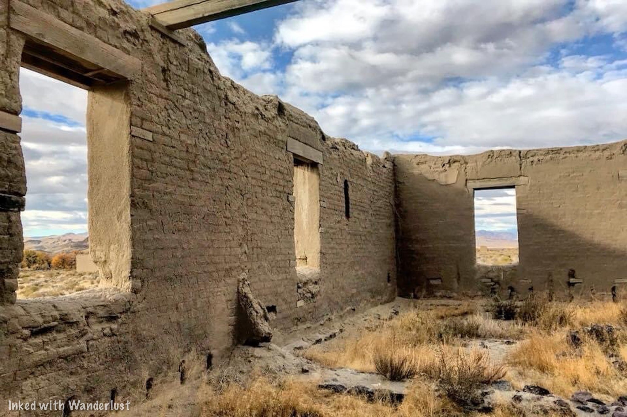
While the park itself offers plenty of fun activities all its own, if you’re planning on an extended stay, you may want to know what else the area offers.
Thankfully, there are many wonderful parks and destinations to visit that are within an easy drive from Walker River:
Berlin-Ichthyosaur State Historic Park: This one is the furthest away at about 2 hours (one-way). However, it’s more than worth the effort. It’s a preserved, mining ghost town and is also the site with the most Ichthyosaur fossils in the state. To read more about it, check out our article here.
Fort Churchill State Historic Park: If you’re into military history, this park is mandatory. Located just 30-minutes or so from Walker River, this state park features the ruins of an old military post. It also features a museum and campground all its own. You can read our article about it here.

Wilson Canyon: Wilson Canyon is a recreation destination all its own. Since it’s BLM land, camping is free and plentiful. You can hike, fish, and use motorized vehicles such motorbikes, side-by-sides, and more! You can read our article on its hiking trail here.
Bridgeport, CA: Bridgeport is a charming town in eastern California right next to the mighty Sierra Nevada Mountains. It’s our favorite town in California due to its proximity to amazing hiking trails, Yosemite, lakes, hot springs, and more! Check out our article about Bridgeport here.
Virginia City: About an hour from the park is the famed mining town, Virginia City. Step back in time and explore this wonderfully preserved and highly historical place. You can tour awesome attractions like MacKay Mansion , Chollar Mine , and more! Check out our article here.
Restaurants & Supplies
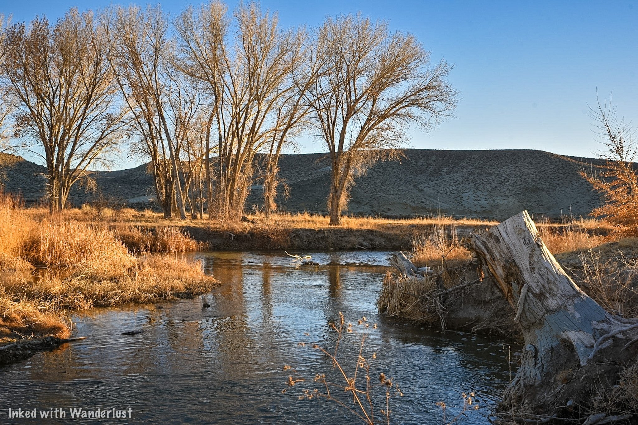
The small town of Yerington is a short drive away from the park and is a great place to pick up supplies or get something to eat. When camping, it’s always preferable to eat your meal over a fire but in the case of an extended stay, you may want to sit down at a restaurant.
For supplies, the one and only traditional grocery store is Raley’s. There’s also a Dollar General located on Main Street that offers limited grocery supplies. As far as restaurants go, there are three fast food joints if all you’re looking for is a quick bite. They are:
McDonalds
Port of Subs
Subway
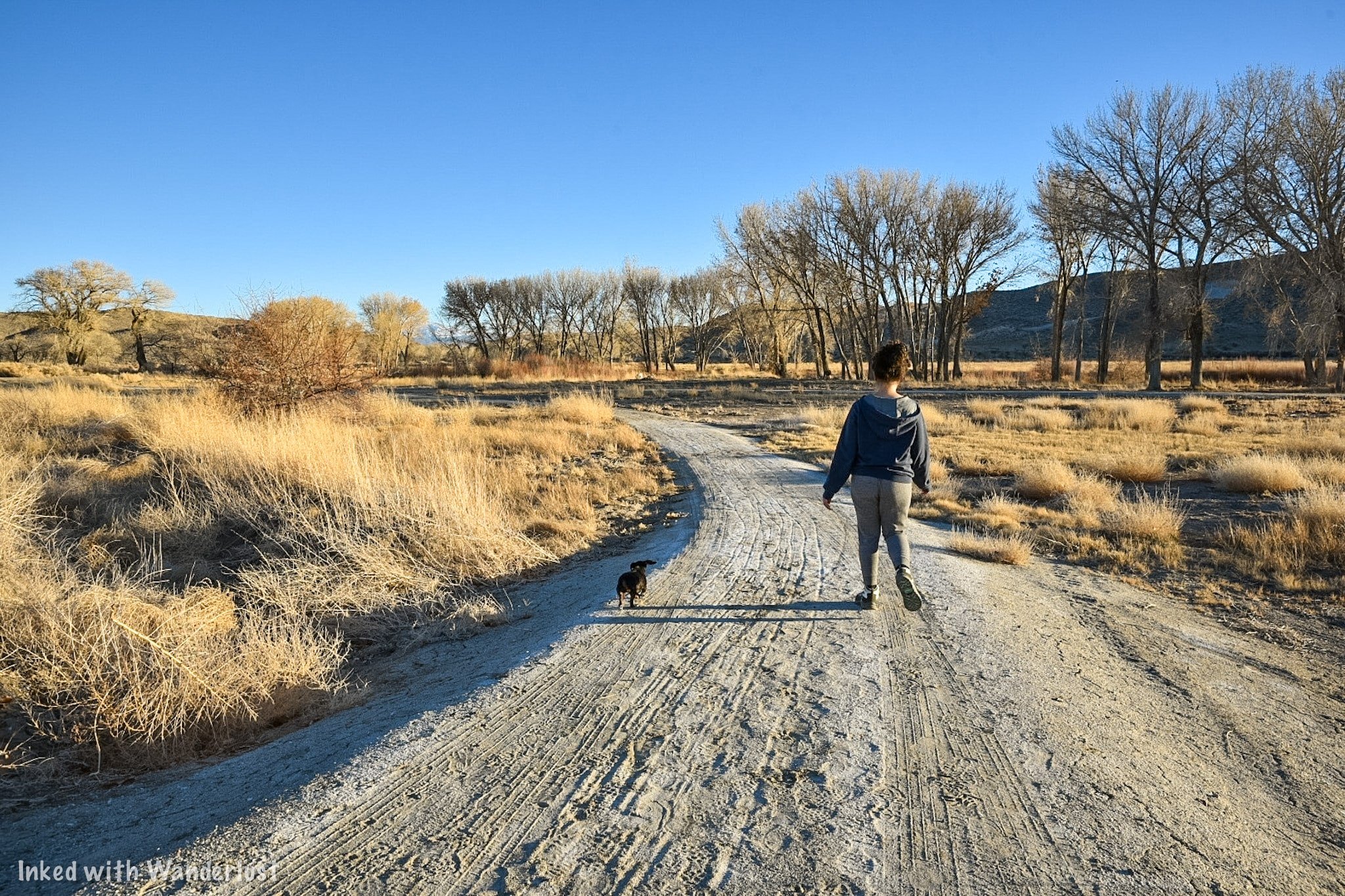
If you’d rather support a local business and sit down to eat, there are a few local places we can personally recommend. They are:
Country Sunflower: It’s slightly out of town but this small, charming, local spot serves up amazing breakfast and lunch. It’s our personal favorite in the area.
Tailgaters Sports Bar: Open for lunch and dinner, Tailgaters offers traditional fare like cheeseburgers, sandwiches, pizza, salads, and more in a sports themed setting.
El Alteno: If you’re craving hot and fresh Mexican food, head to El Alteno. It’s the closest restaurant to the park and has great food and service (Note: They are closed on Saturdays and close at 6pm on Sundays).
Additionally, Yerington has a Raley’s, Dollar General, and Family Dollar where you can pick up supplies like ice, firewood, s’mores kits, and more. Of the three, I would recommend Raley’s, as the two other stores are often cluttered and dirty.

National Automobile Museum: A Huge Classic Car Collection in Reno
Situated in Downtown Reno and just a stone’s throw from the river walk, the National Automobile Museum showcases a massive collection of over 200 classic…
Situated in Downtown Reno and just a stone’s throw from the Riverwalk, the National Automobile Museum showcases a massive collection of over 200 classic vehicles, most of which were once owned by Bill Harah (Founder of the former Harrah’s Casino).
We recently visited during a rainy, gloomy day in Reno. A lot of local businesses took a beating during the 2020 pandemic (and continue to) so we wanted to support them and showcase this awesome museum on our website.
You don’t have to be a car person to enjoy yourself here. On top of Harrah’s massive collection, the museum also showcases many cars that were used in movies and TV shows such as; Titanic, Batman & Robin, Back to the Future, and more!
Additionally, you’ll also see the vehicles that celebrities drove such as; Elvis Presley, Frank Sinatra, and John F. Kennedy! Whether you’re a local with an appreciation for the classics or a family on a Reno vacation, the National Automobile Museum is the perfect activity for you.
Let’s get into it!
Visitor Information

Directions
The National Automobile Museum is conveniently located near Downtown Reno. It’s just an 11-minute walk (or 4-minute drive) from the Reno Arch and is literally down the street from the Truckee River Walk. To get there from the Reno Arch (walking):
Head south away from the arch.
Go left on E. 2nd Street
Go right on Lake Street
Go left on the Tahoe - Pyramid Bikeway (you’ll see the old Reno Archway ahead of you and the Renaissance Hotel on your right).
Go right on Museum Drive and look for the entrance on your right.
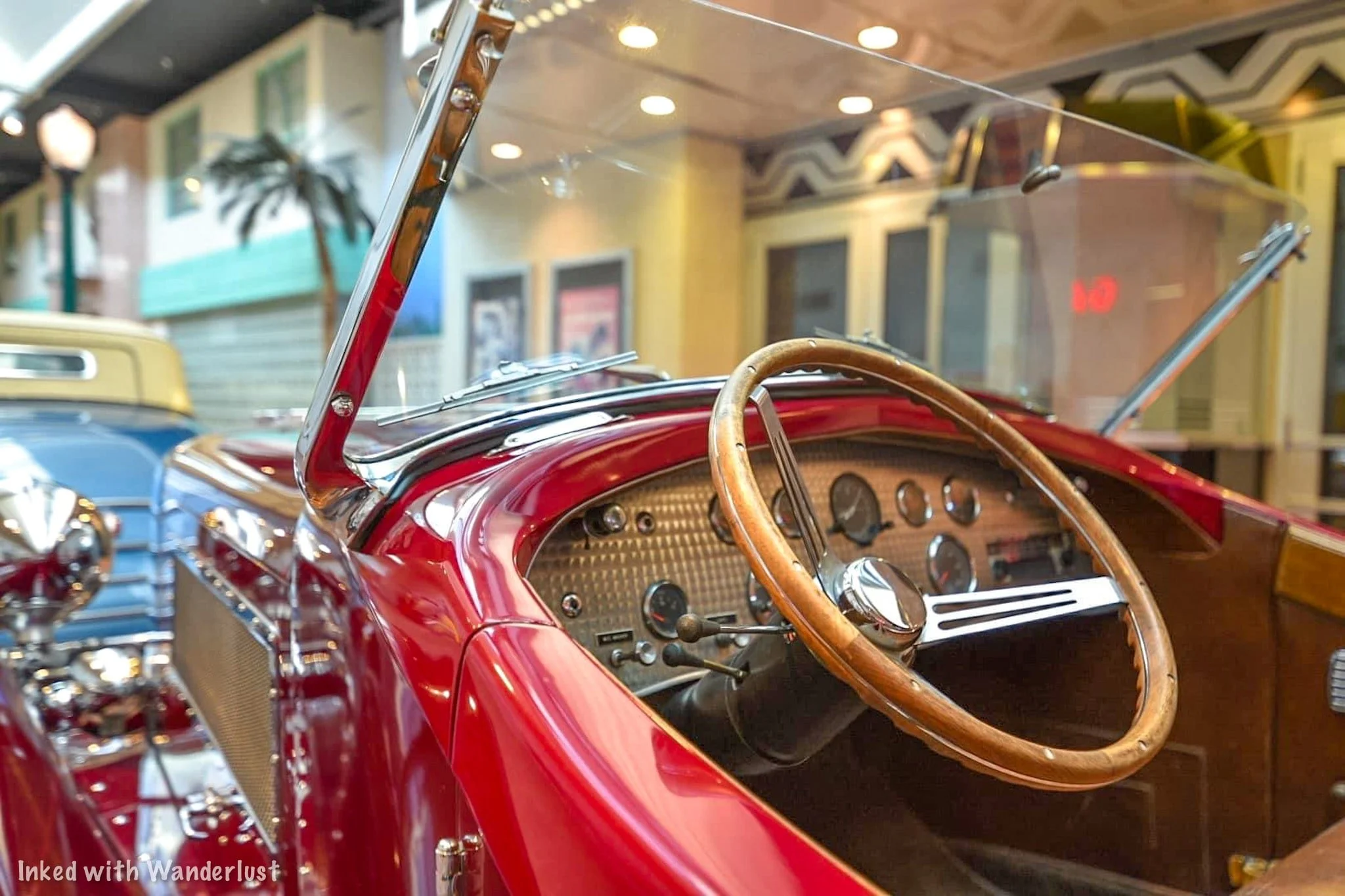
Driving from the Reno Arch has similar directions with just two minor differences:
Instead of turning left at the old archway, you’ll go straight through it and turn left on Mill Street.
Shortly thereafter, you’ll turn left on Museum Drive and pull into the parking lot.
For those of you who just want your GPS to do the work for you, the museum’s is as follows:
10 South Lake Street. Reno, NV 89501
There’s also the option of taking a Taxi or Uber from your hotel. Most drivers know exactly where this popular attraction is so you won’t have to worry about it.

Parking & Admission
The parking lot can accommodate quite a few vehicles and the best part? Parking is included in your admission! Just select any available space and head towards the entrance (pictured above).
Admission prices for the museum are as follows:
Adult: $15
Senior: $13
Active Military: $10
Youth (6 - 15): $10
Children (5 or younger): Free
Admission tickets can be purchased upon arrival. Online tickets are not yet available. Your ticket comes with in and out privileges for the day of purchase. So if you get board later and want to go back, just show them your ticket and you’re good.
Tours

Guided Tour
Guided tours of the museum are offered daily (based on volunteer availability) at 1:30pm and are 90-minutes in length. Your knowledgeable guide will tell you unique stories about some of the amazing antiques you’ll be seeing and learn little-known facts along the way as well.
The guided tours are included in the price of admission, so no worries there. If you have your heart set on one of these, you can call the museum and ask if they have volunteer availability for that day.
Self-Guided Tour
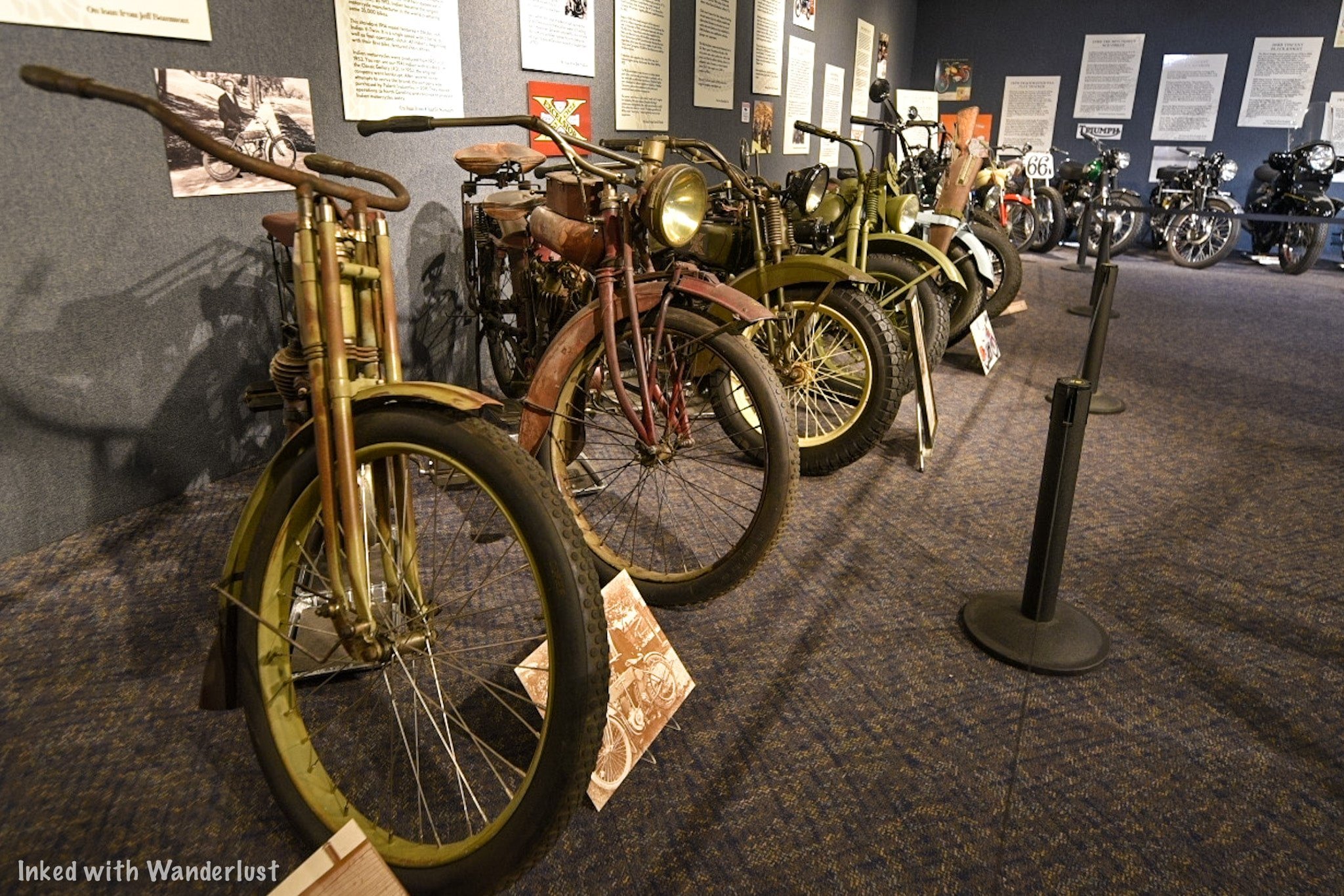
If you’d rather go it yourself (like us) you can take part in the self-guided tour and go at your own pace. There are a total of four rooms to explore, each featuring unique vehicles in specific eras. To start the tour, simply head down the hallway to the left of the ticket counter.

The first exhibit at the end of the hall is where they put their temporary, special exhibits. On display through December 31st, 2021 is the, “America and the Motorcycle: 1900 - 1990”, exhibit. You get real-life examples, in order, how motorcycles have evolved throughout the century.
Special Note - If you’re an AMCA member, show your membership at the ticket counter for a $3 discount on your admission.

Gallery #1 - Turn of the Century (1890’s - 1910’s)
This is where it can get a little hard to follow the correct path. My first time here, I was all over the place. I was going through doors I wasn’t supposed to and doing the tour out of order. This time around, I actually looked at the map, which made it much easier to navigate.
We highly recommend downloading the app to your phone. There’s a QR code you can scan with your phone at the ticket counter and on sporadic signs throughout the tour. Once you reach the end of the hallway, you’ll see the Blacksmith Building (pictured above). This is the first gallery and features cars from the years 1900 to around 1912 or so.

You’re in for quite a treat in this room. A few examples of classics you’ll find here are a 1908 Franklin, 1912 Rambler, and a 1910 Rolls-Royce. Each vehicle has an informative display in front of it describing its history, its original price, and interesting facts.
Our favorite was seeing the 1907 Thomas Flyer. It’s registered as a National Historic Vehicle for being the winner of the 1908 New York - Paris Race. The Rolls-Royce, our other favorite, was originally sold for $7500 in 1910. That would be north of $250,000 today.


You’ll also see the very vehicle that was used in one of the first scenes of the blockbuster movie, Titanic. It’s truly an awesome mix of classic vehicles….and you still have three more rooms to go! Once you’re ready for the next room, exit out onto 1930’s Street.
1930’s Street


1930’s street serves as a buffer between rooms one and two and has a 1932 Lincoln and a 1938 Packard on display, among other vehicles. They’re parked outside a recreated movie theatre facade with Gone with the Wind as the feature film.
The theming of this exhibit was awesome to me. For me, it was the most photogenic of any exhibit in the museum and the cars were beautiful.

Once you feel ready to move onto room two, walk down the street and hang a left on Main Street. Here, you will see the one and only vehicle you’re allowed to get into for a photo opportunity (I was asked to take pictures for a couple and by the time I was done, I completely forgot to get one for myself. You can’t miss it, though).
Gallery #2 - The Roaring Twenties (1920’s - 1930’s)

To find the entrance to the second gallery, look out for the Hardware Store. Immediately to the right of it (pictured above) is the entrance. By the way, you can and should go inside the store. The theming and detail inside is very reminiscent of old time Mom & Pop shops.
After checking out the hardware store, head through the short hallway into the next gallery which showcases cars made during the 1920’s (that said, we did see quite a few cars on display that were made prior to the 20’s).

A few examples of vehicles you’ll see here are a:
1920 Ford converted to an RV (considered to be the first iteration of the RV)
1921 Sheridan
1921 Rolls-Royce
1924 Wills St. Claire


You’ll also see an exhibit of an early day used-car dealership towards the back of the room cheekily titled, “Honest John’s”. Pictured below is the (very expensive) 1921 Rolls-Royce fully decked out in copper.

As you head away from the dealership you’ll see the first interactive displays. There’s two display cases with working motors inside. If you press the button, the motor runs. Showing you up close how motors worked back then (and largely still do today).
Once you’ve finished looking around, head out the exit ahead of you (you’ll know you’ve gone the right way if you’ve made a horseshoe lap around the room). Exit back onto Main Street by the Hardware Store and head left towards the next gallery.
Gallery #3 - The Classic Collection (1930’s - 1950’s)

As you exit Gallery #2, turn left and you’ll see the entrance to Gallery #3. The facade is made to look like you’re walking into a mechanic’s garage. You’ll see a light blue 1954 Buick with white wall tires on your right. As you enter the gallery proper, you’ll notice a miniature NASA Mission Control exhibit on your left (NASA was founded in 1958).

This gallery is the final one featuring a permanent collection and is named after Ranson & Norma Webster (the former sits as the Chairmen on the Board of Trustees for the museum). A few examples of cars you’ll see in this room are a:
1933 Auburn
1938 Phantom Corsair
1939 Ford
The 1938 Phantom Corsair is the only one of its kind and is the creation of Rust Heinz (Heinz Ketchup). The car was praised for being ahead of its time due to its futuristic design aesthetics but due to Rust’s death in 1939, it never entered mass-production. Making this prototype the only one in existence.


Much like the other rooms, you’ll do a half circle around the room at your leisure. At the end of the loop, you’ll end up near where you entered at the NASA exhibit. Here, there are multiple interactive elements for kids (or you) to enjoy. Due to the ongoing pandemic, many of these are closed right now.


When you’re done, simply walk through the NASA exhibit and out through the same way you came in (through the garage). To find the fourth and final gallery, take a right turn out of the exit and walk past the Speedway exhibit. You’ll see a facade of a home garage with a Basketball hoop above it (pictured below). Just walk on through.
Gallery #4 - Cars of the Stars (1950’s & Beyond)

Gallery four is the room that doesn’t have a full, permanent collection inside. It’s essentially a revolving door of themed exhibits (much like the Motorcycle exhibit at the beginning). It does feature cars that were driven by a variety of celebrities that are always there, but the other part of the room displays special exhibits.
The first car you’ll see as you walk through the garage is the infamous 1981 Delorean from the Back to the Future move franchise. If you’re a fan of the films, you’ll certainly appreciate this. Immediately afterwards on your right is a 1973 Cadillac driven by Elvis Presley.
To your left, there’s more examples of celebrity classic cars. You’ll see a 1953 Chevrolet driven by John Wayne, a 1961 Ghia driven by Frank Sinatra, and a 1949 Mercury driven by James Dean, among others.

This room is also an event space. Meaning you could rent it out for a variety of reasons. Due to this, the gallery may not be open during your visit but in all the times we’ve been here, it has never been an issue. You could always call ahead to confirm.
Unlike the prior three galleries, there’s no clear-cut path. It’s all open floor. So feel free to bounce back and forth between vehicles before making your exit. During our most recent visit, there was a first model Tesla on loan to the museum. It is right next to the exit. If you’re done, simply turn right out of the exit and head down “Speed Ally”. On display is a variety of race cars and their evolution throughout the years.

Conclusion
From here, you’re welcome to go back to any one of the galleries or streets to check out the cars again or you can call it a day. To find the exit, head back towards to gallery #3 (the one with the mechanic’s garage). Facing the entrance, the door to the museum lobby is on your right (look for the bathroom sign).
We hope you enjoyed this article and it inspired you to visit this awesome place for yourself. If so, please support our website by sharing it with your friends and family on Facebook, Pinterest, or your favorite social media site. You can further show support by staying on and reading one or more of the related articles above.
Thanks for reading and safe travels!

Mackay Mansion: How To Tour This Real-Life Haunted House in Virginia City
If you’re into visiting historic places - specifically ones that supposedly still house the original occupants - look no further…
2 minute read | contains affiliate links
If you’re into visiting historic places - specifically ones that supposedly still house the original occupants - look no further than Mackay Mansion in Virginia City.
Mackay Mansion was built in 1859 by a man named George Hearst (five years before Nevada became a state). This was the same year silver was discovered here.
Twelve years later in 1871, Hearst would sell the property to Irish immigrant and one of Virginia City’s four “Silver Kings”, John Mackay. Mackay would later go on to be the richest man to come out of the Comstock.

The former occupants have long since passed on, but they are believed to still roam the halls. The spirits of two little girls, an Army cornel, a shadow man, and Mr. & Mrs. Mackay themselves have all been seen.
Over the years, the mansion has been preserved well and year-round, daily tours are conducted detailing the history of this - even by today’s standards - lavish abode.
In this article, we’re going to give you all the information you’ll need to see it for yourself. We’re not going to spoil the tour, but we will show some pictures we took to give you an idea of what to expect.

Exciting news for our readers!
We’re excited to Introduce the all-new "Inked with Wanderlust" online store!
We're thrilled to bring you a fantastic collection of wanderlust-inspired merchandise. Celebrate your love for travel and exploration with our stylish apparel and accessories, designed to ignite your sense of adventure.
Discover a range of unique designs that capture the spirit of wanderlust, from cozy hiking-themed t-shirts to charming accessories that make your wanderlust spirit soar!
Visit our online store today and start your journey of style and adventure. Happy exploring!
Getting To Mackay Mansion

The Mackay Mansion is located in the heart of one of Nevada’s most historic towns; Virginia City. It is right off and can be seen from the main strip through town.
For GPS purposes, the official address is:
291 S. D Street, Virginia City, NV 89440
As you’re driving on the main road, keep an eye out for a blue, 3-story house. There’s a road going down a steep hill right by this house and the mansion is right at the end of this road.
Parking
There’s plenty of parking around the mansion but as you’ll see when you get there, they’ve coned off the area directly in front of it. There’s plenty of street parking on D Street or on the main road above.
Admission Fees & Hours of Operation
The hours and admission fees vary and are dependent on the type of tour and time of year. There are two types of tours available:
Day Tour
The day tour is the one you’ll likely be doing and is the one with the most available time slots. This is also the most affordable option. The day tour schedule is as follows:
Summer
Friday & Saturday between the hours of 10am and 6pm
Sunday - Thursday between the hours of 10am and 5pm
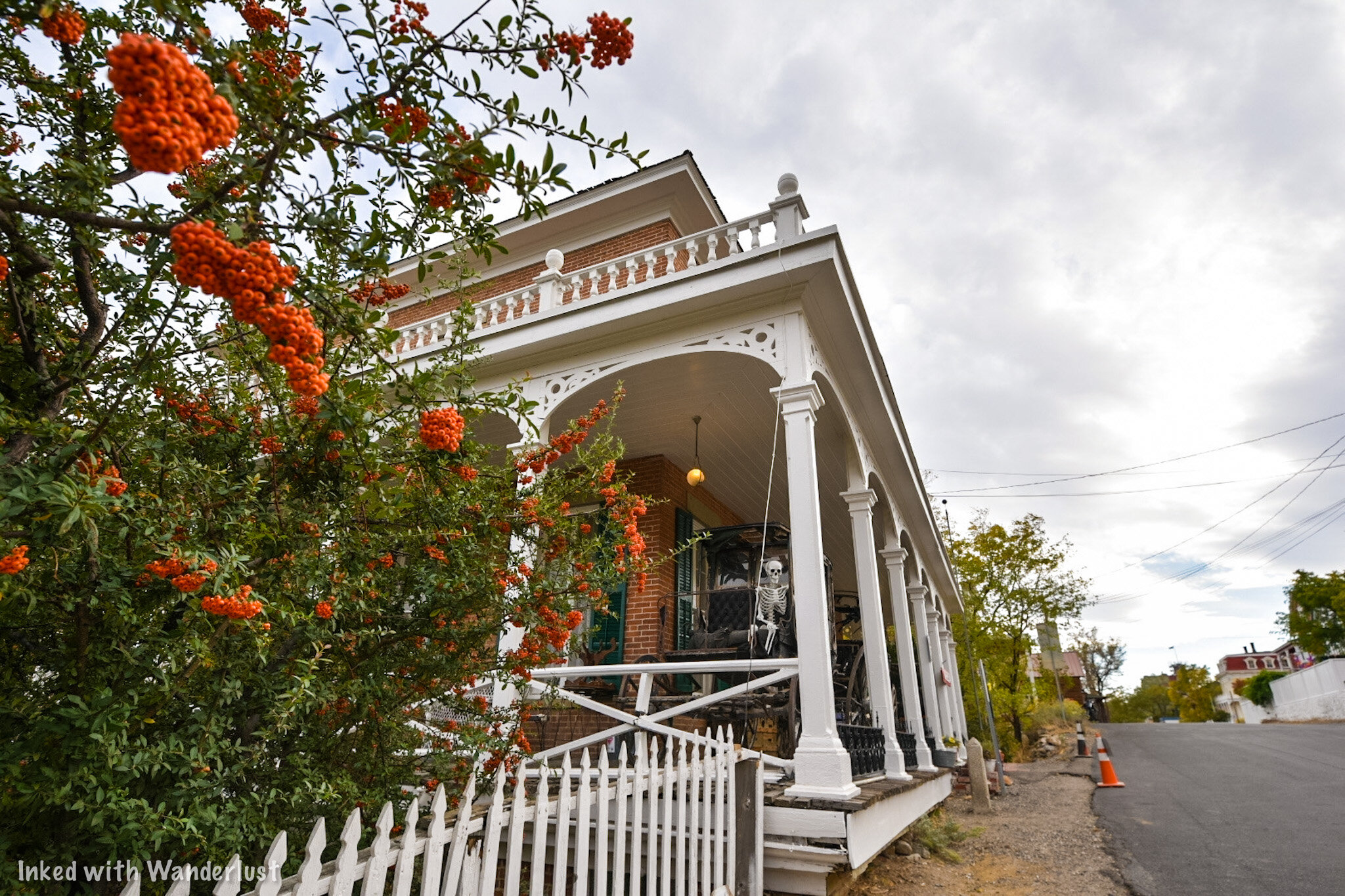
Winter
Sunday - Saturday between the hours of 10am and 5pm (weather permitted).
The fees for day tours during the summer and winter are the same. They are:
$8.00 per adult
$5.00 for kids 5-12 years old
Free for kids under 5
There are several ways you can pay for your admission fees:
You can pay cash (I asked and this was their preferred method of payment).
They will also accept debit/credit cards.
Or you can purchase a Comstock Adventure Pass at the Virginia City Visitor Center. This will also include other local attractions.

Tours run about 30-minutes in length and the final tour will leave 30-minutes before closing. If a tour is running as you arrive, you’ll find the front door locked. Have a seat on the porch and the guide will come get you when they’re ready.
After Hours
We haven’t done an after hours tour (yet), but we’ve heard it’s a lot of fun. You’ll hear a lot of the same information you would during the day, but this one focuses more on the paranormal side of it.
After hours tours run on the same schedule as above but only take place between 5-6pm.
Reservations are highly recommended for the after hours tour as they cannot guarantee you a spot otherwise. To make a reservation, call this number.
The admission fees for this tour are:
$10.00 per person (adult or child)
Mackay Mansion Tour Experience

When it’s your turn to join a tour, your guide will open the door and invite you inside the office. Here, he or she will collect your admission fees and go over some quick safety information.
Our Tour Guide, Megan, was wonderful. Super friendly, knowledgeable, and enthusiastic. We hear this isn’t the exception as all the other guides are exactly the same.

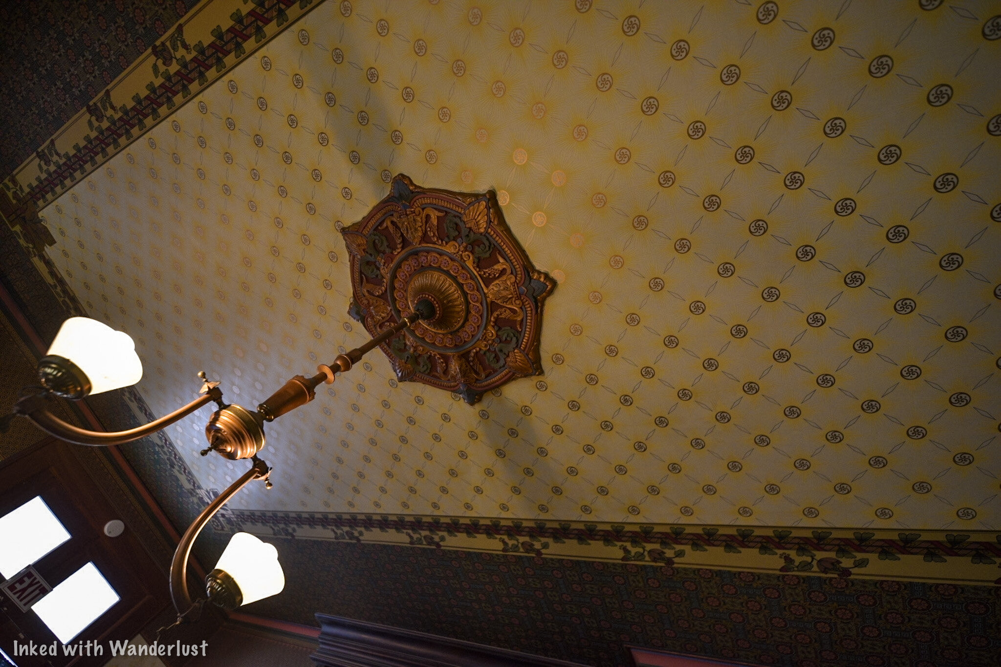
The tour begins with your guide detailing the history of Mackay Mansion and its purpose back in the heyday of the Comstock. You’ll be shown examples of real silver ore, pictures of the time, and the vault where payroll and bullion was kept.
The Living Room

After checking out the vault, you’ll be instructed to head into the next room; the living room. This was my favorite of the tour due to the decor and the hand carved framing around the fireplace.

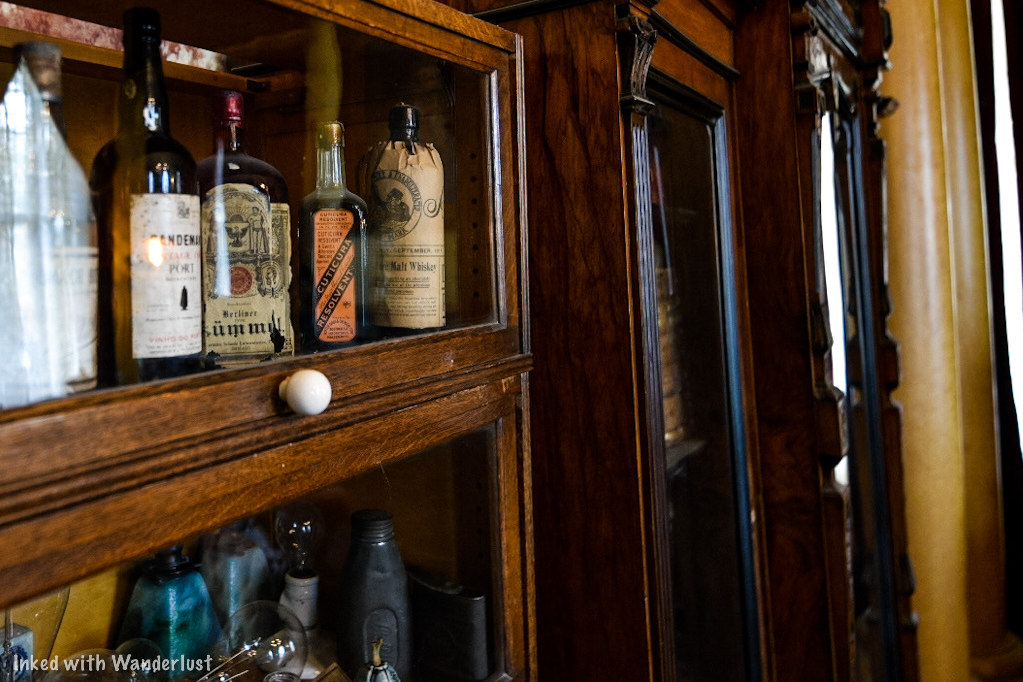
Here, your guide will tell you more about the personal lives of John Mackay and his wife, Marion. Among other things, Marion was a well known seamstress and would often design and sow her own dresses with the intention of, “stopping the show”.

Also, this room is where your guide will delve into the paranormal aspect of the mansion by showing you verified, non-doctored photos of Marion Mackay in that very room and another of a little girl.
The Stairwell

After the living room, you’ll temporarily move into the hallway adjacent to the stairwell. As you can see in the photo above, this wooden stairwell is both narrow and steep.
Here, your guide will go over what to expect on the second level where the bedrooms are. You’ll also see the Tiffany window pane above the door and see more photos of spirits.
The Upstairs Bedrooms

According to our guide, Johnny Depp stayed in John Mackay’s room while filming a movie. He was supposed to stay for 30-days but on the third night, he woke up to a little girl in a white dress jumping on his bed.
After that episode, he refused to stay another night or even step foot back into the mansion. The film crew had to go in to gather his things and move him to a hotel.


Back then, it was common place for a husband and wife to sleep in their own, separate rooms and the Mackay's were no exception. They each had their own adjoining rooms.
Across the hall are the children’s rooms and bathroom. All rooms are roped off except for one of the girls rooms. You’re able to go in and look around but you’re asked not to touch anything.

The late-1800’s era bathroom was a trip. The bathtub was the first in town to be plumbed and the toilet has gold leaf paint on both the outside and inside of it.
This is where the guided portion of your tour will conclude. You’ll be free to continue exploring the rooms at your leisure and to leave, you’ll go down both stairwells and out the door to the grounds out back.

Just before leaving the mansion, look to your left to see the dining room with original table, carpet, and chandelier. To see the grounds, go out the door and turn right.
Don’t forget to tip your guide on the way out or as the tip jar says, “Ghosts will follow you home”.
The Grounds


After finishing the tour, you’re welcome to explore the grounds in the back of the property at your leisure. We highly advise you to do this as it is simply beautiful back there.
To start touring the grounds, simply follow the brick path through some thick greenery. When weddings are held here, this is the pathway Brides take to get to the archway during the ceremony.


Beyond this area is where you’ll find the Gazebo which is original to the property. To get to it, you’ll need to go through a white gate. At first, it’ll appear as if that area is off limits, but you are able to go through.
Events

Events of all kinds can be held here. Weddings are the most common but you could also celebrate birthdays, family reunions, company events, etc. We don’t know the number of people the space can hold but it looks like it can accommodate a decent sized group.

For your event, the space comes with the gazebo, hanging lights, tables, chairs, a bar area, heaters, space for seating, and a grill (you’ll need to provide propane).
If you’re interested in holding an event at Mackay Mansion, you can contact them directly for prices and availability. Be sure to give them our regards!

Once your done, you’ll simply head out the gate and back to the front of the mansion. Afterwards, consider touring another great local destination, Chollar Mine. Read about it in our post below!
Paranormal Activity

According to our tour guide, Mackay Mansion is the 5th most haunted place in the state. We didn’t see any spirits ourselves, but others have reported seeing children, a shadow man, and John Mackay.
Consequently, the mansion has been the subject of many popular shows such as, “Ghost Adventures”, and “Dead Files”. We were told one of the crew members was knocked down by a spirit after trying to access the attic (which is off limits to the public).

The owners decided to open the mansion up to amateurs and professionals alike by offering the opportunity to hold their own paranormal investigations inside this real-life haunted house.
You can the listing for hours, fees, and how to set an appointment for one here.
We had a great time touring Mackay Mansion and we have no doubt you’ll also enjoy it. Even if you don’t believe in the paranormal, the sheer amount of history behind this place will peak your interest.
We hope you enjoyed this article and that it inspired your travels. If so, please support us by sharing it with your friends and family on your favorite social media site. You can further show support by staying on and reading one or more of the related articles above.
Safe travels and thanks for reading!

Tour The Historic Chollar Mine in Virginia City
Established in 1859, Chollar Mine was one of Virginia City’s highest producing mines. Eventually producing 17 million in silver and gold ore over the course of its 80-year…
Established in 1859, Chollar Mine was one of Virginia City’s highest producing mines. Eventually producing 17 million in silver and gold ore over the course of its 80-year operation.
These days, there isn’t any mining going on in VC, but Chollar Mine has stood the test of time and has been preserved to offer daily tours. Visitors will get a rare glimpse at mining life in the 1800’s during this 30-minute adventure.
We recently paid a visit here and took part in a tour. Being a local historian and former miner himself, our tour guide provided tons of interesting information throughout and made it a fun, memorable experience.
While we won’t spoil the tour, we will provide you with all the information you’ll need to plan a visit. We’ll also give you some examples of topics covered during the tour.
Let’s get into it!

Location
The Chollar Mine is located in the historic Nevada town of Virginia City and right off the main strip. The exact address for GPS purposes is:
615 South F Street. Virginia City, NV 89440
If you’re one of the few that doesn’t own a smartphone with GPS capability, here’s a some visual help. Regardless of which direction you’re coming into town from, look out for the Fourth Ward School (pictured above).

Directions
As you’re approaching the school:
If you’re coming from Silver City, you’ll turn right on Occidental Grade (just before the school)
If you’re coming from the opposite direction, turn left just after the school.
You’ll drive a couple hundred yards before seeing a sign for Chollar Mine. Turn left here.
After another 100 yards you’ll see another sign (pictured above). Turn right here and go down the driveway to the parking lot.

Fees
As with most tourist attractions, there are fees to be paid in order to take part in the tour. You can feel good about it, though, as this money goes towards supporting local and preserving the mine itself.
The tour prices are as follows:
$15.00 - Per Adult
$10.00 - Per Child (age 5 - 12)
Free - Children under 5 years old
You should note that tour fees are cash only at this time. There is no ticket booth or window, rather, you’ll be greeted by the operator as you drive up and he will collect the fees.
Special rates are available for large groups from schools, churches, etc. It is also possible to arrange a private tour. You can contact them directly to inquire.

The Tour
Tours are held daily during the months of May through October between the hours of 10:00am - 4:00pm and are roughly 30-minutes in length. Depending on when you arrive, there may be a bit of a wait for the current tour to end.
After paying, your tour will begin at an old barn where you’ll all gather to listen to the tour guide describe the history of Chollar Mine. You’ll also be given a chance to look at the many artifacts that surround you.

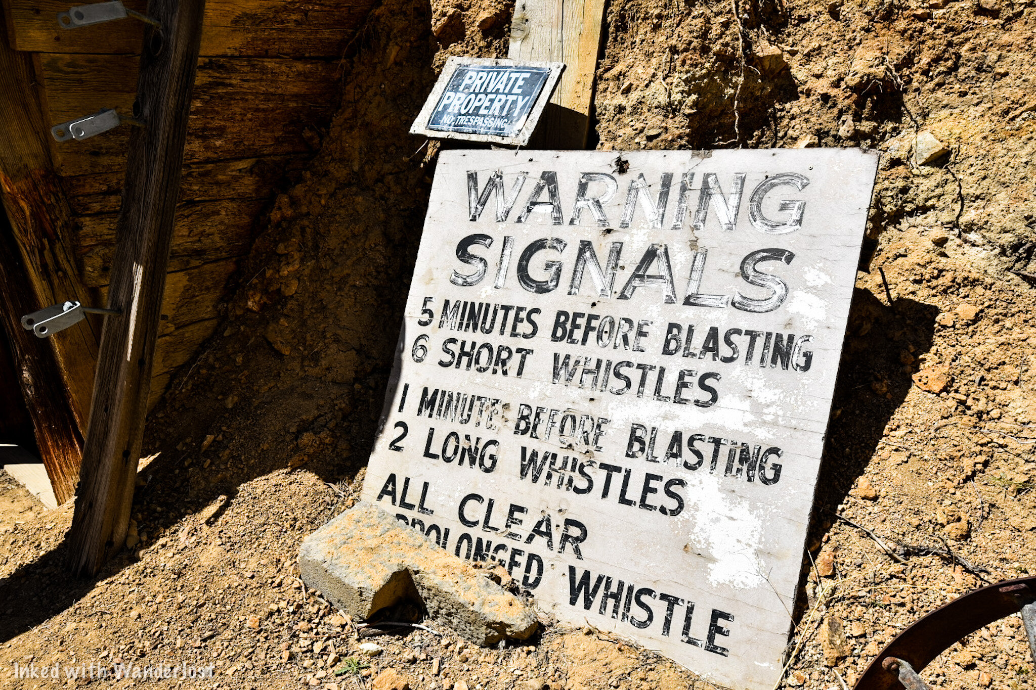
You’ll then be taken to the entrance of the mine and hear more descriptive history of it, the miners themselves, and what life was like back then. Your tour guide will also go over some safety information with you during this time.
You will then be guided through the entrance of the mine. You’ll need to watch your head and your step as you go through the mine tunnel. For clarity, I’m 5’9 and I needed to duck to go through.

Going Inside
The tunnel is 400-feet in length and throughout the majority of it, dark. There is a rope light that runs the length of the tunnel but provides only just enough light for you to get through it. It’s as close to authentic as you can get.

The original mine cart track still runs along the floor so you’ll need to watch your footing around that. There’s also portions of the tunnel where that infamous blue/gray mud that stuck to the miners’ tools and boots is still ever present. Wear shoes that you don’t mind getting dirty.
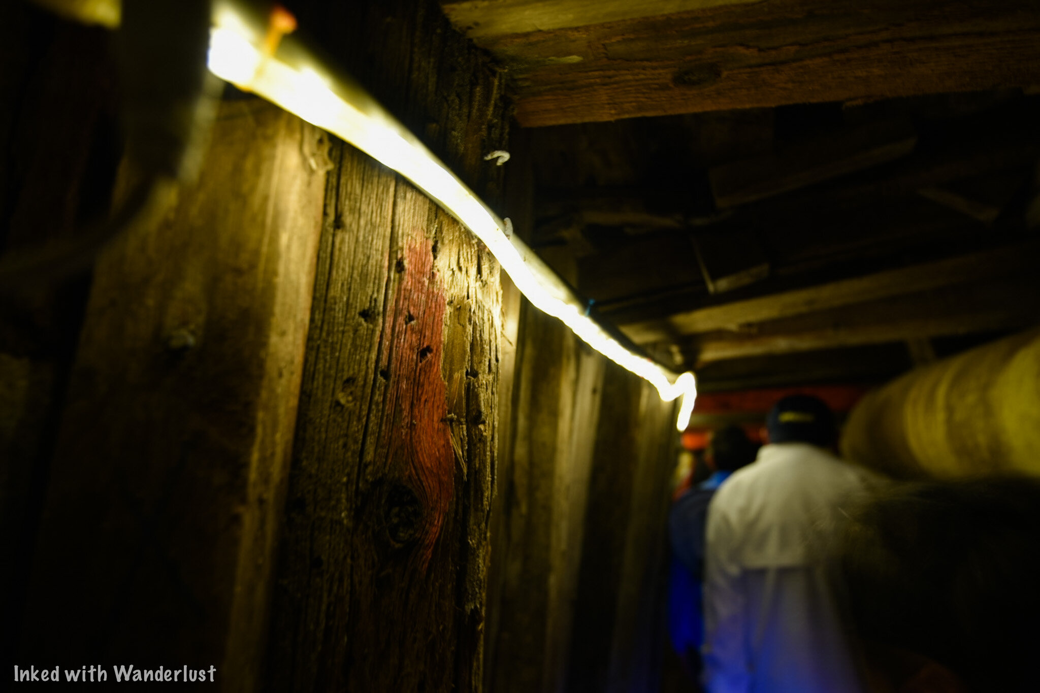
Near the end of the tunnel is where it’ll start getting cramped. When the tunnel was constructed, it was much larger. Over the years with normal wear and damage from earthquakes, the tunnel has gotten smaller. Don’t worry, though. It is safe.
If you’re claustrophobic, have a hard time bending, or have back problems this is not the tour for you. It does get uncomfortable at times and it caused my anxiety to kick in towards the end. Just something to keep in mind.
The Stope (Mining Room)

At the end of the tunnel, you’ll reach a room known as a “stope”. This is the very room where miners worked day in and day out mining for silver ore.
(As stated at the beginning of this article, we’re not going to spoil the tour. We want you to experience it for yourself. So we’re just going to give you a few examples of what to expect):

You’ll be shown examples of tools used by the miners.
You’ll see how the miners communicated with the outside world.
You’ll find out how rats were essential to miners and how they used them.
The lights will be turned off so you can get a sense for what it was like for them if a gust of wind came through and blew out the candles.
You’ll hear stories of local superstitious.
And much, much more.

Once your tour guide is finished, you’ll be given the opportunity to ask your own questions, move around parts of the room you couldn’t see, and take photographs.
The room is small and tight so depending on the amount of people in your group, you won’t be able to move around much until the end. You’ll also have a hard time standing up straight. So be prepared to sit or crouch down.

After spending 15-minutes or so in the room, your tour guide will take you back the same way you came through the tunnel.
As you’re going out be sure to keep your head down. Your eyes have adjusted to the darkness so the sudden rush of light at the end could prevent you from seeing the wooden frames above.

After you exit the tunnel, your tour guide will take any questions you may have and offer to take pictures of you and your group in front of the entrance. This is where you can give a tip if you feel inclined.
At this point, you can continue on with your vacation to other great attractions in the area. If you need suggestions, here’s a list of seven things we think you would love in Virginia City
Conclusion
We highly recommend going on a tour of Chollar Mine (provided you’re ok with tight spaces). It’s an intimate and interesting look at Virginia City’s history. This is something the whole family could take part in.
If you’ve found this article helpful in planning your trip to VC, please support us by sharing it with your friends and family on your favorite social media site. You can further show support by staying on and reading one or more of the related articles above.
Thanks for reading and safe travels!

How To Visit The Historic Lovelock Cave
Nestled within the Humbolt Mountain range and located 20 miles outside the small Nevada town of Lovelock, the Lovelock Cave is a small, but significally historic landmark…
Nestled within the Humbolt Mountain range and located 20 miles outside the small Nevada town of Lovelock, the Lovelock Cave is a small, but significally historic landmark. It’s an easy, straight-forward drive along the Backcountry Byway and once there, it’s a quick hike to the cave entrance from the parking lot.
As stated above, it is small. This is not the kind of cave where you’ll be able to go from room to room deep into the earth. It’s a small entrance leading to a viewing deck inside an area barely bigger than a modern day studio apartment. Don’t let this stop you, though. The historical significance of the cave more than makes up for its lack of size.
Some 22,000 years ago, Lake Lahontan covered this entire area. As water levels began to recede, wave action started to interact with the limestone, resulting in little pocket caves like this one. Lovelock Cave is just one of many in the area that came to be because of Lahontan. Hidden Cave near Fallon is another example.
In later years, Northern Paiute Indians would utilize this cave for storage and shelter between the timeframe of 2,000 B.C and 1,000 A.D and it would go undiscovered until 1912 when bat guano miners found it and began operations. Shortly after, archeological digs would commence and regularly occur for around 60 years, resulting in the discovery of thousands of artifacts and human remains.
Read on below as we give you a detailed summary on how you can make your way out here and see it for yourself. In the second half of the article, we will briefly cover the legend of the cannibalistic giants that lived here as well as the discovery of the oldest known duck decoys in the world. Enjoy!
Directions

Your journey to the cave begins and ends in Lovelock, NV. Thankfully, it’s easy to get there as your journey begins almost as soon as you exit the freeway. Whether you’re coming from the direction of Winnemucca or Reno, these are the easiest directions to follow:
You’ll take exit #106 towards Downtown.
As you’re taking the exit, you’ll notice a McDonalds.
If you’re coming from Winnemucca, you’ll turn right on Main then left on Amherst (just before McDonalds). If you’re coming from Reno, you’ll turn left on Main, go under the overpass, and left on Amherst.
This road will eventually turn into S. Meridian and becomes a well maintained dirt road as you pass through a beautiful agricultural area.
You’ll stay on this road until you reach Derby road at a two-way intersection. You will go left here.
You’ll cross over the Humbolt River and shortly after, come to a point where the road splits in three directions (as pictured below). You’ll want to continue to the right.
Continue going straight until the road terminates at the parking lot.
Even though it is fairly straight forward, you may feel a little lost at times (we did). Just keep an eye out for those “Lovelock Cave Byway” signs. They’re dotted along the entire stretch of this drive. If you haven’t seen one in a while, you may want to turn around.

Pictured above is a beautiful section of the Humbolt River we ran into along the byway. This view was on our left shortly after turning on Derby. Pictured below is where the road splits into three directions shortly after the river crossing. You’ll turn right to continue towards the cave (though we were curious as to what the other roads led to. If you happen to know, please let us know in the comments).

Between here and the cave, you’ll get amazing views of the Humbolt Mountains on your left and the Humboldt State Wildlife Management Area on your right. We observed many species of birds in this area and even spotted a Rattlesnake sun-bathing in the middle of the road. If you’re into birding, you would do well here.
The road you’ll be on is well maintained with only a few parts that get a bit rough for those driving a compact vehicle. For clarity, our Chevy Cruze made it just fine (though there were a few times we had to slow down due to rough bumps in the road). If you have a truck or jeep, you’ll have no issues.
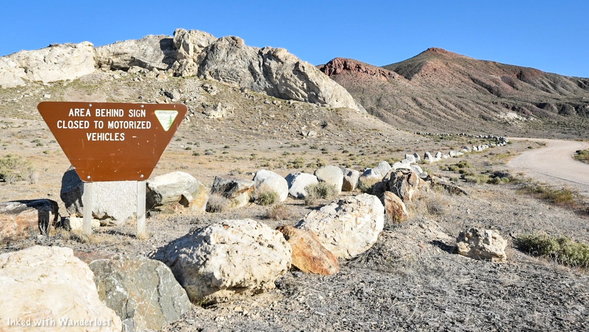

The road will start to go left and up towards the cave and soon, you’ll see the entrance sign and the parking lot ahead of you. The lot is a decent size that could easily accommodate a few dozen or so creatively parked vehicles. There is also a covered picnic table and one restroom. Fair warning, the restroom isn’t very well maintained (better than nothing, though).
The Nature Trail
At the trailhead, you’ll find an informative board describing the history of the cave and the area as a whole. You’ll find the start of the trail just behind here. If you wanted to complete the trail proper (and you should) you’ll start by heading upwards. If you just want to get to the cave, head left.
The nature trail is short, coming in a just over half a mile for the whole loop. In the beginning there is a bit of an uphill climb but it’s on gentle switchbacks and doesn’t require a whole lot of effort. If you took a brochure along with you (at the trailhead), it’ll describe the mountains, plants, and other features as you go.

If you’re on the trail proper, it’ll take you up, over, and around the cave before dropping you off at the entrance. Just before this, you’ll come to another informative board with an expansive view of what was once ancient Lake Lahontan (now Humbolt Sink). The board details the plant, animal, and fish life that once called this area home.

From here, you’ll continue left on the trail until you reach the entrance to the cave. You’ll go down a little bit before working your way back up. This section of the trail does have sheer drop offs on your right, so be sure to watch your footing. Once you get to the entrance, you will see a few spur trails. There’s no right or wrong here. Just pick one and go up.
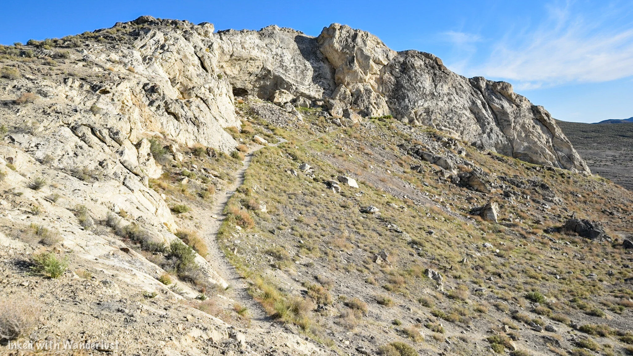

When you arrive at the entrance, you’ll see what we mean by how small it is. In fact, it used to be MUCH wider, but an earthquake caused a large rock to collapse into the mouth of the cave, leaving the tiny entrance we have today. You can still see how large it was by looking to the far right of the entrance.
Lovelock Cave

From here, simply head into the cave. Watch your footing as you descend as it’s a rocky and uneven surface. In front of you, you’ll see a wooden deck. This is where you can enjoy the cave from. This deck was installed around 10 years ago to help maintain the integrity of the cave. The BLM does ask that you stay on the deck as archeological digs do still occur here from time to time.
In the photo below, you will see a brightly lit photo of the viewing deck. I used my camera’s flash to attain this photo. It is NOT this bright inside. It isn’t pitch black or anything as you are able to see where you’re going, but it is much darker than what this photo shows.


All around you, you’ll see burn marks at both the entrance of the cave as well as nearly the entire interior. It is believed that this was due to fires being set by Native Americans for warmth, cooking food, etc. There’s also the legend of Natives setting fire to the entrance of the cave to “smoke out” cannibalistic giants that once lived in this area (more on that later).
There’s a lower portion of the deck to the right that takes you slightly further into the cave. It’s much darker on this side as it’s further from the entrance. Seeing a bat or two is a possibility. The brochure we had stated bats were rare in this cave these days but during our visit, we saw two flying around.

From either side of the deck, you can see the areas where both bat guano miners and archeologists dug through. Guano mining took place in the early 1900’s while archeology digs began later and still occur from time to time. Many historical items were discovered here including multiple bones, mummified remains (unconfirmed), weapons, tools, duck decoys (oldest known in the world), clothing, and other artifacts.
Per my research, a total of 10,000 human remains and cultural artifacts have been discovered in this small cave. Prior to the mining and digging, the floor of the cave was much higher than it is today, specifically the left side (which was where most of the digging took place).
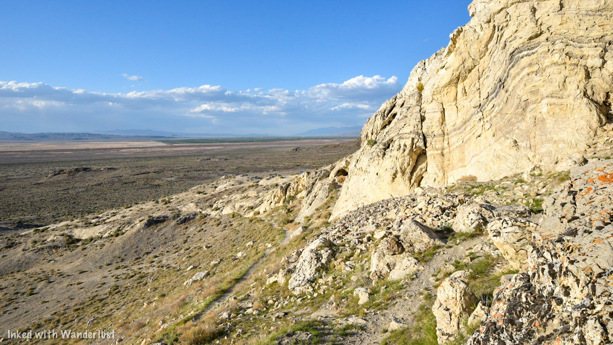
Once you’re done enjoying the cave, simply exit and head to the left back on the loop trail to complete your journey. On this section of the trail, you’ll get more expansive views of the Humbolt Sink and see up close the amazing limestone rock formations that make up the exterior. If you’re a rock nerd (like me) you’ll enjoy it.


From here, you just keep going straight until the trail spits you back out to the parking lot. You’re total milage on the trail will be around 6/10’s of a mile and with time exploring the interior of the cave, it shouldn’t take you more than an hour or two to complete.
Legend of the Giants
Now that we’ve gotten the “how to” part of this article out of the way, lets move on to some history. We have heard the legends and rumors surrounding what was and wasn’t found inside this cave. One of those legends pertains to the red-haired, cannibalistic giants that allegedly lived here while ancient Lake Lahontan was still present.
Native Paiutes described these giants (called, “Si-Te-Cah” and translates to, “tule eaters”) as upwards of 12-feet tall with reddish-brown hair all over their bodies and faces (think modern-day Bigfoot descriptions). They would sail across the sink to tribe villages, kidnap native women and children, and would take them back to this cave (and others) to be eaten.
Sick of their people being kidnapped and eaten (understandably), multiple tribes banded together with the purpose of killing these giants once and for all. So they chased them into the cave and after refusing to come out and fight, they set fire to the entrance of the cave. Some of the giants stayed inside, falling victim to burns and smoke inhalation. Others ran out and died after being hit with a hail of arrows.
It is said that many bones were discovered in the cave, some being split down the middle with the bone marrow extracted (which is probably something a giant cannibal would do). Furthermore, legend has it that mummified remains of these giants were found here. I was unable to find anything conclusive that confirmed the existence of these remains, so take it for what it’s worth.
The Duck Decoys
Among the confirmed artifacts unearthed here, the most known has to be the duck decoys. These decoys date back to between 400 B.C - 100 A.D. They’re made of bundled Tule (a desert plant which grows in marshy wetlands), are painted, and have actual Duck feathers still attached. In all, 11 were found with 8 being complete and 3 being unfinished.
These decoys have the distinction of being the oldest known in the world. They went undiscovered and untouched inside the cave for over 2,000 years. It’s truly amazing. Fittingly, they’re currently on display at the National Museum of the American Indian in Washington, D.C.
Conclusion
It is our hope that you found this article helpful in planning your travels. If you enjoyed it, please support our website by sharing this article with your friends and family on Pinterest, Facebook, or your favorite social media channel.
You can further show your support by staying on and reading one or more of the related articles above and by subscribing to our newsletter. Thank you and safe travels!